Showing 3399 items matching "router"
-
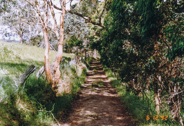
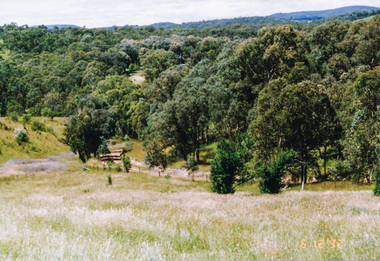 Eltham District Historical Society Inc
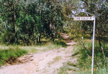
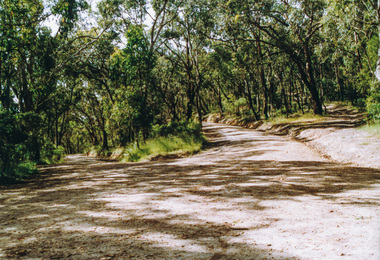
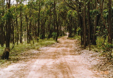
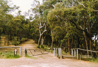
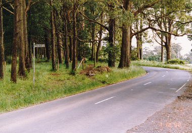
Photograph, Rodger Road from Alma Road, Panton Hill, 6 December 1992, 06/12/1992
The Eltham Horse Trail: Research and Warrandyte to Kinglake: Survey of proposed route, December 1992: (3) Kangaroo Ground to KinglakeColour photographeltham horse trail (1992 survey), panton hill, rodger road, alma road -
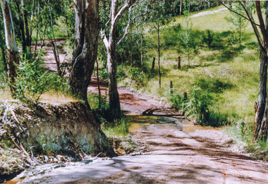 Eltham District Historical Society Inc
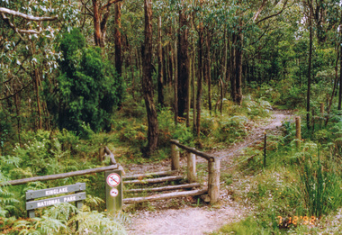
Photograph, Creek crossing, Rodger Road, Panton Hill, 6 December 1992, 06/12/1992
The Eltham Horse Trail: Research and Warrandyte to Kinglake: Survey of proposed route, December 1992: (3) Kangaroo Ground to KinglakeColour photographeltham horse trail (1992 survey), panton hill, rodger road -
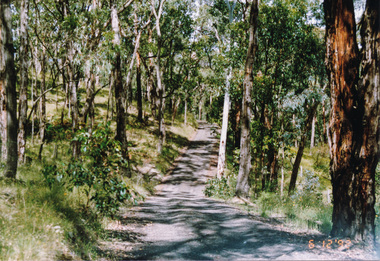 Eltham District Historical Society Inc
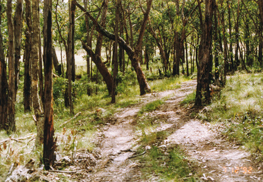
Photograph, Lawrence Road, Panton Hill, 6 December 1992, 06/12/1992
The Eltham Horse Trail: Research and Warrandyte to Kinglake: Survey of proposed route, December 1992: (3) Kangaroo Ground to KinglakeColour photographeltham horse trail (1992 survey), panton hill, lawrence road -
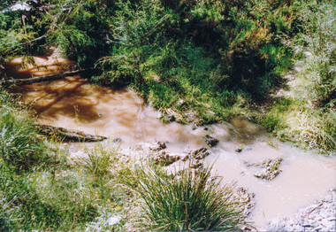 Eltham District Historical Society Inc
Photograph, Creek crossing, Long Gully Bushland Reserve, Panton Hill, 6 December 1992, 06/12/1992
The Eltham Horse Trail: Research and Warrandyte to Kinglake: Survey of proposed route, December 1992: (3) Kangaroo Ground to KinglakeColour photographeltham horse trail (1992 survey), panton hill, long gully road -
 Eltham District Historical Society Inc
Photograph, Motschalls Road from Long Gully Road, Panton Hill, 6 December 1992, 06/12/1992
The Eltham Horse Trail: Research and Warrandyte to Kinglake: Survey of proposed route, December 1992: (3) Kangaroo Ground to KinglakeColour photographeltham horse trail (1992 survey), panton hill, motschalls road, long gully road -
 Eltham District Historical Society Inc
Photograph, Motschalls Road near Gills Road (now Turnung Road), Panton Hill, 6 December 1992, 06/12/1992
The Eltham Horse Trail: Research and Warrandyte to Kinglake: Survey of proposed route, December 1992: (3) Kangaroo Ground to KinglakeTwo colour photographseltham horse trail (1992 survey), panton hill, motschalls road, gills road, turnung road -
 Eltham District Historical Society Inc
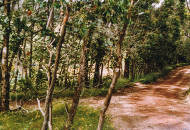
Photograph, Thick bush along unopened Government Road off Motschalls Road, Panton Hill, 6 December 1992, 06/12/1992
The Eltham Horse Trail: Research and Warrandyte to Kinglake: Survey of proposed route, December 1992: (3) Kangaroo Ground to KinglakeColour photographeltham horse trail (1992 survey), panton hill, motschalls road -
 Eltham District Historical Society Inc
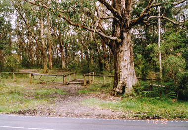
Photograph, Near Clintons Road, Panton Hill, 6 December 1992, 06/12/1992
The Eltham Horse Trail: Research and Warrandyte to Kinglake: Survey of proposed route, December 1992: (3) Kangaroo Ground to KinglakeColour photographeltham horse trail (1992 survey), panton hill, clintons road -
 Eltham District Historical Society Inc
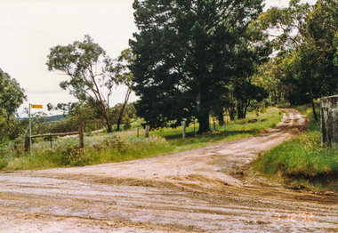
Photograph, Rob Roy Road, Panton Hill to Christmas Hills, 6 December 1992, 06/12/1992
The Eltham Horse Trail: Research and Warrandyte to Kinglake: Survey of proposed route, December 1992: (3) Kangaroo Ground to KinglakeColour photographeltham horse trail (1992 survey), panton hill, rob roy road, christmas hills -
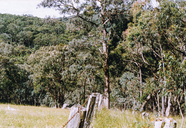 Eltham District Historical Society Inc
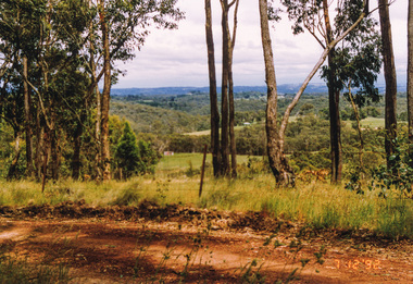
Photograph, Happy Valley bushland from Rob Roy Road, Panton Hill, 6 December 1992, 06/12/1992
The Eltham Horse Trail: Research and Warrandyte to Kinglake: Survey of proposed route, December 1992: (3) Kangaroo Ground to KinglakeColour photographeltham horse trail (1992 survey), panton hill, rob roy road, happy valley -
 Eltham District Historical Society Inc
Photograph, Western end of Mineshaft Road, Smiths Gully, 6 December 1992, 06/12/1992
The Eltham Horse Trail: Research and Warrandyte to Kinglake: Survey of proposed route, December 1992: (3) Kangaroo Ground to KinglakeColour photographeltham horse trail (1992 survey), mineshaft road, smiths gully -
 Eltham District Historical Society Inc
Photograph, Mineshaft Road at One Tree Hill Road, Smiths Gully, 6 December 1992, 06/12/1992
The Eltham Horse Trail: Research and Warrandyte to Kinglake: Survey of proposed route, December 1992: (3) Kangaroo Ground to KinglakeColour photographeltham horse trail (1992 survey), mineshaft road, smiths gully, one tree hill road -
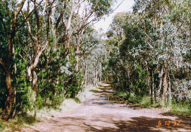
 Eltham District Historical Society Inc
Photograph, Hairpin bend on One Tree Hill Road, Smiths Gully, 6 December 1992, 06/12/1992
The Eltham Horse Trail: Research and Warrandyte to Kinglake: Survey of proposed route, December 1992: (3) Kangaroo Ground to KinglakeColour photographeltham horse trail (1992 survey), smiths gully, one tree hill road -
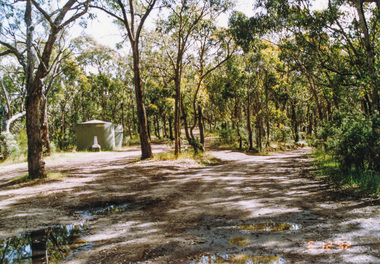
 Eltham District Historical Society Inc
Photograph, Smiths Gully Road looking west near Joyce Road, Smiths Gully, 7 December 1992, 07/12/1992
The Eltham Horse Trail: Research and Warrandyte to Kinglake: Survey of proposed route, December 1992: (3) Kangaroo Ground to KinglakeColour photographeltham horse trail (1992 survey), smiths gully, joyce road, smiths gully road -
 Eltham District Historical Society Inc
Photograph, Looking west from Fox Road, Smiths Gully, 7 December 1992, 07/12/1992
The Eltham Horse Trail: Research and Warrandyte to Kinglake: Survey of proposed route, December 1992: (3) Kangaroo Ground to KinglakeColour photographeltham horse trail (1992 survey), smiths gully, fox road -
 Eltham District Historical Society Inc
Photograph, Track to Rifle Range Road off Fox Road, Smiths Gully, 7 December 1992, 07/12/1992
The Eltham Horse Trail: Research and Warrandyte to Kinglake: Survey of proposed route, December 1992: (3) Kangaroo Ground to KinglakeTwo colour photographseltham horse trail (1992 survey), smiths gully, fox road, rifle range road -
 Eltham District Historical Society Inc
Photograph, Rifle Range Road, Smiths Gully, 7 December 1992, 07/12/1992
The Eltham Horse Trail: Research and Warrandyte to Kinglake: Survey of proposed route, December 1992: (3) Kangaroo Ground to KinglakeColour photographeltham horse trail (1992 survey), smiths gully, rifle range road -
 Eltham District Historical Society Inc
Photograph, Rifle Range Road Track near Buttermans Track, St Andrews, 7 December 1992, 07/12/1992
The Eltham Horse Trail: Research and Warrandyte to Kinglake: Survey of proposed route, December 1992: (3) Kangaroo Ground to KinglakeColour photographeltham horse trail (1992 survey), buttermans track, rifle range road track, st andrews -
 Eltham District Historical Society Inc
Photograph, Marshalls Road from Buttermans Track, St Andrews, 7 December 1992, 07/12/1992
The Eltham Horse Trail: Research and Warrandyte to Kinglake: Survey of proposed route, December 1992: (3) Kangaroo Ground to KinglakeColour photographeltham horse trail (1992 survey), st andrews, marshalls road, buttermans track -
 Eltham District Historical Society Inc
Photograph, Mt Everard Track at Marshalls Road, St Andrews, 7 December 1992, 07/12/1992
The Eltham Horse Trail: Research and Warrandyte to Kinglake: Survey of proposed route, December 1992: (3) Kangaroo Ground to KinglakeColour photographeltham horse trail (1992 survey), st andrews, marshalls road, mt everard track -
 Eltham District Historical Society Inc
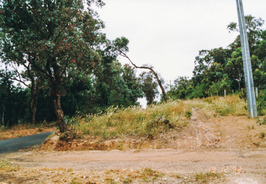
Photograph, Northern end of Mt Everard Track, Kinglake, 7 December 1992, 07/12/1992
The Eltham Horse Trail: Research and Warrandyte to Kinglake: Survey of proposed route, December 1992: (3) Kangaroo Ground to KinglakeColour photographeltham horse trail (1992 survey), mt everard track, kinglake -
 Eltham District Historical Society Inc
Photograph, Southern end of Cooksons Hill Track, Kinglake, 7 December 1992, 07/12/1992
The Eltham Horse Trail: Research and Warrandyte to Kinglake: Survey of proposed route, December 1992: (3) Kangaroo Ground to KinglakeColour photographeltham horse trail (1992 survey), kinglake, cooksons hill track -
 Eltham District Historical Society Inc
Photograph, Northern end of Cooksons Hill Track, Kinglake, 7 December 1992, 07/12/1992
The Eltham Horse Trail: Research and Warrandyte to Kinglake: Survey of proposed route, December 1992: (3) Kangaroo Ground to KinglakeColour photographeltham horse trail (1992 survey), kinglake, cooksons hill track -
 Eltham District Historical Society Inc
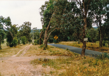
Photograph, Pinchgut Lane to left and Jerusalem Track straight ahead, Kinglake, 7 December 1992, 07/12/1992
The Eltham Horse Trail: Research and Warrandyte to Kinglake: Survey of proposed route, December 1992: (3) Kangaroo Ground to KinglakeColour photographeltham horse trail (1992 survey), kinglake, jerusalem track, pinchgut lane -
 Eltham District Historical Society Inc
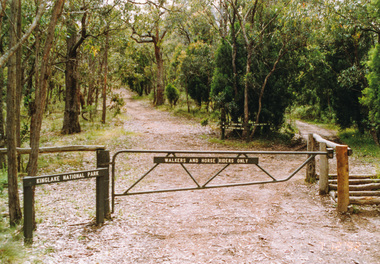
Photograph, Hurstbridge Road at Pinchgut Lane, Kinglake, 7 December 1992, 07/12/1992
The Eltham Horse Trail: Research and Warrandyte to Kinglake: Survey of proposed route, December 1992: (3) Kangaroo Ground to KinglakeColour photographeltham horse trail (1992 survey), kinglake, pinchgut lane, hurstbridge road -
 Eltham District Historical Society Inc
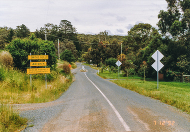
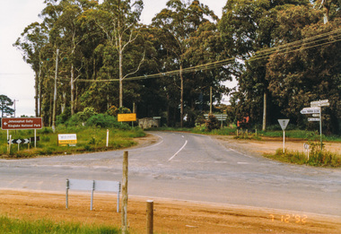
Photograph, Main Road junction, Kinglake, 7 December 1992, 07/12/1992
The Eltham Horse Trail: Research and Warrandyte to Kinglake: Survey of proposed route, December 1992: (3) Kangaroo Ground to KinglakeColour photographeltham horse trail (1992 survey), kinglake, healesville-kinglake road, heidelberg-kinglake road, whittlesea-kinglake road -
 Eltham District Historical Society Inc
Photograph, Ingrams Road, south from Allendale Road, Research, 19 December 1992, 19/12/1992
The Eltham Horse Trail: Research and Warrandyte to Kinglake: Survey of proposed route, December 1992: (4) Connecting trail to ElthamColour photographeltham horse trail (1992 survey), allendale road, ingrams road, research (vic.) -
 Eltham District Historical Society Inc
Photograph, Ingrams Road looking north to Allendale Road, Research, 19 December 1992, 19/12/1992
The Eltham Horse Trail: Research and Warrandyte to Kinglake: Survey of proposed route, December 1992: (4) Connecting trail to ElthamColour photographeltham horse trail (1992 survey), allendale road, ingrams road, research (vic.) -
 Eltham District Historical Society Inc
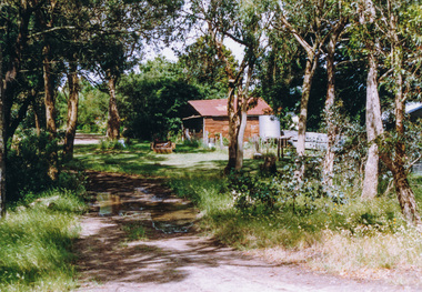
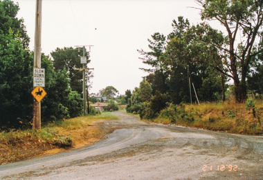
Photograph, Margaret Street from Ingrams Road, Research, 21 December 1992, 21/12/1992
The Eltham Horse Trail: Research and Warrandyte to Kinglake: Survey of proposed route, December 1992: (4) Connecting trail to ElthamColour photographeltham horse trail (1992 survey), ingrams road, research (vic.), margaret street -
 Eltham District Historical Society Inc
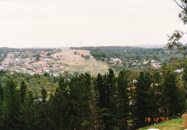
Photograph, Power line easement between Eltham and Research viewed from Afton Street, Research, 19 December 1992, 19/12/1992
The Eltham Horse Trail: Research and Warrandyte to Kinglake: Survey of proposed route, December 1992: (4) Connecting trail to ElthamColour photographeltham horse trail (1992 survey), afton street, eltham, research (vic.), transmission lines