Showing 23111 items matching "sardine-creek"
-
 Eltham District Historical Society Inc
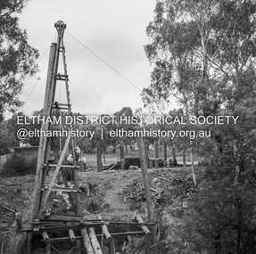
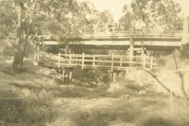
Negative - Photograph, J.A. McDonald, Eltham-Diamond Creek Road, May 1958
Bridge over Diamond Creek Pile driving Diamond Creek pier Bridge construction Eltham-Diamond Creek road over the Diamond Creek (Wattletree Road), Eltham, May 1958Record of various Shire of Eltham infrastructure works undertaken during the period of 1952-1962 involving bridge and road reconstruction projects, sometimes with Eltham Shire Council Project Reference numbers quoted. It was during this period that a number of significant improvements were made to roads and new bridges constructed within the shire that remain in place as of present day (2022). In many situations, the photos provide a tangible visible record of infrastructure that existed throughout the early days of the Shire. The album was put together by or under the direction of the Shire Engineer, J.A. McDonald.infrastructure, shire of eltham, 1958-05, bridge construction, wattletree road bridge -
 Eltham District Historical Society Inc
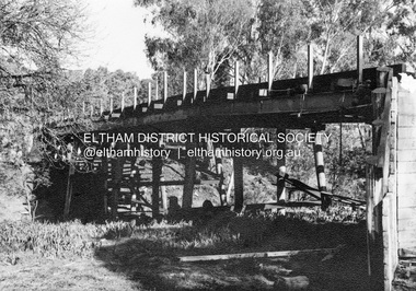
Album - Photograph, J.A. McDonald, Eltham-Diamond Creek Road, Sep. 1959
Bridge over Diamond Creek From Diamond Creek abutment September 1958 Bridge construction Eltham-Diamond Creek road over the Diamond Creek (Wattletree Road), Eltham, Sept 1959Record of various Shire of Eltham infrastructure works undertaken during the period of 1952-1962 involving bridge and road reconstruction projects, sometimes with Eltham Shire Council Project Reference numbers quoted. It was during this period that a number of significant improvements were made to roads and new bridges constructed within the shire that remain in place as of present day (2022). In many situations, the photos provide a tangible visible record of infrastructure that existed throughout the early days of the Shire. The album was put together by or under the direction of the Shire Engineer, J.A. McDonald.infrastructure, road construction, shire of eltham, bridge construction, bridge, diamond creek (creek), eltham, eltham north, glen park bridge, wattletree road bridge -
 Ringwood and District Historical Society
Photograph, View south up New Street from reserve on the bank of the Mullum Creek. 1981
Written on back of photograph, "16/6/81. View south up New Street from reserve on the bank of the Mullum Creek." -
 Ringwood and District Historical Society
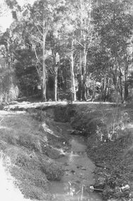
Photograph, View along Mullum Creek in the reserve at foot of New Street 1981
Written on back of photograph, "16/6/81. View along Mullum Creek in the reserve at foot of New Street. The water was clear" -
 Ringwood and District Historical Society
Photograph, Warrandyte Road bridge over Mullum Creek, Ringwood. 1921 or 1931
Written on photographs, "Warrandyte Road bridge over Mullum Creek" One photograph is dated 1921 and the other 1931. (3 copies) -
 Ringwood and District Historical Society
Photograph, Digging for the big barrel drain which runs down New Street from "Target" to the creek, Ringwood. 1981
Written on back of photograph, '25.8.81 - Digging for the big barrel drain which runs down New Street from "Target" to the creek." -
 Ringwood and District Historical Society
Photograph, Mullum Mullum Creek- 29-10-89
Black and white photograph"Written on back of photograph" Mullum Mullum Creek North bank West of Harrison St Rubbish and weeds - view generally to the East -
 Ringwood and District Historical Society
Photograph, Mullum Mullum Creek- 29-10-89
Black and white photograph"Written on back of photograph" Mullum Mullum Creek North bank. A swampy patch at the rear of a Munro St property. Not drained or cared for. -
 Ringwood and District Historical Society
Photograph, Ringwood Rifle Club. Re-building viaduct destroyed in bushfire of January 1962 - Jumping Creek Reserve
Black and white photographTyped on back of photograph- "Ringwood Rifle Club. Re-building viaduct destroyed in bushfires of January 1962. Jumping Creek Reserve". -
 Stawell Historical Society Inc
Photograph, Pleasant Creek Training Centre -- Aerial View
Framed Aerial view of Pleasant Creek Training Centre Referred to as Pleasant Creek Training Centre or Pleasant Creek Special Schoolstawell -
 Whitehorse Historical Society Inc.
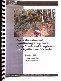
Document - Heritage Report, Rymer, Tom and Debney, Taryn, An Archaelogical Monitoring Program at Deep Creek and Loughnan Roads, Mitcham, Victoria, October 2001
The report on an archaeological monitoring program at Deep Creek and Loughnan Roads, Mitcham for the Eastern Freeway Extension to ensure that any Aboriginal and historical sites were suitably managed.An archaeological monitoring program at Deep Creek and Loughnan Roads, Mitcham for the Eastern Freeway Extension is reported to ensure that any Aboriginal and historical sites were suitably managed.non-fictionThe report on an archaeological monitoring program at Deep Creek and Loughnan Roads, Mitcham for the Eastern Freeway Extension to ensure that any Aboriginal and historical sites were suitably managed.deep creek road mitcham, archaeological sites, loughnan road ringwood -
Lakes Entrance Historical Society
Book, LERHS, Bunga Creek School 3365, 2010
Folder containing sparse information about the Bunga Creek State School no 3365 which was situated a few miles north east of the township Lakes Entrance Victoriaschools, education -
 Clunes Museum
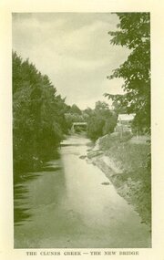
Photograph, AJAX SERIES
PRODUCED IN VICTORIACOPY OF PHOTOGRAPH OF CLUNES CREEK - BLUESTONE "GOVERNMENT" BRIDGE IN THE BACKGROUND, SMALL HUT ON RIGHT HAND BANK OF CREEK.THE CLUNES CREEK - THE NEW BRIDGElocal history, document, postcard, bridges -
 Lakes Entrance Historical Society
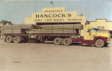
Photograph - Hancock Trucking, Hancocks depot Carpenter Street Lakes Entrance Victoria, 1958
Waygara Sawmilling Company owned by Harry Lederman of MelbourneColour photograph of Hancocks bogie drive truck loaded with timber from Waygara Sawmilling Company Sardine Creek parked in front of Hancocks depot Carpenter Street Lakes Entrance Victoria transport, businesses -
 Stawell Historical Society Inc
Photograph, Pleasant Creek Special School Staff
Pleasant Creek Staff Former Pleasant Creek Hospital site. Sometimes referred to as Pleasant Creek Special School and sometimes Pleasant Creet Training Centre.stawell -
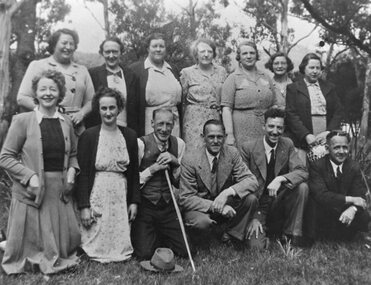
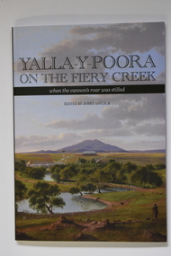 Warrnambool and District Historical Society Inc.
Book - Yalla-Y-Poora On The Fiery Creek, James Affleck, Yalla-Y-Poora On The Fiery Creek when the cannon's roar was stilled, 2023
Number Six in James Affleck's series of book on Soldier Settlements in Western Victoria. An edited compilation of settler families' own stories, combined with a reincorporation of a previously published history of the area, profiles of local people and organisations illustrated with maps, photographs and poetry136 page softcover book. Front cover has the Title: "Yalla-Y-Poora On The Fiery Creek when the cannon's roar was stilled" printed over a coloured print of Eugene von Guerard's painting of Yalla-y-Poora; Back cover: Three colour photographs soldier settlement farming family descendants, soldier settler house and tractor. Yalla-Y-Poora On The Fiery Creek printed on spine.non-fictionNumber Six in James Affleck's series of book on Soldier Settlements in Western Victoria. An edited compilation of settler families' own stories, combined with a reincorporation of a previously published history of the area, profiles of local people and organisations illustrated with maps, photographs and poetrysoldier settlement, yalla-y-poora -
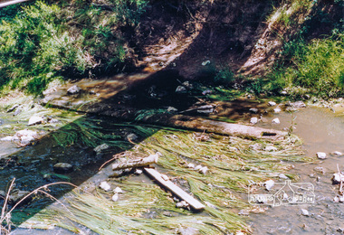 Eltham District Historical Society Inc
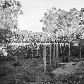
Photograph, Cross beam from old timber Main Road bridge over the Diamond Creek, 1992, 1992
Two colour photographs of old cross beam from original Main Road trestle bridge lying in creek bed. It is downstream from the current re-structured bridgebridges, diamond creek, main road, eltham south -
 Stawell Historical Society Inc
Photograph, Angela Fletcher, Tyrie's Block Tree Greens Creek 1980's, 1980
Photograph of House at Greens Creek and four photographs of enormous tree at Tyrie's Block which was used as a wash house. Tyries went there in 1876. Property sold to Fletchers in 1979trees -
 Whitehorse Historical Society Inc.
Photograph, Creek Road Mitcham 1939/40, 1939/40
George Thompson had just come home from New Zealand. In the photo is sister Mavis Thompson and possibly George's parentsBlack and white photo taken in 1939/40 of weatherboard house built about 1922 in Creek Road, Mitcham - now called Bird Street. The house is now demolished.creek road mitcham, thompson, george -
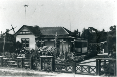
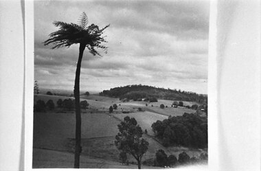 Southern Sherbrooke Historical Society Inc.
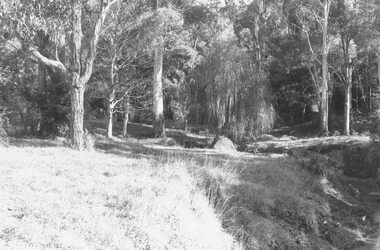
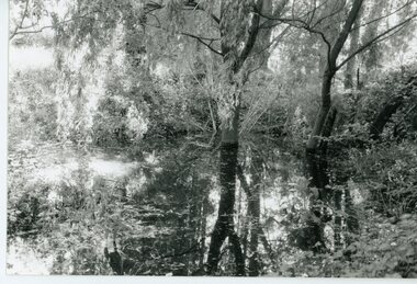
Photograph, Cotswold Valley, Menzies Creek
B&W photo showing the Cotswold Valley, Menzies Creek. It shows fenced paddocks, trees and hedges dotted around. A tall treefern in the foreground. A wooded hill in the background. -
 Stawell Historical Society Inc
Photograph, Pleasant Creek Special School -- Sister A Falvey
Pleasant Creek Sister A. Falvey Former Pleasant Creek Hospital site. Sometimes referred to as Pleasant Creek Special School and sometimes Pleasant Creet Training Centre.stawell -
 Stawell Historical Society Inc
Photograph, Pleasant Creek Special School Ladies Auxiliary
Pleasant Creek Ladies Auxiliary Former Pleasant Creek Hospital site. Sometimes referred to as Pleasant Creek Special School and sometimes Pleasant Creet Training Centre.stawell -
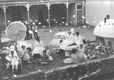 Stawell Historical Society Inc
Photograph, Pleasant Creek Special School Carnival Float
Pleasant Creek Carnival Float Former Pleasant Creek Hospital site. Sometimes referred to as Pleasant Creek Special School and sometimes Pleasant Creet Training Centre.stawell -
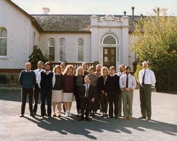 Stawell Historical Society Inc
Photograph, Pleasant Creek Special School Staff 1991 -- Coloured
Pleasant Creek Staff 1991 Former Pleasant Creek Hospital site. Sometimes referred to as Pleasant Creek Special School and sometimes Pleasant Creet Training Centre.stawell -
 Hume City Civic Collection
Container - Bottle, wine, LONGVIEW CREEK/SUNBURY, 1994
The bottle was donated to the museum by Ron and Joan Parker for use in the exhibition ' A history of the Vineyards in Sunbury' held in the George Evans Museum in 1996. The vineyard was planted in 1992.Conventional bronze green glass bottle with indented base. Cream, gold & maroon printed labels. On the front there is a map impression of Longview Gorge in Sunbury. On the back there is geographical and historical information about the vineyard. There is black cap with a thin gold band at its base which covers the neck and opening of the bottle.Front label: " LONGVIEW CREEK / SUNBURY / PINOT NOIR / 1994 / Produce of Australia"; " S A A 5300" embossed on the glass around the base of the bottle.wines, wineries, longview creek vineyard, longview gorge, parker, joan, winemakers, hodgson, david, ron, george evans collection, 1990s -
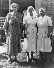 Stawell Historical Society Inc
Photograph, Pleasant Creek Special School --- Matron Carter 1955
Pleasant Creek Matron Carter 1955 Former Pleasant Creek Hospital site. Sometimes referred to as Pleasant Creek Special School and sometimes Pleasant Creet Training Centre.stawell -
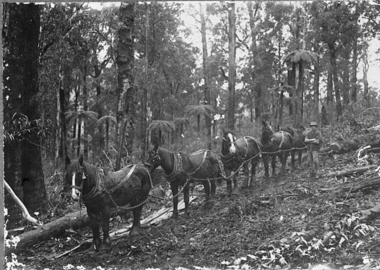 Upper Yarra Museum
Negative Photographic Reproduction, Horse team at work, Hoddles Creek, 13/4/1983
This was the one way of transporting logs to the Timber MillNegative Black white Scanned at 600 dpi. Horse team at work, Hoddles Creek, A four Horses Team "Snigging" a log out of the bush, one man in charge of the team.timber, horse team, sandy ross, hoddles creek, snigging -
 Buninyong & District Historical Society
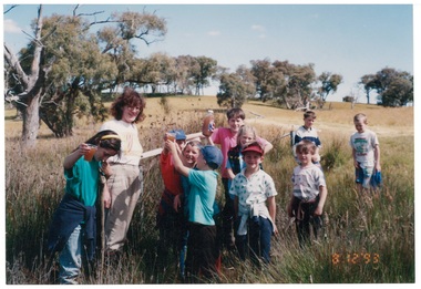
Photograph - Colour photograph of Clarendon State School excursion to Williamson's Creek 1993, Clarendon State School excursion to Williamson's Creek 1993
Colour photo, Clarendon State School excursion to Mineral Springs, Burnt Bridge, Williamson's Creek 1993, last excursion before school closed, led by Ann Beggs Sunterclarendon school, excursion, mineral springs, burnt bridge, williamson's creek -
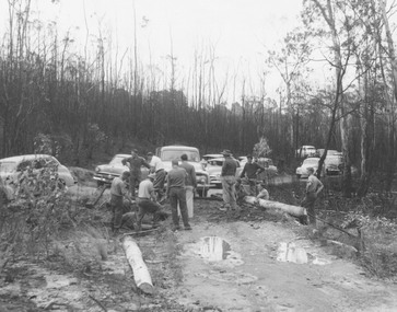
 Eltham District Historical Society Inc
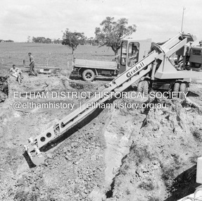
Negative - Photograph, J.A. McDonald, Dixons Creek Road, c.May 1958
Bridge over Dixons Creek Contractor Morris Gradall cutting batters on Dixons CreekRecord of various Shire of Eltham infrastructure works undertaken during the period of 1952-1962 involving bridge and road reconstruction projects, sometimes with Eltham Shire Council Project Reference numbers quoted. It was during this period that a number of significant improvements were made to roads and new bridges constructed within the shire that remain in place as of present day (2022). In many situations, the photos provide a tangible visible record of infrastructure that existed throughout the early days of the Shire. The album was put together by or under the direction of the Shire Engineer, J.A. McDonald.infrastructure, shire of eltham, 1958-05, bridge construction, dixons creek bridge, dixon's creek road, gradall -
 Eltham District Historical Society Inc
Negative - Photograph, J.A. McDonald, Eltham-Diamond Creek Road, May 1958
Bridge construction Eltham-Diamond Creek road over the Diamond Creek (Wattletree Road), Eltham, May 1958 Looking toward Eltham-Yarra Glen Road from Diamond Creek abutmentRecord of various Shire of Eltham infrastructure works undertaken during the period of 1952-1962 involving bridge and road reconstruction projects, sometimes with Eltham Shire Council Project Reference numbers quoted. It was during this period that a number of significant improvements were made to roads and new bridges constructed within the shire that remain in place as of present day (2022). In many situations, the photos provide a tangible visible record of infrastructure that existed throughout the early days of the Shire. The album was put together by or under the direction of the Shire Engineer, J.A. McDonald.1958-05, bridge construction, diamond creek (creek), eltham, eltham north, glen park bridge, infrastructure, shire of eltham, wattletree road bridge