Showing 9800 items matching " west"
-
 Eltham District Historical Society Inc
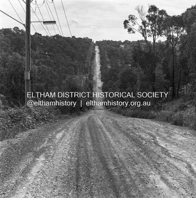
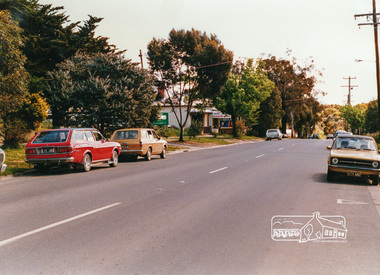
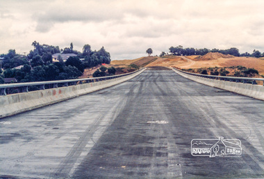
Photograph, Michael Wood, Progress Road looking west from Lower Road, Eltham North, 1976, 1976
Progress Road between Ryans Road and Lower Road, Eltham North; prior to realignment and construction, 1976Kodak Safety Film 120 format 6 x 6 cm black and white negative; 3 strips, 12 frames Also 30 x 25 cm black and white print of this image frameeltham north, progress road, road construction, lower road -
 Eltham District Historical Society Inc
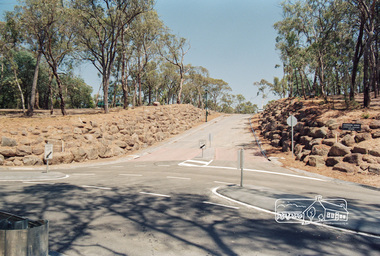
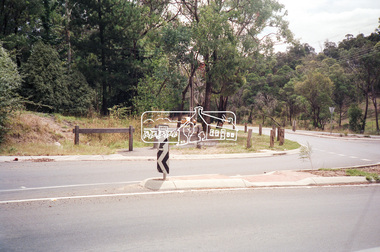
Photograph, Looking west up Nerreman Gateway from intersection with Ryans Road, Eltham, c.1992, 1992c
Gordon Ford landscape design at entrance to Nerreman Gateway.Roll of 35mm colour negative film, 7 strips Fuji 100eltham, gordon ford, nerreman gateway, nerreman park estate, ryans road,streets -
 Eltham District Historical Society Inc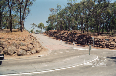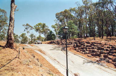
Photograph, Looking west near 942 Main Road, Hurstbridge, c. Oct 1987, 1987
Yvonne's Dressmaking and Alteration Service at 942 Main Road. Formerly a bakery, the building was demolished in 1990 and is now the site of Hurstbridge Saddlery. The milkbar is down the road, brick wall with a blue sign on it. There's still an older house next to the milkbar, but that's hidden from view in this shot as it's further back from the road. Date based on other similar display panels visible in images of the Shire of Eltham display at the Eltham Community Festival, 7 November 1987. Shire of Eltham Engineering Department Providing the resources to undertake • Survey, design, consultation • Road construction and maintenance • Bridge construction and maintenance • Street sweeping • Drain and pit cleaning • Traffic engineering installation and maintenance • Garbage collection • Tip management, land reclamation and beautification • Maintenance of community buildings • Provision of community and recreation facilitiesPhoto print mounted on carddisplay panel, eltham festival, heidelberg-kinglake road, hurstbridge, hurstbridge milk bar, infrastructure, main road, mm, shire of eltham, yvonne's dressmaking and alteration service -
 Eltham District Historical Society Inc
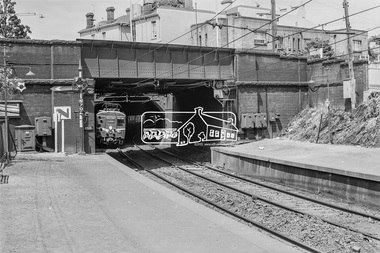
Photograph, George Coop, A Princes Bridge city bound Harris (Blue) train departing West Richmond Railway Station, c.1962, 1962
Digital TIFF file Scan of 35mm Ilford FP3 black and white transparencyharris (blue) train, west richmond railway station -
 Eltham District Historical Society Inc
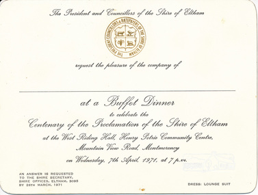
Card, Invitation to Buffet Dinner to celebrate the Centenary of the Proclamation of the Shire of Eltham at the West Riding Hall, Henry Petrie Community Centre, Mountain View Road, Montmorency, 7 April 1971, 1971
Originally donated in a photo album prepared by Doug and Gwen Orford of Historical Society trips.Invitation cardinvitation, activities, buffet dinner, henry petrie community centre, shire of eltham centenary -
 Eltham District Historical Society Inc
Photograph, Looking west along Brougham Street, Eltham, c.1988, 1988c
Road construction works on Brougham Street prior to sealing, outside No. 21.Colour photographbrougham street, eltham, road construction, streets -
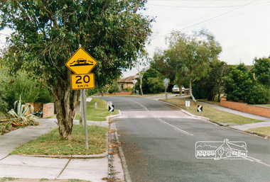 Eltham District Historical Society Inc
Photograph, Looking west near 58 Airlie Road, Montmorency, c.1989, 1989c
The Shire of Eltham was introducing a number of speed humps throughout the shire around this time period and took a photographic record of various new installations.Colour photographinfrastructure, airlie road, montmorency, speed humps, streets -
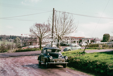 Eltham District Historical Society Inc
Photograph, Looking west from Brougham Street near Eltham Courthouse across Main Road, 30 August 1967, 1967
35mm Colour positive transparency Mount - Agfacolor Service (Blue stepped)brougham steet, eltham, eltham courthouse, main road, mobil service station -
 Eltham District Historical Society Inc
Photograph, Looking west along Old Eltham Road towards intersection with Main Road, Lower Plenty, 1968, 1968
35mm Colour positive transparency Mount - Agfacolor Service (Blue stepped)lower plenty, main road, old eltham road -
 Eltham District Historical Society Inc
Photograph, Looking west along Old Eltham Road towards intersection with Main Road, Lower Plenty, 1968, 1968
35mm Colour positive transparency Mount - Agfacolor Service (Blue stepped)lower plenty, main road, old eltham road -
 Eltham District Historical Society Inc
Photograph, Looking west along Main Road at intersection with Research-Warrandyte Road, Research, c.1989, 1989
Roll of 35mm colour negative film, 5 strips Kodak GA100 5095infrastructure, main road, research (vic.), research-warrandyte road, streets -
 Lara RSL Sub Branch
Manual - Raaf Ground Defence - Australia, New Guinea, South West Pacific Areas 1939 - 1940 - 1945 - Korea
R.A.A. F. Instructional ManualCovers WW2 and Korea WarsA instruction Manual Compiled by Warrant Officer , M.I.D. Owned by A, J. Quickr.a.a.f. manual -
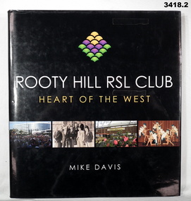 Bendigo Military Museum
Book - BOOK RSL, Mike Davis, Rooty Hill RSL Club, Heart of the West, 2004
.1) Hard cover, black buckram with gold print on front & spine. .2) Dust cover, white & yellow coloured print on front & spine. Black background with 4 coloued photos on front & 1 on back. 189 pages, cut, plain, glass white. Illustrated black / white & colour photos. Yellow coloured end papers & fly leaf. .3) Folded card, laminated beige colour. Copy of Food Ration Book cover used as a menu for the 70th Anniversary of the Rooty Hill RSL Branch 1937 - 2007..3) Printed in black: "On the occasion of the 70th Anniversary of the Rooty Hill RSL Branch 1937 - 2007. Date: 22nd September 2007"book, anniversary, rooty hill -
 Federation University Historical Collection
Letter, West Australian Gold Fields Coolgardie
west australian gold fields coolgardie, coolgardie, daniell -
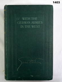 Bendigo Military Museum
Book, Sven Hedin, With the German Armies in the West
Green buckram hard cover, light green print. 402 pages, illustrated black & white maps / drawings. books, biography, military history -
Phillip Island and District Historical Society Inc.
Book, GRIGSON, Geoffrey, West Country / with a portrait by Geoffrey Grigson, 1951
Labelled 'Himmer Bequest'. Stamped 'Cowes Free Public Library'. -
Lorne Historical Society
Map - Subdivision Map, J Batten Lithos, Plan of West Lorne Loutitt Bay Allotments IV and V
One of the early subdivision maps of Lorne.Black and white printed map on cream paper. The map shows allotments from the Erskine River to the Grand Pacific with an inset of allotments between Smith and Otway Streets. Allotments have the owners names.. The sea baths, Cobb and Co stables , Mountjoys Hotel, the Church of England, the telegraph line to Geelong and the jetty are also marked.lorne, subdivisions, -
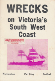 Mission to Seafarers Victoria
Book, Jack Loney, Wrecks on Victoria's South West Coast, 1975
non-fictionkeith oliver, donation -
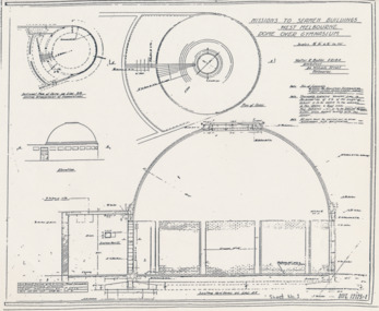 Mission to Seafarers Victoria
Plan - Architectural drawings, Walter Butler, Missions to Seamen Buildings, West Melbourne, Dome Over Gymnasium, 1916
In August 1916, Walter R. Butler presented the plans for the future central Seamen's Institute.The drawings show the original plans with rooms' names and intended use. They also show the original concept for the chapel which was in the Spanish Mission style.Plan copied from the 1983 Howden and Wardrop A4 report. flinders street, mission to seamen, mission to seafarers, walter richmond butler (1864–1949), norla dome, st peter chapel, spanish mission, arts and crafts, 1916 -
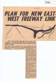 Greensborough Historical Society
Newspaper Clipping, Diamond Valley News, Plan for new East-West freeway link, 1967c
Early plans for the Greensborough by-pass and western ring road.Newspaper clipping, black and white text and image.greensborough bypass, western ring road -
Glenelg Shire Council Cultural Collection
Flyer - Flyer - Brochure Casterton, Victoria, Casterton focus of the South West, c. 1987
DL flyer, tri-fold. Brochure advertising Casterton. Pale mauve, red print, black and white photos. Illustration on front of Casterton Railway Station, signed 'Paul Astbury 1987'. Advertisements in 8156, 8157 are the same, but some of the photos are different. -
4th/19th Prince of Wales's Light Horse Regiment Unit History Room
Booklet, Tactical Methods A. Characteristics - Japanese Tactics - Equipment & Armament B. Tactics and Equipment for Operating against Japanese Forces South West Pacific Area, 1942
All paper stapled booklet covering, in brief, Japanese tactics and equipment and suitable tactics and equipment for use against Japanese forces. world war 2, tactics, japan -
 Eltham District Historical Society Inc
Photograph, Research. Main Road left to right showing school on left top. View from Orchard. Ref. 511 looking south-south west
Source: Mrs. E.R. Reynolds, Thompson Crescent, ResearchThis photo forms part of a collection of photographs gathered by the Shire of Eltham for their centenary project book,"Pioneers and Painters: 100 years of the Shire of Eltham" by Alan Marshall (1971). The collection of over 500 images is held in partnership between Eltham District Historical Society and Yarra Plenty Regional Library (Eltham Library) and is now formally known as the 'The Shire of Eltham Pioneers Photograph Collection.' It is significant in being the first community sourced collection representing the places and people of the Shire's first one hundred years.Digital imagesepp, shire of eltham pioneers photograph collection, research (vic.) -
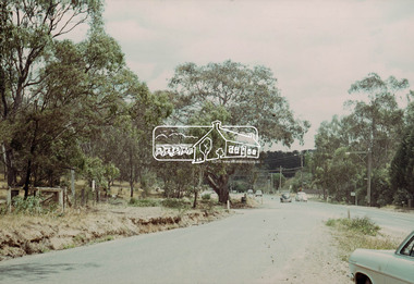
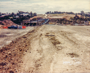 Eltham District Historical Society Inc
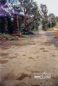
Photograph, Looking west across the new bridge construction across the Plenty River from the eastern side; Greensborough Bypass construction, c.1986, 1986c
Colour photograph originally located in a magnetic style album titled 'Greensborough Bypass 1990s 5' suffering significant degradation. No information contained in album or on reverse of photos except where noted. Relocated to archival photosafe storage.greensborough bypass, road construction, greensborough, bridge construction -
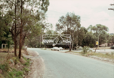
 Eltham District Historical Society Inc
Photograph, Looking west along Plenty River Drive near intersection with Goonyah Court, Greensborough, c.1986, 1986c
Colour photograph originally located in a magnetic style album titled 'Greensborough Bypass 1990s 5' suffering significant degradation. No information contained in album or on reverse of photos except where noted. Relocated to archival photosafe storage.greensborough bypass, road construction, greensborough, plenty river drive, goonyah court -
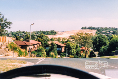
 Eltham District Historical Society Inc
Photograph, Looking west across the new 5-span bridge construction across the Plenty River from near Plenty River Drive; Greensborough Bypass construction, c.1986, 1986c
Colour photograph originally located in a magnetic style album titled 'Greensborough Bypass 1990s 5' suffering significant degradation. No information contained in album or on reverse of photos except where noted. Relocated to archival photosafe storage.greensborough bypass, road construction, greensborough, plenty river drive, bridge construction -
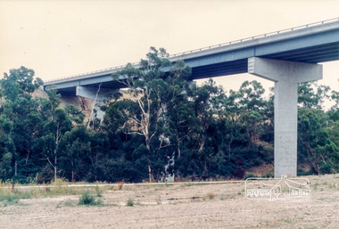
 Eltham District Historical Society Inc
Photograph, Looking west across the new bridge construction across the Plenty River from the eastern side; Greensborough Bypass construction, c.1986, 1986c
Shows the service access road on the hill side which would later be cut away to provide the connection to the Northern Ring Road which was opened in April 1994.Colour photograph originally located in a magnetic style album titled 'Greensborough Bypass 1990s 5' suffering significant degradation. No information contained in album or on reverse of photos except where noted. Relocated to archival photosafe storage.greensborough bypass, road construction, greensborough, northern ring road -
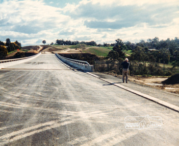
 Eltham District Historical Society Inc
Photograph, Looking west across the new bridge construction across the Plenty River from the eastern side; Greensborough Bypass construction, c.1986, 1986c
Shows the service access road on the hill side which would later be cut away to provide the connection to the Northern Ring Road which was opened in April 1994.Colour photograph originally located in a magnetic style album titled 'Greensborough Bypass 1990s 5' suffering significant degradation. No information contained in album or on reverse of photos except where noted. Relocated to archival photosafe storage.greensborough bypass, road construction, greensborough, northern ring road