Showing 25579 items matching "plenty-township-estate"
-
 Greensborough Historical Society
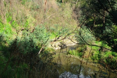
Photograph - Digital Image, Plenty River Greensborough, May 2014 -7, 21/05/2014
The Plenty River flows south from Mt Disappointment before meeting with the Yarra River at Rosanna. Early settlement in Greensborough was based around the Plenty River. These images were taken in the Greensborough area by Marilyn Smith May 2014.Digital copy of colour photograph.plenty river -
 Greensborough Historical Society
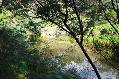
Photograph - Digital Image, Plenty River Greensborough, May 2014 -6, 21/05/2014
The Plenty River flows south from Mt Disappointment before meeting with the Yarra River at Rosanna. Early settlement in Greensborough was based around the Plenty River. These images were taken in the Greensborough area by Marilyn Smith May 2014.Digital copy of colour photograph.plenty river -
 Greensborough Historical Society
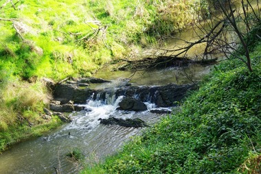
Photograph - Digital Image, Plenty River Greensborough, May 2014 -5, 21/05/2014
The Plenty River flows south from Mt Disappointment before meeting with the Yarra River at Rosanna. Early settlement in Greensborough was based around the Plenty River. These images were taken in the Greensborough area by Marilyn Smith May 2014.Digital copy of colour photograph.plenty river -
 Greensborough Historical Society
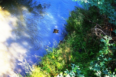
Photograph - Digital Image, Plenty River Greensborough, May 2014 -4, 21/05/2014
The Plenty River flows south from Mt Disappointment before meeting with the Yarra River at Rosanna. Early settlement in Greensborough was based around the Plenty River. These images were taken in the Greensborough area by Marilyn Smith May 2014.Digital copy of colour photograph.plenty river -
 Greensborough Historical Society
Photograph - Digital Image, Plenty River Greensborough, May 2014 -3, 21/05/2014
The Plenty River flows south from Mt Disappointment before meeting with the Yarra River at Rosanna. Early settlement in Greensborough was based around the Plenty River. These images were taken in the Greensborough area by Marilyn Smith May 2014.Digital copy of colour photograph.plenty river -
 Greensborough Historical Society
Photograph - Digital Image, Plenty River Greensborough, May 2014 -2, 21/05/2014
The Plenty River flows south from Mt Disappointment before meeting with the Yarra River at Rosanna. Early settlement in Greensborough was based around the Plenty River. These images were taken in the Greensborough area by Marilyn Smith May 2014.Digital copy of colour photograph.plenty river -
 Ringwood and District Historical Society
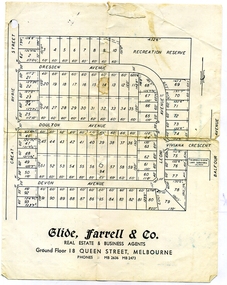
Document, Glen Turnbull, Land Sale Brochure - Heathmont Hills Estate - subdivision of Stan Wieland's Land (undated), 25/2/2008
Small brochure by Glide Farrell & Co, real estate and Business Agents, Melbourne advertising "93 Superb Building Blocks 3Mins Station & Shops", and "Sky-Line Views of Heathmont Hills Estate" , comprising lots in Dresden Ave, Doulton Ave, Devon Ave, Viviana Crescent, Leoni Avenue. -
 Greensborough Historical Society
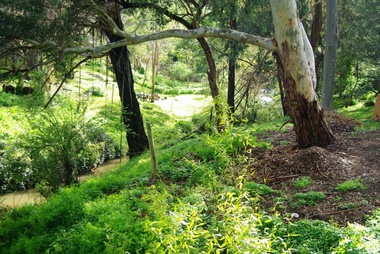
Slide - Photograph, John Ramsdale, Plenty River Montmorency: Slide 112, 1990s
Photograph shows a river and banks; this is the Plenty River at Montmorency.Part of the John Ramsdale collection of slides and audio visual material.Colour photograph scanned from slide.No maker's marks. No caption on slide.plenty river, montmorency -
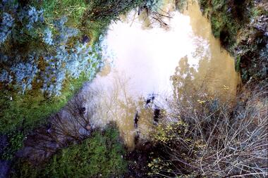 Greensborough Historical Society
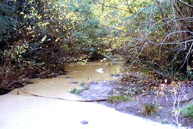
Slide - Photograph, John Ramsdale, Muddy water, Plenty River: Slide 119, 1990s
Photograph is looking down on muddy water in the Plenty River.Part of the John Ramsdale collection of slides and audio visual material.Colour photograph scanned from slide.No caption. Printed maker's mark on slide "Kodak Kodachrome Slide"plenty river -
 Greensborough Historical Society
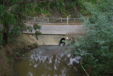
Slide - Photograph, John Ramsdale, Drain into Plenty River: Slide 8, 1990s
Photograph shows a drain or culvert near the Plenty River.Part of the John Ramsdale collection of slides and audio visual material.Colour photograph scanned from slide.No maker's marks. No caption on slide.plenty river, drains, pollution -
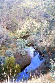 Greensborough Historical Society
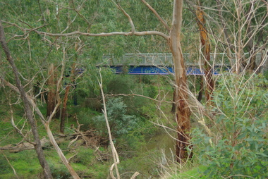
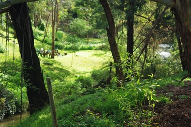
Slide - Photograph, John Ramsdale, Plenty Gorge: Slide 11, 1990s
Photograph shows a river through bushland; this is the Plenty Gorge.Part of the John Ramsdale collection of slides and audio visual material.Colour photograph scanned from slide.No maker's marks. No caption on slide.plenty river, plenty gorge metropolitan park -
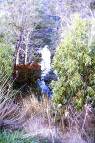 Greensborough Historical Society
Slide - Photograph, John Ramsdale, Plenty Gorge: Slide 59, 1990s
Photograph shows a river through bushland. This is in Plenty Gorge.Part of the John Ramsdale collection of slides and audio visual material.Colour photograph scanned from slide.No maker's marks. No caption on slide.plenty gorge, plenty gorge metropolitan park -
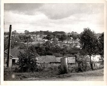 Greensborough Historical Society
Photograph - Digital Image, From Briar Hill towards Plenty Lane, 1960s
Briar Hill in the 1960s, looking towards Plenty LaneDigital copy of black and white photographbriar hill, plenty lane greensborough -
 Greensborough Historical Society
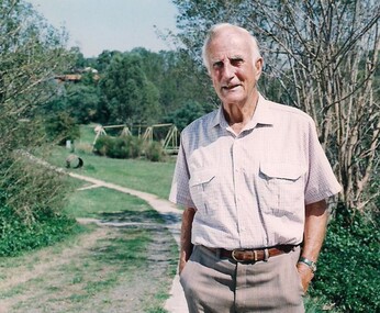
Photograph - Digital Image, Tom Vickers on the Plenty River Trail, 1985_
Tom Vickers on the Plenty River Trail circa 1985.Tom Vickers was a prominent member of the community and a local pharmacist.Digital copy of colour photographvickers family, tom vickers, plenty river trail -
 Greensborough Historical Society
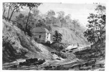
Photograph - Digital image, Mill on the Plenty River, 1870c
Copy of sketch "Mill on the Plenty River", origin unknown. Digital copy of black and white sketch.plenty river -
 Greensborough Historical Society
Photograph - Digital image, Marilyn Smith, On the Plenty River bank near Railway Road Briar Hill, 17/09/2014
On the Plenty River bank near Railway Road Greensborough Digital copy of colour photographrailway road greensborough, plenty river -
 Greensborough Historical Society
Photograph - Digital image, Marilyn Smith, On the Plenty River bank near Railway Road Briar Hill, 17/09/2014
On the Plenty River bank near Railway Road Greensborough Digital copy of colour photographrailway road greensborough, plenty river -
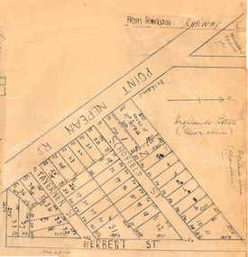 City of Moorabbin Historical Society (Operating the Box Cottage Museum)
Plan - Highlands Estate, Moorabbin
The train line from the city to Frankston was electrified in 1922 which intensified the sale in the municipality of Moorabbin, particularly land which was in the vicinity of the railway stations. This estate was auctioned on Saturday, October 20, 1923.Example of the progress of the Municipality of MoorabbinAdvertising flyer for auction of real estate sales - plan of building blocks for saleHighlands Estate, Moorabbin plan.point nepean road (nepean highway), schofield street, taverner street, herbert street (now linton street), moorabbin, real estate, auction -
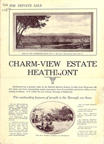 Ringwood and District Historical Society
Flyer, Land Sale Brochure, Charm-View Estate, Heathmont, Vic. - c1926
Double sided folded page advertisement highlighting local facilities, services and layout of blocks for sale in Charm-View Estate.Subdivision includes Heathmont Road, Orchid Street, Bennett Avenue, Dickasons Road and Canterbury Road. (Agents) T. Burkitt & Co., Phone Ringwood 157, Overton & Co., 390 Chapel Street South Yarra, Phone Windsor 542. Solicitor A.V. Wischer, 443 Chancery Lane, Melbourne. -
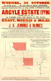 City of Whittlesea
Poster - Posters - advertising, Argyle Estate Advertising, 1913
Poster, paper. Black and red text. Poster for the sale of the sub-divided Argyle Estate Epping 29th October 1913 -
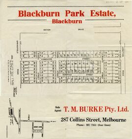 Whitehorse Historical Society Inc.
Document, Blackburn Park Estate, n.d
Land Sale plan for 'Blackburn Park Estate'Land Sale plan for 'Blackburn Park Estate' between Springfield and Junction Roads. Agent T.M. Burke Pty Ltd.Land Sale plan for 'Blackburn Park Estate'blackburn park estate, blackburn north, springfield road, junction road, sussex street, essex street, yorkshire street, lulworth street, norfolk street -
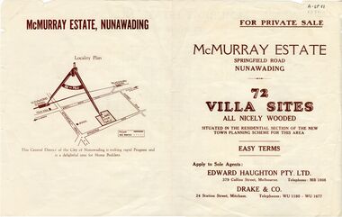 Whitehorse Historical Society Inc.
Document, McMurray Estate, n.d
Brochure advertising sale of 'McMurray Estate', Nunawading. 72 lots.Brochure advertising sale of 'McMurray Estate', Nunawading. 72 lots. Agents: Edward Haughton Pty Ltd; Drake & Co.Brochure advertising sale of 'McMurray Estate', Nunawading. 72 lots. land sales, mcmurray estate, mcmurray, a.w., springfield road, nunawading, esdale street, sandy street, the corso, mcmurray street -
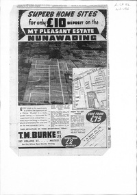 Whitehorse Historical Society Inc.
Document, Mount Pleasant Estate, ca 1953
Plan and advertisements for 'Mt Pleasant Estate' Forest Hill. 381 allotments. Agent: T. M. Burke Pty Ltd.land sales, mount pleasant estate, rooks road, vermont, canterbury road, forest hill, alwyn street, mitcham, diosma crescent, nunawading, nott street, eugenia street, abelia street, weigela court, nandina street, grevillea court, azalea street, felicia grove, beech street -
 Whitehorse Historical Society Inc.
Map, Kylana Estate Tunstall, 1926
Auctioneer's plan of sub-division of Kylana Estate Tunstall.Auctioneer's plan of sub-division of Kylana Estate Tunstall, 8 sites, 2nd Oct 1926. Auctioneer: Sergeant & LehmannAuctioneer's plan of sub-division of Kylana Estate Tunstall.heather grove tunstall, kylana estate, springvale road tunstall, tunstall -
Lakes Entrance Historical Society
Book, Environment Studies Association of Victoria, Report to the Management Committee, Nyerimilang Estate, 1978
A report to the management committee of the Nyerimilang Estate on the assessment of the conservation and education potentials and development needs of Nyerimilang, Gippsland Lakes Victoria.parks, waterways, heritage -
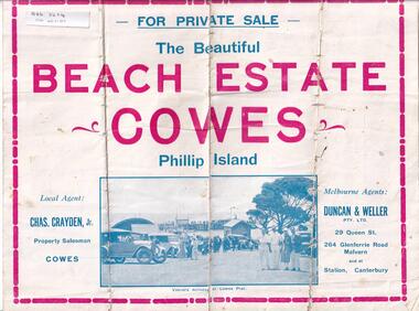 Phillip Island and District Historical Society Inc.
Brochure, Beach Estate Cowes, c 1940's
Advertising Land for Sale in Cowes, Phillip IslandFour page colour Brochure advertising land in Devon Avenue and Cornwall Avenue, Cowes, For Sale. Illustrations of Cowes Pier, The Beach at Cowes and motoring on the Island.Four pages of Real Estate lingo!! Agents - Chas Grayden Jnr, Cowes and Duncan & Weller, Malvernreal estate, cowes phillip island, charles grayden jnr., cowes, duncan & weller, malvern & canterbury -
 Ringwood and District Historical Society
Photograph, Aerial photo of Cherrydene Estate in foreground off Oban Rd, Ringwood - c.1967
Written on back of photograph, "Aerial photo of Cherry Dene Estate in foreground, c1967 off Oban Rd." -
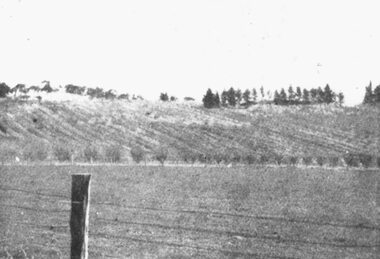 Ringwood and District Historical Society
Photograph, Panoramic View of land for sale. Coleman's Heathmont Estate 15/12/1923
Written on back of photograph, "Panoramic View of land for sale. Coleman's Heathmont Estate 15/12/1923." -
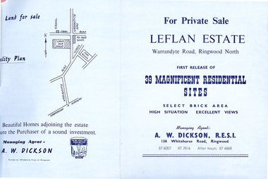 Ringwood and District Historical Society
Document - Folder, Land Sale - Leflan Estate, North Ringwood, Vic. - circa 1967
Bi-fold land sale advertisements for stages 1 and 3 releases of residential allotments in Leflan Estate, Ringwood North, circa 1965-1967. Brochures include area map, layout of the estate, and summary of local facilities and services, with separate attachment listing lot number prices for 2nd and 3rd releases.Subdivision includes Melview Drive, Leslie Grove, Leflan Close, Warrandyte Road and Lockhart Street. Agent - A.W. Dickson, R.E.S.I., 136 Whitehorse Road, Ringwood. (Phone) 870-6007, 870-7016, After hours 870-6868. -
 Greensborough Historical Society
Book, Isabel Ellender, The Plenty Valley Corridor: the archaeological survey of Aboriginal sites / by Isabel Ellender 1991, 1991_
This archaeological survey of the Plenty Valley was conducted by Isabel Ellender in 1991 for the Board of Works (Melbourne Water), in particular the Plenty Gorge Metropolitan Park. The area studied is north of Greensborough to Whittlesea. A number of Aboriginal sites were identified and recommendations made for the future.67 p., illus., maps. Plastic spiral binding.plenty river, aboriginal heritage sites, plenty gorge metropolitan park