Showing 92564 items matching " inc."
-
 Eltham District Historical Society Inc
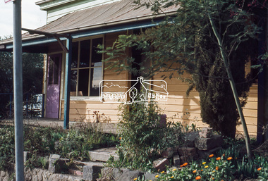
Slide, Joh Ebeli, The old Baker's house prior to demolition, corner of York Street and Main Road, Eltham, c.Sep. 1979
Photo taken immediately prior to the demolition of the old baker's shop on the corner of Main Road and York Street, Eltham. Joh Ebeli and Elwers Howard endeavoured to preserve some parts of the house. The old weatherboard building, possibly dating from the 1860s, comprised a dwelling with a shop in the front room opening off a timber verandah deck which directly fronted the Main Road footpath. At the rear is a brick building of much later date which was for many years used for the bakery. The buildings were demolished for flat construction. Publicity at the time was oriented toward moves to preserve the weatherboard building which came from a number of individuals including members of this society. The society had no official connection with any proposal to retain the building or any part of it on any other site. The issues involved were part of a wider consideration of the matter of preservation of historic buildings. In this case the Society and in particular the committee had been aware for some years of the impending demolition. The possibility of the preservation of the building had been canvassed on a number of occasions. The Society’s view was that whilst the baker’s shop was an interesting old building which contributed to the character of Main Road, it was not of sufficient importance to wage an organised campaign for its preservation. It considered that if the building were to be preserved for historical reasons it would be far more feasible to retain it in its present location than to re-build it on another site.35 mm colour positive transparency Mount - Agfachrome Professional black (Germany) 4 dotsmain road, old eltham bakery, york street -
 Eltham District Historical Society Inc
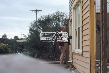
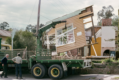
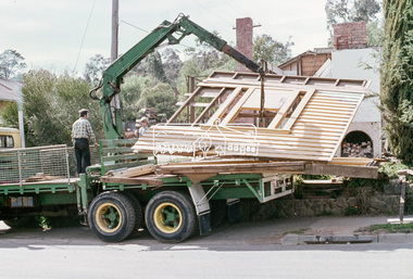
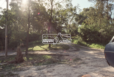
Slide, Joh Ebeli, Preserving parts of the old Baker's house, corner of York Street and Main Road, Eltham, c.Sep. 1979
The old weatherboard building, possibly dating from the 1860s, comprised a dwelling with a shop in the front room opening off a timber verandah deck which directly fronted the Main Road footpath. At the rear is a brick building of much later date which was for many years used for the bakery. The buildings were demolished for flat construction. Joh Ebeli and Elwers Howard endeavoured to preserve some parts of the house.35 mm colour positive transparency Mount - Agfachrome Professional black (Germany) 4 dotsmain road, old eltham bakery, york street -
 Eltham District Historical Society Inc
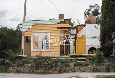
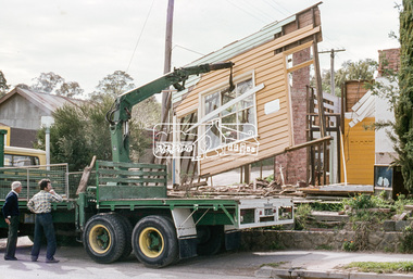
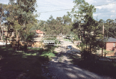
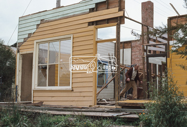
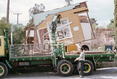
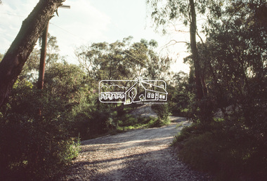
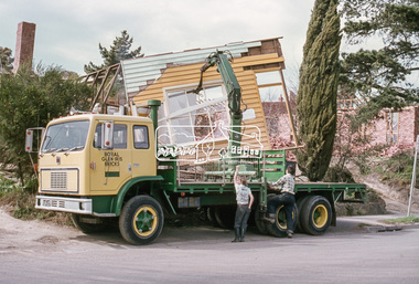
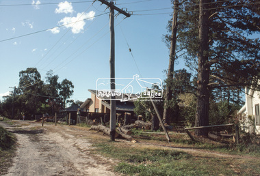
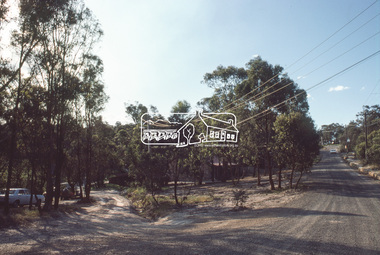
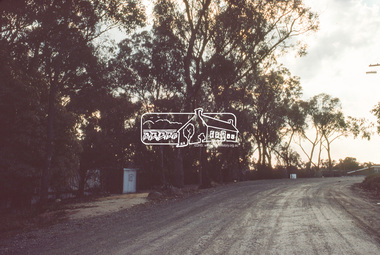
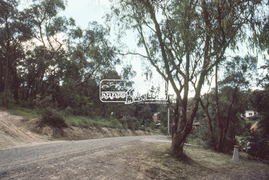
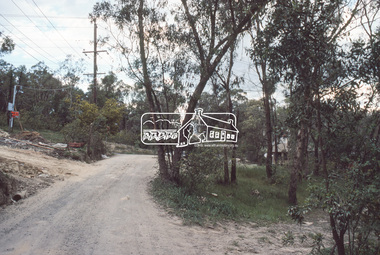
Slide, View looking northeast to turnabout near 10 McCarthy Grove, Montmorency, c.Oct. 1980
One of a series of images of roads and infrastructure taken by Eltham Shire Council Planning and Engineering officers. They provide perspective of the changes in housing styles and road development that began sweeping in from the mid 1970s with increasing urbanisation of what was once more outlying suburbs and regions.35 mm colour positive transparency Mount - Kodak Kodachrome CardProcessed Oct 1980houses, infrastructure, mccarthy grove, montmorency, roads -
 Eltham District Historical Society Inc
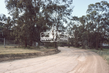
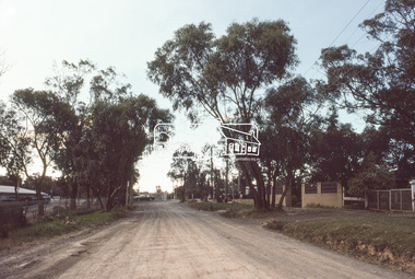
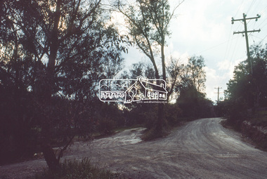
Slide, McCarthy Grove, Montmorency, extended driveway from Main Road, c.Oct. 1980
One of a series of images of roads and infrastructure taken by Eltham Shire Council Planning and Engineering officers. They provide perspective of the changes in housing styles and road development that began sweeping in from the mid 1970s with increasing urbanisation of what was once more outlying suburbs and regions.35 mm colour positive transparency Mount - Kodak Kodachrome CardProcessed Oct 1980houses, infrastructure, mccarthy grove, montmorency, roads -
 Eltham District Historical Society Inc
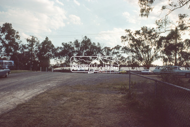
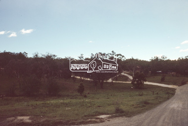
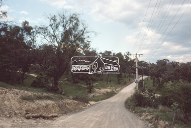
Slide, View looking southwest to turnabout near 9 McCarthy Grove, Montmorency, c.Oct. 1980
One of a series of images of roads and infrastructure taken by Eltham Shire Council Planning and Engineering officers. They provide perspective of the changes in housing styles and road development that began sweeping in from the mid 1970s with increasing urbanisation of what was once more outlying suburbs and regions.35 mm colour positive transparency Mount - Kodak Kodachrome CardProcessed Oct 1980houses, infrastructure, mccarthy grove, montmorency, roads -
 Eltham District Historical Society Inc
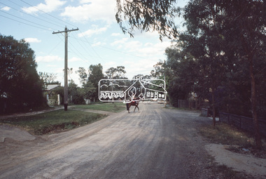
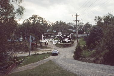
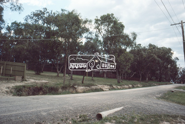
Slide, McCarthy Grove, Montmorency looking west near No. 27, c.Oct. 1980
One of a series of images of roads and infrastructure taken by Eltham Shire Council Planning and Engineering officers. They provide perspective of the changes in housing styles and road development that began sweeping in from the mid 1970s with increasing urbanisation of what was once more outlying suburbs and regions.35 mm colour positive transparency Mount - Kodak Kodachrome CardProcessed Oct 1980houses, infrastructure, mccarthy grove, montmorency, roads -
 Eltham District Historical Society Inc
Slide, McCarthy Grove, Montmorency looking east towards Reichelt Avenue, near no. 27, c.Oct. 1980
One of a series of images of roads and infrastructure taken by Eltham Shire Council Planning and Engineering officers. They provide perspective of the changes in housing styles and road development that began sweeping in from the mid 1970s with increasing urbanisation of what was once more outlying suburbs and regions.35 mm colour positive transparency Mount - Kodak Kodachrome CardProcessed Oct 1980houses, infrastructure, mccarthy grove, montmorency, roads -
 Eltham District Historical Society Inc
Slide, Quinn Estate, McCarthy Grove ext. driveway, Montmorency, near no. 31, c.Oct. 1980
One of a series of images of roads and infrastructure taken by Eltham Shire Council Planning and Engineering officers. They provide perspective of the changes in housing styles and road development that began sweeping in from the mid 1970s with increasing urbanisation of what was once more outlying suburbs and regions.35 mm colour positive transparency Mount - Kodak Kodachrome CardProcessed Oct 1980houses, infrastructure, mccarthy grove, montmorency, roads -
 Eltham District Historical Society Inc
Slide, Looking towards 99 Buena Vista Drive, Montmorency, c.Oct. 1980
One of a series of images of roads and infrastructure taken by Eltham Shire Council Planning and Engineering officers. They provide perspective of the changes in housing styles and road development that began sweeping in from the mid 1970s with increasing urbanisation of what was once more outlying suburbs and regions.35 mm colour positive transparency Mount - Kodak Kodachrome CardProcessed Oct 1980houses, infrastructure, mccarthy grove, montmorency, roads -
 Eltham District Historical Society Inc
Slide, Roundabout at Reichelt Avenue and McCarthy Grove, Montmorency, c.Oct. 1980
One of a series of images of roads and infrastructure focussed on the Quinn Estate in Montmorency taken by Eltham Shire Council Planning and Engineering officers. They provide perspective of the changes in housing styles and road development that began sweeping in from the mid 1970s with increasing urbanisation of what was once more outlying suburbs and regions.35 mm colour positive transparency Mount - Kodak Kodachrome CardProcessed Oct 1980infrastructure, mccarthy grove, montmorency, reichelt avenue, roads, roundabout -
 Eltham District Historical Society Inc
Slide, Mitchell Avenue near Panorama Heights Preschool, Montmorency, c.Oct. 1980
One of a series of images of roads and infrastructure focussed on the Quinn Estate in Montmorency taken by Eltham Shire Council Planning and Engineering officers. They provide perspective of the changes in housing styles and road development that began sweeping in from the mid 1970s with increasing urbanisation of what was once more outlying suburbs and regions.35 mm colour positive transparency Mount - Kodak Kodachrome CardProcessed Oct 1980infrastructure, mitchell avenue, montmorency, panorama heights preschool, roads -
 Eltham District Historical Society Inc
Slide, Mitchell Avenue looking towrads Montmorency South Primary School, c.Oct. 1980
One of a series of images of roads and infrastructure focussed on the Quinn Estate in Montmorency taken by Eltham Shire Council Planning and Engineering officers. They provide perspective of the changes in housing styles and road development that began sweeping in from the mid 1970s with increasing urbanisation of what was once more outlying suburbs and regions.35 mm colour positive transparency Mount - Kodak Kodachrome CardProcessed Oct 1980infrastructure, mitchell avenue, montmorency, montmorency south primary school, roads -
 Eltham District Historical Society Inc
Slide, Looking east along Buena Vista Drive, Montmorency near no. 69, c.Oct. 1980
One of a series of images of roads and infrastructure focussed on the Quinn Estate in Montmorency taken by Eltham Shire Council Planning and Engineering officers. They provide perspective of the changes in housing styles and road development that began sweeping in from the mid 1970s with increasing urbanisation of what was once more outlying suburbs and regions.35 mm colour positive transparency Mount - Kodak Kodachrome CardProcessed Oct 1980buena vista drive, horse, infrastructure, montmorency, roads -
 Eltham District Historical Society Inc
Slide, Quinn Estate, Buena Vista Drive, Montmorency near school looking northwest, c.Oct. 1980
One of a series of images of roads and infrastructure focussed on the Quinn Estate in Montmorency taken by Eltham Shire Council Planning and Engineering officers. They provide perspective of the changes in housing styles and road development that began sweeping in from the mid 1970s with increasing urbanisation of what was once more outlying suburbs and regions.35 mm colour positive transparency Mount - Kodak Kodachrome CardProcessed Oct 1980housing estate, infrastructure, montmorency, quinn estate, roads -
 Eltham District Historical Society Inc
Slide, Looking north along Buena Vista Drive near Montmorency South Primary School, c.Oct. 1980
One of a series of images of roads and infrastructure focussed on the Quinn Estate in Montmorency taken by Eltham Shire Council Planning and Engineering officers. They provide perspective of the changes in housing styles and road development that began sweeping in from the mid 1970s with increasing urbanisation of what was once more outlying suburbs and regions.35 mm colour positive transparency Mount - Kodak Kodachrome CardProcessed Oct 1980buena vista drive, infrastructure, montmorency, montmorency south primary school, roads -
 Eltham District Historical Society Inc
Slide, Quinn Estate looking east along Cressy Streett, Montmorency before Quinn Way, c.Oct. 1980
One of a series of images of roads and infrastructure focussed on the Quinn Estate in Montmorency taken by Eltham Shire Council Planning and Engineering officers. They provide perspective of the changes in housing styles and road development that began sweeping in from the mid 1970s with increasing urbanisation of what was once more outlying suburbs and regions.35 mm colour positive transparency Mount - Kodak Kodachrome CardProcessed Oct 1980infrastructure, montmorency, cressy street, housing estate, quinn estate, quinn way, roads -
 Eltham District Historical Society Inc
Slide, Quinn Estate from Sackville Street looking west to 'T-bowl' near Main Road, Montmorency, c.Oct. 1980
One of a series of images of roads and infrastructure focussed on the Quinn Estate in Montmorency taken by Eltham Shire Council Planning and Engineering officers. They provide perspective of the changes in housing styles and road development that began sweeping in from the mid 1970s with increasing urbanisation of what was once more outlying suburbs and regions.35 mm colour positive transparency Mount - Kodak Kodachrome CardProcessed Oct 1980roads, housing estate, infrastructure, main road, montmorency, quinn estate, sackville street, t-bowl -
 Eltham District Historical Society Inc
Slide, Quinn Estate, looking northeast along Sackville Street, Montmorency near no. 12, c.Oct. 1980
One of a series of images of roads and infrastructure focussed on the Quinn Estate in Montmorency taken by Eltham Shire Council Planning and Engineering officers. They provide perspective of the changes in housing styles and road development that began sweeping in from the mid 1970s with increasing urbanisation of what was once more outlying suburbs and regions.35 mm colour positive transparency Mount - Kodak Kodachrome CardProcessed Oct 1980infrastructure, housing estate, montmorency, quinn estate, roads, sackville street -
 Eltham District Historical Society Inc
Slide, Sackville Street, Montmorency; split road near no. 36, c.Oct. 1980
One of a series of images of roads and infrastructure focussed on the Quinn Estate in Montmorency taken by Eltham Shire Council Planning and Engineering officers. They provide perspective of the changes in housing styles and road development that began sweeping in from the mid 1970s with increasing urbanisation of what was once more outlying suburbs and regions.35 mm colour positive transparency Mount - Kodak Kodachrome CardProcessed Oct 1980sackville street, infrastructure, montmorency, roads -
 Eltham District Historical Society Inc
Slide, Quinn Estate looking east along Sackville Street just prior to Quinn Way, Montmorency, c.Oct. 1980
One of a series of images of roads and infrastructure focussed on the Quinn Estate in Montmorency taken by Eltham Shire Council Planning and Engineering officers. They provide perspective of the changes in housing styles and road development that began sweeping in from the mid 1970s with increasing urbanisation of what was once more outlying suburbs and regions.35 mm colour positive transparency Mount - Kodak Kodachrome CardProcessed Oct 1980roads, housing estate, infrastructure, montmorency, quinn estate, quinn way, sackville street -
 Eltham District Historical Society Inc
Slide, Quinn Estate near Sackville Reserve, Montmorency, c.Oct. 1980
One of a series of images of roads and infrastructure focussed on the Quinn Estate in Montmorency taken by Eltham Shire Council Planning and Engineering officers. They provide perspective of the changes in housing styles and road development that began sweeping in from the mid 1970s with increasing urbanisation of what was once more outlying suburbs and regions.35 mm colour positive transparency Mount - Kodak Kodachrome CardProcessed Oct 1980quinn estate, housing estate, infrastructure, montmorency, roads, sackville reserve, sackville street -
 Eltham District Historical Society Inc
Slide, Reichelt Avenue, Montmorency at intersection with Bolton Street (now closed), c.Oct. 1980
One of a series of images of roads and infrastructure focussed on the Quinn Estate in Montmorency taken by Eltham Shire Council Planning and Engineering officers. They provide perspective of the changes in housing styles and road development that began sweeping in from the mid 1970s with increasing urbanisation of what was once more outlying suburbs and regions.35 mm colour positive transparency Mount - Kodak Kodachrome CardProcessed Oct 1980bolton steet, eltham, infrastructure, montmorency, reichelt avenue, roads -
 Eltham District Historical Society Inc
Slide, Quinn Estate, Reichelt Avenue near Riverina Road, Montmorency, c.Oct. 1980
One of a series of images of roads and infrastructure focussed on the Quinn Estate in Montmorency taken by Eltham Shire Council Planning and Engineering officers. They provide perspective of the changes in housing styles and road development that began sweeping in from the mid 1970s with increasing urbanisation of what was once more outlying suburbs and regions.35 mm colour positive transparency Mount - Kodak Kodachrome CardProcessed Oct 1980housing estate, infrastructure, montmorency, quinn estate, reichelt avenue, roads