Showing 11430 items
matching map
-
 Beechworth Honey Archive
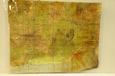
Map- Chiltern/Barnawartha
(4x) Map centred on Chiltern and Barnawartha. Shows Murray River, Hume Highway, Chiltern- Barnawartha Rd and Chiltern- Rutherglen Rd. Scale 1:50,000. Paper is white on back, yellow on front.Map labelled 'Albury series R652' Some markings in red and blue on some maps- blue writes '74-75'map, chiltern, barnawartha, paper, beechworth honey -
 Bendigo Military Museum
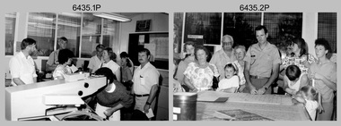
Photograph - Army Survey Regiment Open Day - Map Production, Fortuna, Bendigo, 1990
These 35 photographs were taken at an Army Survey Regiment Open Day at Fortuna Villa, Bendigo on the 24th of February 1990. This occasion was one of several events held to commemorate the 75th anniversary of the formation of the Royal Australian Survey Corps. Although historical tours of Fortuna occurred on a regular basis, this was the first technical open day since 1972. The Royal Australian Survey Corps recognised that an Open Day was the best way for the local community in Bendigo to gain an insight into the unit’s important role as Defence’s map production agency, its technical equipment, and its economic importance to Bendigo. It also gave them an opportunity to tour through historic Fortuna Villa. This occasion is covered in more detail in page 143 of Valerie Lovejoy’s book 'Mapmakers of Fortuna – A history of the Army Survey Regiment’ ISBN: 0-646-42120-4. Refer to items 6434.27P and 6436.18P for more photos of the Open Day taken inside Fortuna, the garden areas and production areas of Lithographic Squadron. Photo prints of some of these photos were scanned and catalogued in items 6247.30P and 6291.6P.These 35 photographs were taken at an Army Survey Regiment Open Day held at Fortuna, Bendigo on the 24th of February 1990. The 35mm colour and black & white negatives photographs were scanned at 96 dpi and are part of the Army Survey Regiment’s Collection. .1) - Photo, black & white, 1990. CPL Neale ‘Tex’ Houston with visitors in Aerotriangulation Section. .2) - Photo, black & white, 1990. L to R: MAJ Peter Clark and WO2 Neil ‘Ned’ Kelly with visitors in Aerotriangulation Section. .3) - Photo, black & white, 1990. SGT Bruce Hammond with visitors in Aerotriangulation Section. .4) - Photo, colour, 1990. SGT Bruce Hammond with visitors in Aerotriangulation Section. .5) - Photo, colour, 1990. SGT Steve Gloster with visitors in Aerotriangulation Section. .6) - Photo, colour, 1990. L to R: CPL Noel Brinsmead and CPL Darren Wilkinson with visitors in Aerotriangulation Section. .7) - Photo, colour, 1990. L to R: CPL Noel Brinsmead with visitors in Aerotriangulation Section. .8) - Photo, colour, 1990. MAJ Peter Clark with visitors in Aerotriangulation Section. .9) - Photo, colour, 1990. CPL Mark Lander with visitors in Plotting Section. .10) - Photo, colour, 1990. SSGT Andy Boath with visitors in Plotting Section. .11) - Photo, colour, 1990. SPR Stuart Bowd with visitors in Plotting Section. .12) - Photo, colour, 1990. CAPT Roger Hancock with visitors in Plotting Section. .13) & .14) - Photo, colour, 1990. AUTOMAP 2 - CPL Peter Peterson with visitors. .15) - Photo, colour, 1990, AUTOMAP 2 - L to R: SSGT Graham Johnston, SPR Grant Davis with civilian visitors. .16) - Photo, colour, 1990, AUTOMAP 2 - L to R: CPL Steve McGuiness, SSGT Graham Johnston with civilian visitors. .17) - Photo, colour, 1990, AUTOMAP 2 - civilian visitors. .19) - Photo, colour, 1990, AUTOMAP 2 - L to R: unidentified, SPR Tony Jackson, CPL Mark Westbrook, SSGT Bob Bright, with civilian visitors. .20) - Photo, colour, 1990, AUTOMAP 2 - L to R: WO2 Adrian ‘Charlie’ Creedy, CPL Mark Westbrook, SPR Mick Duggan with civilian visitors. .21) - Photo, colour, 1990, AUTOMAP 2 - L to R: SPR Mick Duggan, CO LTCOM Rene van den Tol, SSGT Bob Bright, CPL Mark Westbrook with civilian visitors. .22) - Photo, colour, 1990, AUTOMAP 2 - L to R: SPR Damien Nolan, unidentified, SPR Peter Smyth with civilian visitors. .23) - Photo, black & white, 1990, AUTOMAP 2 - L to R: SPR Peter Smyth, CAPT Steve Hledik, SGT Martin Evans, MAJ Neil Taylor with civilian visitors. .24) - Photo, black & white, 1990, AUTOMAP 2 - L to R: SPR Mick Duggan, CPL Mark Westbrook with civilian visitors. .25) - Photo, black & white, 1990, AUTOMAP 2 – LCPL Sandy Winn with civilian visitor. .26) - Photo, black & white, 1990. Display of digital storage media. .27) & .28) - Photo, colour, 1990. Cartography - SPR Ian Baldwin with civilian visitors. .29) - Photo, black & white, 1990. Cartography - SPR Ian Baldwin with civilian visitors. .30) - Photo, black & white, 1990. Cartography - SGT Sherri (Dally) Burke with civilian visitors. .31) - Photo, colour, 1990. Cartography - L to R: SGT Sherri (Dally) Burke, SSGT Dennis Learmonth with civilian visitors. .32) - Photo, colour, 1990. Cartography – SGT Barry Hogan with civilian visitors. .33) & .34) - Photo, colour, 1990. Cartography – CPL Dan Cirsky with civilian visitors. .35) - Photo, colour, 1990. Cartography – L to R: SPR Jeanette (Lane) Dury-Lane, CPL Diane (Thomas) Soutar with civilian visitors..1P to .35P – no annotationsroyal australian survey corps, rasvy, army survey regiment, army svy regt, fortuna, asr, automap 2 -
 Bendigo Military Museum
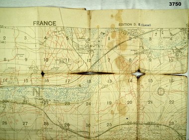
Map - TRENCH MAP, FRANCE WW1, 1918
Areas covered on this map “Corbie, Villers Brettoneux, Hangard, Blangy and Tronville Wood, River Somme”. Item re William Alexander No 502 AIF. Refer Cat No 3746.3 for his service details.Trench map, France, Edition 3B, trenches corrected to 7.7.1918, German trenches in red, British in blue, scale 1:20,000.map, france, trench -
 Bendigo Military Museum
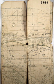
Map - TRENCH MAP, FRANCE WW1, 1918
Areas covered on this map “Corbie, Villers Brettoneaux, Hangard Wood, Aubigney, River Somme”. Item re William Alexander No 502 AIF. Refer Cat No 3746.3 for his service details.Trench map, France, Edition 2A, sheet 62D S.W, scale 1:20,000, British trenches in blue, trenches corrected to 9.5.1918.map, france, trench -
 Greensborough Historical Society
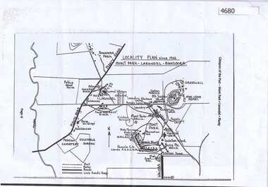
Map, Mont Park buildings still existing, 1946_
Locality Plan indicates buildings still existing within the Mont Park - Larundel mental health complex; Table lists 16 buildings by year built, initial purpose, subsequent uses and current address2 pages,one map, one table larundel, mont park -
 Running Rabbits Military Museum operated by the Upwey Belgrave RSL Sub Branch
Map
Viet Cong Map of Nui Dat Areamaps, vietnam, general -
 Running Rabbits Military Museum operated by the Upwey Belgrave RSL Sub Branch
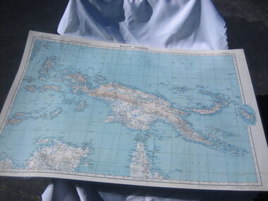
Map
East Indies Map 1 - New Guineadocuments, 1928, general -
 Ringwood RSL Sub-Branch
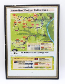
Map
australian wartime battle maps rectangular frame, the battle of maryang san, -
Hand Tool Preservation Association of Australia Inc
Map
This item is part of the Thomas Caine Tool Collection, owned by The National Trust of Australia (Victoria) and curated by the Hand Tools Preservation Association of Australia.Map of essendon, moonee ponds, ascot vale -
 Lara RSL Sub Branch
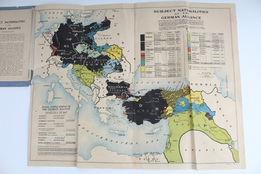
Booklet With Map, Cassell and Compnay Limited, Subject Nationalities of the German Alliance, 1917
Map Produced for Allied ForcesMap of German Alliance as to which nationalities were aligned with GermanyGrey Booklet containing Coloured map of the German AllianceGrey Booklet Subject Nationalities of the German Alliance (With a coloured map from German Sources) Cassell and Company Limited London New York Toronto Melbourne 1917 Price 2d -
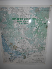 National Vietnam Veterans Museum (NVVM)
Map, Military Civic Action in Phuoc Tuy Province
Laminated map of civil action in Phuoc Tuy Province and Vung Tau Special Zone in the period of March 1970 to June 1971. Details housing, schools, hospitals & infrastructure projects.civil action, phuoc tuy, vung tau -
Moorabbin Air Museum
Map (item) - TAA map of Australia & Papua New Guinea 10th edition
-
Moorabbin Air Museum
Map (item) - Map - Puckapunyal Range Area Victoria
Military Survey 1:25,000 Zone 7 First Edition -
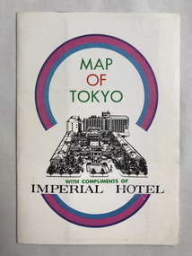 Robin Boyd Foundation
Map, Imperial Hotel, Map of Tokyo
Provided by Imperial Hotel, Tokyo Robin Boyd stayed here in the 1960swalsh st library -
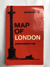 Robin Boyd Foundation
Map, Geographia, Map of London
walsh st library -
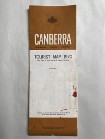 Robin Boyd Foundation
Map, Universal Business Directories, Canberra Tourist Map, 1970
walsh st library -
 Robin Boyd Foundation
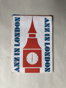
Map, ANZ in London; A map for visitors to London
walsh st library -
 Robin Boyd Foundation
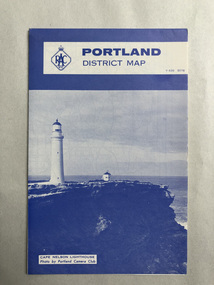
Map, RACV, Portland District Map
walsh st library -
 Robin Boyd Foundation
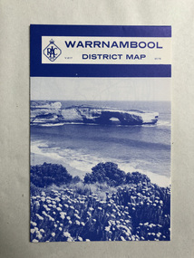
Map, RACV, Warrnambool District Map
walsh st library -
 Robin Boyd Foundation
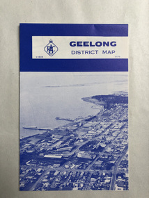
Map, RACV, Geelong District Map
walsh st library -
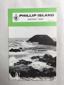 Robin Boyd Foundation
Map, RACV, Phillip Island District Map
walsh st library -
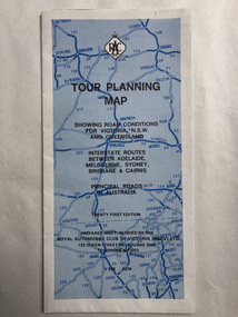 Robin Boyd Foundation
Map, RACV, Tour Planning Map
Showing road conditions for Victoria, NSW and Queenslandwalsh st library -
Moorabbin Air Museum
Map (Item) - BOAC Britannia Fleet London to Colombo Route Map BA774
-
Moorabbin Air Museum
Map (Item) - Ansett Route Map - Broken Hill <> Alice Springs
-
Moorabbin Air Museum
Map (Item) - Map of Port Melbourne & Coode Island Rifle Range circa 1950s-60s
-
Moorabbin Air Museum
Map (Item) - Middle East Egypt WW1 AFC Map
-
Moorabbin Air Museum
Map (Item) - Environs of the Top End Map
-
Moorabbin Air Museum
Map (item) - Map Gippsland
-
 Ballarat Tramway Museum
Map, Ken McCarthy, Map of Proposed National Park Line - SPER, mid 1950's
Hand drawn plan on plain foolscap paper of proposed tram line from Loftus to View Point within National Park for South Pacific Electric Railways - with notes, proposed destination roll.trams, tramways, sper, national park line, loftus, destination roll -
Moorabbin Air Museum
Map (Item) - Includes details of BHP properties, Newcastle Australia map