Showing 25579 items matching "plenty-township-estate"
-
 Warrnambool and District Historical Society Inc.
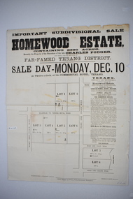
Original document, Advertising "Homewood Estate" Terang, 1886
This notice advertises the sale of the Homewood property near Glenormiston. The sale details state that the property is 2386 acres adjoining "The Sisters" the station of the Black Brothers. The property lies on the main metal road from Terang to Ellerslie, six miles from Terang. It has frontage to Pejark Marsh/drain. It was to be surveyed and sold in blocks of 250 to 300 acres with permanent water and well covered with grasses. The sale of the property followed the death of Charles Podger who died in 1886. On his death he left his wife Ann and six children.His worth was over 20000 pounds with 16000 pounds as real estate and 4300 pounds in personal propertyThe Agent for the sale was James Jellie, solicitors were Warrnambool firm Klingender and O'Mahony and the advertisement was printed by Thomas Smith Gas printing Works Warrnambool. This document has local interest and significance as an early sales of land in the district. The names of agents , solicitors and printers were wll known in the area and the property also a large holding. The Podger name is also well represented in the district to this day.Large white rectangular sheet of paper with black text . Major sale details in heavy black text at the top with descriptive text accompanying map of subdivision of the property on the left.The following names and details are contained within the document. Homewood Estate, Charles Podger, Commercial Hotel Terang, James Jellie Fenelon Mott Surveyor, Klingender & O'Mahony solicitors, Thos, Smith Gas Printing Koroit Street Warrnamboolcharles podger, homewood estate, klingender, o"mahony, kolora, the sisters, terang -
 Greensborough Historical Society
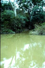
Slide - Photograph, John Ramsdale, Plenty River: Slide 105, 1990s
Photograph shows a river and bank (Plenty River) with some rubbish.Part of the John Ramsdale collection of slides and audio visual material.Colour photograph scanned from slide.No maker's marks. No caption on slide.plenty river, pollution -
 Greensborough Historical Society
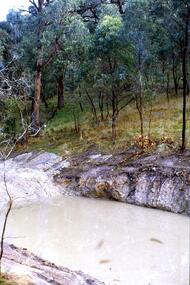
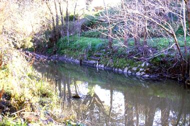
Slide - Photograph, John Ramsdale, Plenty Gorge: Slide 106, 1990s
Photograph shows a rocky area near river in Plenty Gorge.Part of the John Ramsdale collection of slides and audio visual material.Colour photograph scanned from slide.No maker's marks. No caption on slide.plenty river, plenty gorge -
 Greensborough Historical Society
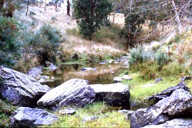
Slide - Photograph, John Ramsdale, Head waters of the Plenty River: Slide 108, 1990s
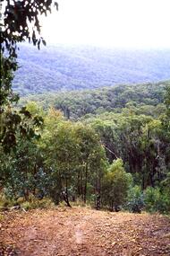
Photograph shows a stand of trees in the head waters of the Plenty RiverPart of the John Ramsdale collection of slides and audio visual material.Colour photograph scanned from slide.No maker's marks. No caption on slide.plenty river -
 Greensborough Historical Society
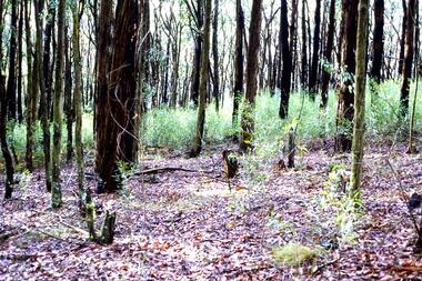
Slide - Photograph, John Ramsdale, Plenty River catchment: Slide 123, 1990s
Photograph shows a river and bushland, part of the Plenty River catchmentPart of the John Ramsdale collection of slides and audio visual material.Colour photograph scanned from slide.No maker's marks. No caption on slide.plenty river -
 Greensborough Historical Society
Slide - Photograph, John Ramsdale, Plenty River with European trees: Slide 27, 1990s
Photograph shows the Plenty River at Greensborough with European trees on the bank.Part of the John Ramsdale collection of slides and audio visual material.Colour photograph scanned from slide.No caption. Printed maker's mark on slide "Kodak Kodachrome Slide"plenty river, vegetation -
 Greensborough Historical Society
Slide - Photograph, John Ramsdale, Plenty river swimming pool, overgrown: Slide 25, 1990s
Photograph shows the concrete steps to the Plenty River pool at Greensborough.Part of the John Ramsdale collection of slides and audio visual material.Colour photograph scanned from slide.No maker's marks. No caption on slide.plenty river swimming pool, swimming pools greensborough, plenty river -
 Greensborough Historical Society
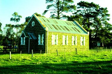
Slide - Photograph, John Ramsdale, Bluestone Church on Plenty Road Mill Park: Slide 30, 1990s
Photograph shows a bluestone church on Plenty Road Mill Park.Part of the John Ramsdale collection of slides and audio visual material.Colour photograph scanned from slide.No maker's marks. No caption on slide.plenty road mill park, bluestone church -
 Greensborough Historical Society
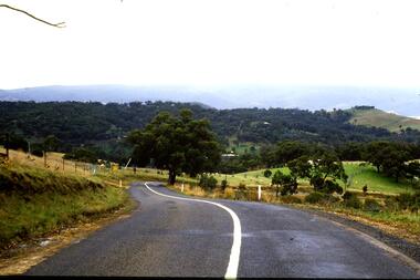
Slide - Photograph, John Ramsdale, Between Whittlesea and Upper Plenty: Slide 33, 1990s
Photograph shows a country road between Whittlesea and Upper PlentyPart of the John Ramsdale collection of slides and audio visual material.Colour photograph scanned from slide.No maker's marks. No caption on slide.whittlesea, upper plenty -
 Greensborough Historical Society
Slide - Photograph, John Ramsdale, Upper Plenty: Slide 35, 1990s
Photograph shows a heavily treed hillside in the upper Plenty area.Part of the John Ramsdale collection of slides and audio visual material.Colour photograph scanned from slide.No maker's marks. No caption on slide.upper plenty -
 Greensborough Historical Society
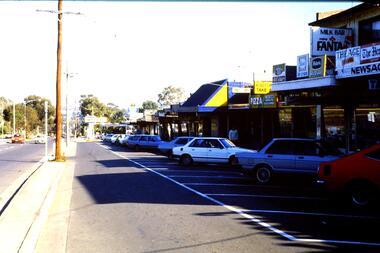
Slide - Photograph, John Ramsdale, Main Road shops, Lower Plenty: Slide 70, 1990s
Photograph shows a shopping centre - Main Road Lower PlentyPart of the John Ramsdale collection of slides and audio visual material.Colour photograph scanned from slide.No maker's marks. No caption on slide.lower plenty, main road lower plenty -
 Greensborough Historical Society
Photograph - Digital Image, Pipes over the Plenty River, 1950c
An early photograph of the Maroondah Aqueduct pipes crossing the Plenty River.Digital copy of black and white photograph.maroondah aqueduct, plenty river -
 Greensborough Historical Society
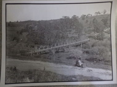
Photograph - Digital Image, Pipes over Plenty, construction of original bridge for Watts Reservoir aqueduct, 1950-1970
Photograph of the Maroondah aqueduct bridge over the Plenty River in Greensborough.Digital copy of black and white photograph.maroondah aqueduct, aqueduct, plenty river -
 Greensborough Historical Society
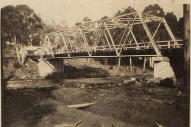
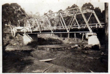
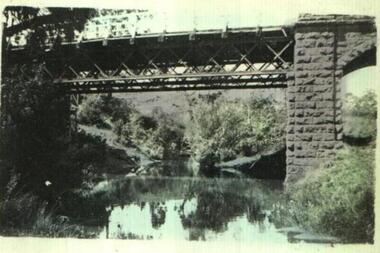
Photograph - Digital image, Old Bridge, Plenty River, 1911c
Photograph of old bridge over Plenty River, date unknown.Digital copy of black and white photograph.plenty river -
 Greensborough Historical Society
Photograph (copy), Aqueduct over the Plenty River / photographer unknown, 1920c
View of the Maroondah Aqueduct where it crosses the Plenty River in Greensborough.Black and white photograph, enlarged and laminated.maroondah aqueduct, plenty river -
 Greensborough Historical Society
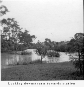
Photograph - Digital Image, Tony Fitton, Plenty River flood 1960s, 1960s
The Plenty River in flood, 1960s. Photos taken by Tony Fitton. Digital copy of black and white photographs.Captions on imageplenty river, floods -
 Greensborough Historical Society
Business card - Digital Image, Plenty Valley Printing Greensborough, 2016_
Plenty Valley Printing is a Greensborough graphic design and printing business.Coloured business cardplenty valley printing, para road greensborough -
 Eltham District Historical Society Inc
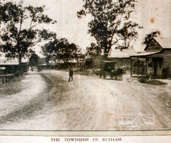
Negative - Photograph, Coghill & Haughton, The Township of Eltham, 1923
Stanhope Estate, Eltham; great suburban subdivisional auction, New Year's Day - Tuesday 1st January 1924 Subdivision of Stanhope property into 80 blocks; auction sale 1 Jan 1924 Roll of 35mm colour negative film, 3 stripsKodak CL 200 5093butcher, coghill and haughton, eltham, eltham railway station, railway station, real estate agent, stanhope estate, stanhope house -
 Greensborough Historical Society
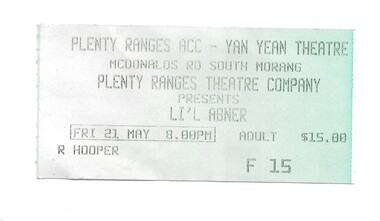
Ephemera - Ticket, Plenty Ranges theatre ticket
Ticket issued to the Plenty Ranges Theatre Company production of "Li'l Abner", Friday 21 May, although the year is not given it is possibly 2005. The Plenty Ranges Theatre Company inc was active from 15 June 2000. Ticket issued to R. Hooper.Pale green paper tickethooper family, plenty ranges theatre company -
 Greensborough Historical Society
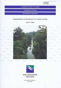
Pamphlet, Lower Plenty River concept plan, summary report: Maroondah Pipetrack to Yarra River, 1992_07
This draft concept plan covers the lower Plenty River from the Maroondah Pipe track in Greensborough to where the Plenty meets the Yarra. Melbourne Water was the lead agency, assisted by the Shires of Eltham and Diamond Valley, City of Heidelberg, the EPA and Department of Planning and Housing.Coloured pamphlet, photograph and plans 12 pages. 2 copies.plenty river, maroondah aqueduct, melbourne water -
 Ringwood and District Historical Society
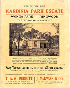
Flyer, Land Sale Brochure, Kardinia Park Estate, North Ringwood, Vic. - circa 1948
Folded buff-coloured land sale advertisement for Kardinia Park Estate in Warranwood area of North Ringwood, including terms of sale, area map, layout plan of the estate, and summary of local facilities and services. Front page features photograph of a man and dog in front of a house captioned as Lot 1 on four acres shown on the estate layout as cnr of Brysons Road and Range View Parade (later Omeo Parade). Second page includes bushland swimming pool photograph and promotional information for prospective buyers.Subdivision includes Kardinia Crescent, Wonga Road, Brysons Road, Range View Parade (later Omeo Parade), Motor Coach Road (later Wonga Park Road, then Warranwood Road). (Agent/s) T.A.W. Burkitt, Main Street, Ringwood, Phone (9 to 6) Ringwood 242, Evenings, Ringwood 157, and J. McEwan & Co, 317 Collins Street, Melbourne, Phone 6750 Central. -
 Ringwood and District Historical Society
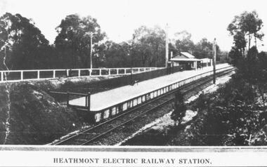
Photograph, Heathmont Railway Station, 1926. Image taken from a land sale brochure advertising Charm-View Estate Sub-division opposite the station
Black and white photographs (2 copies - same size)Written under photograph - HEATHMONT ELECTRIC RAILWAY STATION. Written on back of photograph, "Photo taken from Sub. Div. Land Sale - Heathmont Electric Railway Station right opposite Estate. Charm-View Estate. Heathmont (For private Sale), 1926?" -
 Glenelg Shire Council Cultural Collection
Photograph, Photograph - Lighthouse Estate, n.d
Port of Portland Authority Archivesport of portland -
Glenelg Shire Council Cultural Collection
Photograph, Photograph - Lighthouse Estate, n.d
Port of Portland Authority Archivesport of portland -
Whitehorse Historical Society Inc.
Pamphlet, Green-Brae Estate, 1956
Photocopy of advertisement for the sale of Green-Brae Estate, Springvale Road, Nunawading.Photocopy of advertisement for the sale of Green-Brae Estate, Springvale Road, Nunawading. Comprises 53 home sites. Agent: Weston & Heath.Photocopy of advertisement for the sale of Green-Brae Estate, Springvale Road, Nunawading.land subdivision, green-brae estate nunawading, springvale road, nunawading, brae grove, nunawading, nielsen avenue, nunawading, gladys street, nunawading, lynne court, nunawading -
 Whitehorse Historical Society Inc.
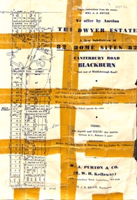
Pamphlet - Advertising brochure, Dwyer Estate, 1951
Brochure advertising auction of 'Dwyer Estate', Canterbury Road, Blackburn. 82 lots, 17 November 1951. Agents: W.J. Purtonauctions, canterbury road, blackburn, pakenham street, doogan street, kalang street, orana street, dwyer street, dwyer estate, dwyer, a.a. (mrs), garie street, h. j. d. bruce -
 Whitehorse Historical Society Inc.
Document, High School Estate, 1940
Advertisement for High School Estate, Box Hill auction on 24/9/1949Advertisement for High School Estate, Box Hill auction on 24/9/1949 of 25 villa sites, including plan of developmentAdvertisement for High School Estate, Box Hill auction on 24/9/1949 auctions, high school estate box hill, middleborough road, blackburn, flora avenue, minna street, thiele court, whitehorse road -
 Whitehorse Historical Society Inc.
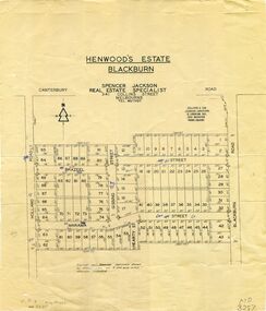
Map, Henwoods Estate, Blackburn
Plan of subdivision in Blackburn SouthPlan of subdivision in Blackburn South between Holland Road and Blackburn Road. Estate advertised by Spencer Jackson, 341 Collins Street.Plan of subdivision in Blackburn South land subdivision, henwoods estate, blackburn south, holland road, brazeel street, marama street, blackburn road, gissing street, hearty street -
 Whitehorse Historical Society Inc.
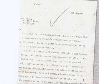
Letter - Correspondence, Heatherdale Estate
Letter from valuer re land owned by Mrs WatsonLetter from valuer re land owned by Mrs Watson - corner of Purches Street and Canterbury Roads, Vermont (Heatherdale Estate)Letter from valuer re land owned by Mrs Watsonland values, heatherdale estate, watson (mrs), purches street, vermont, canterbury road -
Whitehorse Historical Society Inc.
Document, The Savage Estate, n.d
Private sale leaflet of The Savage Estate Springfield Road, Nunawading.Private sale leaflet of The Savage Estate Springfield Road, Nunawading, comprising 46 allotments. Agents Drake & Co and Armstrong & Hoath.Private sale leaflet of The Savage Estate Springfield Road, Nunawading. savage estate, nunawading, springfield road, nunawading, drake co, armstrong hoath estate agents