Showing 10391 items
matching plans
-
 Greensborough Historical Society
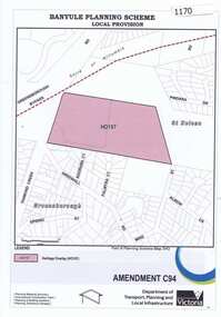
Map, Saxam Heritage Overlay, 2011_
"Saxam" was the home of the Kaye family (1886-1888) then William Santon, a former councillor and Mayor of Heidelberg. Saxam Homestead is a distinctive and substantial timber homestead built in the late 1880s as one of the notable rural properties in the St Helena area. In 2014 the house still stands but is in poor condition with most interior features removed. The site had a heritage overlay as shown. The overlay was reduced in 2014 to protect the house while allowing residential development on the site.Saxam is one of the only remaining farmhouses in the Greensborough area.Copy of map and planning scheme.saxam -
 Ringwood and District Historical Society
Envelope, Packet: City of Ringwood planning reports 1990s
City of Ringwood planning reports -
 Federation University Historical Collection
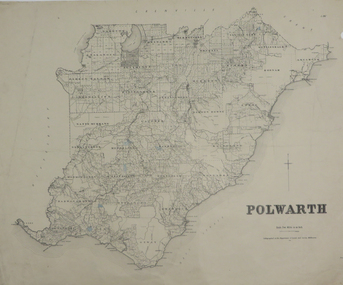
Plan, Polwarth, 1927, 1927
Printed plan with hand colouringotway, polwarth, cape otway -
 Federation University Historical Collection
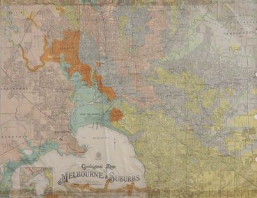
Map, Geological Map of Ascot, 1937, 1937
Coloured plan of Melbourne and suburbs.melbourne, geological, geology, caulfield, brighton, box hill, camberwell, richmond, prahran, st kilda, brunswick, coburg, keilor, braybrook, kew, hawthorn, northcote, williamstown, south melbourne -
 Federation University Historical Collection
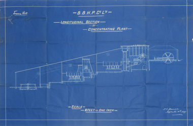
Plan, Blueprint B.B.H.P. Co Ltd Longitudinal Section of Concentrating Plant, 1895
Blueprint plan by H.L. Hancock blueprint, h. l. hancock, longitudinal section, concentrating plant, bhp -
 Federation University Historical Collection
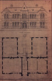
Plan, School of Mines, Ballarat: Front elevation plan for new building, 1899, 1899
Mounted photocopy of plans for 1899ballarat school of mines, plan, front elevation, new classrooms, administration building, a building, architectural drawing -
 Ringwood and District Historical Society
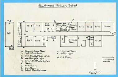
Plan, Sothwood Primaty School floor plan
Floor plan of Southwood PS -
 City of Moorabbin Historical Society (Operating the Box Cottage Museum)
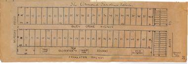
Plan - Ormond Garden Estate, Ormond, 1920
At the end of World War One, there was a renewed interest in residential land and a number of estates opened up in the Municipality of Moorabbin. Ormond Garden Estate was auctioned on Saturday 10 April, 1920.Example of the progress of the Municipality of MoorabbinHand drawn plan of subdivisionOrmond Garden Estatenorth road, glen orme avenue, murray road, ormond, auction, real estate -
 City of Moorabbin Historical Society (Operating the Box Cottage Museum)
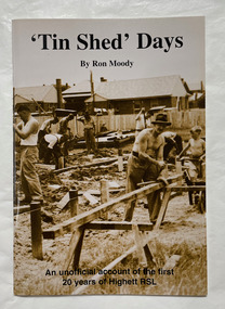
Book, Moody, Ron, 'Tin shed' days, 1997
An unofficial account of the first 20 years of Highett RSL.44 p. : plans, ports. ;non-fictionAn unofficial account of the first 20 years of Highett RSL.highett, highett rsl, returned services league of australia -
Port Melbourne Historical & Preservation Society
Document - Community Service Planning, Beris Campbell Collection, 1974 - 1993
Collection of files from Beris CAMPBELL; Port's first Social Worker. Includes local newspapers, flyers and reportsCommunity Service Planning 1992local government - city of port melbourne, health - general health, politics, public action campaigns, port melbourne citizens action group, port melbourne social welfare centre, city of south melbourne, beris campbell -
Port Melbourne Historical & Preservation Society
Plan - Pathworks, Heath Street, Port Melbourne, Borough of Sandridge, 16 Feb 1861
Plan - Pathworks Heath StreetFrederick Wm. Bull Municipal Surveyor Sandridgeengineering - roads streets lanes and footpaths, frederick william bull -
 Monbulk RSL Sub Branch
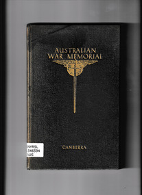
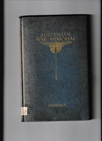
Book, Australian War Memorial, Guide to Australian War Memorial, 1941
An early guide to the Australian War MemorialIll, plans, p.107.non-fictionAn early guide to the Australian War Memorialwar memorials - australia - guidebooks, australian war memorial -
University of Melbourne, Burnley Campus Archives
Document, Additions, repairs, fencing and painting at School of Horticulture and Primary Agriculture Burnley, 1991
Tender documentation incl. plans -
University of Melbourne, Burnley Campus Archives
Document, Amenity Horticulture Orientation Walk, 1980-1990
Description of areas of Burnley with a planamenities, horticulture, burnley -
Whitehorse Historical Society Inc.
Map, Britannia Rise, 2012
Photos and plans of Britannia Rise.Photos and plans of Britannia Rise.Photos and plans of Britannia Rise.britannia rise', whitehorse road mitcham, no 569-571, mitcham railway station, eastlink, britannia mall, kenneth jones real estate -
 Ballarat RSL Sub-Branch Inc.
Folder - Ballarat Avenue of Honour
Management Strategy Plan 1997literature, ballarat rsl, ballarat -
 Brimbank City Council
Brimbank Planning Scheme Frame, 1999
Brimbank Planning Scheme Frame -
Stawell Historical Society Inc
Map, Plan Shewing Position of Stawell, 1859
Plan Shewing Position of Stawellstawell -
Stawell Historical Society Inc
Map, Plan of Works on No1 Reservoir, 1896
Plan of Works on No1 Reservoirstawell, water -
Stawell Historical Society Inc
Map, Plan of the Agricultural Area of Callawadda, 1865
Plan of the Agricultural Area of Callawaddastawell -
University of Melbourne, Burnley Campus Archives
Plan, Re-organisation of Apple Block, 1956
Plan dated June 1956orchards, fruits, apples -
University of Melbourne, Burnley Campus Archives
Plan, BSL Rear Court 66 Brunswick St Fitzroy, 1980-1990
Tracing paper site plan.fitzroy, planning -
University of Melbourne, Burnley Campus Archives
Plan, V.C.A.H Burnley Location map, c.1991
Plan of the Campus with buildings named.vcah, burnley campus -
 University of Melbourne, Burnley Campus Archives
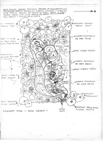
Plan, Kath Deery, Concept Plan - Kath Deery - Bush Tucker Garden, C. 1980
-
University of Melbourne, Burnley Campus Archives
Plan - Planting Design, Vireya Rhododendrons, 2015
vireya rhododendrons, garden plan, plant list -
 The Mrs Aeneas Gunn Memorial Library
Book, Australian War Memorial, Guide to Australian War Memorial, 1945
A guide to the Australian war memorial in CanberraIll, plans, p.114.A guide to the Australian war memorial in Canberraaustralia - war memorials, australia - military museums -
 Melton City Libraries
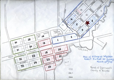
Map, Plan for the Village of Melton, 1853
Site of early village Section numbers 1 - 17 Later became the Flat known as the Common Robert Russell – Surveyor Pinkerton, Sherwin, Bryan, Pyke, Yuille, CollyerMelton Town 1853 Plancouncil -
University of Melbourne, Burnley Campus Archives
Plan (Item), Pavilion, Horticultural Gardens, Burnley
pavilion, burnley gardens, burnley horticultural college -
 Victorian Railway History Library
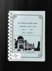
Book, Jack Cranston, On time all the time: Melbournes cable trams 1885-1940, ????
Illustrations and plans of Melbournes cable trams 1885-1940.Ill, plans, p.67.non-fictionIllustrations and plans of Melbournes cable trams 1885-1940.urban transportation - melbourne, cable trams - melbourne -
 Federation University Historical Collection
Plan, Camp Street Ballarat Parish Plan
Camp Street was the site of the original goldfields camp reserve, and it is from here that soldiers and police troopers left to attack the Eureka Stockade on 03 December 1854.PLan of Camp Street Ballaratcamp street, police reserve, old colonists' association, grenville street, lydiard street north, t. cowan, r. surtees, c.m. watson, w.h. foster, j.b. humffray, j.j. goller, h.r. caselli, henry caselli, market reserve, e.v. gribble, old colonists' association of ballarat