Showing 25579 items matching "plenty-township-estate"
-
 Lakes Entrance Historical Society
Book, Environment Studies Association of Victoria, Part 11, Nyerimilang Estate Assessment, 1979
Report of 5 working groups Part 2 detailing suggestions for the future management of the Nyerimilang Estate. 'To be read in conjunction with the main report'.parks, heritage -
 Whitehorse Historical Society Inc.
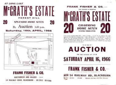
Document - Auction Flyer, McGrath's Estate Auction 1966, 16/04/1966 12:00:00 AM
Auction of 20 home sites in McGrath's Estate, Ottawa Ave, Forest Hill by Frank Fisher & Co on 16 April 1966.Auction of 20 home sites in McGrath's Estate, Ottawa Ave, Forest Hill by Frank Fisher & Co on 16 April 1966.non-fictionAuction of 20 home sites in McGrath's Estate, Ottawa Ave, Forest Hill by Frank Fisher & Co on 16 April 1966.mcgrath's estate, forest hill, forest hill, frank fisher co., peak court, forest hill, ottawa avenue, forest hill, beatrice court, forest hill, lake road, forest hill -
 Greensborough Historical Society
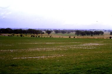
Slide - Photograph, John Ramsdale, Plenty River flood plain: Slide 95, 1990s
Photograph shows water over paddocks; Plenty River flood plain.Part of the John Ramsdale collection of slides and audio visual material.Colour photograph scanned from slide.No maker's marks. No caption on slide.plenty river, plenty river flood -
 Greensborough Historical Society
Slide - Photograph, John Ramsdale, Plenty River Trail: Slide 117, 1990s
Photograph shows a path leading into bushland, this is part of the Plenty River Trail.Part of the John Ramsdale collection of slides and audio visual material.Colour photograph scanned from slide.No maker's marks. No caption on slide.plenty river trail -
 Greensborough Historical Society
Slide - Photograph, John Ramsdale, Plenty River near Apollo Parkways: Slide 128, 1990s
Photograph shows a river and trees - the Plenty River near Apollo Parkways.Part of the John Ramsdale collection of slides and audio visual material.Colour photograph scanned from slide.No maker's marks. No caption on slide.plenty river, apollo parkways -
 Greensborough Historical Society
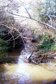
Slide - Photograph, John Ramsdale, Plenty River, upstream from Gorge: Slide 42, 1990s
Photograph shows creek bed with vegetation, upstream from Plenty Gorge.Part of the John Ramsdale collection of slides and audio visual material.Colour photograph scanned from slide.No caption. Printed maker's mark on slide "Kodak Kodachrome Slide"plenty gorge, plenty river, mernda -
 Greensborough Historical Society
Slide - Photograph, John Ramsdale, Run off into Plenty River: Slide 64, 1990s
Photograph shows water over ground. This is run off into the Plenty RiverPart of the John Ramsdale collection of slides and audio visual material.Colour photograph scanned from slide.No caption. Printed maker's mark on slide "Kodak Kodachrome Slide"plenty river -
 Greensborough Historical Society
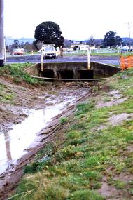
Slide - Photograph, John Ramsdale, Near Plenty Road South Morang: Slide 53, 1990s
Photograph shows drain and culvert near Plenty Road South Morang.Part of the John Ramsdale collection of slides and audio visual material.Colour photograph scanned from slide.No maker's marks. No caption on slide.plenty road south morang -
 Greensborough Historical Society
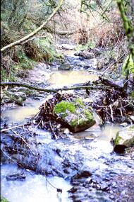
Slide - Photograph, John Ramsdale, Plenty River with low water flow: Slide 54, 1990s
Photograph shows the Plenty River with low water, rocks and fallen branchesPart of the John Ramsdale collection of slides and audio visual material.Colour photograph scanned from slide.No maker's marks. No caption on slide.plenty river -
 Greensborough Historical Society
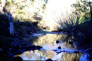
Slide - Photograph, John Ramsdale, Plenty River headwaters: Slide 65, 1990s
Photograph shows water near culvert or drain, this is the Plenty River headwaters.Part of the John Ramsdale collection of slides and audio visual material.Colour photograph scanned from slide.No maker's marks. No caption on slide.plenty river -
 Greensborough Historical Society
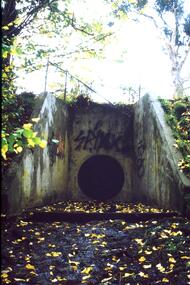
Slide - Photograph, John Ramsdale, Urban runoff into Plenty River: Slide 69, 1990s
Photograph shows a culvert or drain with graffiti. This is urban runoff into Plenty RiverPart of the John Ramsdale collection of slides and audio visual material.Colour photograph scanned from slide.No maker's marks. No caption on slide.plenty river -
 Greensborough Historical Society
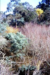
Slide - Photograph, John Ramsdale, Trees and vegetation near Plenty River: Slide 75, 1990s
Photograph shows a bush scene with trees and undergrowth near Plenty River.Part of the John Ramsdale collection of slides and audio visual material.Colour photograph scanned from slide.No maker's marks. No caption on slide.vegetation, plenty river -
 Greensborough Historical Society
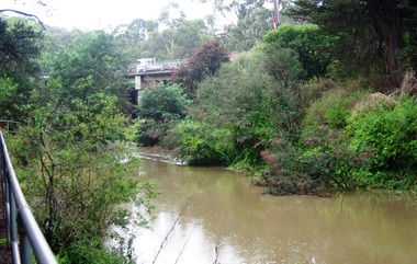
Photograph - Digital image, Plenty River in Flood 2017: The River, 14/12/2017
3 photographs of the Plenty River in flood, Greensborough. This flood was in December 2017.Digital copy of 3 colour photographs.plenty river, floods -
 Greensborough Historical Society
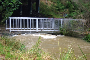
Photograph - Digital image, Plenty River in Flood 2017: The Footbridge, 14/12/2017
3 photographs of the Plenty River in flood, Greensborough. This flood was in December 2017.Digital copy of 3 colour photographs.plenty river, floods -
 Greensborough Historical Society
Photograph - Digital image, Plenty River in Flood 2017: Graffiti, 14/12/2017
Photograph of graffiti on the Plenty River bridge, Greensborough. This flood was in December 2017.Digital copy of colour photograph.plenty river, floods, graffiti -
 Greensborough Historical Society
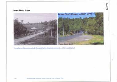
Article and Photograph, Lower Plenty Bridge, 2016_
2 Photographs of the area around the Lower Plenty Bridge, 1906 and 2014.This photograph and text was copied from a Facebook site. Members are people who lived in the Greensborough area and share their reminiscences of the area with others. The site is administered by a GHS member but is not officially affiliated with the Society. Any information is the opinion of the contributor. Article and photograph sourced from social media.lower plenty -
Greensborough Historical Society
Book - Digital Image, School at the crossing place: Lower Plenty Primary School 1874-1974 LP1295, 1874-1974
The Centenary history of Lower Plenty Primary School from 1874-1974. Digital (scanned) copy of the Centenary book.lower plenty primary school -
Greensborough Historical Society
Book, Melbourne Water, Plenty River Waterway Management Activity Plan 2000, 2000_
This report covers the catchment of the Plenty River from its upper reaches in the Great Dividing Range to the confluence with the Yarra River at Viewbank. It discusses ecological diversity and methods of improving water quality and significant areas of the catchment. Includes a brief history of settlement along the Plenty River.This is a significant plan for the improvement of the Plenty River.207 p., maps, folding maps. Printed on white paper with black spiral binding and clear plastic front cover.plenty river, melbourne water -
 Greensborough Historical Society
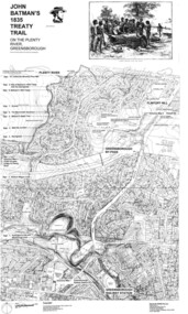
Map, Dennis Ward, John Batman's 1835 Treaty Trail on the Plenty River, 2010_
Map of the Plenty River through Greensborough and surrounding areas, annotated with historic places. Prepared by Dennis Ward, this map shows places of interest with historic markers for a proposed Heritage Trail along the Plenty. This was a joint project of Dennis Ward, Rotary Greensborough and Nillumbik Historical Society.This map shows many places of interest along the Plenty River. Large laminated map, including land subdivisions and street names.plenty river heritage trail -
 Ringwood and District Historical Society
Photograph, View from Colemans Estate Heathmont, 1923. Near corner of Bedford and Canterbury Roads
Typed below photograph, "View from Colemans Estate Heathmont, 1923. Near corner of Bedford and Canterbury Roads". -
 Greensborough Historical Society
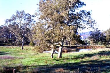
Slide - Photograph, John Ramsdale, Lower Plenty with Odyssey House in background: Slide 103, 1990s
Photograph shows gum trees in paddock. This is in Lower Plenty with Odyssey House in background.Part of the John Ramsdale collection of slides and audio visual material.Colour photograph scanned from slide.No maker's marks. No caption on slide.lower plenty, odyssey house -
 Greensborough Historical Society
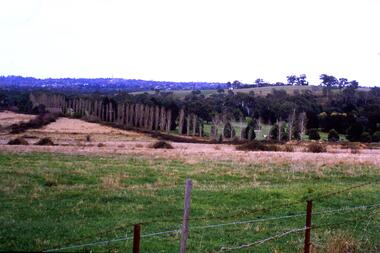
Slide - Photograph, John Ramsdale, Lower Plenty and Rosanna Golf Course: Slide 111, 1990s
Photograph shows a rural scene in Lower Plenty and Rosanna Golf Course to rightPart of the John Ramsdale collection of slides and audio visual material.Colour photograph scanned from slide.No maker's marks. No caption on slide.lower plenty, rosanna golf course -
 Greensborough Historical Society
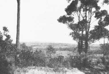
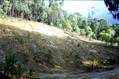
Slide - Photograph, John Ramsdale, Source of the Plenty River: Slide 32, 1990s
Photograph of the source of the Plenty River at Bruces Creek Whittlesea showing water and vegetation.Part of the John Ramsdale collection of slides and audio visual material.Colour photograph scanned from slide.No maker's marks. No caption on slide.plenty river, vegetation, whittlesea -
 Greensborough Historical Society
Slide - Photograph, John Ramsdale, Drain into Plenty River: Slide 71, 1990s
Photograph shows a culvert or drain with graffiti - long view This drains into the Plenty River.Part of the John Ramsdale collection of slides and audio visual material.Colour photograph scanned from slide.No maker's marks. No caption on slide.plenty river -
 Greensborough Historical Society
Slide - Photograph, John Ramsdale, Headwaters of the Plenty River: Slide 81, 1990s
Photograph shows hill with trees and run off to the river. This is the headwaters of the Plenty River.Part of the John Ramsdale collection of slides and audio visual material.Colour photograph scanned from slide.No maker's marks. No caption on slide.plenty river -
 Greensborough Historical Society
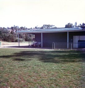
Photographs, Montmorency: old pavilion. Lower Plenty Oval 1979, 17/04/1979
2 photographs of the old pavilion at Lower Plenty Oval, Montmorency, April 1979.2 colour photographs.peter graham, montmorency, lower plenty oval -
 Greensborough Historical Society
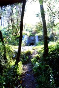
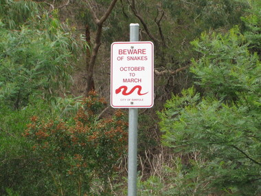
Photograph - Digital image, Dennis Ward, Snake sign on the Plenty River Trail, 27/03/2010
Sign on Plenty River Trail at Greensborough warning of snakes from October to March.Digital copy of colour photograph.plenty river, plenty river trail -
 Greensborough Historical Society
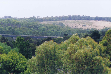
Photograph - Digital image, Frank Solomon, View over Greensborough to Plenty River Drive bridge, 2010c
View over trees to the Greensborough By-pass bridge over Plenty River Drive.Digital copy of colour photographplenty river drive, greensborough bypass -
![Newspaper - Newspaper Clipping - Digital Image, The Whittlesea Post, Kentucky Fried Chicken [Plenty Road Bundoora 1988], 25/10/1988](/media/collectors/4f729f5697f83e03086015b8/items/6744fc640d508cb167f8beca/item-media/6744fc9a0d508cb167f8c76d/item-fit-380x285.jpg) Greensborough Historical Society
Greensborough Historical SocietyNewspaper - Newspaper Clipping - Digital Image, The Whittlesea Post, Kentucky Fried Chicken [Plenty Road Bundoora 1988], 25/10/1988
Kentucky Fried Chicken opened its store in Plenty Road Bundoora in 1988.Digital copy of newspaper articlekentucky fried chicken, kfc bundoora, plenty road bundoora, local businesses, fast food -
 Ringwood and District Historical Society
Map, Proposed Subdivision - Hilltop Estate, Heathmont, Victoria - circa 1925
Plan of Part of Crown Allotments 16 & 18, Parish of Ringwood, County of Mornington. Subdivision includes Site for Heathmont Station, Heathmont Road, George Street, Lilian Street, Edith Street, Edna Street, Great Ryrie Street. Inset locality plan also shows nearby Electric Railway Estate and Heathmont Station Estate. L.H. Webber, Licensed Surveyor, 440 Little Collins Street, Melbourne.