Showing 123672 items matching "main-road"
-
 Eltham District Historical Society Inc
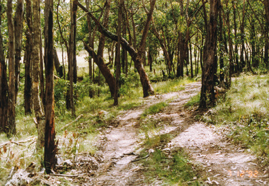
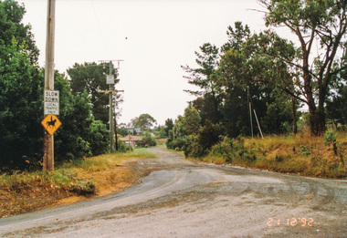
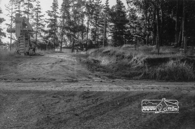
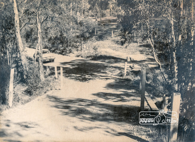
Photograph, Rifle Range Road Track near Buttermans Track, St Andrews, 7 December 1992, 07/12/1992
The Eltham Horse Trail: Research and Warrandyte to Kinglake: Survey of proposed route, December 1992: (3) Kangaroo Ground to KinglakeColour photographeltham horse trail (1992 survey), buttermans track, rifle range road track, st andrews -
 Eltham District Historical Society Inc
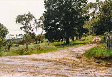
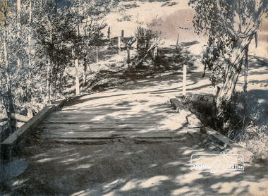
Photograph, Marshalls Road from Buttermans Track, St Andrews, 7 December 1992, 07/12/1992
The Eltham Horse Trail: Research and Warrandyte to Kinglake: Survey of proposed route, December 1992: (3) Kangaroo Ground to KinglakeColour photographeltham horse trail (1992 survey), st andrews, marshalls road, buttermans track -
 Eltham District Historical Society Inc
Photograph, Mt Everard Track at Marshalls Road, St Andrews, 7 December 1992, 07/12/1992
The Eltham Horse Trail: Research and Warrandyte to Kinglake: Survey of proposed route, December 1992: (3) Kangaroo Ground to KinglakeColour photographeltham horse trail (1992 survey), st andrews, marshalls road, mt everard track -
 Eltham District Historical Society Inc
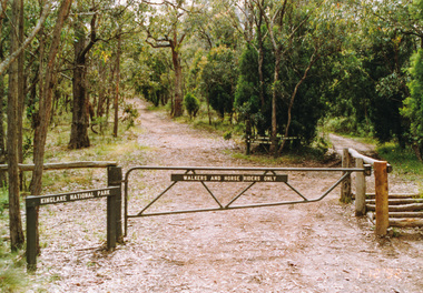
Photograph, Hurstbridge Road at Pinchgut Lane, Kinglake, 7 December 1992, 07/12/1992
The Eltham Horse Trail: Research and Warrandyte to Kinglake: Survey of proposed route, December 1992: (3) Kangaroo Ground to KinglakeColour photographeltham horse trail (1992 survey), kinglake, pinchgut lane, hurstbridge road -
 Eltham District Historical Society Inc
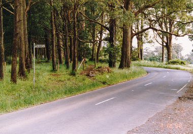
Photograph, Margaret Street from Ingrams Road, Research, 21 December 1992, 21/12/1992
The Eltham Horse Trail: Research and Warrandyte to Kinglake: Survey of proposed route, December 1992: (4) Connecting trail to ElthamColour photographeltham horse trail (1992 survey), ingrams road, research (vic.), margaret street -
 Eltham District Historical Society Inc
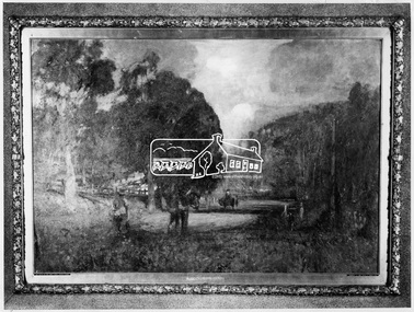
Photograph, Lower Plenty - "The Road to Lower Plenty" - painting by Walter Withers
Source: Geelong Art Gallery via Mr Alan Marshal, then via Shire of Eltham This photo forms part of a collection of photographs gathered by the Shire of Eltham for their centenary project book,"Pioneers and Painters: 100 years of the Shire of Eltham" by Alan Marshall (1971). The collection of over 500 images is held in partnership between Eltham District Historical Society and Yarra Plenty Regional Library (Eltham Library) and is now formally known as the 'The Shire of Eltham Pioneers Photograph Collection.' It is significant in being the first community sourced collection representing the places and people of the Shire's first one hundred years.Digital imagesepp, shire of eltham pioneers photograph collection, montmorency, the road to lower plenty, walter withers -
 Eltham District Historical Society Inc
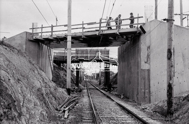
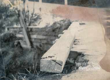
Negative - Photograph, Russell Yeoman, New road bridge under construction over railway line at junction of Sherbourne and Para Roads, Briar Hill, 1971
New bridge in foreground. Old bridge in background before demolition. This photo forms part of a collection of photographs gathered by the Shire of Eltham for their centenary project book,"Pioneers and Painters: 100 years of the Shire of Eltham" by Alan Marshall (1971). The collection of over 500 images is held in partnership between Eltham District Historical Society and Yarra Plenty Regional Library (Eltham Library) and is now formally known as the 'The Shire of Eltham Pioneers Photograph Collection.' It is significant in being the first community sourced collection representing the places and people of the Shire's first one hundred years.Digital image 35 mm B&W negativesepp, shire of eltham pioneers photograph collection, montmorency, briar hill, bridge, para road, railway bridge, railway line, road construction, sherbourne road, bridge construction -
 Eltham District Historical Society Inc
Photograph, Diosma Road, Eltham, 15 October 1990, 15/10/1990
Colour photographinfrastructure, shire of eltham, streets, diosma road, eltham, stokes orchard estate -
 Eltham District Historical Society Inc
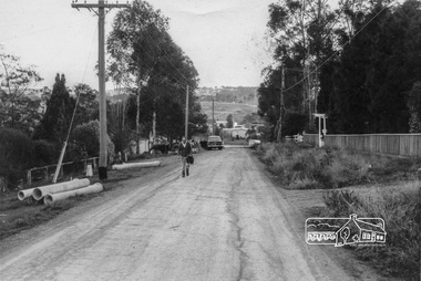
Photograph, 20 Para Road viewed from near 2 Alma Street, Lower Plenty, c.July 1967, 1967
Packaged in "Filmpro King Size prints Definitely Better EST. 1918" envelope. Pencil notes: 36 shots $2.87 Eltham Shire J. McD and 19/7/67. Alma Street and Kett Street Lower Plenty c.July 1967.Black and white photographalma street, lower plenty, houses, streets -
 Eltham District Historical Society Inc
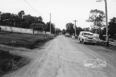
Photograph, Looking southwest along Alma Street to Para Road, Lower Plenty, c.July 1967, 1967
Packaged in "Filmpro King Size prints Definitely Better EST. 1918" envelope. Pencil notes: 36 shots $2.87 Eltham Shire J. McD and 19/7/67. Alma Street and Kett Street Lower Plenty c.July 1967.Black and white photographalma street, lower plenty, houses, streets -
 Eltham District Historical Society Inc
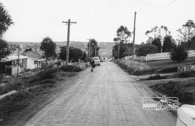
Photograph, Looking northeast along Alma Street to Para Road, Lower Plenty, c.July 1967, 1967
Packaged in "Filmpro King Size prints Definitely Better EST. 1918" envelope. Pencil notes: 36 shots $2.87 Eltham Shire J. McD and 19/7/67. Alma Street and Kett Street Lower Plenty c.July 1967.Black and white photographalma street, lower plenty, houses, streets -
 Eltham District Historical Society Inc
Photograph, Looking southwest along Alma Street to Para Road, Lower Plenty, c.July 1967, 1967
Packaged in "Filmpro King Size prints Definitely Better EST. 1918" envelope. Pencil notes: 36 shots $2.87 Eltham Shire J. McD and 19/7/67. Alma Street and Kett Street Lower Plenty c.July 1967.Black and white photographalma street, lower plenty, houses, streets -
 Eltham District Historical Society Inc
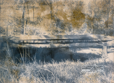
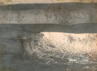
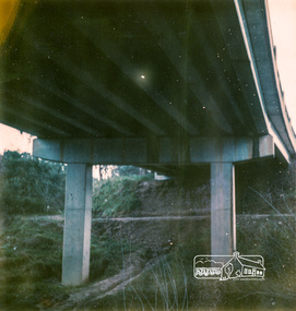
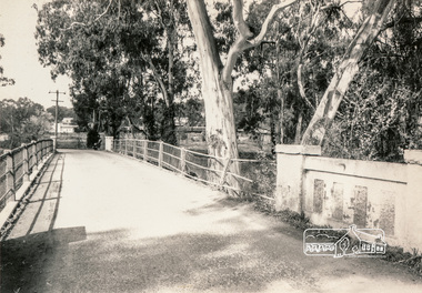
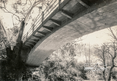
Photograph, Looking west across Mount Pleasant Road Bridge, Research, c.1977, 1977c
Miscellaneous Bridges.Black and white photographmount pleasant road bridge, research (vic.) -
 Eltham District Historical Society Inc
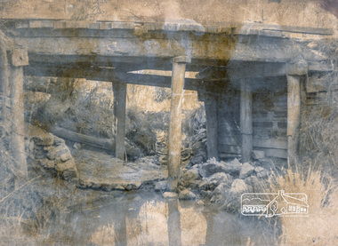
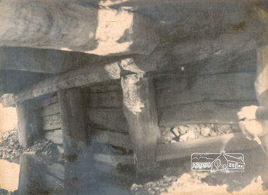
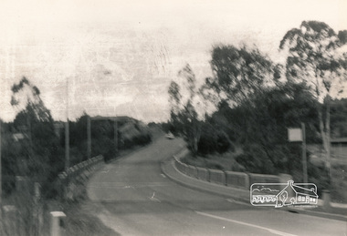
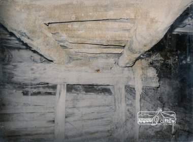
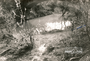
Photograph, Mount Pleasant Road Bridge, Research, c.1977, 1977c
Various Flood Pictures.Black and white photographmount pleasant road bridge, research (vic.) -
 Eltham District Historical Society Inc
Photograph, Mount Pleasant Road Bridge, Research, c.1977, 1977c
Various Flood Pictures.Black and white photographmount pleasant road bridge, research (vic.) -
 Eltham District Historical Society Inc
Photograph, Mount Pleasant Road Bridge, Research, c.1977, 1977c
Various Flood Pictures.Black and white photographmount pleasant road bridge, research (vic.) -
 Eltham District Historical Society Inc
Photograph, Mount Pleasant Road Bridge, Research, c.1977, 1977c
Various Flood Pictures.Black and white photographmount pleasant road bridge, research (vic.) -
 Eltham District Historical Society Inc
Photograph, Mount Pleasant Road Bridge, Research, c.1977, 1977c
Various Flood Pictures.Black and white photographmount pleasant road bridge, research (vic.) -
 Eltham District Historical Society Inc
Photograph, Mount Pleasant Road Bridge, Research, c.1977, 1977c
Various Flood Pictures.Black and white photographmount pleasant road bridge, research (vic.) -
 Eltham District Historical Society Inc
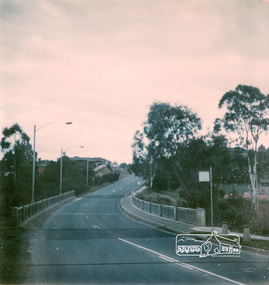
Photograph, New road bridge at Lower Plenty towards Rosanna
Colour photographManufacturer's marks: Polarcolor 4, Batch #E65K753A.infrastructure, bridge, shire of eltham infrastructure, lower plenty, lower plenty bridge, polaroid -
 Eltham District Historical Society Inc
Photograph, New road bridge at Lower Plenty
Colour photographManufacturer's marks: Polarcolor 5, Batch #E65K753A.infrastructure, bridge, shire of eltham infrastructure, lower plenty, lower plenty bridge, polaroid -
 Eltham District Historical Society Inc
Photograph, New road bridge at Lower Plenty
Black and white photographinfrastructure, bridge, shire of eltham infrastructure, lower plenty, lower plenty bridge -
 Eltham District Historical Society Inc
Photograph, Long Gully Road Bridge, Panton Hill
Black and white photographinfrastructure, shire of eltham infrastructure, bridge, long gully road bridge, panton hill -
 Eltham District Historical Society Inc
Photograph, Monash Bridge, Hurstbridge-Arthurs Creek Road, Hurstbridge
Black and white photographinfrastructure, shire of eltham infrastructure, bridge, arched bridge, hurstbridge, hurstbridge arthurs creek road, monash bridge -
 Eltham District Historical Society Inc
Photograph, Monash Bridge, Hurstbridge-Arthurs Creek Road, Hurstbridge
Black and white photographinfrastructure, shire of eltham infrastructure, bridge, arched bridge, hurstbridge, hurstbridge arthurs creek road, monash bridge -
 Eltham District Historical Society Inc
Photograph, Monash Bridge, Hurstbridge-Arthurs Creek Road, Hurstbridge
Black and white photographinfrastructure, shire of eltham infrastructure, bridge, arched bridge, hurstbridge, hurstbridge arthurs creek road, monash bridge -
 Eltham District Historical Society Inc
Photograph, Hurstbridge Football Club, Hurstbridge Memorial Park, 50 Graysharps Road, Hurstbridge, 25 September 1983, 25/09/1983
Colour photographManufacturer marks: Polaroid 5 Batch #03336047031 (March 1983).hurstbridge, graysharps road, hurstbridge football club, hurstbridge memorial park, polaroid -
 Eltham District Historical Society Inc
Photograph, Sign to Hume and Hovell Cricket Ground, at Allandale Road, Strath Creek, Autumn Excursion, Hume and Hovell's 1824 expedition, 26 May 1996, 26/05/1996
[article by Bettina Woodburn in EDHS Newsletter No. 109, July 1996:] ON THE TRAIL OF HUME AND HOVELL - REPORT ON THE AUTUMN EXCURSION - On a green and fresh morning (Sunday 26th May 1996) the Cobb and Co coach (driven by the most obliging Peter Tampion) set off in a north easterly direction from Eltham to connect with Hume and Hovell's route on their 1824 explorations of central Victoria. The Society would follow a series of monuments erected for the 1924 centenary of the expedition from King Parrot Creek (Tuesday 7th December 1824), through Strath Creek, over Sunday Creek (Sunday 12th December 1824) at Broadford, Tullamarine, St Albans, Deer Park, through Werribee, skirting east of the You Yangs to Lara and Avalon Beach. Because their distance-measuring wheel had broken and a one degree mistake was made in calculations, the two leaders of the original group of six convict-companions arrived at Corio Bay, instead of the expected Western Port, discovered earlier by Flinders. From below Mt. Disappointment (Hume and Hovell's difficulties in "scrambling over brush and rock", "leeches in forest, as well as no water", "cutting grass 4-5 ft. high", dreadful scrub", "devil flies") we took an easier route, saw the Strath Creek memorial in ground fog and a wonderful "field of dreams", the Hume-Hovell privately owned cricket ground with its white picket boundary fence. Now, after a steep climb, in sunshine under gums we stretched and viewed magnificent rolling hills and fog-filled valleys - not "smoke from Aborigines' bush fires". After morning tea at Broadford we followed the Sunday Creek valley beside the Hume Freeway, passed the Wallan Wallan Rest Area (more appropriately Hume and Hovell Rest Area) to tum right at Beveridge. In Gellibrand Hill Park, near the headwaters of the Moonee Ponds Creek, we experienced the landscape the first European settlers saw - huge river red gums and rolling pastures. The gardens and sheltered courtyard of the 1840s, timber, brought from .....[?] prefabricated Woodlands Homestead, provided a pleasant lunch stop. We enjoyed a private tour, panoramic views over Melbourne and surroundings and the excitement of arriving and departing aircraft. Our next river crossing was at Werribee, "in a vast treeless plain", then we drove on by-ways no coach had previously travelled, to find "an immense sheet of water" salty Corio Bay, off-course to the west. In late afternoon of a super, calm, late autumn day we headed homewards. Back at Eltham we were rather surprised to find that we had travelled a total of 347 km. Thanks again to Russell Yeoman for his research and organization. What a wonderful day! Colour photographactivities, hume and hovell, allandale road, strath creek -
 Eltham District Historical Society Inc
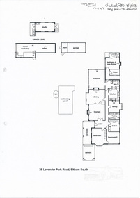
Folder, Kinloch-Bervie, 28 Lavender Park Road, Eltham South, April 2003
Morrison Kleeman Real Estate sales information material4 pages A4 gayle blackwood collection, houses, morrison kleeman real estate, eltham south, kinloch-bervie, lavender park road