Showing 1938 items
matching floods
-
 Inverloch Historical Society
Photograph, 1934 Dec - Pound Creek - tidal floods - pig paddock - side of house - Henderson property
... 1934 Dec - Pound Creek - tidal floods - pig paddock - side ... -
 Inverloch Historical Society
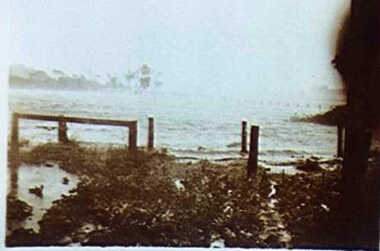
000250 - Photograph - 1934 Dec - Pound Creek - tidal floods - pig paddock - Henderson property - E Henderson
... 000250 - Photograph - 1934 Dec - Pound Creek - tidal floods ... -
 Inverloch Historical Society
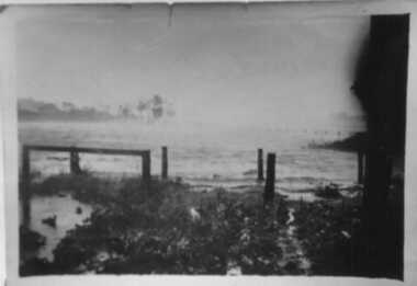
000251 - Photograph - 1934 - Pound Creek - Henderson property - floods in front of house - E Henderson
... property - floods in front of house - E Henderson ... -
 Inverloch Historical Society
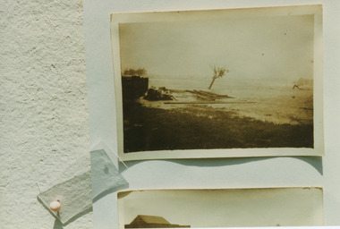
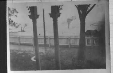
000253 - Photograph - 1934 - Pound Creek - Henderson property - floods - water coming around pig paddock side of house - E Henderson
... property - floods - water coming around pig paddock side of house ... -
 Inverloch Historical Society
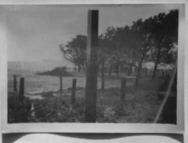
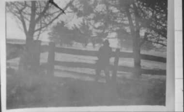
000241 - Photograph - 1934 - Pound Creek - Henderson property - front fence floods - E Henderson
... property - front fence floods - E Henderson ... -
 Inverloch Historical Society
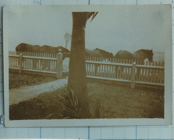
000236 - Photograph - 1934 Dec - Pound Creek - Henderson property - floods at front gate and horses - E Henderson
... property - floods at front gate and horses - E Henderson ... -
 Whitehorse Historical Society Inc.
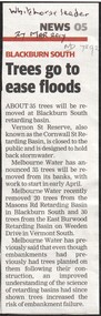
Article, Trees go to ease floods, 2017
... Trees go to ease floods ...Melbourne Water will remove 35 trees from the embankments of the Vernon Street Reserve, also known as the Cornwall Street Retarding Basin, to reduce the risk of embankment failure.trees, blackburn south, vernon street, blackburn, melbourne water -
 Ballarat Heritage Services
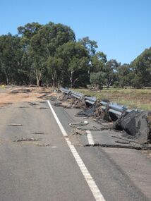
Photograph - Colour, Asphalt on Bridge, Floods, Carisbrook
... Asphalt on Bridge, Floods, Carisbrook ... -
 Ballarat Heritage Services
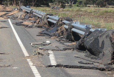
Photograph - Colour, Asphalt on Bridge, Floods, Carisbrook
... Asphalt on Bridge, Floods, Carisbrook ...carisbrook, flood, road damage, asphalt -
 Ballarat Heritage Services
Photograph - Colour, Floods, Carisbrook, Victoria
... Floods, Carisbrook, Victoria ...carisbrook, flood, flood recovery -
 Inverloch Historical Society
000171 - Photograph - 1934 Dec - Pound Creek - Tidal floods - Nick near stables and Henderson property fence - E Henderson
... 000171 - Photograph - 1934 Dec - Pound Creek - Tidal floods ... -
 Stawell Historical Society Inc
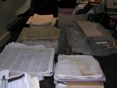
Archive - CD/DVD, Holford Wettenhall, Family photographs including Carrs Plains Aboriginals, sheep, floods, horses, snow, 2006
... Plains Aboriginals, sheep, floods, horses, snow ...stawell -
Stawell Historical Society Inc
Archive - CD/DVD, Holford Wettenhall, Family photographs including Carrs Plains Aboriginals, sheep, floods, horses, snow, 2006
... Plains Aboriginals, sheep, floods, horses, snow ...stawell -
Stawell Historical Society Inc
Archive - CD/DVD, Wettenhall Telford Photos Carrs Plains. Aborigionals, Floods Horses
... , Floods Horses. ...stawell -
Merbein District Historical Society
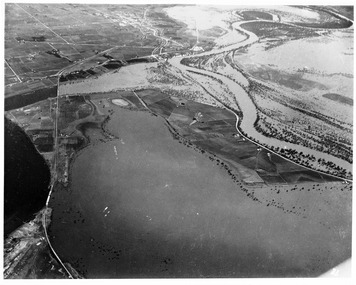
Newspaper, Murray Darling 1956 Floods 40th Anniversary, 1956
... Murray Darling 1956 Floods 40th Anniversary ...cowanna bend, yelta, lindsay adams, paschendale avenue, tony treadwell, christine adams, golda adams -
 Merbein District Historical Society
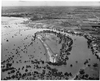
Photograph, Merbein 1956 Floods, 1956
... Merbein 1956 Floods ...cowanna bend - dareton -
 Merbein District Historical Society
Photograph, Merbein 1956 Floods, 1956
... Merbein 1956 Floods ...river road merbein, lake hawthorn -
 Merbein District Historical Society
Photograph, Merbein 1956 Floods, 1956
... Merbein 1956 Floods ...merbein racecourse, merbein 1956 floods -
 Merbein District Historical Society
Photograph, Merbein 1956 Floods, 1956
... Merbein 1956 Floods ...merbein 1956 floods -
 Merbein District Historical Society
Photograph, Merbein 1956 Floods, 1956
... Merbein 1956 Floods ...merbein flood (west of township) -
 Merbein District Historical Society
Photograph, Merbein 1956 Floods, 1956
... Merbein 1956 Floods ...merbein floods -
 Merbein District Historical Society
Photograph, Merbein 1956 Floods, 1956
... Merbein 1956 Floods ...mildara winery area floods, merbein 1956 floods, merbein irigation pumps -
 Merbein District Historical Society
Photograph, Merbein 1956 Floods, 1956
... Merbein 1956 Floods ...merbein 1956 floods -
 Merbein District Historical Society
Photograph, Merbein 1956 Floods, 1956
... Merbein 1956 Floods ...curlwaa -
 Merbein District Historical Society
Photograph, Merbein 1956 Floods, 1956
... Merbein 1956 Floods ...merbein pumps - woodyard -
 Merbein District Historical Society
Photograph, Merbein 1956 Floods, 1956
... Merbein 1956 Floods ...merbein river road - pumps -
 Hume City Civic Collection
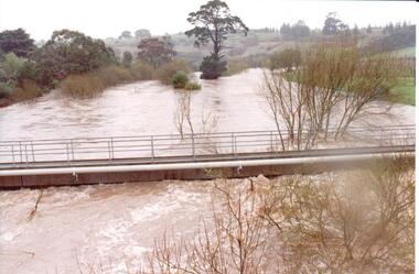
Photograph
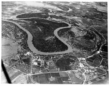
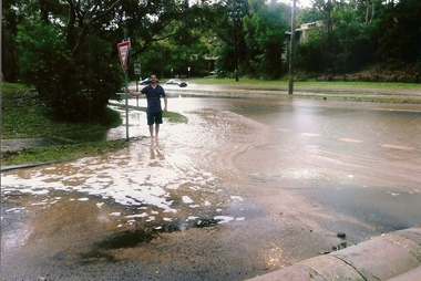
... floods ...The series of photographs were taken after exceptional heavy rain had fallen in Sunbury in the early 1990s. Jackson's Creek overflowed its banks and the surrounding flood plain area was under water.A coloured photograph of Jackson's Creek in flood taken near the footbridge in Macedon Street. The Nook area and Goonawarra Vineyard are in the background.floods, weather patterns, jacksons creek, george evans collection -
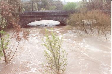 Hume City Civic Collection
Photograph
... floods ...The series of photographs were taken after exceptional heavy rain had fallen in Sunbury in the early 1990s. Jackson's Creek overflowed its banks and the surrounding flood plain area was under water.A coloured photograph of Jackson's Creek in flood. The floodwaters have almost reached the top of the arch of the Macedon Street stone bridge.floods, weather patterns, jacksons creek, george evans collection -
 Greensborough Historical Society
Photographs, Christmas Day 2011 Hail Storm, 25/12/2011
... floods ...Christmas Day 2011 started out fine and sunny but by mid afternoon, storms - which brought with them huge hailstones, torrential rain and flash flooding swept through Melbourne suburbs. These photographs show some of the hail and flooding in the Greenhills area of Greensborough.Original photographs taken by residents of the area.21 coloured photographs, 4 black and white copies of photos (A4). Each depicts an aspect of the Christmas Day 2011 hail storm and floods in Greensborough.christmas day 2011, floods, greenhills, greensborough, hailstorms -
 Charlton Golden Grains Museum Inc
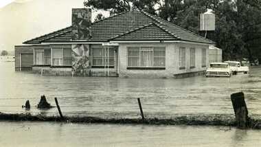
Photograph, Cameron, Ian, 1973 Flood W. Fitzpatrick's House on Calder Highway, Feb 1973
1973 flood. W. Fitzpatrick's house on Calder Hwy, surrounded by flood water from Yeungroon Creek.B/W photograph of 1973 flood. W Fitzpatrick's house on Calder Highway surrounded by flood water from flooded Yeungroon Creek.flood, charlton, calder highway, yeungroon