Showing 8885 items
matching lake
-
 Stawell Historical Society Inc
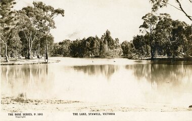
Postcard, The Rose Stenographers, The Lake Stawell, c 1910
The Old Lake Reserve Stawell WestThe Rose Series P.1641Front - The Rose Series P. 1641. The Lake Stawell Victoriathe old lake reserve stawell west -
 Lakes Entrance Historical Society
Photograph - Northropes Bunga Haven Lake Bunga Victoria, H D Bulmer, 1904 c
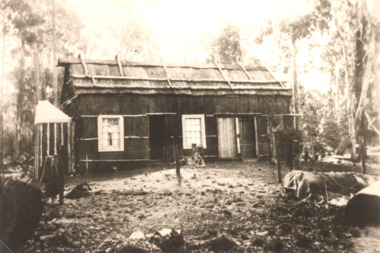
Sepia toned photograph of a bark house in bushland with glazed sash windows of six panes upper and lower. Large chimney of dropped slabs held in place by narrow uprights. Known as Northropes Bunga Haven Lake Bunga Victoriabuildings, settlers -
 Ballarat Heritage Services
Photograph - Digital photograph, Lake Bled
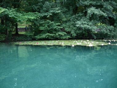
The lake is of mixed glacial and tectonic origin. It is 2,120 m (6,960 ft) long and 1,380 m (4,530 ft) wide, with a maximum depth of 29.5 m (97 ft), and it has a small island. The lake lies in a picturesque environment, surrounded by mountains and forests. Medieval Bled Castle stands above the lake on the north shore. The World Rowing Championships in 1966, 1979, 1989, and 2011 were held at Lake Bled.Colour photograph of Lake Bled.lake bled -
 Ballarat Heritage Services
Photograph - Image - Black and White, Lake Daylesford, c1949, c1949
Lake Daylesford was created in 1929. Photograph of Lake Daylesford.lake daylesford, daylesford -
 Stawell Historical Society Inc
Photograph, Cato Lake looking from Viictoria Street -- Coloured
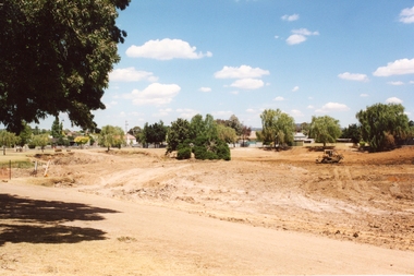
Cato Lake view from Victoria Street looking towards Sloane Street. This view shows the emptying of the lake carried out in c 2002 for deepening the lake by Shire Council Works. This view shows a tractor working around the empty lake. Coloured photograph of emptied Cato Lake from Victoria Street side looking towards Sloane Street. The lake was emptied in c 2002 for deepening by Shire Council Works. This view shows a tractor working around the emptied lake. In the background are trees with houses amounts them.Written in biro 5.2.2002stawell -
 Ballarat Heritage Services
Digital photographs, L.J. Gervasoni, Lake at Tower Hill, c2015
Tower Hill is an extinct volcano in the Western District of Victoria.Colour photographs of Tower Hill and the crater lake.tower hill, volcano, natural heritage, koroit, lake, landscape -
 Lakes Entrance Historical Society
Photograph - Bark hut Lake Tyers area Victoria, H D Bulmer, 1910 c
Sepia toned photograph of a bark roofed house, walls possibly also bark, wattle fence corrugated iron tank at corner of house two six paned windows either side of doorway, believed to be Lake Tyers area Victoriaagriculture, buildings -
 Victorian Interpretive Projects Inc.
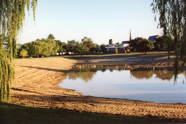
Photograph - colour, Clare Gervasoni, Lake Wendouree Walk, 12/03/2007
In 2007 Lake Wendouree was dry. on 12 March 2007 a fundraiser enabled people to walk through the centre of the lake. Two colour photographs in digital format showing the dry bed of Lake Wendouree and a number of boathouses and Nazareth House taken from the centre of the lake.ballarat, lake wendouree -
 Federation University Historical Collection
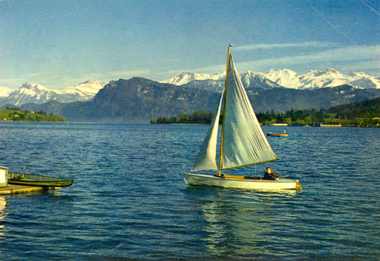
Postcard - colour, Franz Schneider, Lucerne, Lake Lucerne and Mountains, c1920
Colour postcard of a white yacht on Lake Lucerne, Switzerland. Alps are evident in the background.chatham-holmes family collection, lucerne, boat, alps, lake -
 Whitehorse Historical Society Inc.
Document, Blackburn Lake Gazette, 1978 -79
First edition of the Blackburn Lake Gazette.First edition of the Blackburn Lake Gazette, the school paper of Blackburn Lake Primary School No. 4860.First edition of the Blackburn Lake Gazette.blackburn lake primary school no. 4860, school paper -
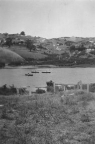
 Stawell Historical Society Inc
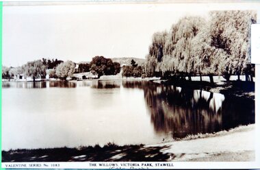
Photograph - View of Cato Lake, Black & White photo of Valentine Series No 1083 Willows Victoria/Cato Lake
View of Victoria/Cato Lake showing just a short section of the walking track and willows around the lake. Houses can be seen in the distance. The lake is very still as the trees are reflected in the water.Black & White photo of Valentine Series No 1083 Victoria/Cato lake. The photo is of a post card of Victoria/Cato Lake. Willow trees line the right side of the photograph. Valentine Series No 1083. The willows Victoria Park, Stawell. stawell -
Gippsland and Regional Studies Collection
Photograph - Gippsland scenery, Nicholas John Caire, Toorloo Bay, Lake Tyers, 1886
Sepia photographic print depicting man in boat on Lake Tyers, Gippsland, VictoriaVerso: label attached with title and description: "This scene is situated on the North Arm of the Lake, which abounds with Picturesque Scenery, both in extensive Reaches and, and in Miniature Bays, Coves and Inlets. Lake Tyers is situated 7 miles beyond the Gippsland Lakes Entrance." A man is rowing a boat in the foreground. The series was published in 1886."nicholas caire, toorloo bay, lake tyers, tyers, gippsland, boat, fishing -
 Federation University Historical Collection
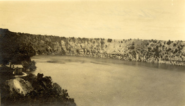
Photograph - Photograph - black and white, Blue Lake, Mount Gambier
Black and white photograph of the Blue Lake at Mt Gambier, South Australia. A house is located on the left side of the photograph. Verso - handwritten in black ink "The Blue Lake Mount Gambier"chatham family archive, chatham, mt gambier, blue lake, mount gambier -
 Ballarat Heritage Services
Photograph - Photograph - Black and White, Lake Daylesford
Lake Daylesford was created in 1929. The township of Daylesford surrounds Lake Daylesford.daylesford, murray views, lake daylesford -
 Ballarat Heritage Services
Photograph - Photograph - Black and White, Lake Daylesford
Lake Daylesford was created in 1929. Black and white photograph of Lake Daylesford.daylesford, lake daylesford -
 Ballarat Heritage Services
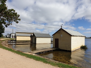
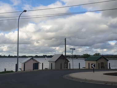
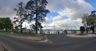
Photograph - Boathouse, Clare Gervasoni, Boathouses on Lake Wendouree, Ballarat, 2021
Lake Wendouree was originally known as Yuille's Swamp.Colour photograph of a boathouse on Lake Wendouree.. lake wendouree, boathouse -
 Ballarat Heritage Services
Photograph - Boathouse, Clare Gervasoni, Boathouses on Lake Wendouree, Ballarat, 09/10/2020
Lake Wendouree was originally known as Yuille's Swamp.Colour photograph of a boathouse on Lake Wendouree.. lake wendouree, boathouse, ballarat, wendouree parade -
 Ballarat Heritage Services
Photograph - Boathouse, Clare Gervasoni, Boathouses on Lake Wendouree, Ballarat, 09/10/2020
Lake Wendouree was originally known as Yuille's Swamp.Colour photograph of a boathouse on Lake Wendouree.. lake wendouree, boathouse, ballarat, wendouree parade, panorama -
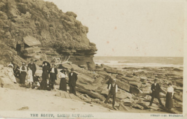 Lakes Entrance Historical Society
Postcard - Red Bluff 1910 c, Stanley Vogt, 1910c
Paired with image 03731.1 for display in 150 years Lakes Entrance 1858 to 2008 held in October 2008Sepia toned postcard west side of Red Bluff showing a group of eight men and five women and a child. Sand washed away exposing vast rocky beach, short vegetation on rocky bluff. Women wearing full length skirts and wide brim hats with veils, men in three piece suits dark in colour on ninety mile beach Lake Tyers VictoriaThe Bluff Lakes Entrancetopography, fashion -
 Stawell Historical Society Inc
Photograph, Cato Lake looking from Sloane Street -- Coloured
Cato Lake view from Sloane Street. This photo is one of three showing Stawell Council Works deepening Cato Lake in February c 2002. Tracks from a tractor can be seen all round the lake. Willows branches hang either side of the view with trees along the horizon. The Presbyterian Church tower, Senior Citizen room and Anglican Church can be seen amongst the trees in the background.Coloured photograph of Cato Lake. The view is from Sloane Street and the lake was in the process of being lowered for the deepening of the lake by Shire Council Works. Tractor tracks can be seen all round the lake. Willows hang either side of the view with trees along the horizon. The Presbyterian Church tower in the background near the Senior Citizen room and Anglican Church to the right.Date on back of photo in biro 12.2.2002.stawell -
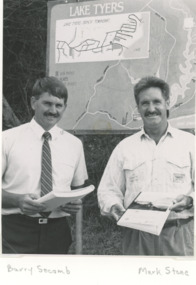 Lakes Entrance Historical Society
Photograph, Lake Tyers Beach Strategy Plan. Lake Tyers Beach progress Association
Launch of Lake Tyers Beach Strategy Plan . Second photo of Joe Taylor at his farewell Black and white photograph of Cr. Barry Secomb (Tambo Shire), Mark Stone(Regional Manager DCE) . Plus second photo of members of Lake Tyers Beach progress Association clubs, township planning -
 Marysville & District Historical Society
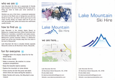
Ephemera (item) - Advertising brochure, Lake Mountain Ski Hire, Unknown
An advertising brochure for Lake Mountain Ski HireAn advertising brochure for Lake Mountain Ski Hiremarysville, victoria, lake mountain, lake mountain ski hire -
 Stawell Historical Society Inc
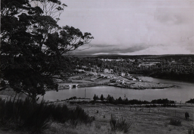
Slide, Ian McCann, Lake Bellfield, 2022
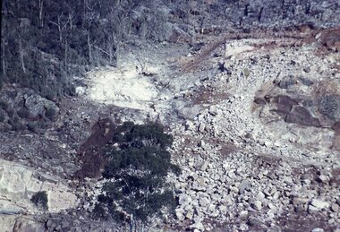
Lake Bellfield During ConstuctionColour Slide: showing lake Bellfield during construction. -
 Stawell Historical Society Inc
Slide, Ian McCann, Lake Bellfied, 1960's
Lake Bellfield During ConstructionColour Slide; Showing lake Bellfield during construction. -
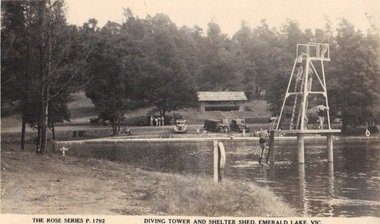 Emerald Museum & Nobelius Heritage Park
Photograph, Rose Series Postcard - Diving Tower and Shelter Shed, Emerald Lake. Victoria, circa 1940 - 50
Depicting early years of Emerald Lake Photograph of Emerald Park Lake showing diving tower circa 40'sFront: The Rose Series P. 1792 'Diving Tower and Shelter Shed, Emerald Lake, Vic. emerald park lake, rose series postcards -
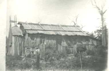 Lakes Entrance Historical Society
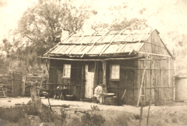
Photograph - Bark hut at Lake Tyers area Victoria, Bark hut at Lake Tyers area Victoria, 1900 c
Second identical copy 04618.1Black and white photograph of a bark hut showing walls of vertical sheets of bark held in place by horizontal battons. On the roof overlapping sheets of bark are held in place by a horizontal log attached to the saddle pole on the roof ridge by vertical timbers. Nails were not used wooden pegs or greenhide strips kept the frame stable. This building believed to be in the Lake Tyers area Victoriahouses, land settlement -
 Stawell Historical Society Inc
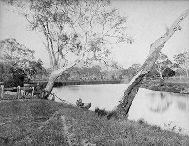
Photograph, Scene near Lake Lonsdale at Rosehill Station 1872
Scene near Lake Lonsdale 1872 at Rosehill Station (Scoullar and Brinkman) Taken for the Philadelphian Exhibition Similar to Cat No 1309 photo taken by Armstrong 1866Lake Scene with lake and men in punt. Gentleman in top Hat near tree on left.Part of Rosehill Station near Grampians Mountains (Scoullar and Brinkman) Taken for the Philadelphia Exhibition 1872stawell -
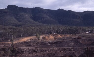
 Stawell Historical Society Inc
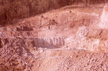
Slide, Ian McCann, Earth Works at the Construction of Lake Bellfield, 1960's
Constuction of Lake BellfieldColour Slide. Showing the Earthworks at Lake Bellfield during Constructiongrampians -
 Ballarat and District Irish Association
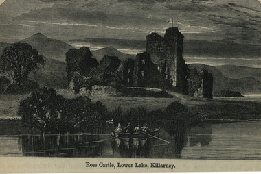
Image, Ross Castle, Lower Lake, Killarney, c1864
Ross Castle sits on the edge of Killarney's lower lake and was built by O'Donoghue Mór in the 15th century. The Castle came into the hands of the Brownes who became the Earls of Kenmare and owned an extensive portion of the lands that are now part of Killarney National Park . Legend has it that O'Donoghue still exists in a deep slumber under the waters of Lough Leane. On the first morning of May every seven years he rises from the lake on his magnificent white horse and circles the lake. Anyone catching a glimpse of him is said to be assured of good fortune for the rest of their lives. The large rock at the entrance to the bay is known as O'Donoghue's prison. Ross Castle was the last stronghold in Munster to hold out against Cromwell. It was eventually taken by General Ludlow in 1652. (http://www.killarneynationalpark.ie/Ross%20Castle/Ross%20Castle.htm)Image of a boat being rowed on a lake in front of Ross Castle, Lower Lake, Killarney.ballarat irish, ross castle, lower lake, killarney -
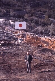
 Stawell Historical Society Inc
Slide, Ian McCann, Construction of Lake Bellfield, 1965
Lake Bellfield Under ConstructionColour Slide: showing rubble prior to removal at Lake Bellfield