Showing 280 items
matching victoria reef mine
-
 Bendigo Historical Society Inc.
Document - LONG GULLY HISTORY GROUP COLLECTION: GOLD MINING
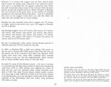
Copy of page 52 from a book. Mentioned are nuggets of gold. Some large Bendigo nuggets and their weight in ounces are mentioned, but no names of the nuggets. Some yields from shaft mining are also mentioned. The Pearl Mine and the Victoria Quartz did a lot of work without sighting any gold, while nearby at the Wittschiebe shaft there was a good find. There is also a short piece about the Pearl Mine Battery. It belongs to photo that was on the next page.bendigo, history, long gully history group, the long gully history group - gold mining, hustlers hill, victoria hill, st laurence court, anglo-german, pearl mine, victoria quartz, wittschiebe shaft, new chum reef, danger hill, belltopper hill -
 Bendigo Historical Society Inc.
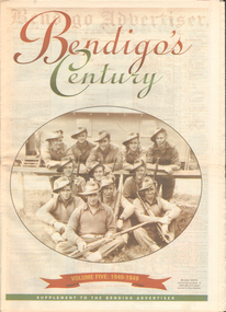
Newspaper - LONG GULLY HISTORY GROUP COLLECTION: BENDIGO'S CENTURY VOLUME FIVE: 1940 - 1949
Newspaper supplement titled Bendigo's Century Volume Five: 1940 - 1949. Each year has heading of Who's Who, Weather, Sport and Business. Front page is titled Bendigo's Century and has a photo of a group of soldiers in uniform and with rifles. They were district servicemen on leave in 1944. Each year has heading of Who's Who, Weather, Sport and Business. First years are 1940 - 1949 titled Bendigo as it was. It has two photos of women wading through the 1949 Pall Mall flood waters and one of Miners in the crib room of the Central Deborah Mine. They are Jackie Lewis, Bob Johnson, W Landy, Ryga Yates and Les Johnson. 1940 - Army moves in to racecourse, 1941 - Devastating fire at pottery, 1942 - Forces expand, 1943 - Nation's eyes on Bendigo, 1944 - News dawns of D-day landing, 1945 - City cheers the end of the war, 1946 - Celebrations begin in city, 1947 - Gallery gets top paintings, 1948 - Water plan looks good and 1949 - Flood takes a toll on city.bendigo, history, long gully history group, the long gully history group - bendigo's century - volume five: 1940 - 1949, bendigo advertiser, central deborah mine, jackie lewis, bob johnson, w landy, ryga yates, les johnson, central nell gwynne, department of defence, bendigo jockey club, 8th division, robert menzies, deborah mine, bendigo decentralisation vigilance committee, cr w h taylor, bendigo war funds organisation, the easter fair society, bendigo agricultural show committee, mr e g ham, mr j v fairbairn, cr a staples, the bendigo chamber of commerce, richard hartley smith abbott, captain harley abbott, bendigo art gallery, bill woodfull, bendigo high school, north deborah mine, boardwalk, toni riley pharmacy, windermere hotel, cr g a pethard, coliban system, north deborah mine, bendigo pottery, bendigo trades hall council, private lawrence burstall, major-general g j rankin mhr, andrew dunstan, ordnance factory, royal australian navy, hmas bendigo, sec offices, muioof, ymca, georger addlem, fred addlem, cr a j anderson, pauline buvhan thompson, leslie thompson, edward joseph leonski, bendigo football league, mr j dedman, william stephens, forest street methodist church, pte charles phillips, pte w e durward, pte t foley, william john stephens, central nell gwynne, air chief marshall sir arthur tedder, cr taylor, united nations, flying officer, r bruce tuff, flight lieutenant owens, royal air force, commonwealth war workers housing trust scheme, mr s mckinnon, bendigo decentralised vigilance committee, ravenswood estate, john lienhop mlc, margaret (peggy) brennan, strathfieldsaye shire council, school of mines, bendigo base hospital, william george ashman, ashman's tailors, bendigo jockey club, victorian football association, bendigo east swimming pool, deborah anticline, specimen hill methodist church, north deborah, adolf hitler, benito mussolini, australian 7th division, cr galvin, bendigo war funds organisation, hmas bendigo, lt-commander jackson, bendigo football league, central deborah mine, victoria day, cr truscott, bendigo gaol, lansellstowe, awas barracks, bendigo citizens committee, john cain snr, ordnance factory, bendigo agricultural society, the duke of gloucester, duchess of gloucester, bendigo tennis association, north deborah, gillies famous pies, aids & appliance shop, mrs georgina scott, dr j a neptune scott, alfred sisley, corot, daubigney, louis sonnenberg, gas employees' union, john lienhop, soldier settlement commission, burnewang estate, king george vi, princess elizabeth, lt philip mountbatten, mr e j w herbert, ansett airways, reg ansett, most rev, dr john mccarthy, dr bernard stewart, michael giudice, bendigo united breweries, bendigo lyric photo plays, bendigo sun newspaper, shamrock hotel, west bendigo progress association, alan mcdonald, south bendigo football club, albert collier, j t webbo, mervyn tresize, state rivers and water supply commission, eppalock reservoir, public works committee, bendigo rotary club, john edgar, bendigo base hospital, albert dunstan, benevolent home, magetti's wine hall, wallace reef wine hall, magetti family, albert magetti, lance galvin, bradford cotton spinnings (victoria) pty otd, arthur syer, stanley crossman, albert arthur dunstan, rev dr henry backhaus, city family hotel, lyric theatre, bank of australasia, city club hotelcolonial mutual building, r matchett & co, lansellstowe, leonard lansell, bendigo bas hospital, australian women's army service, mr hollway, kenworth (aust) ltd, foggitt jones's bacon factory, gordon sayers, sandhurst trustees, dr john drowley, alexander hislop, royal mint, north deborah mine, ironbark south mining company, central nell gwynne company, new chum syncline -
 Bendigo Historical Society Inc.
Document - THE RICH VICTORIA HILL AND ITS HISTORICAL ASSOCIATIONS, c1969
Document. 2 copies plus 4 loose sheets. 14 page typed document on the buildings and mines of Victoria Hill in the Gold Era. (10 pages document and 4 pages pictures). Document mentions 'Quartz Miners Arms' Hotel, Conrad Heinz - Bendigo Mayor 1894 and owned a butcher shop in Victoria Hill, British and American Hotel, Manchester Arms Hotel, Victoria Reef Gold Mining Company, Ironbark Mining Company, Hercules and Energetic Mining Company, William Rae, Gold Mines Hotel, David Chaplin Sterry, North Old Chum Mine, Ballerstedt's First Open-cut (J. C. T. Christopher Ballerstedt and Theodore Ballerstedt), Lansell's Big 180 Shaft (George Lansell), Victoria Quartz Mine, Mr E. J. Dunn (Chief Government Geologist). Pictures are- Victoria Hill from Rae's Open Cut, Looking North from Old Chum Hill to the Victoria Hill, Victoria Quartz on Victoria Hill, W. M. Rae's Crushing Works.cottage, miners, the rich victoria hill and its historical associations -
 Bendigo Historical Society Inc.
Photograph - WES HARRY COLLECTION: TOWNSHIP OF EAGLEHAWK, C. 1860's
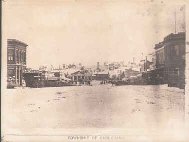
Sepia photograph of the Township of Eaglehawk, looking down the hill from about Victoria St. Visible are the Victoria Hotel and the Exchange Hotel on the left hand side of the photo. At the bottom of the hill there is the old Town Hall and in the distance on the hill is one of the Virginia Reef mines.place, eaglehawk, streetscape, eaglehawk, victoria hotel, exchange hotel, virginia reef -
 Bendigo Historical Society Inc.
Document - PREMIER COMPANIES (GOLD MINING)
Document. 2 page typed document titled 'Premier Companies'. Lists various mining companies from 1870 to 1920 and the amount in pounds that each mine yielded. Mentions mines - Great Extended Hustlers, Great Extended Hustlers Tribute, Garden Gully United, Victory, Pandora, United Hustlers, Redan Garden Gully, United Devonshire, Old Chum, Victoria Quartz, North Johnson's, Johnson's Reef, New Red White and Blue, New Chum United, Lady Barkly, New Chum Railway, Great Southern, South New Moon, New Argus, Virginia, Central Red White and Blue, New Chum Goldfields, Victoria Consols, Carlisle, Hercules and Energetic, New Golden Fleece, Bendigo Amalgamated Goldfields.cottage, miners, premier companies (mining), bendigo mines -
 Bendigo Historical Society Inc.
Document - ROMANCE OF THE GOLDFIELDS
Document. 8 page typed document titled 'Romance of the Goldfields'. (2 copies). 'Copy' is typed at the top of document. Mentions the gold rushes of Bendigo and Forest Creek. Mentions, Messrs. Gibson & Fenton, Mr Robert Ross Haverfield, Kennedy and Farrell, Asquith, Ben Hall, William and Walter Sandbach, Ron O'Donnell, Johnson, Bypass, Latham, Watson, Bell, Mr J B Watson, Mr George Lansell. Also mentions Gold Yields. Mentions Mines - Advance, Great Extended Hustlers, Garden Gully, New Chum, Victoria, Kent Mine, Golden Fleece, Richard Heales, Cornish United, Great Extended Hustlers, Tribute Company, Williams United, South New Moon, New Moon, Carlisle Group, Johnson's Reef, North Johnson's, Hercules and '180'. Envelope that this document was in is marked 'Notes re - Romance of Goldfields, Premier Companies, Sebastian Mining Leases, Resources of Bgo Goldfields, Sheepshead Line of Reef'.cottage, miners, romance of the goldfields, bendigo, forest creek -
 Bendigo Historical Society Inc.
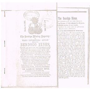
Document - THE BENDIGO MINING REGISTRY
Photocopy of The Bendigo Mining Registry or True Investors guide to all the Bendigo Mines in 1851 and up to 1883. Contains an original poem, Index, names and addresses of Legal Managers, names of Companies and Mining Managers, and reference page to a description of every mine in Bendigo, with length, size, depth, machinery, dividends, capital, number of shares, paid-up, and historical and scientific sketches - past and present - of the main situations. Twelve Lines of Reefs. The Gold Problem Scare Solved. Success of Deep Sinking. E - W & N. S. Parallelograms.document, gold, bendigo mines 1851 - 1883, the bendigo mining registry, r a murray, hay kirkwood, wm welch, district survey office, geological survey of victoria -
 Bendigo Historical Society Inc.
Document - ARTICLES FOR RHSV BENDIGO BRANCH NEWSLETTER MARCH 1972
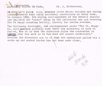
Articles for RHSV Bendigo Branch Newsletter March 1972; 1. Article in ''Federal Australian'' (Jan 1882) re undue delays erecting the St Mungo crushing battery; 2. ''Moans and Groans'' re wages for miners and meeting at Royal Hotel of May 31st, 1873; reference to a Regulation of Mines law of Jan 1st 1874 (Angus McKay), margin note on handwritten copy states that ''Further information on (the) Act and the lot of the miners and engine drivers will be given in future issues of the Newsletter''; 3. Article with return and costs information about working on a claim - details of shaft and sinking - (Grant and??Co), adjacent to private Victoria Reef Quartz Co., later the Victoria Quartz.document, gold, mining in bendigo -
 Bendigo Historical Society Inc.
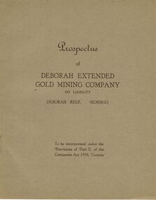
Document - MCCOLL, RANKIN AND STANISTREET COLLECTION: DEBORAH EXTENDED GOLD MINING COMPANY NL, 1940
McColl Rankin & Stanistreet, 12 Copies of Prospectus of Deborah Extended Gold Mining Company No Liability, Deborah Reef, Bendigo. To be incorporated under the Provisions of Part II, of the Companies Act 1938, Victoria. Application form and map of mines included in book form, dated 1940. Profit and Loss Account for Term ended 31st August, 1945 also included on separate sheet (has been folded in half across). Auditors: Wm. R. McKie & W. J. Sparkman.organization, mining, deborah extended gold mining cpy nl, mccoll rankin & stanistreet, deborah extended gold mining company nl, prospectus, profit and loss account for 31 august 1945, map of mine, form application -
 Bendigo Historical Society Inc.
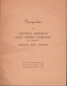
Document - MCCOLL, RANKIN AND STANISTREET COLLECTION: CENTRAL DEBORAH GOLD MINE NL: PROSPECTUS, 1939
Document: McColl, Rankin & Stanistreet Collection: Central Deborah Gold Mine NL - 4 copies of prospectus. Buff covered booklet. Written on front ' Prospectus of Central Deborah Gold Mining Company No Liability Deborah Reef, Bendigo. To be incorporated under the Provisions of Part II of the companies Act 1938. Victoria.' Details capital, proposed directors and manager. Contains map of Central and North Deborah mines and Monument Hill.organization, business, central deborah gold mine, mccoll, rankin & stanistreet collection: central deborah gold mine nl. gold mining -
 Bendigo Historical Society Inc.
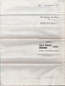
Document - MCCOLL, RANKIN AND STANISTREET COLLECTION: NAPOLEON REEF GOLD MINING CO. N.L, 22 August 1950
Document: 5 Page legal document with map of lease area, Lease No. 11273 Bendigo, Vol.331, Fol. 36453, 15 year lease from 12 December 1949, in vicinity of Inglis, Harvey & Curnow Streets, Signed by Dallas Brooks, Gov of Victoria & J.J. Stanistreet, Mine Manager.organization, business, industrial - mining, mccoll rankin & stanistreet, mining, gold mining, napoleon reef -
 Bendigo Historical Society Inc.
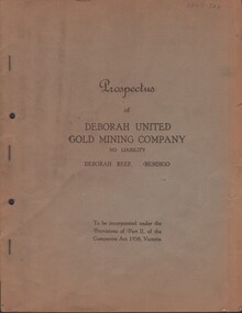
Document - MCCOLL, RANKIN AND STANISTREET COLLECTION: DEBORAH UNITED GMC PROSPECTUS, 7 August 1940
Document. McColl, Rankin & Stanistreet Prospectus of Deborah United GMC N/L Deborah Reef Bendigo To be incorporated under the Provisions of Part 11, of the Companies Act 1938, Victoria Stapled folder and paper.organization, business, deborah united gold mine nl, mccoll, rankin & stanistreet. deborah united gmc. prospectus -
 Bendigo Historical Society Inc.
Document - LONG GULLY HISTORY GROUP COLLECTION: THE BENDIGO GOLDFIELD … INTRODUCTION TO FIELD
The Bendigo Goldfield ...Introduction to Field. Compiled by A. Richardson. Mentioned are the Deborah Line of Reef, The Sheepshead Line, The Nell Gwynne Line and The Carshalton Line of Reef. Mines mentioned are: The Deborah, The North Deborah, Central Deborah, The New Red White and Blue Consolidated (Big Blue), North Red White and Blue, Central Red white and Blue, Little 180, South Ironbark, Ironbark, Hercules, Central Nell Gwynne and The New Chum Syncline. Lansell's Bendigo Battery is also mentioned. There is a short description of each mine, depth. location, machinery, Gold yield, Dividends and Calls. Closing date of some (some closed as a result of fire). Also mentioned is the postal service and the establishment of cemeteries at Bendigo, White Hills, Eaglehawk and Kangaroo Flat.Albert Richardsonbendigo, history, long gully history group, the long gully history group - the bendigo goldfield...introduction to field, a richardson, new chum railway mine, the dascombe nugget, the victoria nugget, r r haverfield, ballerstadt, rae, wittscheibe, lazarus, cave and amos, geo lansell, the old chum, victoria, specimen, hustlers, bendigo amalgamated goldfields, bendigo mines limited, nell gwynne, napoleon, carshalton, the deborah, roberts & sons, the north deborah, williams' united, central deborah, lansell's south red white & blue, the new red white and blue consolidated (big blue), union, h harkness & co, thompson & co, lansell's bendigo battery, showgrounds industrial hall, north red white and blue, central red white and blue, little 180, john brown knitwear factory, south ironbark, victoria consols east shaft, ironbark, manchester arms hotel, unity mine, wattle gully mine chewton, hercules, hercules and energetic, bendigo amalgamated goldfields coy, long gully post office, the old wheal owl, central nell gwynne, gold mines hotel, bendigo city council, mr jack barker, bendigo and district tourist association, the new chum syncline, courier of the mines newspaper, camp hill school, sandhurst east post office, bendigo cemetery, white hills cemetery, eaglehawk cemetery, kangaroo flat cemetery -
 Bendigo Historical Society Inc.
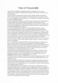
Document - LONG GULLY HISTORY GROUP COLLECTION: TALES OF VICTORIA HILL
Two printed pages titled Tales of Victoria Hill. Mentioned is the gold yield on the New Chum Line of Reef, early gold discovery, Christopher Ballerstedt and his son Theodore, Theodore building Fortuna as well as a crusher or battery in its grounds. He believed he had exhausted the riches from his claims and sold the claim on the hill to George Lansell, deepest gold mine, interconnecting to neighbouring mines to obtain the required up and down drafts for ventilation, rising of the water levels resulting the closure of the Victorian Quartz Mine when a rope broke and the equipment that is still there. An accompanying photo of the Victoria Quartz Mine shows the buildings, chimney and poppet legs and a man standing in front of a building. There is also an accompanying floppy disc.bendigo, history, long gully history group, the long gully history group - tales of victoria hill, j n macarthy, christopher ballerstedt, theodore ballerstedt, fortuna, george lansell, lansell's 180, victoria quartz co, victorian consols, bendigo's deepest known gold bearing reef -
 Bendigo Historical Society Inc.
Document - LONG GULLY HISTORY GROUP COLLECTION: GUIDE TO SOME FAMOUS MINES
Three pages titled Guide to Some Famous Mines. Compiled by A Richardson. Each mine is listed as on the reef it is situated on. Reefs are The New Chum Line of Reef and the Garden Gully Line of Reefs, and the Devonshire Group. Mentioned is the mine's location, depth of shaft, poppet legs, machinery, location of engine house, gold yield, dividends and owners of mine. The mines are: The New Chum Line of Reef. The New Chum Railway, Kochs Pioneer, Windmill Hill, Confidence Extended, Johnson's No 1, Johnson's No2, Johnson's No 3, North Johnson's, Princess Dagmar, Golden Age, Johnson's Reef Extended, Golden Pyke, Constellation, Great Northern, Virginia, Specimen Hill United, New Argus, Clarence United, North Argus, South New Moon, New Chum Hill, The New Chum and Victoria, Catherine Reef United. Garden Gully Line of Reefs. The Great Southern, Ulster United, Londonderry, South Garden, The Sea Amalgamated, Garden Gully United, Victory and Pandora, Unity Mine, Carlisle United, Cornish United, Eureka Extended, South Belle Vue United, Shenandoah, Shamrock, New Chum Consolidated, New Chum United, Lansell's 222, Rae's Open Cut, Great Central Victoria, Victoria Consols, The Ironbark, Hercules and Energetic, Pearl, The Devonshire Group. North of Staley,The Duke of Edinburgh, New St Mungo, Duchess Tribute, South Devonshire, Duchess of Edinburgh, Princess Alexandra, West United Devonshire, Hopewell, Phoenix. Yhe Mungo Mines. Unicorn, South St Mungo, Lady Barkly, The St Mungo, Sadowa, Eastwood. Snobs Hill Group. The Ellenborough, The Belmont and Saxby, York and Durham, The Acadia, William's United, The Victoria Hill - Ironbark, The North Old Chum, Lansell's Big 180, Ballerstadt's Open-Cut and The Victoria Quartz.bendigo, history, long gully history group, the long gully history group - guide to some famous mines, a richardson, the new chum railway, kochs pioneer, windmill hill, confidence extended, johnson's no 1, johnson's no2, johnson's no 3, north johnson's, princess dagmar, golden age, johnson's reef extended, golden pyke, constellation, great northern, virginia, specimen hill united, new argus, clarence united, north argus, south new moon, new chum hill, the new chum and victoria, catherine reef united, the great southern, ulster united, londonderry, south garden, the sea amalgamated, garden gully united, victory and pandora, unity mine, carlisle united, cornish united, eureka extended, south belle vue united, shenandoah, shamrock, new chum consolidated, new chum united, lansell's 222, rae's open cut, great central victoria, victoria consols, the ironbark, hercules and energetic, pearl, the duke of edinburgh, new st mungo, duchess tribute, south devonshire, duchess of edinburgh, princess alexandra, west united devonshire, hopewell, phoenix, unicorn, south st mungo, lady barkly, the st mungo, sadowa, eastwood, the ellenborough, the belmont and saxby, york and durham, the acadia, william's united, the victoria hill - ironbark, the north old chum, lansell's big 180, ballerstadt's open-cut, the victoria quartz -
 Bendigo Historical Society Inc.
Document - FOR HISTORICAL SOCIETY BENDIGO BRANCH NEWSLETTER
... Advertiser Angus Mackay Regulation of Mines 1874 Victoria Reef Quartz ...Handwritten copy of items for the Newsletter. Included is Machinery Contractor Called to Task. He took a lot longer to do the work than he should have. Boys Will Be Boys tells of a boy who was supposed to driving the whim horse, but in the absence of the braceman, he amused himself by taking a truck out of the cage and putting it back again. Then he started stepping backwards and forwards by holding onto a rope across the shaft, then fell down the shaft. He got a severe shaking. Cheers and Groans are about the long hours the miners worked and the introduction of the 8 hour day. Primitive Shafts is about the Victoria Reef Shafts. It tells of the underground working and raising the ore, crushing and yield.document, for historical society bendigo branch newsletter, federal australian, st mungo crushing battery, a richardson, royal hotel, bendigo advertiser, angus mackay, regulation of mines 1874, victoria reef quartz co, victoria quartz, grant and co, dicker's mining record 23/11/1861 pages 9 and 10 -
 Bendigo Historical Society Inc.
Document - LANSELL RELATED DOCUMENTS
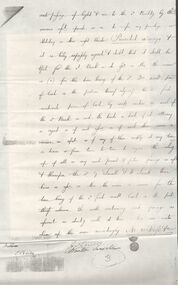
Document.Copy of Williamstown Historical Society Newsletter No 17 (1977).On the second and third page of this Newsletter is an article entitled ''The guns of the 'Nelson''', written by Doug Mills, Castlemaine. The Warship NELSON underwent alterations in 1860, including cut down to two decks and lengthened, her armaments reduced to 72 guns. Two 7inch 68 pounder guns were added to her armament. In February 7 1867 she was officially given to the Colony of Victoria by the Imperial Government. At the time her Commander was Captain Charles B. Payne. The Warship reached Melbourne in 4th February 1868. Relics of the NELSON were auctioned at Williamstown Victoria Naval Depot, and her two anchors are preserved for public display at Williamstown. An active demand for a share of the guns from various towns in the State. Ballarat received four (4) guns, Bendigo and Castlemaine two (2) each, while one has been given to each of the following towns: - Ararat, Tarnagulla, Hamilton, Bacchus Marsh, Echuca and Geelong. Collection of Lansell related documents: a. Copy of photograph - Lansell's Big 180 Victoria Hill - early 1870s - New Chum Hill in background. B. Lansell Estate mines - compiled from the annual report of the Hon Minister of Mines for Victoria, 1906. A listing of the George Lansell Mining Company interests at the time of his death. These were, New Moon Co, N.L., Clarence, New Prince Of Wales Co. N.L., Virginia G. M. Co., Catherine Reef United Co N.L., Great Northern Co N.L., Williams United, McDuff Amalgamated Co, South Mungo Co, South Prince Of Wales Consolidated, Constellation Co. Golden Pyke Co, Johnson's Reef Extended Company, Golden Age Co., Princess Dagmar Co, New St Mungo Co, Johnson's Reef Co, North Johnson's Co, Collman and Tacchi Co, Confidence Extended Co, G. Lansell Sandhurst Mines, Pearl Co., Windmill Hill Co., United Hustlers and Redan, Koch's Pioneer Co., Hercules and Energetic Co., Lansell's Comet, Cornish United Co., Ironbark Co., Hustler's Reef Co., and No. 1 Lansell's 83, Carlisle Co., Great Extended Hustler's Co., Victoria Consolidated Co., Great Central Victoria Co., Victoria Quartz Co., Victory and Pandora , Lansell's Big 180, Tambour Major, New Chum and Victoria Co., Garden Gully United Co., G. Lansell, Lansell's 222, Lazarus Co., Sea Amalgamated Co., Hustler's Royal Reserve Co., Horwood and Burrowe's Co., New Chum Consolidated Co., G Lansell's Sheepshead, Gariboldi Co., Londonderry Co., Shamrock Co., Great Britain Co., Fortuna Hustler's Co., Eureka Extended Co., G. Lansell's G.V.L., New Red White and Blue Consolidated, Great Southern Co., Lansell's Concord Mines, True Blue Co., G. G. Consolidated Co., Extended Red White and Blue Co., Great Columbian, Sedgwick and New Birthday. Also, a listing: ''Among the biggest yields to ate (sic) (date?) in ozs or Pounds were''; New Moon.Co. N.L. 180,087 ounces, Clarence £303,932, Catherine Reef United N.L. £762,815, Great Northern Co Ltd £394,525, Johnson's Reef Co 277,320ounces, Windmill Hill Co. 113,842ounces, Hustler's Reef Co. And No.1 1,144,923ounces, Carlisle Co 307,835ounces, Great Extended Hustlers Co £1,038,125, Garden Gully United Co. £1,653,900, Great Southern 97,752ounces, New Chum Consolidated 89,526ounces. This part (b) has handwritten inscription ''compiled by J Sarvaas MCE(??) Certified Mining Surveyor; 22/8/06''; c. Copy of Deed dated Dec 1886 between George Lansell, Wooten Lansell and the Bank of New South Wales relating to a wall and windows and openings etc etc. (3 pages of legalese!!!!!). Also, a (related?) page copy of a Grant -by purchase to the Bank of New South Wales with a date of August 1855 on it ''Enrolled in the Office of the Registrar of the Supreme Court of the Colony of Victoria - signed by Acting Registrar.document, gold, mines -
 Stawell Historical Society Inc
Photograph, Lantern Festival Big Hill c 2000-- 7 Photos -- Coloured
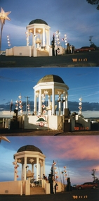
Photos of the Lantern Festival workshop held to pull the community together during the battle to save Big Hill from the mining Companies application to have an "Open Pit Mine" in 1998-1999. Master lantern maker Graeme Dunstan coordinated the work shops, with financial support from the "Big Hill Action Group". when the decision from Victoria State Government was given, the group celebrated by carrying lanterns from Gold Reef Hall - near the Post Office up to Big Hill.Seven colour photographs of the Lantern festive workshop at Big Hill in c 2000. Taken by Jim Melbourne stawell -
 Stawell Historical Society Inc
Map, Department of Mines Victoria, The Reefs. The Principle Reefs at Quartz Reefs, 1868
... . The Principle Reefs at Quartz Reefs Map Department of Mines Victoria ...c1868 Map showing the position of principal Reefs at Quartz ReefsTracing Shewing the position of the principle reefs at Quartz Reefs. Scale 8 Chains to an inch mining, gold, map -
Whitehorse Historical Society Inc.
Legal record - Correspondence, Goldfields and mineral districts of Victoria, 1985
Letter from the State Library of Victoria about location of a gold mime near Koonung Creek in Box Hill North with a reef 2 feet in thickness which yielded 1oz per ton.Letter from the State Library of Victoria about location of a gold mime near Koonung Creek in Box Hill North with a reef 2 feet in thickness which yielded 1oz per ton. Information from R. Brough Smyth 'Goldfields and mineral districts of Victoria'. - 1869Letter from the State Library of Victoria about location of a gold mime near Koonung Creek in Box Hill North with a reef 2 feet in thickness which yielded 1oz per ton. mines and mining, state library of victoria, jackson avenue, box hill north, goldmining -
 Rutherglen Historical Society
Map, 1908
This is a map produced as part of a book entitled.. It is also stamped on the back in blue ink with an oval ring and the words North of England Institute. Newcastle. Mining & Meterolgical Faculty. Purchased on 23rd July 2017 by the Society after research by member Simon Killeen. Mining map of one of the first mines in Rutherglen area ( Chiltern West)Cream paper, black printing, rectangle with a drawingGeographical Survey of Victoria, Memoir, No6. Plate XX Plan of Underground Workings CHILTERN VALLEY CONSOLS MINE, RUTHERGLEN, PARISH OF CHILTERN WESTgold, rutherglen, mining, chiltern, underground mine map, geological survey, reef drives -
 Bendigo Historical Society Inc.
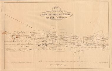
Document - MARKS COLLECTION: ABE LINCOLN CO LEASE
Two copies of plan for Abe Lincoln Co. Lease, New Chum, Sandhurst. One original, one copy. On top of plan 'Plan Showing Position of the Abe Lincoln Co. Lease, New Chum, Sandhurst' under name 'by H.B. Nicholas, Mining Surveyor' Sheepshead Reef, Easter reef, Alfred Reef, Allingham Reef,Adventure Reef, Belle Vue Reef, New Chum Reef, Black Lead, Victoria Reef lines shown on map with mine leases marked. On bottom of map 'Monument Hill Reef' line marked.bendigo, mining, abe lincoln lease -
 Bendigo Historical Society Inc.
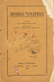
Book - JOAN O'SHEA COLLECTION: BENDIGO GOLDFIELD BOOK, 1936
Joan O'Shea collection. Buff coloured book issued by Mines Department Melbourne. Victoria Australia 1936. Information contained within refers to History, Recent developments and future Prospects, Geology, Lines of Reef for the Bendigo area, information regarding tonnage of gold and values of same at that time. The index at the rear of the book lists all of the mines in the Bendigo area.Geo. Brown, Secretary for Mines, Mines Departmentmining, business, mines department -
 Bendigo Historical Society Inc.
Document - MCCOLL, RANKIN AND STANISTREET COLLECTION: SUNDRY REPORTS, 1930's
Manilla Folder containing reports from various mines in Bendigo and surrounding areas. 1. 4 page typewritten report on the Balaclava Hill Mine at Rushworth and some newspaper clippings about the mine with a plan of the underground workings; 2. Page from the Árgus' dated 2nd August 1900 featuring an article on the survey of the Garden line of Reefs; 3. 5 page report with maps on the Tooleen Gold Field; 4. Single page report about an unnamed mining area claimed to be on the southern end of the Deborah line of reef. (this could be the 'Three Jays' mine in Sedgwick. P. Wilkin); 5. Hand written report on the Coronation Mine, 2 miles east of Walhalla.; 6. Hand written report dated 1935, of the Queen Mary mine, St. Arnaud.; 7. 1932 report on the North Neangar lease.; 8 4 page report on the Kings Prize Gold Mining Syndicate.; 9. Description of the plant of the Marong Alluvial Company? Also a guide for marking out leases.; 10. Crushing details (1 page) from the 'Enterprise' Mine South of and adjacent to Perseverence.; 11. 1 page crushing details from Rowe Brothers, Mosquito Mine, Fryerstown.; 12 hand written report mentions Arthur Hatfield, Scarsdale.; 13. Map with lines of reef showing the position of the New Moon Consolidated and the New Moon United shafts.; 14, Large scale map from Harrison/Victoria street to Havilah Road showing the positions of the Carlisle, North Garden and Unity Shafts.gold mining, miners' safety cage, sundry reports, mining. bendigo, rushworth, balaclava hill, garden line of reef, toolleen, coronation mine, walhalla, queen mary mine, st. arnaud. north neangar, kings prize gold mining syndicate, marong, enterprise mine, perseverence, rowe brothers, mosquito mine, fryerstown, arthur hatfield, scarsdale, new moon consolidate, new moon united, carlisle, north garden, unity. -
Bendigo Historical Society Inc.
Booklet - Victoria Hill
Victoria Hill, accessed from Marong Road, was one of the richest areas on the Bendigo goldfields and was the beginning of reef mining as opposed to alluvial mining. Between 1853 and 1861 there were 16 claims registered on Victoria Hill. Between 1908 and 1910 it was the site of the world's deepest shaft (1365-1406 meters)Today it provides interpretive walks that include sites such as an open-cut mine (1850's), poppet head, quartz crushing battery (1930's) and the foundations of George Lancell's 180 mine. It is registered as a site of historical significance.Clear plastic cover spiral bound booklet of 25 pages. 'Victoria Hill'. A historical background of Victoria Hill and the surrounding area. A colour photo of a poppet head on front. Original story written by Albert Richardson in 1971. This is a revised edition by Philip Wilkin in 2012. Illustrated with colour and B&W photos. Pages 13 to 25 have been inadvertently inserted upside down. A single page A4 leaflet 'Victoria Hill Self Guided Tour' has been put inside after page 1Handwritten in ink on front page 'Donated to Specimen Cottage'victoria hill, gold mine -
 Bendigo Historical Society Inc.
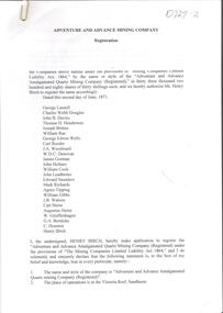
Document - Phyllis Toy Collection: 'Adventure and Advance Mining Company'
This company was registered in May 1871. It amalgamated the Adventure, Advance and Try-me-well mines to mine below the 300 foot levels of these mines.Collection of Government Gazette and newspaper articles relating to the 'Adventure and Advance Amalgamated Quartz Mining Company' on the Victoria Reef, Sandhurst. . Papers include the registration notice of the Mine in 1871, detailing the shareholders. Half yearly meeting reports 1872 - 1880 are attached. Slip of paper attached to each item describes the content, for example 'Half yearly meeting reports of the Adventure and Advance Company as published in the Bendigo Advertiser from 30.1.1872 - 31.8.1880. Missing February 1873, February 1877. Also included, Victoria Consols Company Reports 31.8.1880.adventure gold mine, sandhurst, goldmining, adventure and advance amalgamated quartz mining company -
 Bendigo Historical Society Inc.
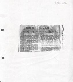
Newspaper - Kangaroo Flat Gold Mine Collection: Article, Facelift for Derelict Mining Sites, 6th November 1985
Newspaper article, (photocopied onto A4 paper) Bendigo Advertiser November 6th, 1985, headed '£100,000 facelift for derelict mining sites?' Article describes how the Bendigo Council were seeking a loan from the Goldfields Revolving Fund for the restoration of the Victoria Hill area and for the restoration of the relics and poppet legs of the Central Nell Gwynne, the Nell Gwynne Reef Mine, the North Deborah and the Big Deborah Mine sites.Written in black pen on right hand side: B'go Adv. Nov. 6th. '85gold mining, nell gwynne mine, north deborah mine, big deborah mine, poppet legs, bendigo, restoration -
Tarnagulla History Archive
Set of Maps (Mining & Local Area), various
David Gordon Collection. A set of mining documents, maps and plans: 1. Dunolly Deep Leads - showing location and names of deep lead gold deposits in region around Dunolly including at Tarnagulla and Newbridge. Geological Survey of Victoria, Department of Minerals and Energy. Bulletin No. 62, Map No. 4 Dunolly (770 x 485 mm). 2. Poseidon Lead (Facsimile) 3. Nick O Time Lead (Facsimile) 4. Happy Go Lucky Mine prospectus and plan (colour copy) 5. Jones Creek GM Co. (Raven & Gourlay's) Waanyarra - Prospectus (colour copy) 6. Poseidon Area Plan (colour copy) and Poseidon Area map (B&W copy). 7. Cross-section diagram of Spread Eagle Reef 8. New Birthday Gold Mine - area map (colour copy) and mine cross-section ( (colour copy). 9. Cross section of Poverty Reef, by Department of Mines (B&W copy, 2 parts on A2 paper) 10. Time-Lease Graph for Watts Reef, Specimen Reef, Stony Reef, Poverty Reef (second page in detail), created by Eric WIlkinson for Ref Mining NL, 1995 11. 1859 Plan of the Gold Workings & Township of Sandy Creek, Shewing the Mining Leases, Extended Claims & Machinery by R.J. McMillan, Mining Surveyor (B&W copy) 12. Longitundinal and Transverse Vertical Sections of Poverty Reef, Sandy Creek 1859, by R.J. McMillan, Mining Surveyor (B&W copy) 13. Tarnagulla Locality Plan (B&W copy) 14. Universal Grid Reference Map (Topographic) for Laanecoorie North (2 copies) 15. Universal Grid Reference Map (Topographic) for Inglewood South 16. Poverty Reef, Plan showing shafts and early tenements, created by Eric WIlkinson for Ref Mining NL, 1995 17. Locality Map of mining leases in Tarnagulla 18. Plan and Elevation of part of Poverty Reef, Sandy Creek, showing the claims and positions of the shaft. by R.J. McMillan, Mining Surveyor (Facsimile, composed of taped together components) 19.Plan and Elevation of part of Poverty Reef, Sandy Creek, showing the claims and positions of the shaft. by R.J. McMillan, Mining Surveyor (Facsimile, composed of taped together components) -
 Tarnagulla History Archive
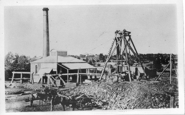
Photograph, Victoria Shaft on Poverty Reef, Tarnagulla, June 1866
Donald Clark Collection. A monochrome photograph depicting a mine with poppet head at Tarnagulla Copy photograph. mining -
 Bendigo Historical Society Inc.
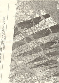
Map - LONG GULLY HISTORY GROUP COLLECTION: BENDIGO GOLD FIELD - GOLDEN SQUARE GEOLOGICAL SURVEY OF VICTORIA
BHS CollectionPart of a map of the Bendigo Gold Field - Golden Square. Geological Survey of Victoria. Shown are reefs, faults and anticlines. Many of the mines are shown on the map. Gullies, hills and streets are also shown.bendigo, history, long gully history group, the long gully history group - bendigo gold field - golden square geological survey of victoria, north bendigo state school reserve, hospital reserve, benevolent asylum reserve, empire hill, richmond hill, raes hill, south end hill, victoria hill, new chum hill, iron bark hill, redan hill, view hill, hustlers hill, camp hill