Showing 93 items matching "bendigo aerial photos"
-
 Bendigo Historical Society Inc.
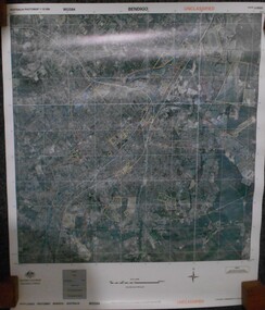
Map - BENDIGO AERIAL MAP 2007
... Aerial photo bendigo map Aerial map of Bendigo 2007 printed ...Aerial map of Bendigo 2007 printed on vinyl. Written on bottom of map ' Australian Government Department of Defence photomap Bendigo Australia WGS84.aerial photo, bendigo map -
 Bendigo Historical Society Inc.
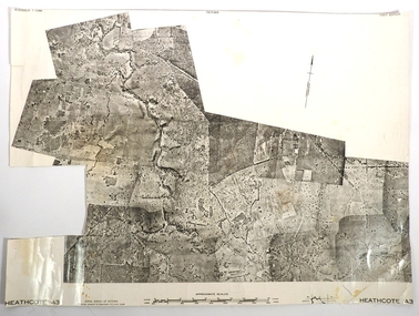
Map - FRED COWIE COLLECTION: AERIAL MAPS OF HEATHCOTE/EPPALOCK, 28-9-1960
Map, Heathcote C2, Township of Heathcote, Melbourne Road through town branching off to Bendigo & Echuca. Aerial Survey of Victoria. Photo-map prepared by Department of Crown Lands and Survey from photographs taken in 1960. Copied photographically at the Central Plan Office.Fred Cowie,46 McIvor Rd,Bgo..Central Plan Officemap, heathcote, fred cowie -
 Bendigo Historical Society Inc.
Map - FRED COWIE COLLECTION: AERIAL MAPS OF HEATHCOTE/EPPALOCK
Map, Heathcote A3, Aerial Survey of Victoria, Photo-map prepared by Department of Crown Lands.Campaspe River , Wild Duck Creek, Knowsley, Eppalock Weir.Fred Cowie,46 McIvor Rd ,Bendigo.map, heathcote, fred cowie