Showing 237 items matching "black saturday fires 2009"
-
 Marysville & District Historical Society
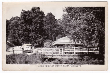
Postcard (Item) - Black and white postcard, Murray Views, MURRAY VIEWS NO. 27. CROSSWAYS CABARET, MARYSVILLE, VIC, Unknown
A black and white postcard of the Crossways Cabaret in Marysville in Victoria published by Murray Views. The Crossways was built in the early 1920s and is the oldest building in Marysville. The Crossways historic inn survived the 2009 Black Saturday bushfires thanks to the efforts of its c-owner Greg Cherry and, in the days after the fires, provided a much-needed refuge to the Marysville community and firefighters. This postcard was produced by Murray Views in Gympie in Queensland as a souvenir of Marysville.A black and white postcard of the Crossways Cabaret in Marysville in Victoria published by Murray Views.marysville, victoria, australia, postcard, souvenir, crossways cabaret, crossways historic inn, crossways country inn, murray views no. 27, accommodation, 2009 black saturday bushfires -
 Marysville & District Historical Society
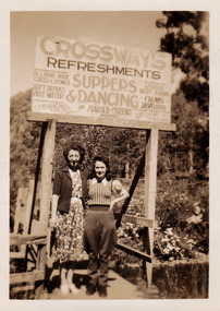
Photograph (Item) - Black and white photograph, 1948
A black and white photograph of two unknown ladies standing under the sign at The Crossways in Marysville. The Crossways was built in the early 1920s and is the oldest building in Marysville. The Crossways historic inn survived the 2009 Black Saturday bushfires thanks to the efforts of its c-owner Greg Cherry and, in the days after the fires, provided a much-needed refuge to the Marysville community and firefighters. A black and white photograph of two unknown ladies standing under the sign at The Crossways in Marysville.MARYSVILLE 1945marysville, victoria, australia, photograph, crossways, crossways cabaret, crossways historic inn, crossways country inn, accommodation, 2009 black saturday bushfires -
 Marysville & District Historical Society
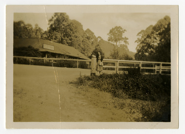
Photograph (Item) - Black and white photograph, 1948
A black and white photograph of an unknown lady standing outside The Crossways in Marysville. The Crossways was built in the early 1920s and is the oldest building in Marysville. The Crossways historic inn survived the 2009 Black Saturday bushfires thanks to the efforts of its c-owner Greg Cherry and, in the days after the fires, provided a much-needed refuge to the Marysville community and firefighters. The photograph has been incorrectly labeled as "THE CROSSINGS" CABARET.A black and white photograph of an unknown lady standing outside The Crossways in Marysville."THE CROSSINGS" CABARET/ MARYSVILLE 1948marysville, victoria, australia, photograph, the crossways, crossways cabaret, crossways historic inn, crossways country inn, accommodation, 2009 black saturday bushfires -
 Marysville & District Historical Society
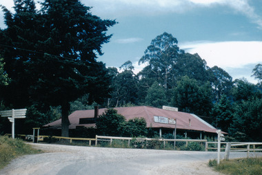
Photograph (Item) - Colour photograph, 1957
A colour photograph of the Crossways Cabaret in Marysville. The Crossways was built in the early 1920s and is the oldest building in Marysville. The Crossways historic inn survived the 2009 Black Saturday bushfires thanks to the efforts of its c-owner Greg Cherry and, in the days after the fires, provided a much-needed refuge to the Marysville community and firefighters. A colour photograph of the Crossways Cabaret in Marysville.marysville, victoria, australia, photograph, the crossways cabaret, the crossways, crossways, crossways country inn, crossways historic inn, accommodation, 2009 black saturday bushfires -
 Marysville & District Historical Society
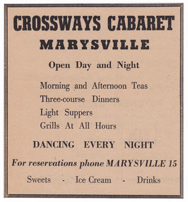
Ephemera (Item) - Advertisement, Unknown
An advertisement regarding The Crossways Cabaret in Marysville. The Crossways was built in the early 1920s and is the oldest building in Marysville. The Crossways historic inn survived the 2009 Black Saturday bushfires thanks to the efforts of its c-owner Greg Cherry and, in the days after the fires, provided a much-needed refuge to the Marysville community and firefighters. An advertisement regarding The Crossways Cabaret in Marysville.marysville, victoria, australia, the crossways cabaret, the crossways, crossways, crossways country inn, crossways historic inn, advertisement, accommodation, 2009 black saturday bushfires -
 Marysville & District Historical Society
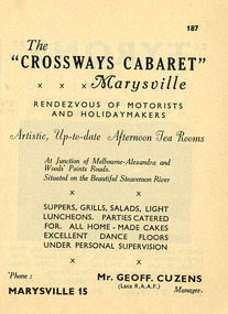
Ephemera (Item) - Advertisement, CROSSWAYS CABARET MARYSVILLE, Unknown
An advertisement regarding the Crossways Cabaret in Marysville. The Crossways was built in the early 1920s and is the oldest building in Marysville. The Crossways historic inn survived the 2009 Black Saturday bushfires thanks to the efforts of its c-owner Greg Cherry and, in the days after the fires, provided a much-needed refuge to the Marysville community and firefighters. An advertisement regarding the Crossways Cabaret in Marysville.marysville, victoria, australia, the crossways cabaret, the crossways, crossways, crossways country inn, crossways historic inn, advertisement, accommodation, 2009 black saturday bushfires -
 Marysville & District Historical Society
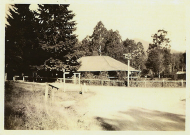
Photograph (Item) - Black and white photograph, Unknown
A black and white photograph of The Crossways in Marysville. The Crossways was built in the early 1920s and is the oldest building in Marysville. The Crossways historic inn survived the 2009 Black Saturday bushfires thanks to the efforts of its c-owner Greg Cherry and, in the days after the fires, provided a much-needed refuge to the Marysville community and firefighters. A black and white photograph of The Crossways in Marysville.marysville, victoria, australia, photograph, the crossways cabaret, the crossways, crossways, crossways country inn, crossways historic inn, 2009 black saturday bushfires, accommodation -
 Marysville & District Historical Society
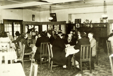
Photograph (Item) - Black and white photograph, Unknown
A black and white photograph of the dining area in The Crossways in Marysville. The Crossways was built in the early 1920s and is the oldest building in Marysville. The Crossways historic inn survived the 2009 Black Saturday bushfires thanks to the efforts of its c-owner Greg Cherry and, in the days after the fires, provided a much-needed refuge to the Marysville community and firefighters. A black and white photograph of the dining area in The Crossways in Marysville.marysville, victoria, australia, photograph, the crossways cabaret, the crossways, crossways, crossways country inn, crossways historic inn, 2009 black saturday bushfires, accommodation -
 Marysville & District Historical Society
Photograph (Item), Roy Liebig, Unknown
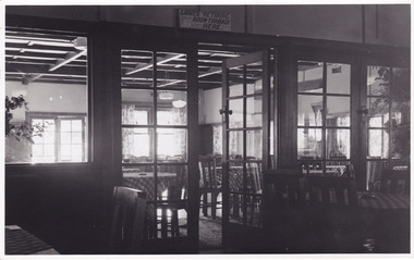
A black and white photograph of the view looking from the supper room into the dance room at the Crossways Cabaret in Marysville. The Crossways was built in the early 1920s and is the oldest building in Marysville. The Crossways historic inn survived the 2009 Black Saturday bushfires thanks to the efforts of its c-owner Greg Cherry and, in the days after the fires, provided a much-needed refuge to the Marysville community and firefighters. A black and white photograph of the view looking from the supper room into the dance room at the Crossways Cabaret in Marysville.Looking from the supper room/ into the dance room at the/ Crossways Cabaret./ Marysville Visit.marysville, victoria, australia, photograph, the crossways cabaret, the crossways, crossways, crossways country inn, crossways historic inn, 2009 black saturday bushfires, accommodation, roy liebig -
 Marysville & District Historical Society
Photograph (Item) - Black and white photograph, Roy Liebig, 04-1949
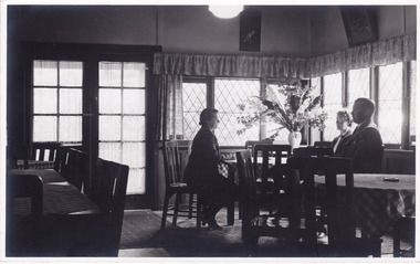
A black and white photograph taken in a dining area in the Crossways Cabaret in April, 1949. The Crossways was built in the early 1920s and is the oldest building in Marysville. The Crossways historic inn survived the 2009 Black Saturday bushfires thanks to the efforts of its c-owner Greg Cherry and, in the days after the fires, provided a much-needed refuge to the Marysville community and firefighters. A black and white photograph taken in a dining area in the Crossways Cabaret in April, 1949.My wife Katie,/ does a little talking/ at the Crossways Cabaret./ Marysville Visit,/ April 1949.marysville, victoria, australia, photograph, the crossways cabaret, the crossways, crossways, crossways country inn, crossways historic inn, 2009 black saturday bushfires, accommodation, roy liebig -
 Marysville & District Historical Society
Photograph (Item) - Colour photograph, Unknown
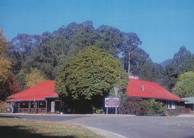
A colour photograph of The Crossways in Marysville. The Crossways was built in the early 1920s and is the oldest building in Marysville. The Crossways historic inn survived the 2009 Black Saturday bushfires thanks to the efforts of its c-owner Greg Cherry and, in the days after the fires, provided a much-needed refuge to the Marysville community and firefighters. A colour photograph of The Crossways in Marysville.marysville, victoria, australia, photograph, the crossways cabaret, the crossways, crossways, crossways country inn, crossways historic inn, 2009 black saturday bushfires, accommodation -
 Marysville & District Historical Society
Newspaper (Item) - Newspaper article, Jay Town, Cheers to a pub with no peer, Unknown
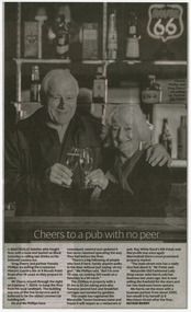
A newspaper article regarding the selling of The Crossways Historic Inn in Marysville. The Crossways was built in the early 1920s and is the oldest building in Marysville. The Crossways historic inn survived the 2009 Black Saturday bushfires thanks to the efforts of its c-owner Greg Cherry and, in the days after the fires, provided a much-needed refuge to the Marysville community and firefighters. A newspaper article regarding the selling of The Crossways Historic Inn in Marysville.marysville, victoria, australia, the crossways cabaret, the crossways, crossways, crossways country inn, crossways historic inn, 2009 black saturday bushfires, accommodation, newspaper article -
 Eltham District Historical Society Inc
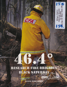
Book, 46.4º - Research Fire Brigades - Black Saturday by Janine Woolnough, 2009
... Brigade during the 2009 Black Saturday fires. Includes list... Fire Brigade during the 2009 Black Saturday fires. Includes ...Stories and pictures written and taken by the Research Fire Brigade during the 2009 Black Saturday fires. Includes list of Brigade members.72 p. : col. ill., facsims., col. ports. ; 25 cm.ISBN 9780646523057research fire brigade, bush fire 2009, kinglake victoria -
 Eltham District Historical Society Inc
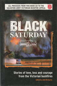
Book, Black Saturday : Stories of love, loss and courage from the Victorian bushfires edited by John McGourty, 2009
The Black Saturday bushfires were a series of bushfires that ignited or were burning across the Australian state of Victoria on and around Saturday, 7 February 2009 and were Australia's all-time worst bushfire disasters. Contributions from reporters and photographers from News Limited. The book is a collection of individual stories, featuring deeply personal contributions from: people directly affected by the bushfires, their friends and relatives; the people who came to their aid - fire fighters, doctors, nurses and wildlife rescuers; accounts from journalists on the scene; and those involved in coordinating the response. Arranged town-by-town, with introductions detailing the scope and impact of the fires on each community. Contents: Kilmore East & Wandong - Strathewen & Kinglake West - St Andrews & Steels Creek - Kinglake - Flowerdale - Marysville--Gippsland -Beechworth & Mudgegonga - the lost ( listing those who perished ) - map of tragedy. Proceeds from the sale of each book was given to the Salvation Army Victorian Bushfire Appeal.SoftcoverYarra Plenty Regional Library identification sticker with name, number and bar code ISBN 9780732290108strathewen, st andrews, black saturday, fires -
 Eltham District Historical Society Inc
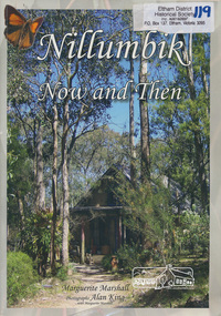
Book, Marguerite Marshall, Nillumbik now and then / Marguerite Marshall; photographs Alan King with Marguerite Marshall, 2008
Nillumbik Now and Then takes the reader on a journey from when the Aboriginal people were this area's sole inhabitnats, to the present day. Nillumbik's history - told in this collection of 96 stories, which are nearly all based on sites - mirrors those of the wider Australian community. It includes tales of the Wurundjeri people, a former convict, farmers, a bushranger, gold-mining, soldiers, artists, intellectuals, environmentalists and sportspeople. Each story is illustrated with a photograph. As a journalist with the former Diamond Valley News, Marguerite Marshall wrote a series of articles on local places of historic interest, later published as the small book "Eltham Shire - Historic Buildings and Places". Many years later an expanded version was published under the title "Nillumbik Now and Then". This is a much larger version of "Nillumbik Now and Then", including significant rewriting and many additional articles. The new publication was made possible by financial support from the Victorian Public Records Office, Bendigo Bank and Nillumbik Shire Council. EDHS and other historical societies in Nillumbik assisted with content for many of the stories. The book was launched at the Eltham Library on Wednesday 19th November 2008. Source: EDHS Newsletter No 183, November 2009 The front cover art depicts The former house of naturalist and artist Neil Douglas at Bend of Islands, photographer Marguerite Marshall. This collection of almost 130 photos and stories about places and people within the Shire of Nillumbik, an urban and rural municipality in Melbourne's north, contributes to an understanding of the history of the Shire. Published in 2008 immediately prior to the Black Saturday bushfires of February 7 2009, it documents sites that were impacted, and in some cases destroyed by the fires. It includes photographs taken especially for the publication, creating a unique time capsule representing the Shire in the early 21st century. It remains the most recent comprehenesive publication devoted to the Shire's history connecting local residents to the past. Paperback; x, 198 p. : ill., ports. ; 30 cm.Signed by the authornillumbik shire, houses, buildings, weller's hotel, landmarks, bend of islands -
 Marysville & District Historical Society
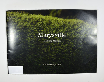
Book, Julia Peddie, Marysville-In Loving Memory, 2009
... the 2009 Black Saturday bush fire.... of photographs taken in and around Marysville before the 2009 Black ...A book of photographs taken in and around Marysville before the 2009 Black Saturday bush fire.Front cover has a photograph of what appears to be a hedge. Back cover has a photograph of Steavenson Falls.non-fictionA book of photographs taken in and around Marysville before the 2009 Black Saturday bush fire.marysville, victoria, history -
 Marysville & District Historical Society
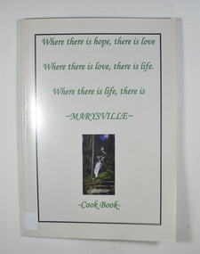
Book - Paperback book, Marysville Cookbook, 08-2010
... A cookbook that was created after the 2009 Black Saturday... that was created after the 2009 Black Saturday bush fires to assist ...A cookbook that was created after the 2009 Black Saturday bush fires to assist the survivors who had lost everything to at least have some recipes for meals.Paperback. Front cover has a short verse; Where there is hope, there is love, Where there is love, there is life. Where there is life, there is Marysville. There is also a small photograph of Steavenson Fallsnon-fictionA cookbook that was created after the 2009 Black Saturday bush fires to assist the survivors who had lost everything to at least have some recipes for meals.marysville, cookbook, recipes, victoria, 2009 black saturday bushfires -
 Marysville & District Historical Society
Booklet - Information booklet, Ann Thomas, Wilks Creek Bridge, 1993
... of the bridge were destroyed in the 2009 Black Saturday fires ...A history of the Wilks Creek Bridge and its connection to the Yarra Track.Paperback. Front cover has an old photograph of the Wilks Creek Bridge.non-fictionA history of the Wilks Creek Bridge and its connection to the Yarra Track.wilks creek bridge, yarra track, narbethong, marysville, victoria, clement wilks, wood's point goldfields, jordan goldfields, john monash, monash and anderson, 2009 black saturday bushfires -
 Marysville & District Historical Society
Photograph (Item) - Colour photograph, Pre 2009
... in the 2009 Black Saturday fires. The handcrafted bluestone masonry ...A colour photograph of the Wilks Creek Bridge near Marysville in Victoria.A colour photograph of the Wilks Creek Bridge near Marysville in Victoria. The Wilks Creek Bridge is a former timber and bluestone road bridge on the Yarra Track, and is located just off the Black Spur route, between Narbethong and Marysville, Victoria, Australia. It was built in 1870 to the design of colonial Public Works Department engineer Clement Wilks as part of the construction of a new road to the Woods Point and Jordan Goldfields. Like many bridges of the period, it had a timber superstructure employing squared beams supported by struts and straining pieces, on cut bluestone abutments. The bridge was remodelled around 1900 by engineer John Monash of the famous bridge-engineering firm of Monash and Anderson. It was last used for heavy vehicular traffic in 1980 following the realignment of Marysville Road, and was left to decay until its demolishment in 2008. All timber traces of the bridge were destroyed in the 2009 Black Saturday fires. The handcrafted bluestone masonry wingwalls and abutments, especially shaped to receive timber struts, rate among the earliest of its kind surviving intact in Victoria.wilks creek bridge, yarra track, narbethong, marysville, victoria, clement wilks, wood's point goldfields, jordan goldfields, john monash, monash and anderson, 2009 black saturday bushfires -
 Marysville & District Historical Society
Photograph (Item) - Black and white photograph, 1993
... of the bridge were destroyed in the 2009 Black Saturday fires ...A black and white photograph taken at the re-opening of the Wilks Creek Bridge picnic area and launch of Ann Thomas' book Wilks Creek Bridge.A black and white photograph taken at the re-opening of the Wilks Creek Bridge picnic area and launch of Ann Thomas' book Wilks Creek Bridge. The Wilks Creek Bridge is a former timber and bluestone road bridge on the Yarra Track, and is located just off the Black Spur route, between Narbethong and Marysville, Victoria, Australia. It was built in 1870 to the design of colonial Public Works Department engineer Clement Wilks as part of the construction of a new road to the Woods Point and Jordan Goldfields. Like many bridges of the period, it had a timber superstructure employing squared beams supported by struts and straining pieces, on cut bluestone abutments. The bridge was remodelled around 1900 by engineer John Monash of the famous bridge-engineering firm of Monash and Anderson. It was last used for heavy vehicular traffic in 1980 following the realignment of Marysville Road, and was left to decay until its demolishment in 2008. All timber traces of the bridge were destroyed in the 2009 Black Saturday fires. The handcrafted bluestone masonry wingwalls and abutments, especially shaped to receive timber struts, rate among the earliest of its kind surviving intact in Victoria.wilks creek bridge, yarra track, narbethong, marysville, victoria, clement wilks, wood's point goldfields, jordan goldfields, john monash, monash and anderson, 2009 black saturday bushfires -
 Marysville & District Historical Society
Document (Item) - Heritage Report, Biosis Research Pty Ltd, Heritage Report-Dismantling of Wilks Creek Brdige Deck Marysville, Unknown
... of the bridge were destroyed in the 2009 Black Saturday fires ...A heritage report on the dismantiling of the Wilks Creek Bridge deck in Marysville in Victoria.A heritage report on the dismantiling of the Wilks Creek Bridge deck in Marysville in Victoria. The Wilks Creek Bridge is a former timber and bluestone road bridge on the Yarra Track, and is located just off the Black Spur route, between Narbethong and Marysville, Victoria, Australia. It was built in 1870 to the design of colonial Public Works Department engineer Clement Wilks as part of the construction of a new road to the Woods Point and Jordan Goldfields. Like many bridges of the period, it had a timber superstructure employing squared beams supported by struts and straining pieces, on cut bluestone abutments. The bridge was remodelled around 1900 by engineer John Monash of the famous bridge-engineering firm of Monash and Anderson. It was last used for heavy vehicular traffic in 1980 following the realignment of Marysville Road, and was left to decay until its demolishment in 2008. All timber traces of the bridge were destroyed in the 2009 Black Saturday fires. The handcrafted bluestone masonry wingwalls and abutments, especially shaped to receive timber struts, rate among the earliest of its kind surviving intact in Victoria.wilks creek bridge, yarra track, narbethong, marysville, victoria, clement wilks, wood's point goldfields, jordan goldfields, john monash, monash and anderson, 2009 black saturday bushfires -
 Eltham District Historical Society Inc
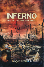
Book, Roger Franklin, Inferno: The Day Victoria Burned by Roger Franklin, 2009
... February 2009 Black Saturday Bush fires Victoria ISBN 267 p., [16 ...Description of bush fires in Victoria on Black Saturday 7 February 2009267 p., [16] p. of plates : ill. (chiefly col.), maps, ports. ; 25 cm.ISBN black saturday, bush fires victoria -
 Ringwood and District Historical Society
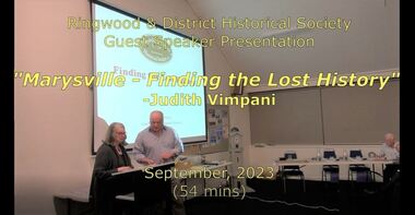
Mixed media - Video, RDHS Guest Speaker Presentation - "Marysville - Finding the Lost History" - Judith Vimpani
... in the catastrophic 2009 Black Saturday fires.... Marysville's history lost in the catastrophic 2009 Black Saturday fires ...Digitised video (2.26GB). Duration: 54 minutes. Recorded September, 2023 (Video is available for viewing at Ringwood & District Historical Society Archives by appointment)Presenter: Judith Vimpani, Vice President of Marysville Historical Society, talks about her experiences, interviews and extensive research in re-gathering Marysville's history lost in the catastrophic 2009 Black Saturday fires. -
 Victorian Interpretive Projects Inc.
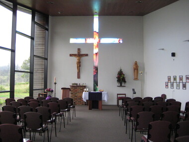
Photograph - Digital, Clare Kathleen Gervasoni, St Mary's Kinglake, 2012, 15/12/2012
The images depict the newly completed fourth Catholic Church at Kinglake. The previous three churches having been destroyed by 'Black Saturday' bushfire. The painting is oil on canvas. The historical continuity is expressed by the continuity of the skyline and the disconnectedness of the colours. it is not a literal depiction of each church, but a recognizable and symbolic image conveying resilience of faith of the local community. The first church was burnt down in a bushfire, the second burnt down by vandals, and the three burnt down in the 2009 bushfires known as 'Black Saturday'.The white cross and black fence at the lower left commemorated the remarkable fact that these remained intact after the 2009 bushfires. The red-orange can be the colour of the kinglake soil or the fires. The return of new life is indicated by the green growth on the burnt gumtrees. The presence of the Holy Trinity is shown above the entrance to the church. The return of new life is indicated by the green growth on the burnt gumtrees. The presence of the Holy Trinity is shown above the entrance to the church. The Holy Sprit is symbolized by the sulphur crested cockatoo, an Australian bird instead of the white dove. The symbol for the father is above the church in the triangle which has God's Holy Name (I AM) as given to Moses from the Burning Bush, written in Hebrew. Christ is represented by the cross above the entrance. The previous church was destroyed in the 2009 bushfires. The area is surrounded by 22,000 hectares of Kinglake National Park, the largest National Park close to Melbourne. The park was established in 1928 to protect native flora and fauna. Kinglake takes its name from Alexander Kinglake who travelled through the area in 1870. Photographs showing the newly built St Mary's Catholic Church at Kinglake. .1) Interior of Church .2) Painting of the Four Churches of Kinglake by Judy Racz .3-5) Views from the Church windows to the adjoining landscape .6) St Mary's Church groundskinglake, bushfire, black saturday, church, catholic, racz, st mary's catholic church kinglake -
 Yarra Ranges Regional Museum
Animal specimen - Burnt Skink, February 2009
The skink was found in the garden on a property in Glenburn, Victoria, Australia. It was burnt during the February 2009 bushfires. Two specimens were found immediately after the bushfires however only one was locatable when donated.This specimen has historic significance for its association with the February 2009 bushfires. It is a rare, complete example of the impact of the bushfires on a diverse range of fauna in and around Yarra Ranges. Although many animals were affected by the bushfires, very few specimens were collected and preserved. This specimen is reliably provenanced to a property in Glendale (just outside the boundaries of the Shire of Yarra Ranges) which was affected by the 2009 bushfires.Fully grown, complete skink burnt during the Black Saturday bushfires in February 2009 in Glenburn, Victoria.fire, yarra ranges, skink, bushfire, bushfires, 2009, animal, glenburn -
 Nillumbik Shire Council
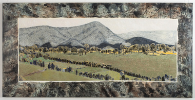
Mixed media: Liz NETTLETON, Liz Nettleton, Respite and Repose, 2010
... the violence felt from the 2009 Black Saturday bush fires... the 2009 Black Saturday bush fires / At the Arthurs Creek cemetery ...Nettleton creates an image of peace and tranquility after the violence felt from the 2009 Black Saturday bush fires / At the Arthurs Creek cemetery Nettleton found the grave of Reg Evans and Angela Brunton, friends who had perished in the fires / Nettleton sat on the edge of their joint grave and photographed their view / It was only after examining the photos more closely that she realized Mount Sugarloaf had burnt almost to the valley / Sugarloaf is always in an indigo haze. This work is by a local contemporary artist and encompasses themes dealing with the 2009 Black Saturday bushfires. Mixed media (acrylic paint, acrylic ink and indian ink) on board / Landscape painting of Mount Sugarloaf and green pastures after the 2009 Black Saturday bushfires / Mount Sugarloaf is depicted in an indigo haze in the background / A line of trees bathed in light border the mountain's edge / Lines of trees parallel to each other jut out diagonally in the foreground / Framing this view of the landscape is a pattern (topographical maps of the Nillumbik area), which suggest the vast extent of the devastated area of landscape. In black marker 'LIZ NETTLETON' + artist signature '2011' on back - middle right side nettleton, respite and repose, landscape, painting, mixed media, black saturday, mount sugarloaf -
 Nillumbik Shire Council
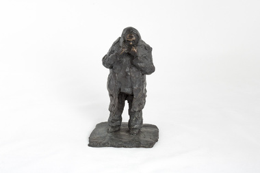
Sculpture: Peter WEGNER (b.1954 NZ - a.1958 AUS), Peter Wegner, The Blanket (from the 'Black Saturday' series), 2009
The 'Black Saturday' bushfires were a series of bushfires that ignited across the Australian state of Victoria on and around Saturday, 7 February 2009. It was Australia's worst ever natural disaster. The fires occurred during extreme bushfire-weather conditions and resulted in Australia's highest ever loss of life from a bushfire: 173 people died and 414 were injured as a result of the fires.This work is by a local contemporary artist with a national and international reputation for figurative and portrait works. The 'Black Saturday' series is a powerful investigation of emotion and grief as experienced by many Nillumbik residents during the 2009 'Black Saturday' bushfires. A cluster of bronze figurines either stand alone or embrace in groups. Their expressions and gestures of despair are made more pertinent with the raw like application and surface treatment of the material used. The 'Black Saturday' series is a challenging work, but one that encourages healing, connection and empathy. Solitary male figure wrapped in a blanket, clutched to his chest and over his head. Surface treatment is textured. Metallic brown colour with base starting to turn a green patina. Sticker underside of sculpture 'WEGNER THE BLANKET AG205642'wegner, bronze, figurine, black saturday, sculpture -
 Nillumbik Shire Council
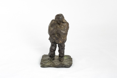
Sculpture: Peter WEGNER (b.1954 NZ - a.1958 AUS), Peter Wegner, Man in Shock (from the 'Black Saturday' series), 2010
The 'Black Saturday' bushfires were a series of bushfires that ignited across the Australian state of Victoria on and around Saturday, 7 February 2009. It was Australia's worst ever natural disaster. The fires occurred during extreme bushfire-weather conditions and resulted in Australia's highest ever loss of life from a bushfire: 173 people died and 414 were injured as a result of the fires.This work is by a local contemporary artist with a national and international reputation for figurative and portrait works. The 'Black Saturday' series is a powerful investigation of emotion and grief as experienced by many Nillumbik residents during the 2009 'Black Saturday' bushfires. A cluster of bronze figurines either stand alone or embrace in groups. Their expressions and gestures of despair are made more pertinent with the raw like application and surface treatment of the material used. The 'Black Saturday' series is a challenging work, but one that encourages healing, connection and empathy. Solitary male figure wearing a long hooded coat clutching his hands underneath his chin in shock. Surface treatment is textured. Dark metallic brown colour. Hand carved on base, back of figure '2/6 WEGNER 10'wegner, bronze, figurine, black saturday, sculpture