Showing 93 items
matching canterbury road forest hill
-
 Whitehorse Historical Society Inc.
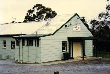
Photograph, Forest Hill Hall
The Forest Hill Hall was built before the 1960s and is situated on the South East side of the intersection of Canterbury and Springvale Rds.The hall seats 70 and can supply tables chairs and a stove. The floor is timber and there is a disability access. There are no parties allowedColoured photograph of a green building with a yellow door. Forest Hill Hall is printed on a board above the doorforest hill hall, halls -
 Surrey Hills Historical Society Collection
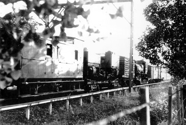
Photograph, Narrow Gauge Garratt Loco G 42 being transferred through Surrey Hills to Belgrave
The G42 Garratt Steam Locomotive was one of two heavier more powerful locomotives that operated on Victoria's narrow gauge railways. These Beyer Garratt locomotives were built in Manchester, England and delivered in 1926. They were numbered G41 and G42. They operated on the Colac–Beech Forest–Crowes line and the Moe–Walhalla line respectively. After the line from Moe closed in 1954, G42 was sent to Colac, where it worked until closure of that line in mid-1962. At that time the G41 was in poor condition and was scrapped. G42 was offered to the Puffing Billy Preservation Society.A black and white photocopy of a goods train and carriages.surrey hills, trains, goods carriages, g42 garratt steam locomotive, puffing billy preservation society, victorian railways -
 Ringwood and District Historical Society
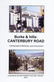
Book, Burke & Hills: Canterbury Road Camberwell to Montrose, by Heathmont History Group - 2014
Soft cover book of 40 pages with spiral wire spine. Compilation of images and descriptive timeline of the geology, geography and European settlement history of Canterbury Road.Soon after beginning at Burke Road Camberwell, Canterbury Road moves into the gentle hills of Canterbury, then on to Surrey Hills, Box Hill and Forest Hill. Further along past these three "hills" come three "monts" - Vermont, Heathmont and at its other end, Montrose, by then in the foothills of the Dandenongs. Grand homes and churches at one end, major and minor shopping centres along the 25km, factories now where farms were, big box stores, fast food outlets, train stations, resrvoir, traffic, residential stretches, modern apartment blocks, parklands, child-minding centres, sporting ovals, a sewage farm, hotels, quarries, commercial developments, plant nurseries, a golf course, bridges, memorials, Asian food shops, telecommunication towers, bushland, creeks, crossroads, traffic lights, mansions, orchards, swamps ... Delaneys Road, renamed Canterbury Road after a 19th century Victorian Governor, is a fascinating study in land use and history as suburban Melbourne has continually diversified and pushed outwards. Compiled by Heathmont History Group, Rita James, Les Prato, Betty Colbert, Jeff Leipold, Gerry Robinson (convenor).