Showing 466 items
matching conservation areas
-
 Lakes Entrance Historical Society
Book, Land Conservation Council Victoria, The Gippsland Lakes Land Use Strategy Plan 1978, 1985
A review of public land use in the East Gippsland area, including natural resources, flora and fauna, recreation. Contains photographs, maps statistics.conservation, aboriginals, primary industry -
Clunes Museum
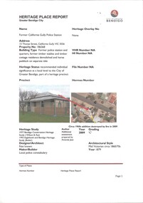
Document - REPORT, LAND CONSERVATION COUNCIL OF VICTORIA, FINAL RECOMMENDATIONS - NORTH CENTRAL AREA, FEBRUARY 1981
... history document recommendations land conservation THE LAND ...THE LAND CONSERVATION COUNCIL WAS ESTABLISHED BY THE LAND CONSERVATION ACT 1970. AS ONE OF ITS THREE FUNCTIONS, IT MAKES RECOMMENDATIONS TO THE MINISTER FOR CONSERVATION WITH RESPECT TO THE USE OF PUBLIC LAND, IN ORDER TO PROVIDE FOR THE BALANCED USE OF LAND IN VICTORIA...BOUND BOOKLET - ORANGE SOFT COVER WITH NAVY BLUE BINDING LAND CONSERVATION COUNCIL, VICTORIA MELBOURNE - FEBRUARY 1981 - INCLUDING MAPSnon-fictionTHE LAND CONSERVATION COUNCIL WAS ESTABLISHED BY THE LAND CONSERVATION ACT 1970. AS ONE OF ITS THREE FUNCTIONS, IT MAKES RECOMMENDATIONS TO THE MINISTER FOR CONSERVATION WITH RESPECT TO THE USE OF PUBLIC LAND, IN ORDER TO PROVIDE FOR THE BALANCED USE OF LAND IN VICTORIA...local history, document, recommendations, land conservation -
Stawell Historical Society Inc
Book - Report, Grampians: A Report on recreation and Timber Uses of. Too Steep to Graze - Too Rocky to Plough, 1979
1) Conservation & Economics 2) Grampians Study Area 3) Land Use 4) Management 5) Criticisms of the Management Plan Appendix Graphs & MapsGreen Paper cover: Black tape on SpineConservation council of Victoria and Logo -
Koorie Heritage Trust
Book, Beauglehole, A. C, The distribution and conservation of vascular plants in the Wimmera area, Victoria, 1987
87 p. : ill. ; 23 x 27 cm.botany -- victoria -- wimmera river region. botany -- victoria -- wimmera river watershed. botany -- victoria -- wimmera. -
Koorie Heritage Trust
Book, Beauglehole, A. C, The distribution and conservation of vascular plants in the Gippsland Lakes hinterland area, Victoria, 1985
Col. map on 1 folded sheet in pocket. Bibliography: p. 9-10.botany -- victoria -- gippsland. -
Koorie Heritage Trust
Book, Beauglehole, A. C, The distribution and conservation of vascular plants in the Murray Valley area, Victoria, 1986
ii, 81 p. : ill., maps ; 21 x 30 cm. + col. map.botany -- murray river valley (n.s.w.-s.a.) -
Koorie Heritage Trust
Book, Beauglehole, A. C. & H. M, The distribution and conservation of vascular plants in the north east area, Victoria, 1988
ii, 98 p. : ill., maps ; 21 x 30 cm. + 1 folded col. map.botany -- victoria, northeastern. -
Koorie Heritage Trust
Book, Beauglehole, A. C, The distribution and conservation of vascular plants in the Corangamite-Otway area, Victoria, 1980
ii,108p. : ill. ; 21x30cm. + 1 col.fold.map in pocket.indigenous vascular plants. distribution. south-west victoria. | botany -- victoria. -
Koorie Heritage Trust
Book, Beauglehole, A. C, The distribution and conservation of vascular plants in the Melbourne area, Victoria, 1983
iii, 156 p. : ill. ; 22 x 30 cm. + 1 folded col. map.indigenous vascular plants. distribution. melbourne region | botany -- victoria -- melbourne region. -
Koorie Heritage Trust
Book, Beauglehole, A. C, The Distribtion and Conservation of Vascular Plants in the South Gippsland area, Victoria, 1984
i-iii; 90 P.; fold-out map on end-cover; tables; maps; ill.; appendices.21 cm.south gippsland, vic.-fauna and flora. -
Koorie Heritage Trust
Book, Beauglehole, A. C, The distribution and conservation of vascular plants in the north central area, Victoria, 1982
iv, 102 p. : ill., maps ; 22 x 30 cm. + 1 col. folded map.indigenous vascular plants. distribution. northern victoria | botany -- victoria. -
Koorie Heritage Trust
Book, Beauglehole, A. C, The distribution and conservation of vascular plants in the south west area, Victoria, 1984
iv, 124 p. : ill., maps (some col.) ; 21 x 29 cm.botany -- victoria, southwestern. -
Koorie Heritage Trust
Book, Beauglehole, A. C, The distribution and conservation of vascular plants in the East Gippsland area, Victoria, 1981
iv, 124 p. : ill., maps (some col.) ; 22 x 30 cm.indigenous vascular plants. distribution. victoria. gippsland. | botany -- victoria -- gippsland. -
Koorie Heritage Trust
Book, Beauglehole, A. C, The distribution and conservation of vascular plants in the Ballarat area, Victoria, 1983
iv, 94 p. : ill. ; 22 x 30 cm. + 1 folded col. map.indigenous vascular plants. distribution. victoria. ballarat region. | botany -- victoria -- ballarat region. -
Koorie Heritage Trust
Book, Beauglehole, A. C, The distribution and conservation of vascular plants in the alpine area, Victoria, 1981
One col. map on folded leaf in pocket. Bibliography: p. 9-11.indigenous vascular plants. distribution. victoria. alpine regions | botany -- victoria. -
 Whitehorse Historical Society Inc.
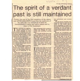
Article, The Spirit of a verdant past is still maintained, 24/07/1991 12:00:00 AM
Article from The Age, 24 July 1991, pp4, 10 By Anne Gillison on conservation and revegetationArticle from The Age, 24 July 1991, pp4, 10 By Anne Gillison on conservation and revegetation in Whitehorse Road Nunawading area.Article from The Age, 24 July 1991, pp4, 10 By Anne Gillison on conservation and revegetationparks and reserves, native plants, nunawading, whitehorse road -
Whitehorse Historical Society Inc.
Document, Melbourne and Metropolitan Archaeological survey, 1/03/1982
History of Aboriginal occupation of the Melbourne area. Evidence of shell midden refuse associated with their campsites. Evidence of scarred trees and scatters of stone artefacts along major stream systems. It has been established that man was in the Melbourne area 40,000 years ago and that Aboriginal occupation probably continued uninterrupted throughout the extremes of the last ice age, around 20,000 years ago when Port Phillip itself was dry land. Study will take 2 - 3 years. Aims (1) identify areas of potential archaeological importance (2) implement a pilot survey program (3) prepare comprehensive proposals for survey of sites. (4) liaise and establish rapport with municipal authorities in study area.aborigines, wurundjeri, bunurong, australian heritage commission, victoria. ministry for conservation, victoria archaeological survey -
Southern Sherbrooke Historical Society Inc.
Book, "The Conservation of Sites and Structures of Historical and Archaelogical Significance in the Upper Yarra Valley and Dandenong Ranges Region", 1978
The work in two volumes, "Vol.1" containing the report with the exception of Chapter 5, which is the list and description of sites, and an unnumbered volume containing the entire report, was cancelled from the Belgrave branch of the Eastern Regional LibraThe publication, referred to as the Tansley Report, was prepared in 1978 as part of a Bachelor of Town & Regional Planning degree. It contains sections on conservation, pre-history and history of the area, and a list of significant sites. This is a photocopy of the original report. -
 Ballarat Tramway Museum
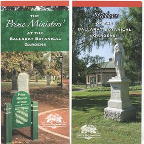
Pamphlet, Friends of the Botanical Gardens, "Ballarat Botanical Gardens", 2016 - 2018
Set of four DL size pamphlets giving details of specific areas of the Ballarat Botanic Gardens, published by the Friends of the Ballarat Botanical Gardens and the POW Memorial Trustees. .1 - The Prime Ministers' at the Ballarat Botanical Gardens - giving details of the Prime Ministers busts and their short history, the sculptors, the history of the avenue. .2 - Statues of the Ballarat Botanical Gardens - 4 fold DL - includes a list and a map of the various statues and conservation issues. .3 - Friends of the Ballarat Botanical Gardens - 2 fold DL - information and membership application form along with contact information. .4- The Australian Ex-Prisoners of War Memorial - 3 fold DL - giving details of the war memorial and contact information.trams, tramways, gardens, botanical gardens, prime ministers avenue, statues, ex prisoner of war memorial -
 Otway Districts Historical Society
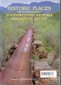
Book, Land Conservation Council, Historic places: Special investigation: South-Western Victoria: Descriptive report, January 1996
The south-west of Victoria, possessing a rich heritage of the signs of past human activity, is fertile ground for an investigation of historic places on public land. This report includes an initial inventory of almost 2000 places. The report outlines the history and the related heritage of the area, describes in some detail its biophysical attributes and introduces the natural resources and present land use. This information provides a context for understanding the origins of the historical features that are observes today.Historic places: Special investigation: South-Western Victoria: Descriptive report. Land Conservation Council. Land Conservation Council; Melbourne (Vic); January 1966. viii, 180 p.; illus.; maps. Soft cover. ISBN 0 7241 9288 3Maps in plastic sleeve.land conservation council; conservation; south-western victoria; historic places; -
 Bendigo Historical Society Inc.
Document - WHITE HILLS BOTANIC GARDENS, BENDIGO: HERITAGE SIGNIFICANCE ASSESSMENT AND STRATEGY PROJECT
Four hundred and forty three page report titled 'White Hills Botanic Gardens, Bendigo - Heritage Significance Assessment and Strategy Project by Lee Andrews & Associates Heritage Consulting, dated 31 October 2006. Contains History of White Hills Botanic Gardens, Physical Survey ad Analysis, Comparative Analysis, Analysis and Assessment of Cultural Significance, Developing the Conservation Policy, Conservation Policy, Conservation Guidelines, Conservation Actions,References and Appendices. Also contains a number of photos, copies of plans and documents, and a plan of the area with the trees marked and identified.document, white hills botanic gardens bendigo - heritage significance assessment and strategy project, bendigo historical society, jim evans, tim buykx, greater bendigo city council, lee andrews & associates heritage consulting, bendigo advertiser, the bendigonian, bendigo independent, argus, bendigo homes and property, mal gregory, mitch kemp, anthony sheean, casey ely, vicki johnson, sandra crump, friends of bendigo's botanic gardens, jane cleary, judy milner, jan orr, heritage victoria, john hawker, department of sustainability and environment historic places, norm stimson, bill dundas, janette hodgson, royal botanic gardens melbourne, roger spencer, university of melbourne burnley campus, greg moore, goldfields research centre, bendigo library, vivien newton, rita hull, state library of victoria, matheson library monash university, mueller correspondence project, sara maroske, library of the royal botanic gardens melbourne jill thurlow, helen cohn, gwen pascoe, john dwyer, larritt and russell -
 Bendigo Historical Society Inc.
Document - HERITAGE REPORT: FORMER POLICE STATION AND QUARTERS: CALIFORNIA GULLY
Seventeen page Heritage Place Report on the Former California Gully Police Station at 15 Thorpe Street, California Gully. It is the former police station and quarters, former timber stables and timber cottage residence demolished and horse paddock on separate title. Report includes a Statement of Significance, Place History (History of the Area), Policing California Gully Goldfields, History of the Buildings, Chronology of Ownership, Rate Books 1858, - 1867 - 1868, 1895 Borough of Eaglehawk Rates, 1922 Voters Roll, 1952 & 1962 Sands & McDougall Directory Thorpe St California Gully, Comparable Examples, Secondary Sources, Description Conservation Policy Guidelines (Specific), Physical Conditions, Physical Description 1, Map of Early Photo Location, Bendigo Parish Plan circa 1870, Certificate of Title 1950 & 1960. Pge 14 has plans, maps and an aerial photo of 15 Thorpe Street. Page 15 has an aerial photo of 15 Thorpe Street, California Gully with Allotment Size. Page 16 & 17 has photos.heritage, heritage report - former police station and quarters - california gully, city of greater bendigo, wilson & ass, butler, amanda jean, johnson reef shafts no 1 & 2, rose of denmark, princess dagmar, bendigo amalgamated goldfields company, captain frederick standish, royal irish constabulary, e thorpe, campbell, taylor, watson, brown, hosken, mckowne, mcqualter, parker, hicks, eaglehawk municipal council, victorian police force, d bannear, historic mining sites in the sandhurst eaglehawk and raywood mining divisions, department of conservation and natural resources, joshua thorpe, thorpe & co, johnson & co, william thorn, michael thomas, james murdock, edward c brown, francis youlden, gold escort, water police, mounted police, city police (melbourne), geelong police, gold fields police, rural bench constabulary, the people's force, robert haldane, n wild, streets of the borough of eaglehawk, police registration act, william henry mitchell, camp hotel, j o c nieman, j m catarach, g w hosken, margaret hosken nee mckown, majorie alice mcqualter, kellie anne mcqualter, adam joseph doolan, mr hicks, sands & mcdougall, hill george, meeking howard, mcewan frank a, jinks stanley, mccaig mrs eleanor, gordon john l, mcqualter mrs adeline, maher william l, raynor robert, flack john p, whitehead miss a, sang george t, linddsay john p, dyer henry, jackman george a, tibbetts mrs s a, hosken mrs margaret winifred nee mckowne, chaplin frank w, wilson c e, wright george, miller g a, sheyhill basil hugh, marshall r, miles j h, parker w b, barkla w g, nicholls les, cartledge clifford william, cole charles basil, farmers citizens trustees co, bev hanson -
 Bendigo Historical Society Inc.
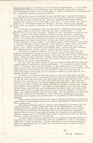
Document - PETER ELLIS COLLECTION: LETTER, 20th August, 1980
Letter (11 Pages) from Peter N Ellis to the Land Conservation Council. Letter refers to proposed State parks - Kamarooka State Park and Whipstick State Park. other areas mentioned are the Wellsford Forest, Mandurang Forest, Lockwood Forest, Waanyaraa, Fryerstown, Whipstick Hill (Flagstaff Hill) and Black Rock. Other areas are Wellsford/Axedale Forest, Sugarloaf Range, Mandurang Forest, Main Coliban Channel, Lockwood Forest, Tarnagulla/Dunolly Forest, Fryerstown, Seven Sisters (between Huntly and Goornong). Plant and tree life in each area is mentioned including the cutting of eucalypt for the production of Eucalyptus oil.person, individual, peter ellis oam, peter ellis collection, land conservation council, kamarooka state park, whipstick state park, eucalyptus oil production, fncv victorian naturalist, d j paton, bendigo field naturalists club, wellsford forest, mandurang forest, main coliban channel, lockwood forest, waanyaras, fryerstown, whipstick hill (flagstaff hill), parish of neilborough, old underground water race, puddling machine, srwsc -
 Bendigo Historical Society Inc.
Document - PETER ELLIS COLLECTION: INFORMATION ON THE BARFOLD GORGE
Foolscap page of information on the Barfold Gorge, by Frank Robbins. Barfold Gorge is compared with the Sydenham Organ Pipes National Park. There is a description of the Gorge. Native vegetation growing there is also mentioned. Turning it into a National Park is mentioned but it is in private ownership and this would require buy back of the land and create access problems as it is a farming area.place, land, barfold gorge, peter ellis collection, barfold gorge, sydenham organ pipes national park, campaspe river, mitchell's falls, queen's falls, piper's creek, turpin's falls, land conservation council, victoria conservation trust, frank robbins -
 Bendigo Historical Society Inc.
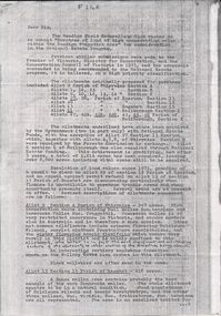
Document - PETER ELLIS COLLECTION: LETTER FROM BENDIGO FIELD NATURALISTS CLUB
Photocopy of an unsigned letter from The Bendigo Field Naturalists Club with copies sent to the Ministry for Conservation, Premier of Victoria, National Estate Dept, Forests Commission of Victoria, Conservation Council of Victoria, Loddon Campaspe Regional Authority, The Hon D McClure MLA, the Hon F S Grimwade MLC, F J Granter MLC, N B Reid MLC and J Bourchier MP. Letter refers to the Purchase of land of high conservation value within the Bendigo Whipstick area for consideration in the National Estate Program.communication, postal, letters, peter ellis collection, the bendigo field naturalists club, national estate funds, forests commission of vict, wallaby caves, mr ruedin, conservation council of victoria, national estate dept, whipstick interim development order, loddon campaspe regional authority, the hon d mcclure mla, the hon f s grimwade mlc, f j granter mlc, n b reid mlc, j bourchier mp -
 Bendigo Historical Society Inc.
Document - PETER ELLIS COLLECTION: LETTER, 4th October, 1976
Letter, dated 4/10/1976 from Diana R. Collier, Hon. Secretary, The Bendigo Field Naturalists Club to The Minister for Lands, The Hon. W. A. Borthwick making an application to have a reserved area for the preservation of native flora and fauna near the Quarry Hill Golf Club. Features, fauna and flora are mentioned including an original Boundary Stone and the Fairy Waxflower (Eriostemon verrucosus) also known as the Bendigo Wax Flower. Included is a list of birds (including some that nest in the area sometimes) and plants.communication, postal, letters, peter ellis collection, the bendigo field naturalists club, proposed boyd st nature reserve, the hon w a borthwick, recreation reserve extension (rs 3458), cemetry reserve extension (rs 3777), rubbish depot (rs 5980), education purposes reserve, (rs 6402), j willis, bendigo city council, city boundary stone, regel, quarry hill golf club, canberra botanical gardens, stony ridge flora reserve sydney, kings park perth, maranoa gardens melbourne, kaweka sanctuary castlemaine, central and northern branch of the national trust, school sanctuary (quarry hill), education dept, society for growing australian plants - bendigo group, lawn cemetery, bendigo city council parks and recreation dept, bendigo trust afforestation committee, quality of life action group, ackhurst plan, winifred waddell estate, dept of crown lands and survey, ministry for conservation, mr g edwards, mr m goode, mr j chellacombe, diana r collier -
 Ballarat Tramway Museum
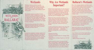
Pamphlet, City of Ballarat, "Wetlands in Ballarat", early 1990s
The pamphlet provides information about the wetland areas in the Ballarat district, in particular the ones in the North Gardens Reserve and Lake Wendouree. Provides information on the importance of the Wetlands, locations and a map. As well, provides contact details for the Department of Conservation and Natural Resources and the City of Ballaarat. Based on the spelling of the City of Ballaarat pamphlet early 1990s.Yields information about the Ballarat's wetlands within in which the tramway museum operates.Pamphlet - 4 fold DL printed in red and green ink.city of ballarat, wetlands, lake wendouree, conservation -
 Kew Historical Society Inc
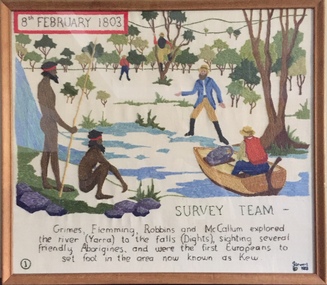
Textile - Bicentennial tapestry, 1. Survey Team, 8th February 1803, 1988
This is one of eight embroidered panels, completed during the 1988 Australian Bi-Centennial, and carried out under the auspices of City of Kew Council and the Kew Historical Society. Nearly 600 residents, including many children, participated in their production by adding a few or more stitches. A book records their names and the panels upon which they worked. Artist: Joy Stewart / Co-ordinator: Dorothy Benyei.1. Survey Team. A framed embroidery created by adults and children of the City of Kew as a Bicentennial project, based on a design by the artist Joy Stewart. Five of the six completed embroideries created in the project are/were displayed in the Kew Library. [The five embroidered panels have now been temporarily removed for conservation reasons].Inscription: "SURVEY TEAM 8th February 1803 / Grimes, Flemming, Robbins and McCallum explored the river (Yarra) to the falls (Dights), sighting several friendly Aborigines, and were the first Europeans to set foot in the area now known as Kew." Embroidered signature of the artist: "(c) JStewart, 1988"bicentennial project (kew), joy stewart, charles grimes expedition, australian bicentennial -
 Kew Historical Society Inc
Plan, Melbourne & Metropolitan Board of Works : Borough of Kew : Detail Plan No.1568, 1905
The Melbourne and Metropolitan Board of Works (MMBW) plans were produced from the 1890s to the 1950s. They were crucial to the design and development of Melbourne's sewerage and drainage system. The plans, at a scale of 40 feet to 1 inch (1:480), provide a detailed historical record of Melbourne streetscapes and environmental features. Each plan covers one or two street blocks (roughly six streets), showing details of buildings, including garden layouts and ownership boundaries, and features such as laneways, drains, bridges, parks, municipal boundaries and other prominent landmarks as they existed at the time each plan was produced. (Source: State Library of Victoria)This plan forms part of a large group of MMBW plans and maps that was donated to the Society by the Mr Poulter, City Engineer of the City of Kew in 1989. Within this collection, thirty-five hand-coloured plans, backed with linen, are of statewide significance as they include annotations that provide details of construction materials used in buildings in the first decade of the 20th century as well as additional information about land ownership and usage. The copies in the Public Record Office Victoria and the State Library of Victoria are monochrome versions which do not denote building materials so that the maps in this collection are invaluable and unique tools for researchers and heritage consultants. A number of the plans are not held in the collection of the State Library of Victoria so they have the additional attribute of rarity.Original survey plan, issued by the MMBW to a contractor with responsibility for constructing sewers in the area identified on the plan within the Borough of Kew. The plan was at some stage hand-coloured, possibly by the contractor, but more likely by officers working in the Engineering Department of the Borough and later Town, then City of Kew. The hand-coloured sections of buildings on the plan were used to denote masonry or brick constructions (pink), weatherboard constructions (yellow), and public buildings (grey). Plan No.1568 covers the area bounded by Cotham Road, John Street, Sackville Street, and Edward Street. Alfred Street and Rowland Street are in shown in the middle of the plan. The two most notable buildings shown are ‘St Helliers’, the home of the Dumaresq family, and St Hilary’s Church and school. While the colours used to indicate St Hilary’s are grey as in other civic/public buildings, the first St Hilary’s Anglican Church was at this stage constructed in weatherboard. At the left of the plan, facing Sackville Street is a house named ‘Glencara’. The 1988 ‘Kew Conservation Study’ recorded that “The first documentary evidence of this house comes from Rate Books which record that in 1893 a Mrs Treadway was the owner of this building with an N.A.V. of £81? At that date the occupier of the house was Charles B. Kelly, a clerk, while by 1910 Kelly had become the owner of the property described in that year ‘as a six-roomed stone, brick and wood house with stables and outbuildings’”. Contrary to this description, the 1905 plan indicates that the house was entirely constructed of masonry.melbourne and metropolitan board of works, detail plans, mmbw 1568 -
 Kew Historical Society Inc
Photograph - Civic event in Stradbroke Park, 1976
Stradbroke Park. Extent: Kilby Road to Harp Road at Burke Road. Historical Documentation: 1851 - Portion 91 purchased by Edward Glynn; 1888 - The Harp of Erin Estate (which included Section 91) offered for sale; 1896 - The area now known as Stradbroke Park was bisected by a creek that flowed from the Yarra via Hay's Paddock (q.v.) and extended through to Burke Road; 1943 - W.D. Birrell, Town Clerk of Kew, proposed that the creek be filled and a reserve created; 1954 - Entire area designated as 'open space' and named 'Stradbroke Park'. The line of the creek that ran through the Park created a further reserve on the north side of High Street, now known as 'Harrison Reserve'. Existing Condition: The park is largely of mown grass that has mature trees set into it It is possible that a number of these are remnant of the original vegetation, while there are also a number of exotic trees introduced, particularly at the northern end of the park. The southern end is dominated by playing fields. (Source: Sanderson, P 1988. Kew Conservation Study)Colour photographic positive (with colour degradation) of sporting teams at a civic event in Stradbroke Park in Kew East in May 1976. The event was officiated by the Mayor of Kew, Cr Alan Hutchinson. Sporting teams in uniform included: footballers, athletes, cricketers, hockey players. Stradbroke Park is situated on the western boundary of Kew at Burke and Harp Roads.stradbroke park, cr alan hutchinson, team sports -- kew (vic.)