Showing 3053 items
matching highway
-
 Ringwood and District Historical Society
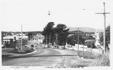
Postcard, Maroondah Highway West, Ringwood, 1956. Entrance to the town of Ringwood, Vic., looking East - Rose Series Postcard P13868
Black and white postcard photograph of Maroondah Highway Ringwood looking east. Note VC Item 4763 is a postal cover imprinted with Windmill Joinery. Inscription on front: "Rose Series P13688 Entrance to the Town of Ringwood, Vic" Hand Written on back of card, "1956 - 'Windmill' joinery on right - Coach and Horses Hotel on left". -
 Ringwood and District Historical Society
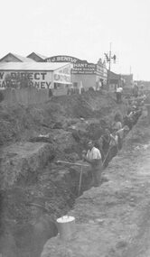
Photograph, Maroondah Highway East, Ringwood- c1920's. Excavation for new water main
Black and white photograph (2 copies- 1 large, 1 small)Written on rear of backing sheet: "Digging trench for water main along Maroondah Highway." -
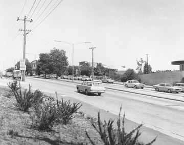
 Ringwood and District Historical Society
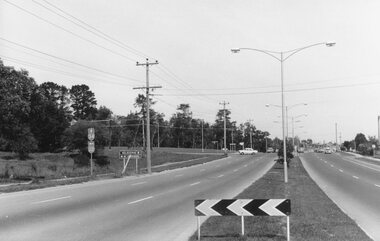
Photograph, Maroondah Highway East, Ringwood- 1969. Looking west towards Ringwood from Mt Dandenong Road intersection
Black and white photographWritten on back of photograph: "Nov 1969, Cnr Mt Dandenong Road and Maroondah Highway." -
 Ringwood and District Historical Society
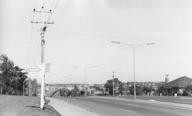
Photograph, Maroondah Highway East, Ringwood- 1969. Looking west towards Ringwood from Mt Dandenong Road
Black and white photographWritten on back of photograph: "Cnr Maroondah Highway and Mt Dandenong Road. Nov 1969." -
 Ringwood and District Historical Society
Photograph, Ringwood Motor Inn, Maroondah Highway, 1981
Written on back of photograph, "24/7/81. Ringwood Motor Inn, Maroondah Highway." -
 Ringwood and District Historical Society
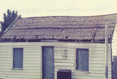
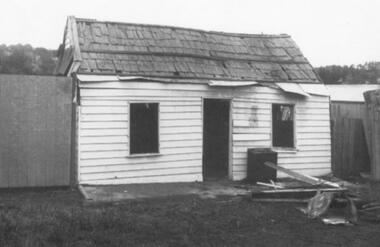
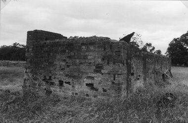
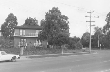
Photograph, Miner's residence at 367 Maroondah Highway, Ringwood. Built 1872, demolished 1975
Catalogue card reads, "367 Maroondah Highway, Ringwood. Built 1872, demolished 1975". -
 Ringwood and District Historical Society
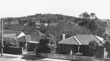
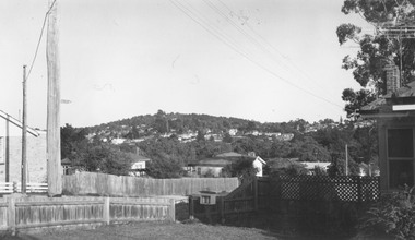
Photograph, View from Maroondah Highway opposite Braeside Avenue towards Loughnan's Hill - 1973
View from Maroondah Highway opposite Braeside Avenue towards Loughnan's Hill - 1973. -
 Ringwood and District Historical Society
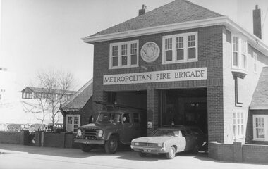
Photograph, "Ringwood (Fire Station), Maroondah Highway 1973
Written on backing sheet, "Ringwood (Fire Station), Maroondah Highway 1973. Opened 1931" -
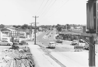
 Ringwood and District Historical Society
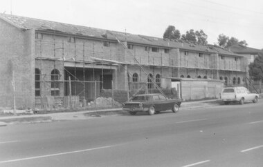
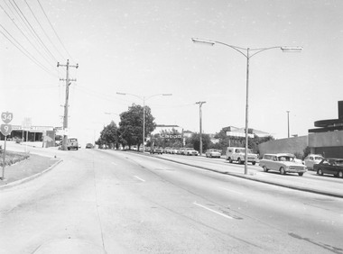
Photograph, Maroondah Highway Central, Ringwood. View looking west from Warrandyte Road, 1974
Black and white photographWritten on rear of backing sheet: "Maroondah Highway near corner Warrandyte Rd., 1974". -
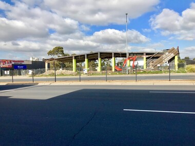 Ringwood and District Historical Society
Photograph - Multiple, Demolition of Iceland Building, 28 Maroondah Highway, Ringwood 19 July 2019, 19/7/2019
Built in 1970 by Pat Burley, Iceland was a popular attraction, with bands as well as ice skating. It was sold in 1981, and subsequently was converted into various business units. 4 photos taken during the demolition if the old Ringwood Ice-skating Rink building, Iceland, 28 Maroondah Highway between New Street and the freeway. -
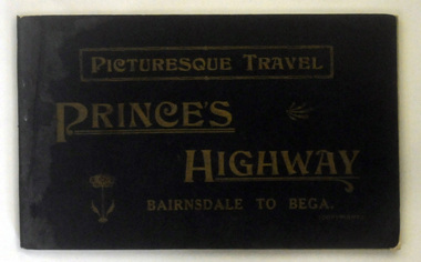 Orbost & District Historical Society
book, Vogt, H, Picturesque Travel Prince Highway, C 1921
Possibly owned by A. C. Nixon. This book was donated by Peter Nixon.A small 139 pp book with a black /dark brown cover and gold lettering. It is titled Picturesque Travel Prince's Highway Bairnsdale to Bega. The back cover is green.inside - Presented to Orbost Historical Society by Peter Nixon, Chief Commissioner, Shire 1/2/97.travel prince's-highway car-touring -
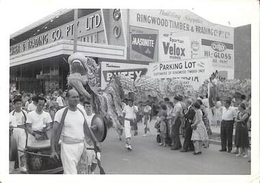 Ringwood and District Historical Society
Photograph, View of procession celebrating City of Ringwood 1960 in Maroondah Highway, 1960
View of procession celebrating City of Ringwood 1960 in Maroondah Highway corner of New Street outside Ringwood Timber and Trading, including Chinese dragon, musicians and spectators. -
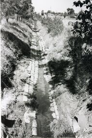 Stawell Historical Society Inc
Photograph, Main Drain - Napier Street to Western Highway
Main Drain - Napier Street to Western Highwaystawell -
 Ringwood and District Historical Society
Photograph, Corner Warrandyte Road and Maroondah Highway, Ringwood c1971
Blurry PhotographWritten on back of photograph, "Corner Warrandyte Road and Maroondah Highway, approximately 1971. Safeways Store". -
 Ringwood and District Historical Society
Photograph, Opposite end of Mines Road on Maroondah Highway, Ringwood. 1981
Written on back of photograph, "24/7/81. Opposite end of Mines Road on Maroondah Highway." -
 Ringwood and District Historical Society
Photograph, Maroondah Highway West, Ringwood- 1960
Black and white photographWritten on back of photograph: "Maroondah Highway from cool store site - looking west, 1960". -
 Ringwood and District Historical Society
Photograph, Loughnan Hill from corner Maroondah Highway and Herbert Street, 1964
Written on backing sheet, "Loughnan Hill from corner Maroondah Highway and Herbert Street, 1964". -
 Ringwood and District Historical Society
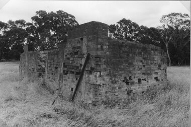
Photograph, Dismantling of original Miners' Cottage in Maroondah Highway, Ringwood, prior to re-construction at Ringwood Lake c.1970s
Written on back of picture, "Original site in Maroondah Highway. Original Miners' Cottage being dismantled". -
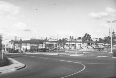
 Ringwood and District Historical Society
Photograph, Maroondah Highway Central, Ringwood. View looking west from Warrandyte Road - 1974
Black and white photographWritten on rear of backing sheet: "Maroondah Highway, 1974 - West from Warrandyte Rd. ext." -
 Ringwood and District Historical Society
Photograph, Maroondah Highway Central, Ringwood. Buildings at rear of property, N.E. corner of Adelaide Street and Maroondah Highway, 1963. (Eastland Litigation Photo), May 1963
This series of SS0380 photos are part of the "Eastland Litigation" launched in 1962 by the Whitehorse Traders Co-operative Association (WTCA), against the Ringwood Council's Interim Development Order of 1960. WTCA sought "orders from the Supreme Court of Victoria that the planning scheme was invalid" - See "The Eastland Litigation" chapter in "From Horse Shoes to High Heels - Ringwood Shopping Centre and Eastland 1858-2008" by Richard Carter, Bounce Books 2009.Black and White Photograph (2 copies)Written on back of photograph: "Photo showing buildings at rear of property, N.E. corner of Adelaide Street and Maroondah Highway". Stamps on back of photograph read, 'In the Supreme court, 13 Aug. 1963', and 'Edwin G. Adamson....May '63.' -
 Stawell Historical Society Inc
Photograph, Wehl Family home "Carlsruhe" on the Western Highway -- Tannery Remains
Private Home Western Highway (Wehl) Tannery Remainsstawell -
 Stawell Historical Society Inc
Photograph, Wehl Family home "Carlsruhe" on the Western Highway -- Tannery Remains
Private Home Western Highway (Wehl) Tannery Remainsstawell -
 Stawell Historical Society Inc
Photograph, B P Petrol Depot on the Western Highway -- Aerial View -- Coloured
Aerial View along Western Highway (BP Depot)stawell -
 Ringwood and District Historical Society
Photograph, Joan Walker, East Ringwood 2000 - Burnt Bridge taken from Maroondah Highway just near Kalinda Road, 2000
East Ringwood 2000 - Burnt Bridge Shopping Centre taken from Maroondah Highway just near Kalinda Road - B&W Photo from Album 6501 -
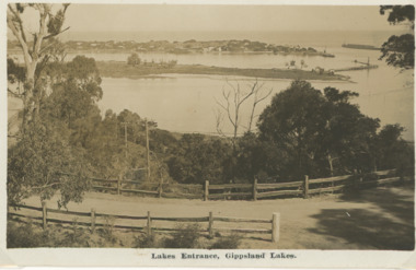 Lakes Entrance Historical Society
Postcard, H D Bulmer, Princes Highway Lakes Entrance Victoria, c1930
Black and white postcard showing part of Princes Highway below Jemmys Point, undeveloped Bullock Island New Works area and Entrance in distance Lakes Entrance VictoriaLakes Entrance Gippsland Lakesroads and streets, transport, township, waterways -
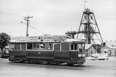 Eltham District Historical Society Inc
Photograph, Bendigo Tramways No. 7 en route to Golden Square passes the Central Deborah Gold Mining Co, High Street (Midland Highway) and Violet Street, Bendigo, January 1972, Jan 1972
Looking east from Midland Highway at intersection of Violet StreetDigital TIFF file Scan of 35mm Ilford FP3 black and white negative transparencybendigo, bendigo tramways no. 7, central deborah gold mining co. n.l., eaglehawk, george coop collection, golden square, high street, midland highway, tram, violet street -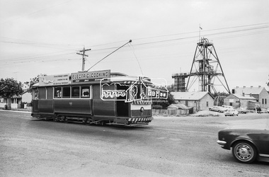
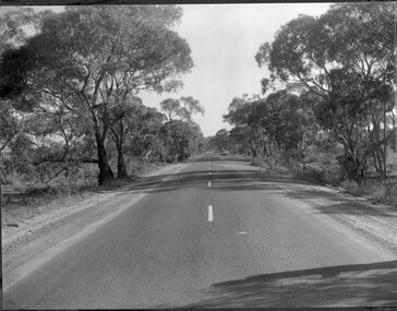 Stawell Historical Society Inc
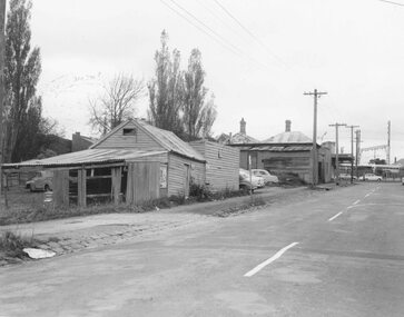
Photograph, Road Scenes of the Western Highway c1950 -- 2 Photos
Road Scenes of Western Highway about 1950. Two photographs.stawell -
 Ringwood and District Historical Society
Photograph, South east corner of Mines Road and Maroondah Highway, Ringwood. 1981
Written on back of photograph, "24/7/81. South east corner of Mines Road and Maroondah Highway." -
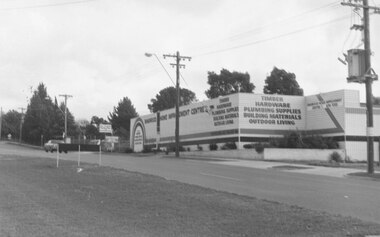
 Ringwood and District Historical Society
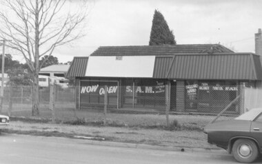
Photograph, 477 Maroondah Highway Ringwood. S.A.M.. New and second-hand agricultural machinery. 1981
Written on back of photograph, "11.8.81 477 Maroondah Highway. S.A.M.. New and second-hand agricultural machinery."