Showing 164 items
matching mason's mark
-
 Uniting Church Archives - Synod of Victoria
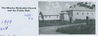
Photograph - B&W Photograph, Mincha Methodist Church and Public Hall
n 1927, during the ministry of the Reverend Charles Mason, Methodist Church services and a combined Anglican-Methodist Sunday School were held in the Mincha State School, The Mincha Memorial Methodist Church was opened on13 March 1936. It was called the Mincha Centenary Church to mark 100 years since the arrival in Victoria of Reverend Orton, the first Methodist minister.The photograph shows the front and one side of the church and public hall which are located side by side. -
 Ballarat Heritage Services
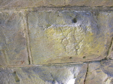
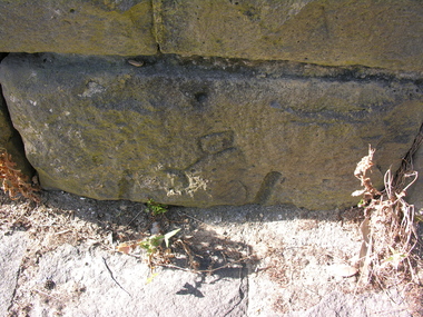
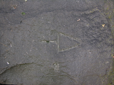
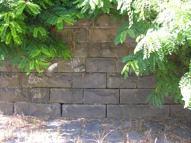
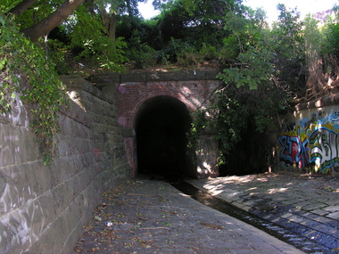
Photograph - Colour, Stonemason's Mark, Yarrowee Channel, Ballarat, Victoria, Australia, 2017
... Office goldfields masons marks bluestone yarrowee channel Colour ...Colour photograph of a stonemason's mark in bluestone.masons marks, bluestone, yarrowee channel -
 Ballarat Heritage Services
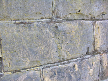
Photograph - Colour, Stonemason's Mark, Yarrowee Channel, Ballarat, Victoria, Australia, 2017
... Office goldfields Bluestone yarrowee channel Mason's Marks Colour ...Colour photographs of stonemason's mark in blustone. bluestone, yarrowee channel, mason's marks -
 Ballarat Heritage Services
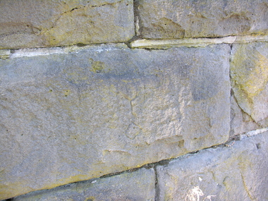
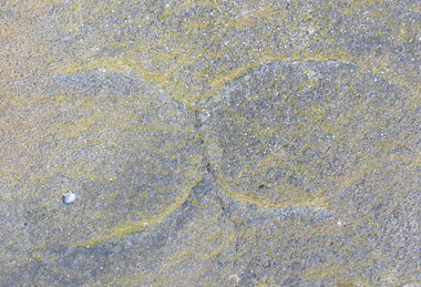
Photograph - Colour, Stonemason's Mark, Yarrowee Channel, Ballarat, Victoria, Australia, 2016
... Office goldfields bluestone yarrowee channel mason's marks Colour ...Colour photograph of a stonemason's mark in bluestone. bluestone, yarrowee channel, mason's marks -
 Ballarat Heritage Services
Photograph - Colour, Stonemason's Mark, Yarrowee Channel, Ballarat, Victoria, Australia, 2016
... Office goldfields Bluestone Yarrowee Channel mason's marks Colour ...Colour photograph of a stonemason's mark in bluestone. bluestone, yarrowee channel, mason's marks -
 Ballarat Heritage Services
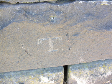
Photograph - Colour, Stonemason's Mark, Yarrowee Channel, Ballarat, Victoria, Australia, 2016
... Office goldfields mason's marks bluestone yarrowee channel Colour ...Colour photograph of stonemason's marks in bluestone.mason's marks, bluestone, yarrowee channel -
 Ballarat Heritage Services
Photograph - Colour, Stonemason's Mark, Yarrowee Channel, Ballarat, Victoria, Australia, 2016
... Office goldfields bluestone yarrowee channel mason's marks Colour ...Colour photograph of stonemason's mark on bluestone. bluestone, yarrowee channel, mason's marks -
 Ballarat Heritage Services
Photograph - Colour, Stonemason's Mark, Yarrowee Channel, Ballarat, Victoria, Australia, 2016
... Office goldfields Bluestone yarrowee channel mason's marks Colour ...Colour photograph os stonemason's marks on bluestone.bluestone, yarrowee channel, mason's marks -
 Ballarat Heritage Services
Photograph - Colour, Stonemason's Mark, Yarrowee Channel, Ballarat, Victoria, Australia, 2016
... Office goldfields bluestone yarrowee channel mason's marks Colour ...Colour photograph of stonemason's marks on bluestone. bluestone, yarrowee channel, mason's marks -
 Ballarat Heritage Services
Photograph - Colour, Stonemason's Mark, Yarrowee Channel, Ballarat, Victoria, Australia, 2017
... Office goldfields bluestone yarrowee channel mason's marks Colour ...Colour photograph of stonemason's marks on bluestone.bluestone, yarrowee channel, mason's marks -
 Ballarat Heritage Services
Photograph - Colour, Stonemason's Mark, Yarrowee Channel, Ballarat, Victoria, Australia, 2016
... Office goldfields Bluestone yarrowee channel mason's marks Colour ...Colour photograph of stonemason's marks on bluesrtone.bluestone, yarrowee channel, mason's marks -
 Ballarat Heritage Services
Photograph - Colour, Stonemason's Mark, Yarrowee Channel, Ballarat, Victoria, Australia, 2016
... Office goldfields bluestone yarrowee channel mason's marks Colour ...Colour photograph of stonemason's marks on bluestone bluestone, yarrowee channel, mason's marks -
 Ballarat Heritage Services
Photograph - Colour, Stonemason's Mark, Yarrowee Channel, Ballarat, Victoria, Australia, 2016
... Office goldfields Bluestone yarrowee channel Mason's Marks Colour ...Colour photograph of stonemason's marks on bluestone.bluestone, yarrowee channel, mason's marks -
 Ballarat Heritage Services
Photograph - Colour, Stonemason's Mark, Yarrowee Channel, Ballarat, Victoria, Australia, 2017
... Office goldfields bluestone yarrowee channel mason's marks Colour ...Colour photograph of stonemason's marks on bluestone. bluestone, yarrowee channel, mason's marks -
 Ballarat Heritage Services
Photograph - Colour, Mason's Marks, Carlisle Cathedral 27 October 2016
... Office goldfields Mason's Marks, Carlisle Cathedral 27 October ... -
 Ballarat Heritage Services
Photograph - Colour, Mason's Marks, Carlisle Cathedral, 27 October 2016
... Office goldfields Carlisle cathedral masons marks Mason's Marks ...carlisle cathedral, masons marks -
 Ballarat Heritage Services
Photograph - Colour, Mason's Marks, Carlisle Cathedral, 27 October 2016
... Office goldfields Carlisle cathedral masons marks Mason's Marks ...carlisle cathedral, masons marks -
 Ballarat Heritage Services
Photograph - Colour, Mason's Marks, Carlisle Cathedral 27 October 2016
... Office goldfields Mason's Marks, Carlisle Cathedral 27 October ... -
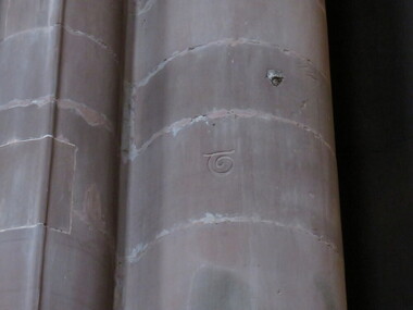
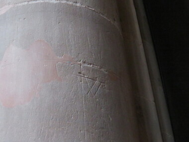
 Ballarat Heritage Services
Photograph - Colour, Mason's Marks, Carlisle Cathedral 27 October 2016
... Office goldfields Mason's Marks, Carlisle Cathedral 27 October ... -
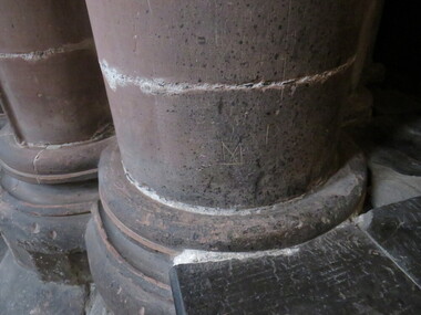
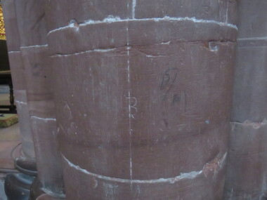
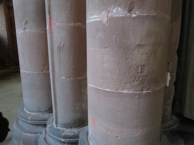
 Ballarat Heritage Services
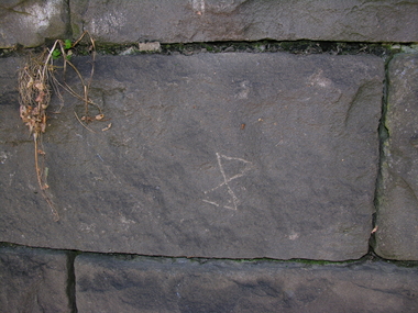
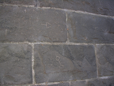
Photograph - Colour, Mason's Marks, Carlisle Cathedral 27 October 2016
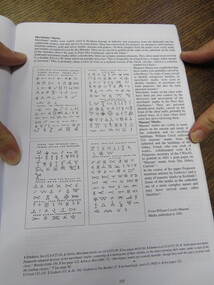
... to Thomas Crump, English stonemason. Mason's Marks, Carlisle ...The particular mark on this column belongs to Thomas Crump, English stonemason. -
 Ballarat Heritage Services
Photograph - Colour, Mason's Marks, Carlisle Cathedral, 27 October 2017
... Office goldfields Mason's Marks, Carlisle Cathedral, 27 October ... -
 Ballarat Heritage Services
Photograph - Colour, Mason's Marks, Carlisle Cathedral, 27 October 2016
... Office goldfields Mason's Marks, Carlisle Cathedral, 27 October ... -
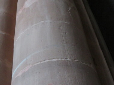
 Ballarat Heritage Services
Photograph - Colour, Mason's Marks, Carlisle Cathedral, 27 October 2016
... Office goldfields Mason's Marks, Carlisle Cathedral, 27 October ... -
 Ballarat Heritage Services
Photograph - Colour, Mason's Marks, Carlisle Cathedral, 27 October 2016
... Office goldfields Mason's Marks, Carlisle Cathedral, 27 October ... -
 Ballarat Heritage Services
Photograph - Colour, Mason's Marks, Carlisle Cathedral, 27 October 2016
... Office goldfields Mason's Marks, Carlisle Cathedral, 27 October ... -
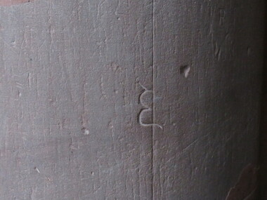
 Ballarat Heritage Services
Photograph - Colour, Mason's Marks, Carlisle Cathedral, 27 October 2016
... Office goldfields Mason's Marks, Carlisle Cathedral, 27 October ... -
 Ballarat Heritage Services
Photograph - Colour, Mason's Marks, Carlisle Cathedral, 27 October 2016
... Office goldfields Mason's Marks, Carlisle Cathedral, 27 October ... -
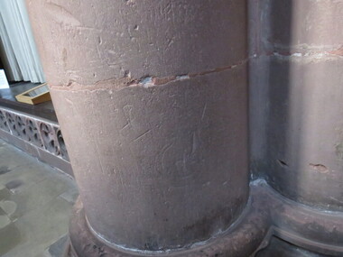
 Ballarat Heritage Services
Photograph - Colour, Mason's Marks, Carlisle Cathedral, 27 October 2016
... Office goldfields Mason's Marks, Carlisle Cathedral, 27 October ... -
 Ballarat Heritage Services
Photograph - Colour, Mason's Marks, Carlisle Cathedral, 27 October 2016
... Office goldfields Mason's Marks, Carlisle Cathedral, 27 October ... -
 Ballarat Heritage Services
Photograph - Colour, Mason's Marks, Carlisle Cathedral, 27 October 2016
... Office goldfields Mason's Marks, Carlisle Cathedral, 27 October ...