Showing 2027 items matching "planning document"
-
 Kew Historical Society Inc
Plan - Subdivision Plan, Six Big Home Sites, Camberwell North, c.1936
... Subdivision plans are historically important documents used... Subdivision plans are historically important documents used ...Subdivision plans are historically important documents used as evidence of the growth of suburbs in Australia. They frequently provide information about when the land was sold on which a built structure was subsequently constructed as well as evidence relating to surveyors and real estate and financial agents. The numerous subdivision plans in the Kew Historical Society's collection represent working documents, ranging from the initial sketches made in planning a subdivision to printed plans on which auctioneers or agents listed the prices for which individual lots were sold. In a number of cases, the reverse of a subdivision plan in the collection includes a photograph of a house that was also for sale by the agent. These photographs provide significant heritage information relating house design and decoration, fencing and household gardens.A subdivision in what is currently Balwyn, but which was advertised as being in Camberwell North. The subdivision included six allotments facing Buchanan Avenue and Houghton Street. The subdivision was to the east of the Pointed Firs Estate (1936). In addition to the intrinsic value of this subdivision plan, it also reveals information about the development of transport infrastructure in this area. The subdivision plan notes that the Tramways Board has approved the extension of the tram route past the current terminus at Balwyn Road.subdivision plans - camberwell -
 Kew Historical Society Inc
Plan - Subdivision Plan, Windella-Darnley Subdivision, Studley Park, 1920s
... Subdivision plans are historically important documents used... Subdivision plans are historically important documents used ...Subdivision plans are historically important documents used as evidence of the growth of suburbs in Australia. They frequently provide information about when the land was sold on which a built structure was subsequently constructed as well as evidence relating to surveyors and real estate and financial agents. The numerous subdivision plans in the Kew Historical Society's collection represent working documents, ranging from the initial sketches made in planning a subdivision to printed plans on which auctioneers or agents listed the prices for which individual lots were sold. In a number of cases, the reverse of a subdivision plan in the collection includes a photograph of a house that was also for sale by the agent. These photographs provide significant heritage information relating house design and decoration, fencing and household gardens.Version 1 of two subdivision plans (the later one is MAP.0027) for the section of Studley Park Road near the Junction on the south side. Named in the subdivision are the mansions of Darley and Windella (now demolished). Before the subdivision of Darley and Windella, both houses fronted Studley Park Road. Both houses appear to be advertised as lots in the subdivision. Bisecting the subdivision is a street, Antrim Avenue that was never constructed. A street, which was subsequently constructed in this vicinity, was Merrion Place, which now runs between Studley Park Road and Highfield Grove. There are 14 proposed lots in this subdivision."Antrim Avenue. See over for new plan"subdivision plans - kew, studley park, windella, darnley, studley park road -- kew (vic.), merrion place -- kew (vic.), merrion grove -- kew (vic.), highbury grove -- kew (vic.) -
 Kew Historical Society Inc
Plan - Subdivision Plan, Shop Sites, East Kew, c.1927
... Subdivision plans are historically important documents used... Subdivision plans are historically important documents used ...Subdivision plans are historically important documents used as evidence of the growth of suburbs in Australia. They frequently provide information about when the land was sold on which a built structure was subsequently constructed as well as evidence relating to surveyors and real estate and financial agents. The numerous subdivision plans in the Kew Historical Society's collection represent working documents, ranging from the initial sketches made in planning a subdivision to printed plans on which auctioneers or agents listed the prices for which individual lots were sold. In a number of cases, the reverse of a subdivision plan in the collection includes a photograph of a house that was also for sale by the agent. These photographs provide significant heritage information relating house design and decoration, fencing and household gardens.This is one of a small number of subdivision plans for commercial property in the collection. The subdivision proposed to create six shop sites in High Street between the Harp of Erin and Station Street. The plan shows this stretch of High Street, East Kew already lined with shops that include the hotel on the corner, the new State Savings Bank, a dentist’s surgery and Lambert’s Store. The High Street Tram was to reach Burke Road in 1925, so the proposed subdivision must postdate that event, and the opening of the Bank in 1926.subdivision plans - east kew, high street - east kew -
 Kew Historical Society Inc
Plan - Subdivision Plan, Eastlawn Estate, 1914
... Subdivision plans are historically important documents used... Subdivision plans are historically important documents used ...Subdivision plans are historically important documents used as evidence of the growth of suburbs in Australia. They frequently provide information about when the land was sold on which a built structure was subsequently constructed as well as evidence relating to surveyors and real estate and financial agents. The numerous subdivision plans in the Kew Historical Society's collection represent working documents, ranging from the initial sketches made in planning a subdivision to printed plans on which auctioneers or agents listed the prices for which individual lots were sold. In a number of cases, the reverse of a subdivision plan in the collection includes a photograph of a house that was also for sale by the agent. These photographs provide significant heritage information relating house design and decoration, fencing and household gardens.The ‘Eastlawn Estate’ was surveyed and ready for auction in March 1914, three months before the outbreak of World War I. Sixty-six allotments, created on the ‘order of Mr & Miss Preston’ surrounded the mansion of Woodlands in Harp Road. Woodlands formed part of the Estate, being advertised as lot 1. The allotments faced High, Station and Wright Streets, Harp and Normanby Roads, and Woodlands Avenue. Pru Sanderson in the Kew Conservation Study (Vol.2, 1988) wrote that the Eastlawn Estate ‘covered the western half of the failed Harp of Erin Estate’. Contemporary advertisements promoted the Eastlawn Estate as: ‘There will be no more convenient district nor pleasant Suburb than East Kew for the busy business man. When the Electric Tram is laid, he will be able to journey quickly and pleasantly direct from Collins Street to his home in the Eastlawn Estate in about 20 minutes’. The actual plans of subdivision were included in advertisements in The Argus and in the local newspapers.subdivision plans - east kew, eastlawn estate -
 Kew Historical Society Inc
Plan - Subdivision Plan, Raheen Estate Subdivision, 1960
... Subdivision plans are historically important documents used... Subdivision plans are historically important documents used ...Subdivision plans are historically important documents used as evidence of the growth of suburbs in Australia. They frequently provide information about when the land was sold on which a built structure was subsequently constructed as well as evidence relating to surveyors and real estate and financial agents. The numerous subdivision plans in the Kew Historical Society's collection represent working documents, ranging from the initial sketches made in planning a subdivision to printed plans on which auctioneers or agents listed the prices for which individual lots were sold. In a number of cases, the reverse of a subdivision plan in the collection includes a photograph of a house that was also for sale by the agent. These photographs provide significant heritage information relating house design and decoration, fencing and household gardens.The Raheen Estate Subdivision of 1960 involved the creation of 36 residential allotments and the sale of 34 of these. The land on which the subdivision was created had until 1960 formed part of the grounds of the mansion Raheen in Studley Park Road. In 1917, the Catholic Church had purchased Raheen and its lands. It was to become the home of Archbishop of Melbourne, Daniel Mannix, for 46 years. The sale of the subdivision took place three years before the Archbishop’s death. Subsequent archbishops were to reside at Raheen until its sale to the Pratt family in 1981. When the sale of the Estate was reported in the newspapers in 1960, it was described as the last big subdivision near Melbourne. At the auction, 33 of the 36 allotments were sold. The auction realised £315,750. Purchasers were advised that the vendor intended to keep lots 22 and 23. The alllotments in the subdivision required the construction of new roads. These included Eamon Court and Raheen Drive. The justification provided by the Church for the sale was that the estate was being sold to finance school building projects.subdivision plans - kew, studley park, raheen estate, eamon court, studley park road, coombes avenue, raheen drive -
 Bendigo Historical Society Inc.
Document - MARKS COLLECTION: SECTION OF MAIN CHANNEL
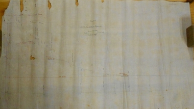
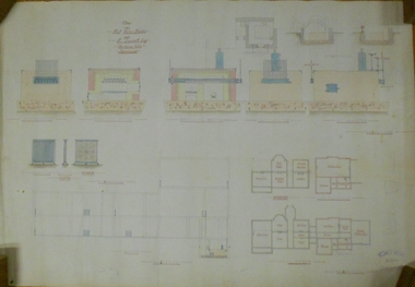
... = 3472.2 gals per minute'. Plan located in documents from George...'. Plan located in documents from George Lansell auction. Document ...Plan drawn on waxed type paper, fragile. Written in centre of map 'Section on Centre of Main Channel, Scale horizontal 2 chs, vertical 10ft., to an inch'. Plan shows Melbourne Road on top section. Written in red ink '5,000,000 galls in 24 hours = 3472.2 gals per minute'. Plan located in documents from George Lansell auction.bendigo, mining, water channel section -
 Glen Eira Historical Society
Plan - Uniting Church Archives, Orrong Road, 78-66, Elsternwick
... Six documents including plan and correspondence between... VIC 3162 melbourne Six documents including plan ...Six documents including plan and correspondence between Elsternwick Methodist Church, Public Health Department and Beddoe Pty Ltd concerning the application to make alterations and additions including the erecting of a brick kindergarten from 30/07/1937 to 03/03/1939.elsternwick methodist church, orrong road, beddoe pty ltd., halls, kindergarten, robinson c.h., briggs james r., beddoe f.g., charlesworth a.c., methodist church trust, town clerks, hoddle street -
 Kew Historical Society Inc
Plan - Subdivision Plan, Windella-Darnley Subdivision, Studley Park, 1920s
... Subdivision plans are historically important documents used... Subdivision plans are historically important documents used ...Subdivision plans are historically important documents used as evidence of the growth of suburbs in Australia. They frequently provide information about when the land was sold on which a built structure was subsequently constructed as well as evidence relating to surveyors and real estate and financial agents. The numerous subdivision plans in the Kew Historical Society's collection represent working documents, ranging from the initial sketches made in planning a subdivision to printed plans on which auctioneers or agents listed the prices for which individual lots were sold. In a number of cases, the reverse of a subdivision plan in the collection includes a photograph of a house that was also for sale by the agent. These photographs provide significant heritage information relating house design and decoration, fencing and household gardens.Version 2 of two subdivision plans (the earlier is 2016.0305.1) for the section of Studley Park Road near the Junction on the south side. Named in the subdivision are the mansions of Darley and Windella (now demolished). Before the subdivision of Darley and Windella, both houses fronted Studley Park Road. Both houses appear to be advertised as lots in the subdivision. Bisecting the subdivision is a street, Antrim Avenue that was never constructed. A street, which was subsequently constructed in this vicinity, was Merrion Place, which now runs between Studley Park Road and Highfield Grove. There are 13 proposed lots in this subdivision in contrast to the earlier plan. This resulted from larger lots being proposed for Studley Park Road.subdivision plans - kew, studley park, windella, darnley, antrim avenue -- kew (vic.), studley park road -- kew (vic.), merrion place -- kew (vic.), merrion grove -- kew (vic.), highbury grove -- kew (vic.) -
 Wodonga & District Historical Society Inc
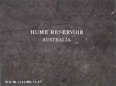
Album - Hume Reservoir Australia Album - Cover, Department of Public Works, N.S.W, 1927
... documenting the planning and development of the Hume Reservoir up... and national significance as it documents the planning and development ...This set of photos is from a leather bound album bearing the inscription "HUME RESERVOIR AUSTRALIA" plus 'The Rt. Hon. L. C. M. S. Amery, P. C., M .P.' all inscribed in gold. It was presented to The Rt. Hon. L. C. M. S. Amery, P. C., M. P, Secretary of State for Dominion Affairs on the occasion of his visit to the Hume Reservoir on 2nd November 1927. To ensure preservation of the album and its contents, the images and information pages have all been digitised. It is assumed that over the past 70 to 80 years there has been some loss of contrast due to fading, and probably detail. Thus, each photo was enhanced in several steps. Digitalisation of the album was completed by Eric Eulenstein in Wodonga in April 2002. The position of Secretary of State for Dominion Affairs was a British cabinet-level position created in 1925 and responsible for British relations with the Dominions — Canada, Australia, New Zealand, South Africa, Newfoundland, and the Irish Free State — and the self-governing Crown colony of Southern Rhodesia.This album is of local and national significance as it documents the planning and development of the Hume Reservoir up to 1927. It was the largest water reservoir in the British Empire. The album records the pioneering engineering work that went into its construction.Leather bound cover of the album of photos and information documenting the planning and development of the Hume Reservoir up to 1927. It was presented to The Rt. Hon. L.C.M.S. Amery, P.C., M.P, Secretary of State for Dominion Affairs on the occasion of his visit to the Hume Reservoir on 2nd November 1927. Embossed in gold in centre of cover "HUME RESERVOIR/AUSTRALIA" At bottom left "The Rt. Hon. L.C.M.S. Amery, P.C., M.P."hume reservoir australia, the rt. hon. l.c.m.s. amery -
Port Melbourne Historical & Preservation Society
Document - Folder, bound, J KItchen & Sons, Port Melbourne factory, J Kitchen & Sons Pty Ltd, 1950
... of proposed development, current valuation and many documents... development, current valuation and many documents and plans ...Black leather bound folder with "Port Melbourne factory- June 1950" in white print on front cover. Folder contains a 1939 photograph of J Kitchen & Sons factory, drawing of proposed development, current valuation and many documents and plans for the development from 1950 to 1954.industry - manufacturing, built environment - industrial, j kitchen & sons pty ltd -
 Ballarat Tramway Museum
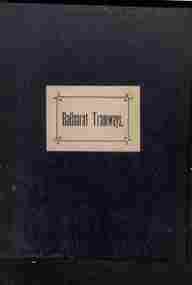
Administrative record - Book, Andersons' printing, "Ballaarat Tramways", Jan. 1888
... the documents relating to the establishment of the Ballaarat Tramways... the documents relating to the establishment of the Ballaarat Tramways ...Book with an index or table of contents, listing all the documents relating to the establishment of the Ballaarat Tramways (the horse tram operator) including, references to Legislation and orders in council, original tender conditions, the contract between the Council and Edward Thomson, Specifications for the construction, delegation to the operator, and plan of routes. Last document dated 17/1/1888.Yields information about the establishment of the Ballarat horse trams, Councils and the operator.Bound book, with end papers, 20 pages, patterned covers, titled with a label on the front cover - "Ballaarat Tramways"Has an old ownership note on the inside front cover.secv, tramways, horse trams, city of ballaarat, ballaarat tramway company, tenders, specifications, operations, maps -
 Melbourne Tram Museum
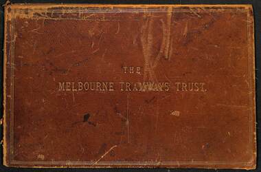
Document - Folder, Kemp & Boyce Printers, "Melbourne Tramways Trust - Cable Tramways", March 1889
... Plans and documents prepared by George Duncan... Plans and documents prepared by George Duncan for the Melbourne ...Plans and documents prepared by George Duncan for the Melbourne Tramways Trust showing details of the track construction, drainage and costs for the construction of the Melbourne cable tram and horse tram system for the Melbourne and Tramway Omnibus Co. Part 1 - track cross sections for both cable and horse trams and various rail weights - lbs/yard part 2 - details costs and mileages for each liine, report from George Duncan and remnant part of a printed map missing the lower half. part 3 - drainage report detailing the works and cost for each line. part 4 - continuation of drainage report - and last part of the book Map printed on cloth - blue print - showing the various lines. Note the Windsor to St Kilda line shown as a horse tram line, but was built as a cable line - the last to be opened.Yields information about the construction of the cable tram system by the Melbourne Tramway TrustFolder - heavy card leather covered covers with gold lines around the edges and gold blocked title. Has marbled glued end papers, containing 9 cloth backed blue print drawings, 22 printed sheets and two foldout maps. The lower half of the first fold out map has been torn out and lost. The second fold out map, a cloth backed blue print.Date stamped in two places with "The Melbourne Tramways Trust Engineers 9 Mar 89" (1889), in two places.tramways, trams, cable trams, mtt, mtoco, melbourne tramway trust, construction, drainage, maps, george duncan, track work, costs -
Port Melbourne Historical & Preservation Society
Document - DVD, Public Records Office Victoria (PROV), Temperance Hall, Port Melbourne, Public Building file, 1890 - 1963
... , documents and plans concerning the Temperance Hall, corner Nott... 25 pages of images of letters, documents and plans concerning ...COPYRIGHT PROV Temperance Hall, Port Melbourne, Public Building file. DVD containing 25 pages of images of letters, documents and plans concerning the Temperance Hall, corner Nott and Liardet Streets, Port Melbourne from 1890 to 1963, belonging to the Independent Order of Rechabites. 1963 documents relate to the sale of the building to Port Melbourne Council for use as an Elderly Citizens Centrebuilt environment - civic, local government - city of port melbourne, societies clubs unions and other organisations, health - general health, port melbourne temperance hall, edward clark, town clerks, senior citizens centre, liardet community centre -
Glen Eira Historical Society
Plan - Caulfield State School No. 773
... . Correspondence, plans, photos and documents. A4 page pamphlet(3 copies.... Correspondence, plans, photos and documents. A4 page pamphlet(3 copies ...Three documents about this school covering: A 20 page booklet, (2 copies) of historical notes on Caulfield Primary School, dated November, 1977 compiled by A. H. Long to commemorate 100 years of the school at the Glen Huntly Road. Site. Contains brief history from 1859 to 1977, and copies of related. Correspondence, plans, photos and documents. A4 page pamphlet(3 copies) for the 1988 past pupils reunion at Caulfield. Primary School. Contains the program of events and a list of school principals. Unattributed hand written note, dated 27/03/1988. Mentioning former pupils, now authors George Johnston and Frank Dalby Davidson.caulfield primary school, burke cecilia., watts thos, bayston henry, webb frederick g. h. lampriere william. pennington harold. long a h., barry thomas m., striely e m., chambers john, stephen john wilber force, harriman b.c., white john e, francis richard, wood robert, lampe herman e. j f, webb james w., barry thomas m, bayston henry, vre james a, smith thomas, lampe hermann e. j. f., clarkson george, white john e, taylor ralph h.w, williamson edward. f, barclay samuel, almond william t., lennie andrew p.s., kirmsse carl e., elliott eddy, rogers arthur d, shaw edgar f, liston william p, haley alfred i, kelly michael j, potter arthur h., miller robert, james fred., mcfadyen j, moran t., bridges r.g., mcgowan j. i, painter h., beatty i, barnes c, riach j, gilbert j, brown j, wilson kenneth, ritchie elma, willetts gertie, young bess, cedar street, poplar street, glen huntly road., olive street, caulfield., caulfield common school, williamson charles, moran t., mcgowan j. i., campbell jack (mayor), macphee ian (mp), tanner ted (mla), urguart karen, forryan julie, watts kristie, t.satsakis ritsa, soos gj., schools, primary schools, teachers, independent schools, victorian style, gables, plans, landscape planning, financial documents, sewerage and sanitation, correspondence, special certificate for regular attendance, james fred, johnstone george, davidson dalby -
 Kew Historical Society Inc
Photograph - Cosy Five Roomed Rough Cast Bungalow, Kew, J E Barnes, c.1920
... Subdivision plans are historically important documents used... Subdivision plans are historically important documents used ...Subdivision plans are historically important documents used as evidence of the growth of suburbs in Australia. They frequently provide information about when the land was sold on which a built structure was subsequently constructed as well as evidence relating to surveyors and real estate and financial agents. The numerous subdivision plans in the Kew Historical Society's collection represent working documents, ranging from the initial sketches made in planning a subdivision to printed plans on which auctioneers or agents listed the prices for which individual lots were sold. In a number of cases, the reverse of a subdivision plan in the collection includes a photograph of a house that was also for sale by the agent. These photographs provide significant heritage information relating house design and decoration, fencing and household gardens. The photograph is also aesthetically significant as it was taken by J. E. Barnes, a nationally significant photographer. He was the most important photographer to have worked in Kew. He was active as a photographer in the district from c.1906 until his death in 1921. Best known as 'the Embarkation Photographer' (see the Australian War Memorial collection), Josiah Earl Barnes was also the official photographer employed by the Borough (and later Town, then City) of Kew. He clearly also completed commercial jobs for local businesses, as is the case in this photograph of a house for a local real estate and financial agent. A modest weatherboard house with rough-cast rendered walls. The gabled entrance incorporates elements of the Japanese aesthetic. The strong lines of the dark timber gable are reinforced by the colour and shape of the pickets in the fence. In contrast to an earlier period, the chimneys appear truncated. The use of extensive double-hung sash windows in the front rooms reflects a new interest in light in houses. The use of separate sunshades over windows in an earlier period is here replaced by an extension of the roofline over the window. The photographer Josiah Barnes died in 1921; so, the photograph of the house must predate this date. The location of the house, which was advertised for sale, has to date not been identified. Illegible inscription. Photographer's information on mount.josiah earl barnes, j e barnes, photography - kew, interwar housing - victoria, 1920s housing - kew -
 Kew Historical Society Inc
Photograph - 2 Young Street, Kew, Paramount Photos, 1920s
... Subdivision plans are historically important documents used... Subdivision plans are historically important documents used ...Subdivision plans are historically important documents used as evidence of the growth of suburbs in Australia. They frequently provide information about when the land was sold on which a built structure was subsequently constructed as well as evidence relating to surveyors and real estate and financial agents. The numerous subdivision plans in the Kew Historical Society's collection represent working documents, ranging from the initial sketches made in planning a subdivision to printed plans on which auctioneers or agents listed the prices for which individual lots were sold. In a number of cases, the reverse of a subdivision plan in the collection includes a photograph of a house that was also for sale by the agent. These photographs provide significant heritage information relating house design and decoration, fencing and household gardens.A prepossessing, large home constructed in the Arts and Crafts style. Located on the banks of the Yarra at 2 Young Street, Kew overlooking the factories of Richmond, the design of the house takes account of the gradient with the addition of a level below the front entrance. The elegant roof includes a number of projecting gables and dormers. The gables are typically half-timbered and rendered. In addition to the asymmetrically placed portico, there are at least two open verandas, supported by timber pillars and with roofs that reflect the overall pitch of the roof of the housereal estate photographs, 2 young street - kew -
 Kew Historical Society Inc
Photograph - 8 roomed DF Brick Villa, Kew, J E Barnes, c.1920
... Subdivision plans are historically important documents used... Subdivision plans are historically important documents used ...Subdivision plans are historically important documents used as evidence of the growth of suburbs in Australia. They frequently provide information about when the land was sold on which a built structure was subsequently constructed as well as evidence relating to surveyors and real estate and financial agents. The numerous subdivision plans in the Kew Historical Society's collection represent working documents, ranging from the initial sketches made in planning a subdivision to printed plans on which auctioneers or agents listed the prices for which individual lots were sold. In a number of cases, the reverse of a subdivision plan in the collection includes a photograph of a house that was also for sale by the agent. These photographs provide significant heritage information relating house design and decoration, fencing and household gardens. The photograph is of additional aesthetic significance as it was photographed by J. E. Barnes. Josiah Earl Barnes is a nationally significant photographer. He was also the most important photographer to have worked in Kew. He was active as a photographer in the district from c.1906 until his death in 1921. Best known as 'the Embarkation Photographer' (see the Australian War Memorial collection), J. Earl Barnes was also the official photographer employed by the Borough (and later Town, then City) of Kew. He clearly also completed commercial jobs for local businesses, as is the case in this photograph of a house for a local real estate and financial agent.A photograph, mounted on board of a double fronted Federation-era brick villa in Kew, photographed for a local real estate agent and financier by J. E. Barnes of Kew. On the reverse of the photograph is a subdivision plan for the Normanby Estate, East Kew - 2016.0039.1. As can be seen from the image, there is a large tear on the surface of the photograph.The brown card on which the photograph is mounted includes the following handwritten description, which may aid the identification of the house: "Kew, 3 minutes from tram, 8 roomed DF Brick Villa, tile roof including two attics, sleepout, bathroom, heater, E Light, Entrance Hall, double doors, leadlights, laundry, garden, lawns, land 75 x 170, 1975 pounds". Also photographers inscription on mount, lower left: J. E. Barnes / Photo / Phone 1966 Haw. KEW.j. e. barnes, josiah earl barnes, j. earl banes - photographer, architecture - federation style, houses - kew, real estate photographs -
 Bendigo Historical Society Inc.
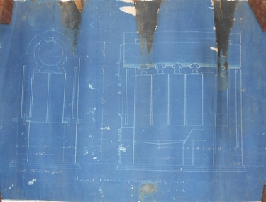
Document - MARKS COLLECTION: PLAN OF HOT WATER HEATER FORTUNA FOR G. LANSELL
... of document: floor plans of ground plan and basement. Plan stamped... of document: floor plans of ground plan and basement. Plan stamped ...Plan of hot water heater, Fortuna Villa, drawn on heavy paper. On top of plan in red ink 'Plan of Hot Water Heater for G. Lansell Esq for Fortuna Villa Sandhurst' Drawings show front, transverse, longitudinal, back and side elevations of heater, also back, side and front elevation of individual water heaters, including one with ornate screen. On bottom of document: floor plans of ground plan and basement. Plan stamped on RH bottom: William C. Vahland, Architect, Sandhurst.bendigo, house, fortuna villa -
 Glen Eira Historical Society
Document - Japanese School of Melbourne
... School of Melbourne Planning Brief document draft February 1984.../The Japanese School of Melbourne Planning Brief document draft February ...Six documents about the Japanese School: 1/The Japanese School of Melbourne Planning Brief document draft February 1984 to the City of Caulfield. Brief includes background of school, current educational standards of school and structure, future plans, including forecast of future student numbers, request to use prefabricated rooms. Also plans for new building and room alterations. Includes appendice which has current and projection graph of students attending. Period covered: January 1968-February 1984 (17 pages). 2/Fourteen page school prospectus, which includes history and location, term dates, school hours, curriculum subjects, teachers qualifications, health department approval and enrolment list. Also includes Division of School Duties, school educational aims and guidance priorities. Period covered: 07/09/1968-13/05/1986. 3/An 11/11/1988 Melbourne Development and Prospectus for the Japanese School of Melbourne, includes purpose of school, development options, planning brief, construction time, and development program. Includes seven plans and maps of school location and bus routes (14 pages). Prepared for the City of Caulfield on its request. 4/List of representatives of the Japanese School of Melbourne that met with City of Caulfield councilors on 23/11/1988. 5/Black and white photo of 'Ian Rob with Japanese students September 1991', six students included. 6/Colour photograph of 'Mayor Ed Biggs with Japanese students February 1992', thirteen adults and young people included.japanese school of melbourne limited, japanese school, caulfield, holy cross catholic, holy cross school, ellington school, keeron street, mockridge stahle and mitchell architects, architects, secondary schools, primary schools, playgrounds, hawthorn road, caulfield south, yaji hidero, japanese community, yazaki yasuo, morita hiroshi, teachers, bloink des, stokes tony, building surveyors, japanese supplementary school of melbourne, school committees, libraries, school houses, brick, bloink clarke harding consulting architects group, anthony stokes and assoc. building surveyors and town planners, rob ian, biggs ed mayor -
 Bendigo Historical Society Inc.
Document - MCCOLL, RANKIN AND STANISTREET COLLECTION: INDENTURE GOLD MINING LEASE CROWN LAND 11197 ALICE PEEL, 8th July 1945
... 6 page indenture document plus plan, between King George... page indenture document plus plan, between King George VI ...6 page indenture document plus plan, between King George VI and Alice Peel Executrix of the Will of Edward Peel, deceased., dated 8th July, 1945. Lease number 11197, total area of 11 acres, 3 roods, 15 perches. Leases shown on plan: 1197, 1198, 11062, 10690, 11141, 11075. Cemetery reserve shown. Streets: Gladstone Street, Adam Street, Houston Street, Fletcher Street, Honeybone Street, Key on plan shows depths correlated to colours. On back of document history of ownership of lease shown - Deborah Gold Mines No Liability, dated 1946, and 1950.bendigo, mining, lease 11197 bendigo. edward peel, alice peel, edward pell, gladson, adam, huston fletcher and honeybone streets. -
 Bendigo Historical Society Inc.
Document - MARKS COLLECTION: PLANS AND INSTRUCTIONS FOR DUPLEX SAFETY BOILER
... 4 documents. Two plans showing measurements and details...BENDIGO Mining duplex safety boiler 4 documents. Two plans ...4 documents. Two plans showing measurements and details of Duplex Safety Boiler. Plans are drawn on dark blue paper, backed with material. A. On bottom of plan 'Sectional elevations of Duplex Safety Boiler New York 1881' B. On bottom of plan 'Plan for 50 hp Duplex Safety Boiler, ten 5ft sections' C. and D. Accompanying plans are two pages of instructions 'Directions for setting a Duplex Safety Boiler'. Written instructions in white pen on dark blue paper ( difficult to read, some faded ) 12 steps are outlined, with remarks at the bottom of the second sheet. This boiler could have been used in a Lansell mine ? (further research required).bendigo, mining, duplex safety boiler -
 Bendigo Historical Society Inc.
Document - MCCOLL, RANKIN AND STANISTREET COLLECTION: GOLD MINING LEASE NORTH DEBORAH MINING COMPANY, 6th May, 1941
... 6 page indenture document plus plan, between King George... page indenture document plus plan, between King George VI ...6 page indenture document plus plan, between King George VI and North Deborah Mining company, no liability, Parish of Sandhurst, dated 6th May 1941. Lease number 11146 Bendigo. ' all that piece of land above a depth of one hundred feet below the surface of the land delineated and coloured yellow' Signed by J. Stanistreet, manager. Plan shows excised area in pink. Excised below 100ft shown in yellow ( lease 11146 ) On top of plan ' Mining district of Bendigo, County of Bendigo, Parish of Sandhurst. Area section has been amended to show 1 rood, 14 perches. Leases on plan : No. 9988, 11013, 11062, 11033, 11146, 10753, 11020. Streets: Sullivan Street, Hargreaves Street, Violet Street, Queen Street, King Street. Railway line shown. Scale 8 chains to 1 inch.bendigo, mining, north deborah mining company, north deborah mine, j stanistreet, sullivan heargreaves, queen, king streets. -
 Bendigo Military Museum
Photograph - Visit by the Chief of the General Staff to the Army Survey Regiment, Fortuna, Bendigo, 1979
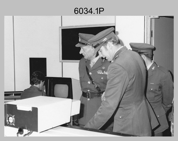
... aero triangulation planning documents. CAPT Don Maskew... CB; OC MAJ Peter Eddy discuss aero triangulation planning ...This is a set of 14 photographs of a visit to the Army Survey Regiment, Fortuna, Bendigo on the 5th of June 1979 by the Chief of the General Staff (CGS) Lieutenant General Sir Donald Dunstan AC, KBE, CB. He was accompanied by his wife. They were escorted through the production areas of the Army Survey Regiment by the CO LTCOL Bob Skitch. Lieutenant General Sir Donald Dunstan AC, KBE, CB was an esteemed Australian Army officer, who was CGS from 1977 to 1982. Upon retirement from the Army in 1982, he was appointed to the position of Governor of South Australia from 1982 to 1991. LTCOL Bob Skitch was the CO of the Army Svy Rgt from 1976 to 1980. Also featuring in these photos is MAJ Peter Eddy, who was the OC of Air Survey Squadron. He was later promoted to LTCOL and was CO of the Army Svy Rgt from 1981 to 1982. See item 6035.9P for photos of the CGS’s presentation of the Defence Force Service Medal to four recipients.This is a set of 14 photographs of a visit by the Chief of the General Staff to the Army Survey Regiment Fortuna, Bendigo on the 5th of June 1979. The photographs were printed on photographic paper and are part of the Army Survey Regiment’s Collection. They were scanned at 300 dpi. .1) - Photo, black and white, 1979. Tour of Air Survey Squadron. L to R: unidentified, LTGEN General Sir Donald Dunstan AC, KBE, CB; OC MAJ Peter Eddy, unidentified. .2) - Photo, black and white, 1979. Tour of Air Survey Squadron. LTGEN General Sir Donald Dunstan AC, KBE, CB; views 3D stereoscopic aerial photography on a Zeiss (Jena) Stecometer. OC MAJ Peter Eddy is on his right. .3) - Photo, black and white, 1979. Tour of Air Survey Squadron. L to R: unidentified, CO LTCOL Bob Skitch, OC MAJ Peter Eddy, LTGEN General Sir Donald Dunstan AC, KBE CB viewing an aerial photograph. WO1 Brian Mead and others are operating a Wild PUG4 point transfer device. .4) - Photo, black and white, 1979. Enlargement of photo .3). Tour of Air Survey Squadron. L to R: unidentified, CO LTCOL Bob Skitch, OC MAJ Peter Eddy, LTGEN General Sir Donald Dunstan AC, KBE CB viewing an aerial photograph. .5) - Photo, black and white, 1979. Tour of Air Survey Squadron. LTGEN General Sir Donald Dunstan AC, KBE, CB; and unidentified technician view 3D stereoscopic aerial photography on a Wild B8 stereo plotter. .6) - Photo, black and white, 1979. Tour of Air Survey Squadron. L to R: OC MAJ Peter Eddy LTGEN General Sir Donald Dunstan AC, KBE CB; CO LTCOL Bob Skitch, view the output of a verification plot on an AUTOMAP 1 Gerber 1442 drum plotter. .7) - Photo, black and white, 1979. Tour of Air Survey Squadron. L to R: CO LTCOL Bob Skitch, unidentified aide de camp officer, LTGEN General Sir Donald Dunstan AC, KBE CB; OC MAJ Peter Eddy discuss aero triangulation planning documents. CAPT Don Maskew in background. .8) - Photo, black and white, 1979. Tour of Cartographic Squadron. L to R: CPL Dennis Learmonth, acting OC CAPT Bob Roche, CAPT Eddy Schulze, LTGEN General Sir Donald Dunstan AC, KBE CB; SSGT John ‘JB’ Barrie discuss cartographic map compilation procedures .9) - Photo, black and white, 1979. Tour of Cartographic Squadron. L to R: Tech WO WO1 Roger Rix, acting OC CAPT Bob Roche, CAPT Eddy Schulze, unidentified visitor, Mrs Dunstan with examples of map products. .10) - Photo, black and white, 1979. Tour of Cartographic Squadron. L to R: CPL Terry Danger, CO LTCOL Bob Skitch, LTGEN General Sir Donald Dunstan AC, KBE CB; discuss terrain embossing (hill shading) procedures. .11) - Photo, black and white, 1979. Tour of Cartographic Squadron. L to R: CO LTCOL Bob Skitch, LTGEN General Sir Donald Dunstan AC, KBE CB; acting OC CAPT Bob Roche, SSGT Dick Manley, CAPT Don Maskew and CAPT Steve Cooper in background. SPR Cheryl Lofthouse is retouching blemishes on a map separation film negative. .12) - Photo, black and white, 1979. Tour of Lithographic Squadron. L to R: CAPT Stan Vote, unidentified aide de camp officer, CO LTCOL Bob Skitch, LTGEN General Sir Donald Dunstan AC, KBE CB; MAJ Sam Schwartz EXCH-US, LT John Harrison discuss bulk map printing processes with an Ultra-MAN-III Printing Press. .13) - Photo, black and white, 1979. Officers Mess L to R: LTGEN General Sir Donald Dunstan AC, KBE CB; with CO LTCOL Bob Skitch. .14) - Photo, black and white, 1979. Officers Mess L to R: MAJ Peter Eddy, LTGEN General Sir Donald Dunstan AC, KBE CB..1P to .14P – no annotationsroyal australian survey corps, rasvy, army survey regiment, army svy regt, fortuna, asr -
 Federation University Historical Collection
Document, Establishment of the Ballarat School of Mines, 1870, 1870
... Correspondence and planning documents relating... Correspondence and planning documents relating to the setting up ...The Ballarat School of Mines was the first site of technical edducation in Australasia. It is now a predecessor institution of Federation University Australia. It's first president was Redmond Barry.Correspondence and planning documents relating to the setting up of the Ballarat School of Mines. it includes tenders for contractors for the refurbishment of the former Ballarat Circuit Court. .1) Rules for the pupils of the Mining School at Zurickau, 18/11/1870 (not translated by Emanuel Steinfeld, perhaps by W. Henderson) .2) Regulations of the Mining Academy at Frieberg, 18/11/1870 .3) Einrichtungen, Freiberg, 1870 (written in German) .4) Letter from Somerville Learmonth of Ercildoun to Harrie Wood, Clerk of the Board of Mines Ballarat, accepting a position as one of three trustees of the Ballarat School of Mines, along with Redmond Barry and R.H. Bland, 08/01/1870 .5) Printing order with Robert Wreford, 26/01/1870 .6) H. Waymouth to Mr Bickett re the Ballarat School of Mines, 1780 .7) Letter from R.H. Bland of Clunes to Harrie Wood of the Ballarat Mining Board, 27/01/1870 .8) Letter from Somerville Livingstone Learmonth of Ercildoun to Harrie Woods of the Ballarat Mining Board refusing the offer to be a Trustee of the Ballarat School of Mines, 28/01/1870 .9) Minutes of the meeting of the Ballarat School of Mines Executive Council, 05/02/1870 and Correspondence from Harrie Wood to J. Warrington Rogers re the lease of the building for the Ballarat School of Mines, 21/01/1870 .10) Chief Secretary's Office to Ballarat Mining Board re Life Membership of the Ballarat School of Mines, 02/02/1870 .10b) Letter from Redmond Barry, Carlton Gardens, Melbourne re the visit of the Governor of Victoria to the Ballarat School of Mines, 04/02/1870 .12) Letter from Charles Pucke on behalf of Mr McCulloch to H, Ainswood, Secretary of the Ballarat Mining Board, 11/07/1870 .13) Correspondence from Henry Rosales of Walhalla (Chairman of the Gippsland Mining Board) to James Baker of the Ballarat School of Mines, 28/12/1870 .11) Meeting of the Executive Council, Bickett, Eddy Downes, 08/02/1870 .14) Letter from John Phillips, contract surveyor of St Arnaud to Mr Newman, Vice-President of the Ballarat School of Mines, 15/12/1870 .15) Articles ordered and obtained for the Ballarat School of Mines, 03/01/1870 .16) Telegram from John Lewis of Clunes to the Ballarat School of Mines. .16b) Quote from painter Thomas Robson for painting the Ballarat School of Mines, 05/06/1870 .17) Note from Duncan Gillies to Harrie Wood re grant for the Ballarat School of Mines, 05/06/1870 .18) Correspondence re Grant to the Ballarat School of Mines, Duncan Gillies, 04/07/1870 .19) Correspondence concerning the Ballarat School of Mines from F. Valient to Harrie Wood, 14/05/1870 .19b) Correspondence from Somerville Livingstone Learmonth to Harrie Woods - an apology for a meeting with Judge Rogers, 23/05/1870 .20) Letter from R.H. Bland to Harrie Wood, 15/07/1870 .22) Telegraph from J. Warrington Rogers to Harrie Wood of the Ballarat Mining Board concerning tenders for the Ballarat School of Mines, which was established in 1870. .23) Letter from Ballarat Mining Board to Judge Warrington Rogers, 31/05/1870 .24) Telegraph to Harrie Wood of the Ballarat Mining Board from J. Warrington Rogers concerning Sir Redmond Barry. A note at the bottom of the telegraph notes ‘This telegram has been delayed through repairs on line. .25) Letter on Melbourne Public Library Letterhead from librarian Augustus Fulk, 05/08/1870 .26) Letter from R.H. Bland to Harrie Wood, 30/05/1870 .27) Letter from Robert Park re alteration of the former Ballarat Court House for use as the Ballarat School of Mines, 05/05/1870. .28) Letter from G. Whitty re painting of the former Ballarat Court House for use as the Ballarat School of Mines, 04/05/1870 .29) Letter from William Newman re plastering of the former Ballarat Court House for use as the Ballarat School of Mines, 05/05/1870 .30) Letter from Charles A. Abbott re teaching Mechanical Drawing at the Ballarat School of Mines, 04/04/1870 .32) Letter from Redmond Barry to the Ballarat School of Mines, 07/1870 .31) National Insurance Company of Australia insurance for the Ballarat School of Mines (former Ballarat Circuit Court), 01/05/1870 .33) Letter from R.H. Bland to Harrie Wood, 09/1870 .34) Letter from Somerville Livingstone Learmonth to Harrie Wood, 06/09/1870 .35) Letter to the Chief Secretary to the Ballarat School of Mines Library & Museum, 30/11/1870 .36) Parliament house (Kitto) to the Ballarat Mining Board, 15/11/1870 .37) H. de la Poer Wall of Grenville College to R.W. Newman of the Ballarat School of Mines, 27/04/1971 .38) W.H. Odgers to the Ballarat East Town Clerk, 20/05/1870 .39) Correspondence to the Borough of Clunes for the Ballarat Mining Board requesting a grant to set of a school of mines at Ballarat. 25/03/1870 .40) Surveyor to Harrie Wood, Mining Registrar, 27/04/1870 .40) Letter to Judge Warrington Rogers re the contractor's account for satisfactory completion of work on the Ballarat School of Mines, 11/07/1870 .43) Desks for the Ballarat School of Mines by Henry Gough, 1870 .44) Ballarat Star Office to James Baker of the Ballarat School of Mines, 1870ballarat school of mines, frieberg mining academy, learmonth, somerville learmonth, wreford, weymouth, bland, rivet henry bland, barry, redmond barry, mcculloch, phillips, john phillips, robson, gillies, duncan gillies, warrington rogers, melbourne public library, whitty, robert park, newman, william newman, charles abbott, janes baler, de la poer wall, odgers, louis le gould, wood, harrie wood, steinfeld, emanuel steinfeld, ainswood, pucke, thomas robson, telegraph, telegram, state library of victoria, fulks, architecture, reed, j. reed, rosales, abbott, charles a. abbott, mechanical drawing, drawing, ballarat circuit courthouse, ballarat courthouse, national insurance company of australia, grenville college, chief secretary's office, robert sandon, school of mines, schools of mines, establishment, ballarat school of mines establishment, germany, london, ercildoun -
 Eltham District Historical Society Inc
Document - Report, Paul Jerome, Advisory Committee on a Proposed Convenience Centre and an Alternative Shire Proposal - Eltham Gateway Community Precinct Concept Plan - 895 Main Road Eltham, October 1997
... the requirements of the planning scheme which is a statutory document... the requirements of the planning scheme which is a statutory document ...On 15 December 1994 the former Shire of Eltham ceased to exist following the Liberal Kennett Government local council amalgamations. A new Nillumbik Shire Council was established with unelected commissioners appointed. That Council sold the former Eltham Shire Council Offices and land at 89S Main Road Eltham to Dallas Price Homes Pty. Ltd. the sale being conditional upon the granting of a planning permit for a petrol station/convenience store, fast food and video outlet. The sale was conditional that if the permit was not granted by 30 August. 1997, the contract could be avoided by either the purchaser or the vendor. The proposed development consisted of a petrol station with undercover fuelling facilities, convenience shopping, a drive through service facility for fast food, an 80 seat cafe, automated banking, a children's play area and retail space. In addition, the proposal included a 200 square metre community facility for Council use, provision of on site carparking over 2 levels for 83 vehicles, and advertising signage. An Advisory Committee consisting of Dimitry Reed and Margaret Pitt was appointed under Section 151 of the Planning and Environment Act 1987 to hear submissions on the proposal to develop the land at 895 Main Road Eltham, the site of the former Eltham Shire Offices. In September 1996, two applications were made by Contour Consultants Australia Pty Ltd on behalf of Dallas Price Homes Ply Ltd, to Nillumbik Shire Council. After extensive notification, the Council received 213 objections and a petition of over 1400 signatures. On October 9, 1996, Nillumbik Shire Council issued Notices of Decision to Grant Permit on Applications number 96/03376 and 96/0377 for the use and development of the land as a convenience Centre consisting of a petrol station, convenience store, cafe/takeaway food premises, a retail facility and a community facility, with associated advertising signs. Objectors to the proposals lodged Planning Appeals number 96/40724 and 96/40812 with the Administrative Appeals Tribunal on November 1, 1996. The grounds of appeal can be summarised as: inappropriate development, insufficient carparking, traffic and access issues, unsatisfactory design, inadequate permit conditions, the proposal being out of character with the area. and being contrary to the purpose and orderly development of the Eltham Town Centre, excessive noise, lack of consultation and unsuitable signage. On November 13, 1996, the Minister for Planning and Local Government directed the Registrar of the Administrative Appeals Tribunal. under Section 41 (1) (a) of the Planning Act 1980, to refer the Appeals to the Governor in Council for determination without a hearing or recommendation by the Tribunal. The Minister for Planning and Local Government called in the Appeals as he considered that they raised major issues of policy relating to the facilitation of development in accordance with the objectives set out in Section 4 of the Planning and Environment Act 1987, and that determination of the Appeals could have a substantial effect on the achievement of these planning objectives. The Minister required the Advisory Committee to consider the planning merits of the proposed use and development, and to address the issues raised in the objections. The Advisory Committee was required to produce a report providing: • The Committee's response to the matters detailed; • Relevant supporting information for the Advisory Committee's recommendation; and • A description of the proceedings conducted by the Advisory Committee and a list of those consulted or heard by the Committee. In March 1997, elections were held in the Shire of Nillumbik and the view of the new Council to this proposal differed from the view held by the earlier Council Hence the Submission made to the Committee by the Shire was against the decision by the Shire of Nillumbik to issue the Notices of Decision to Grant a Permit. The Recommendations of the Advisory Committee were: i. The cafe and take away food premises are as of right uses and are therefore allowable, but that shop and petrol station are unacceptable uses. A community facility is a discretionary use and is acceptable. ii. A development of the type and scale proposed is totally inappropriate for this land and that the Applications number 96/03376 and 96/0377 for the use and development of the land as a convenience Centre consisting of a petrol station, convenience store, café/takeaway food premises, a retail facility and a community facility, with associated advertising signs, be refused. iii. The land should be rezoned for public purposes and should remain in the community's ownership for community use. Following this, the Minister for Planning and Local Government, the Hon. Robert Maclellan, appointed Mr. Paul Jerome as an Advisory Committee under section 151 of the Planning and Environment Act 1987 to consider a Convenience Centre and an alternative proposal by Iha Shire of Nillumbik being the Eltham Gateway Community Precinct Concept Plan for the site of the former Shire of Eltham municipal offices at 895 Main Road, Eltham. In summary, the terms of reference for the Advisory Committee required it to: • consider the merits of the Council proposal • examine the merits of both proposals in terms of net community benefit • address the report of the previous Advisory Committee on the Convenience Centre proposal The Advisory Committee inspected the site and considered all the material before It including submissions made by all parties to the previous Advisory Committee and correspondence received by the Department of Infrastructure both before and after that Committee submltted its report. The Advisory Committee also held discussions with the following people: • Cr. Robert Marshall • Cr. Margaret Jennings • Cr. Lex de Man • Mr. Dallas Howgate of Dallas Price Properties, also Dallas Price Homes • Mr. Barry Rochford, CEO, Shire of Nillumbik • Ms. Yvonne Rust, Planning Officer, Shire of Nillumbik • Mr. Gregory Burgess, Architect of the Eltham Library and of Council’s Community Precinct Concept Plan • Mr. Jim Connor representing Mrs Thelma Barkway of the Eltham Senior Citizens Club Having considered all the material before it, the Committee arrived at two basic conclusions. First, the DPP proposal should be rejected because, on its merits, It does not sufficiently satisfy the requirements of the planning scheme which is a statutory document. The planning scheme requires that, before making a decision on the permit applications for the DPP proposal, a range of matters must be considered. It follows that consideration of these matters should Influence the decision. These matters include local policies relating to character and amenity. In particular, these policies seek • to conserve and enhance the bushland/country atmosphere, artistic heritage and strong sense of community of the Eltham Town Centre by ensuring that the design and height of any new development is sympathetic to existing buildings • to achieve a pleasing physical environment within the Eltham Town Centre by encouraging a high standard of architecture and urban design • to encourage Improvement to pedestrian amenity through such facilities as open and shattered rest areas and meeting places, crossing facilities, pedestrian arcades, pedestrian links to car parks and pedestrian weather protection • to reduce conflict between vehicular traffic and pedestrian flows, and • to encourage pedestrian thoroughfares It is submitted, as set out In the main body of this report, that the DPP proposal fails substantially to meet these policies and In so doing does not merit the exercise of discretion In Its favour with the Issuing of a permit. This finding is not offset by the investment and employment attributes of the proposal. They do not override the need to comply with the planning scheme. Second, the Council proposal, on Its own merits, substantially meets all statutory requirements applicable to this site with a possible reservation about car parking and traffic management which need further definition and assessment as the concept is refined. The Council proposal, however, has a serious weakness in that Its financial viability has not been adequately tested. The Committee refers to 'financial' rather than 'commercial' viability in recognition that Council owns the land and may enter into a range of agreements and partnerships to realise its concept some of which may be truly commercial and some of which may involve an element of subsidy arising from Council's involvement as a public body acting on behalf of its community. The Committee concludes that Council should be given the opportunity, within a reasonable timeframe to establish the financial feasibility of its concept and should develop a strategy for the future of Its land asset at 895 Main Road in the event that Its concept for the site cannot be realised. 895 main road, advisory committee, dallas price homes, eltham, eltham shire office, nillumbik shire council, planning application, administrative appeals tribunal -
 The Beechworth Burke Museum
Photograph, 1960s
This photograph was taken in the 1960s at Lake Sambell Caravan Park, visible in the photograph are individual caravan sites with electricity outlets, a large single-story building, a parked car, and two caravans partially obstructed by trees. Lake Sambell Caravan Park opened in 1959 owing to the work of R.E. Carter, Beechworth Shire engineer from 1954-63. Carter advocated for improvements to the lake and surrounding area in order to encourage tourism in Beechworth. The opening of the caravan park was part of many improvements to Lake Sambell made in this period by Carter including: the swimming pool in 1961, water skiing and boating facilities, and increased lake surface in 1964. These improvements were financed mainly by grants from the Tourist Development Authority. The popularity of caravanning in Australia exploded during this post-war period of the late 1950s and 1960s. This popularity was driven by multiple factors, including: the stopping of fuel rations, the accessibility of car ownership through the manufacturing of affordable cars, technological developments in caravan design, and the increase in prosperity and leisure time for many Australians. Facilities such as electrical outlets to power caravans are present in this photograph of Lake Sambell Caravan Park. Lake Sambell is an artificial lake that was developed on the previous site of the Rocky Mountain Mining Company workings and was officially opened by Minister for Lands, Mr Baily, on October 5, 1928. The disused and unattractive remains of the mine were converted into a recreational area intended for swimming, boating, and fishing. The lake is named after Mr L.H. Sambell, shire engineer and secretary of the Forward Beechworth Committee, who advocated for the enhancement of Beechworth into a tourist destination and was central to the planning and establishment of the lake. This photograph is of historic and social significance in documenting the enhancement of the Lake Sambell area overseen by R.E. Carter and providing insight into caravanning during the 1960s in Australia. Caravanning was extremely popular in Australia during the late 1950s and 60s due to multiple social and economic factors including the stopping of fuel rations, the accessibility of car ownership through the manufacturing of affordable cars, technological developments in caravan design, and the increase in prosperity and leisure time for many Australians. Black and white rectangle photograph printed on photographic paper and unmounted.Reverse: 3538/ [logo back printing KODAK/ VELOX/ PAPER] / C798lake sambell caravan park, lake sambell, lake sambell 1960s, lake sambell fishing, lake sambell boating, lake sambell swimming pool, r.e. carter, l.h. sambell, tourist development authority, caravanning 1960s, caravan electricity outlets, caravan park, forward beechworth committee, rocky mountain mining company, lake caravan park, caravan mid 20th century, beechworth tourism, travel in the 1960s, holiday 1960s -
 Orbost & District Historical Society
folder of documents, 1992-1993
Orbost Aero Club began in 1969 with Basil Dowie as Chair, David Nixon as Secretary/Treasurer. The group went into recess from 1977-1991 closing in 1997. The mid 1960s were boom years in flying training in Australia and the number of Aero Clubs grew rapidly. The Club played a significant role in the establishment of the small airport at Marlo and in the ongoing operation and development of the airport over the years particularly for patient transfer by aerial ambulance. The Orbost Aero Club Club played a significant role in the establishment of the small airport at Marlo and in the ongoing operation and development of the airport over the years.A manila folder containing plans and approvals for the airport terminal building at Marlo Airport. On a label on front - AIRPORT TERMINAL BUILDING 1992/1993 plans & approval ORBOST AERO CLUBorbost-aero- club marlo-airport -
 Orbost & District Historical Society
book / document, Shire of Orbost Planning Schemes March 1989, 1989
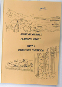
This document was produced in 1989 for Orbost Shire Council. It ccovers the area s of Orbost, Mallacoota, Cann River and Newmerella and includes urban and non-urban areas.This document is a useful reference tool.A book with a brown front cover with a plastic over-sheet and plastic binding.On the cover are b/w drawings of rural landscapes, trees and the coast. It is titled SHIRE OF ORBOST PLANNING STUDY Part 1 Strategic Overviews, March 1989.orbost-planning -
 Orbost & District Historical Society
documents, Original - 5.8.1912 - 8.7.1914
These photocopied documents were used in the Orbost Secondary College Library. In the latter half of 1913 working bees, concerts, balls, sports carnivals and collections were held to raise funds before The Hospital Movement felt they were ready to ask The Public Health Department for plans for a suitable building (2000 -2500 pounds) for use as a permanent hospital in Orbost. A Hospital Committee was formed and despite several a major setback (the president died in November 2013), continued to hold many public events in order to raise the funds necessary. Orbost Hospital was officially opened in 1930. ( Read Margaret Holland's "Orbost Hospital: History, Personalities and Stories.) These documents are a useful research tool on the history of Orbost Regional Health.A stapled collection of photo-copied minutes from the fund-raising committee for the Orbost Hospital.orbost-hospital health-fund-raising -
 Orbost & District Historical Society
plans, June 15 1931
The Rising Sun Reef first opened, at Bonang in 1868.– at Goongerah Creek south west of Bonang. William Hunter (1893-1971), resident of Tatura and Mallacoota was a soldier, surveyor and amateur naturalist. This document is a useful research tool.Plans and application for the "Rising Sun Goldmine". Tery are on foolscap sized white paper with black text. hunter-william gold-mining rising-sun-goldmine bonang