Showing 17547 items matching "plenty-hotel"
-
 Eltham District Historical Society Inc
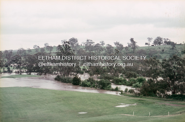
Slide, Floodwater, west from Clubhouse of Rosanna Golf Club, Lower Plenty, November 1971, 1971
Many parts of Melbourne flooded including Rosanna Golf Club, Lower Plenty in Novembere 1971. Many surburban roads, including the new south-eastern freeway were cut by flood waters. Here the level of the Plenty River floods onto the golf course. 35 mm colour positive transparency Mount - Agfacolor Service (Blue)floods, lower plenty, rosanna golf club, flooding, plenty river -
 Tatura Irrigation & Wartime Camps Museum
Photograph - original, A. Gye Photographer, Hogans Commercial Hotel and Store, late 1880's
Original sepia photograph of Thomas Hogan's Commercial Hotel and Cash Drapery Store. Signs on building - Hogan's Commercial Hotel, Cash Drapery, cheap boot and shoe ware house. London House, sign post made from gum tree.Sepia original photograph of many men, women, children, horses and buggies in front of Hogan's Commercial Hotel and store.on back: Thomas Hogan's Commercial Hotel and Cash Drapery Store, Ross Street, Tatura.hogans commercial hotel -
 Charlton Golden Grains Museum Inc
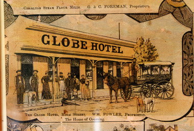
Photograph - Lithograph, Rider & Mercer, Views of Charlton, c.1988
The Globe Hotel built 1874-75 for John Walsh was destroyed by fire and rebuilt in ?. Leased by William Fowler in 1891 who had been in Charlton since 1877. Copy of Lithograph of Charlton buildings. Large sign on building 'GLOBE HOTEL'. Eight men and women and three children standing in front of building, a horse and wagon also in front of the building with a man standing in the wagon holding the reins. Two greyhounds on the road.The Globe Hotel, High Street. WM. Fowler, Proprietor. The Home of Coursing.lithograph, globe hotel, fowler william, walsh john -
 Greensborough Historical Society
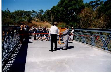
Photograph - Digital Image, Anne Paul, Opening of restored Old Lower Plenty Bridge 2001, 14/03/2001
The opening of the restored Old Lower Plenty Bridge, opened on 14/03/2001 by the Minister for Environment and Conservation Sherryl Garbutt MLA and Mayor of Banyule Cr Dale Peters. The project was jointly funded by Banyule Council and Parks Victoria. The restored bridge is the oldest remaining bridge in the former Shire of Eltham and forms part of the Plenty River Trail.Digital copy of colour photographlower plenty, lower plenty bridge, sherryl garbutt, dale peters, banyule council, parks victoria -
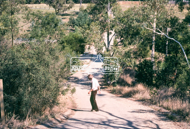
 Eltham District Historical Society Inc
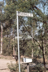
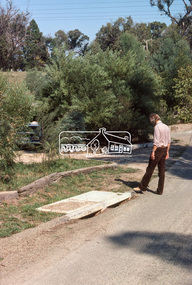
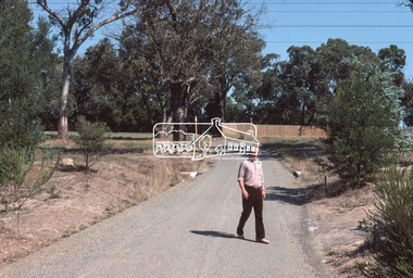
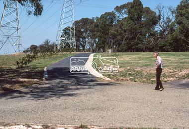
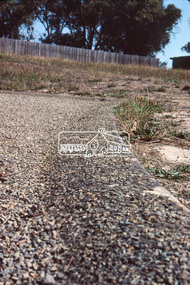
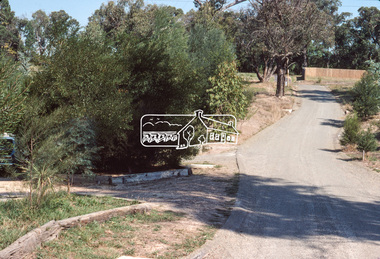
Photograph, Riverhill Drive intersection with Rosehill Road, Lower Plenty, c.March 1981, 1981
Infrastructure features used by Eltham Shire Council in the construction of Riverhill Drive, Lower Plenty, c.March 198135mm colour positive transparency Kodak Kodachrome cardboard mountbell, g. stevens, infrastructure, lower plenty, riverhill drive, road construction, rosehill road, streets -
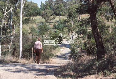 Eltham District Historical Society Inc
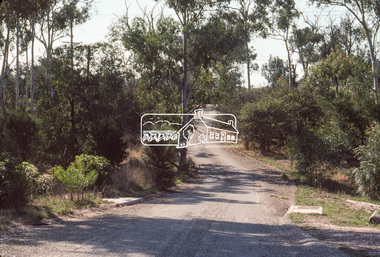
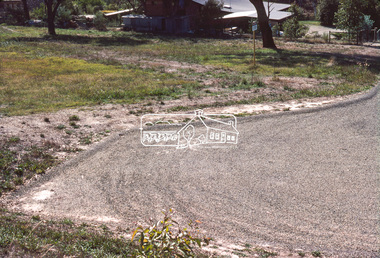
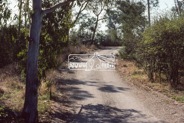
Photograph, Looking down Riverhill Drive from intersection of Rosehill Road, Lower Plenty, c.March 1981, 1981
Infrastructure features used by Eltham Shire Council in the construction of Riverhill Drive, Lower Plenty, c.March 198135mm colour positive transparency Kodak Kodachrome cardboard mountinfrastructure, lower plenty, riverhill drive, road construction, rosehill road, streets -
 Eltham District Historical Society Inc
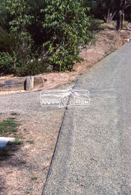
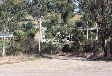
Photograph, Width and stand of construction, Riverhill Drive, Lower Plenty, c.March 1981, 1981
Infrastructure features used by Eltham Shire Council in the construction of Riverhill Drive, Lower Plenty, c.March 198135mm colour positive transparency Kodak Kodachrome cardboard mount Also Kodak Enlargement of slide 27 x 35.5 cminfrastructure, lower plenty, riverhill drive, road construction, streets -
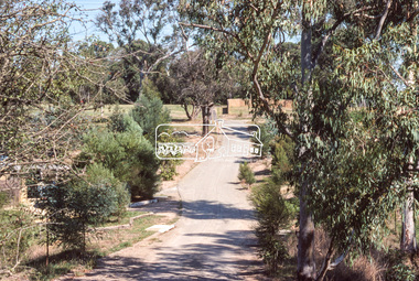 Eltham District Historical Society Inc
Photograph, Curvilinear design, Riverhill Drive, Lower Plenty, c.March 1981, 1981
Infrastructure features used by Eltham Shire Council in the construction of Riverhill Drive, Lower Plenty, c.March 198135mm colour positive transparency Kodak Kodachrome cardboard mountinfrastructure, lower plenty, riverhill drive, road construction, streets -
 Eltham District Historical Society Inc
Photograph, Vegetation, Riverhill Drive, Lower Plenty, c.March 1981, 1981
Infrastructure features used by Eltham Shire Council in the construction of Riverhill Drive, Lower Plenty, c.March 198135mm colour positive transparency Kodak Kodachrome cardboard mountinfrastructure, lower plenty, riverhill drive, road construction, streets -
 Eltham District Historical Society Inc
Photograph, Water drainage pits with double side entry, Riverhill Drive, Lower Plenty, c.March 1981, 1981
Infrastructure features used by Eltham Shire Council in the construction of Riverhill Drive, Lower Plenty, c.March 198135mm colour positive transparency Kodak Kodachrome cardboard mountinfrastructure, lower plenty, riverhill drive, road construction, streets -
 Eltham District Historical Society Inc
Photograph, Rollover kerb sprayed and Lilydale topped, Riverhill Drive, Lower Plenty, c.March 1981, 1981
Infrastructure features used by Eltham Shire Council in the construction of Riverhill Drive, Lower Plenty, c.March 198135mm colour positive transparency Kodak Kodachrome cardboard mountinfrastructure, lower plenty, riverhill drive, road construction, streets -
 Eltham District Historical Society Inc
Photograph, Lilydale topping on final surface, Riverhill Drive, Lower Plenty, c.March 1981, 1981
Infrastructure features used by Eltham Shire Council in the construction of Riverhill Drive, Lower Plenty, c.March 198135mm colour positive transparency Kodak Kodachrome cardboard mountinfrastructure, lower plenty, riverhill drive, road construction, streets -
 Eltham District Historical Society Inc
Photograph, Curvilinear design, Riverhill Drive, Lower Plenty, c.March 1981, 1981
Infrastructure features used by Eltham Shire Council in the construction of Riverhill Drive, Lower Plenty, c.March 198135mm colour positive transparency Kodak Kodachrome cardboard mountinfrastructure, lower plenty, riverhill drive, road construction, streets -
 Eltham District Historical Society Inc
Photograph, Rollover kerb sprayed and Lilydale topped, Riverhill Drive, Lower Plenty, c.March 1981, 1981
Infrastructure features used by Eltham Shire Council in the construction of Riverhill Drive, Lower Plenty, c.March 198135mm colour positive transparency Kodak Kodachrome cardboard mountinfrastructure, lower plenty, riverhill drive, road construction, streets -
 Eltham District Historical Society Inc
Photograph, T-bowl and extended drive, Riverhill Drive, Lower Plenty, c.March 1981, 1981
Infrastructure features used by Eltham Shire Council in the construction of Riverhill Drive, Lower Plenty, c.March 198135mm colour positive transparency Kodak Kodachrome cardboard mountinfrastructure, lower plenty, riverhill drive, road construction, streets -
 Eltham District Historical Society Inc
Photograph, Rollover kerb sprayed and Lilydale topped, Riverhill Drive, Lower Plenty, c.March 1981, 1981
Infrastructure features used by Eltham Shire Council in the construction of Riverhill Drive, Lower Plenty, c.March 198135mm colour positive transparency Kodak Kodachrome cardboard mountinfrastructure, lower plenty, riverhill drive, road construction, streets -
 Eltham District Historical Society Inc
Photograph, T-bowl, Riverhill Drive, Lower Plenty, c.March 1981, 1981
Infrastructure features used by Eltham Shire Council in the construction of Riverhill Drive, Lower Plenty, c.March 198135mm colour positive transparency Kodak Kodachrome cardboard mountinfrastructure, lower plenty, riverhill drive, road construction, streets -
 Eltham District Historical Society Inc
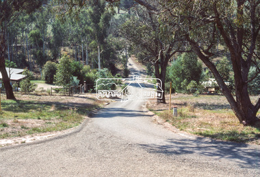
Photograph, Riverhill Drive from T-bowl to Rosehill Road, Lower Plenty, c.March 1981, 1981
Infrastructure features used by Eltham Shire Council in the construction of Riverhill Drive, Lower Plenty, c.March 198135mm colour positive transparency Kodak Kodachrome cardboard mountinfrastructure, lower plenty, riverhill drive, road construction, streets -
 Eltham District Historical Society Inc
Photograph, General view, Riverhill Drive, Lower Plenty, c.March 1981, 1981
Infrastructure features used by Eltham Shire Council in the construction of Riverhill Drive, Lower Plenty, c.March 198135mm colour positive transparency Kodak Kodachrome cardboard mountinfrastructure, lower plenty, riverhill drive, road construction, streets -
 Eltham District Historical Society Inc
Photograph, General view of Riverhill Drive showing pits, Lower Plenty, c.March 1981, 1981
Infrastructure features used by Eltham Shire Council in the construction of Riverhill Drive, Lower Plenty, c.March 198135mm colour positive transparency Kodak Kodachrome cardboard mountinfrastructure, lower plenty, riverhill drive, road construction, streets -
 Eltham District Historical Society Inc
Photograph, Water drainage pits at low point, Riverhill Drive, Lower Plenty, c.March 1981, 1981
Infrastructure features used by Eltham Shire Council in the construction of Riverhill Drive, Lower Plenty, c.March 198135mm colour positive transparency Kodak Kodachrome cardboard mount Also Kodak Enlargement of slide 27 x 35.5 cminfrastructure, lower plenty, riverhill drive, road construction, streets -
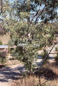
 Eltham District Historical Society Inc
Photograph, Driveway detail, Riverhill Drive, Lower Plenty, c.March 1981, 1981
Infrastructure features used by Eltham Shire Council in the construction of Riverhill Drive, Lower Plenty, c.March 198135mm colour positive transparency Kodak Kodachrome cardboard mountinfrastructure, lower plenty, riverhill drive, road construction, streets -
 Eltham District Historical Society Inc
Photograph, Riverhill Drive leadup to Rosehill Road, Lower Plenty, c.March 1981, 1981
Infrastructure features used by Eltham Shire Council in the construction of Riverhill Drive, Lower Plenty, c.March 198135mm colour positive transparency Kodak Kodachrome cardboard mountinfrastructure, lower plenty, riverhill drive, road construction, rosehill road, streets -
 Eltham District Historical Society Inc
Photograph, Riverhill Drive intersection with Rosehill Road, Lower Plenty, c.March 1981, 1981
Infrastructure features used by Eltham Shire Council in the construction of Riverhill Drive, Lower Plenty, c.March 198135mm colour positive transparency Kodak Kodachrome cardboard mountinfrastructure, lower plenty, riverhill drive, road construction, rosehill road, streets -
 Greensborough Historical Society
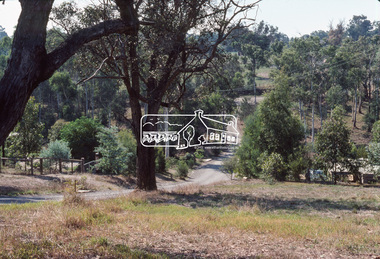
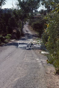
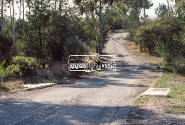
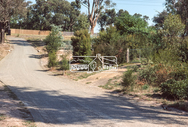
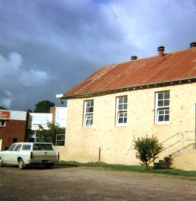
Photographs, Lower Plenty Hall, 1981, 1981_
5 photographs of the exterior of Lower Plenty Hall 1981, taken by Peter Graham, a Shire of Eltham Councillor.5 colour photographs.lower plenty, lower plenty hall, peter graham -
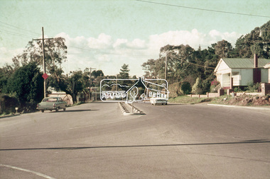 Eltham District Historical Society Inc
Photograph, Looking northeast along Main Road at intersection with Para Road, Lower Plenty, July 1969, 1969
House on right is 122 Main Road, Lower Plenty viewed from intersection of Main Road with Para Road35mm colour positive transparency blue Agfacolour Service plastic mountlower plenty, main road, para road -
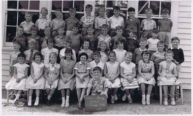
 Greensborough Historical Society
School Photograph - Digital Image, Lower Plenty Primary School LP1295 1963 Grade 6, 1963_
Class photograph from Grade 6 1963 at Lower Plenty Primary School No.1295. Student names are not identified.Digital copy of black and white class photograph.lower plenty primary school, lower plenty state school -
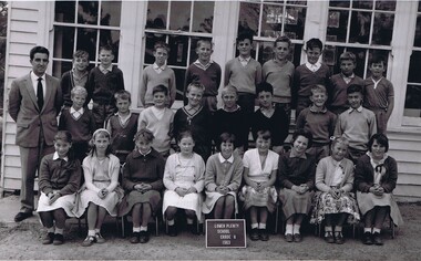
 Greensborough Historical Society
School Photograph - Digital Image, Lower Plenty Primary School LP1295 1961 Grades 3&4, 1961_
Class photograph from Grades 3 and 4 1961 at Lower Plenty Primary School No.1295. Student names are not identified.Digital copy of black and white class photograph.lower plenty primary school, lower plenty state school -
 Greensborough Historical Society
Photograph - Digital Image, Anne Paul, Opening of restored Old Lower Plenty Bridge 2001 - area adjacent, 14/03/2001
The opening of the restored Old Lower Plenty Bridge, opened on 14/03/2001 by the Minister for Environment and Conservation Sherryl Garbutt MLA and Mayor of Banyule Cr Dale Peters. The project was jointly funded by Banyule Council and Parks Victoria. The restored bridge is the oldest remaining bridge in Nillumbik and forms part of the Plenty River Trail. this photograph shows the area adjacent to the bridge on the day of the opening.Digital copy of colour photographlower plenty, lower plenty bridge, sherryl garbutt, dale peters, banyule council, parks victoria