Showing 16882 items matching "plenty-river"
-
 Greensborough Historical Society
Book - Annual Report, Yarra Plenty Regional Library, Annual report 15-16, Yarra Plenty Regional Library, 2016_
Yarra Plenty Regional Library annual report 2015-2016 outlines library staff, programs and finances.55p., colour illus.yarra plenty regional library, yprl -
 Greensborough Historical Society
Book, Melbourne Water, Plenty River Waterway Management Activity Plan 2000, 2000_
This report covers the catchment of the Plenty River from its upper reaches in the Great Dividing Range to the confluence with the Yarra River at Viewbank. It discusses ecological diversity and methods of improving water quality and significant areas of the catchment. Includes a brief history of settlement along the Plenty River.This is a significant plan for the improvement of the Plenty River.207 p., maps, folding maps. Printed on white paper with black spiral binding and clear plastic front cover.plenty river, melbourne water -
 Greensborough Historical Society
Slide - Photograph, John Ramsdale, Plenty River: Slide 104, 1990s
Photograph shows a riverbank with rubbish on the Plenty River.Part of the John Ramsdale collection of slides and audio visual material.Colour photograph scanned from slide.No maker's marks. No caption on slide.plenty river, pollution -
 Greensborough Historical Society
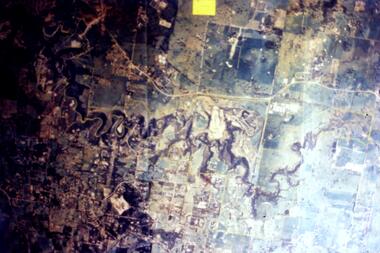
Slide - Photograph, John Ramsdale, Aerial view of Plenty River: Slide 16, 1990s
Photograph shows aerial view of the Plenty River.Part of the John Ramsdale collection of slides and audio visual material.Colour photograph scanned from slide.No maker's marks. No caption on slide.plenty river, aerial photograph -
 Greensborough Historical Society
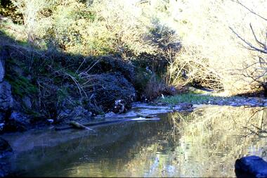
Slide - Photograph, John Ramsdale, Rubbish in Plenty River: Slide 58, 1990s
Photograph shows leaf mulch in Plenty River.Part of the John Ramsdale collection of slides and audio visual material.Colour photograph scanned from slide.No maker's marks. No caption on slide.plenty river -
 Greensborough Historical Society
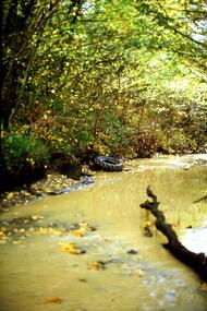
Slide - Photograph, John Ramsdale, Muddy Plenty River: Slide 93, 1990s
Photograph shows a muddy Plenty River with a small creek entering the river. Note the dumped car in background.Part of the John Ramsdale collection of slides and audio visual material.Colour photograph scanned from slide.No maker's marks. No caption on slide.plenty river, pollution -
 Greensborough Historical Society
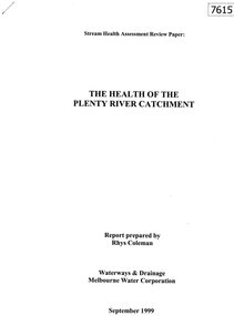
Document - Report, Rhys Coleman, The Health of the Plenty River Catchment 1999, 1999_09
Report prepared by Rhys Coleman for Waterways and Drainage, Melbourne Water Corporation, discusses the health of the Plenty River catchment from upstream of Toorourrong Reservoir, through Whittlesea and Mernda, South Morang and Plenty to Greensborough and confluence with the Yarra River.31 p., tables.plenty river, melbourne water corporation -
 Greensborough Historical Society
Slide - Photograph, John Ramsdale, Plenty River: Slide 15, 1990s
Photograph shows the Plenty River with rubbish, including tyre and fallen branch. This part of the River is on the Montmorency - Greensborough border.Part of the John Ramsdale collection of slides and audio visual material.Colour photograph scanned from slide.No maker's marks. No caption on slide.plenty river, pollution -
 Greensborough Historical Society
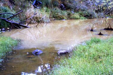
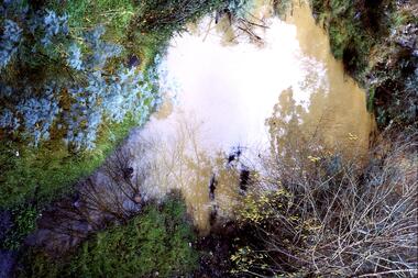
Slide - Photograph, John Ramsdale, Muddy water, Plenty River: Slide 119, 1990s
Photograph is looking down on muddy water in the Plenty River.Part of the John Ramsdale collection of slides and audio visual material.Colour photograph scanned from slide.No caption. Printed maker's mark on slide "Kodak Kodachrome Slide"plenty river -
 Greensborough Historical Society
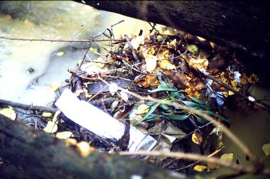
Slide - Photograph, John Ramsdale, Drain into Plenty River: Slide 8, 1990s
Photograph shows a drain or culvert near the Plenty River.Part of the John Ramsdale collection of slides and audio visual material.Colour photograph scanned from slide.No maker's marks. No caption on slide.plenty river, drains, pollution -
 Greensborough Historical Society
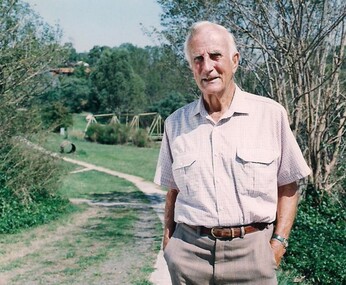
Photograph - Digital Image, Tom Vickers on the Plenty River Trail, 1985_
Tom Vickers on the Plenty River Trail circa 1985.Tom Vickers was a prominent member of the community and a local pharmacist.Digital copy of colour photographvickers family, tom vickers, plenty river trail -
 Greensborough Historical Society
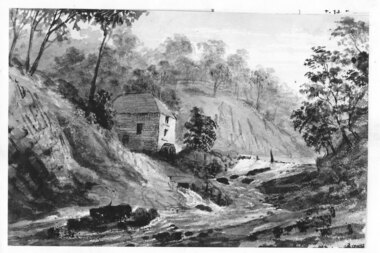
Photograph - Digital image, Mill on the Plenty River, 1870c
Copy of sketch "Mill on the Plenty River", origin unknown. Digital copy of black and white sketch.plenty river -
 Greensborough Historical Society
Photograph - Digital image, Marilyn Smith, On the Plenty River bank near Railway Road Briar Hill, 17/09/2014
On the Plenty River bank near Railway Road Greensborough Digital copy of colour photographrailway road greensborough, plenty river -
 Greensborough Historical Society
Photograph - Digital image, Marilyn Smith, On the Plenty River bank near Railway Road Briar Hill, 17/09/2014
On the Plenty River bank near Railway Road Greensborough Digital copy of colour photographrailway road greensborough, plenty river -
 Heidelberg Golf Club
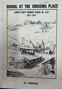
Booklet, W. F. Henderson, School at the crossing place: Lower Plenty Primary School no.1295, 1874-1974, 1973
Centenary publication of Lower Plenty Primary School by W. F. Handerson (Principal 1973). Contains references to Mrs Thomas, Bryn Teg and HGC.24p., illus. lower plenty primary school, bryn teg, mary thomas -
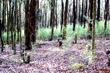 Greensborough Historical Society
Slide - Photograph, John Ramsdale, Head waters of the Plenty River: Slide 108, 1990s
Photograph shows a stand of trees in the head waters of the Plenty RiverPart of the John Ramsdale collection of slides and audio visual material.Colour photograph scanned from slide.No maker's marks. No caption on slide.plenty river -
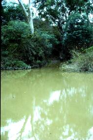 Greensborough Historical Society
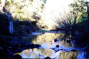
Slide - Photograph, John Ramsdale, Plenty River with European trees: Slide 27, 1990s
Photograph shows the Plenty River at Greensborough with European trees on the bank.Part of the John Ramsdale collection of slides and audio visual material.Colour photograph scanned from slide.No caption. Printed maker's mark on slide "Kodak Kodachrome Slide"plenty river, vegetation -
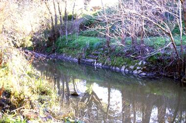 Greensborough Historical Society
Slide - Photograph, John Ramsdale, Plenty river swimming pool, overgrown: Slide 25, 1990s
Photograph shows the concrete steps to the Plenty River pool at Greensborough.Part of the John Ramsdale collection of slides and audio visual material.Colour photograph scanned from slide.No maker's marks. No caption on slide.plenty river swimming pool, swimming pools greensborough, plenty river -
 Greensborough Historical Society
Photograph - Digital Image, Pipes over the Plenty River, 1950c
An early photograph of the Maroondah Aqueduct pipes crossing the Plenty River.Digital copy of black and white photograph.maroondah aqueduct, plenty river -
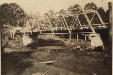
 Greensborough Historical Society
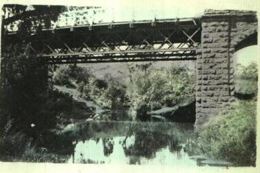
Photograph - Digital image, Old Bridge, Plenty River, 1911c
Photograph of old bridge over Plenty River, date unknown.Digital copy of black and white photograph.plenty river -
 Greensborough Historical Society
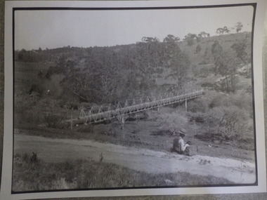
Photograph (copy), Aqueduct over the Plenty River / photographer unknown, 1920c
View of the Maroondah Aqueduct where it crosses the Plenty River in Greensborough.Black and white photograph, enlarged and laminated.maroondah aqueduct, plenty river -
 Greensborough Historical Society
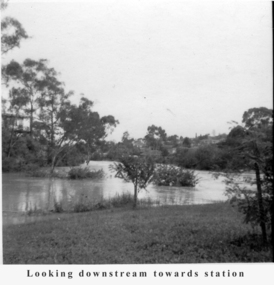
Photograph - Digital Image, Tony Fitton, Plenty River flood 1960s, 1960s
The Plenty River in flood, 1960s. Photos taken by Tony Fitton. Digital copy of black and white photographs.Captions on imageplenty river, floods -
 Greensborough Historical Society
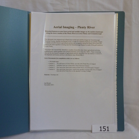
Folder, Aerial Imaging - Plenty River: by Ian Bryant, 2011_11
Investigates early land use along the Plenty River from north of the main aqueduct crossing in Greensborough to south of the golf course in Lower PlentyHistorical features seen from aerial and satellite images of the modern landscape may indicate earlier agricultural land usage.9 x A4 pages of text and colour annotated maps downloaded from nearmap.com.plenty river, ian bryant, lower plenty, greensborough, yallambie park, aerial photography -
 Greensborough Historical Society
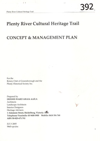
Report, Plenty River Cultural Heritage Trail : Concept & management plan, 2005_07
Prepared for the Rotary Club of Greensborough and Plenty Historical Society by Dennis Ward, this report outlines the heritage importance of the Plenty River Trail around Greensborough.This is an ongoing project by Dennis Ward. This report is an early version of the 2011 Squatters, speculators and settlers: Plenty River Cultural heritage trail. (Item 258) 66 page report, Illus, (some col.) , maps. In red 2-ring binder.Some handwritten notes in last pages.plenty river cultural heritage trail, dennis ward, rotary club of greensborough, plenty historical society, plenty river -
 Greensborough Historical Society
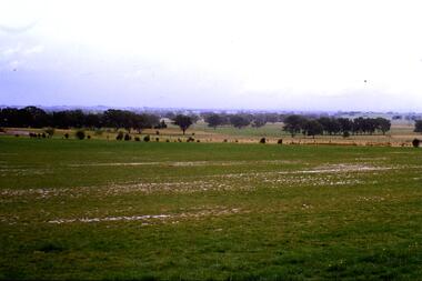
Slide - Photograph, John Ramsdale, Plenty River flood plain: Slide 95, 1990s
Photograph shows water over paddocks; Plenty River flood plain.Part of the John Ramsdale collection of slides and audio visual material.Colour photograph scanned from slide.No maker's marks. No caption on slide.plenty river, plenty river flood -
 Greensborough Historical Society
Slide - Photograph, John Ramsdale, Plenty River Trail: Slide 117, 1990s
Photograph shows a path leading into bushland, this is part of the Plenty River Trail.Part of the John Ramsdale collection of slides and audio visual material.Colour photograph scanned from slide.No maker's marks. No caption on slide.plenty river trail -
 Greensborough Historical Society
Slide - Photograph, John Ramsdale, Run off into Plenty River: Slide 64, 1990s
Photograph shows water over ground. This is run off into the Plenty RiverPart of the John Ramsdale collection of slides and audio visual material.Colour photograph scanned from slide.No caption. Printed maker's mark on slide "Kodak Kodachrome Slide"plenty river -
 Greensborough Historical Society
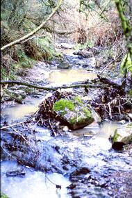
Slide - Photograph, John Ramsdale, Plenty River with low water flow: Slide 54, 1990s
Photograph shows the Plenty River with low water, rocks and fallen branchesPart of the John Ramsdale collection of slides and audio visual material.Colour photograph scanned from slide.No maker's marks. No caption on slide.plenty river -
 Greensborough Historical Society
Slide - Photograph, John Ramsdale, Plenty River headwaters: Slide 65, 1990s
Photograph shows water near culvert or drain, this is the Plenty River headwaters.Part of the John Ramsdale collection of slides and audio visual material.Colour photograph scanned from slide.No maker's marks. No caption on slide.plenty river -
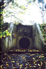 Greensborough Historical Society
Slide - Photograph, John Ramsdale, Urban runoff into Plenty River: Slide 69, 1990s
Photograph shows a culvert or drain with graffiti. This is urban runoff into Plenty RiverPart of the John Ramsdale collection of slides and audio visual material.Colour photograph scanned from slide.No maker's marks. No caption on slide.plenty river