Showing 634 items matching "river view"
-
 Eltham District Historical Society Inc
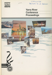
Book, Melbourne Metropolitan Board of Works, Yarra River Conference Proceedings, 1991
Conference staged by the Board of Works to present a range of papers examining the river's environment, recreational uses, natural resources, development, commerce and land use. Conference delegates included representatives from Eltham Shire Council and was held in April 1991. Session 1 Heritage and Environment: Flora and fauna / Paul Gullan. -- Geology and topography / Brian Finlayson. -- Aboriginal culture / Margaret Gardiner. Session 2 History. Session 3: Management plans and policies : overview of responsibilities / Dr Colin Leigh. --Role of the media / Peter Cole-Adams. -- Urban development / Paul Jerome. -- Port of Melbourne area / Leigh McKay. -- Recreation / Ken Marriott. Session 4: Perspectives - the current view. Session 5: Issues, challenges, potential solutions.non-fictionConference staged by the Board of Works to present a range of papers examining the river's environment, recreational uses, natural resources, development, commerce and land use. Conference delegates included representatives from Eltham Shire Council and was held in April 1991. Session 1 Heritage and Environment: Flora and fauna / Paul Gullan. -- Geology and topography / Brian Finlayson. -- Aboriginal culture / Margaret Gardiner. Session 2 History. Session 3: Management plans and policies : overview of responsibilities / Dr Colin Leigh. --Role of the media / Peter Cole-Adams. -- Urban development / Paul Jerome. -- Port of Melbourne area / Leigh McKay. -- Recreation / Ken Marriott. Session 4: Perspectives - the current view. Session 5: Issues, challenges, potential solutions.yarra river, melbourne -
 Eltham District Historical Society Inc
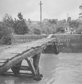
Album - Photograph, J.A. McDonald, Eltham-Greensborough Road, 18 Oct. 1956
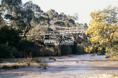
Bridge Street Bridge Flood level on Greensborough pier 18th October 1956 View looking west across the Diamond Creek and tempoary walking access bridge towards intersection of Susan Street. The building visible on centreeline is the present-day SES facility. Beware!.. our rivers are rising (1956, October 19). The Argus (Melbourne, Vic. : 1848 - 1957), p. 1. Retrieved August 24, 2022, from http://nla.gov.au/nla.news-article84392304Record of various Shire of Eltham infrastructure works undertaken during the period of 1952-1962 involving bridge and road reconstruction projects, sometimes with Eltham Shire Council Project Reference numbers quoted. It was during this period that a number of significant improvements were made to roads and new bridges constructed within the shire that remain in place as of present day (2022). In many situations, the photos provide a tangible visible record of infrastructure that existed throughout the early days of the Shire. The album was put together by or under the direction of the Shire Engineer, J.A. McDonald.infrastructure, road construction, shire of eltham, bridge construction, bridge street bridge, eltham, eltham-greensborough road, 1956-10-18, diamond creek (creek), floods, floodwater, silver street bridge -
 Eltham District Historical Society Inc
Negative - Photograph, J.A. McDonald, Eltham-Yarra Glen Road, Lower Plenty, c. July 1962
View looking west across the Eltham-Yarra Glen Road approaching the Lower Plenty Bridge near turn-off for the Golf Club Hotel. Present-day Lower Plenty Road follows a revised alignment across a new bridge. The former bridge is now part of the Plenty River Trail and Edward Willis Court now follows this section of the original Eltham-Yarra Glen Road.. The Golf Club Hotel is gone and a new Lower Plenty Hotel was built slightly further up the hill.Record of various Shire of Eltham infrastructure works undertaken during the period of 1952-1962 involving bridge and road reconstruction projects, sometimes with Eltham Shire Council Project Reference numbers quoted. It was during this period that a number of significant improvements were made to roads and new bridges constructed within the shire that remain in place as of present day (2022). In many situations, the photos provide a tangible visible record of infrastructure that existed throughout the early days of the Shire. The album was put together by or under the direction of the Shire Engineer, J.A. McDonald.1962-07, shire of eltham, old eltham road, edward willis court, eltham-yarra glen road, golf club hotel, infrastructure, lower plenty, road construction -
 Eltham District Historical Society Inc
Photograph - Black and White Print, Moor-rul Viewing Platform, March 2007
Early stages - no display panels installed. OPENING OF THE VIEWING PLATFORM AT KANGAROO GROUND Nillumbik Council has advised that the viewing platform at Kangaroo Ground 27km NE of Melbourne is to be opened to the public on Wednesday, March 26th 2008 (Melway 271 , G10). The function of the platform is to provide shelter adjacent to the War Memorial Tower whilst allowing all people to enjoy the stunning panoramic views. From the platform you. can see the Dandenongs, the city of Melbourne, the You Yangs, Mount Macedon, the Kinglake Ranges and the Mt Baw-Baw Ranges where the Yarra River starts. This landscape covers all the ancestral lands of the Wurundjeri and some of the wider Kulin nation land. The platform has been given the name Moor-rut, a name which described the fertile soils of the Kangaroo Ground area in contrast to the poorer (Silurian) country of its surrounds, which the Wurundjeri knew as 'Nillumbik' or less rich country. The full 360 degree view can be seen from the adjacent Tower of Remembrance which has 53 stairs. The viewing platform however can be accessed by wheelchair. Inside the viewing platform there are eight double sided interpretive panels giving the history and information regarding this special area. The viewing platform's interpretive panels set out the Aboriginal and European history of the area and also the geology and the local flora and fauna, so that the casual visitor comes away understanding more about this significant part of Victoria. The concept of the viewing platform is part of the refurbishment project for the Kangaroo Ground War Memorial Park which has taken place since 1997 with the active approval and financial assistance of the Nillumbik Shire Council. This project has been guided by an Advisory Committee with volunteer community representatives from the local Historical Societies, the Country Fire Authority, the Returned Services League and the Wurundjeri people. Other allied groups such as the Nillumbik Reconciliation Group have been called upon for their expertise. The initial idea for the viewing platform came from Dean Stewart when he was the caretaker while living at the park. He discussed this idea with local author Mick Woiwod and Harry Gilham of Eltham District Historical Society when they were planning the refurbishment of the War Memorial Park in 1996. When the committee was formalised by the Nillumbik Council in 1997, Nicholas Pelling, representing the CFA and RSL, joined the group. Dennis Ward, local architect, then volunteered to develop the concept plan for the refurbishment of the park and later drew up the plans for the viewing platform. The Kangaroo Ground War Memorial Park and its Tower of Remembrance is located on one of the highest locations in the Yarra Valley. The Tower of Remembrance is a unique war memorial constructed from local stone standing 14 metres high. It was built in the style of a Scottish watchtower reflecting the strong Scottish influence of the first European settlers of the district from the 1840s onward. The park was opened in 1921 and the Tower of Remembrance was dedicated in 1926 recognising the local people who served in the First World War. Those who served in the Second World War were recognised by plaques dedicated in 1951 and more recently those who served in Korea, Borneo, Malaya and Vietnam by plaques unveiled in 2001. Harry Gilham, Advisory Committee Convenor - Eltham District Historical Society Newsletter N0 179 March 2008 Black and white inkjet print on paper 14 x 21 cmmoor-rul viewing platform, garden hill, kangaroo ground, memorial park -
 Eltham District Historical Society Inc
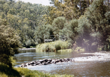
Slide - Photograph, Yarra River, Koornong, c.Sep. 1989
... views. Yarra River Koornong Process Date Sep 1989 35mm colour ...Part of a slide show presentation "Bridges & Waterways of the Shire" by Russell Yeoman to the 13 September 1989 Society meeting. The presentation included slides of historic photos from the Shire of Eltham Pioneers collections as well as several recent views.35mm colour positive transparency (1 of 33) Mount - Agfa CS System grey 8 dotsProcess Date Sep 1989yarra river, koornong -
 Eltham District Historical Society Inc
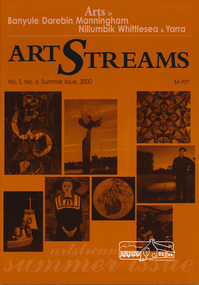
Journal, Peter Doughtery, ArtStreams: Arts in Banyule, Darebin, Manningham, Nillumbik, Whittlesea & Yarra; Vol. 5, No. 6 (sic - 5), Summer Issue 2000, 2000
Vol. 5, No. 6 (5), Summer Issue 2000 CONTENTS John Perceval and Helen Daniel 2 Two who served their communities well Gateway Sculpture Project 3 New public art in Manningham The Artary Project 5 Getting onto the net Tucker: Australian Gothic 6 Albert and Barbara Tucker's gift to Australia Short Story 8 Learning Curves Interview 10 Elizabeth James on drawing Open Studios 12 40 artists welcome the public Banyule Youth Awards 18 Support for emerging young artists Not Just a Pretty Place 20 Nillumbik art in Public Places CD Reviews 22 Book Reviews 23 Australian Classical Music 24 Elizabeth Scarlett Theatre Reviews 25 Artin About 26 Wining & Dining 30 Book Review 32 Artist's Services 32 "Peter Dougherty has been involved in the local art scene for many years. As publisher and editor of the arts magazine Artstreams, his comments on the various branches of the arts are widely respected. His "The Arts" column in the Diamond Valley Leader presents a brief summary for a much wider cross section of the local community. Peter also operates his own gallery and the Artstreams Cafe at the St Andrews market. Peter has a wealth of knowledge about present day and historical aspects of local art and artists." - Eltham District Historical Society Newsletter No. 161, March 2005Colour front and back cover with feature articles and literary pieces with photographs and advertisements printed in black and white. 36 pages, 30 cm. Vol. 1, no. 1 (Nov. 1996) - Vol. 10, no. 5 (summer ed. 2005/06) art streams, public art, sentinal, river peel, manningham, artary project, plenty views golf park, albert tucker, barbara tucker, kinglake gallery, bulleen art & garden centre, st andrews gallery, steve flanagan, eltham wiregrass gallery, elizabeth james, willy wonka's ice cream gourmet food, nillumbik artists' open studios, accadia ceramics, alan martin, alan sartori, attunga, veronica holland, leanne mooney, sally nihill, bend of islands, michael skewes, elizabeth vercoe, creek house studio, syd tunn, ona henderson, chris pittard, mary lou pittard, diamond creek living & learning centre, drew gregory, jane annois, jane trikojus, jenni mitchell, grace mitchell, mervyn hannan, girraeen studio, jill forrest, kangaroo studios, peter burns, jules burns, muddy waters studio, nel ten wolde, overbank end, kay steventon, kim tarpey, reg cox, robert phillips studio, stained glass studio, shan shnookal, matthew holderness, ray macminn, jane viola, john hewish, open pottery studios, linda detoma, judith roberts, cassandra tobias, christian benetto, kevina-jo smith, julianne piko, hugh crosthwaite, sarah slater, peter doyle, stuart sinclair, carly young, lenister farm, not just a pretty place, kangaroo house, dynamic vegies, old bakery cottage bookshop, nick charles, felicity nottingham, michael mcgirr, eltham little theatre, heidelberg theartre company, montsalvat, recherche, ken eckerall, thompsons pharmacy, st andrews market, 2000 banyule young artists award, heide museum of modern art -
 Eltham District Historical Society Inc
Slide - Photograph, Aerial Photo (c.1987): Main Road, Lower Plenty from Heidelberg Golf Course to Plenty River, c.Aug. 1990
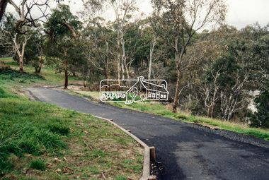
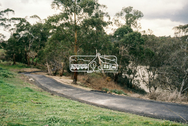
Part of a presentation, "Roads and Byways of the Shire of Eltham", by Russell Yeoman to the 12 September 1990 Society meeting. Slides shown included copies of old photos and recent images ranging from the suburban streets of Eltham and Montmorency to the mountain roads of Kinglake. In the byways category are views of some iof the Shire's bicycle paths including then recently completed sections of the Main Yarra Trail at Lower Plenty.35mm colour positive transparency (1 of 37) Mount - Agfachrome Agfa CS System black 8 dotsinfrastructure, roads, aerial photographs, heidelberg golf club, lower plenty, lower plenty bridge, main road, plenty river -
 Eltham District Historical Society Inc
Slide - Photograph, Footbridge, Odyssey House, Lower Plenty, c.Sep. 1989
Part of a slide show presentation "Bridges & Waterways of the Shire" by Russell Yeoman to the 13 September 1989 Society meeting. The presentation included slides of historic photos from the Shire of Eltham Pioneers collections as well as several recent views.35mm colour positive transparency (1 of 15) Mount - Agfa CS System grey 8 dotsfootbridge, lower plenty, odyssey house, yarra river -
 Eltham District Historical Society Inc
Slide - Photograph, Main Yarra Trail, Lower Plenty, c.Aug. 1990
Part of a presentation, "Roads and Byways of the Shire of Eltham", by Russell Yeoman to the 12 September 1990 Society meeting. Slides shown included copies of old photos and recent images ranging from the suburban streets of Eltham and Montmorency to the mountain roads of Kinglake. In the byways category are views of some iof the Shire's bicycle paths including then recently completed sections of the Main Yarra Trail at Lower Plenty.35mm colour positive transparency (1 of 37) Mount - Agfachrome Agfa CS System black 8 dotsinfrastructure, bonds road, lower plenty, main yarra trail, roads, yarra river -
 Eltham District Historical Society Inc
Slide - Photograph, Viewing platform near the confluence of Diamond Creek and Yarra River, c.Nov. 2001
Part of a slide show presentation "A Trip Down the Diamond Creek" by Russell Yeoman to the Eltham District Historical Society meeting of 14 Nov. 200135mm colour positive transparency Mount - Black and Whiteconfluence, diamond creek, yarra river -
 Eltham District Historical Society Inc
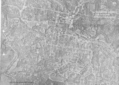
Work on paper (Sub-Item) - Aerial Photograph, Diamond Creek from Yarra River to Wattletree Road, Eltham
Black and white aerial photograph witrh key features around the central place of Eltham township marked inluding Yarra River, Main Road, Bridge Street and Ryans Road, Eltham North land development, real estate, aerial view, eltham, eltham north -
 Eltham District Historical Society Inc
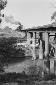
Photograph, Steam locomotive K-158 crossing the railway bridge over the Campaspe River at Rochester, Victoria, c.November 1963, 1963
It is the railway bridge over the Campaspe River at Rochester, Vic. original to the construction of the line. It was taken late on a Saturday morning and shows the regular goods train of that period approaching, then crossing the bridge. I originally planned to take just one view. The approaching train was first then it was a rapid run back along the raised river bank to get the broadside shot. I had little time to steady myself or properly check camera settings, hence the slightly soft focus etc. The train would eventually continue over the Echuca Iron Bridge into NSW. I think its ultimate destination was Deniliquin but not sure.Digital TIFF file Scan of 35mm Ilford FP3 black and white negative transparencygeorge coop collection, k-158, k-class steam locomotive (vr newport workshops), railway bridge, campaspe river, rochester -
 Eltham District Historical Society Inc
Photograph, Henley Bridge, c.1928
Situated on the Yarra River, 5.5 kms south of Christmas Hills on private property. This timber trestle bridge is said to have been built some time after 1907 by Melbourne master-builder, David Mitchell (the father of Dame Nellie Melba), to connect his two "Henley Farm" properties with Lilydale. In earlier days, when the McPhersons owned the property, their children used a punt to cross the river to attend Yering Primary School. This private bridge is best viewed from the end of Wendy Way. - Source: Christmas Hills Past and Present, Yarra Glen & District Historical Society, 2004.This photo forms part of a collection of photographs gathered by the Shire of Eltham for their centenary project book,"Pioneers and Painters: 100 years of the Shire of Eltham" by Alan Marshall (1971). The collection of over 500 images is held in partnership between Eltham District Historical Society and Yarra Plenty Regional Library (Eltham Library) and is now formally known as the 'The Shire of Eltham Pioneers Photograph Collection.' It is significant in being the first community sourced collection representing the places and people of the Shire's first one hundred years.9 x 12.5 cm printshire of eltham pioneers photograph collection, warrandyte, henley bridge -
 Eltham District Historical Society Inc
Photograph, Steam locomotive K-158 crossing the railway bridge over the Campaspe River at Rochester, Victoria, c.November 1963, 1963
It is the railway bridge over the Campaspe River at Rochester, Vic. original to the construction of the line. It was taken late on a Saturday morning and shows the regular goods train of that period approaching, then crossing the bridge. I originally planned to take just one view. The approaching train was first then it was a rapid run back along the raised river bank to get the broadside shot. I had little time to steady myself or properly check camera settings, hence the slightly soft focus etc. The train would eventually continue over the Echuca Iron Bridge into NSW. I think its ultimate destination was Deniliquin but not sure.Digital TIFF file Scan of 35mm Ilford FP3 black and white negative transparencygeorge coop collection, k-158, k-class steam locomotive (vr newport workshops), railway bridge, campaspe river, rochester -
 Marysville & District Historical Society
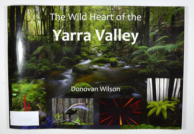
Book, The Wild Heart of the Yarra Valley
A pictorial book of the flora, fauna, rivers, waterfalls and rainforest in the Upper Yarra ValleyPaperback. Front cover has a main photograph of a creek running through a forest. There is also four smaller photographs. They are of a Red Coral Fungi, a Superb Lyrebird, a night time view looking upwards in a grove of trees and a view of a Soft tree fern. The back cover has a photograph of a Superb Lyrebird.yarra valley, upper yarra valley, flora, fauna, photography, rivers, waterfalls, rainforest, nature, donovan wilson -
 Marysville & District Historical Society
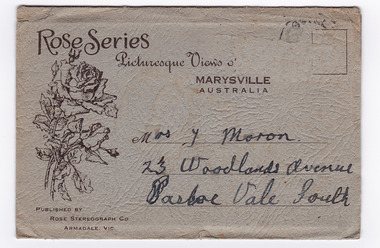
Photograph (item) - Black and white photographs, Rose Stereograph Company, Rose Series Picturesque Views of Marysville Australia, 1913-1967
A series of photographs produced by the Rose Stereograph Company in Victoria, Australia as a souvenir of Marysville.Souvenir envelope containing 12 black and white photographs of natural attractions in Marysville and surrounding area. Published by Rose Stereograph Co, Armadale, Victoria.Rose Series/ Picturesque Views of/ MARYSVILLE/ AUSTRALIA PUBLISHED BY/ ROSE STEREOGRAPH CO/ ARMADALE, VIC. Mrs. J Moron/ 23 Woodlands Avenue/ Pascoe Vale South The date stamp is illegible.the taggerty river marysville vic (image 1), panorama from mt gordon marysville vic (image 2), cora lynn falls marysville vic (image 3), cumberland-cora lynn trip marysville vic at the meeting of the waters (image 4), michael dene marysville vic (image 5), nichols lookout marysville vic (image 6), the stevenson river marysville vic (image 7), cathederal mount from mt gordon marysville vic (image 8), stevenson falls marysville vic (image 9), mountain ash tallest known hardwood tree in world (301ft 6in) cumberland marysville vic (image 10, the main street marysville vic (image 11), talbot drive vic no 12 taggerty river (image 12), rose stereograph company, souvenir, marysville, victoria -
 Marysville & District Historical Society
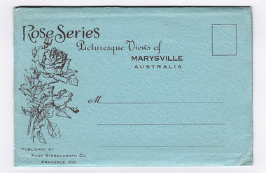
Photograph (item) - Black and white photographs, Rose Stereograph Company, Rose Series Picturesque Views of Marysville Australia, 1913-1967
A series of photographs produced by the Rose Stereograph Company in Victoria, Australia as a souvenir of Marysville.Souvenir envelope containing 12 black and white photographs of natural attractions in Marysville and surrounding area. Published by Rose Stereograph Co, Armadale, Victoria.Rose Series/ Picturesque Views of/ MARYSVILLE/ AUSTRALIA PUBLISHED BY/ ROSE STEREOGRAPH CO/ ARMADALE, VIC.the taggerty river marysville vic (image 1), panorama from mt gordon marysville vic (image 2), cora lynn falls marysville vic (image 3), cumberland-cora lynn trip marysville vic at the meeting of the waters (image 4), michael dene marysville vic (image 5), nichols lookout marysville vic (image 6), the stevenson river marysville vic (image 7), cathederal mount from mt gordon marysville vic (image 8), stevenson falls marysville vic (image 9), mountain ash tallest known hardwood tree in world (301ft 6in) cumberland marysville vic (image 10, the main street marysville vic (image 11), talbot drive vic no 12 taggerty river (image 12), souvenir, rose stereograph company, marysville, victoria -
 Marysville & District Historical Society
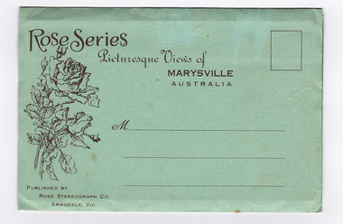
Photograph (item) - Black and white photographs, Rose Stereograph Company, Rose Series Picturesque Views of Marysville Australia, 1913-1967
A series of photographs produced by the Rose Stereograph Company in Victoria, Australia as a souvenir of Marysville.Souvenir envelope containing 12 black and white photographs of natural attractions in Marysville and surrounding area. Published by Rose Stereograph Co, Armadale, Victoria.Rose Series/ Picturesque Views of/ MARYSVILLE/ AUSTRALIA PUBLISHED BY/ ROSE STEREOGRAPH CO/ ARMADALE, VIC.the taggerty river marysville vic (image 1), panorama from mt gordon marysville vic (image 2), cora lynn falls marysville vic (image 3), cumberland-cora lynn trip marysville vic at the meeting of the waters (image 4), michael dene marysville vic (image 5), nichols lookout marysville vic (image 6), the stevenson river marysville vic (image 7), cathederal mount from mt gordon marysville vic (image 8), stevenson falls marysville vic (image 9), mountain ash tallest known hardwood tree in world (301ft 6in) cumberland marysville vic (image 10, the main street marysville vic (image 11), talbot drive vic no 12 taggerty river (image 12), marysville, rose stereograph company, souvenir, victoria -
 Marysville & District Historical Society
Photograph (item) - Black and white photographs, Rose Stereograph Company, Rose Series Picturesque Views of Marysville Australia, 1913-1967
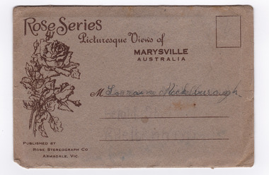
A series of photographs produced by the Rose Stereograph Company in Victoria, Australia.Souvenir envelope containing 12 black and white photographs of natural attractions in Marysville and surrounding area. Published by Rose Stereograph Co, Armadale, Victoria.Rose Series/ Picturesque Views of/ MARYSVILLE/ AUSTRALIA PUBLISHED BY/ ROSE STEREOGRAPH CO/ ARMADALE, VIC. M Lorraine Mickelburoughthe taggerty river marysville vic (image 1), panorama from mt gordon marysville vic (image 2), cora lynn falls marysville vic (image 3), cumberland-cora lynn trip marysville vic at the meeting of the waters (image 4), michael dene marysville vic (image 5), nichols lookout marysville vic (image 6), the stevenson river marysville vic (image 7), cathederal mount from mt gordon marysville vic (image 8), stevenson falls marysville vic (image 9), mountain ash tallest known hardwood tree in world (301ft 6in) cumberland marysville vic (image 10, the main street marysville vic (image 11), talbot drive vic no 12 taggerty river (image 12), marysville, rose stereograph company, souvenir, victoria -
 Marysville & District Historical Society
Photograph (item) - Black and white photographs, Rose Stereograph Company, Rose Series Picturesque Views of Marysville Australia, 1913-1967
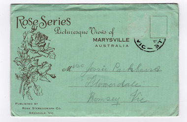
A series of photographs produced by the Rose Stereograph Company in Victoria, Australia as a souvenir of Marysville.Souvenir envelope containing 12 black and white photographs of natural attractions in Marysville and surrounding area. Published by Rose Stereograph Co, Armadale, Victoria.Rose Series/ Picturesque Views of/ MARYSVILLE/ AUSTRALIA PUBLISHED BY/ ROSE STEREOGRAPH CO/ ARMADALE, VIC. Miss Jessie Parkhurst/ "Flowerdale"/ Romsey. Vic. From Medythe taggerty river marysville vic (image 1), panorama from mt gordon marysville vic (image 2), cora lynn falls marysville vic (image 3), cumberland-cora lynn trip marysville vic at the meeting of the waters (image 4), michael dene marysville vic (image 5), nichols lookout marysville vic (image 6), the stevenson river marysville vic (image 7), cathederal mount from mt gordon marysville vic (image 8), stevenson falls marysville vic (image 9), mountain ash tallest known hardwood tree in world (301ft 6in) cumberland marysville vic (image 10, the main street marysville vic (image 11), talbot drive vic no 12 taggerty river (image 12), marysville, rose stereograph company, souvenir, victoria -
 Marysville & District Historical Society
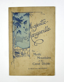
Booklet, Marysville Tourist Association, Magestic Marysville-The Mystic Mountains of the Great Divide, 1920's
An information guide of day trips to attractions in and around Marysville in Victoria. This booklet was produced by the Marysville Tourist Association.Paperback. Cover is beige with a drawing of two people standing next to a car looking at the view. The title is in dark blue across the front.non-fictionAn information guide of day trips to attractions in and around Marysville in Victoria. This booklet was produced by the Marysville Tourist Association.marysville, victoria, marysville tourise association, steavenson falls, keppel falls, cameron cascades, cumberland, mt cathedral, eildon, snob's creek falls, wolfram mine, mt strickland, keppel's lookout, mt kitchener, mt edgar, mt gordon, nichol's lookout, michael dene, beauty spot, gilbert's gully, taggerty river, wood's point -
 Marysville & District Historical Society
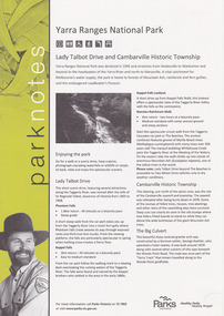
Flyer (item) - Information Flyer, Parks Victoria, park notes-Yarra Ranges National Park-Lady Talbot Drive and Cambarville Historic Township, June 2013
A flyer produced by Parks Victoria of information on Lady Talbot Drive and Cambarville Historic Township.A flyer produced by Parks Victoria of information on Lady Talbot Drive and Cambarville Historic Township. Lady Talbot Drive a 24 kilometer scenic rainforest car journey which passes a number of walks and waterfalls in the Yarra Ranges National Park. Lady Talbot Drive is named after Lady Sarah Elizabeth, the wife of Sir Reginald Talbot, who was the Governor of Victoria from 25th April, 1904 to 6th July 1908. Cambarville is notable for its giant mountain ash (Eucalyptus regnans) trees within the Cumberland Memorial Scenic Reserve, and relics from former sawmills and gold mining. The Big Culvert is located nearby on the Marysville-Woods Point Road, which was historically part of the Yarra Track. Cambarville was established as a timber mill town in the 1940s. Timber mill owners A Cameron and FJ Barton named Cambarville. They established the mill to salvage timber from trees destroyed in the 1939 bushfires. Cambarville was impacted by the 2009 Black Saturday bushfires and any remaining structures were destroyed. parks victoria, yarra ranges national park, lady talbot drive, lady talbot forest drive, cambarville, taggerty river, sir reginald talbot, lady sarah elizabeth talbot, phantom falls, keppel falls, keppel falls lookout, beeches rainforest walk, big culvert, cumberland walk, the big tree, the sitka spruce, cora lynn falls, sovereign view -
 Marysville & District Historical Society
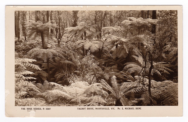
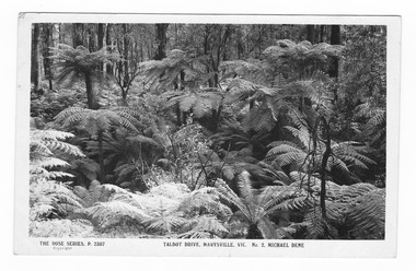
Postcard (item) - Black and white postcard, Rose Stereograph Company, Talbot Drive, Marysville, Vic. No. 2, Michael Dene, 1913-1967
... sawmill.The Taggerty River Lookout offers views over the Taggerty ...A postcard in a series produced by the Rose Stereograph Company in Victoria, Australia as a souvenir of Marysville.A black and white photograph showing trees and tree ferns, taken along the Michaeldene Trail near Lady Talbot Drive in Marysville in Victoria. The Michaeldene Trail is a level two loop that leads to the Taggerty River Lookout and may be undertaken as either as a Short (2.7 km) Loop, or a Long (4.3 km) Loop - 30 minutes to one hour and a half. The attractive bushland linking the Steavenson and Taggerty Rivers allows walkers and cyclists to step back in time to Marysville’s historic logging past. Sections of this mostly flat circuit follow old tramline alignments, which in places reveal the original timber sleepers on which the big logs were transported to the nearby sawmill.The Taggerty River Lookout offers views over the Taggerty River. The Trestle Bridge was built to span a small gully and provide access to the timber on Red Hill. Lady Talbot Drive is a 24 kilometer scenic rainforest car journey which passes a number of walks and waterfalls in the Yarra Ranges National Park. Lady Talbot Drive is named after Lady Sarah Elizabeth, the wife of Sir Reginald Talbot, who was the Governor of Victoria from 25th April, 1904 to 6th July 1908. This postcard was produced by the Rose Stereograph Company as a souvenir of Marysville.REAL PHOTO POST CARD THE "ROSE"SERIES DE LUXE PRODUCED IN AUSTRALIA Published by "The Rose Stereographs" Armadale, Victoria.marysville, victoria, michael dene, michael dene track, p. 2307, walking track, rose series postcard, postcard, souvenir, lady talbot drive, sarah elizabeth talbot, sir reginald talbot -
 Marysville & District Historical Society
Postcard (item) - Black and white postcard, Rose Stereograph Company, Talbot Drive, Marysville, Vic. No. 2, Michael Dene, 1913-1967
... sawmill.The Taggerty River Lookout offers views over the Taggerty ...A postcard in a series produced by the Rose Stereograph Company in Victoria, Australia as a souvenir of Marysville.A black and white photograph showing trees and tree ferns, taken along the Michaeldene Trail near Lady Talbot Drive in Marysville in Victoria. The Michaeldene Trail is a level two loop that leads to the Taggerty River Lookout and may be undertaken as either as a Short (2.7 km) Loop, or a Long (4.3 km) Loop - 30 minutes to one hour and a half. The attractive bushland linking the Steavenson and Taggerty Rivers allows walkers and cyclists to step back in time to Marysville’s historic logging past. Sections of this mostly flat circuit follow old tramline alignments, which in places reveal the original timber sleepers on which the big logs were transported to the nearby sawmill.The Taggerty River Lookout offers views over the Taggerty River. The Trestle Bridge was built to span a small gully and provide access to the timber on Red Hill. Lady Talbot Drive is a 24 kilometer scenic rainforest car journey which passes a number of walks and waterfalls in the Yarra Ranges National Park. Lady Talbot Drive is named after Lady Sarah Elizabeth, the wife of Sir Reginald Talbot, who was the Governor of Victoria from 25th April, 1904 to 6th July 1908.REAL PHOTO POST CARD THE "ROSE"SERIES DE LUXE PRODUCED IN AUSTRALIA Published by the Rose Stereographs Armadale, Victoria. Tomorrow is your Official day/ I believe. So Very Very many happy/ returns, & best of luck & good/ wishes from/ your May I rec'd this on/ 1st. (illegible)/ thought it a good snap of our ferns.marysville, victoria, michael dene, michael dene track, p. 2307, walking track, rose series postcard, postcard, souvenir, lady talbot drive, sarah elizabeth talbot, sir reginald talbot -
 Marysville & District Historical Society
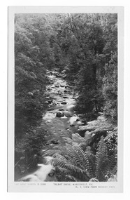
Postcard (item) - Black and white postcard, Rose Stereograph Company, Talbot Drive, Marysville, Vic. No. 4, View from Murray Pass, 1913-1967
... An early black and white photograph of the view...An early black and white photograph of the view... and white photograph of the view of the Taggerty River from Murray ...An early black and white photograph of the view of the Taggerty River from Murray Pass near Marysville in Victoria.An early black and white photograph of the Taggerty River from Murray Pass near Marysville, Victoria. Murray Pass is located on the Lady Talbot Drive. Lady Talbot Drive a 24 kilometer scenic rainforest car journey which passes a number of walks and waterfalls in the Yarra Ranges National Park. Lady Talbot Drive is named after Lady Sarah Elizabeth, the wife of Sir Reginald Talbot, who was the Governor of Victoria from 25th April, 1904 to 6th July 1908. This postcard was produced by the Rose Stereograph Company as a souvenir of Marysville.POST CARD The "Rose" Series/ De Luxe A Real Photograph/ Produced in Australia Published by the Rose Stereograph Co./ Armadale, Victoria. Dear Harold/ This is the prettiest card I/ could get for you. Probably we will/ go this trip in a day or two./ Yours Nance xxx xxxmarysville, victoria, photograph, taggerty river, murray pass, lady talbot forest drive, 2309, postcard, souvenir, lady talbot drive, sir reginald talbot, sarah elizabeth talbot, rose series postcard -
 Marysville & District Historical Society
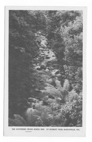
Postcard (item) - Black and white postcard, Rose Stereograph Company, At Murray Pass, Marysville, Vic, 1913-1967
... An early black and white photograph of the view... photograph of the view of the Taggerty River from Murray Pass near ...A postcard in a series produced by the Rose Stereograph Company in Victoria, Australia as a souvenir of Marysville.An early black and white photograph of the Taggerty River from Murray Pass near Marysville, Victoria. Murray Pass is located on the Lady Talbot Drive. Lady Talbot Drive a 24 kilometer scenic rainforest car journey which passes a number of walks and waterfalls in the Yarra Ranges National Park. Lady Talbot Drive is named after Lady Sarah Elizabeth, the wife of Sir Reginald Talbot, who was the Governor of Victoria from 25th April, 1904 to 6th July 1908. This postcard was produced by the Rose Stereograph Company as a souvenir of Marysville.POST CARD. Correspondence Addressmarysville, victoria, photograph, taggerty river, murray pass, lady talbot forest drive, southern cross series, 2309, postcard, souvenir, lady talbot drive, sir reginald talbot, sarah elizabeth talbot -
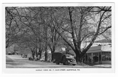 Marysville & District Historical Society
Postcard (Item) - Black and white postcard, Murray Views, Murray Views No. 17. Main Street, Marysville, Vic, c1940s
A black and white photograph of Murchison Street in Marysville in Victoria.A black and white photograph of the main street in Marysville in Victoria. This is now known as Murchison Street. This postcard was produced by Murray Views in Gympie in Queensland as a souvenir of Marysville.POST CARD STAMP REAL (illegible)/ AUSTRALIA BY MURRAY (illegible) Tuesday 1st/ Dear Ade,/ Well here I am/ as I said/ writing/ to you. I have 8 minutes/ before the dinner gong goes so/ I'd better hurry./ We're having a super/ time, but the weather is/ shocking. Today we put/ on our raincoats, golf shoes/ & umbrellas & walked to/ the Taggerty River & back/ via Talbot Drive. It/ was lovely (& wet(. It's about/ 6 miles or maybe more./ I didn't think you or John/ would come on such a / terrible day. How's work?/ Think of me eating, sleeping/ & playing won't you./ There are 17 people here. There/ were 30 when we arrived./ Doesn't the Main Street look/ beaut? That's how it really look./ Saw "Mad About Men" here on/ Saturday night. Extra good/ show. Must close. See you/ Friday week. Love Pat.murchison street, marysville, victoria, murray views pty ltd, murray views no 17, postcard, souvenir -
 Marysville & District Historical Society
Book, The Wild Heart of the Yarra Valley
A pictorial book of the flora, fauna, rivers, waterfalls and rainforest in the Upper Yarra ValleyPaperback. Front cover has a main photograph of a creek running through a forest. There is also four smaller photographs. They are of a Red Coral Fungi, a Superb Lyrebird, a night time view looking upwards in a grove of trees and a view of a Soft tree fern. The back cover has a photograph of a Superb Lyrebird.yarra valley, upper yarra valley, flora, fauna, photography, rivers, waterfalls, rainforest, nature, donovan wilson