Showing 109 items matching "shire of healesville"
-
 Whitehorse Historical Society Inc.
Correspondence, Healesville Road, 24/03/1937
... of amounts expended on Main Healesville Road by Shire of Blackburn... Healesville Road by Shire of Blackburn and Mitcham Healesville Road ...Claim for reimbursement from the Country Roads Board of amounts expended on Main Healesville Road by Shire of Blackburn and Mitchamhealesville road, victoria. country roads board, shire of blackburn and mitcham, roads and streets -
Whitehorse Historical Society Inc.
Document - Correspondence, Healesville Road, 9/04/1937
... of amounts expended on the Main Healesville Road by Shire... Mitcham melbourne Healesville Road Shire of Blackburn and Mitcham ...Claim for reimbursement from the Country Roads Board of amounts expended on the Main Healesville Road by Shire of Blackburn and Mitchamhealesville road, shire of blackburn and mitcham, victoria. country roads board, roads and streets -
Whitehorse Historical Society Inc.
Document - Correspondence, Healesville Road, 26/04/1937
... for amounts expended on Main Healesville Road by Shire of Blackburn... Healesville Road by Shire of Blackburn and Mitcham Healesville Road ...Claim for reimbursement from Country Roads Board for amounts expended on Main Healesville Road by Shire of Blackburn and Mitchamshire of blackburn and mitcham, victoria. country roads board, roads and streets, healesville road -
Whitehorse Historical Society Inc.
Document - Correspondence, Healesville Road, 18/06/1937
... expended on Main Healesville Road by Shire of Blackburn and Mitcham... Healesville Road by Shire of Blackburn and Mitcham Healesville Road ...Claim for reimbursement from Country Roads Board of amounts expended on Main Healesville Road by Shire of Blackburn and Mitchamshire of blackburn and mitcham, victoria. country roads board, roads and streets, healesville road -
Whitehorse Historical Society Inc.
Document - Correspondence, Healesville Road, 2/08/1937
... for amounts expended on Main Healesville and Burwood Roads by Shire... expended on Main Healesville and Burwood Roads by Shire ...Claim for reimbursement from Country Roads Board for amounts expended on Main Healesville and Burwood Roads by Shire of Blackburn and Mitchamshire of blackburn and mitcham, victoria. country roads board, healesville road, roads and streets, burwood road -
Whitehorse Historical Society Inc.
Document - Correspondence, Healesville Road, 16/08/1937
... for amounts expended on Main Healesville and Burwood Roads by Shire... expended on Main Healesville and Burwood Roads by Shire ...Claim for reimbursement from Country Roads Board for amounts expended on Main Healesville and Burwood Roads by Shire of Blackburn and Mitchamshire of blackburn and mitcham, victoria. country roads board, roads and streets, healesville road, burwood road -
Whitehorse Historical Society Inc.
Document - Correspondence, Healesville Road, 1/09/1937
... on the Burwood Road by Shire of Blackburn and Mitcham. Healesville Road ...Claim for reimbursement from Country Roads Board for amounts expended on the Burwood Road by Shire of Blackburn and Mitcham.burwood road, roads and streets, shire of blackburn and mitcham, victoria. country roads board -
Whitehorse Historical Society Inc.
Document - Correspondence, Healesville Roads, 14/09/1937
... for amounts expended on Main Healesville and Burwood Roads by Shire... expended on Main Healesville and Burwood Roads by Shire ...Claim for reimbursement from Country Roads Board for amounts expended on Main Healesville and Burwood Roads by Shire of Blackburn and Mitchamshire of blackburn and mitcham, victoria country roads board, roads and streets, burwood road, healesville road -
Whitehorse Historical Society Inc.
Document - Correspondence, Healesville Road, 16/11/1937
... for amounts expended on Main Healesville and Burwood Roads by Shire... expended on Main Healesville and Burwood Roads by Shire ...Claim for reimbursement from Country Roads Board for amounts expended on Main Healesville and Burwood Roads by Shire of Blackburn and Mitchamshire of blackburn and mitcham, victoria. country roads board, healesville road, burwood road, roads and streets -
Whitehorse Historical Society Inc.
Document - Correspondence, Roads, 01/08/-/09/1933
... Shire of Blackburn and Mitcham Healesville Road Whitehorse Road ...Correspondence between Secretary, Country Roads Board and Secretary, Shire of Blackburn and Mitcham re maintenance works for 1933 financial year and details of proposed work on main Healesville Road (now Whitehorse Road). Comprises letter, draft response, carbon of response, plans and schedule.roads and streets, victoria. country roads board, shire of blackburn and mitcham, healesville road, whitehorse road, nunawading -
Whitehorse Historical Society Inc.
Document, Roads, 1/03/1937
Details of maintenance costs for a section of Main Healesville Road (now Whitehorse Road) including Country Roads Board summary of expenditure, payment record and other forms.healesville road, victoria. country roads board, shire of blackburn and mitcham, roads and streets, whitehorse road, nunawading -
Whitehorse Historical Society Inc.
Document, Roads, 1/02/1937
... Mitcham melbourne Burwood Highway Healesville Road Shire ...Claims by Shire of Blackburn and Mitcham for reimbursement from Country Roads board for amounts expended on the main Healesville (now Whitehorse) and Burwood Roads, February 1937.burwood highway, healesville road, shire of blackburn and mitcham, victoria. country roads board, roads and streets, whitehorse road, nunawading -
Whitehorse Historical Society Inc.
Document, Roads, 1/03/1937
Claim by Shire of Blackburn and Mitcham for reimbursement from Country Roads Board for amounts expended on the Main Healesville Road (now Whitehorse Road), March 1937.healesville road, roads and streets, victoria. country roads board, shire of blackburn and mitcham, whitehorse road, nunawading -
Southern Sherbrooke Historical Society Inc.
Draft Precinct Brochures - Shire of Yarra Ranges, "Shire of Yarra Ranges Neighbourhood Character Study"
Collection of Draft Precinct Brochures in ring binder prepared by the Shire Of Yarra Ranges for public comment. Areas include: Belgrave, Coldstream, Chirnside Park, Healesville, Kilsyth, Lilydale, Monbulk, Montrose, Mooroolbark, Mt. Evelyn, Seville, Seville East, Tecoma, Upwey, Wandin North, Warburton, woori Yallock, Yarra Glen and Yarra Junction. -
Healesville Sanctuary Heritage Centre
Newspaper - Cutting, The Argus, Melbourne, New Sanctuary Committee's Appointment, 31 May 1949
... of Healesville Shire Council and Healesville public have yet ...New committee named in article. Representatives of Healesville Shire Council and Healesville public have yet to be nominated.photocopynon-fictionNew committee named in article. Representatives of Healesville Shire Council and Healesville public have yet to be nominated.1940s -
 Eltham District Historical Society Inc
Photograph, C.S. Wingrove, Secretary, Eltham District Road Board 1858-1871; Shire Secretary, Shire of Eltham 1871-1904, 1858-1871
Charles Symons Wingrove, J.P. (1829-1905) arrived in Victorian in 1851. He had trained as an engineer, but tried his luck on the goldfields. In 1857 he was appointed as Secretary to the Eltham District Roads Board only one year after its foundation. He was to hold the position with the Board and later the Eltham Shire Council for total of 47 years. He also held the position of engineer for a large part of this period. During part of this time he was also secretary to the Heidelberg Shire Council. Over this period he was responsibly for an area stretching from Clifton Hill to Healesville, along the northern bank of the Yarra River. Other positions included Secretary to the Victorian Agricultural Society over along period.Wingrove was a main figure in the Municipal Association of Victoria. By the time he retired he was recognized as the “Grand Old Man” of Victorian local government. In 1858 Wingrove had a brick cottage built in Main Road near the State School and he lived here until his death. One room was uded as the Board and Council office. His descendants owned the house until 1974. It was later used as a psychiatric clinic. The park opposite the cottage has been named Wingrove Park in his honour. He is buried at St Helena with other members of his family. Age (Melbourne, Vic. : 1854 - 1954), Tuesday 18 July 1905, page 5 ABOUT PEOPLE. A conspicuous figure in northern municpal history, Mr. Charles Symons Wingrove, has passed away. He was for many years secretary and engineer for the shire of Eltham, and prior to the formation of the shire held the position under the old road board, his official connection with the district dating from beyond 1857. For about twelve years he also filled the position of shire engineer for Heidelberg council while retaining his other post, and the immense territory under his professional control, reaching from the boundary of Collingwood up to Healesville, was a matter of fatherly pride and interest to him. He arrived in Victoria in 1851, and was 76 years of age at his death. Mr. Wingrove retired from the position in the Eltham council only about a year ago. The interment will take place in St. Helena Cemetery, near Eltham township, today. Secretary, Eltham District Road Board 1858-1871 Secretary for the Shire of Eltham 1871-1904. Nearly 50 years service to the local community. For about twelve years he also filled the position of shire engineer for Heidelberg council. Reproduced Page 137 "Pioneers & Painters" This photo forms part of a collection of photographs gathered by the Shire of Eltham for their centenary project book,"Pioneers and Painters: 100 years of the Shire of Eltham" by Alan Marshall (1971). The collection of over 500 images is held in partnership between Eltham District Historical Society and Yarra Plenty Regional Library (Eltham Library) and is now formally known as the 'The Shire of Eltham Pioneers Photograph Collection.' It is significant in being the first community sourced collection representing the places and people of the Shire's first one hundred years.Digital image Print 25 x 20 cmc.s.wingrove, charles symons wingrove, eltham district road board, sepp, shire of eltham pioneers photograph collection, shire secretary, wingrove cottage, pioneers and painters, shire of eltham, councilor, municipal officer -
 Eltham District Historical Society Inc
Photograph - Digital Photograph, Alan King, Kinglake National Park, 27 March 2008
Fern gullies around Jehosaphat Gully Covered under National Estate. Published: Nillumbik Now and Then / Marguerite Marshall 2008; photographs Alan King with Marguerite Marshall.; p125 The magnificent Kinglake National Park, fringing Nillumbik’s north, is the largest national park close to Melbourne. Thanks to the vision and hard work of a band of local people, the park was created from what was rapidly becoming degraded land. Seeing a threat to Kinglake’s indigenous flora and fauna, several prominent local people campaigned for a national park, which was established in 1928.1 Since then, the park has grown through donations and acquisitions of land, from around 13,800 acres of land (5585ha) to 22,360 hectares. The Sugarloaf and Everard Blocks – of almost 8000 hectares – stand in Nillumbik and the park extends into Mitchell and Murrundindi Shires and the City of Whittlesea. Mt Everard commemorates William Hugh Everard, State member for Evelyn when the park was established. Before 1928, European settlers had degraded the Kinglake area, which was named after the celebrated English author and lawyer, Alexander William Kinglake. Remains of gold shafts and diggings in the park are reminders of Kinglake’s first settlers, who hoped to strike it rich at the gold diggings. But like other gold fields in this shire, they proved not very lucrative and soon timber cutting replaced mining in importance. However, before long, the accessible timber supply ran out, so in the 1920s agriculture took over – particularly potatoes and berry fruits – which involved large-scale clearing.2 The park’s instigator was retired Melbourne University Professor of Music, William Laver.3 As chair of the Kinglake Progress Association he began negotiations to have crown lands on the southern scarp of the Great Dividing Range reserved as a national park. Even before the park was proclaimed, from 1927, KPA members cut tracks to the major scenic points. Professor Laver was one of several people who gave land for the park, donating around 50 acres (20ha), including the Jehosaphat Gully.4 Laver chaired the park’s first Committee of Management, which raised money to employ a ranger and provide facilities, including tracks and roads for fire protection vehicles, toilets and shelters. The committee charged fees for firewood collection, some grazing of livestock, and visitor entrance, and obtained small State Government and Eltham Shire grants. In 1957 the State Government provided revenue for national parks. Then, in 1975, the State Government took over the management and the Committee of Management became an advisory committee, which disbanded in 1978. Originally, the park covered crown land in the Shires of Eltham and Whittlesea; then Wombelano Falls in Yea and other areas were added. In 1970 the park extended into the Shires of Eltham, Healesville, Whittlesea and Yea.5 Bush fires have been an ongoing problem. In 1939 hundreds of eucalypts and acacias had to be sown around the Jehosaphat Gully to rejuvenate the forest. To manage bushfires, the Committee of Management, then the State Government, worked closely with the Forestry Commission, shire councils and local fire brigades. Early national parks focussed on recreation. But by the 1980s, conservation, education and scientific research became more important, playing a vital role in preserving representative samples of the natural environment. Each year many thousands of people use the park’s extensive network of walking tracks amongst the protected plant and animal life as well as camping, cycling and horse riding. The park, along the slopes of the Great Dividing Range, has lookouts revealing magnificent views of the Melbourne skyline, Port Phillip Bay, the Yarra Valley and the You Yangs. Vegetation in the Masons Falls area includes messmate forest, Austral grass-trees, ferns and Hazel Pomaderris. In spring, orchids, lilies, everlasting daisies, correas, grevillea and heath appear. Around Jehosaphat Gully are wet and dry forest, fern gullies and banksia. Animal life includes wallabies, kangaroos, koalas, echidnas, possums, gliders and bandicoots. Male lyrebirds can be heard mimicking in the Jehosaphat Gully, particularly in the Everard Block in winter.This collection of almost 130 photos about places and people within the Shire of Nillumbik, an urban and rural municipality in Melbourne's north, contributes to an understanding of the history of the Shire. Published in 2008 immediately prior to the Black Saturday bushfires of February 7, 2009, it documents sites that were impacted, and in some cases destroyed by the fires. It includes photographs taken especially for the publication, creating a unique time capsule representing the Shire in the early 21st century. It remains the most recent comprehenesive publication devoted to the Shire's history connecting local residents to the past. nillumbik now and then (marshall-king) collection, kinglake national park, jehosaphat gully -
 Eltham District Historical Society Inc
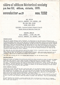
Newsletter, Newsletter, No. 27 November 1982
Contents: • November meeting – Film night: featuring Dr. Donald Thomson’s films of Central Australian Aboriginal tribal life • Christmas break-up • Eltham Community Festival • “Healesville – History in the hills” The Shire of Eltham Historical Society was formed in October 1967. The first newsletter of the Society was issued May 1978 and has been published continuously ever since on a bi-monthly basis. With the cessation of the Shire of Eltham in late 1994, the Society's name was revised to Eltham District Historical Society and this name first appeared with issue No. 103, July 1995. The collection of the Society's newsletters provides a valuable resource on the history of the Society's activities, office bearers and committee members, guest speakers and subjects of historical interest pertinent to the former Shire of Eltham and the Eltham District.A4 photocopied newsletter distributed to membersnewsletter, eltham district historical society, shire of eltham historical society -
 Eltham District Historical Society Inc
Film - Video (VHS), Nillumbik Shire Council, The Nillumbik Story, 1996
PART 1 – NILLUMBIK (00:00-07:17) Opening features various scenes around Nillumbik Shire. For 40,000 years Nillumbik was the home of the Wurundjeri people. Robert Hoddle gave the district its name. Jock Ryan, then president of Nillumbik Historical Society discusses the names Nillumbik and Diamond Creek. In the late 1830s white occupation began with gold found in Warrandyte in 1851 and 12 years later at Diamond Creek -the Diamond Reef which led to the Caledonian gold rush. Jock Ryan discusses the Diamond Creek mine, which was thriving until it burnt out in 1915. Large numbers of workmen moved into area in late 1870s to construct the Maroondah Aqueduct. With growing population of Melbourne, the nearby Yan Yean system had severely disrupted the flow of the Plenty River, forcing the closure of three flour mills there. The aqueduct came to the rescue carrying water 66km from Healesville to Preston. When the Diamond Creek gold mine burnt down the local economy suffered but fruit growing industry had already been established and Diamond Creek became a thriving fruit growing centre. Interview with Jack Powell, a long-time fruiterer at St Andrews market, his family had lived in the area for a hundred years, 3 to 4 generations, “a lot of hard work”. By the time the railway arrived fruit growing was no longer competitive. The railway brought the city closer and day trippers. The Green Wedge separates the shire from the more densely developed neighbours such as Whittlesea, Doncaster, Templestowe, Bulleen and Greensborough. Population at the time (1996) was 19,000 but links to the past remain strong. Mudbrick houses along the Heritage Trail The saving of Shillinglaw Cottage from demolition in 1963 and relocation brick by brick. PART 2 – ENVIRONMENT (07:18-14:44) Peter Brock (with Bev Brock in background) at St Andrews market discusses his childhood growing up in the district and the environment and the values it instilled upon him and his own family. The Brocks have been in the district since the 1860s. Nillumbik Shire responsible for managing three catchment areas; Diamond Creek, Arthurs Creek and Watsons Creek. Follows the course of the Diamond Creek commencing in Kinglake through the district to its confluence with the Yarra River at Eltham at Eltham Lower Park. Highlights Eltham Lower Park community revegetation program and the newly constructed (1996) viewing platform built of new and recycled timbers at the confluence of the Diamond Creek and Yarra River. Also featured are outdoor recreation on the river and at Eltham Lower Park including the Diamond Valley miniature railway. Sugarloaf reservoir and recreational activities and fishing. Aerial view of Memorial Park and Shire of Eltham War Memorial tower at Garden Hill, Kangaroo Ground. Significant tourism opportunities for the shire with 3 million potential day-trippers in metropolitan Melbourne. Council and community working together to find a way to promote the shires natural and artistic assets. At Arthurs Creek, the Brock family and neighbours working together to take care of their waterway. Peter Brock’s uncle, Sandy Brock talks about environmental management and the Arthurs Creek Landcare group and actions to eradicate blackberry problem. Having previously planted Cypress rows they are replacing them with indigenous species to improve the water supply, keeping cattle out of the creek bed to improve the quality downstream flowing into the Yarra. Eltham East Primary School Band playing “All things bright and beautiful” merges into scenes of the bushland sanctuary set aside by the school in 1980 with unidentified teacher discusses the sanctuary and their education program and school children’s comments. Plight of a family of Wedgetail eagles nesting in the path of a developer’s bulldozer at North Warrandyte and actions to save their nesting areas. PART 3 – ARTS (14:45-22:00) Arts and Jazz festival at Montsalvat featuring interviews with Sigmund Jorgensen discussing Montsalvat and its principles. Also Matcham Skipper. Clifton Pugh’s funeral at Montsalvat and his legacy at Dunmoochin near Cottlesbridge with artists in residence, at the time, Chicago artist Charles Reddington who discusses the benefits of the experience. An unidentified female artist also talks about the program and why people are drawn to the area. Unidentified man on street talking about the amount of talent in the area, artists, poets, musicians, authors. Artist Ming Mackay (1918-2009) interviewed talking about the people she mixes with on “the Hill”. Works of local artists are displayed Eltham Library Community Gallery and Wiregrass gallery with a new coffee shop at the Wiregrass making it an even more popular destination. Music at St Andrews Hotel (may be a little bit country) and the Saturday market where likely to hear anything. Sellers and patrons at the market asked about what attracts them to the market and where they came from. Scenes of poets/authors giving readings. CREDITS Music by John Greenfield from the CD Sweet Rain “The Snow Tree”, Uncle Music UNC 2001 Cameras - David Mirabella and Peter Farragher Editor – Olwyn Jones Written and Produced by Jason Cameron A Jason Cameron Proction for Nillumbik ShireProvides a record of the relatively newly created Shire of Nillumbik at the time and the features and attactions of the shire in its people arts, culture and environmentVHS Cassette (five copies) DVD (one copy) Converted to MP4 file format 0:22:00, 1.60GBvideo recording, arthurs creek, arthurs creek landcare group, artists, artists in residence, arts, arts festival, authors, blackberry, brock family, bulldozer, bulleen, bushland sanctuary, caledonian gold rush, charles reddington, clifton pugh, cottlesbridge, cypress rows, developer, diamond creek, diamond creek mine, diamond reef, diamond valley miniature railway, doncaster, dunmoochin, education program, eeps, eltham, eltham east primary school, eltham east primary school band, eltham library community gallery, eltham lower park, environment, fishing, flour mill, fruit growing, fruiterer, garden hill, gold mining, green wedge, greensborough, heritage trail, hurstbridge railway line, jazz festival, jock ryan, kangaroo ground, kangaroo ground tower, kinglake, maroondah aqueduct, matcham skipper, memorial park, ming mackay (1918-2009), montsalvat, mudbrick houses, music, musicians, nesting area, nillumbik historical society, nillumbik shire, north warrandyte, old timer, orchards, peter brock, plenty river, poets, population, recreation, recreational activities, revegetation, robert hoddle, sandy brock, shillinglaw cottage, shire of eltham war memorial, sigmund jorgensen, st andrews hotel, st andrews market, sugarloaf reservoir, templestowe, the hill, tourism, viewing platform, warrandyte, water catchment area, watsons creek, wedgetail eagle, whittlesea, wiregrass gallery, wurundjeri, yarra river, jack powell