Showing 112 items
matching strategy plan
-
 Eltham District Historical Society Inc
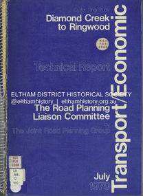
Book, The Joint Road Planning Group, Outer Ring Study, Diamond Creek to Ringwood: Technical Report Transport and Economic Evaluation, July 1979
Prepared for The Road Planning Liaison Committee by The Joint Road Planning Group. The Outer Ring Study, Diamond Creek to Ringwood was a long term planning study carried out under the direction of the Road Planning Liaison Committee for the Government of Victoria. .. The basic aim of the .. Study was to determine the most appropriate future road system in the area between Diamond Creek and Ringwood, consistent with local and regional concerns and the environment of the area, with a view to seeking an emendment to the Metropolitan Planning Scheme to preserve the option to implement an appropriate road system some time in the future if this was considered necessary. This technical report discusses, in detail, the transport and economic aspects of the investigation.. the techniques used take into account the long term implications of a range of possible travel cost policies and options and land use strategies.non-fictionPrepared for The Road Planning Liaison Committee by The Joint Road Planning Group. The Outer Ring Study, Diamond Creek to Ringwood was a long term planning study carried out under the direction of the Road Planning Liaison Committee for the Government of Victoria. .. The basic aim of the .. Study was to determine the most appropriate future road system in the area between Diamond Creek and Ringwood, consistent with local and regional concerns and the environment of the area, with a view to seeking an emendment to the Metropolitan Planning Scheme to preserve the option to implement an appropriate road system some time in the future if this was considered necessary. This technical report discusses, in detail, the transport and economic aspects of the investigation.. the techniques used take into account the long term implications of a range of possible travel cost policies and options and land use strategies.melbourne ring road, roads, freeways -
 Eltham District Historical Society Inc
Document - Report, Paul Jerome, Advisory Committee on a Proposed Convenience Centre and an Alternative Shire Proposal - Eltham Gateway Community Precinct Concept Plan - 895 Main Road Eltham, October 1997
On 15 December 1994 the former Shire of Eltham ceased to exist following the Liberal Kennett Government local council amalgamations. A new Nillumbik Shire Council was established with unelected commissioners appointed. That Council sold the former Eltham Shire Council Offices and land at 89S Main Road Eltham to Dallas Price Homes Pty. Ltd. the sale being conditional upon the granting of a planning permit for a petrol station/convenience store, fast food and video outlet. The sale was conditional that if the permit was not granted by 30 August. 1997, the contract could be avoided by either the purchaser or the vendor. The proposed development consisted of a petrol station with undercover fuelling facilities, convenience shopping, a drive through service facility for fast food, an 80 seat cafe, automated banking, a children's play area and retail space. In addition, the proposal included a 200 square metre community facility for Council use, provision of on site carparking over 2 levels for 83 vehicles, and advertising signage. An Advisory Committee consisting of Dimitry Reed and Margaret Pitt was appointed under Section 151 of the Planning and Environment Act 1987 to hear submissions on the proposal to develop the land at 895 Main Road Eltham, the site of the former Eltham Shire Offices. In September 1996, two applications were made by Contour Consultants Australia Pty Ltd on behalf of Dallas Price Homes Ply Ltd, to Nillumbik Shire Council. After extensive notification, the Council received 213 objections and a petition of over 1400 signatures. On October 9, 1996, Nillumbik Shire Council issued Notices of Decision to Grant Permit on Applications number 96/03376 and 96/0377 for the use and development of the land as a convenience Centre consisting of a petrol station, convenience store, cafe/takeaway food premises, a retail facility and a community facility, with associated advertising signs. Objectors to the proposals lodged Planning Appeals number 96/40724 and 96/40812 with the Administrative Appeals Tribunal on November 1, 1996. The grounds of appeal can be summarised as: inappropriate development, insufficient carparking, traffic and access issues, unsatisfactory design, inadequate permit conditions, the proposal being out of character with the area. and being contrary to the purpose and orderly development of the Eltham Town Centre, excessive noise, lack of consultation and unsuitable signage. On November 13, 1996, the Minister for Planning and Local Government directed the Registrar of the Administrative Appeals Tribunal. under Section 41 (1) (a) of the Planning Act 1980, to refer the Appeals to the Governor in Council for determination without a hearing or recommendation by the Tribunal. The Minister for Planning and Local Government called in the Appeals as he considered that they raised major issues of policy relating to the facilitation of development in accordance with the objectives set out in Section 4 of the Planning and Environment Act 1987, and that determination of the Appeals could have a substantial effect on the achievement of these planning objectives. The Minister required the Advisory Committee to consider the planning merits of the proposed use and development, and to address the issues raised in the objections. The Advisory Committee was required to produce a report providing: • The Committee's response to the matters detailed; • Relevant supporting information for the Advisory Committee's recommendation; and • A description of the proceedings conducted by the Advisory Committee and a list of those consulted or heard by the Committee. In March 1997, elections were held in the Shire of Nillumbik and the view of the new Council to this proposal differed from the view held by the earlier Council Hence the Submission made to the Committee by the Shire was against the decision by the Shire of Nillumbik to issue the Notices of Decision to Grant a Permit. The Recommendations of the Advisory Committee were: i. The cafe and take away food premises are as of right uses and are therefore allowable, but that shop and petrol station are unacceptable uses. A community facility is a discretionary use and is acceptable. ii. A development of the type and scale proposed is totally inappropriate for this land and that the Applications number 96/03376 and 96/0377 for the use and development of the land as a convenience Centre consisting of a petrol station, convenience store, café/takeaway food premises, a retail facility and a community facility, with associated advertising signs, be refused. iii. The land should be rezoned for public purposes and should remain in the community's ownership for community use. Following this, the Minister for Planning and Local Government, the Hon. Robert Maclellan, appointed Mr. Paul Jerome as an Advisory Committee under section 151 of the Planning and Environment Act 1987 to consider a Convenience Centre and an alternative proposal by Iha Shire of Nillumbik being the Eltham Gateway Community Precinct Concept Plan for the site of the former Shire of Eltham municipal offices at 895 Main Road, Eltham. In summary, the terms of reference for the Advisory Committee required it to: • consider the merits of the Council proposal • examine the merits of both proposals in terms of net community benefit • address the report of the previous Advisory Committee on the Convenience Centre proposal The Advisory Committee inspected the site and considered all the material before It including submissions made by all parties to the previous Advisory Committee and correspondence received by the Department of Infrastructure both before and after that Committee submltted its report. The Advisory Committee also held discussions with the following people: • Cr. Robert Marshall • Cr. Margaret Jennings • Cr. Lex de Man • Mr. Dallas Howgate of Dallas Price Properties, also Dallas Price Homes • Mr. Barry Rochford, CEO, Shire of Nillumbik • Ms. Yvonne Rust, Planning Officer, Shire of Nillumbik • Mr. Gregory Burgess, Architect of the Eltham Library and of Council’s Community Precinct Concept Plan • Mr. Jim Connor representing Mrs Thelma Barkway of the Eltham Senior Citizens Club Having considered all the material before it, the Committee arrived at two basic conclusions. First, the DPP proposal should be rejected because, on its merits, It does not sufficiently satisfy the requirements of the planning scheme which is a statutory document. The planning scheme requires that, before making a decision on the permit applications for the DPP proposal, a range of matters must be considered. It follows that consideration of these matters should Influence the decision. These matters include local policies relating to character and amenity. In particular, these policies seek • to conserve and enhance the bushland/country atmosphere, artistic heritage and strong sense of community of the Eltham Town Centre by ensuring that the design and height of any new development is sympathetic to existing buildings • to achieve a pleasing physical environment within the Eltham Town Centre by encouraging a high standard of architecture and urban design • to encourage Improvement to pedestrian amenity through such facilities as open and shattered rest areas and meeting places, crossing facilities, pedestrian arcades, pedestrian links to car parks and pedestrian weather protection • to reduce conflict between vehicular traffic and pedestrian flows, and • to encourage pedestrian thoroughfares It is submitted, as set out In the main body of this report, that the DPP proposal fails substantially to meet these policies and In so doing does not merit the exercise of discretion In Its favour with the Issuing of a permit. This finding is not offset by the investment and employment attributes of the proposal. They do not override the need to comply with the planning scheme. Second, the Council proposal, on Its own merits, substantially meets all statutory requirements applicable to this site with a possible reservation about car parking and traffic management which need further definition and assessment as the concept is refined. The Council proposal, however, has a serious weakness in that Its financial viability has not been adequately tested. The Committee refers to 'financial' rather than 'commercial' viability in recognition that Council owns the land and may enter into a range of agreements and partnerships to realise its concept some of which may be truly commercial and some of which may involve an element of subsidy arising from Council's involvement as a public body acting on behalf of its community. The Committee concludes that Council should be given the opportunity, within a reasonable timeframe to establish the financial feasibility of its concept and should develop a strategy for the future of Its land asset at 895 Main Road in the event that Its concept for the site cannot be realised. 895 main road, advisory committee, dallas price homes, eltham, eltham shire office, nillumbik shire council, planning application, administrative appeals tribunal -
 Bendigo Military Museum
Photograph - 4th Field Survey Squadron – Operation NERVOSE 85 Field Phase, Northern Territory, 1985
... plans an exit strategy from the latrine. .8) to .10) - Photo... & white, 1985. CPL Andy Lucas plans an exit strategy from ...This is a set of 16 photographs taken in 1985* during 4th Field Survey Squadron’s deployment on Operation NERVOSE 85 in the Northern Territory. Operation NERVOSE 85 was mounted by 4 Fd Svy Sqn in the EAST ARNHEM, VICTORIA RIVER DOWNS AND DALY WATERS areas from 26 May to 18 Sep 85. The aim of Operation NERVOSE 85 was to finalise the horizontal and vertical control for mapping at a scale of 1:50,000, to field check 40x 1:50,000 preliminary maps and to obtain mapping photography in support of the RAAF TINDAL redevelopment project. *Note –These photos were most likely taken in 1985, contrary to the ‘1987’ date annotated on the negative sleeves. The Op NERVOSE 85 Project Report available on RASVY’s web site lists a nominal roll of personnel. Photos of 4 Fd Svy Sqn taken in 1985 and 1987 provide names of posted personnel. Several personnel identified in these photos were posted to 4 Fd Svy Sqn in 1985, not in 1987. See items 6504.13P, 6505.28P and 6507.20P for more photos taken prior to and during Operation NERVOSE 1985. This is a set of 16 photographs taken in 1985 during 4th Field Survey Squadron’s deployment on Operation Nervose in the Northern Territory. The black & white photographs are on 35mm negative film and are part of the Army Survey Regiment’s Collection. The photographs were scanned at 96 dpi. ..1) & .2) - Photo, black & white, 1985. Q-store and OPS Room. .3) & .4) - Photo, black & white, 1985. Base Camp at unknown location. .5) - Photo, black & white, 1985. Personnel spectate during a social cricket match. L to R on left: CPL Andy Lucas, unidentified (x3). L to R on right: unidentified (x4), LTCOL Kevin Murphy – SO1 Svy HQ FF Comd, unidentified, SSGT Barry Lutwyche OAM (closest to camera). .6) - Photo, black & white, 1985. Personnel spectate during a social cricket match. L to R on left: unidentified (x2). L to R on right: unidentified (x3), LCPL Chris ‘Charlie’ Brown (standing up), SSGT Barry Lutwyche OAM (closest to camera), LTCOL Kevin Murphy – SO1 Svy HQ FF Comd. .7) - Photo, black & white, 1985. CPL Andy Lucas plans an exit strategy from the latrine. .8) to .10) - Photo, black & white, 1985. Social cricket match action. .11) to .14) - Photo, black & white, 1985. LCPL Chris ‘Charlie’ Brown operates a second-generation Transit Doppler satellite Magnavox MX-1502 Satellite Surveyor Geoceiver. .15) to .16) - Photo, black & white, 1985. LCPL Steve McGuiness sets up a Geoceiver antenna..1P to .16P – There are no personnel identified. ‘1987 OP NERVOSE VICTORIA RIVER DOWNS AND DALY WATERS.’ annotated on negative sleeve.royal australian survey corps, rasvy, 4 fd svy sqn, op nervose 85 -
 Lakes Entrance Historical Society
Book, Regional Coordination Group and Strategy Steering Committee, The East Gippsland Planning and Development Strategy, 1997
... Planning and Development Strategy. Book Regional Coordination Group ...An outline of planning and proposed development by the East Gippsland, Victoria, Shire Council from 1997 to the year 2010. Maps included.township, land settlement, tourism -
 Melbourne Tram Museum
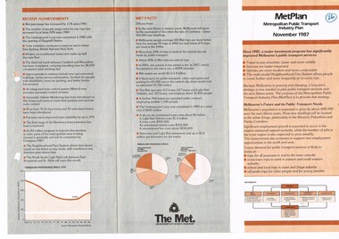
Pamphlet, The Met, "Metplan - Metropolitan Public Transport Industry Plan - November 1987", Nov. 1987
Three fold pamphlet, titled "Metplan - Metropolitan Public Transport Industry Plan - November 1987", providing an update of the planning for the Melbourne Public Transport system. Gives three strategies, for going ahead. Has graphs, list of recent achievements and Met Facts. Has the Met logo.Has "26" circled in ink on the front cover.trams, tramways, metplan, public transport, buses, tramways, planning, railways -
 Melbourne Tram Museum
Document - Report, RBA Architects and Conservation Consultants, "For Hawthorn Tram Depot - Comment on the proposed redevelopment and Heritage Strategy", Nov. 1999
Report - 33 A4 pages - photocopied - titled "For Hawthorn Tram Depot - Comment on the proposed redevelopment and Heritage Strategy" Prepared by RBA Architects and Conservation Consultants of St Kilda for the East Asia Property Group Pty Ltd, 26/11/1999. Has a table of contents, gives a description of the proposed works, the site, the buildings, the proposed use, the two sheets, Tower wagon shed, the proposals and comments on Potential Impact of Development on the Cultural Heritage Significance. See Reg Item 550 for "Hawthorn and Malvern Tram Depots - Conservation Report"trams, tramways, hawthorn depot, conservation planning, tram museum -
 Melbourne Tram Museum
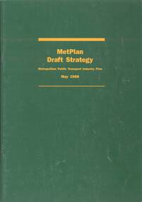
Document - Report, The Met, "Metplan Draft Strategy - May 1988", May. 1988
Report - summary - folded A3 sheet titled "Metplan Draft Strategy - May 1988". Gives introduction, purpose, strategy, maps, options for the various regions, system improvements, resources and next stops. Has the Met logo on the rear.trams, tramways, the met, reports, melbourne, metplan, new tramcars, planning, mta -
 Melbourne Tram Museum
Document - Report, Victoria Transport, "Central Area Transport Study", Mar. 1991
Report - 28 pages + card cover, centre stapled, titled "Central Area Transport Study", produced by Victoria Transport as part of the Central Area Transport Strategy (CATS), with a forward by the Minister for Transport, has a table of contents, figures and tables. Provides a set of Action Plans, looks at future, implementation, options, roads, tram and rail lines, cycle and pedestrians. See Reg Item 471 for a 1988 draft.In ink on top right hand corner "(1991)",trams, tramways, public transport, melbourne, road transport, the met, minister for transport -
 Melbourne Tram Museum
Document - Report, Road Traffic Authority, "Central Area Transport Study", Dec. 1988
Report - 108 pages + card cover, centre stapled, titled "Central Area Transport Study", produced by the Road Traffic Authority as part of the Central Area Transport Strategy (CATS), with a forward by the Minister for Transport Jim Kennan, has a table of contents, figures and tables. Provides a set of Action Plans, looks at future development areas around Melbourne, options, roads, tram and rail lines, cycle and pedestrians. Draft document. See Reg Item 1582 for a March 1991 version.Has pen marks high lighting various paragraphs.trams, tramways, public transport, melbourne, road transport, the met, minister for transport -
 Melbourne Tram Museum
Document - Report, State Co-ordination Council of Vic, "Transport Plan 1978 for Victoria", Dec. 1978
Reports - "Transport Plan 1978 for Victoria" Draft for Community Discussion - Released December 1978. .1 - Vol 1 - "The Strategy" - 48 pages, comb bound with green card coves. Looks at issues and policies in general, metro and non metro, transport policies and basic strategy. .2 - Vol 2 - "The five year plan" - 52 pages, comb bound with manila card covers with two fold out plans, looking at funding, a work program, projects and a bibliography for the three volumes. .3 - Vol 3 - "Basic Transport Data" - 108 pages, comb bound with blue card covers, with many tables and figures, looking at various demographics, metrics, including historical background, transport administration, existing transport system, travel characteristics and forecasts.trams, tramways, public transport, road transport, melbourne -
 Melbourne Tram Museum
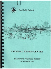
Document - Report, Dennis Johnston and Associates, Road Traffic Authority, "National Tennis Centre - Transport strategy Report November 1987", 1987
Report - 35 pages, within light blue covers, comb bound with black binder, titled "National Tennis Centre - Transport strategy Report November 1987". Report looks at the then planned Tennis Centre precinct and use of public transport in order to access it. It includes coach and car parking and how to handle various modes. Includes the MCG carpark, maps, parking areas, walking paths, access points. At the time, the tram line was located in Batman Ave. Also includes notes on the public information campaigns. Produced with the assistance of the MTA. Report prepared by Dennis Johnston and Associates for the Road Traffic Authority.trams, tramways, public transport, tennis centre, melbourne, mta -
 Melbourne Tram Museum
Document - Report, Metropolitan Transit Authority (MTA), "Metplan Draft Strategy - Metropolitan Public Transport Industry Plan - May 1988", May. 1988
Report - 40 pages, green card cover, centre stapled titled "Metplan Draft Strategy - Metropolitan Public Transport Industry Plan - May 1988", looking at Melbourne's transport needs over the next 15 years. Comments were to close on 15/8/1988. Produced by the MTA, signed off by K. P. Shea as Managing Director. Has an index, looks at the Task, heavy, light rail, tram, bus, taxis, ticketing systems, management, and the various regions including funding and budget.trams, tramways, discussion paper, transport, light rail, tramways, railways, road transport, minister for transport, mta, metplan -
 Bendigo Military Museum
Document - Disbandment of Army Survey Regiment Planning 1995, Army Survey Regiment, Bendigo, December 1995
... to be disbanded by 1 Dec 1996. Planning for the Disbandment is to consist... to be disbanded by 1 Dec 1996. Planning for the Disbandment is to consist ....1 Disbandment of Army Survey Regiment (ASR) Planning19 May 1995. Reference A - DCGS Directive /95 Implementation of the In-house option for the provision of Digital Topographic Support to the ADF. Reference B - Army Svy Regt 623-11-02 262/95 ADF Contingency Capability for the Provision of Topographic Data during the transition ASR to ATSE dated 12 May 1995. Reference A directs the ASR to be disbanded by 1 Dec 1996. Planning for the Disbandment is to consist of the following: Phase 1 - Development of Draft Outline Plan (1) Determine the Aim, Limitations and factors to be considered in the appreciation into the disbandment, (2) Conduct an appreciation to determine the best course of action, (3) Develop an Outline Plan for the Best Course of Action. (4) Brief DSVY-A and staff on the proposed Outline Plan. Phase 2 - Review of the Outline Plan by DSVY-A and issue further guidance. Phase 3 - Develop the Detailed plan including project management strategy. The disbandment is to achieve the smooth transition of operational responsibility to ATSE. The responsibility and resources to maintain the Minimum Operational Capability outlined in Reference B is to be formally passed to ATSE prior to disbandment. Proposed timings: Phase 1 completed by 1 Jun 95, Phase 2 completed by 15 Jun 95, Phase 3 complete d by 30 Jun 95, Disbandment completed by no later than 1 Dec 96 (Executive Order). All postings, administration and stores and equipment returns are to be completed by this date. .2 Disbandment of Army Survey Regiment Planning Report 26 May 1995 - Develop possible courses of action for the disbandment of ASR with reference to Technical, Historical and Union Issues by 6 Jun 95. .3 Disbandment of Army Survey Regiment Disbandment Team 26 May 1995 - Allocation of Team Members and responsibilities. .4 Disbandment of Army Survey Regiment May 1995 - Minimum Contingency Technical Equipment List for transition to ATSE. .5 Disbandment of Army Survey Regiment Plan 23 Aug 1995 - During the transition period (1 Jul 95 - 1 Dec 1996) leading to the full implementation of the Preferred In House Option (PIHO) Army Svy Regt and ATSE will at all times operate concurrently whilst Army Svy Regt scales down production and progressively transfers all technical functions to ATSE. Army Svy Regt will continue programmed production activities at best endeavor until declared operationally ineffective. During the transition to ATSE a contingency mapping capability is to be maintained. .6 Directorate of Survey - Army Commercial Support Program Digital Topographic Support to the ADF In-House Option Directive Dec 95. This directive defines the CSP contract management arrangements between the contract Administrator (DSVY-A) and the Contractor (ATSE) for the implementation and operation of the IHO for digital Topographic support to the ADF. .1 Disbandment of Army Survey Regiment Planning19 May 1995 - A4 paper clipped document, 4 x hole punched, 21 pages, diagrams and typed and hand written. .2 Disbandment of Army Survey Regiment Planning Report 26 May 1995 - A4 paper stapled document, 4 x hole punched, 9 pages, diagrams and typed and hand written. .3 Disbandment of Army Survey Regiment Disbandment Team 26 May 1995 - A4 paper stapled document, 4 x hole punched, 2 pages, typed. .4 Disbandment of Army Survey Regiment May 1995 - Minimum Contingency Technical Equipment for transition. A4 paper stapled document, 4 x hole punched, 2 pages, typed. .5 Disbandment of Army Survey Regiment Plan 23 Aug 1995 - A4 paper stapled document, 4 x hole punched, 10 pages, diagrams and typed. .6 Directorate of Survey - Army Commercial Support Program Digital Topographic Support to the ADF In-House Option Directive Dec 95. A4 paper clipped document, 4 x hole punched, 16 pages, diagrams and typed, hand written notes. royal australian survey corps, rasvy, fortuna, army survey regiment, army svy regt, atse, asr -
Lakes Entrance Historical Society
Book, East Gippsland Regional Catchment & Land Planning Board, Draft Regional Catchment Strategy 1996, 1996
... Draft of regional catchment strategy Waterways Planning ...Draft of regional catchment strategyPaperback 58 pageswaterways, planning committee -
Clunes Museum
Document - REPORT, HEPBURN SHIRE, 2024
PLANNING POLICY PRINCIPLES WILL BE TAILORED TO RESPOND TO LANDSCAPE VARIATION AND DRIVERS OF LAND USE CHANGE AND THE DIFFERENTIAL IMPACT THAT THESE HAVE ACROSS THE SHIRE....1 RURAL HEPBURN - AGRICULTURAL LAND STUDY AND RURAL SETTLEMENT STRATEGY, UNBOUND REPORT PRINTED IN COLOUR ON PAPER, 94 PAGES .2 FUTURE HEPBURN - CLUNES STRUCTURE PLAN, UNBOUND REPORT PRINTED IN COLOUR ON PAPER, 67 PAGES ADOPTED BY HEPBURN SHIRE COUNCIL 3 SEPTEMBER 2024hepburn shire council, rural settlement strategy -
 Eltham District Historical Society Inc
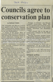
Article, Natalie Town, Councils agree to conservation plan, 6 December 1995
Newspaper article about the new Diamond Valley Conservation Strategy which will be used by Nillumbik and Banyule councils when developing conservation policies. The strategy was developed by the former Shire of Diamond Valley and documents environment and heritage values and possible threats to those values of the former Shire and policy aims and objectives.non-fictionNewspaper article about the new Diamond Valley Conservation Strategy which will be used by Nillumbik and Banyule councils when developing conservation policies. The strategy was developed by the former Shire of Diamond Valley and documents environment and heritage values and possible threats to those values of the former Shire and policy aims and objectives.conservation, strategy -
Lakes Entrance Historical Society
Book, Strategy Steering Committee, East Gippsland Planning &Development Strategy Draft Strategy May 1996, 1996
... to the formulation of an affective strategy for the municipality ...This document summaries the first round of consultations and meetings between East Gippsland Shire Council Government departments residents and ratepayers prior to the formulation of an affective strategy for the municipality for the future East Gippslandlocal government -
Lakes Entrance Historical Society
Book, Strategy Steering Committee, East Gippsland Shire Draft Strategy Mar 1997, 1997
The draft stategy plan provided a basic for discussion with the community about goals and future directions for the next 15 years for East Gippsland Victoriahouses, environment -
 Eltham District Historical Society Inc
Audio - Audio Compact Cassette Tape, Harry Gilham, Audio Recording; Eltham Library History presented by Harry Gilham, 1994
... was planned. Council developed a strategy to set aside capital funds... was planned. Council developed a strategy to set aside capital funds ...The new Eltham Library was opened 22 May 1994 and celebrates its 30th anniversay in 2024. This audio recording, presented by Harry Gilham, President of Eltham District Historical Society at the time of the opening is a summarised history of the Eltham Library service to 1994. Eltham Library Service 1930s - 1994 Originally collated by Harry Gilham, President, Eltham District Historical Society Inc (1993-2009) (edited 2022) In the Eltham township area, in the early 1930s, library books for adults were available from E J Andrew's newsagency in Main Road. In the newsagency come haberdashery, some shelves were set aside for a lending library of adults' books. In 1935, Mr & Mrs JC Rains purchased the newsagency and continued the lending service until the late 1940s. At this time the business was extended from haberdashery to sell ladies' and men's clothing. The library section was discontinued. In the 1930s a mobile book library was also run by a Mr Foster of Bible Street, Eltham. In the 1950s adult books were available from racks in the foyer of the Eltham Shire Offices which was then located beside the Eltham Hall on the comer of Arthur Street and Main Road. In the early 1950s a referendum of ratepayers was called to seek public opinion on the issue of raising money for a public library for which the rates would have to be increased - the motion was defeated. On 11 November 1965 Eltham Shire Council, in conjunction with the City of Heidelberg and the Shire of Diamond Valley, met to form the Heidelberg Regional Library Service. Eltham was represented by Councillors Charis Pelling and John Lewis. The first library service for the Shire of Eltham from this group came in the shape of a bookmobile van which had, amongst others, a central stopover near the Shillinglaw trees outside the newly opened Shire offices at 895 Main Road, the original site of Shillinglaw Cottage and the former Shillinglaw farm. Present-day Wingrove Park was another stopover and the many recorded requests for this service can be read as denoting the areas of population or gathering points at that period throughout the Shire. 1968 saw the Shire convert the ‘Brinkkotter’ house in Dudley Street to house both adult and children's books. This library was originally staffed from the City of Heidelberg Library and records of committee meetings range from borrowing Heidelberg's old library shelving to trying to increase the Government's subsidy to a dollar for dollar basis. Book loans in the period 1966-67 totalled 30,400 and the following year ran to 52,113. With 2 books plus 1 paperback the limit per person, it was overcrowded and unable to house the range of other services which had become common library stock. Planning to extend the Shire Offices by the addition of the south wing was an opportunity to re-house the Shire's Library. The opening of the library in the extension was carried out on 17th August 1971 by the Hon R J Hamer ED, MP, Chief Secretary of Victoria. Cr Geoffrey Dreverman officiated as the Shire President. The Heidelberg Regional Library Service continued until September 1985 when it disbanded. On 21 November 1985 the Yarra Plenty Regional Library Service was established. At that time Eltham was represented by Councillors Mary Grant and Robert Manuell. By 1987, over-crowding of the Eltham Library and an inability to house the range of other services yet again rose to prominence. At a Council meeting held on 1 June 1987, the Councillors supported a resolution which threatened to close the library on 30 September 1987. Council's frustration arose from yet another re-run of the annual State Government versus Council Library funding and records show first arose in Eltham Council in 1967 with the Government of 1he day. After prolonged public anger and petitions the motion to close the library was rescinded in August 1987. Council, considering the community's concern, set up a ‘Library Review Working Party’ which a year later became the Library Occasional Committee with direct access to Council. This Committee investigated the workings of the 386 square metre library and found inadequate space for storage and display, lack of equipment, out-of-date furniture together with an increasing patronage which resulted in queues of borrowers becoming longer no matter when the library was open. Community consultation took the form of 1,000 questionnaires sent to users and non-users along with noticeboard reminders of what was planned. Council developed a strategy to set aside capital funds from 1988 on an annual basis so that preliminary planning and consultative expenses could be met, and construction could be completed early 1997. The Committee visited metropolitan libraries which were catering for a similar population as was projected for Eltham. Australia-wide Federal Government funding grants under the Local Capital Works Program became available from October 1992 for community projects endorsed by local Councils. The Eltham Council submitted a proposal, based on library findings and requirements accumulated by the Library Occasional Committee, to the Federal Grants Committee to build a new Eltham Library. The Federal Grants Committee supported the funding request allowing commencement of the library project three years earlier than planned. With finance finalised, the Council set up its Eltham Library Re-development Special Committee which was given the task of overseeing what could be the last major expansion of the Shire's Library Service as Eltham's population nears its projected maximum. The new library was designed by Gregory Burgess and Peter Ryan of Gregory Burgess Pty Ltd. Construction of the library commenced in 1993 and was officially opened May 22nd, 1994. The library building was designed to reflect its parkland setting. External features include: the roof which includes interesting aspects when viewed from Main Road; verandahs which provide ramp access and give a sheltered entrance to the building; walls which feature locally made mudbricks, conventional bricks and copper panels; and space for an outdoor courtyard/reading area which will be developed later. Internally there are several features. The building includes a foyer with a fireplace suitable for displays including artwork, a community multi-purpose room suitable for meetings or functions and an outdoor cafeteria. The ceilings are lined with Victorian Ash. The shapes for the ceiling give a free-flowing form to the building. Brush Box has been used for the circulation and information desks. The tree trunk columns are Grey lronbark from New South Wales. Arches and various-shaped windows add interest to the internal structure. The carpet design reflects the Eltham environment and compliments the natural colours and timbers used in the building. Tiles by artist Felix Bosari feature in the building and additional art by local artists added externally and internally to the building. Since 1994 the library has undergone a major extension to cater for children’s services and others. See also EDHS_02111Digital file only recorded from Audio Cassette tape on loan Converted to MP3 file; 11.1MB, 0:08:49eltham library, opening, harry gilham, harry gilham collection, 1994, audio cassette, audio recording -
Bialik College
Document (series) - Box of strategic planning booklets and documents
strategy, elc, religion, 2000s, 1990s, 1980s, 2010s, promotionstrategy, elc, religion, 2000s, 1990s, 1980s, 2010s, promotion -
Port Melbourne Historical & Preservation Society
Pamphlet - CoPP's Port Melbourne foreshore strategy, City of Port Phillip, Port Melbourne Foreshore Strategy, 1995
The Port Melbourne Foreshore Strategy, prepared during the time of the commissioners, was an attempt to create a framework to manage anticipated development pressuresPamphlet advertising the City of Port Phillip's Port Melbourne foreshore strategy, 1995 (see also 967) Absent 11 Mar 2025town planning, local government - city of port phillip -
 Broadmeadows Historical Society & Museum
Photograph, Construction of Access Road, Banksia Gardens, c 1980s
... planning strategy, aimed at enhancing connectivity and facilitating ...This item depicts the construction of the Access Road to Banksia Gardens, The photograph captures a significant moment in the development of the Banksia Gardens housing project, highlighting the infrastructure improvements aimed at enhancing accessibility and connectivity within the community. The construction of the access road was a crucial step in the urban planning process, facilitating easier movement for residents and contributing to the overall development and integration of the housing estate.This item, showing the construction of the Access Road to Banksia Gardens, holds significant historical value. It documents a pivotal moment in the development of the Banksia Gardens housing project, illustrating the efforts to improve infrastructure and accessibility within the community. The construction of the access road was a key component in the urban planning strategy, aimed at enhancing connectivity and facilitating the movement of residents. This development not only improved the practical aspects of daily life for the community but also symbolised progress and growth within the housing estate. The photograph serves as an important record of the planning and development processes that shaped the Banksia Gardens community.Poor quality black and white photograph on matte photographic paper.banksia gardens, broadmeadows, construction, access road, c 1980's