Showing 1806 items matching "yarra park"
-
 Wonga Park Community Cottage History Group
photograph, dam making, c 1940 for 1003 c1960 for 1003-1
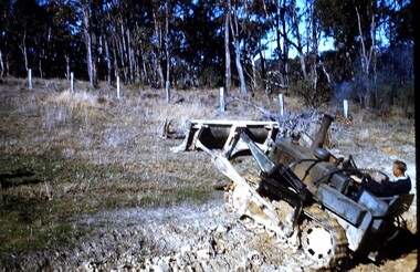
... Wonga Park , Yarra Valley, Victoria, Australia... Old Yarra Road Wonga Park melbourne Ernie Kear and his son ...Ernie Kear and his son Bruce were local excavators and involved in many projects around Wonga Park requiring bull dozing, in particular clearing land for orchards, building dams etcEarly history of Wonga Park orchard growing district. Early dams were built by horse and scoop on the back which was handled by the orchardist, or the dam builder but later replaced by bulldozersErnie Kear excavating a dam in Wonga Park c 1940 no hard copy electronic only -
 Wonga Park Community Cottage History Group
Photograph (sub-item) - Black and White, Viewing the camp from across the river at the 1948 Jamboree
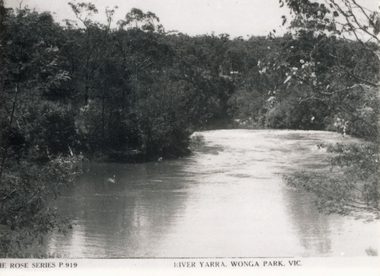
... THE ROSE SERIES P. 919 RIVER YARRA, WONGA PARK ... Old Yarra Road Wonga Park melbourne THE ROSE SERIES P. 919 ...THE ROSE SERIES P. 919 RIVER YARRA, WONGA PARK -
 St Kilda Historical Society
Photograph - Photo map, 3/3/1964
... Yarra Albert Park 1964 Vic 1833 Melbourne 1963 Project Run 15 ...One of a series of photo-maps produced for the Department of Crown Lands and Survey (1857-1983). For correlation with a current map, and access to other historical photo maps of Victoria, see the Historic Photo-Maps Index published by the Department of Environment, Land, Water and Planning at https://services.land.vic.gov.au/DELWPmaps/historical-photomaps/Black and white aerial photographVic 1833 Melbourne 1963 Project Run 15 3.3.64 Lens 205 152.70 M/M 5.150 56prahran, fawkner park, south yarra, albert park, 1964 -
 St Kilda Historical Society
Photograph - Photo map, Department of Crown Lands and Survey, 08/01/1970
... South Yarra Middle Park Prahran Windsor St Kilda St Kilda West ...One of a series of photo-maps produced for the Department of Crown Lands and Survey (1857-1983). For correlation with a current map, and access to other historical photo maps of Victoria, see the Historic Photo-Maps Index published by the Department of Environment, Land, Water and Planning at https://services.land.vic.gov.au/DELWPmaps/historical-photomaps/Black and white arial photographVic 2345 Department of Crown Lands and Survey Victoria,.© Melbourne 1970 Project Run 40 8.1.70 5,100 ASL 77albert park, fawkner park, south yarra, middle park, prahran, windsor, st kilda, st kilda west, 1970 -
 Kew Historical Society Inc
Photograph - Hicks' Cruises ticket seller at Princess Bridge, c.1953
... -- melbourne (vic.) river yarra Studley park hawthorn tea gardens ...Commercially-operated boat tours on the Maribyrnong and Yarra Rivers in Melbourne were a major tourist attraction, especially in the first half of the twentieth century. A number of companies ran ferries and motor-launches to locations such as the Riverview Tea Gardens (1909-1947) at Ascot Vale, and the Hawthorn Tea Gardens on the corner of Power Street and Riversdale Road. One of the families which ran these services was Hicks Bros, which from circa 1921 operated a ferry service from Princess Walk (Melbourne) to Studley Park. This is one of a series of 17 black and white undated photographic proofs donated to the Kew Historical Society in 2013 by the Queenscliffe Historical Museum. The series includes images of individuals, tea rooms, ferries, motor launches, ocean liners and tugs. In 1953, the owner of Hicks Bros was involved in an inquest into the drowning of a Ukrainian tourist on a ferry operated by Melbourne Ferries, a rival firm. In published reports of the inquest, reference is made to a number of photographs taken by Robert Irvine Atchison, part-owner of Hicks Bros. As the reverse of the photographs indicates copyright is held by the State of Victoria, the collection may have derived from that year.Closeup photograph of a ticket seller touting for business for a tourist ferry moored at Princess Bridge The sign on the boat identifies the destination of the ferry as 'Studley Park via Hawthorn Tea Gardens'. The ferry is empty of passengers.hicks' cruises, tourism -- melbourne (vic.), river yarra, studley park, hawthorn tea gardens -
 Kew Historical Society Inc
Photograph - Victorian Canoe Club, V.C.C. Studley Park, 1920-30
... Yarra Studley park boat houses canoe clubs "V.C.C. Studley Park ...Canoeing on the River Yarra at Melbourne was an important and widespread recreational pursuit for Melbournians, especially in the first half of the twentieth century. The Victorian Canoe Club was formed in 1912 at a meeting in Melbourne and its first committee elected in the same year. Records indicate that the Club continued into at least the 1950s .The album has historic and social significance as a record of recreational activities (as well as canoe making) in the early years of the twentieth century. It has local significance as the site of the headquarters of the Club was in Studley park. A number of photographs in the album provide vistas of Kew on the Yarra that are otherwise unavailable.One of 24 labelled photos in part album, originating from the Victorian Canoe Club, which had its headquarters in Studley Park, Kew. The album includes a photographic record of canoe construction and also locations in Studley Park and Kew where the canoes were used. The subject of this photograph is identified as 'V.C.C. Studley Park' with its single storey weatherboard club house on the banks of the Yarra River."V.C.C. Studley Park"victorian canoe club, river yarra, studley park, boat houses, canoe clubs -
 Kew Historical Society Inc
Photograph - Victorian Canoe Club, On the Yarra, 1920-30
... Yarra Studley park canoe clubs canoeing Recreation -- canoeing ...Canoeing on the River Yarra at Melbourne was an important and widespread recreational pursuit for Melbournians, especially in the first half of the twentieth century. The Victorian Canoe Club was formed in 1912 at a meeting in Melbourne and its first committee elected in the same year. Records indicate that the Club continued into at least the 1950s .The album has historic and social significance as a record of recreational activities (as well as canoe making) in the early years of the twentieth century. It has local significance as the site of the headquarters of the Club was in Studley park. A number of photographs in the album provide vistas of Kew on the Yarra that are otherwise unavailable.One of 24 labelled photos in part album, originating from the Victorian Canoe Club, which had its headquarters in Studley Park, Kew. The album includes a photographic record of canoe construction and also locations in Studley Park and Kew where the canoes were used. The subject of this photograph is identified as 'On the Yarra' with a man paddling a canoe. Another canoe is in the background. "On the Yarra"victorian canoe club, river yarra, studley park, canoe clubs, canoeing, recreation -- canoeing -
 Kew Historical Society Inc
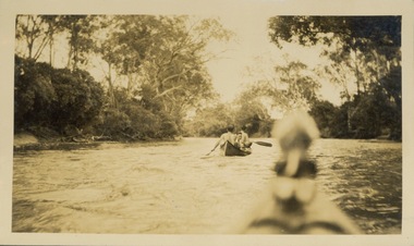
Photograph - Victorian Canoe Club, Through the rapids, 1920-30
... Yarra Studley park canoe clubs canoeing Recreation -- canoeing ...Canoeing on the River Yarra at Melbourne was an important and widespread recreational pursuit for Melbournians, especially in the first half of the twentieth century. The Victorian Canoe Club was formed in 1912 at a meeting in Melbourne and its first committee elected in the same year. Records indicate that the Club continued into at least the 1950s .The album has historic and social significance as a record of recreational activities (as well as canoe making) in the early years of the twentieth century. It has local significance as the site of the headquarters of the Club was in Studley park. A number of photographs in the album provide vistas of Kew on the Yarra that are otherwise unavailable.One of 24 labelled photos in part album, originating from the Victorian Canoe Club, which had its headquarters in Studley Park, Kew. The album includes a photographic record of canoe construction and also locations in Studley Park and Kew where the canoes were used. The subject of this photograph is identified as 'Through the rapids' with two men and a boy in the first canoe travelling through rapids with another canoe following from which the photograph is taken. "Through the rapids"victorian canoe club, river yarra, studley park, canoe clubs, canoeing, recreation -- canoeing -
 Kew Historical Society Inc
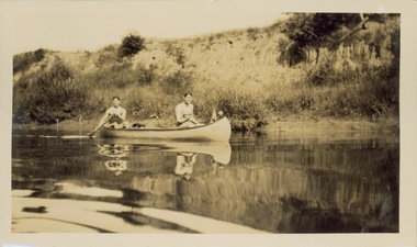
Photograph - Victorian Canoe Club, Yarra near Burke Road, 1920-30
... Yarra Studley park canoe clubs canoeing Recreation -- canoeing ...Canoeing on the River Yarra at Melbourne was an important and widespread recreational pursuit for Melbournians, especially in the first half of the twentieth century. The Victorian Canoe Club was formed in 1912 at a meeting in Melbourne and its first committee elected in the same year. Records indicate that the Club continued into at least the 1950s .The album has historic and social significance as a record of recreational activities (as well as canoe making) in the early years of the twentieth century. It has local significance as the site of the headquarters of the Club was in Studley park. A number of photographs in the album provide vistas of Kew on the Yarra that are otherwise unavailable.One of 24 labelled photos in part album, originating from the Victorian Canoe Club, which had its headquarters in Studley Park, Kew. The album includes a photographic record of canoe construction and also locations in Studley Park and Kew where the canoes were used. The subject of this photograph is identified as 'Near Burke Road' with two young men in a canoe on a still section of the Yarra. "Near Bourke Rd"victorian canoe club, river yarra, studley park, canoe clubs, canoeing, recreation -- canoeing, burke road -- kew (vic.) -
 Kew Historical Society Inc
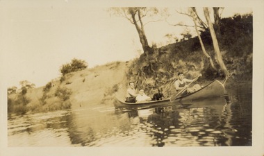
Photograph - Victorian Canoe Club, Yarra near Burke Road, 1920-30
... Yarra Studley park canoe clubs canoeing Recreation -- canoeing ...Canoeing on the River Yarra at Melbourne was an important and widespread recreational pursuit for Melbournians, especially in the first half of the twentieth century. The Victorian Canoe Club was formed in 1912 at a meeting in Melbourne and its first committee elected in the same year. Records indicate that the Club continued into at least the 1950s .The album has historic and social significance as a record of recreational activities (as well as canoe making) in the early years of the twentieth century. It has local significance as the site of the headquarters of the Club was in Studley park. A number of photographs in the album provide vistas of Kew on the Yarra that are otherwise unavailable.One of 24 labelled photos in part album, originating from the Victorian Canoe Club, which had its headquarters in Studley Park, Kew. The album includes a photographic record of canoe construction and also locations in Studley Park and Kew where the canoes were used. The subject of this photograph is identified as 'Near Burke Road' with three men and a dog in a canoe on a still section of the Yarra. "Near Bourke Rd"victorian canoe club, river yarra, studley park, canoe clubs, canoeing, recreation -- canoeing, burke road -- kew (vic.) -
 Kew Historical Society Inc
Photograph - Yarra Bend and Kew Asylum, 1924
... yarra bend park... kew asylum yarra bend park "Yarra Rvr / Kew" Digital copy ...Henry Beater Christian (1886-1962) , was a descendant of one of the earliest settler families in Kew. Employed at the Kew Asylum as a 'public servant', he was a skilled amateur photographer, photographing numerous scenes in Kew and on his travels around Victoria. The majority of his photographs date from 1916 to 1929. His finest photographs are housed in two photograph albums. Digital copy of a photograph from page 6 of the 47-page photograph album containing 261 gelatinous silver images, loaned by Diane Washfold with permission given to digitise and hold a copy in our collection. This is a photograph of the grounds of the Yarra Bend Asylum looking across the Yarra River to the Kew Asylum on the horizon. The photograph predates the 1929 closure of the Yarra Bend Asylum. "Yarra Rvr / Kew"henry beater christian (1886-1962), landscape photography, kew (vic.) — yarra river, christian-washfold collection, photograph albums, yarra bend asylum, kew asylum, yarra bend park -
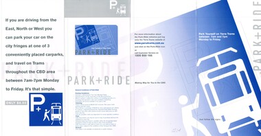 Melbourne Tram Museum
Pamphlet, Yarra Trams, "Park & Ride", c2001
... about a Park and Ride scheme of Yarra Trams. Trams tramways ...pamphlet about parking at Melbourne Museum, Colonial Stadium, or Olympic Park, and then using trams after purchasing a ticket. The map gave the locations of car parks and the travel limitations of the ticket. The pamphlet has instructions on how to use, the costs, and that it is only available on the tram service. Not dated, c2001 - Colonial stadium known as such between 2000 and 2002 - see https://en.wikipedia.org/wiki/Docklands_Stadium - accessed 7-12-2015. Second copy has a yellow sticker on the front, "All Day car parking and Tram Travel $8.50"Yields information about a Park and Ride scheme of Yarra Trams.Pamphlet - DL four fold titled "Park & Ride". Two copies held.trams, tramways, yarra trams, park and ride, tickets, melbourne -
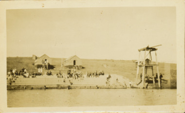
![Photograph (sub-item) - Black and White, The Wonga Park ‘swimming pool’ in the Yarra River, 1940’s – now in Jumping Creek Reserve (1985) [This may be the swimming pool in Jumping Creek Reserve or may be the swimming pool in Clifford Park in use in the 1948-9 Pan-Pacific Jamboree]](/media/collectors/5c7716e021ea6a1a60039fee/items/631b95b3d61f455ba20ef2cb/item-media/631b961fd61f455ba20ef417/item-fit-380x285.jpg) Wonga Park Community Cottage History Group
Wonga Park Community Cottage History GroupPhotograph (sub-item) - Black and White, The Wonga Park ‘swimming pool’ in the Yarra River, 1940’s – now in Jumping Creek Reserve (1985) [This may be the swimming pool in Jumping Creek Reserve or may be the swimming pool in Clifford Park in use in the 1948-9 Pan-Pacific Jamboree]
... THE ROSE SERIES P. 922 SWIMMING POOL, RIVER YARRA, WONGA... Old Yarra Road Wonga Park melbourne THE ROSE SERIES P. 922 ...THE ROSE SERIES P. 922 SWIMMING POOL, RIVER YARRA, WONGA PARK, VIC. -
 Kew Historical Society Inc
Photograph - Deep Rock Swimming Pool and Clubrooms on the Yarra, c.1925
... "Bathing Club. Deep Rock on the Yarra. Studley Park... "Bathing Club. Deep Rock on the Yarra. Studley Park Melbourne ...The former Deep Rock Swimming Pool was about 500 yards [457 metres] above Dight’s Falls. It was there that the Deep Rock Swimming Club was established in 1906. This initial club was expanded in 1916 to incorporate a life-saving club. In 1918, John Wren, the president of the club offered the club £1000, and undertook to sponsor a patriotic carnival in March 1918, at which swimming champions would take part. The ‘pool’ was to achieve fame as the venue for a world record-breaking ‘swallow dive’ of 205 feet 9 inches [63 metres] by ‘Prince Wickyama’, [aka Alec Wickham], a Solomon Islander. The dive from a special platform on the west side of the Yarra was reputedly viewed by between 50,000-100,000 spectators, with funds going to the State War Council. The Herald, 25 March 1918, claimed that the wide area occupied by spectators made more precise estimates impossible. In the 1980s, the construction of the Eastern Freeway, and the consequent re-routing of the Yarra River led to the site of the Deep Rock Pool being obliterated. A small cairn and plaque on the Fairfield side of the river now marks its former site.Very rare early photograph off the Deep Rock swimming pool. The pool and its built structures are historically and socially important to the people of Collingwood, Fairfield and Kew. Small, faded, Gelatin Silver print positive photograph of the Deep Rock Swimming Pool situated on the Yarra at Collingwood and Fairfield. The famous diving tower is at the right of the photo. The built structures were constructed for the Deep Rock Swimming and Life Saving Club. People are sitting on the terraces above the river. "Bathing Club. Deep Rock on the Yarra. Studley Park Melbourne. Please credit E.J. Thomasson Collection"deep rock swimming pool, deep rock swimming club, deep rock lifesaving club, swimming -- river yarra, river yarra -
 Eltham District Historical Society Inc
Photograph, Fay Bridge, Griffith Park, Eltham, n.d
... melbourne Griffith Park is the former property and home of Cr Fred ...Griffith Park is the former property and home of Cr Fred Griffith in the 1950sfay bridge collection, daffodils, griffith park, yarra river -
 Eltham District Historical Society Inc
Document - Folder, McLean, 1984-1999
... Warrandyte Bridge Warrandyte Wingrove park Yarra River EDHS_04789 ...References to McLean family, Hector John McLean and Louisa Frances (nee Green) and six daughters who lived in Eltham during the period 1930 to 1934 inclusive. Lived in the former Evelyn Hotel at the time it was destroyed by fire and being part of the Centenary Parade in 1934 where the family won the Group Section for their entry “Pioneers of Eltham” Reminiscences provided by Edith Jones (nee M1934 flood, ballroom, baptism, barber shop, bittern, boy scouts, bremner's flat, burgoyne's shop, cable tram, cemetery road, centenary celebrations, centenary parade, christening, coach house, collis grocery, dalton street, depression, dole, dorothy jean mclean, edith jones (nee mclean), eltham fire brigade, eltham high school, eltham higher elementary school, eltham lower park, eltham railway station, eltham state school no. 209, evelyn hotel, fire damage - buildings, flinders naval depot, fordham, gladys evelyn mclean, gold mining, gwenneth mae mclean, gwladys evelyn mclean, headmistress, hector john mclean, isherwood house and shop, louisa frances mclean (nee green), metery road, methodist church, miss finnin, miss grant cottage, motor bike races, mrs barrett, mrs bremner, mrs hurley, olive isabel mclean, parade, phoebe lillian mclean, picnic, pioneers of eltham, pitt street, research fire brigade, rev. r.g. arthur, shed, shops, st margarets church hall, st margaret's church, stables, state savings bank of victoria, susso books, todaro, vinnie willet, warrandyte bridge, warrandyte, wingrove park, yarra river -
 Eltham District Historical Society Inc
Book, Diamond Creek Basin Study. Part 1, A Compendium of Factors Relevant to Stormwater Flows, 1980
... road weidlich road wingrove park yarra river zig zag road water ...Basin Studies are studies to evaluate water supply and demand and help ensure reliable water supplies by identifying strategies to address imbalances in water supply and demand.Spiral Bound. 157 leaves in various foliations (some folded) : illustrated. (some colour.), maps (some colour.)aerial photographs, allendale road, arthurs creek mine, arthurs creek road bridge, arthurs creek, bald spur look-out, bank protection, bolton steet, bridge street bridge, bridge street, bridges, challenger street, chute street, construction, coolaroo drive, culvert, deep creek, diamond creek basin, diamond creek region, diamond creek, diamond street bridge, drainage works, eltham lower park, eltham town park, eltham trestle bridge, eltham west drains, eltham, erosion, flood management, floods, footbridge, glen katherine estate, gold mining, gum glade, hurstbridge, kangaroo ground, kinglake escarpment, kinglake national park, latiners hat factory, main road bridge, main road, masons falls, melbourne metropolitan board of works, monash bridge, mount sugarloaf, nillumbik park, orchards, railway culvert, railway line, ramptons road, real estate advertisement, research creek, st helena east drain, st helena road, st helena, storm sewers, stormwater, sugarloaf-preston transfer main crossing, susan street, union mine, village pond, water flow, watkins street, wattletree road, weidlich road, wingrove park, yarra river, zig zag road, water supply, basin study -
 Marysville & District Historical Society
Flyer (item) - Information Flyer, Artworkz Tourism, Marysville-Phantom Falls, Post 2009
... yarra ranges national park... Marysville yarra-valley-and-the-dandenong-ranges A flyer ...A flyer that was produced as a guide to Phantom Falls near Marysville in Victoria.A flyer that was produced as a guide to Phantom Falls near Marysville in Victoria. Phantom Falls is located off Lady Talbot Drive. Lady Talbot Drive a 24 kilometer scenic rainforest car journey which passes a number of walks and waterfalls in the Yarra Ranges National Park. Lady Talbot Drive is named after Lady Sarah Elizabeth, the wife of Sir Reginald Talbot, who was the Governor of Victoria from 25th April, 1904 to 6th July 1908.phantom falls, marysville, victoria, lady talbot drive, lady talbot forest drive, sir reginald talbot, lady sarah elizabeth talbot, yarra ranges national park -
 Marysville & District Historical Society
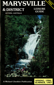
Booklet (Item) - Leisure guide, Michael Chesire & Associates Pty. Ltd, MARYSVILLE & DISTRICT LEISURE GUIDE-SPRING, 1986/SUMMBER, 1987, 1986
... lake eildon fraser national park yarra valley wineries ...A free leisure guide to Marysville and the surrounding district published for Spring 1986, and Summer, 1987. This was produced by Michael Cheshire as a free publication to promote tourism in Marysville and the surrounding district. It includes maps of the Big River Valley, Cumberland Valley, Lady Talbot Forest Drive, the Marysville area, and the township of Marysville. It was released in the spring of 1986. A free leisure guide to Marysville and the surrounding district published for Spring 1986, and Summer 1987.Kilmore Historical Society *10/183 *MDL.1.marysville, victoria, australia, leisure guide, michael cheshire & associates pty ltd, marysville golf club, blackwood lodges, sir colin mackenzie fauna park, lake eildon, fraser national park, yarra valley wineries, marysville coach tours, kooringa, marylands guest house, lady talbot forest drive, wishing well, taggerty river recreation area, athols abbey, phantom falls, keppel falls, the beeches walking track, marylyn guest house, kufstein inn motel, the cumberland, marysville tourist & progress association, marysville newsagency & general store, crossways restaurant & motel, beauty spot walk, tree fern gully walk, michaeldene track, keppel track, woods lookout track, marysville hotel motel, lake mountain ski hire, marysville recreation and fun park, mytanta horseback safaris, upper big river valley, the big culvert, marysville mountain view horse hire, maryton park, amber view holiday lodges, cathedral restaurant, the top shop, tower motel, menzes garage, beauty spot nursery, marysville ski hire, lake mountain ski school, faraway forest, scenic motel, buxton trout farm, marysville hardware, timbertop steakhouse, marysville trout farm, healesville sanctuary, buxton hotel motel, nanda binya lodge, buxton antique and furniture mart, the black spur inn hotel, alexandra, lake mountain, j l gould sawmills pty. ltd., geoffrey pope & associates, marysville crafts & gifts, olde yarra track shoppe, cumberland scenic reserve, tudor lodge road house, fruit salad farm, highwayman's retreat -
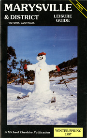 Marysville & District Historical Society
Booklet (Item) - Leisure guide, Michael Chesire & Associates Pty. Ltd, MARYSVILLE & DISTRICT LEISURE GUIDE-WINTER/SPRING 1987, 1987
... eildon fraser national park yarra valley wineries marysville ...A free leisure guide to Marysville and the surrounding district published for Winter and Spring, 1987. This was produced by Michael Cheshire as a free publication to promote tourism in Marysville and the surrounding district. It includes maps of the Big River Valley, Cumberland Valley, Lady Talbot Forest Drive, the Marysville area, and the township of Marysville. It was released in the winter of 1987. A free leisure guide to Marysville and the surrounding district published for Winter and Spring, 1987.marysville, victoria, australia, leisure guide, michael cheshire & associates pty ltd, marysville golf club, blackwood lodges, sir colin mackenzie fauna park, lake eildon, fraser national park, yarra valley wineries, marysville coach tours, kooringa, marylands guest house, lady talbot forest drive, wishing well, taggerty river recreation area, athols abbey, phantom falls, keppel falls, the beeches walking track, marylyn guest house, kufstein inn motel, the cumberland, marysville tourist & progress association, marysville newsagency & general store, crossways restaurant & motel, beauty spot walk, tree fern gully walk, michaeldene track, keppel track, woods lookout track, marysville hotel motel, lake mountain ski hire, marysville recreation and fun park, mytanta horseback safaris, upper big river valley, the big culvert, marysville mountain view horse hire, maryton park, amber view holiday lodges, cathedral restaurant, the top shop, tower motel, menzes garage, marysville ski hire, lake mountain ski school, faraway forest, scenic motel, buxton trout farm, marysville hardware, timbertop steakhouse, marysville trout farm, healesville sanctuary, buxton hotel motel, nanda binya lodge, buxton antique and furniture mart, the black spur inn hotel, alexandra, lake mountain, j l gould sawmills pty. ltd., geoffrey pope & associates, marysville crafts & gifts, olde yarra track shoppe, cumberland scenic reserve, tudor lodge road house, fruit salad farm, highwayman's retreat, beauty spot display gardens & nursery, ski lake mountain cross country ski hire & kitchen, buxton store, valley view marysville, acheron way, mt donna buang road, snow gum woodlands, alpine ash forests, mountain ash forests, stringybark forests, messmate forests, manna gum forests -
 Marysville & District Historical Society
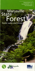
Ephemera (Item) - Information brochure, Department of Sustainability and Environment, Marysville State Forest, 2003
... yarra ranges national park... & environmnet lake mountain cambarville yarra ranges national park ...An information brochure on various forest walks and drives throughout the Marysville State Forest that was published by the Victorian Department of Sustainability and Environment in 2003.An information brochure on various forest walks and drives throughout the Marysville State Forest that was published by the Victorian Department of Sustainability and Environment in 2003.marysville, victoria, australia, information brochure, marysville state forest, lady talbot forest drive, taggerty river picnic area, the beeches, coupe loop, leadbeater's possum, beckter lookout, steavenson falls, marysville visitor information centre, department of sustainability & environmnet, lake mountain, cambarville, yarra ranges national park, cathedral range state park, murrindindi scenic reserve, gilberts gully loop, beauty spot nature trail, trestle track, michaeldene track, keppel lookout, marysville tour -
 Marysville & District Historical Society
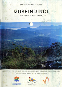
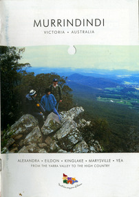
Booklet (Item) - Information booklet, Alexandra Newspapers, OFFICIAL VISITORS' GUIDE MURRINDINDI VICTORIA-AUSTRALIA, 03-2005
... yarra ranges national park... range state park murrindindi scenic reserve yarra ranges ...An information booklet on the Murrindindi region in Victoria. This information booklet was produced by Alexandra Newspapers in partnership with the Murrindindi Regional Tourism Association in March 2005.An information booklet on the Murrindindi region in Victoria.Produced and published by Alexandra Newspapers/ Pty Ltd in partnership with the Murrindindi Regional/ Tourism Association. murrindindi, victoria, australia, alexandra, eildon, kinglake, marysville, yea, yarra valley, high country, visit victoria, alexandra newspapers, murrindindi tourism association, rubicon valley horse riding, cathedral range state park, murrindindi scenic reserve, yarra ranges national park, cumberland memorial scenic reserve, the big culvert, cambarville, the big tree, steavenson falls, cora lynn falls, cumberland falls, lady talbot drive, phantom falls, keppel falls, the beeches, the cascades, wilhelmina falls, murrindindi cascades, lake mountain, cathedral lane vineyard, south cathedral farm, marysville holiday cottages, crystal journey, country touch, marysville ski centre, mountain lodge marysville, eco adventure tours, the mountain gallery, marysville country real estate, camellia log cabin, crossways historic country inn, marylands country house, ashlar cottage b&b, kerami guesthouse, melina cottages, willowbank at taggerty, mary lyn holiday resort, kooringa resort & conference centre, marysville caravan & holiday park, lyell guest cottages, eagle mountain retreat, keppels hotel motel, anastasia fairytale cottage, mystic mountain holiday cottages, esa camping & conference centre, buxton trout & salmon farm, woodlands rainforest bungalows, the old woolshed cafe, yarrolyn holiday park -
 Eltham District Historical Society Inc
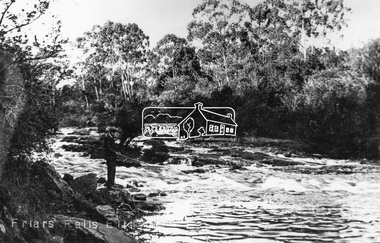
Negative - Photograph, Tom Prior, Friars Falls, Eltham, c.1910
... Friars Falls is near Griffith Park, Eltham on the Yarra... melbourne Friars Falls is near Griffith Park, Eltham on the Yarra ...Friars Falls is near Griffith Park, Eltham on the Yarra RiverThis photo forms part of a collection of photographs gathered by the Shire of Eltham for their centenary project book,"Pioneers and Painters: 100 years of the Shire of Eltham" by Alan Marshall (1971). The collection of over 500 images is held in partnership between Eltham District Historical Society and Yarra Plenty Regional Library (Eltham Library) and is now formally known as the 'The Shire of Eltham Pioneers Photograph Collection.' It is significant in being the first community sourced collection representing the places and people of the Shire's first one hundred years. The Reynolds family were early settlers in Research. The Reynolds/ Prior collection of photographs were taken by Tom Prior, the maternal uncle of Ivy Reynolds, around 1900 and the 60 photos in the album give a fine overview of many of the landmarks of Research and Eltham over 100 years ago. lvy lived in the family home for many years at 106 Thompson Cres Research. Ivy's father, Ernst Richard Reynolds and grandfather, Richard Reynolds, lived at the same address. Ivy's father Richard worked for Mr. Trail on his property in Research. Reynolds Road is named after the family. Mr Tom Prior (wife Eva) worked at the Melbourne zoo. He was very innovative and made his own camera, using the black cloth hood to exclude the light. The photographs are a reminder of the rural nature of Research and Eltham and its rich heritage.Digital image 4 x 5 inch B&W Negshire of eltham pioneers photograph collection, eltham, friars falls, griffith park, yarra river, reynolds prior collection -
 Eltham District Historical Society Inc
Photograph, Liz Pidgeon, Heritage Excursion; Eltham Lower Park Walk and Talk, 1 July 2017, 1 July 2017
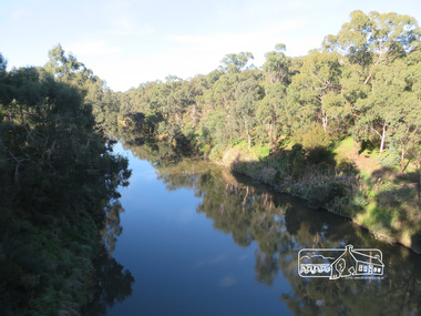
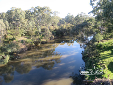
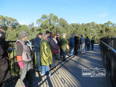
... district historical society eltham lower park yarra river ...Newsletter No., 234, June 2017 Heritage Excursion - Saturday 1st July - Eltham Lower Park - Walk and Talk Eltham Lower Park has played an important part in the history of our area since the early days of European settlement when it was used by local residents as an informal racecourse. Prior to that its location at the junction of the Diamond Creek and the Yarra River made it an important meeting place for the Wurundjeri people. The park combines formal elements and sporting facilities with remnant bushland that is of environmental significance. It is home to sporting and horse riding clubs, popular play spaces and the Diamond Valley Miniature Railway, which attracts large numbers of visitors. The park will be the venue for our July excursion which will comprise a walk of about 3.5 km around the park and adjacent areas. Along the way we will discuss the history and natural history of the area. The path along the creek and the river provides a pleasant and scenic walk. This walk on Saturday 1st July is about 3.5 km in length and will take 2 to 2.5 hours. It will start at 2pm at the Main Road car park at the front of the park. (Melway ref 21 H 10). Born Digitalheritage excursion, activities, eltham district historical society, eltham lower park, yarra river, reflection -
 Eltham District Historical Society Inc
Photograph, Liz Pidgeon, Heritage Excursion; Eltham Lower Park Walk and Talk, 1 July 2017, 1 July 2017
... activities eltham district historical society eltham lower park Yarra ...The Yarra Footbridge Newsletter No., 234, June 2017 Heritage Excursion - Saturday 1st July - Eltham Lower Park - Walk and Talk Eltham Lower Park has played an important part in the history of our area since the early days of European settlement when it was used by local residents as an informal racecourse. Prior to that its location at the junction of the Diamond Creek and the Yarra River made it an important meeting place for the Wurundjeri people. The park combines formal elements and sporting facilities with remnant bushland that is of environmental significance. It is home to sporting and horse riding clubs, popular play spaces and the Diamond Valley Miniature Railway, which attracts large numbers of visitors. The park will be the venue for our July excursion which will comprise a walk of about 3.5 km around the park and adjacent areas. Along the way we will discuss the history and natural history of the area. The path along the creek and the river provides a pleasant and scenic walk. This walk on Saturday 1st July is about 3.5 km in length and will take 2 to 2.5 hours. It will start at 2pm at the Main Road car park at the front of the park. (Melway ref 21 H 10). Born Digitalheritage excursion, activities, eltham district historical society, eltham lower park, yarra footbridge -
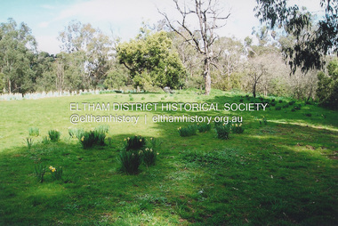
 Eltham District Historical Society Inc
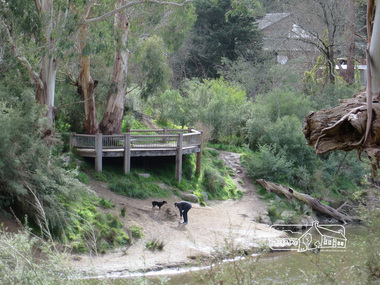
Photograph, Liz Pidgeon, View from Candlebark Park across the Yarra to the confluence of the Diamond Creek and Yarra River at Lennister Farm, 16 July 2017, 16 July 2017
... View from Candlebark Park across the Yarra to the... melbourne eltham candlebark park yarra river diamond creek lennister ...Born Digitaleltham, candlebark park, yarra river, diamond creek, lennister farm -
 Marysville & District Historical Society
Booklet (Item) - Leisure guide, Michael Chesire & Associates Pty. Ltd, MARYSVILLE & DISTRICT LEISURE GUIDE-AUTUMN/WINTER, 1986, 1986
... park yarra valley wineries marysville coach tours kooringa ...A free leisure guide to Marysville and the surrounding district published for Autumn and Winter, 1986. This was produced by Michael Cheshire as a free publication to promote tourism in Marysville and the surrounding district. It includes maps of the Big River Valley, Cumberland Valley, Lady Talbot Forest Drive, the Marysville area, and the township of Marysville. It was released in the autumn of 1986 and was sponsored by the Marysville Tourist & Progress Association. The Association was formed in November 1907 to promote tourism within the area. This included the physical creation of signage, parklands, roads, and walks to various attractions. A free leisure guide to Marysville and the surrounding district published for Autumn and Winter, 1986.marysville, victoria, australia, leisure guide, michael cheshire & associates pty ltd, marysville golf club, blackwood lodges, sir colin mackenzie fauna park, lake eildon, fraser national park, yarra valley wineries, marysville coach tours, kooringa, marylands guest house, lady talbot forest drive, wishing well, taggerty river recreation area, athols abbey, phantom falls, keppel falls, the beeches walking track, marylyn guest house, kufstein inn motel, the cumberland, marysville tourist & progress association, marysville newsagency & general store, crossways restaurant & motel, beauty spot walk, tree fern gully walk, michaeldene track, keppel track, woods lookout track, marysville hotel motel, lake mountain ski hire, marysville recreation and fun park, mytanta horseback safaris, upper big river valley, the big culvert, marysville mountain view horse hire, maryton park, amber view holiday lodges, cathedral restaurant, the top shop, tower motel, menzes garage, beauty spot nursery, marysville ski hire, lake mountain ski school, faraway forest, scenic motel, buxton trout farm, marysville hardware, timbertop steakhouse, marysville trout farm, healesville sanctuary, buxton hotel motel, nanda binya lodge, buxton antique and furniture mart, the black spur inn hotel, alexandra, lake mountain, geoffrey pope & associates -
 Marysville & District Historical Society
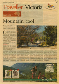
Newspaper (Item) - Newspaper article, The Age, POCKET GUIDE TO MARYSVILLE, 22-11-2008
... yarra ranges national park... yarra ranges national park the big tree cumberland walk lake ...A newspaper article on Marysville, its local attractions, places to shop and dine, where to stay and ways of traveling to Marysville. This article was published in The Age on Saturday, November 22, 2008.A newspaper article on Marysville, its local attractions, places to shop and dine, where to stay and ways of traveling to Marysville.marysville, victoria, australia, the age, black spur, marysville visitor information centre, steavenson falls, lady talbot drive, taggerty river, keppel falls, phantom falls, beeches rainforest walk, cambarville, yarra ranges national park, the big tree, cumberland walk, lake mountain, steavenson river, acheron river, buxton bait and tackle, marysville trout and salmon ponds, buxton trout and salmon farm, bruno's art and sculpture garden, villa day spa, cathedral view natural therapies, marysville massage, murchison street, village walk, uncle fred & aunty val's old style lolly shop, country touch gallery, manical mechanicals, hidden talent craft gallery, carmyle farm boutique, marysville community market, marysville patisserie, marysville country bakery, fraga's cafe restaurant, terracotta room, marylands country house, the cumberland, mantirri blueberry farm, narbethong, marysville farmers market, the black spur inn, allawah country cottages, barree mud brick cottages -
 Marysville & District Historical Society
Booklet (Item) - Information booklet, Alexandra Newspapers, MURRINDINDI VICTORIA-AUSTRALIA, 02-2004
... yarra ranges national park... range state park murrindindi scenic reserve yarra ranges ...An information booklet on the Murrindindi region in Victoria. This information booklet was produced by Alexandra Newspapers in partnership with the Murrindindi Regional Tourism Association in February 2004.An information booklet on the Murrindindi region in Victoria.Produced and published by Alexandra Newspapers/ Pty Ltd in partnership with the Murrindindi Regional/ Tourism Association. murrindindi, victoria, australia, alexandra, eildon, kinglake, marysville, yea, yarra valley, high country, visit victoria, alexandra newspapers, murrindindi tourism association, rubicon valley horse riding, cathedral range state park, murrindindi scenic reserve, yarra ranges national park, cumberland memorial scenic reserve, the big culvert, cambarville, the big tree, steavenson falls, cora lynn falls, cumberland falls, lady talbot drive, phantom falls, keppel falls, the beeches, the cascades, wilhelmina falls, murrindindi cascades, lake mountain, cathedral lane vineyard, south cathedral farm, marysville holiday cottages, crystal journey, country touch, marysville ski centre, mountain lodge marysville, eco adventure tours, the mountain gallery, marysville country real estate, camellia log cabin, crossways historic country inn, marylands country house, ashlar cottage b&b, kerami guesthouse, melina cottages, willowbank at taggerty, mary lyn holiday resort, kooringa resort & conference centre, marysville caravan & holiday park, lyell guest cottages, eagle mountain retreat, keppels hotel motel, anastasia fairytale cottage, mystic mountain holiday cottages, esa camping & conference centre, buxton trout & salmon farm, woodlands rainforest bungalows, the old woolshed cafe, yarrolyn holiday park