Showing 18666 items matching "oh-6"
-
 Eltham District Historical Society Inc
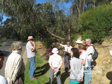
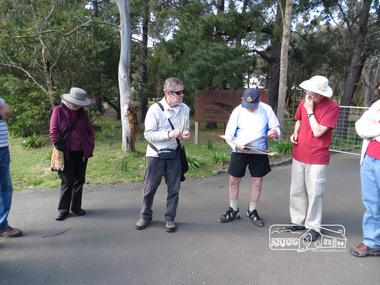
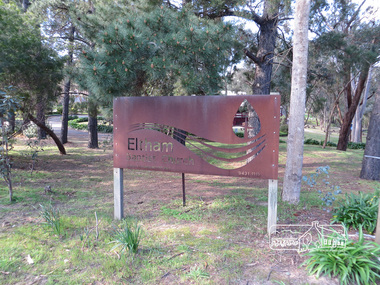
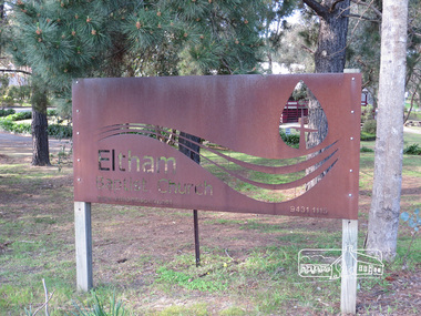
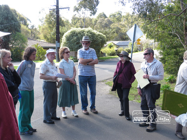
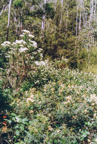
Photograph, Liz Pidgeon, Heritage Excursion; East of Eltham, 6 Sep 2014, 20 May 2017
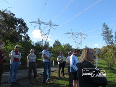
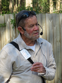
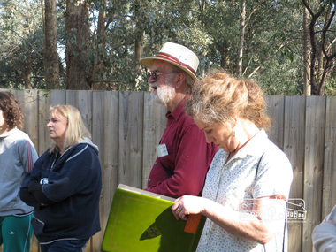
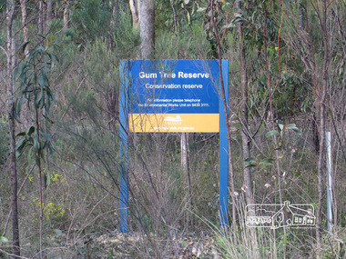
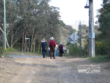
... Heritage Excursion; East of Eltham, 6 Sep 2014...It will start at 2pm at the corner of Eucalyptus Road, Pitt Street and Nyora Road. eltham east eltham district historical society heritage excursion activities nyora road reynolds road gum tree road reserve diosma road stokes orchard eucalyptus road Born Digital Heritage Excursion; East of Eltham, 6 Sep 2014 Photograph Liz Pidgeon ...Newsletter No. 218, September 2014 September Excursion - East of Eltham Walk In Newsletter No. 197, March 2011, there was a brief history of Crown Allotment 15 Section 5 Parish of Nillumbik (CA 15) a parcel of land of a quarter of a square mile extending from Eucalyptus Road to Reynolds Road at the eastern extremity of Eltham. From the 1940s it was known as Stokes orchard. In later years it has been subdivided for residential purposes but leaving significant areas as power line and water supply reserves and bushland reserves that are habitat for the threatened For our excursion on 6th September we intend to walk through CA 15 to a bushland reserve east of Reynolds Road. The walk will traverse the boundary between suburban Eltham and the non-urban areas to the south and east. This is a pleasant walk through residential areas and bushland. Along the way we will discuss the early and more recent history of CA 15 as well as local natural history and geology. This walk is about 3.5 km in length and will take 2 to 2.5 hours. It will start at 2pm at the corner of Eucalyptus Road, Pitt Street and Nyora Road.Born Digitaleltham east, eltham district historical society, heritage excursion, activities, nyora road, reynolds road, gum tree road reserve, diosma road, stokes orchard, eucalyptus road -
 Eltham District Historical Society Inc
Photograph, Liz Pidgeon, Heritage Excursion; East of Eltham, 6 Sep 2014, 20 May 2017
... Heritage Excursion; East of Eltham, 6 Sep 2014...It will start at 2pm at the corner of Eucalyptus Road, Pitt Street and Nyora Road. eltham east eltham district historical society heritage excursion activities nyora road reynolds road gum tree road reserve diosma road stokes orchard eucalyptus road Born Digital Heritage Excursion; East of Eltham, 6 Sep 2014 Photograph Liz Pidgeon ...Newsletter No. 218, September 2014 September Excursion - East of Eltham Walk In Newsletter No. 197, March 2011, there was a brief history of Crown Allotment 15 Section 5 Parish of Nillumbik (CA 15) a parcel of land of a quarter of a square mile extending from Eucalyptus Road to Reynolds Road at the eastern extremity of Eltham. From the 1940s it was known as Stokes orchard. In later years it has been subdivided for residential purposes but leaving significant areas as power line and water supply reserves and bushland reserves that are habitat for the threatened For our excursion on 6th September we intend to walk through CA 15 to a bushland reserve east of Reynolds Road. The walk will traverse the boundary between suburban Eltham and the non-urban areas to the south and east. This is a pleasant walk through residential areas and bushland. Along the way we will discuss the early and more recent history of CA 15 as well as local natural history and geology. This walk is about 3.5 km in length and will take 2 to 2.5 hours. It will start at 2pm at the corner of Eucalyptus Road, Pitt Street and Nyora Road.Born Digitaleltham east, eltham district historical society, heritage excursion, activities, nyora road, reynolds road, gum tree road reserve, diosma road, stokes orchard, eucalyptus road -
 Eltham District Historical Society Inc
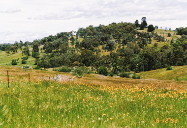
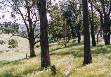
Photograph, Unopened section of Kings Road south from Glenvern Road, Panton Hill, 6 December 1992, 06/12/1992
... Unopened section of Kings Road south from Glenvern Road, Panton Hill, 6 December 1992...Eltham District Historical Society Inc 728 Main Rd Eltham melbourne The Eltham Horse Trail: Research and Warrandyte to Kinglake: Survey of proposed route, December 1992: (3) Kangaroo Ground to Kinglake eltham horse trail (1992 survey) glenvern road kings road panton hill Colour photograph Unopened section of Kings Road south from Glenvern Road, Panton Hill, 6 December 1992 Photograph ...The Eltham Horse Trail: Research and Warrandyte to Kinglake: Survey of proposed route, December 1992: (3) Kangaroo Ground to KinglakeColour photographeltham horse trail (1992 survey), glenvern road, kings road, panton hill -
 Eltham District Historical Society Inc
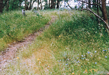
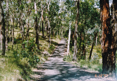
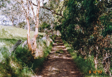
Photograph, Track along Glenvern Road, Panton Hill, 6 December 1992, 06/12/1992
... Track along Glenvern Road, Panton Hill, 6 December 1992...Eltham District Historical Society Inc 728 Main Rd Eltham melbourne The Eltham Horse Trail: Research and Warrandyte to Kinglake: Survey of proposed route, December 1992: (3) Kangaroo Ground to Kinglake eltham horse trail (1992 survey) glenvern road panton hill Colour photograph Track along Glenvern Road, Panton Hill, 6 December 1992 Photograph ...The Eltham Horse Trail: Research and Warrandyte to Kinglake: Survey of proposed route, December 1992: (3) Kangaroo Ground to KinglakeColour photographeltham horse trail (1992 survey), glenvern road, panton hill -
 Eltham District Historical Society Inc
Photograph, Track along Cracknells Road, Panton Hill, 6 December 1992, 06/12/1992
... Track along Cracknells Road, Panton Hill, 6 December 1992...Eltham District Historical Society Inc 728 Main Rd Eltham melbourne The Eltham Horse Trail: Research and Warrandyte to Kinglake: Survey of proposed route, December 1992: (3) Kangaroo Ground to Kinglake eltham horse trail (1992 survey) panton hill cracknells road Colour photograph Track along Cracknells Road, Panton Hill, 6 December 1992 Photograph ...The Eltham Horse Trail: Research and Warrandyte to Kinglake: Survey of proposed route, December 1992: (3) Kangaroo Ground to KinglakeColour photographeltham horse trail (1992 survey), panton hill, cracknells road -
 Eltham District Historical Society Inc
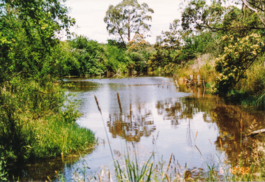
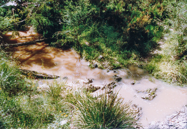
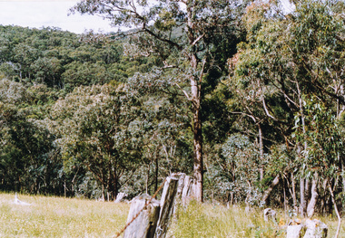
Photograph, Dam in Cracknells Road, Panton Hill, 6 December 1992, 06/12/1992
... Dam in Cracknells Road, Panton Hill, 6 December 1992...Eltham District Historical Society Inc 728 Main Rd Eltham melbourne The Eltham Horse Trail: Research and Warrandyte to Kinglake: Survey of proposed route, December 1992: (3) Kangaroo Ground to Kinglake eltham horse trail (1992 survey) panton hill cracknells road Colour photograph Dam in Cracknells Road, Panton Hill, 6 December 1992 Photograph ...The Eltham Horse Trail: Research and Warrandyte to Kinglake: Survey of proposed route, December 1992: (3) Kangaroo Ground to KinglakeColour photographeltham horse trail (1992 survey), panton hill, cracknells road -
 Eltham District Historical Society Inc
Photograph, Cracknells Road near Alma Road, Panton Hill, 6 December 1992, 06/12/1992
... Cracknells Road near Alma Road, Panton Hill, 6 December 1992...Eltham District Historical Society Inc 728 Main Rd Eltham melbourne The Eltham Horse Trail: Research and Warrandyte to Kinglake: Survey of proposed route, December 1992: (3) Kangaroo Ground to Kinglake eltham horse trail (1992 survey) panton hill cracknells road alma road Colour photograph Cracknells Road near Alma Road, Panton Hill, 6 December 1992 Photograph ...The Eltham Horse Trail: Research and Warrandyte to Kinglake: Survey of proposed route, December 1992: (3) Kangaroo Ground to KinglakeColour photographeltham horse trail (1992 survey), panton hill, cracknells road, alma road -
 Eltham District Historical Society Inc
Photograph, Rodger Road from Alma Road, Panton Hill, 6 December 1992, 06/12/1992
... Rodger Road from Alma Road, Panton Hill, 6 December 1992...Eltham District Historical Society Inc 728 Main Rd Eltham melbourne The Eltham Horse Trail: Research and Warrandyte to Kinglake: Survey of proposed route, December 1992: (3) Kangaroo Ground to Kinglake eltham horse trail (1992 survey) panton hill rodger road alma road Colour photograph Rodger Road from Alma Road, Panton Hill, 6 December 1992 Photograph ...The Eltham Horse Trail: Research and Warrandyte to Kinglake: Survey of proposed route, December 1992: (3) Kangaroo Ground to KinglakeColour photographeltham horse trail (1992 survey), panton hill, rodger road, alma road -
 Eltham District Historical Society Inc
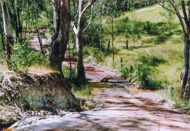
Photograph, Creek crossing, Rodger Road, Panton Hill, 6 December 1992, 06/12/1992
... Creek crossing, Rodger Road, Panton Hill, 6 December 1992...Eltham District Historical Society Inc 728 Main Rd Eltham melbourne The Eltham Horse Trail: Research and Warrandyte to Kinglake: Survey of proposed route, December 1992: (3) Kangaroo Ground to Kinglake eltham horse trail (1992 survey) panton hill rodger road Colour photograph Creek crossing, Rodger Road, Panton Hill, 6 December 1992 Photograph ...The Eltham Horse Trail: Research and Warrandyte to Kinglake: Survey of proposed route, December 1992: (3) Kangaroo Ground to KinglakeColour photographeltham horse trail (1992 survey), panton hill, rodger road -
 Eltham District Historical Society Inc
Photograph, Lawrence Road, Panton Hill, 6 December 1992, 06/12/1992
... Lawrence Road, Panton Hill, 6 December 1992...Eltham District Historical Society Inc 728 Main Rd Eltham melbourne The Eltham Horse Trail: Research and Warrandyte to Kinglake: Survey of proposed route, December 1992: (3) Kangaroo Ground to Kinglake eltham horse trail (1992 survey) panton hill lawrence road Colour photograph Lawrence Road, Panton Hill, 6 December 1992 Photograph ...The Eltham Horse Trail: Research and Warrandyte to Kinglake: Survey of proposed route, December 1992: (3) Kangaroo Ground to KinglakeColour photographeltham horse trail (1992 survey), panton hill, lawrence road -
 Eltham District Historical Society Inc
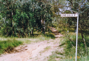
Photograph, Creek crossing, Long Gully Bushland Reserve, Panton Hill, 6 December 1992, 06/12/1992
... Creek crossing, Long Gully Bushland Reserve, Panton Hill, 6 December 1992...Eltham District Historical Society Inc 728 Main Rd Eltham melbourne The Eltham Horse Trail: Research and Warrandyte to Kinglake: Survey of proposed route, December 1992: (3) Kangaroo Ground to Kinglake eltham horse trail (1992 survey) panton hill long gully road Colour photograph Creek crossing, Long Gully Bushland Reserve, Panton Hill, 6 December 1992 Photograph ...The Eltham Horse Trail: Research and Warrandyte to Kinglake: Survey of proposed route, December 1992: (3) Kangaroo Ground to KinglakeColour photographeltham horse trail (1992 survey), panton hill, long gully road -
 Eltham District Historical Society Inc
Photograph, Motschalls Road from Long Gully Road, Panton Hill, 6 December 1992, 06/12/1992
... Motschalls Road from Long Gully Road, Panton Hill, 6 December 1992...Eltham District Historical Society Inc 728 Main Rd Eltham melbourne The Eltham Horse Trail: Research and Warrandyte to Kinglake: Survey of proposed route, December 1992: (3) Kangaroo Ground to Kinglake eltham horse trail (1992 survey) panton hill motschalls road long gully road Colour photograph Motschalls Road from Long Gully Road, Panton Hill, 6 December 1992 Photograph ...The Eltham Horse Trail: Research and Warrandyte to Kinglake: Survey of proposed route, December 1992: (3) Kangaroo Ground to KinglakeColour photographeltham horse trail (1992 survey), panton hill, motschalls road, long gully road -
 Eltham District Historical Society Inc
Photograph, Motschalls Road near Gills Road (now Turnung Road), Panton Hill, 6 December 1992, 06/12/1992
... Motschalls Road near Gills Road (now Turnung Road), Panton Hill, 6 December 1992...Eltham District Historical Society Inc 728 Main Rd Eltham melbourne The Eltham Horse Trail: Research and Warrandyte to Kinglake: Survey of proposed route, December 1992: (3) Kangaroo Ground to Kinglake eltham horse trail (1992 survey) panton hill motschalls road gills road turnung road Two colour photographs Motschalls Road near Gills Road (now Turnung Road), Panton Hill, 6 December 1992 Photograph ...The Eltham Horse Trail: Research and Warrandyte to Kinglake: Survey of proposed route, December 1992: (3) Kangaroo Ground to KinglakeTwo colour photographseltham horse trail (1992 survey), panton hill, motschalls road, gills road, turnung road -
 Eltham District Historical Society Inc
Photograph, Thick bush along unopened Government Road off Motschalls Road, Panton Hill, 6 December 1992, 06/12/1992
... Thick bush along unopened Government Road off Motschalls Road, Panton Hill, 6 December 1992...Eltham District Historical Society Inc 728 Main Rd Eltham melbourne The Eltham Horse Trail: Research and Warrandyte to Kinglake: Survey of proposed route, December 1992: (3) Kangaroo Ground to Kinglake eltham horse trail (1992 survey) panton hill motschalls road Colour photograph Thick bush along unopened Government Road off Motschalls Road, Panton Hill, 6 December 1992 Photograph ...The Eltham Horse Trail: Research and Warrandyte to Kinglake: Survey of proposed route, December 1992: (3) Kangaroo Ground to KinglakeColour photographeltham horse trail (1992 survey), panton hill, motschalls road -
 Eltham District Historical Society Inc
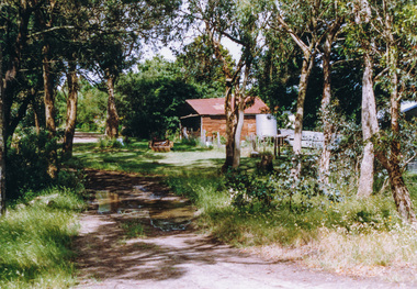
Photograph, Near Clintons Road, Panton Hill, 6 December 1992, 06/12/1992
... Near Clintons Road, Panton Hill, 6 December 1992...Eltham District Historical Society Inc 728 Main Rd Eltham melbourne The Eltham Horse Trail: Research and Warrandyte to Kinglake: Survey of proposed route, December 1992: (3) Kangaroo Ground to Kinglake eltham horse trail (1992 survey) panton hill clintons road Colour photograph Near Clintons Road, Panton Hill, 6 December 1992 Photograph ...The Eltham Horse Trail: Research and Warrandyte to Kinglake: Survey of proposed route, December 1992: (3) Kangaroo Ground to KinglakeColour photographeltham horse trail (1992 survey), panton hill, clintons road -
 Eltham District Historical Society Inc
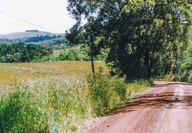
Photograph, Rob Roy Road, Panton Hill to Christmas Hills, 6 December 1992, 06/12/1992
... Rob Roy Road, Panton Hill to Christmas Hills, 6 December 1992...Eltham District Historical Society Inc 728 Main Rd Eltham melbourne The Eltham Horse Trail: Research and Warrandyte to Kinglake: Survey of proposed route, December 1992: (3) Kangaroo Ground to Kinglake eltham horse trail (1992 survey) panton hill rob roy road christmas hills Colour photograph Rob Roy Road, Panton Hill to Christmas Hills, 6 December 1992 Photograph ...The Eltham Horse Trail: Research and Warrandyte to Kinglake: Survey of proposed route, December 1992: (3) Kangaroo Ground to KinglakeColour photographeltham horse trail (1992 survey), panton hill, rob roy road, christmas hills -
 Eltham District Historical Society Inc
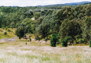
Photograph, Happy Valley bushland from Rob Roy Road, Panton Hill, 6 December 1992, 06/12/1992
... Happy Valley bushland from Rob Roy Road, Panton Hill, 6 December 1992...Eltham District Historical Society Inc 728 Main Rd Eltham melbourne The Eltham Horse Trail: Research and Warrandyte to Kinglake: Survey of proposed route, December 1992: (3) Kangaroo Ground to Kinglake eltham horse trail (1992 survey) panton hill rob roy road happy valley Colour photograph Happy Valley bushland from Rob Roy Road, Panton Hill, 6 December 1992 Photograph ...The Eltham Horse Trail: Research and Warrandyte to Kinglake: Survey of proposed route, December 1992: (3) Kangaroo Ground to KinglakeColour photographeltham horse trail (1992 survey), panton hill, rob roy road, happy valley