Showing 8447 items
matching snowy-river-dry-cleaners
-
 Greensborough Historical Society
Slide - Photograph, John Ramsdale, Plenty River Trail: Slide 117, 1990s
Photograph shows a path leading into bushland, this is part of the Plenty River Trail.Part of the John Ramsdale collection of slides and audio visual material.Colour photograph scanned from slide.No maker's marks. No caption on slide.plenty river trail -
 Greensborough Historical Society
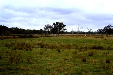
Slide - Photograph, John Ramsdale, Flood plain of the Plenty River: Slide 90, 1990s
Photograph shows farmland on the flood plain of the Plenty River, north of MerndaPart of the John Ramsdale collection of slides and audio visual material.Colour photograph scanned from slide.No maker's marks. Caption on slide "Plenty"plenty river, mernda -
 Greensborough Historical Society
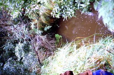
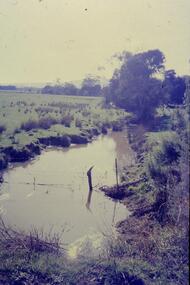
Slide - Photograph, John Ramsdale, Run off into Plenty River: Slide 64, 1990s
Photograph shows water over ground. This is run off into the Plenty RiverPart of the John Ramsdale collection of slides and audio visual material.Colour photograph scanned from slide.No caption. Printed maker's mark on slide "Kodak Kodachrome Slide"plenty river -
 Greensborough Historical Society
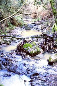
Slide - Photograph, John Ramsdale, Plenty River with low water flow: Slide 54, 1990s
Photograph shows the Plenty River with low water, rocks and fallen branchesPart of the John Ramsdale collection of slides and audio visual material.Colour photograph scanned from slide.No maker's marks. No caption on slide.plenty river -
 Greensborough Historical Society
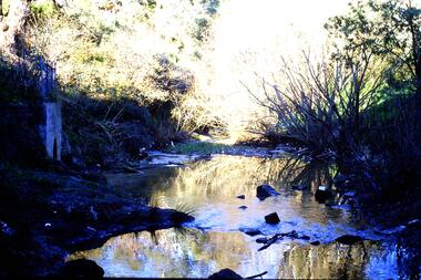
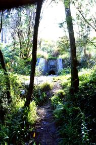
Slide - Photograph, John Ramsdale, Plenty River headwaters: Slide 65, 1990s
Photograph shows water near culvert or drain, this is the Plenty River headwaters.Part of the John Ramsdale collection of slides and audio visual material.Colour photograph scanned from slide.No maker's marks. No caption on slide.plenty river -
 Greensborough Historical Society
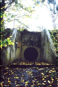
Slide - Photograph, John Ramsdale, Urban runoff into Plenty River: Slide 69, 1990s
Photograph shows a culvert or drain with graffiti. This is urban runoff into Plenty RiverPart of the John Ramsdale collection of slides and audio visual material.Colour photograph scanned from slide.No maker's marks. No caption on slide.plenty river -
 Greensborough Historical Society
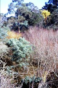
Slide - Photograph, John Ramsdale, Trees and vegetation near Plenty River: Slide 75, 1990s
Photograph shows a bush scene with trees and undergrowth near Plenty River.Part of the John Ramsdale collection of slides and audio visual material.Colour photograph scanned from slide.No maker's marks. No caption on slide.vegetation, plenty river -
 Greensborough Historical Society
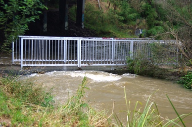
Photograph - Digital image, Plenty River in Flood 2017: The Footbridge, 14/12/2017
3 photographs of the Plenty River in flood, Greensborough. This flood was in December 2017.Digital copy of 3 colour photographs.plenty river, floods -
 Greensborough Historical Society
Photograph - Digital image, Plenty River in Flood 2017: Graffiti, 14/12/2017
Photograph of graffiti on the Plenty River bridge, Greensborough. This flood was in December 2017.Digital copy of colour photograph.plenty river, floods, graffiti -
 Greensborough Historical Society
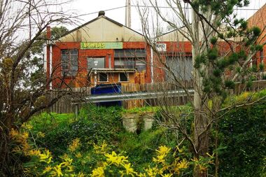
Photograph - Digital image, Marilyn Smith, Main Street mower shop from the river, 16/08/2015
The back of the mover shop on 125 Main Street, taken from the river.Digital copy of colour photographmain street greensborough -
 Stawell Historical Society Inc
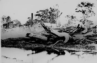
Photograph, Bush Saw Mill on the Wimmera river 1887
Bush Saw Mill by Charles Nettleton. Wimmera River of Victorian 1887stawell manufacture -
 Greensborough Historical Society
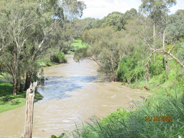
Photograph - Photograph - Digital Image, Peter Simmenauer, Plenty River floods near Plenty Lane 2022, 14/10/2022
Plenty River in flood near Plenty Lane October 2022 Greensborough. Colour digital photographDate stamped: 14/10/2022plenty lane greensborough, plenty river, floods -
 Greensborough Historical Society
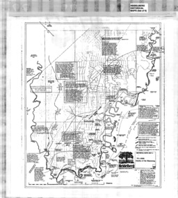
Map, Heidelberg: Historic River Landscape Assessment, Historical Maps. Map A To 1838. Country of the Wawarang, 1985c
Geographical area of around 35 sq. kilometres marked with physical features such as major roads, rivers, vegetation and properties, with contemporary notes on landowners, descriptions and comments on the land and its development. Bounded by Shire of Diamond Valley to the North, Darebin Creek to the West and Plenty River to the East.Black an white sketch map on white paperheidelberg, heidelberg - maps -
 Greensborough Historical Society
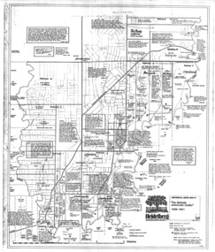
Map, Heidelberg: Historic River Landscape Assessment. Historical Maps. Map B 1838-1851, "The Distinctly aristocratic locality", 1985c
Geographical area of around 35 sq. kilometres marked with physical features such as major roads, rivers, vegetation and properties, with contemporary notes on landowners, descriptions and comments on the land and its development. Bounded by Shire of Diamond Valley to the North, Darebin Creek to the West and Plenty River to the EastBlack and white sketch map on white paperheidelberg, heidelberg - maps -
 Bendigo Historical Society Inc.
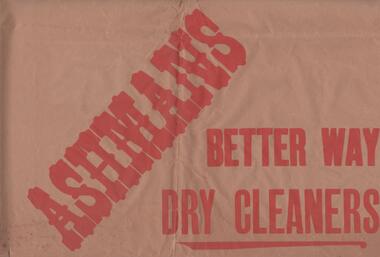
Ephemera - BENDIGO BUSINESSES COLLECTION: ASHMANS
Large brown paper advertising for Ashmans, better way dry cleaners, ring Bendigo 933 and we will call for and deliver. Red lettering.bendigo, business, ashmans -
 Greensborough Historical Society
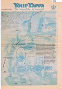
Newspaper - Newspaper Clipping, The Age, Your Yarra, The river and the city it created, 23/09/1980
Newspaper liftout about the Yarra River, early Melbourne and Port Phillip Bay.Newspaper article from The Age Newspaper, 2 sided printed in blue and black with photosyarra river, port phillip bay, melbourne -
 Greensborough Historical Society
Slide - Photograph, John Ramsdale, Source of the Plenty River: Slide 32, 1990s
Photograph of the source of the Plenty River at Bruces Creek Whittlesea showing water and vegetation.Part of the John Ramsdale collection of slides and audio visual material.Colour photograph scanned from slide.No maker's marks. No caption on slide.plenty river, vegetation, whittlesea -
 Greensborough Historical Society
Slide - Photograph, John Ramsdale, Drain into Plenty River: Slide 71, 1990s
Photograph shows a culvert or drain with graffiti - long view This drains into the Plenty River.Part of the John Ramsdale collection of slides and audio visual material.Colour photograph scanned from slide.No maker's marks. No caption on slide.plenty river -
 Greensborough Historical Society
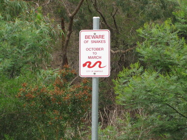
Photograph - Digital image, Dennis Ward, Snake sign on the Plenty River Trail, 27/03/2010
Sign on Plenty River Trail at Greensborough warning of snakes from October to March.Digital copy of colour photograph.plenty river, plenty river trail -
 Greensborough Historical Society
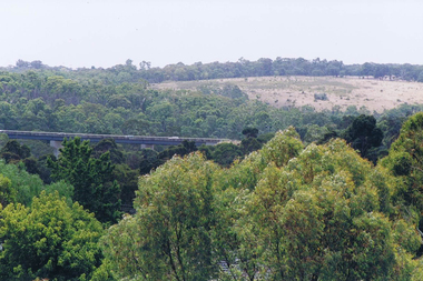
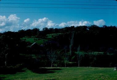
Photograph - Digital image, Frank Solomon, View over Greensborough to Plenty River Drive bridge, 2010c
View over trees to the Greensborough By-pass bridge over Plenty River Drive.Digital copy of colour photographplenty river drive, greensborough bypass -
 Ballarat Heritage Services
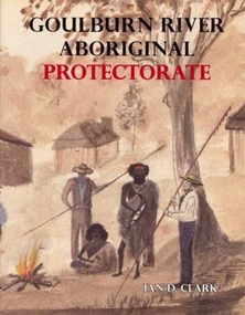
Book, Ian Clark, 'Goulburn River Aboriginal Protectorate' By Ian Clark
Gouburn River Aboriginal Protectorate was published by BHS Publishing and written by Ian Clark. gouldburn river, aboriginal protectorate, aborigines, le souef, ian clark -
 Wonga Park Community Cottage History Group
Photograph (Item) - Black and White, Wonga Park: Yarra River with Crooning Waters house and Mt Lofty
Wonga Park: A view of the Yarra River with Crooning Waters house and Mt LoftyPhoto is named 14880031.jpg on CD -
 Stawell Historical Society Inc
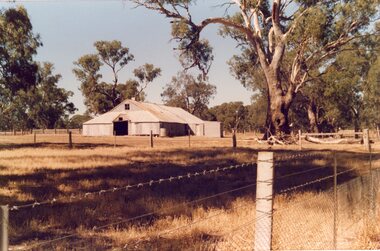
Photograph, "Woodlands" Homestead on Wimmera River near Crowlands -- Shearing Shed -- Coloured
Coloured Photo of Shearing Shed at Woodlands Homestead on Wimmera River near Crowlandsstawell -
 Greensborough Historical Society
Photograph - Digital Image, Blackjack from the river flats below, 1954_
Blackjack from the river flats below. The Blackjack property, house and acres of fruit orchards ran down to the Plenty River off Hume Street Greensborough and was the home of the Robinson family to late 1956. The photographs were taken as slides by Frank Robinson and digitised by his son James in 2015.Digital copy of colour photograph.blackjack, robinson family -
 Greensborough Historical Society
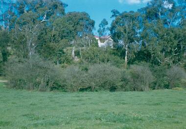
Photograph - Digital Image, Blackjack: Greensborough flats and house on the Plenty River, 1953_
Greensborough flats and house on the Plenty River at Blackjack, the home of the Robinson family to late 1956. The Blackjack property, house and acres of fruit orchards ran down to the Plenty River off Hume Street Greensborough. The photographs were taken as slides by Frank Robinson and digitised by his son James in 2015.Digital copy of colour photograph.blackjack, robinson family, plenty river -
 Greensborough Historical Society
Report, Examining Draughtsman's Report - Watts River Aqueduct, 20/07/1897
This Field Survey was commissioned by the Melbourne Board of Works and was used to position the Maroondah Aqueduct bridge north of Greensborough at its crossing point on the Plenty River. It incorporated the use of wrought iron water pipes and therefore is of lighter construction than other similar bridges in the district. It features a traverse of the Plenty RiverThe Maroondah Aqueduct bridge is a significant example of late 19th century engineering. A 4 page reproduction of an Office of Titles document. Copy of handwritten report includes maps.maroondah aqueduct, watts river aqueduct, bridge, greensborough, office of titles, 1897, wrought iron water pipes, plenty river, melbourne board of works -
 Lakes Entrance Historical Society
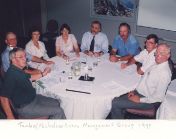
Photograph, Lakes Post Newspaper, Tambo Nicholson River Management Group East Gippsland Victoria, 1999
Colour photograph of members of Tambo Nicholson River Management Group seated at round table discussion Charles Hogan Alan Somerville Margaret Gardener Jeanette Severs Rex Candy Kevin Dean Robin Minter and Bill Wilson East Gippsland Victoriaenvironment, fish, waterways -
 Greensborough Historical Society
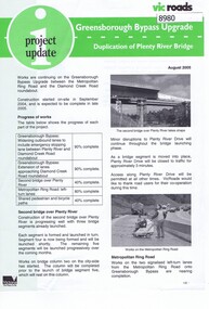
Newsletter, Vic Roads, Vic Roads , Greensborough Bypass Upgrade - Duplication of Plenty River Bridge, August 2005
Vic Roads Newsletter regarding the Greensborough Bypass Upgrade and duplication of the Plenty River Bridge.2 page Newsletter with print and black & white photosgreensborough bypass, vicroads, plenty ri, plenty river bridge -
 Greensborough Historical Society
Slide - Photograph, John Ramsdale, Plenty River: Slide 19, 1990s
Photograph shows low water flow on the Plenty River near South Morang or Mernda.Part of the John Ramsdale collection of slides and audio visual material.Colour photograph scanned from slide.No maker's marks. No caption on slide.south morang, mernda, plenty river -
 Greensborough Historical Society
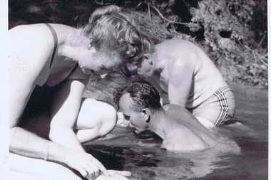
Photograph - Digital image, Jessie and Gordon Scholes with Tom Vickers, Plenty River, 1943c
Photograph of Jessie Scholes (nee Partington), Gordon Scholes and Tom Vickers at the Plenty River.Digital copy of black and white photograph.jessie scholes, jessie partington, gordon scholes, tom vickers, plenty river