Showing 11835 items
matching ringwood
-
 Ringwood and District Historical Society
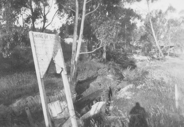
Photograph, Mullum Creek looking towards Warrandyte Rd. bridge. Showing Shire of Lillydale notice 1931
Written on backing sheet, "Mullum Creek looking towards Warrandyte Rd. bridge. Showing Shire of Lillydale notice". One photograph is dated 1931. -
 Ringwood and District Historical Society
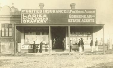
Photograph, Shop formerly in Station St. corner Greenwood Ave (undated)
Signs read "The United Insurance Co Ltd Fire Marine Accident", "Ladies & Children's Drapery", "Godbehear & Co Estate Agents"Typed below photograph, 'Shop formerly in Station St. corner Greenwood Ave." -
 Ringwood and District Historical Society
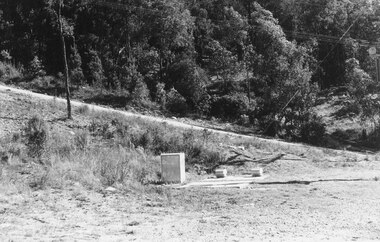
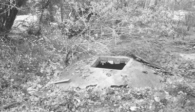
Photograph, Sewer pumping station in Lonely Valley. Glenvale Rd. in background (undated)
Written on back of photograph, "Sewer pumping station in Lonely Valley. Glenvale Rd. in background." -
 Ringwood and District Historical Society
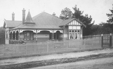
Photograph, Now Church of England property. Then front of Capt. Miles residence - 1965
Written on backing sheet, "Now Church of England property. Then front of Capt. Miles residence - 1965". -
 Ringwood and District Historical Society
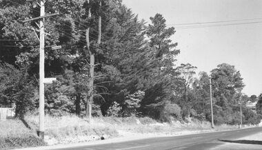
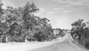
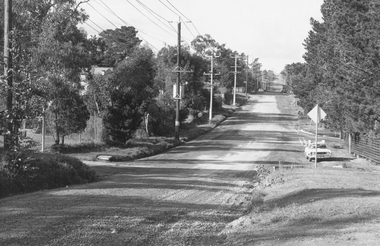
Photograph, Warrandyte Rd. looking towards Maroondah Highway over Mullum Creek bridge - 1966
Typed below photograph, "Warrandyte Rd. looking towards Maroondah Highway - 1966". Backing sheet reads, "Warrandyte Rd. bridge over Mullum Ck. Church of England now on left - 1966". -
 Ringwood and District Historical Society
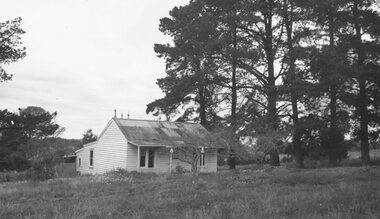
Photograph, House in Mullum Road (undated)
Weatherboard cottage with tin roof amongst pine trees.Typed below photograph, "House in Mullum Road" -
 Ringwood and District Historical Society
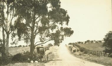
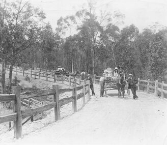
Photograph, Road to 'Quambee (undated)
With two horses attached to trap, feeding.Typed below photograph, "Road to 'Quambee'". -
 Ringwood and District Historical Society
Photograph, Wonga Rd. 1909
With small boy standing on bank at edge of roadWritten on back of smaller photograph, "Wonga Rd. 1909". -
 Ringwood and District Historical Society
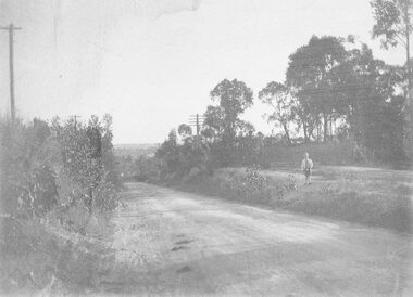
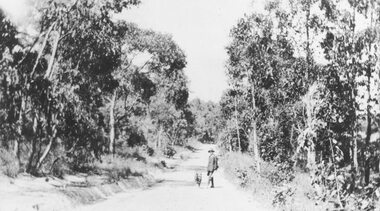
Photograph, Deep Creek Road in the early days (undated)
Narrow Dirt Road, with you man and dog standing in road. No date.Typed below photograph, "Deep Creek Road in the early days". -
 Ringwood and District Historical Society
Photograph, Horses and Carts on Road to Healesville? (undated)
Typed below one enlargement, "Road to Healesville?" and below the other, "Stopping for a chat". -
 Ringwood and District Historical Society
Photograph, Well rear old house corner Oban and Warrandyte Roads, 1964
Written on backing sheet, "Well rear old house corner Oban and Warrandyte Roads, 1964". -
 Ringwood and District Historical Society
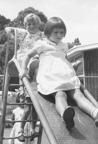
Photograph, Greenwood Park Kindergarten (undated) (3 photos)
Catalogue card reads, "Greenwood Park Kindergarten" (3 scenes). Note same young girl (unidentified) is in all 3 photos. -
 Ringwood and District Historical Society
Photograph, About No.69 Warrandyte Road, not the Crag (undated)
Written on backing sheet, "About No.69 Warrandyte Road, not the Crag". Catalogue card reads, "Lived in by Mrs. McCann". -
 Ringwood and District Historical Society
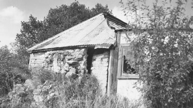
Photograph, Stone Cottage - 1965, probably not 32 Mt Dandenong Rd
Old Stone Cottage with tin roof.Written on backing sheet, "1965 - I don't think this is 32 Mt. Dand." -
 Ringwood and District Historical Society
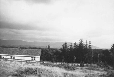
Photograph, View from block of land on Boulevarde, Heathmont, 1960
Written on back of small photograph, "From block of land on Boulevarde, Heathmont, 1960". -
 Ringwood and District Historical Society
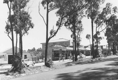
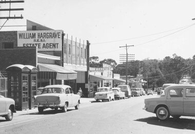
Photograph, Heathmont shopping centre - East end, Feb. 1960
Typed below photograph, "Heathmont shopping centre - East end, Feb. 1960". -
 Ringwood and District Historical Society
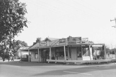
Photograph, Heathmont shopping centre - West end outside Post Office, Feb. 1960
Black and white photograph of shops line road. Trees in background down hill from shops. (2 small and 2 enlargements)Typed below photograph, "Heathmont shopping centre - West end outside Post Office, Feb. 1960". -
 Ringwood and District Historical Society
Photograph, Store, corner Warrandyte and Loughnan Roads (undated)
Typed below photograph, "Store, corner Warrandyte and Loughnan Roads". -
 Ringwood and District Historical Society
Photograph, View of Glenvale Road near top of first hill from bridge looking north east 1964
See Also #25Written on back of photograph, "Copy of a 1964 view of Glenvale Road near top of first hill from bridge looking north east. Original supplied by Garrett Gundry." -
 Ringwood and District Historical Society
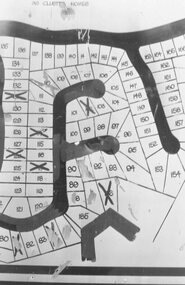
Photograph, Plan of Lots in Bel-Air Estate 1991
4 photographs of sections of the plans.a. Written on back of photograph, "20/6/81. Plan of Bel Air Estate. Werac Drive runs down left side of plan. Kubis Drive crosses top. Debbie Place drops down from Kubis. Manuela Tce. runs right from Werac, ends at a bend and becomes Rudolf Court running North. Lyn Court takes off right from Rudolf and Burlock Ave. touches estate with an elbow" b. Written on back of photograph, "20/6/81. Plan of lots in Bel Air Estate. Glenvale Road down left side of plan, Kubis Dr. Runs across picture. June Square drops from and Jenken Close rises form Kubis Dr. Werac Dr. drops to bottom of picture and Manuella takes off to right". d. Written on back of photograph, "20/6/91. Lots in Bel-Air Estate. Kubis Dr. rises from bottom left to Oban Road top. Pamela Crt. drops from Kubis at left, Iluka Crt. takes off right. Whitlam Dr. runs left at top and Menzies Cr. drops off it to centre of picture". c. Written on back of photograph, "20/6/81. Plan of lots on Bel-Air Estate. Kubis Dr., Debbie Place, Pamela Crt, Iluka Crt. Menzies Drive" -
 Ringwood and District Historical Society
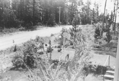
Photograph, Looking east from the end of the bitumen past the corner of Kubis Drive 1981
Written on back of photograph, "19/6/81. Looking east from the end of the bitumen past the corner of Kubis Drive (on right)." -
 Ringwood and District Historical Society
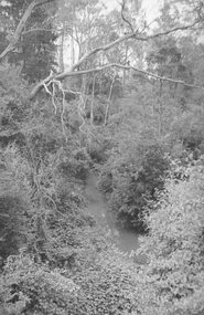
Photograph, Mullum Creek from bridge in Warrandyte Rd. Looking East 1970
From bridge in Warrandyte Road. See DB Item 2957 for later photo, same scene, with bridge identified.Typed below photograph, "Mullum Creek 1970 from bridge" -
 Ringwood and District Historical Society
Photograph, Mullum Creek from bridge in Warrandyte Rd. Looking east, 1972
Written on backing sheet, "Mullum Creek from bridge in Warrandyte Rd. Looking east, 1972" -
 Ringwood and District Historical Society
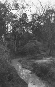
Photograph, Mullum Creek from bridge in Warrandyte Rd. Looking east, 1973
Written on backing sheet, "Mullum Creek from bridge in Warrandyte Rd. Looking east, 1973". -
 Ringwood and District Historical Society
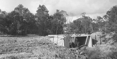
Photograph, Bridge over Mullum Creek under construction, Oliver Street. 1963
2 photographsWritten on back of photograph, "Bridge over Mullum Creek, Oliver Street. 17/11/1963" -
 Ringwood and District Historical Society
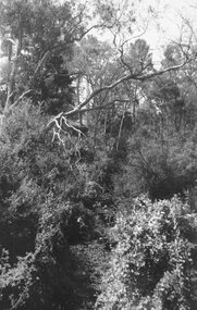
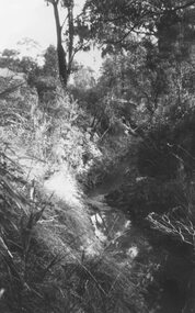
Photograph, Mullum Creek, 75 yds east of Warrandyte Rd. Bridge 1964
Possibly May 1971 as per item 2979?Typed below photograph, "Mullum Creek, 75 yds east of Warrandyte Rd. Bridge in centre". 1964 -
 Ringwood and District Historical Society
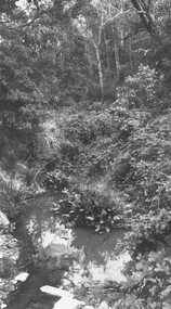
Photograph, Mullum Creek, 75 yds. east of bridge 1972
Written on backing sheet, "Mullum Creek, 75 yds. east of bridge 1972". -
 Ringwood and District Historical Society
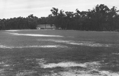
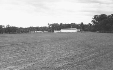
Photograph, Heathmont Reserve, Canterbury Rd. 1973
Written on backing sheet, "Heathmont Reserve, Canterbury Rd. 1973". -
 Ringwood and District Historical Society
Photograph, H. E. Parker Reserve, Heathmont, 1973
Written on backing sheet, "H. E. Parker Reserve, 1973". -
 Ringwood and District Historical Society
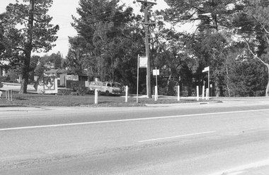
Photograph, Intersection of Tortice Dr. Old Warrandyte Rd. and Warrandyte Road 1981
Written on back of photograph, "19/6/81. Intersection of Tortice Dr. Old Warrandyte Rd. and Warrandyte Road (in foreground)."