Showing 9803 items matching " west"
-
 Ringwood and District Historical Society
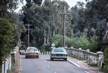
Photograph, Maroondah Highway West, Ringwood- c1920. Weekly Ringwood Market
Black and white oval-shaped photograph of scene at Ringwood Market, c1920. (3 copies)Written under one photograph: "Old Ringwood market corner of Maroondah Hwy and Ringwood St. Maroondah Hwy in background. SEC office now occupies site of buildings on left. c1920. -
 Eltham District Historical Society Inc
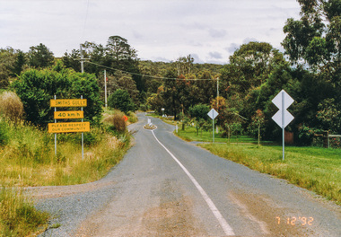
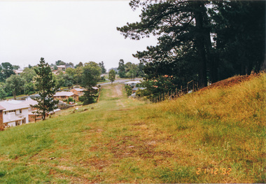
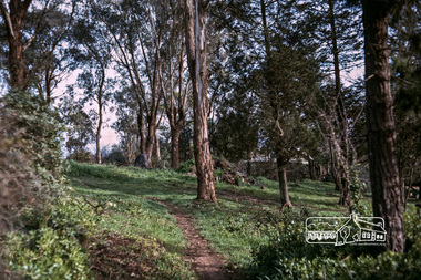
Photograph, Smiths Gully Road looking west near Joyce Road, Smiths Gully, 7 December 1992, 07/12/1992
The Eltham Horse Trail: Research and Warrandyte to Kinglake: Survey of proposed route, December 1992: (3) Kangaroo Ground to KinglakeColour photographeltham horse trail (1992 survey), smiths gully, joyce road, smiths gully road -
 Eltham District Historical Society Inc
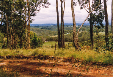
Photograph, Looking west from Fox Road, Smiths Gully, 7 December 1992, 07/12/1992
The Eltham Horse Trail: Research and Warrandyte to Kinglake: Survey of proposed route, December 1992: (3) Kangaroo Ground to KinglakeColour photographeltham horse trail (1992 survey), smiths gully, fox road -
 Eltham District Historical Society Inc
Photograph, Metropolitan Water pipe track west from Afton Street, Research, 19 December 1992, 19/12/1992
The Eltham Horse Trail: Research and Warrandyte to Kinglake: Survey of proposed route, December 1992: (4) Connecting trail to ElthamColour photographeltham horse trail (1992 survey), afton street, research (vic.) -
 Eltham District Historical Society Inc
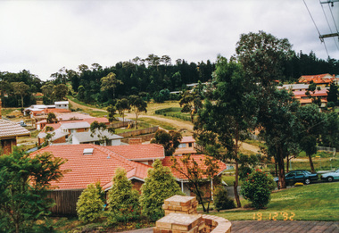
Photograph, Metropolitan Water pipe track west from Maroong Drive, Research, 19 December 1992, 19/12/1992
The Eltham Horse Trail: Research and Warrandyte to Kinglake: Survey of proposed route, December 1992: (4) Connecting trail to ElthamColour photographeltham horse trail (1992 survey), research (vic.), maroong drive -
 Eltham District Historical Society Inc
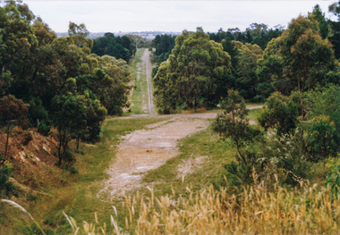
Photograph, Metropolitan Water pipe track looking west near The Esplanade, Research, 21 December 1992, 21/12/1992
The Eltham Horse Trail: Research and Warrandyte to Kinglake: Survey of proposed route, December 1992: (4) Connecting trail to ElthamColour photographeltham horse trail (1992 survey), research (vic.), the esplanade -
 Eltham District Historical Society Inc
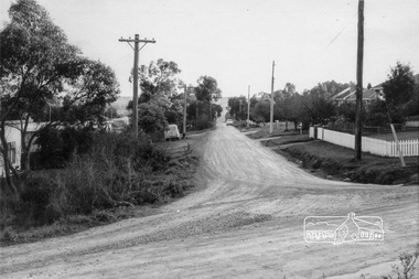
Photograph, Looking west along Cressy Street, Montmorency, 15 October 1990, 15/10/1990
Colour photographinfrastructure, shire of eltham, streets, montmorency, cressy street -
 Eltham District Historical Society Inc
Photograph, Looking west along Alma Street from Kett Street, Lower Plenty, c.July 1967, 1967
Packaged in "Filmpro King Size prints Definitely Better EST. 1918" envelope. Pencil notes: 36 shots $2.87 Eltham Shire J. McD and 19/7/67. Alma Street and Kett Street Lower Plenty c.July 1967.Black and white photographlower plenty, houses, streets, kett street, alma street -
 Eltham District Historical Society Inc
Photograph, Looking west across Mount Pleasant Road Bridge, Research, c.1977, 1977c
Miscellaneous Bridges.Black and white photographmount pleasant road bridge, research (vic.) -
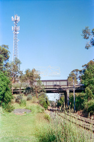 Eltham District Historical Society Inc
Negative - Photograph, Looking west to Mountainview Road Bridge from Petrie Park, Montmorency, 1998c
Roll of 35mm colour negative film, 8 strips and associated 10 x 15 cm colour printKodak Gold 100-5montmorency, mountainview road bridge, petrie park, railway line -
 Eltham District Historical Society Inc
Photograph, Fred Mitchell, Empty block of land, York Street, west of Bible Street, Eltham, 1968, 1968
Digital copy of colour photographfred mitchell collection, 1968, eltham, york street, houses, bible street -
 Eltham District Historical Society Inc
Photograph, Fred Mitchell, Looking west along Bridge Street from near Main Road, Eltham, 1968, 1968
Digital copy of colour photographfred mitchell collection, 1968, eltham, bridge street -
 Eltham District Historical Society Inc
Photograph, Fred Mitchell, Eltham tip, west of Main Road, Eltham, 1968, 1968
Was reclaimed and developed into part of Eltham Town Park, later Alistair Knox Park.Digital copy of colour photographfred mitchell collection, 1968, main road, alistair knox park, eltham town park, eltham tip -
 Eltham District Historical Society Inc
Photograph, Fred Mitchell, House and barn to the west of Fitzsimons Lane, Templestowe, 1968, 1968
Now incorporated into Westerfolds Park.Digital copy of colour photographfred mitchell collection, 1968, fitzsimons lane, templestowe, westerfolds park, houses -
 Eltham District Historical Society Inc
Photograph, Fred Mitchell, House and barn to the west of Fitzsimons Lane, Templestowe, 1968, 1968
Now incorporated into Westerfolds Park.Digital copy of colour photographfred mitchell collection, 1968, fitzsimons lane, templestowe, westerfolds park, houses -
 Eltham District Historical Society Inc
Photograph, Fred Mitchell, House and barn to the west of Fitzsimons Lane, Templestowe, 1968, 1968
Now incorporated into Westerfolds Park. Panoramic stitch created by EDHS from two separate images 02742/3.Digital composite of two colour photographsfred mitchell collection, 1968, fitzsimons lane, templestowe, westerfolds park, houses -
 Eltham District Historical Society Inc
Photograph, Fred Mitchell, Looking west across Main Road Bridge over the Diamond Creek, Eltham South, 1983, 1983
Digital copy of colour photographfred mitchell collection, 1983, main road bridge, eltham south -
 Eltham District Historical Society Inc
Negative - Photograph, Harry Gilham, Diamond Creek in flood, looking west towards Eltham High School (across submerged footbridge), c.Aug. 1996
This (submerged) footbridge has since been replaced by a higher-level bridge and the steps have been abolished.Roll of 35mm colour negative film, 5 of 6 stripsKodak Gold 100-5diamond creek, floods, dalton street, wingrove park trail, eltham high school -
 Eltham District Historical Society Inc
Photograph, Fred Mitchell, Looking west across Main Road Bridge over the Diamond Creek, Eltham South, 1983, 1983
Digital copy of colour photographfred mitchell collection, 1983, main road bridge, eltham south -
 Federation University Historical Collection
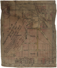
Plan, Plan of Amalgamated Tenements for G.J. Carroll and Party, Ballarat West
g.j. carroll and party, carroll, g.j. carroll, webster street, mill street, mair sreet, sturt street, ballarat railway, ballaarat old cemetery, crewsick road, gregory street\sussex street, errard street, raglan street, lyons stret, dawson street, howitt street, ascot street, ripon street, talbot street, windermere street -
 Federation University Historical Collection
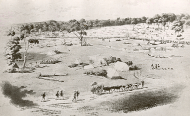
Photograph - Photograph - black and white, William Strutt, View of Golden Point, Ballarat, Taken from West
The lithograph is held by the State Library of Victoria. Printed below the image is Lithographed by Campbell & Macartney. The title is beneath image and continues: 'Respectfully dedicated to the inhabitants of Victoria / By their obedient servant / Wm. Strutt.'Photograph of a lithograph of view of the Golden Point - Ballarat by William Strutt. The Golden Point goldfield at Ballarat is depicted with a number of people congregated along a creek (Yarrowee Creek), some tents, stockyards evident, a butcher's shambles (tent) a bullock dray, three aborigines and a number of 'diggers' walking towards the goldfield are evident.ballarat, golden point, william strutt, ballarat townscape, mining, goldfield -
 Federation University Historical Collection
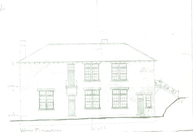
Plan, West Elevation of the Ballarat School of Mines Building Old Plumbing Building
This building was built in 1918-19 to a design by H.J. Kerr, District Architect (Western District), under the design control of the Chief Architect, S.C. Brittingham, Public Works Department. Their initials appear on the attached copy of the original drawing of the building. (Research by David Rowe)Copy of the Plumbing building on the grounds of the Ballarat School of Mines campusballarat school of mines, plans, building o, plumbing, old plumbing building, h.j. kerr, s.c. brittingham -
 Federation University Historical Collection
Book, Robert H.T. Smith, Economic Geography: Vol. 48 No. 3 July 1972: Spatial Structure and Process in Tropical West Africa, 1972
Robert H.T. Smith was Chancellor of University of Ballarat (later Federation University Australia)Soft buff cloured book.robert h.t. smith, geography, economic geography, africa -
Federation University Historical Collection
Booklet, Mining Under Wendouree Parade, Ballarat West, 1861, 1861
Blue foolscap printed order in council under the Gold Fields Act.mining, j.h. kay, wendouree parade, goldfields act, j.b. humffray -
Federation University Historical Collection
Book, Claude Meillassoux, The Development of Indigenous Trade and Markets in West Africa, 1971, 1971
Robert H.T. Smith was Chancellor of University of Ballarat (later Federation University Australia).Hard covered book with brown dust jacket. robert h.t. smith, geography, west africa, indigenous trade, markets -
 Federation University Historical Collection
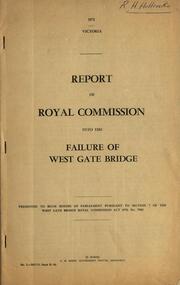
Book - Report, Report of Royal Commission into the Failure of West Gate Bridge, 1971, 1971
.1) Foolscap soft brown covered report on the failure of the Westgate Bridge over the Yarra River. .2) Document relatng to the collapse of the Westgate Bridgewestgate bridge, bridges, royal commission, c.h. rixon, west gate, engineering -
Federation University Historical Collection
Book, South West Gippsland Tourism Development Strategy, 1989, c1999
Black plastic binding on a report tourism and development strategy report.tourism, tourism strategy, south west gippsland, gippsland, coal creek historical town, wilsons promontory, penguin parade, grand prix, grand ridge road, wonthaggi, phillip island, foster korumburra, inverloch, kilcunda, san remo, bass, bunurong marin park, port franklin, tarwin lower -
Australian Commando Association - Victoria
Book, Australia in the War of 1939-45 ARMY South West Pacific Area
non-fiction -
Australian Commando Association - Victoria
Book, Jungle Warfare - Australian Army South West Pacific
non-fiction