Showing 199897 items matching "12-errard-street-south"
-
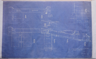 Robin Boyd Foundation
Drawing - Architectural, Robin Boyd, 290 Walsh Street, South Yarra, Jun-58
Project: House for Mr and Mrs Robin Boyd drawn by Robin Boyd of Grounds Romberg & Boyd. Details-Refer Sheet 8, Drawing Sheet no. 9Working Drawing, Colour Photocopy -
 Department of Health and Human Services
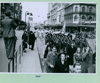
Members of the South Yarra Church of Christ followed by Army Cadets taking the salute in front of the Melbourne Town Hall on Swanston Street, Melbourne CBD Australia - 1948, from the War Memorial - Department of Health – National Fitness Office (Sports & Recreation) – Historical Press Release Photo Collection
Department of Health – National Fitness Office (Sports & Recreation) – Historical Press Release Photo - Empire Youth Day & Royals on Tour CollectionDepartment of Health – National Fitness Office (Sports & Recreation) – Historical Press Release Photo - Empire Youth Day & Royals on Tour Collection -
 Department of Health and Human Services
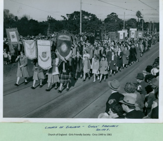
Christian groups from Coburg, East Brunswick, Williamstown and South Melbourne marching over Princes Bridge towards the Melbourne Town Hall on Swanston Street, Melbourne CBD Australia, from the War Memorial - Department of Health – National Fitness Office (Sports & Recreation) – Historical Press Release Photo Collection
Department of Health – National Fitness Office (Sports & Recreation) – Historical Press Release Photo - Empire Youth Day & Royals on Tour CollectionDepartment of Health – National Fitness Office (Sports & Recreation) – Historical Press Release Photo - Empire Youth Day & Royals on Tour Collection -
 Department of Health and Human Services
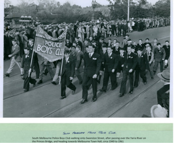
South Melbourne Police Boys' Club marching over Princes Bridge heading towards the Melbourne Town Hall on Swanston Street, Melbourne CBD Australia, from the War Memorial - Department of Health – National Fitness Office (Sports & Recreation) – Historical Press Release Photo Collection
Department of Health – National Fitness Office (Sports & Recreation) – Historical Press Release Photo - Empire Youth Day & Royals on Tour CollectionDepartment of Health – National Fitness Office (Sports & Recreation) – Historical Press Release Photo - Empire Youth Day & Royals on Tour Collection -
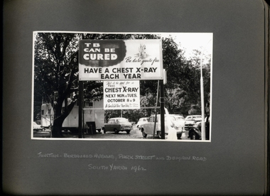 Department of Health and Human Services
Photograph, "TB Can be Cured - Have a Chest X-Ray Each Year" promotional street signage at the junction of Birdwood Avenue, Park St and Domain Rd South Yarra 1962 - Department of Health - Tuberculosis Branch - Publicity material
-
 Thompson's Foundry Band Inc. (Castlemaine)
Sheet Music, South Rampart Street Parade
-
 Ringwood and District Historical Society
Photograph, View south from 8 Tamar Street, Ringwood, Victoria - c.1960s
Digital Only -
 Merri-bek City Council
Painting - Oil on linen, Kirrily Hammond, Lygon Street South, Brunswick East, 2012
Framed oil paintingSigned on verso -
 Ballarat Heritage Services
Photograph, Clare Gervasoni, 17 Raglan Street South, Ballarat Central, 28/05/2023
Weatherboard house in Ballarat Central called Rosdelraglan st, house, architecture, weatherboard, rosdel -
 Ballarat Heritage Services
Photograph, Clare Gervasoni, 8 and 10 Raglan Street South, Ballarat Central, 28/05/2023
Redbrick houses in Ballarat Central.raglan st, brick, house, architecture -
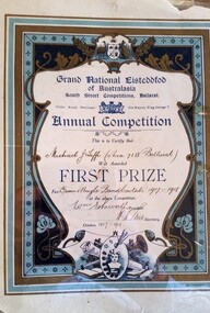 Hymettus Cottage & Garden Ballarat
Certificate - Award Certificate, South Street Competitions Ballarat First Prize certificate, 1918
-
 Darebin Art Collection
Photograph, David Wadelton, Looking toward Westgarth Street from South Crescent, 1996
south crescent -
 Ballarat Heritage Services
Photograph, Clare Gervasoni, 23 Raglan Street South, Ballarat Central, 2023
Bluestone house in Ballarat Central.bluestone, raglan st -
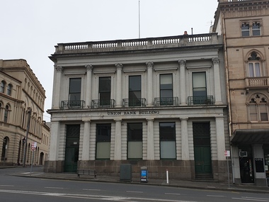 Ballarat Heritage Services
Photograph, Former Union Bank, Lydiard Street South, Ballarat, 2020, 15/02/2020
This former bank building was contructed for the Union Bank of Australia in 1863-64 to the design of architect Leonard Terry. It replaced an earlier building that operated from 1857. The Union Bank disposed of the building in 1951 when it merged with the Bank of Australasia.Double storey bank building. The ground floor facade is designed as a five bay colonnade of engaged Doric columns, a motif repeated above using Corinthian columns to support the balustraded parapet. union bank of australasia, lydiard street south, ballarat -
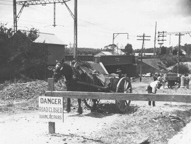 Ringwood and District Historical Society
Photograph, Construction of railway viaduct in Pitt Street, Ringwood - circa 1923, south side looking east
Black and White photograph (2 copies)Type below one copy: "Making Warrandyte Rd Subway, 1923 Taken from Pitt St." -
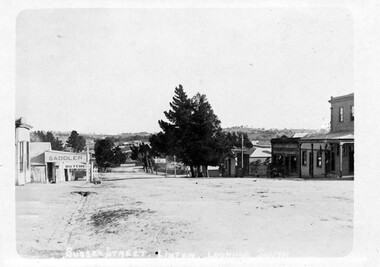 Linton and District Historical Society Inc
Photograph, Sussex Street, Linton, view to south, before 1912
The photograph is undated but was probably taken before 1912, as the Surface Hill Hotel was closed and demolished around this time.Sepia postcard photograph which shows the Surface Hill Hotel and Ching's Produce Store on the right, and O'Sullivan's saddlery and G G Bennett's butcher's shop on the left.sussex street linton, buildings, shops, surface hill hotel, r. ching grocer and produce merchant, o'sullivan's saddlery, g g bennett butcher's shop -
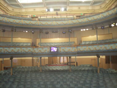 Ballarat Heritage Services
Photograph - Photograph - Colour, Her Majesty's Theatre, Lydiard Street South, Ballarat, c2015
Colour photograph of the balcony at Ballarat's Her Majesty's Theatre.her majesty's theatre ballarat, performing arts -
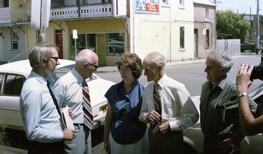 Vision Australia
Photograph - Image, Royal Blind Society of New South Wales street images, 1982
Two images of a group of people standing on a footpath and being interviewed. The central point are two men and a woman, with the television camera pointed towards them in both shots.2 negatives on strip under heading 'Christmas Party 1982'royal blind society of new south wales, marketing -
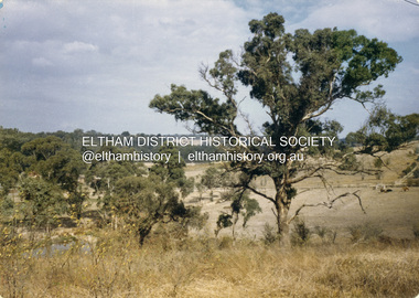 Eltham District Historical Society Inc
Colour Print, David Taylor, View from the rear Eltham High School looking south across Ely Street, Eltham towards the Fabbro family home, c.1976
The view looks across present-day Cronus Court housing development. Aerial photos for 1976 reflect the undeveloped landscape as viewed. By 1981 the estate was well established with all houses built.david taylor collection, eltham, eltham high school, fabbro's farm, cronus court -
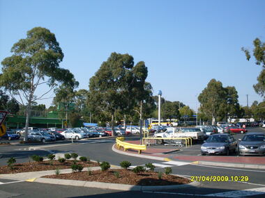 Ringwood and District Historical Society
Photograph, Taken from Eastland, across carpark towards former Safeway then Harris Scarfe store, looking south-east, on 21 April 2009. Showing location of former Adelaide Street
Ron Brons photographic study of Ringwood. -
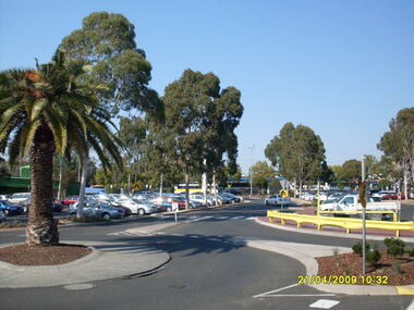
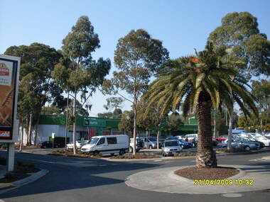 Ringwood and District Historical Society
Photograph, Looking along former Adelaide Street, from the access road roundabout, towards the south-east, on 21 April 2009. Showing bus terminus on the other side of the highway, at the station, and former Harris Scarfe store
Ron Brons photographic study of Ringwood. -
 Ringwood and District Historical Society
Photograph, Looking along former Adelaide Street, from the access road roundabout, towards the south-east, on 21 April 2009. Showing bus terminus on the other side of the highway, at the station
Ron Brons photographic study of Ringwood. -
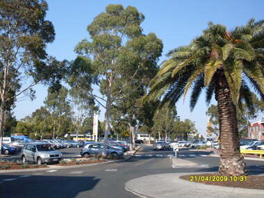 Ringwood and District Historical Society
Photograph, Looking along former Adelaide Street, from the access road roundabout, towards the south, on 21 April 2009. Showing bus terminus on the other side of the highway, at the station
Ron Brons photographic study of Ringwood. -
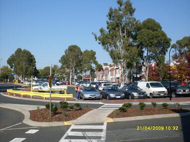 Ringwood and District Historical Society
Photograph, Looking along former Adelaide Street, from the access road roundabout, towards the south-east, on 21 April 2009. Showing pedestrian crossings
Ron Brons photographic study of Ringwood. -
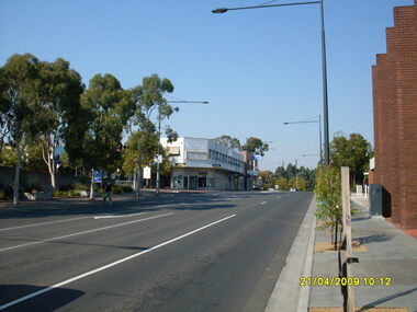 Ringwood and District Historical Society
Photograph, Ringwood Street looking south, Ringwood on 21 April 2009. Civic Place on left, with Paul Vale (criminal lawyer)
Ron Brons photographic study of Ringwood -
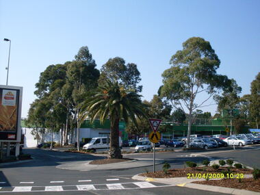 Ringwood and District Historical Society
Photograph, Across carpark towards former Harris Scarfe store, looking south-east, on 21 April 2009. Showing location of former Adelaide Street
Ron Brons photographic study of Ringwood. -
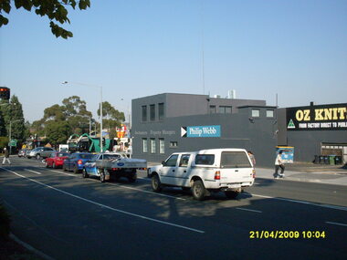 Ringwood and District Historical Society
Photograph, Corner of Maroondah Highway and Ringwood Street looking south, Ringwood on 21 April 2009. Ozknit and Phillip Webb Real Estate on west side of road
Ron Brons photographic study of Ringwood -
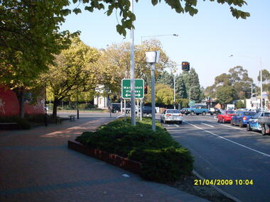
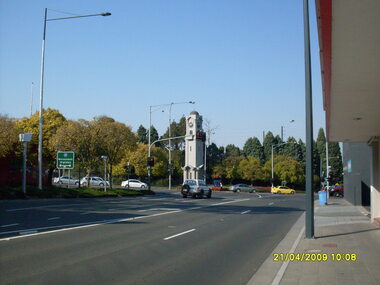 Ringwood and District Historical Society
Photograph, Corner of Maroondah Highway and Ringwood Street looking south, Ringwood on 21 April 2009. Memorial Clocktower in centre
Ron Brons photographic study of Ringwood -
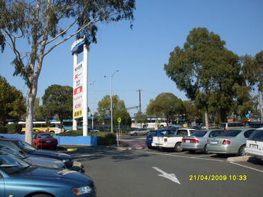 Ringwood and District Historical Society
Photograph, Eastland car park looking south, Ringwood on 21 April 2009. Showing former entrance to Adelaide Street from Maroondah Highway, overlooking bus terminus
Ron Brons photographic study of Ringwood -
 Ringwood and District Historical Society
Photograph, Corner of Maroondah Highway and Wantirna Road looking south taken from Ringwood Street, Ringwood on 21 April 2009. Memorial Clocktower in the distance with former Post Office location on left
Ron Brons photographic study of Ringwood