Showing 1027 items matching "disasters"
-
 Flagstaff Hill Maritime Museum and Village
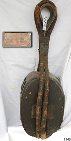
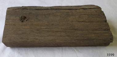
Equipment - Block (sailing), Burrows, Ship Candler, c. 1869
The Lightning was an American-built sailing ship and it is believed the rope block was part of the ship’s rigging or included as cargo. The plaque on the block mentions that the item was, “as supplied by Burrows Ship Chandlers” in 1869. The plaque could also mean that the rope block was supplied by the firm Burrows, Ship Chandler and Shipping Stock, as a replacement block for the Lightning. The American vessel named “Lightning” was a 3-masted, fully rigged extreme clipper ship. She was commissioned by James Baines, of the Black Ball Line in Liverpool, England, during the time of the Australian Gold Rush for the trade of passengers and cargo between England and Australia. Her load listed on early consignments included livestock and animals, including rabbits sent to Thomas Austin of Barwon Park, Winchelsea, Victoria, where the challenging association between Australia's agriculture and the imported rabbits started. The Lightning was built in 1854 by shipbuilder Donald McKay, in East Boston, USA. She was described as spacious and comfortable and regarded as one of the smartest ships of the time. The vessel set many speed records for her voyages and became one of the most famous of racing clippers and one of the fastest ever launched. In 1854, with Captain 'Bully' Forbes and Mate 'Bully' Bragg, Lightning made the return trip from Melbourne to Liverpool in only 64 days, 3 hours and 10 minutes; a record. Captain Enright became the new Master of LIGHTNING soon after this record was established and was regarded as one of the finest mariners in the Australian trade. One of Captain Enright's innovations was to publish a ship's paper called "The Lightning Gazette". What is of additional historic interest is that captain "Bully Forbes" had left the Lightning to captain the ill-fated Schomberg. In 1857, for a very brief time under Capt. Byrne the Lightning was used as a troopship, taking British officers and soldiers, stores and ammunition, to fight in India. In 1859 she then returned to her normal route between Liverpool and Melbourne, apart from 1867 when she made a special trip between Melbourne and Port Chalmers in New Zealand. In 1869 the Lightning was sold to Thomas Harrison of Liverpool, and continued to sail for the Black Ball Line. Master of Lightning, Captain Henry Jones, sailed her to Geelong in October 1869, and whilst docked, he had her loaded with a cargo of wool, copper, wire, tallow and other goods. At about 1 am on 31st October 1869, whilst still docked and fully laden, a fire was noticed on the vessel. Efforts to extinguish the fire were unsuccessful, so she was towed to the "Lightning Shoals" in Corio Bay, where she eventually sank, losing all cargo but no lives. The Lightning is listed on the Victorian Heritage Register (Ref S 415). The vessel is historically significant for being one of the fastest wooden ships ever built. it was notable as the first clipper built in the USA for British owners and as a shipping disaster in Geelong's history. The Lightning spent its whole career carrying cargo and immigrants from England to Australia. Its documented voyages give us a snapshot into shipping history, not only of Australia in the mid-19th century but how the world's commercial transport functioned o promote trade and emigration during this time.Large ship's block, wood, with two wooden sheaves and fibre straps, eye and thimble. The metal plaque attached to the block has an inscription. The block was used on the ship "Lightning".Plaque inscription: "BLOCK OFF THE LIGHTNING / AS SUPPLIED BY / BURROWS SHIPS CHANDLERS / & SHIPPING STOCK CORIO BAY / 1863" (or 1869)flagstaff hill, warrnambool, shipwrecked coast, flagstaff hill maritime museum, maritime museum, shipwreck coast, flagstaff hill maritime village, great ocean road, sailing ship lightning, extreme clipper ship, american clipper ship, record breaking clipper ship, james baines, black ball line, donald mckay shipbuilder, captain ‘bully’ forbes, australian immigration, liverpool to melbourne migration, captain enright, captain byrne, captain henry jones, corio bay geelong, lightning shoals geelong, rabbits introduced to australia, burrows and bascombe, burrows, ship chandler, corio bay, burrow's ship chandlers and shipping stock, -
 Flagstaff Hill Maritime Museum and Village
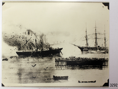
Photograph, 31st October 1869
This photograph was taken at the scene of the fire on the LIGHTNING, in Corio Bay, Geelong on 31st October 1869. The American clipper ship LIGHTNING was a 3 masted, fully rigged extreme clipper ship. She was commissioned by James Baines, of the Black Ball Line in Liverpool, England, during the time of the Australian Gold Rush for the trade of passengers and cargo between England and Australia. Her cargo listed early consignments of livestock and animals, including rabbits sent to Thomas Austin of Barwon Park, Winchelsea, Victoria. The LIGHTNING was built in 1854 by shipbuilder Donald McKay, of East Boston, USA. She was described as spacious and comfortable, and one of the smartest ships known. The LIGHTNING set many speed records for her sea crossings, and became one of the most famous of the racing clippers and one of the fastest ever launched. In 1854, with Captain ‘Bully’ Forbes and Mate ‘Bully’ Bragg, LIGHTNING made the return trip from Melbourne to Liverpool in only 64 days, 3 hours and 10 minutes; a record for all time. Captain Enright became the new Master of LIGHTNING soon afterwards. He has been described as one of the finest mariners in the Australian trade. One of Captain Enright’s innovations was to publish a ship’s paper called The Lightning Gazette. (Captain Forbes had left to captain the SCHOMBERG.) In January 1855 Capt. Enright sailed the LIGHTNING from Liverpool with over 700 passengers and returned home carrying gold as her cargo. In 1857, for a very brief time under Capt. Byrne the LIGHTNING was used as a troop ship, taking British officers and soldiers, stores and ammunition, to fight in India. In 1859 she then returned to her run between Liverpool and Melbourne, apart from 1867 when she made a special trip between Melbourne and Port Chalmers in New Zealand. In 1869 the LIGHTNING was sold to Thomas Harrison of Liverpool, and she continued to sail for the Black Ball Line. Master of LIGHTNING, Captain Henry Jones, sailed her to Geelong in October 1869, and whilst docked, he had her loaded with a cargo of wool, copper, wire, tallow and other goods. At about 1am on 31st October 1869, whilst still docked and fully laden, a fire was noticed on the LIGHTNING. Efforts to extinguished the fire were unsuccessful, so she was towed to the shoals in Corio Bay, where she eventually sank, losing all cargo but no lives. The area is now known as Lightning Shoals. The LIGHTNING is listed on the Victorian Heritage Register VHR S415. She is historically significant for being one of the fastest wooden ships ever built, the first clipper built in the USA for British owners and being the worst shipping disaster in Geelong's history. It spent its whole career carrying cargo and immigrants from England to Australia.Black and white photograph of the burning of the clipper Lightning in Corio Bay Geelong, Sunday Oct 31st 1869. Photograph shows the Lightning in the process of burning, smoke billowing above the deck. Another sailing ship, plus several small boats, are in the bay, with a crowd on the pier.flagstaff hill, warrnambool, shipwrecked-coast, flagstaff-hill, flagstaff-hill-maritime-museum, maritime-museum, sailing ship lightning, extreme clipper ship, american clipper ship, record breaking clipper ship, james baines, black ball line, donald mckay shipbuilder, captain ‘bully’ forbes, australian immigration, liverpool to melbourne migration, captain enright, captain byrne, captain henry jones, corio bay geelong, lightning shoals geelong, rabbits introduced to australia, historic photograph of shipwreck lightning, shipwreck-coast, flagstaff-hill-maritime-village, clipper lightning, photograph -
 Flagstaff Hill Maritime Museum and Village
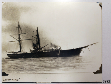
Photograph, Lightning, 31st October 1869
This photograph shows the remains of the clipper ship LIGHTNING as it continues to burn to its end in Corio Bay, Geelong, 31st October 1869. The American clipper ship LIGHTNING was a 3 masted, fully rigged extreme clipper ship. She was commissioned by James Baines, of the Black Ball Line in Liverpool, England, during the time of the Australian Gold Rush for the trade of passengers and cargo between England and Australia. Her cargo listed early consignments of livestock and animals, including rabbits sent to Thomas Austin of Barwon Park, Winchelsea, Victoria. The LIGHTNING was built in 1854 by shipbuilder Donald McKay, of East Boston, USA. She was described as spacious and comfortable, and one of the smartest ships known. The LIGHTNING set many speed records for her sea crossings, and became one of the most famous of the racing clippers and one of the fastest ever launched. In 1854, with Captain ‘Bully’ Forbes and Mate ‘Bully’ Bragg, LIGHTNING made the return trip from Melbourne to Liverpool in only 64 days, 3 hours and 10 minutes; a record for all time. Captain Enright became the new Master of LIGHTNING soon afterwards. He has been described as one of the finest mariners in the Australian trade. One of Captain Enright’s innovations was to publish a ship’s paper called The Lightning Gazette. (Captain Forbes had left to captain the SCHOMBERG.) In January 1855 Capt. Enright sailed the LIGHTNING from Liverpool with over 700 passengers and returned home carrying gold as her cargo. In 1857, for a very brief time under Capt. Byrne the LIGHTNING was used as a troop ship, taking British officers and soldiers, stores and ammunition, to fight in India. In 1859 she then returned to her run between Liverpool and Melbourne, apart from 1867 when she made a special trip between Melbourne and Port Chalmers in New Zealand. In 1869 the LIGHTNING was sold to Thomas Harrison of Liverpool, and she continued to sail for the Black Ball Line. Master of LIGHTNING, Captain Henry Jones, sailed her to Geelong in October 1869, and whilst docked, he had her loaded with a cargo of wool, copper, wire, tallow and other goods. At about 1am on 31st October 1869, whilst still docked and fully laden, a fire was noticed on the LIGHTNING. Efforts to extinguished the fire were unsuccessful, so she was towed to the shoals in Corio Bay, where she eventually sank, losing all cargo but no lives. The area is now known as Lightning Shoals. The LIGHTNING is listed on the Victorian Heritage Register VHR S415. She is historically significant for being one of the fastest wooden ships ever built, the first clipper built in the USA for British owners and being the worst shipping disaster in Geelong's history. It spent its whole career carrying cargo and immigrants from England to Australia.Black and white photograph of the burning of the sailing ship LIGHTNING, 31st October 1869 in Corio Bay, Geelong. The photograph shows the ship with only 2 masts remaining, still billowing smoke. Below the photograph is the photograph's title.Title hand written 'LIGHTNING"flagstaff hill, warrnambool, shipwrecked-coast, flagstaff-hill, flagstaff-hill-maritime-museum, maritime-museum, shipwreck-coast, flagstaff-hill-maritime-village, sailing ship lightning, extreme clipper ship, american clipper ship, record breaking clipper ship, james baines, black ball line, donald mckay shipbuilder, captain ‘bully’ forbes, australian immigration, liverpool to melbourne migration, captain enright, captain byrne, captain henry jones, corio bay geelong, lightning shoals geelong, rabbits introduced to australia, burning of the lightning, historic photograph of shipwreck lightning -
 Flagstaff Hill Maritime Museum and Village
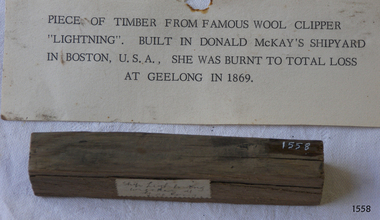
Wood Sample, c. 1854
This piece of wood is from the American clipper ship LIGHTNING was a 3 masted, fully rigged extreme clipper ship. She was commissioned by James Baines, of the Black Ball Line in Liverpool, England, during the time of the Australian Gold Rush for the trade of passengers and cargo between England and Australia. Her cargo listed early consignments of livestock and animals, including rabbits sent to Thomas Austin of Barwon Park, Winchelsea, Victoria. The LIGHTNING was built in 1854 by shipbuilder Donald McKay, of East Boston, USA. She was described as spacious and comfortable, and one of the smartest ships known. The LIGHTNING set many speed records for her sea crossings, and became one of the most famous of the racing clippers and one of the fastest ever launched. In 1854, with Captain ‘Bully’ Forbes and Mate ‘Bully’ Bragg, LIGHTNING made the return trip from Melbourne to Liverpool in only 64 days, 3 hours and 10 minutes; a record for all time. Captain Enright became the new Master of LIGHTNING soon afterwards. He has been described as one of the finest mariners in the Australian trade. One of Captain Enright’s innovations was to publish a ship’s paper called The Lightning Gazette. (Captain Forbes had left to captain the SCHOMBERG.) In January 1855 Capt. Enright sailed the LIGHTNING from Liverpool with over 700 passengers and returned home carrying gold as her cargo. In 1857, for a very brief time under Capt. Byrne the LIGHTNING was used as a troop ship, taking British officers and soldiers, stores and ammunition, to fight in India. In 1859 she then returned to her run between Liverpool and Melbourne, apart from 1867 when she made a special trip between Melbourne and Port Chalmers in New Zealand. In 1869 the LIGHTNING was sold to Thomas Harrison of Liverpool, and she continued to sail for the Black Ball Line. Master of LIGHTNING, Captain Henry Jones, sailed her to Geelong in October 1869, and whilst docked, he had her loaded with a cargo of wool, copper, wire, tallow and other goods. At about 1am on 31st October 1869, whilst still docked and fully laden, a fire was noticed on the LIGHTNING. Efforts to extinguished the fire were unsuccessful, so she was towed to the shoals in Corio Bay, where she eventually sank, losing all cargo but no lives. The area is now known as Lightning Shoals. The LIGHTNING is listed on the Victorian Heritage Register VHR S415. She is historically significant for being one of the fastest wooden ships ever built, the first clipper built in the USA for British owners and being the worst shipping disaster in Geelong's history. It spent its whole career carrying cargo and immigrants from England to Australia.Sample of wood from the wool clipper LIGHTNING, 1854-1869, The sample has a label and a card with information about the ship and a person. Card, typewritten, "PIECE OF TIMBER FROM FAMOUS WOOL CLIPPER / "LIGHTNING". BUILD IN DONALD McKAY'S SHIPYARD / IN BOSTON, U.S.A.. SHE WAS BURNT TO TOTAL LOSS / IN GEELONG IN 1869"flagstaff hill, warrnambool, shipwrecked-coast, flagstaff-hill, flagstaff-hill-maritime-museum, maritime-museum, shipwreck-coast, flagstaff-hill-maritime-village, sailing ship lightning, extreme clipper ship, american clipper ship, record breaking clipper ship, james baines, black ball line, donald mckay shipbuilder, captain ‘bully’ forbes, australian immigration, liverpool to melbourne migration, captain enright, captain byrne, captain henry jones, lightning shoals geelong, rabbits introduced to australia, wood sample from lightning -
 Flagstaff Hill Maritime Museum and Village
Wood Sample, c. 1854
This sample of wood is from the American clipper ship LIGHTNING was a 3 masted, fully rigged extreme clipper ship. She was commissioned by James Baines, of the Black Ball Line in Liverpool, England, during the time of the Australian Gold Rush for the trade of passengers and cargo between England and Australia. Her cargo listed early consignments of livestock and animals, including rabbits sent to Thomas Austin of Barwon Park, Winchelsea, Victoria. The LIGHTNING was built in 1854 by shipbuilder Donald McKay, of East Boston, USA. She was described as spacious and comfortable, and one of the smartest ships known. The LIGHTNING set many speed records for her sea crossings, and became one of the most famous of the racing clippers and one of the fastest ever launched. In 1854, with Captain ‘Bully’ Forbes and Mate ‘Bully’ Bragg, LIGHTNING made the return trip from Melbourne to Liverpool in only 64 days, 3 hours and 10 minutes; a record for all time. Captain Enright became the new Master of LIGHTNING soon afterwards. He has been described as one of the finest mariners in the Australian trade. One of Captain Enright’s innovations was to publish a ship’s paper called The Lightning Gazette. (Captain Forbes had left to captain the SCHOMBERG.) In January 1855 Capt. Enright sailed the LIGHTNING from Liverpool with over 700 passengers and returned home carrying gold as her cargo. In 1857, for a very brief time under Capt. Byrne the LIGHTNING was used as a troop ship, taking British officers and soldiers, stores and ammunition, to fight in India. In 1859 she then returned to her run between Liverpool and Melbourne, apart from 1867 when she made a special trip between Melbourne and Port Chalmers in New Zealand. In 1869 the LIGHTNING was sold to Thomas Harrison of Liverpool, and she continued to sail for the Black Ball Line. Master of LIGHTNING, Captain Henry Jones, sailed her to Geelong in October 1869, and whilst docked, he had her loaded with a cargo of wool, copper, wire, tallow and other goods. At about 1am on 31st October 1869, whilst still docked and fully laden, a fire was noticed on the LIGHTNING. Efforts to extinguished the fire were unsuccessful, so she was towed to the shoals in Corio Bay, where she eventually sank, losing all cargo but no lives. The area is now known as Lightning Shoals. The LIGHTNING is listed on the Victorian Heritage Register VHR S415. She is historically significant for being one of the fastest wooden ships ever built, the first clipper built in the USA for British owners and being the worst shipping disaster in Geelong's history. It spent its whole career carrying cargo and immigrants from England to Australia.Sample wooden rectangular from the clipper Lightning, which burned out at Geelong 31 Oct 1869.flagstaff hill, warrnambool, shipwrecked-coast, flagstaff-hill, flagstaff-hill-maritime-museum, maritime-museum, sailing ship lightning, extreme clipper ship, american clipper ship, record breaking clipper ship, james baines, black ball line, donald mckay shipbuilder, captain ‘bully’ forbes, australian immigration, liverpool to melbourne migration, captain enright, captain byrne, captain henry jones, lightning shoals geelong, rabbits introduced to australia, wood from sailing ship, shipwreck-coast, flagstaff-hill-maritime-village, lightning -
 Federation University Historical Collection
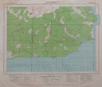
Map, Mallacoota, 1942, 1942
Printed colour map on paperThis map is an official document, if found, it must be handed in to the nearest military headquarters or police stationmallacoota, bass straight, cape evarard, cann river, genoa river, disaster bay -
 Bendigo Historical Society Inc.
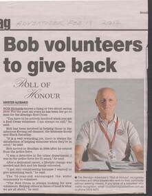
Document - NEWSPAPER CUTTING: BOB RICHARDS, 18th February, 2012
Newspaper cutting Bendigo Advertiser Feb 18 2012 - re Bob Richards. Volunteer with Red Cross.Bendigo Advertiser.person, individual, bob richards, bendigo red cross, kerang rail disaster, brisbane floods, black saturday -
 Bendigo Historical Society Inc.
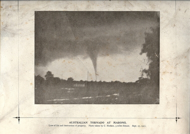
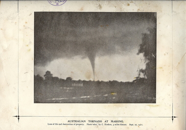
Photograph - TORNADO AT MARONG, 27 Sept 1911
Copy of black and white photograph of tornado at Marong. Dark sky above with funnel to ground. Printed on cream card with printed border. Inscriptions: on front - below image 'Australian Tornado at Marong, loss of life and destruction of property. Photo taken by C Hosken, three miles distant. Sept. 27, 1911. On TR corner 'MP106'. On back - circular stamp 'Royal Historical Society of Victoria, Bendigo Branch', '2nd of 2 copies' hand written in ink.topic, natural disaster -
 Bendigo Historical Society Inc.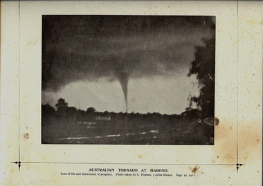
Photograph - TORNADO AT MARONG, 27 Sept 1911
Copy of black and white photograph of tornado at Marong. Dark sky above with funnel to ground. Printed on cream card with printed border. Inscriptions: on front - below image 'Australian Tornado at Marong, loss of life and destruction of property. Photo taken by C Hosken, three miles distant. Sept. 27, 1911. On TR corner 'MP106'. On back - circular stamp 'Royal Historical Society of Victoria, Bendigo Branch', '2nd of 2 copies' hand written in ink.topic, natural disaster -
 Port Melbourne Historical & Preservation Society
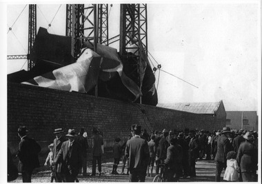
Postcard - Gasworks, Gas Holder Explosion, 1920
One from a set of six postcards related to the Gasworks and produced from early images by the City of Port Phillip: Gasometer explosion Easter, 1920Cards have three logos: Gasworks Arts, City of Port Phillip, Gas and Fuel Corporationindustry, utilities - gas, south melbourne gasworks, disaster - explosion -
 Port Melbourne Historical & Preservation Society
Photograph - Aftermath, Gasworks explosion, Pickles Street, William Swift, William Swift, 1920
Black and white photo by W. Swift, showing aftermath of the 1920 Gasworks explosion. Crowds in Pickles Street.utilities - gas, built environment - industrial, gasworks, william swift, disaster - explosion -
 Monbulk RSL Sub Branch
Book, Suzanne Wellborn, Bush heroes : a people, a place, a legend, 2002
More than one quarter of the Australian soldiers chosen to land on Gallipoli at dawn on 25 April 1915 were Western Australians. Four years later, only one in four of them had escaped death or severe injury. But that morning, by climbing the cliffs under a hail of Turkish bullets, they won a permanent place in Australia's most celebrated national legend. At Gallipoli that was all any of the attacking troops won." "The British and French, whose armies also suffered heavy losses at the Dardanelles, regarded the campaign as nothing but a humiliating military disaster best forgotten. In Australia Gallipoli was hailed as 'the proving of a nation's soul' and the day of the landing became sacred.Index, bibliography, notes, ill, maps, p.240.non-fictionMore than one quarter of the Australian soldiers chosen to land on Gallipoli at dawn on 25 April 1915 were Western Australians. Four years later, only one in four of them had escaped death or severe injury. But that morning, by climbing the cliffs under a hail of Turkish bullets, they won a permanent place in Australia's most celebrated national legend. At Gallipoli that was all any of the attacking troops won." "The British and French, whose armies also suffered heavy losses at the Dardanelles, regarded the campaign as nothing but a humiliating military disaster best forgotten. In Australia Gallipoli was hailed as 'the proving of a nation's soul' and the day of the landing became sacred.world war 1914-1918 - campaigns - gallipoli, australian army - soldiers - western australia -
 Monbulk RSL Sub Branch
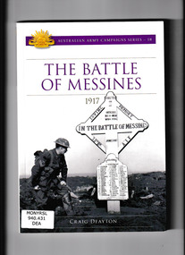
Book, Craig Deayton, The battle of Messines : 1917, 2017
On 7 June 1917, the British Second Army launched its attack on Messines Ridge, detonating 19 giant mines beneath the German front-line positions. By the end of the day, one of the strongest positions on the Western Front had fallen, a place of such importance that the Germans had pledged to hold it at any cost. It was the greatest British victory in three years of war. The first two years of the First World War had represented an almost unending catalogue of disaster for the Australians. Messines was not only their first real victory, it was also the first test in senior command for Major General John Monash who commanded the newly formed 3rd Division and would later be hailed as Australia's greatest soldier. Messines was a baptism of fire for the 3rd Division which came into the line alongside the battle-scarred 4th Australian Division, badly mauled at Bullecourt just six weeks earlier in one of the worst defeats of the war. The fighting at Messines would descend into unimaginable savagery, a lethal and sometimes hand-to-hand affair of bayonets, clubs, bombs and incessant machine-gun fire, described by one Australian as '72 hours of Hell'. After their string of bloody defeats over 1915 and 1916, Messines would be the ultimate test for the Australians. Collapse summaryIndex, bibliography, ill (col), p.172.non-fictionOn 7 June 1917, the British Second Army launched its attack on Messines Ridge, detonating 19 giant mines beneath the German front-line positions. By the end of the day, one of the strongest positions on the Western Front had fallen, a place of such importance that the Germans had pledged to hold it at any cost. It was the greatest British victory in three years of war. The first two years of the First World War had represented an almost unending catalogue of disaster for the Australians. Messines was not only their first real victory, it was also the first test in senior command for Major General John Monash who commanded the newly formed 3rd Division and would later be hailed as Australia's greatest soldier. Messines was a baptism of fire for the 3rd Division which came into the line alongside the battle-scarred 4th Australian Division, badly mauled at Bullecourt just six weeks earlier in one of the worst defeats of the war. The fighting at Messines would descend into unimaginable savagery, a lethal and sometimes hand-to-hand affair of bayonets, clubs, bombs and incessant machine-gun fire, described by one Australian as '72 hours of Hell'. After their string of bloody defeats over 1915 and 1916, Messines would be the ultimate test for the Australians. Collapse summary world war 1914-1918- campaigns - western front, battles of messines - australian participation - 1917 -
 Monbulk RSL Sub Branch
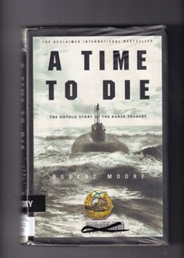
Book, Robert Moore, A time to die: The untold story of the Kursk tragedy, 2002
At 11:28 a.m. on Saturday, August 12, 2000, high in the Arctic Circle under the roiling surface of the unforgiving Barents Sea, Captain Gennady Lyachin was taking the Kursk, the pride of Russia's elite Northern Fleet, through the last steps of firing a practice torpedo, part of an elaborate naval exercise. Suddenly, the torpedo exploded in a massive fireball, instantly incinerating all seven men in the submarine's forward compartment. The horror, however, was just beginning. The full, gripping story of the remarkable drama inside the Kursk and of the desperate rescue efforts has never been told - until now.Index, ill (b/w plates), p.362.non-fictionAt 11:28 a.m. on Saturday, August 12, 2000, high in the Arctic Circle under the roiling surface of the unforgiving Barents Sea, Captain Gennady Lyachin was taking the Kursk, the pride of Russia's elite Northern Fleet, through the last steps of firing a practice torpedo, part of an elaborate naval exercise. Suddenly, the torpedo exploded in a massive fireball, instantly incinerating all seven men in the submarine's forward compartment. The horror, however, was just beginning. The full, gripping story of the remarkable drama inside the Kursk and of the desperate rescue efforts has never been told - until now.russian submarine kursk explosion, submarine disasters - russia -
 Monbulk RSL Sub Branch
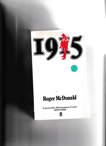
Book, Roger McDonald, 1915, 1979
The year young Australians sailed off to war in high hopes of adventure, only to find themselves faced with disaster. The tragedy and violence of Gallipoli provide the climax to this very personal, moving and surprisingly romantic story. With remarkable skill and in achingly beautiful prose, Roger McDonald takes the reader on an archetypal Australian journey which parallels the nation's progress from its country childhood, through the adolescent exuberance of its young cities, to initiation on one of the world's ancient battlefields. It is a vital journey, haunted by menace and disillusionment, one embedded in our national mythology. This astonishing first novel, published to great critical acclaim in 1979 and since then selling over 100,000 copies, tells the story of two boys from the bush, the thoughtful and awkward Walter and his knowing friend Billy Mackenzie, and their girls Frances and Diana. Together they discover a future which seems full of promise, drawing them into the exciting turmoil of passion and war. But theirs is a fateful alliance, in a world all too quickly passing, with an outcome they never could have foreseen.p.426fictionThe year young Australians sailed off to war in high hopes of adventure, only to find themselves faced with disaster. The tragedy and violence of Gallipoli provide the climax to this very personal, moving and surprisingly romantic story. With remarkable skill and in achingly beautiful prose, Roger McDonald takes the reader on an archetypal Australian journey which parallels the nation's progress from its country childhood, through the adolescent exuberance of its young cities, to initiation on one of the world's ancient battlefields. It is a vital journey, haunted by menace and disillusionment, one embedded in our national mythology. This astonishing first novel, published to great critical acclaim in 1979 and since then selling over 100,000 copies, tells the story of two boys from the bush, the thoughtful and awkward Walter and his knowing friend Billy Mackenzie, and their girls Frances and Diana. Together they discover a future which seems full of promise, drawing them into the exciting turmoil of passion and war. But theirs is a fateful alliance, in a world all too quickly passing, with an outcome they never could have foreseen.gallipoli campaign - fiction, world war 1914-1918 - fiction -
 Monbulk RSL Sub Branch
Book, Random House, Write home for me : a red cross women in Vietnam, 2006
Working as a journalist at the Adelaide Advertiser in 1966, Jean Debelle yearned to be involved in the biggest story of the decade - the Vietnam War. But only male journalists in Australia were being sent to cover the escalating conflict. Instead, she volunteered to work in Vietnam for the Red Cross to tend to the non-medical welfare of the sick and wounded ANZAC forces. Jean had planned to report on the war in spare moments - but there were none. For one year she lived in the spotlight: a young Australian woman among 5,000 men. This intimate personal account is told from the rare and compassionate perspective of a young woman living close to the battlefront. Jean tells of the resilience of the soldiers in the face of daily atrocities and of the international medical personnel fighting to save lives and to rebuild shattered bodies and minds. It is also the story of the Vietnamese, struggling to maintain not just their traditions but their very lives in the face of brutal hardship. With infectious humour, Jean tells of striving to be like a sister to the men when sex was in the very air they breathed. But she experienced stark terror when she faced a crazed gunman, had a close call in a minefield and was caught in the midst of a Vietnamese skirmish. Jean also offers an unvarnished look at the Australians' worst battle in Vietnam, Long Tan, and their worst landmine disaster. With unblinking candour, she writes of the harsh realisation that after nine months in Vietnam she had grown cold to the unrelenting horror of war. From diaries, letters and Red Cross reports, Jean Debelle Lamensdorf has researched and written a story not only of tragedy but also of hope and humour. It is a compelling adventure story - and one of love.Index, bibliography, ill, maps, p.302.non-fictionWorking as a journalist at the Adelaide Advertiser in 1966, Jean Debelle yearned to be involved in the biggest story of the decade - the Vietnam War. But only male journalists in Australia were being sent to cover the escalating conflict. Instead, she volunteered to work in Vietnam for the Red Cross to tend to the non-medical welfare of the sick and wounded ANZAC forces. Jean had planned to report on the war in spare moments - but there were none. For one year she lived in the spotlight: a young Australian woman among 5,000 men. This intimate personal account is told from the rare and compassionate perspective of a young woman living close to the battlefront. Jean tells of the resilience of the soldiers in the face of daily atrocities and of the international medical personnel fighting to save lives and to rebuild shattered bodies and minds. It is also the story of the Vietnamese, struggling to maintain not just their traditions but their very lives in the face of brutal hardship. With infectious humour, Jean tells of striving to be like a sister to the men when sex was in the very air they breathed. But she experienced stark terror when she faced a crazed gunman, had a close call in a minefield and was caught in the midst of a Vietnamese skirmish. Jean also offers an unvarnished look at the Australians' worst battle in Vietnam, Long Tan, and their worst landmine disaster. With unblinking candour, she writes of the harsh realisation that after nine months in Vietnam she had grown cold to the unrelenting horror of war. From diaries, letters and Red Cross reports, Jean Debelle Lamensdorf has researched and written a story not only of tragedy but also of hope and humour. It is a compelling adventure story - and one of love. vietnam war 1961-1975 – australian involvement, vietnam war 1961-1975 - red cross - women -
 Monbulk RSL Sub Branch
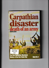
Book, Pan Books, Carpathian disaster : Death of an army, 1971
The victory of the Russian army on the Eastern front in 1916Ill, p.159.non-fictionThe victory of the Russian army on the Eastern front in 1916world war 1914-1918 - military history, world war 1914 - campaigns - eastern front -
 Monbulk RSL Sub Branch
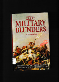
Book, Andre Deutsch, Great military blunders, 2012
From ancient times to the Bay of Pigs and the Falklands War, military history has been marked as much by misjudgements and incompetence as by gallantry and glory. Such blunders have sometimes ended in tragedy, sometimes in farce - such as the English troops, supposedly marching on Cadiz in 1625, who instead got drunk in a salt marsh. And sometimes they have ended in triumph, despite all the odds. In this fascinating and entertaining collection, author Geoffrey Regan not only recounts some of the staggering stories, but also highlights the kinds of difficulties that can lead to military disaster. His anecdotes encompass every aspect of warfare from the insanity of commanders to the provision of inadequate supplies. This entertaining and instructive book will appeal to the military buff and general reader alike.Ill, p.272.non-fictionFrom ancient times to the Bay of Pigs and the Falklands War, military history has been marked as much by misjudgements and incompetence as by gallantry and glory. Such blunders have sometimes ended in tragedy, sometimes in farce - such as the English troops, supposedly marching on Cadiz in 1625, who instead got drunk in a salt marsh. And sometimes they have ended in triumph, despite all the odds. In this fascinating and entertaining collection, author Geoffrey Regan not only recounts some of the staggering stories, but also highlights the kinds of difficulties that can lead to military disaster. His anecdotes encompass every aspect of warfare from the insanity of commanders to the provision of inadequate supplies. This entertaining and instructive book will appeal to the military buff and general reader alike. military art and science - history, military history -
 Monbulk RSL Sub Branch
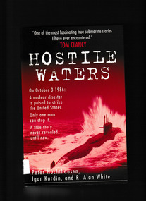
Book, Hutchinson, Hostile waters, 1997
The cold war was nearly over by 1986, yet under the sea the deadly game of hide-and-seek played by Soviet and American submarines continued unabated. Off the east coast of America, an aging Soviet ballistic missile sub, a "boomer," suffered a crippling accident, coming within moments of a nuclear meltdown. Had her reactors exploded, the radioactivity released into the Gulf Stream would have dwarfed the Chernobyl disaster. This is the gripping, true story of the young Soviet sailors who fought to save their submarine, risking fire, smoke, poison gas, and intense radioactivity. Their secret struggle and sacrifice saved the American coast from nuclear catastrophe. Told in the words of the survivors, it is a story never before revealed outside the submarine community.Bib, ill, p.303.The cold war was nearly over by 1986, yet under the sea the deadly game of hide-and-seek played by Soviet and American submarines continued unabated. Off the east coast of America, an aging Soviet ballistic missile sub, a "boomer," suffered a crippling accident, coming within moments of a nuclear meltdown. Had her reactors exploded, the radioactivity released into the Gulf Stream would have dwarfed the Chernobyl disaster. This is the gripping, true story of the young Soviet sailors who fought to save their submarine, risking fire, smoke, poison gas, and intense radioactivity. Their secret struggle and sacrifice saved the American coast from nuclear catastrophe. Told in the words of the survivors, it is a story never before revealed outside the submarine community. nuclear submarines - soviet union, nuclear submarines - accidents -
 National Vietnam Veterans Museum (NVVM)
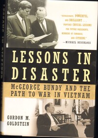
Book, Goldstein, Gordon M, Lessons in Disaster: McGeorge Bundy and the path to war in Vietnam, 2008
This meticulously researched book gives us remarkalbe insight into one of the most critical foreign policy decisions in U.S. history. Anyone aspiring to a leadership position in American politics or public policy should carefully examine this perceptive work and its many valuable lessons.This meticulously researched book gives us remarkalbe insight into one of the most critical foreign policy decisions in U.S. history. Anyone aspiring to a leadership position in American politics or public policy should carefully examine this perceptive work and its many valuable lessons.united states - foreign relations - vietnam, vietnam war, 1961-1975 - causes, united states - foreign relations - 1961-1963 -
National Vietnam Veterans Museum (NVVM)
Book, Gallipoli: the Dardanelles disaster in soldiers' word and Photograph, 2015
world war, 1914-1918 -- campaigns -- turkey -- gallipoli peninsula -- pictorial works -
 National Vietnam Veterans Museum (NVVM)
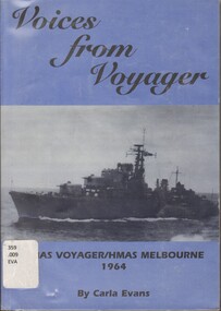
Book, Evans, Carla, Voices from Voyager/HMAS Voyager/HMAS Melbourne 1964
A tragedy this day stunned our nation - Australia's worst peace-time military disaster - the sinking of the destroyer HMAS VOYAGER.A tragedy this day stunned our nation - Australia's worst peace-time military disaster - the sinking of the destroyer HMAS VOYAGER.voyager (destroyer 1952-1964), sailors - australia - biography, marine accidents - australian capital territory - jervis bay -
Clunes Museum
Book, JEFFREY ATKINSON, THE CARDIGAN MINE DISASTER
ON THE 20TH AMRCH 1902 THE PEOPLE OF VICTORIA WERE SHCIKED TO READ IN THEIR NEWSPAPS THAT THERE HAD BEEN A MAJOR DISASTER AT A MINE JUST OUTSID BALLARAT IN WHICH A NUMBER OF MINERS WERE TRAPPED UNDERGROUND IN THE FLOODED WORKINGSON FRONT COVER: IMAGE OF MINING STRUCTURES AND MULLOCK HEAPS IN GREEN WAS HCOLOUR OVERVIEW OF GOLD MINING AND DEEP LEAD MINING IN PARTICULAR 58 PAGESnon-fictionON THE 20TH AMRCH 1902 THE PEOPLE OF VICTORIA WERE SHCIKED TO READ IN THEIR NEWSPAPS THAT THERE HAD BEEN A MAJOR DISASTER AT A MINE JUST OUTSID BALLARAT IN WHICH A NUMBER OF MINERS WERE TRAPPED UNDERGROUND IN THE FLOODED WORKINGScardigan mine disaster, mine collapse -
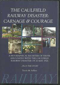 The Adam Lindsay Gordon Commemorative Committee Inc.
Book, The Caulfield Rail Disaster-Carnage and Courage- a Biographical register of Those Associated with the Caulfield Railway Disaster 26 May 1926- Travis m Sellers 2011
-
Koorie Heritage Trust
Book, Baker, D.W.A, The civilised surveyor : Thomas Mitchell and the Australian Aborigines, 1997
By the 1830's the squatters were poised to extend theri runs over eastern Australia and so dispossess untold thousands of Aboriginal families of their land. Mitchell witnessed at first hand some of the worst years of a monstrous and incomprehensible disaster. More than that, his work directly assisted in this destruction.xv, 213 pages : illustrations, maps ; 22 cm.By the 1830's the squatters were poised to extend theri runs over eastern Australia and so dispossess untold thousands of Aboriginal families of their land. Mitchell witnessed at first hand some of the worst years of a monstrous and incomprehensible disaster. More than that, his work directly assisted in this destruction.mitchell, thomas, sir, 1792-1855 -- relations with aborigines, australian -- new south wales. | mitchell, thomas, sir, 1792-1855 -- journeys -- new south wales. | aboriginal australians -- new south wales -- first contact with europeans. | aboriginal australians -- first contact with europeans. -
 Ballarat Heritage Services
Photograph - Colour, Flood recovery, Carisbrook
Colour photograph damaged during floods at Carsibrook, Victoria. carisbrook flood, disaster recovery -
Unions Ballarat
The cardigan mine disaster (Don Woodward Collection), Atkinson, Jeffrey, 2002
An account of the flooding of the Cardigan mine (near Ballarat) in 1902. Four men died and five were rescued from the mine.Workplace safety and Ballarat historical relevance.Book; 58 pages. Front cover: light green background; dark green graphic of the mine; black lettering; author's name and title.Title page: price - $18.50 - in pencil.btlc, ballarat trades hall, ballarat trades and labour council, occupational health and safety, cardigan mine, gold mining - ballarat -
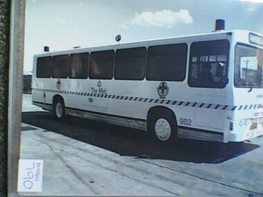 Ambulance Victoria Museum
Photograph, Ambulance Bus, Leyland
emergency bus.Black and white photo of ambulance bus.982 AMBULANCE THE METdisaster -
Mt Dandenong & District Historical Society Inc.
Book, Disaster In The Dandenongs. The Kyeema Airliner Tragedy, 2008
First edition has 64 pages and was published in Ferntree Gullykyeema, air crash, mount dandenong