Showing 1645 items
matching settlements
-
 Eltham District Historical Society Inc
Photograph, Liz Pidgeon, Heritage Excursion; Eltham Lower Park Walk and Talk, 1 July 2017, 1 July 2017
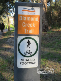
Sign produced by Shire of Nillumbik: Diamond Creek Trail shared footway Newsletter No., 234, June 2017 Heritage Excursion - Saturday 1st July - Eltham Lower Park - Walk and Talk Eltham Lower Park has played an important part in the history of our area since the early days of European settlement when it was used by local residents as an informal racecourse. Prior to that its location at the junction of the Diamond Creek and the Yarra River made it an important meeting place for the Wurundjeri people. The park combines formal elements and sporting facilities with remnant bushland that is of environmental significance. It is home to sporting and horse riding clubs, popular play spaces and the Diamond Valley Miniature Railway, which attracts large numbers of visitors. The park will be the venue for our July excursion which will comprise a walk of about 3.5 km around the park and adjacent areas. Along the way we will discuss the history and natural history of the area. The path along the creek and the river provides a pleasant and scenic walk. This walk on Saturday 1st July is about 3.5 km in length and will take 2 to 2.5 hours. It will start at 2pm at the Main Road car park at the front of the park. (Melway ref 21 H 10). Born Digitalelection day, heritage excursion, activities, eltham district historical society, eltham lower park, sign -
 Eltham District Historical Society Inc
Photograph, Liz Pidgeon, Heritage Excursion; Eltham Lower Park Walk and Talk, 1 July 2017, 1 July 2017
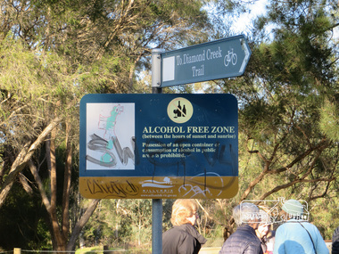
Signage - To Diamond Creek Trail and Alcohol free zone Newsletter No., 234, June 2017 Heritage Excursion - Saturday 1st July - Eltham Lower Park - Walk and Talk Eltham Lower Park has played an important part in the history of our area since the early days of European settlement when it was used by local residents as an informal racecourse. Prior to that its location at the junction of the Diamond Creek and the Yarra River made it an important meeting place for the Wurundjeri people. The park combines formal elements and sporting facilities with remnant bushland that is of environmental significance. It is home to sporting and horse riding clubs, popular play spaces and the Diamond Valley Miniature Railway, which attracts large numbers of visitors. The park will be the venue for our July excursion which will comprise a walk of about 3.5 km around the park and adjacent areas. Along the way we will discuss the history and natural history of the area. The path along the creek and the river provides a pleasant and scenic walk. This walk on Saturday 1st July is about 3.5 km in length and will take 2 to 2.5 hours. It will start at 2pm at the Main Road car park at the front of the park. (Melway ref 21 H 10). Born Digitalelection day, heritage excursion, activities, eltham district historical society, eltham lower park, sign, alcohol free zone -
 Eltham District Historical Society Inc
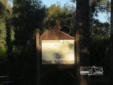
Photograph, Liz Pidgeon, Heritage Excursion; Eltham Lower Park Walk and Talk, 1 July 2017, 1 July 2017
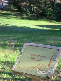
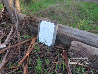
Information Board - Lenister Farm Wetlands Newsletter No., 234, June 2017 Heritage Excursion - Saturday 1st July - Eltham Lower Park - Walk and Talk Eltham Lower Park has played an important part in the history of our area since the early days of European settlement when it was used by local residents as an informal racecourse. Prior to that its location at the junction of the Diamond Creek and the Yarra River made it an important meeting place for the Wurundjeri people. The park combines formal elements and sporting facilities with remnant bushland that is of environmental significance. It is home to sporting and horse riding clubs, popular play spaces and the Diamond Valley Miniature Railway, which attracts large numbers of visitors. The park will be the venue for our July excursion which will comprise a walk of about 3.5 km around the park and adjacent areas. Along the way we will discuss the history and natural history of the area. The path along the creek and the river provides a pleasant and scenic walk. This walk on Saturday 1st July is about 3.5 km in length and will take 2 to 2.5 hours. It will start at 2pm at the Main Road car park at the front of the park. (Melway ref 21 H 10). Born Digitalheritage excursion, activities, eltham district historical society, eltham lower park, information board, lenister farm -
 Eltham District Historical Society Inc
Photograph, Liz Pidgeon, Heritage Excursion; Eltham Lower Park Walk and Talk, 1 July 2017, 1 July 2017
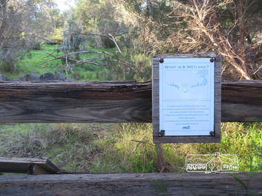
Sign on trail - what is a wetland Newsletter No., 234, June 2017 Heritage Excursion - Saturday 1st July - Eltham Lower Park - Walk and Talk Eltham Lower Park has played an important part in the history of our area since the early days of European settlement when it was used by local residents as an informal racecourse. Prior to that its location at the junction of the Diamond Creek and the Yarra River made it an important meeting place for the Wurundjeri people. The park combines formal elements and sporting facilities with remnant bushland that is of environmental significance. It is home to sporting and horse riding clubs, popular play spaces and the Diamond Valley Miniature Railway, which attracts large numbers of visitors. The park will be the venue for our July excursion which will comprise a walk of about 3.5 km around the park and adjacent areas. Along the way we will discuss the history and natural history of the area. The path along the creek and the river provides a pleasant and scenic walk. This walk on Saturday 1st July is about 3.5 km in length and will take 2 to 2.5 hours. It will start at 2pm at the Main Road car park at the front of the park. (Melway ref 21 H 10). Born Digitalheritage excursion, activities, eltham district historical society, eltham lower park, sign -
 Eltham District Historical Society Inc
Photograph, Liz Pidgeon, Heritage Excursion; Eltham Lower Park Walk and Talk, 1 July 2017, 1 July 2017
Faded Information Board - Wetland Wildlife situated in Lenister Wetlands Newsletter No., 234, June 2017 Heritage Excursion - Saturday 1st July - Eltham Lower Park - Walk and Talk Eltham Lower Park has played an important part in the history of our area since the early days of European settlement when it was used by local residents as an informal racecourse. Prior to that its location at the junction of the Diamond Creek and the Yarra River made it an important meeting place for the Wurundjeri people. The park combines formal elements and sporting facilities with remnant bushland that is of environmental significance. It is home to sporting and horse riding clubs, popular play spaces and the Diamond Valley Miniature Railway, which attracts large numbers of visitors. The park will be the venue for our July excursion which will comprise a walk of about 3.5 km around the park and adjacent areas. Along the way we will discuss the history and natural history of the area. The path along the creek and the river provides a pleasant and scenic walk. This walk on Saturday 1st July is about 3.5 km in length and will take 2 to 2.5 hours. It will start at 2pm at the Main Road car park at the front of the park. (Melway ref 21 H 10). Born Digitalheritage excursion, activities, eltham district historical society, eltham lower park, information board -
 Eltham District Historical Society Inc
Photograph, Liz Pidgeon, Heritage Excursion; Eltham Lower Park Walk and Talk, 1 July 2017, 1 July 2017
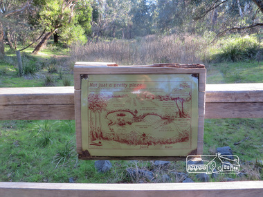
Information Board : Not just a pretty place Newsletter No., 234, June 2017 Heritage Excursion - Saturday 1st July - Eltham Lower Park - Walk and Talk Eltham Lower Park has played an important part in the history of our area since the early days of European settlement when it was used by local residents as an informal racecourse. Prior to that its location at the junction of the Diamond Creek and the Yarra River made it an important meeting place for the Wurundjeri people. The park combines formal elements and sporting facilities with remnant bushland that is of environmental significance. It is home to sporting and horse riding clubs, popular play spaces and the Diamond Valley Miniature Railway, which attracts large numbers of visitors. The park will be the venue for our July excursion which will comprise a walk of about 3.5 km around the park and adjacent areas. Along the way we will discuss the history and natural history of the area. The path along the creek and the river provides a pleasant and scenic walk. This walk on Saturday 1st July is about 3.5 km in length and will take 2 to 2.5 hours. It will start at 2pm at the Main Road car park at the front of the park. (Melway ref 21 H 10). Born Digitalelection day, heritage excursion, activities, eltham district historical society, eltham lower park, information board -
 Eltham District Historical Society Inc
Photograph, Liz Pidgeon, Heritage Excursion; Eltham Lower Park Walk and Talk, 1 July 2017, 1 July 2017
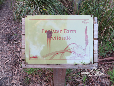
Information Board with rust - Lenister Farm Wetlands Newsletter No., 234, June 2017 Heritage Excursion - Saturday 1st July - Eltham Lower Park - Walk and Talk Eltham Lower Park has played an important part in the history of our area since the early days of European settlement when it was used by local residents as an informal racecourse. Prior to that its location at the junction of the Diamond Creek and the Yarra River made it an important meeting place for the Wurundjeri people. The park combines formal elements and sporting facilities with remnant bushland that is of environmental significance. It is home to sporting and horse riding clubs, popular play spaces and the Diamond Valley Miniature Railway, which attracts large numbers of visitors. The park will be the venue for our July excursion which will comprise a walk of about 3.5 km around the park and adjacent areas. Along the way we will discuss the history and natural history of the area. The path along the creek and the river provides a pleasant and scenic walk. This walk on Saturday 1st July is about 3.5 km in length and will take 2 to 2.5 hours. It will start at 2pm at the Main Road car park at the front of the park. (Melway ref 21 H 10). Born Digitalelection day, heritage excursion, activities, eltham district historical society, eltham lower park, information board, lenister farm wetlands -
 Eltham District Historical Society Inc
Photograph, Liz Pidgeon, Heritage Excursion; Eltham Lower Park Walk and Talk, 1 July 2017, 1 July 2017
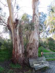
Connecting trunks of gum trees near the viewing platform on the Diamond Creek. Newsletter No., 234, June 2017 Heritage Excursion - Saturday 1st July - Eltham Lower Park - Walk and Talk Eltham Lower Park has played an important part in the history of our area since the early days of European settlement when it was used by local residents as an informal racecourse. Prior to that its location at the junction of the Diamond Creek and the Yarra River made it an important meeting place for the Wurundjeri people. The park combines formal elements and sporting facilities with remnant bushland that is of environmental significance. It is home to sporting and horse riding clubs, popular play spaces and the Diamond Valley Miniature Railway, which attracts large numbers of visitors. The park will be the venue for our July excursion which will comprise a walk of about 3.5 km around the park and adjacent areas. Along the way we will discuss the history and natural history of the area. The path along the creek and the river provides a pleasant and scenic walk. This walk on Saturday 1st July is about 3.5 km in length and will take 2 to 2.5 hours. It will start at 2pm at the Main Road car park at the front of the park. (Melway ref 21 H 10). Born Digitalheritage excursion, activities, eltham district historical society, eltham lower park, gum trees -
 Eltham District Historical Society Inc
Photograph, Liz Pidgeon, Heritage Excursion; Eltham Lower Park Walk and Talk, 1 July 2017, 1 July 2017
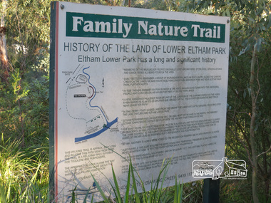
Information Board titled: Family Nature Trail - History of the land of Lower Eltham Park Newsletter No., 234, June 2017 Heritage Excursion - Saturday 1st July - Eltham Lower Park - Walk and Talk Eltham Lower Park has played an important part in the history of our area since the early days of European settlement when it was used by local residents as an informal racecourse. Prior to that its location at the junction of the Diamond Creek and the Yarra River made it an important meeting place for the Wurundjeri people. The park combines formal elements and sporting facilities with remnant bushland that is of environmental significance. It is home to sporting and horse riding clubs, popular play spaces and the Diamond Valley Miniature Railway, which attracts large numbers of visitors. The park will be the venue for our July excursion which will comprise a walk of about 3.5 km around the park and adjacent areas. Along the way we will discuss the history and natural history of the area. The path along the creek and the river provides a pleasant and scenic walk. This walk on Saturday 1st July is about 3.5 km in length and will take 2 to 2.5 hours. It will start at 2pm at the Main Road car park at the front of the park. (Melway ref 21 H 10). Born Digitalheritage excursion, activities, eltham district historical society, eltham lower park, information board, trail -
 Eltham District Historical Society Inc
Photograph, Liz Pidgeon, Heritage Excursion; Eltham Lower Park Walk and Talk, 1 July 2017, 1 July 2017
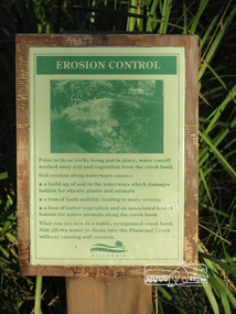
Information board titled "erosion control" including a photo and causes produced by the Shire of Nillumbik Newsletter No., 234, June 2017 Heritage Excursion - Saturday 1st July - Eltham Lower Park - Walk and Talk Eltham Lower Park has played an important part in the history of our area since the early days of European settlement when it was used by local residents as an informal racecourse. Prior to that its location at the junction of the Diamond Creek and the Yarra River made it an important meeting place for the Wurundjeri people. The park combines formal elements and sporting facilities with remnant bushland that is of environmental significance. It is home to sporting and horse riding clubs, popular play spaces and the Diamond Valley Miniature Railway, which attracts large numbers of visitors. The park will be the venue for our July excursion which will comprise a walk of about 3.5 km around the park and adjacent areas. Along the way we will discuss the history and natural history of the area. The path along the creek and the river provides a pleasant and scenic walk. This walk on Saturday 1st July is about 3.5 km in length and will take 2 to 2.5 hours. It will start at 2pm at the Main Road car park at the front of the park. (Melway ref 21 H 10). Born Digitalheritage excursion, activities, eltham district historical society, eltham lower park, erosion, information board -
 Eltham District Historical Society Inc
Photograph, Liz Pidgeon, Heritage Excursion; Eltham Lower Park Walk and Talk, 1 July 2017, 1 July 2017
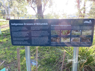
Plaque explaining "Indigenous grasses of Nillumbik" from the Shire of Nillumbik Newsletter No., 234, June 2017 Heritage Excursion - Saturday 1st July - Eltham Lower Park - Walk and Talk Eltham Lower Park has played an important part in the history of our area since the early days of European settlement when it was used by local residents as an informal racecourse. Prior to that its location at the junction of the Diamond Creek and the Yarra River made it an important meeting place for the Wurundjeri people. The park combines formal elements and sporting facilities with remnant bushland that is of environmental significance. It is home to sporting and horse riding clubs, popular play spaces and the Diamond Valley Miniature Railway, which attracts large numbers of visitors. The park will be the venue for our July excursion which will comprise a walk of about 3.5 km around the park and adjacent areas. Along the way we will discuss the history and natural history of the area. The path along the creek and the river provides a pleasant and scenic walk. This walk on Saturday 1st July is about 3.5 km in length and will take 2 to 2.5 hours. It will start at 2pm at the Main Road car park at the front of the park. (Melway ref 21 H 10). Born Digitalheritage excursion, activities, eltham district historical society, eltham lower park, information board, indigenous grass, indigenous plants -
 Eltham District Historical Society Inc
Photograph, Liz Pidgeon, Heritage Excursion; Eltham Lower Park Walk and Talk, 1 July 2017, 1 July 2017
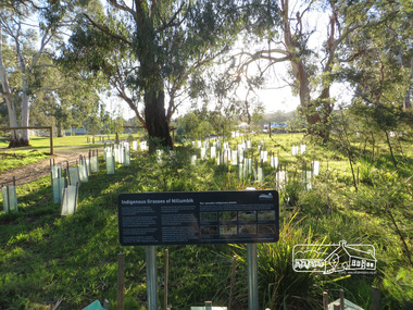
Area planted with indigenous plants with information sign board Newsletter No., 234, June 2017 Heritage Excursion - Saturday 1st July - Eltham Lower Park - Walk and Talk Eltham Lower Park has played an important part in the history of our area since the early days of European settlement when it was used by local residents as an informal racecourse. Prior to that its location at the junction of the Diamond Creek and the Yarra River made it an important meeting place for the Wurundjeri people. The park combines formal elements and sporting facilities with remnant bushland that is of environmental significance. It is home to sporting and horse riding clubs, popular play spaces and the Diamond Valley Miniature Railway, which attracts large numbers of visitors. The park will be the venue for our July excursion which will comprise a walk of about 3.5 km around the park and adjacent areas. Along the way we will discuss the history and natural history of the area. The path along the creek and the river provides a pleasant and scenic walk. This walk on Saturday 1st July is about 3.5 km in length and will take 2 to 2.5 hours. It will start at 2pm at the Main Road car park at the front of the park. (Melway ref 21 H 10). Born Digitalheritage excursion, activities, eltham district historical society, eltham lower park, indigenous plants -
 Eltham District Historical Society Inc
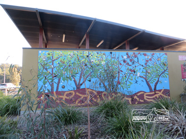
Photograph, Liz Pidgeon, Heritage Excursion; Eltham Lower Park Walk and Talk, 1 July 2017, 1 July 2017
Mural artwork painted on the wall divider of the new toilet block at Eltham Lower Park Newsletter No., 234, June 2017 Heritage Excursion - Saturday 1st July - Eltham Lower Park - Walk and Talk Eltham Lower Park has played an important part in the history of our area since the early days of European settlement when it was used by local residents as an informal racecourse. Prior to that its location at the junction of the Diamond Creek and the Yarra River made it an important meeting place for the Wurundjeri people. The park combines formal elements and sporting facilities with remnant bushland that is of environmental significance. It is home to sporting and horse riding clubs, popular play spaces and the Diamond Valley Miniature Railway, which attracts large numbers of visitors. The park will be the venue for our July excursion which will comprise a walk of about 3.5 km around the park and adjacent areas. Along the way we will discuss the history and natural history of the area. The path along the creek and the river provides a pleasant and scenic walk. This walk on Saturday 1st July is about 3.5 km in length and will take 2 to 2.5 hours. It will start at 2pm at the Main Road car park at the front of the park. (Melway ref 21 H 10). Born Digitalheritage excursion, activities, eltham district historical society, eltham lower park, mural, tiolet block -
 Eltham District Historical Society Inc
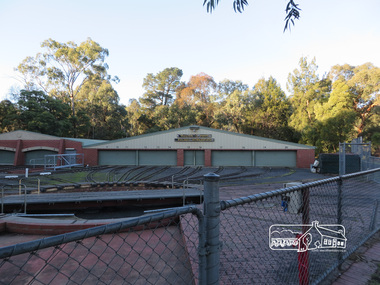
Photograph, Liz Pidgeon, Heritage Excursion; Eltham Lower Park Walk and Talk, 1 July 2017, 1 July 2017
Diamond Valley Miniature Railway Sheds Newsletter No., 234, June 2017 Heritage Excursion - Saturday 1st July - Eltham Lower Park - Walk and Talk Eltham Lower Park has played an important part in the history of our area since the early days of European settlement when it was used by local residents as an informal racecourse. Prior to that its location at the junction of the Diamond Creek and the Yarra River made it an important meeting place for the Wurundjeri people. The park combines formal elements and sporting facilities with remnant bushland that is of environmental significance. It is home to sporting and horse riding clubs, popular play spaces and the Diamond Valley Miniature Railway, which attracts large numbers of visitors. The park will be the venue for our July excursion which will comprise a walk of about 3.5 km around the park and adjacent areas. Along the way we will discuss the history and natural history of the area. The path along the creek and the river provides a pleasant and scenic walk. This walk on Saturday 1st July is about 3.5 km in length and will take 2 to 2.5 hours. It will start at 2pm at the Main Road car park at the front of the park. (Melway ref 21 H 10). Born Digitalheritage excursion, activities, eltham district historical society, eltham lower park, diamond valley miniature railway -
 Eltham District Historical Society Inc
Photograph, Liz Pidgeon, Heritage Excursion; Eltham Lower Park Walk and Talk, 1 July 2017, 1 July 2017
Sign at the front of the park which includes a map. Newsletter No., 234, June 2017 Heritage Excursion - Saturday 1st July - Eltham Lower Park - Walk and Talk Eltham Lower Park has played an important part in the history of our area since the early days of European settlement when it was used by local residents as an informal racecourse. Prior to that its location at the junction of the Diamond Creek and the Yarra River made it an important meeting place for the Wurundjeri people. The park combines formal elements and sporting facilities with remnant bushland that is of environmental significance. It is home to sporting and horse riding clubs, popular play spaces and the Diamond Valley Miniature Railway, which attracts large numbers of visitors. The park will be the venue for our July excursion which will comprise a walk of about 3.5 km around the park and adjacent areas. Along the way we will discuss the history and natural history of the area. The path along the creek and the river provides a pleasant and scenic walk. This walk on Saturday 1st July is about 3.5 km in length and will take 2 to 2.5 hours. It will start at 2pm at the Main Road car park at the front of the park. (Melway ref 21 H 10). Born Digitalelection day, heritage excursion, activities, eltham district historical society, eltham lower park, sign -
 Eltham District Historical Society Inc
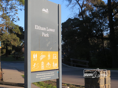
Photograph, Liz Pidgeon, Heritage Excursion; Eltham Lower Park Walk and Talk, 1 July 2017, 1 July 2017
Eltham Lower Park sign with Council logo at the entrance of the Park. Newsletter No., 234, June 2017 Heritage Excursion - Saturday 1st July - Eltham Lower Park - Walk and Talk Eltham Lower Park has played an important part in the history of our area since the early days of European settlement when it was used by local residents as an informal racecourse. Prior to that its location at the junction of the Diamond Creek and the Yarra River made it an important meeting place for the Wurundjeri people. The park combines formal elements and sporting facilities with remnant bushland that is of environmental significance. It is home to sporting and horse riding clubs, popular play spaces and the Diamond Valley Miniature Railway, which attracts large numbers of visitors. The park will be the venue for our July excursion which will comprise a walk of about 3.5 km around the park and adjacent areas. Along the way we will discuss the history and natural history of the area. The path along the creek and the river provides a pleasant and scenic walk. This walk on Saturday 1st July is about 3.5 km in length and will take 2 to 2.5 hours. It will start at 2pm at the Main Road car park at the front of the park. (Melway ref 21 H 10). Born Digitalelection day, heritage excursion, activities, eltham district historical society, eltham lower park, sign -
 Eltham District Historical Society Inc
Photograph, Liz Pidgeon, Heritage Excursion; Eltham Lower Park Walk and Talk, 1 July 2017, 1 July 2017
Local historian Russell Yeoman with EDHS President Jim Connor Newsletter No., 234, June 2017 Heritage Excursion - Saturday 1st July - Eltham Lower Park - Walk and Talk Eltham Lower Park has played an important part in the history of our area since the early days of European settlement when it was used by local residents as an informal racecourse. Prior to that its location at the junction of the Diamond Creek and the Yarra River made it an important meeting place for the Wurundjeri people. The park combines formal elements and sporting facilities with remnant bushland that is of environmental significance. It is home to sporting and horse riding clubs, popular play spaces and the Diamond Valley Miniature Railway, which attracts large numbers of visitors. The park will be the venue for our July excursion which will comprise a walk of about 3.5 km around the park and adjacent areas. Along the way we will discuss the history and natural history of the area. The path along the creek and the river provides a pleasant and scenic walk. This walk on Saturday 1st July is about 3.5 km in length and will take 2 to 2.5 hours. It will start at 2pm at the Main Road car park at the front of the park. (Melway ref 21 H 10). Born Digitalheritage excursion, activities, eltham district historical society, eltham lower park, russell yeoman, jim connor -
 Federation University Historical Collection
Book, Birds of Australia, early 1890s
Not Gould although on spine. Minutes of the SMB council 14 April 1891 "6, A requisition from Professor Krause for a new work on the birds of Australia was referred to the Education committee. Broinowski was commisioned by the Department of Public Instruction in New South Wales to supply them with pictures of Australian birds which he published in 6 volumes from 1887 - 1891. Gracius Broinowski was born in Poland in 1837. To avoid conscription with the Russian army he roamed Europe in poverty,his possessions having been stolen earlier in Germany. Hearing tales of the Australian gold fields, he borderd the 'Windjammer' bound for Victoria as a deckhand. Broinowski swam ashore at Portland, Victoria in 1857 age twenty. For seven years he walked from one rural settlement to another working as a shepherd, stockman and independent farmer. In 1864 Bronoiwski married in Melbourne and found work with Hamel & Ferguson (print sellers and publishers). 'The Birds of Australia' was finalised in 1891 with 303 full page illustrations lithographed in colour with notes on over 700 species. Limited to 1000 copies the edition sold out quickly. Bronowski died in 1913 at Mosmon NSW, aged 76. He was survived by his wife, a daughter and 6 sons.Green hard cover book, black leather spine and corners. Title on spine written in gold letters, gold decorations on spine. Pages not numbered. Coloured plates (lithographs). Vol. 1 - 6. Printed and bound.Stamped throughout the book "School of Mines Ballarat Library".birds, gracius j. broinowski, fauna, ballarat technical art school library -
 Bayside Gallery - Bayside City Council Art & Heritage Collection
Painting - oil and acrylic on canvas, Robert Kelly, Chinaman's Creek, 2016
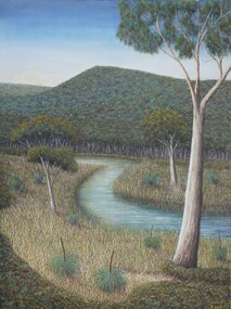
Bob Kelly paints landscapes of culturally significant sites along the Mornington Peninsula and depicts these locations as he imagines they originally were before colonisation. Using traditional Western painting techniques, Kelly records the underlying spirit of the Peninsula from a Wathaurong perspective. Chinaman’s Creek in Capel Sound (Rosebud West) was an important watercourse that originally ran from Wonga (Arthur’s Seat) down through Tootgarook Swamp into Port Phillip Bay. It was a great fresh water and food source and home for many Boonwurrung people. Since settlement over 170 years ago, the creek has been drained, blocked, reconstructed and damaged. Kelly depicts a lush green landscape in which the clean creek water winds through the surrounding vegetation of spinifex grasses and gum trees, the background hills are abundant with trees, untouched from man's intervention. Using painstaking detail, Kelly records each blade of grass and ripple on the surface of Chinaman’s Creek. His attention to detail serves to powerfully reimagine this important cultural site, returning it to its former pristine state, and reinvigorating its role as a key place of sustenance for the Indigenous populations of the Peninsula. Chinaman's Creek was a finalist in the 2017 Bayside Acquisitive Art Prize.oil and acrylic on canvaslandscape, creek, trees, chinaman's creek, painting, indigenous, robert kelly, bayside acquisitive art prize, bob kelly, wathaurong, rosebud, arthur's seat, tootgarook swamp, port phillip bay, boonwurrung -
 Federation University Art Collection
Work on paper - Digital Prints, Gilson, Deanne, 'Wadawurrung Axe Heads 1-4' by Deanne Gilson, 2011
Dr Deanne GILSON (1967- ) Country: Wadawurrung Deanne Gilson is a Federation University alumni, and an award-winning multi-disciplinary artist. Her practice draws its inspiration from ‘Ancestral marks’ and design on cultural objects found in museum archives and family oral histories. Deanne’s practice seeks to interrogate the colonial legacy of settlement and the western hegemonic systems of class, race and representation in historical photographs that were imposed on her Ancestors. Her work also explores the matriarchal role through her feminist perspectives, looking at the history of marriage and the oppressive function it has played within her family. Deanne has completed the following educationala achievements. 2014 – 2015 Masters by Research (Visual Art), Deakin University Geelong 2013 Graduate Diploma in Education Secondary, Federation University 2011 Certificate IV in Aboriginal Contemporary Art & Craft 2010 Cultural Heritage Management Course, Lakes Entrance 1 Week 2007 – 2010 Graduated, Bachelor of Visual Arts with Honours, University of Ballarat 1984 Diploma of Art, School of Mines & Industries TAFE This item is part of the Federation University Art Collection. The Art Collection features over 2000 works and was listed as a 'Ballarat Treasure' in 2007.This work depicts an axehead found on Wadawurrung country and is a responce to workign alongside archeologists untertaking land surveys of her ancestral lands and the visual documentaiton of artefcts.art, artwork, deanne gilson, gilson, wadawurrung, stone axe, aboriginal, alumni -
 Dandenong/Cranbourne RSL Sub Branch
Document - English document, Unknown
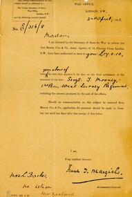
Historical due to date shown on the form. Possibly Sgt Mooney served in the Boer War.Document signed by the Accountant-General, War Office London 1901 in regards to a legacy for 17 pounds and 10 pence. F. 6-Form 45. War Office, London, SW., 3rd April 1901. Madam, I am directed by the Secretary of State for War to inform you that Messrs. Cox & Co., Army Agents, of 16, Charing Cross, London, SW., have been authorized to issue to you 17 pounds and 10 pence, being you share of the sum that appears to be due on the final settlement of the accounts of the late Sergt. J. Mooney, Ist Bn, West Surrey Regiment, including the amount produced by the sale of his effects. Should no communication on this subject be received from Messrs. Cox & Co., application for payment should be made to them, but not until ten days after the receipt of this letter. I am, Your obedient Servant, Frank T. Marzials, Accountant-General. Form is addressed to Mrs L. Barker, New Zealand -
 Eltham District Historical Society Inc
Photograph, Liz Pidgeon, Heritage Excursion; Eltham Lower Park Walk and Talk, 1 July 2017, 1 July 2017
Sign: Nillumbik Shire Council Pony Club area dogs must be leashed horses must not be ridden on asphalt pathways Newsletter No., 234, June 2017 Heritage Excursion - Saturday 1st July - Eltham Lower Park - Walk and Talk Eltham Lower Park has played an important part in the history of our area since the early days of European settlement when it was used by local residents as an informal racecourse. Prior to that its location at the junction of the Diamond Creek and the Yarra River made it an important meeting place for the Wurundjeri people. The park combines formal elements and sporting facilities with remnant bushland that is of environmental significance. It is home to sporting and horse riding clubs, popular play spaces and the Diamond Valley Miniature Railway, which attracts large numbers of visitors. The park will be the venue for our July excursion which will comprise a walk of about 3.5 km around the park and adjacent areas. Along the way we will discuss the history and natural history of the area. The path along the creek and the river provides a pleasant and scenic walk. This walk on Saturday 1st July is about 3.5 km in length and will take 2 to 2.5 hours. It will start at 2pm at the Main Road car park at the front of the park. (Melway ref 21 H 10). Born Digitalelection day, heritage excursion, activities, eltham district historical society, eltham lower park, sign, eltham pony club -
 Eltham District Historical Society Inc
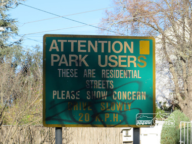
Photograph, Liz Pidgeon, Heritage Excursion; Eltham Lower Park Walk and Talk, 1 July 2017, 1 July 2017
Street signage: Attention park users these are residential streets please show concern drive slowly 20 m.p.h with graffiti Newsletter No., 234, June 2017 Heritage Excursion - Saturday 1st July - Eltham Lower Park - Walk and Talk Eltham Lower Park has played an important part in the history of our area since the early days of European settlement when it was used by local residents as an informal racecourse. Prior to that its location at the junction of the Diamond Creek and the Yarra River made it an important meeting place for the Wurundjeri people. The park combines formal elements and sporting facilities with remnant bushland that is of environmental significance. It is home to sporting and horse riding clubs, popular play spaces and the Diamond Valley Miniature Railway, which attracts large numbers of visitors. The park will be the venue for our July excursion which will comprise a walk of about 3.5 km around the park and adjacent areas. Along the way we will discuss the history and natural history of the area. The path along the creek and the river provides a pleasant and scenic walk. This walk on Saturday 1st July is about 3.5 km in length and will take 2 to 2.5 hours. It will start at 2pm at the Main Road car park at the front of the park. (Melway ref 21 H 10). Born Digitalheritage excursion, activities, eltham district historical society, eltham lower park, sign, grafitti -
 Eltham District Historical Society Inc
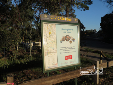
Photograph, Liz Pidgeon, Heritage Excursion; Eltham Lower Park Walk and Talk, 1 July 2017, 1 July 2017
Civic Guide sign near the entrance of Eltham Lower Park with a map of the local area and an advertisement for Eltham College Newsletter No., 234, June 2017 Heritage Excursion - Saturday 1st July - Eltham Lower Park - Walk and Talk Eltham Lower Park has played an important part in the history of our area since the early days of European settlement when it was used by local residents as an informal racecourse. Prior to that its location at the junction of the Diamond Creek and the Yarra River made it an important meeting place for the Wurundjeri people. The park combines formal elements and sporting facilities with remnant bushland that is of environmental significance. It is home to sporting and horse riding clubs, popular play spaces and the Diamond Valley Miniature Railway, which attracts large numbers of visitors. The park will be the venue for our July excursion which will comprise a walk of about 3.5 km around the park and adjacent areas. Along the way we will discuss the history and natural history of the area. The path along the creek and the river provides a pleasant and scenic walk. This walk on Saturday 1st July is about 3.5 km in length and will take 2 to 2.5 hours. It will start at 2pm at the Main Road car park at the front of the park. (Melway ref 21 H 10). Born Digitalheritage excursion, activities, eltham district historical society, eltham lower park, civic guide, eltham college, sign -
 Eltham District Historical Society Inc
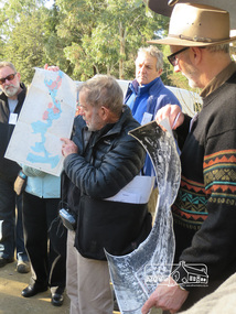
Photograph, Liz Pidgeon, Heritage Excursion; Eltham Lower Park Walk and Talk, 1 July 2017, 1 July 2017
Local Historian Russell Yeoman and EDHS President Jim Connor with a map and aerial photograph of the area the heritage walk will cover. Newsletter No., 234, June 2017 Heritage Excursion - Saturday 1st July - Eltham Lower Park - Walk and Talk Eltham Lower Park has played an important part in the history of our area since the early days of European settlement when it was used by local residents as an informal racecourse. Prior to that its location at the junction of the Diamond Creek and the Yarra River made it an important meeting place for the Wurundjeri people. The park combines formal elements and sporting facilities with remnant bushland that is of environmental significance. It is home to sporting and horse riding clubs, popular play spaces and the Diamond Valley Miniature Railway, which attracts large numbers of visitors. The park will be the venue for our July excursion which will comprise a walk of about 3.5 km around the park and adjacent areas. Along the way we will discuss the history and natural history of the area. The path along the creek and the river provides a pleasant and scenic walk. This walk on Saturday 1st July is about 3.5 km in length and will take 2 to 2.5 hours. It will start at 2pm at the Main Road car park at the front of the park. (Melway ref 21 H 10). Born Digitalheritage excursion, activities, eltham district historical society, eltham lower park, russell yeoman, jim connor, guide -
 Melton City Libraries
Pamphlet, Dry Stone Wall Driving Trail, Unknown
"The dry stone walls provide a tangible link to the area’s white settlement, and they remain a symbol of the profound change in land usage from the original Kulin custodians to the European arrivals of the nineteenth century. The bulk of dry stone wall construction in Victoria occurred between the 1850s and 1880s. The gold rush of the early 1850s in particular inspired a flurry of construction. At this time, labour previously available for shepherding livestock dried up, as men gravitated to the goldfields to seek their fortunes. This necessitated the building of fencing to contain the district’s growing number of sheep, cattle and horses. An explosion in surveying, subdivision and the sale of Crown lands also contributed to a boost in construction. Government regulations that punished pastoralists for allowing their livestock to stray provided further incentive to fence-off previously open expanses of land. The major benefit of this type of fencing was that it utilised the materials at hand; the plentiful grey basalt that scattered the landscape. In the case of the dry stone walls built around Melton, the characteristic round or oval shape of the volcanic fieldstones on the western plains inspired some distinctive designs.54 Another advantage of dry stone walls was their ability to withstand the ravages of flood, fire and drought often experienced in the district. This durability accounts for the fact that many of these fences still exist today". Dry Stone Wall trail brochure/pamphlet for visitors provided by Melton Visitor Information Centrecouncil, landscapes of significance -
 Glenelg Shire Council Cultural Collection
Painting, a) Johnston & Co. Hamilton b) Johnstone O'Shannessy, Melbourne, Burswood, late 1800s
From Victorian Heritage: The single storey mansion house with enclosed glass verandah, Burswood was built in 1853 on a site overlooking the Portland Bay for English born pioneer colonist Edward Henty. John Barrow of Adelaide was the architect for this exceptional Australian regency style residence which he designed as a central block of fine axed basalt ashlar and slate roof (now replaced) with flanking brick wings forming an enclosed rear courtyard. Burswood is the most important early mansion house in western Victoria, being an exceptional Australian regency design by distinguished colonial architect James Barrow. Edward Henty, a member of one of Australia's most remarkable colonial families and the founder of Portland, established the first permanent settlement in Victoria on 19th November 1834, and Burswood is testimony to his success as an early colonist. Henty lived in his mansion for 17 years in a semi-regal state. Burswood has been little altered since completion in 1853. A glasshouse conservatory to the side of the present enclosed verandah was demolished prior to 1895 and the slate roof replaced with iron. Johnstone, O’Shannessy & Co was a leading photographic studio located in Melbourne, Victoria, Australia. It was active from 1865 to 1905. Henry James Johnstone was also an artist and studied at Louis Buvelot's school and with Thomas Clark.Painting of a sandstone coloured building. A grand house with a driveway and well-kept gardens to the front. There is a horse and cart with a man standing to the side of it. There is a female figure exiting the building and another female and a man further along the driveway with a dog. The building has a glass conservatory attached to the side. The sky is blue with several fluffy clouds.Bottom right: Johnstone O'Shannessy & Co Melbourne (in white paint)homestead, henty, historic buildings, colonial, burswood house -
 Victorian Aboriginal Corporation for Languages
Book, Ian Macfarlane, Historical records of Victoria : foundation series : volume 2A : the Aborigines of Port Phillip 1835-1839, 1982
Reproductions of various transactions and reports dealing with Aboriginal people in Port Phillip in the period 1835-39, beginning with some of the earliest reports and tracing the evolution of government interaction and policy towards Aborigines in the 19th century. Covers mission work, government reports, the native police, conflicts with squatters, with numerous illustrations and original reports. Contents: Part I, Evolution of British policy Ch. 1. Proposals to appoint protectors of aborigines Ch. 2. Racial conflict in the year of official settlement at Port Phillip Ch. 3. House of Commons Select Committee on Aborigines Part II, The Wesleyan Mission at Buntingdale Ch. 4. Establishment and early operations of the Wesleyan mission Part III, The Government acts Ch. 5. Establishing the first government mission 1835-7 Ch. 6. Food and clothing for the Aborigines Ch. 7. Punishment of Aborigines found drunk, 1836-8 Ch. 8. Operations of the government mission, November 1837 to March 1839 Ch. 9. First attempt to form a native police corps Part IV, Growing conflict with squatters, 1837-8 Ch. 10. The disappearance of Gellibrand and Hesse Ch. 11. Attacks in the Western District Ch. 12. Attacks on the overland routes to Port Phillip Ch. 13. Evolution of policy in Sydney, 1838.b&w illustrations, b&w photographs, tables, document reproductionsvictorian history, colonisation, justice system -
 Ballarat Tramway Museum
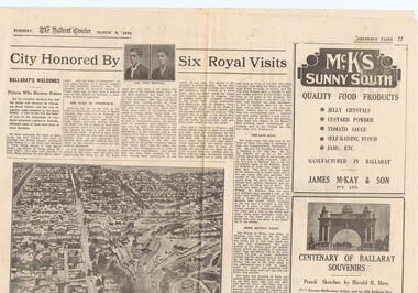
Newspaper, The Courier Ballarat, City Honored by six Royal Visits, Mar. 1938
Yields information about Ballarat and its locations or environs late 1938.Pages 11,12, 19 and 20 of the centenary of settlement in the Ballarat district by the Ballarat Courier - March 1938. See also items 186, 198 and 199. Page 11 Royal visits, banking in Ballarat, photos - NW section of Ballarat, railway station in foreground. Ads for J.McKay and Son, Roy Reeds (Men's store) and Ballarat Gas Co. Also photo of "The Corner" in Sturt St. - old Mining Exchange. Page 12 - full page ad for Morseheads, women's store. Page 19 - articles - Ballarat Lighting and Power, ESCo, SEC, electric trams. photos of the Arch of Victory, first electric tram, Lake Wendouree. Advertisements for Austin Spears (cycles), McDougall and Chisholm (drapers), W.E. Longhurst (bread) and the ES&A bank. Also article on South St. Society - music and elocution. Page 20 - articles - Ballarat Gas Co., horse and electric trams, agriculture in district and Ballarat's war record (WWI). Photos of work at Gong Gong Reservoir and Committeemen of the Ballarat Horticultural Society - 1859 to 1885. Ads for Ballarat College, Clarendon, Queens (girls) and Ballarat Grammar schools, Ern Craig Motors (Vauxhall) and Snows men's wear. Record reviewed and images of pages added 7-9-2013 and 10-9-2013trams, tramways, ballarat electricity, centenary, banking, transport, trams, esco -
 Flagstaff Hill Maritime Museum and Village
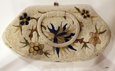
Accessory - Bag, 1930's
In the words of Donor, Betty Stone, "Owned by my aunt Mrs Elsie Mary (nee Dale) Towers, born 24 December 1895, daughter of Ellis and Ann Dale, of Latrigg, Wangoom, Warrnambool. This beaded bag was a personal gift from Miss Lake to Elsie Dale sometime in the early 1930s. Miss Lake was a member of a leading Warrnambool family whose property Lyndoch was situated by the banks of the Hopkins River. After completing her nursing course at Warrnambool Hospital and working there for a time, Elsie Dale was appointed Sister-in-Charge of the newly formed Baby Health Centre, which initially operated in temporary accommodation at or near the Council Chambers. In 1928 the Centre moved into new brick premises on Liebig Street. The building comprised of five rooms, a back yard and a front veranda where mothers parked their prams. The Warrnambool Standard reported in February 1928. The purpose of the Clinic is to the saving of infant's life. Many mothers attended the Clinic in the former location. They were able to acquire valuable knowledge from Sister Dale who is in charge of the Clinic and also have their infants weighed and measured each week. During the early days of the Centre Miss Lake, as a patron, took a keen interest in all aspects of the Centre and co-operated very closely with Sister Dale. Miss Lake would often call in at the centre while her uniformed chauffeur would wait beside her limousine parked in the street outside the Baby Heath Centre. I also recall my aunt driving to Lyndoch to discuss matters concerning the Centre with Miss Lake. Miss Lake purchased this evening bag in England, and upon her return from her overseas tour in the early 1930s, presented it to Sister Dale as a token of appreciation. Dedicated to her vocation, Sister Dale gave unstintingly of her effort, time and resources to create an attractive venue for mothers to visit. Her contribution to the welfare of all mothers and babies in the Warrnambool area, particularly during the Depression years, was considerable. Sister Dale, who drove a Dodge Tourer car, visited mothers in their homes when necessary and regularly visited the indigenous settlement at Framlingham. Amongst my early childhood memories are those of accompanying my aunt when she drove to the Nestles factory at Dennington to purchase large tins of dried milk baby food which she then delivered to the mothers who lived at the Framlingham settlement. Sister Elsie Dale retired in 1949 and moved to Mooroopna after her marriage to Solomon Towers. (Died aged 75 years 27 July 1971) (Note: For additional information please refer to Betty Stone’s book “Pioneers and Places - A History of three Warrnambool Pioneering Families” ie. Chamberlain, Dale and Lees Families)This item is associated with the families of Chamberlain, Dale and Lees. These families are listed in the "Pioneers' Register" for Warrnambool Township and the Shire, 1835-1900, published by A.I.G.S. Warrnambool Branch. Elsie Dale was the first Sister to work in the newly established Baby Health Centre in Warrnambool.Beaded evening bag or clutch purse. The bag was a gift to Elsie Dale from friend Miss Lake, purchased in England early 1930's. The fabric is covered in tiny white beads and features a floral design in browns and greens. The bag has two bead-covered handles and the lining includes a small pocket. Part of the 'Chamberlain Dale Lees Collection'.flagstaff hill, warrnambool, shipwrecked coast, flagstaff hill maritime museum, maritime museum, shipwreck coast, flagstaff hill maritime village, great ocean road, chamberlain, dale, lees, stone, betty stone, warrnambool pioneers, elsie dale, miss lake, lyndoch, handbag, purse, evening bag, beaded handbag, beaded purse, ladies' accessory, clutch purse, warrnambool baby health centre, infant welfare centre