Showing 12221 items matching " reserves"
-
 Greensborough Historical Society
Leaflet, Greensborough Historical Society, Andrew Yandell Reserve, with Greensborough Historical Society, 28/10/2017
This booklet was produced for a meeting of the Greensborough Historical Society which included a guided walk through the Andrew Yandell Reserve.4 page colour leaflet, with 4 photographic masters used for its productionandrew yandell reserve -
 Eltham District Historical Society Inc
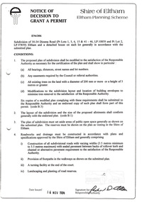
Document, Notice of Decision to Grant a Permit; Ref: E94/306 - Subdivision of 30-34 Diosma Road; 16 November 1994, 16/11/1994
This permit was eventually overturned following community objection and the land was donated by Yarra Valley Water for use as a community reserve.The Stokes Orchard Estate collection is typical of housing developments of the late 1970s and 1980s. It was one of the earliest estates in Eltham following the nearby Woodridge Estate development.A4 document consisting of ten pagesAs notedstokes place, eltham, stokes orchard, stokes orchard estate, streets, houses, peter and carla vermey, diosma road, letter of objection, melbourne metropolitan board of works, planning application, reservoir, shire of eltham -
 National Wool Museum
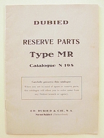
Booklet, Dubied Reserve Parts Type MR Catalogue N198
Catalogue of reserve parts for the Dubied Type MR hand knitting machine, which also forms part of the collection.machine knitting, sartori, mrs genitilia -
 Robin Boyd Foundation
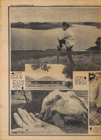
Newspaper - Clipping, Kevin Killey, Tower Hill lives again, 9-Dec-71
Article celebrating the Tower Hill State Game reserve and the new Natural History Centre, designed by Robin Boyd.Double page, p 34-35walsh st library -
 Lakes Entrance Historical Society
Photograph - St Annes Girls School Teachers, 1949 c
Also a black and white photograph of gravel road in Buchan Caves reserve 05439.1 14 X 7 CMBlack and white photograph of Miss Dora Bradley, Miss Bailey,Miss Rivers, Miss Carlyle and Miss Turner teachers from St Annes Girls School on visit to Buchan Caves Buchan Victoriatourism, schools, teachers -
 Bendigo Historical Society Inc.
Photograph - CRICKET MATCH ENGLAND VERSUS BENDIGO, 1901
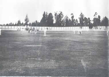
Black and white photo ( copy ) Photo is enclosed in cricket score book sheets. Written on outside of score sheet ' photos for Wes Harry. Originals 2. Large 1. ( Match Eng. V Bendigo ) Wes Harry with ball ( 1901 ) presented to Father S ( ? ) Harry, taken at Upper Reserve Oval ( now QEO ) ( 1989 ) on grand stand steps. Cricket field with white clad players. 2 umpires. High fence in background. Written on back in biro : 'With compliments, Ken Hurst, Bendigo 1990 , England v Bendigo at Upper Reserve Oval Bendigo 1901. England 341 and 5 - 204. Batting for England Hayware and Tyldesby - photo. Bowling for Bendigo J. Harry, 6 - 107 - photo.topic, sport, cricket -
 Bendigo Historical Society Inc.
Document - HUSTLERS REEF - PLANS & SECTIONS TO ACCOMPANY BULLETIN NO 33
Pink page pasted onto cream card titled Plans and Sections to accompany Bulletin No 33. Hustler's Line of Reef, Bendigo by H S Whitelaw, by Authority: Albert J. Mullett, Government Printer, Melbourne. Plate No 1 to No 34. Mines mentioned: Fortuna Hustler's Mine, Hustler's Royal Reserve No 2 Mine, Hustler's Royal Reserve Mine Park Shaft, Great Extended Hustler's Mine, Hustler's Reef and Hustler's Reef No 1 Mines, Hustler's Reef Mine, Comet Mine, United Hustler's and Redan Mine, K. K. Mine, Hustler's Consols Mine, Fortuna Hustler's Mine. Department of Mines Geological Survey of Victoria 1914. Written on the back: Lightning Hill area to Summer Hill.document, hustlers reef, plans & sections to accompany bulletin no 33, geological survey of victoria, department of mines, hustler's line of reef, h s whitelaw, fortuna hustler's mine, hustler's royal reserve no 2 mine, hustler's royal reserve mine park shaft, great extended hustler's mine, hustler's reef mine, hustler's reef no 1 mine, comet mine, united hustler's mine, redan mine, k k mine, hustler's consols mine, fortuna hustler's mine, hustler's consols mine, albert j mullett, government printer melbourne -
 Bendigo Historical Society Inc.
Document - Geological Survey of Victoria, Hustlers Line of Reef, Bendigo, April, 2014
Seven men were killed at the Great Extended Hustler's mine disaster on 2nd May 1914 by an explosion of dynamite occurring as the men were waiting at the plat to ascend the mine at the end of their shift. No blame was attached to anyone in the findings of the inquisition. It was unknown what caused the dynamite to explode. This document formed part of the research done at the time by Bendigo Historical Society, of the 100 years commemoration of the mine disaster, held at Hustler's Hill in 2014. Seven page photocopy of Department of Mines, Bulletin, Geological Survey of Victoria, Hustlers Line of Reef, Bendigo, No. 33 by H.S. Whitelaw. Includes plan of Hustlers Royal Reserve No. 2, (main shaft) showing location on Pall Mall, and location of Post Office and Law Courts; plan of location of Hustlers Royal Reserve No. 2 (Park Shaft) showing Jail (sic), Camp Hill State School, two 'lagoons' in between tennis court, croquet court and bowling green; a plan of the Great Extended Hustler's Shaft and two copied images of Hustler's Hill showing mining buildings, poppet heads and chimneys. Comet, K.K., Hustler's No. 1, Old Comet and United Hustler's and Redan Mines are shown in the images. great extended hustlers, goldmining, accident, quartz, mining, k.k. mine, comet mine, hustler's line of reef, old comet, united hustler's, redan -
 Bendigo Historical Society Inc.
Document - Regulation of Mines Bill, famous mines of Bendigo, April, 2014
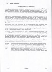
Seven men were killed at the Great Extended Hustler's mine disaster on 2nd May 1914 by an explosion of dynamite occurring as the men were waiting at the plat to ascend the mine at the end of their shift. No blame was attached to anyone in the findings of the inquisition. It was unknown what caused the dynamite to explode. Three page typed document. First page: 'The Regulation of Mines Bill' by Albert Richardson; Angus Mackay, Minister of Mines introduced the Bill in the Legislative Assembly on October 16th 1873 and it became law on January 1st 1874. Second page: 'Famous Gold Mines of Bendigo and Eaglehawk' by Albert Richardson, discusses deep shafts, more than 4000 feet shafts, wages for 1911. Hustler's Line of Reef mines are listed from north to south: Hustler Consols; United Hustler's and Redan, K.K., Comet, Hustler's Reef No. 1, Hustlers Reef, Great Extended Hustlers (formed 4.2.1865) Hustler's Royal Reserve Co., (Park Shaft) Hustler's Royal Reserve (City Shaft) and Fortuna Hustler's (formed August 1888).great extended hustlers, goldmining, accident, quartz, mining, k.k. mine, comet mine, hustler's line of reef, old comet, united hustler's, redan -
 Bendigo Historical Society Inc.
Document - Y.W.C.A. Reserve Girl Citizens
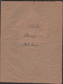
Three Y.W.C.A. documents circa 1950 11066.1 Reserve Girl Citizens Club Leader's record book. Book for "Bell Birds" containing member names, attendance record for Blue and Gold teams; contained in an exercise book covered in brown paper. Members 1950: Myrtle Hassett, Evelyn Hassett, Mary Bacon, Beatrice Bacon, Carol Aisbett, Jean Ipsen, Maureen Browning, Isabel Shelton, Clare West, Carol West, Joy Quinn. 11066.2 Y.W.C.A. Reserve Girl Citizens "Instructions to Leaders" detailing Assembly, Announcements and duties when divided into clubs - mark roll and fee collection. 11066.3 Typed script for "The Butler's Mistake" - a play libretto with parts for King, Queen, Waitress and Narrator 11066.1 Exercise book notes "Y.W.C.A. Bendigo Bell Birds" hand written on front cover.y.w.c.a. activity records -
 Ringwood and District Historical Society
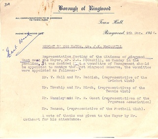
Administrative record - Borough Of Ringwood 4th December 1946, 11th December 1946, Report to the Mayor Cr. J.K. McCaskill J.P
A report to the Mayor stating it was decided a Committee of Management be appointed to manage the East Ringwood Reserve. Mr T Hall and Mr Reddish (Representative of the Cricket Club) Mr Howship and Mr Birch (Representatives of the Tennis Club) Mr. Wamsley and Mr R Gues (Representatives of the Progress Association Mr Benson (Representative of the Football Club) -
 Emerald Museum & Nobelius Heritage Park
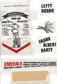
Bromides, 1984-1985
Various bromides used for printing Advertisements, including for Emerald Cricket Club, Emerald Netball Club, Emerald Hardware, Rotary Inner Wheel, Peter Stickley Real Estate, Emerald Nobelius Estate sale,Emerald Tolley and Lamble Agricultural Services,Emerald District Waterboard, Melbourne Reptile and Fauna Reserve and Emerald Security.bromides, emerald, clubs -
 Ringwood and District Historical Society
Map, Plan of Country Lands in the Parishes of Nunawading Ringwood and Scoresby - circa 1855
Blueprint copy of Survey Map detailing original Selectors' names and property locations. List of Parish map references including property bearings, distances in Links, and markings on trees. Descriptive remarks include areas marked "Farmer's Common", "Poor soil thickly/moderately timbered with stringy bark", and location of water and firewood reserves."Surveyed and plotted by N.M. Bickford, Superintendant of Mr. Hodgkinson's Field Party". "The land comprised in this survey is of inferior quality, moderately undulating, and thickly wooded. It is watered by Dandenong Creek and Deep Creek." Inset map showing location of (*proposed) cemetery on southern corner of Lillydale Road from Melbourne and Sawmill Road, later Mount Dandenong Road. (*Cemetery did not eventuate.) -
 Bendigo Historical Society Inc.
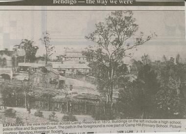
Newspaper - JENNY FOLEY COLLECTION: EXPANSIVE
Bendigo Advertiser ''The way we were'' from 2000. Expansive: the view north-east across Camp Reserve in 1870. Buildings on the left include a high school, police office and Supreme Court. The path in the foreground is now part of Camp Hill Primary School. Picture courtesy Bendigo Historical Society. The clip is in a folder.newspaper, bendigo advertiser, the way we were -
 Bendigo Historical Society Inc.
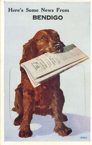
Postcard - NOVELTY POSTCARD BENDIGO VIEWS 1984
14.5cm X 9.2cm Postcard of Retriever dog holding paper with 9 fold-out Bendigo Views. Printed 1984 City Hall, Civic Buildings, Central Deborah Mine, Alexandra Fountain, Look-out Tower, Conservatory Gardens, Soldiers Memorial Hall, Post-Office. Pall Mall, The Lake Upper Reserve.Valentine's Mail Postcard.bendigo, buildings, heritage buildings -
 Bendigo Historical Society Inc.
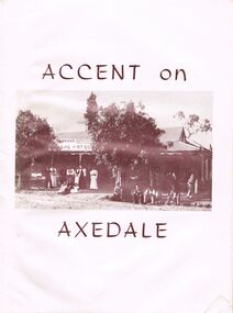
Document - BOOKLET: ACCENT ON AXEDALE
Booklet: ''Accent on Axedale'', published by the Centenary and Back to Axedale Committee 1970. 36 pages with photographs. Chapters on: Early Settlement; Churches; Education; Police; Municipal Affairs; Commerce; Cemeteries; Race Course Reserve; The Railway (O'Keefe); Eppalock Weir; The Hall; The Wars; C.W.A; Camp Sites; C.F.A; Axedale Progress Association; Sport;Alfred Ruskin Publications. Freelance Press, 61-63 City South Melbourne. 3205axedale, history, early settlement, axedale sporting club, indoor bowls, axedale progress association, c.w.a., country fire association.eppalock weir, the railway, race course reserve, cemeteries, axedale farmers club, the pitcher dressers poem by w. g. o'neill, bluestone quarries, threshing teams, hotels, general store and post office. education, churches, early settlement. -
 Bendigo Historical Society Inc.
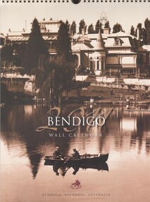
Ephemera - BENDIGO WALL CALENDAR 2011
A 2011 Bendigo wall calendar. Photos included: J.R. Hoskins timber yard, Dudley House,Bendigo tram, Bendigo advertiser hargreaves Street, Commercial House, Chinese Joss House, Victoria Hill,Members of the Bendigo stock exchange, Upper reserve View Street, Hotel Shamrock, Scholten & Marsh, Bendigo arcadebendigo, tourism, calendar -
Whitehorse Historical Society Inc.
Letter - Correspondence, Nunawading Park Tennis Club, 1983
Letter to the editor, Nunawading Gazette, from Alan Macgillicuddy Figgis about the history of Nunawading Park Tennis Club formed 1919.Letter to the editor, Nunawading Gazette, from Alan Macgillicuddy Figgis about the history of Nunawading Park Tennis Club formed 1919. It was located corner of Canterbury and Middleborough Roads and is now incorporated in the R.H.L. Sparks Reserve. Alan was a foundation member of the club. Also describes his work with the E.S. & A. Bank pioneering agencies in the district.Letter to the editor, Nunawading Gazette, from Alan Macgillicuddy Figgis about the history of Nunawading Park Tennis Club formed 1919. tennis, nunawading park tennis club, figgis, alan, r.h.l. sparks reserve, banks, english, scottish and australian bank -
 Bendigo Historical Society Inc.
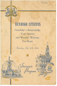
Document - WELCOME HOME 1946, 1946
Bendigo Citizens Welcome Home Souvenir Program for Saturday July 20, 1946. Crest of City of Bendigo, images of the Snamrock and the Fountain on cover. Cream coloured with blue and gold printing. Program includes a Procession and a Tableau at the Upper Reserve involving 3000 school children. Sports Program followed. See 74.215 Folder 6 .event, official, ww2 welcome home -
Kew Historical Society Inc
Archive (Sub-series) - Subject File, CAMPBELL, Dr. Kate (1899-1986), 1958
Various partiesReference, Research, InformationSecondary Values (KHS Imposed Order)Subject file containing information on Dame Kate Campbell MD (1899-1986), who was a pioneer doctor in the field of pediatrics. The file contains newspaper articles/clippings relating to her work. A number of the articles were written at the time of her death in 1986. Kate Campbell Reserve in northern Kew is named after her.doctors - kew (vic), parks and gardens - kew (vic)doctors - kew (vic), parks and gardens - kew (vic) -
 Bendigo Historical Society Inc.
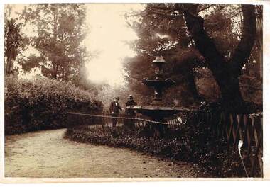
Photograph - FOUNTAIN IN ROSLIND PARK
Photograph - black and white. Written on back of photo -' Fountain in Rosalind Park, old camp reserve. Violet and Mr Baker'. The photo shows a three tier fountain, water emitting from top, surrounded by a simple metal fence. Man and woman standing alongside fence looking at fountain, presumably Violet and Mr. Baker.place, public gardens, rosalind park, fountain in roslind park. bendigo. violet and mr baker. -
![Plan, Improvements on the Camp Reserve Ballarat, 1870, 26/4/1870 (exact); Traced by Henry [Mornes?], district surveyor, on the above date](/media/collectors/4f729f6797f83e0308601707/items/4f72a4fa97f83e0308602508/item-media/59b79d3921ea680200c6b8a7/item-fit-380x285.jpg) Federation University Historical Collection
Federation University Historical CollectionPlan, Improvements on the Camp Reserve Ballarat, 1870, 26/4/1870 (exact); Traced by Henry [Mornes?], district surveyor, on the above date
The Ballarat Camp housed the Goldfields administrators. It was from this site that the troopers left on the morning of 3 December 1854 to attack the Eureka Stockade. Much of the area shown in on the west side of Camp Street is now used by the Federation University Arts Academy.Hand-drawn plan on white linen showing the camp reserve in what is now known Ballarat's Camp Street. The plan shows allotments in an area bounded by Mair, Sturt and Lydiard Streets. The plan has colours indicating wooden buildings, stone buildings, brick buildings, Wood & zinc buildings, and wood & brick buildings.ballarat, camp street, horace walker, henry mornes, goldfields architecture, reserve for public, buildings, goldfields administration, eureka stockade -
 University of Melbourne, Burnley Campus Archives
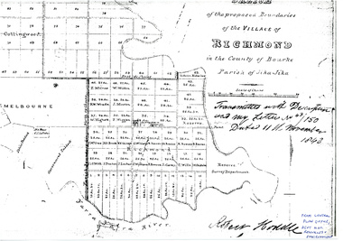
Plan - Photocopy, Sketch of the Proposed Boundaries of the Village of Richmond, 1843
Sketch of the proposed boundaries of the village of Richmond in the County of Bourke Parish of Jika-Jika. Handwritten on original: "Transmitted with Description and my letter No 43/150 Dated 11th November 1843 Robert Hoddle." Shows Burnley Gardens site as "Reserve. Survey Department." original in Central Plan Office, Department of Natural Resources and EnvironmentIn ink: From Central Plan Office Dept. Nat. Resources & Environmentrichmond, jika-jika, survey department, yarra river, robert hoddle -
 Greensborough Historical Society
Slide - Photograph, John Ramsdale, Pioneer Reserve plaque: Slide 26, 1990s
Photograph shows the Pioneer Reserve Park Plaque explaining that the bluestones came from the bridge over the Plenty River at Greensborough.Part of the John Ramsdale collection of slides and audio visual material.Colour photograph scanned from slide.No maker's marks. No caption on slide.plenty river, pioneer reserve greensborough, bluestone bridge greensborough -
 Greensborough Historical Society
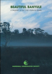
Book, Beautiful Banyule: by Carol Toomey, 1999_
A record of reserves and their features in the City of Banyule 1999. Full title: Beautiful Banyule: a register of out city's natural assets.A register of Banyule's natural assets104 pages, colour illustrations.Soft cover with treed skyline on front cover. 2 copies.Library labels.city of banyule, parks banyule, gardens banyule, historical sites banyule. -
 Greensborough Historical Society
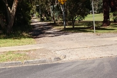
Photograph - Digital Image, Marilyn Smith, Plantation Lane Briar Hill, 16/01/2018
Plantation Lane runs from Williams Street Greensborough, near Sherbourne Road, through the E J Andrew ReserveDigital colour photographe j andrew reserve, briar hill, plantation lane, williams street greensborough -
 Greensborough Historical Society
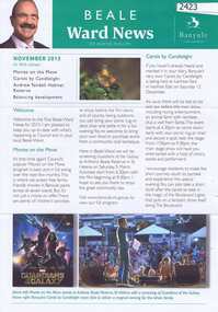
Newsletter, Beale Ward News. Cr Wayne Phillips. November 2015, 2015_11
Beale Ward News is the newsletter of Banyule Councillor Wayne Phillips. This edition includes an article on the Andrew Yandell Habitat Reserve.2 pages, text and colour images.wayne phillips, yandell reserve -
 Greensborough Historical Society
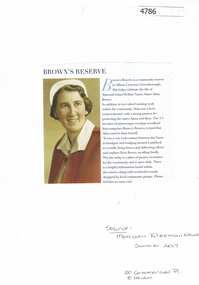
Article, Morrison Kleeman Real Estate, Brown's Reserve Greenhills, 2017_12
Information about Maternal Infant Welfare Nurse Alma Brown's property is now a community reserve in Albion Crescent Greensborough.Text and photograph alma brown, browns nature reserve greensborough, albion crescent greensborough -
 Federation University Historical Collection
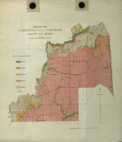
Plan - Map, Mines Department, Parish of Narmbool and part of Cargerie, County of Grant, 1892, 06/1992
This map shows the position of the homestead on the Narmbool Pre-emptive Right, volcanic craters, stock reserve, quarry and geological eras,Geological map showing Narmbool and part of Cargerie in the County of Grant in five colours, predominantly pink.narmbool, cargerie, narmbool pre-emptive right, williamson's creek, leigh river, green hill, collyer's hill, volcano, crater, krause, ferdinand krause -
 Mt Dandenong & District Historical Society Inc.
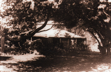
Photograph, 'Mountain Grange', Homestead of Thomas Hand and Family
View through trees of Mountain Grange, home of the Hand family. Now the site of Kalorama Memorial Reserve and Karwarra Gardens.Sepia photograph showing a wooden building in a treed setting.thomas hand, mountain grange, kalorama memorial reserve, karwarra gardens