Showing 11482 items matching "maps "
-
 Bendigo Military Museum
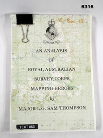
Administrative record - An analysis of Royal Australian Survey Corps mapping errors by Major LG Sam Thompson, Major LG Sam Thompson US Army Corps of Engineers at Army Survey Regiment, circa 1978
The purpose of the report is to analyze and study the map making procedures at the Army Survey Regiment to quantify the accuracy of the mapping to see if they meet acceptable accuracy standards. This was achieved through the study of possible errors.A4 loose leaf booklet held together with a "bulldog" paper clip. Cover part of an a RASvy 1:50,000 map. 1x Cover, 7x Introductory pages, 103x report pages.Marked on front cover "X - Box - 13", "TEXT 063"royal australian survey corps, rasvy, fortuna, army survey regiment, army svy regt, asr -
 Greensborough Historical Society
Map, Melbourne and Metropolitan Board of Works. Survey Division, MMBW, Yarra 2500 / 14.27. Yarrambat, Yan Yean Road, 1978_04
Melbourne and Metropolitan Board of Works. Yarra 2500 [base map] 14.26. Yarrambat, Yan Yean Road. Parishes of Morang 3183 and Greensborough 2724. Municipality of Diamond Valley 257. Prominent streets include: Yan Yean Road, North Oatlands Road and Pioneer Road. Features include Yarrambat War Memorial Reserve.MMBW Map in 1:2500 [scale] series. Cream parchment with green tape reinforcing on edges and punched holes on left edge.mmbw, melbourne and metropolitan board of works, shire of diamond valley, whttlesea, yarrambat - maps -
 Greensborough Historical Society
Business Card, Clements Avenue Automotive, Clements Avenue Automotive, Bundoora, 2018c
Clements Avenue Automotive is an automobile repair and service business in BundooraBusiness card, printed in colour both sidesLocation map, contact detailsautomotive repairs, bundoora, clements avenue bundoora -
 Victorian Aboriginal Corporation for Languages
Journal, Peter K Austin, Language documentation and description, Vol. 7, 2010
Maps, b&w illustrationslinguistics, language documentation, sign languages -
 Victorian Aboriginal Corporation for Languages
Journal, Imogen Gunn, Language documentation and description, Vol. 8, 2010
B&w photographs, mapslinguistics, endangered languages, oral literature, throat singing -
 Victorian Aboriginal Corporation for Languages
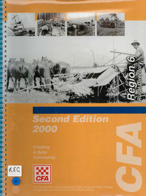
Map, Country Fire Authority, Region 6 rural directory, 2000
maps, b&w photographscolac, lismore, cressy, lake corangamite, camperdown, terang, cobden, peterborough, port campbell, apollo bay, forrest, victorian regional maps, fire protection -
 Victorian Aboriginal Corporation for Languages
Periodical, La Trobe University Department of Linguistics, La Trobe working papers in linguistics, 1994
maps, word lists, chartslinguistics -
 Victorian Aboriginal Corporation for Languages
Periodical, La Trobe University Department of Linguistics, La Trobe working papers in linguistics, 1995
Features 'Classifying Victorian languages' by Barry Blake and Julie Reidmaps, word lists, chartslinguistics -
 Victorian Aboriginal Corporation for Languages
Periodical, Western Australian College of Advanced Education, Wikaru : journal of the Institute of Applied Aboriginal Studies, Western Australian College of Advanced Education, 1987
The articles in this issue give accounts of independent Aboriginal schools in various areas. The authors look at these schools' goals and outcomes in a range of situations.b&w illustrations, mapsaboriginal schools, worowa aboriginal college, yiyili, jitapurru, oombulgurri -
 Victorian Aboriginal Corporation for Languages
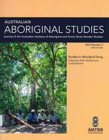
Periodical, Australian Institute of Aboriginal and Torres Strait Islander Studies, Australian Aboriginal studies : journal of the Australian Institute of Aboriginal and Torres Strait Islander Studies, 2007
1. Musical and linguistic perspectives on Aboriginal song Allan Marett and Linda Barwick Song brings language and music together. Great singers are at once musicians and wordsmiths, who toss rhythm, melody and word against one another in complex cross-play. In this paper we outline some initial findings that are emerging from our interdisciplinary study of the musical traditions of the Cobourg region of western Arnhem Land, a coastal area situated in the far north of the Australian continent 350 kilometres northeast of Darwin. We focus on a set of songs called Jurtbirrk, sung in Iwaidja, a highly endangered language, whose core speaker base is now located in the community of Minjilang on Croker Island. We bring to bear analytical methodologies from both musicology and linguistics to illuminate this hitherto undocumented genre of love songs. 2. Iwaidja Jurtbirrk songs: Bringing language and music together Linda Barwick (University of Sydney), Bruce Birch and Nicholas Evans (University of Melbourne) Song brings language and music together. Great singers are at once musicians and wordsmiths, who toss rhythm, melody and word against one another in complex cross-play. In this paper we outline some initial findings that are emerging from our interdisciplinary study of the musical traditions of the Cobourg region of western Arnhem Land, a coastal area situated in the far north of the Australian continent 350 kilometres northeast of Darwin. We focus on a set of songs called Jurtbirrk, sung in Iwaidja, a highly endangered language, whose core speaker base is now located in the community of Minjilang on Croker Island. We bring to bear analytical methodologies from both musicology and linguistics to illuminate this hitherto undocumented genre of love songs. 3. Morrdjdjanjno ngan-marnbom story nakka, ?songs that turn me into a story teller?: The morrdjdjanjno of western Arnhem Land Murray Garde (University of Melbourne) Morrdjdjanjno is the name of a song genre from the Arnhem Land plateau in the Top End of the Northern Territory and this paper is a first description of this previously undocumented song tradition. Morrdjdjanjno are songs owned neither by individuals or clans, but are handed down as ?open domain? songs with some singers having knowledge of certain songs unknown to others. Many morrdjdjanjno were once performed as part of animal increase rituals and each song is associated with a particular animal species, especially macropods. Sung only by men, they can be accompanied by clap sticks alone or both clap sticks and didjeridu. First investigations reveal that the song texts are not in everyday speech but include, among other things, totemic referential terms for animals which are exclusive to morrdjdjanjno. Translations from song language into ordinary register speech can often be ?worked up? when the song texts are discussed in their cultural and performance context. The transmission of these songs is severely endangered at present as there are only two known singers remaining both of whom are elderly. 4. Sung and spoken: An analysis of two different versions of a Kun-barlang love song Isabel O?Keeffe (nee Bickerdike) (University of Melbourne) In examining a sung version and a spoken version of a Kun-barlang love song text recorded by Alice Moyle in 1962, I outline the context and overall structure of the song, then provide a detailed comparative analysis of the two versions. I draw some preliminary conclusions about the nature of Kun-barlang song language, particularly in relation to the rhythmic setting of words in song texts and the use of vocables as structural markers. 5. Simplifying musical practice in order to enhance local identity: Rhythmic modes in the Walakandha wangga (Wadeye, Northern Territory) Allan Marett (University of Sydney) Around 1982, senior performers of the Walakandha wangga, a repertory of song and dance from the northern Australian community of Wadeye (Port Keats), made a conscious decision to simplify their complex musical and dance practice in order to strengthen the articulation of a group identity in ceremonial performance. Recordings from the period 1972?82 attest to a rich diversity of rhythmic modes, each of which was associated with a different style of dance. By the mid-1980s, however, this complexity had been significantly reduced. I trace the origin of the original complexity, explore the reasons why this was subsequently reduced, and trace the resultant changes in musical practice. 6. ?Too long, that wangga?: Analysing wangga texts over time Lysbeth Ford (University of Sydney) For the past forty or so years, Daly region song-men have joined with musicologists and linguists to document their wangga songs. This work has revealed a corpus of more than one hundred wangga songs composed in five language varieties Within this corpus are a few wangga texts recorded with their prose versions. I compare sung and spoken texts in an attempt to show not only what makes wangga texts consistently different from prose texts, but also how the most recent wangga texts differ from those composed some forty years ago. 7. Flesh with country: Juxtaposition and minimal contrast in the construction and melodic treatment of jadmi song texts Sally Treloyn (University of Sydney) For some time researchers of Centralian-style songs have found that compositional and performance practices that guide the construction and musical treatment of song texts have a broader social function. Most recently, Barwick has identified an ?aesthetics of parataxis or juxtaposition? in the design of Warumungu song texts and musical organisation (as well as visual arts and dances), that mirrors social values (such as the skin system) and forms 'inductive space' in which relationships between distinct classes of being, places, and groups of persons are established. Here I set out how juxtaposition and minimal contrast in the construction and melodic treatment of jadmi-type junba texts from the north and north-central Kimberley region similarly create 'inductive space' within which living performers, ancestral beings, and the country to which they are attached, are drawn into dynamic, contiguous relationships. 8. The poetics of central Australian Aboriginal song Myfany Turpin (University of Sydney) An often cited feature of traditional songs from Central Australia (CA songs) is the obfuscation of meaning. This arises partly from the difficulties of translation and partly from the difficulties in identifying words in song. The latter is the subject of this paper, where I argue it is a by-product of adhering to the requirements of a highly structured art form. Drawing upon a set of songs from the Arandic language group, I describe the CA song as having three independent obligatory components (text, rhythm and melody) and specify how text is set to rhythm within a rhythmic and a phonological constraint. I show how syllable counting, for the purposes of text setting, reflects a feature of the Arandic sound system. The resultant rhythmic text is then set to melody while adhering to a pattern of text alliteration. 9. Budutthun ratja wiyinymirri: Formal flexibility in the Yol?u manikay tradition and the challenge of recording a complete repertoire Aaron Corn (University of Sydney) with Neparr? a Gumbula (University of Sydney) Among the Yol?u (people) of north-eastern Arnhem Land, manikay (song) series serve as records of sacred relationships between humans, country and ancestors. Their formal structures constitute the overarching order of all ceremonial actions, and their lyrics comprise sacred esoteric lexicons held nowhere else in the Yol?u languages. A consummate knowledge of manikay and its interpenetrability with ancestors, country, and parallel canons of sacred y�ku (names), bu?gul (dances) and miny'tji (designs) is an essential prerequisite to traditional leadership in Yol?u society. Drawing on our recordings of the Baripuy manikay series from 2004 and 2005, we explore the aesthetics and functions of formal flexibility in the manikay tradition. We examine the individuation of lyrical realisations among singers, and the role of rhythmic modes in articulating between luku (root) and bu?gul'mirri (ceremonial) components of repertoire. Our findings will contribute significantly to intercultural understandings of manikay theory and aesthetics, and the centrality of manikay to Yol?u intellectual traditions. 10. Australian Aboriginal song language: So many questions, so little to work with Michael Walsh Review of the questions related to the analysis of Aboriginal song language; requirements for morpheme glossing, component package, interpretations, prose and song text comparison, separation of Indigenous and ethnographic explanations, candour about collection methods, limitations and interpretative origins.maps, colour photographs, tablesyolgnu, wadeye, music and culture -
 Victorian Aboriginal Corporation for Languages
Periodical, Australian National University Department of Pacific and Southeast Asian History, Aboriginal history, 1994
b&w photographs, maps -
 Victorian Aboriginal Corporation for Languages
Periodical, Australian National University Department of Pacific and Southeast Asian History, Aboriginal history, 1978
maps, b&w photographs -
 Victorian Aboriginal Corporation for Languages
Periodical, Royal Historical Society of Victoria, Victorian historical journal : George Bass's amazing Western Port adventure, 1998
maps, b&w illustrationsgeorge bass, western port -
 Victorian Aboriginal Corporation for Languages
Periodical, Royal Historical Society of Victoria, Victorian historical journal : Australia's imperial war, 2000
maps, b&w photographsvictorian history, war history -
 Victorian Aboriginal Corporation for Languages
Thesis, Cathrine Koukmenides, Pronouns as evidence for genetic relationships in Victorian languages, 1997
Thesis on language in Victoria, includes historical notes.Maps, charts, word listspama-nyungan, warnman, gundungurra, dyirringan, wathaurong, wathawurrung, tyattyalla, wudjubaluk, wuttyabullak, woiwurrung, kulin, madhi-madhi, wadi-wadi, wamba-wamba, wemba wemba, bereba-bereba, barababaraba, colac, warrnambool, bunganditj, kulin, yorta yorta, yabula yabula, jabulajabula, dhudhuroa, pallanganmidda, gippsland, ganai, gunai kurnai -
 Victorian Aboriginal Corporation for Languages
Thesis, Marguerita Stephens, White without soap - Philanthropy, caste and exclusion in colonial Victoria 1835-1888: A political economy of race, 2003
Maps, b&w illustrationscoranderrk, kulin, barak, strzelecki, racial science, infanticide, genocide, assimilation, bon berry childrens asylum -
 Victorian Aboriginal Corporation for Languages
Book, Felicity Jensz, German Moravian missionaries in the British colony of Victoria, Australia, 1848-1908 : influential strangers, 2010
Contents: God's lot : Moravians and missions "The most wretched and bleakest" : Moravian desire to work amongst the Australian Aborigines "Ein fauler Fleck" : Lake Boga, a putrid stain "I is done no more" : the first converts "Alles geht seinen schleppenden Gang" expansion, movement and sluggish progress "Every triumphant death" closure in a British colony.Maps, b&w illustrationsdjadja wurrung, dja dja wurrung, gunai, wati wati, wemba wemba, woi wurrung, wurundjeri, wotjobaluk, wergaia, wotjubalak, wotjibolik, wudjubalug, kulin nation, victorian history, moravian missions, colonisation, port phillip protectorate -
 Victorian Aboriginal Corporation for Languages
Book, Dawn A Lee, Daughter of two worlds, 2002
The biography of a Victorian Koori woman who traced her family lineage back to the first contact between Indigenous Victorians and the founder of Melbourne. Daughter of Two Worlds by Dawn Lee begins with a tragic affair between Eliza Batman, the wife of Melbourne pioneer John Batman, and William Willoughby, Batman's right-hand man and a pillar of Melbourne's early Wesleyan church. The book also unearths the remarkable truth behind a family legend that Dawn Lee's great grandfather was a mysterious white English lord who met her great grandmother, Susannah, a full tribal Gunditjmara woman.maps, b&w photographsgunditjmara, dawn a lee, aboriginal victorians, victorian history -
 Victorian Aboriginal Corporation for Languages
Book, Elizabeth Nelson, Letters from Aboriginal women of Victoria, 1867-1926, 2002
This edited collection of women's correspondence constitutes an important historical record of the experiences of Aboriginal women during a crucial period of social change. In particular the letters are valuable for the insight they offer into the impact on Aboriginal communities of government legislation and mission policies and the women's assertion of their entitlement to freedom and agency. Written by 81 different women, the letters cover such issues as children, family, religion, land, housing and material assistance.maps, b&w photographsvictorian aboriginal women, correspondence, government policy -
 Victorian Aboriginal Corporation for Languages
Book, Edgar Morrison, The Loddon Aborigines : tales of old Jim Crow, 1971
This regional survey is the last of a trilogy, each of which deals with a particular aspect of living conditions and racial relationships in the Loddon watershed in the early Colonial days.maps, b&w photographsloddon -
 Victorian Aboriginal Corporation for Languages
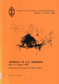
Book, Gary Presland, Journals of G.A. Robinson, May to August 1841, 1980
Transcription of G. A. Robinson?s journals for the period of May to August 1841. Contains numerous references to Aboriginal social organisation, personal name lists and clan grouping. Reproductions of Robinson?s sketches. Edited with an introduction by Gary Presland.maps, b&w illustrationsgeorge augustus robinson -
 Victorian Aboriginal Corporation for Languages
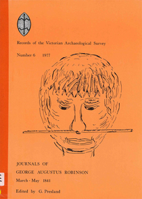
Book, Gary Presland, Journals of George Augustus Robinson March - May 1841, 1977
Extracts of manuscripts held in the Mitchell Library, Sydney, and published with their permission.Maps, b&w illustrationsgeorge augustus robinson -
 Victorian Aboriginal Corporation for Languages
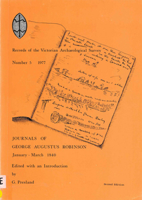
Book, Gary Presland, Journals of George Augustus Robinson, January - March 1840, 1977
With an introduction by Gary Presland. Extracts of manuscripts held in the Mitchell Library, Sydney and published with permission.Maps, b&w illustrationsgeorge augustus robinson -
 Victorian Aboriginal Corporation for Languages
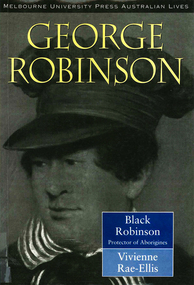
Book, Vivienne Rae-Ellis, Black Robinson : protector of Aborigines, 1996
Biography of George Augustus Robinson, official protector of Aborgines in Tasmania and Port Phillip. A detailed study of Robinson?s involvement with the government and with Aboriginal people, with much information on his personal life and dealings.Maps, b&w illustrationsgeorge augustus robinson, victorian history -
 Victorian Aboriginal Corporation for Languages
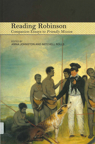
Book, Anna Johnston, Reading Robinson : companion essays to Friendly mission, 2008
maps, b&w photographsgeorge augustus robinson, friendly mission -
 Victorian Aboriginal Corporation for Languages
Book, Robert H Stainthorpe et al, Early reminiscences of the Wimmera and Mallee and Reminiscences of the early Mallee and Wimmera, 2009
maps, b&w photographsmallee, wimmera -
 Victorian Aboriginal Corporation for Languages
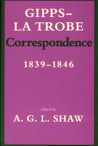
Book, A G L Shaw, Gipps - La Trobe correspondence 1839-1846, 1989
Transcription of correspondence between Sir George Gipps and C.J. La Trobe, giving a record of the early history of Victorian Aboriginal peoples in relation to white settlers.Maps, b&w illustrationssir george gipps, la trobe -
 Victorian Aboriginal Corporation for Languages
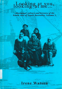
Book, Irene Watson, Looking at you, looking at me... : Aboriginal culture and history of the South-east of South Australia. Volume 1, 2002
The author is an Aboriginal woman, descendant of a family of long and continuous association with the south-east region of South Australia. This book attempts to overcome some of the difficulties in colonial relationships of the past to piece together the history of the Aboriginal people who survived in this area.maps, b&w photographssouth australian history -
 Victorian Aboriginal Corporation for Languages
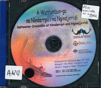
Book with CD, Altji Ambrose Piyalam, A-wurrumbun-ga na Ninderrpil i na Ngindjirridi = saltwater crocodile at Ninderrpil and Ngindjirridi: ancestral knowledge of the Magati Ke Rak Yederr and Marri Ngarr Rak Thawurr, 2003
Story in Language and Englishmaps, illustrations, photographs, CDstorytelling in language, magati ke rak yederr, marri ngarr rak thawurr -
Victorian Aboriginal Corporation for Languages
Conference proceedings, Joe Blythe, Maintaining the links : language, identity and the land : proceedings of the Seventh FEL Conference, Broome, Western Australia, 22-24 September 2003, 2003
Major headings: Languages & Land claims; Toponymy & Topography; Planning for the future; Language, identity & the environment; Language & Identity: Home & Away; Language revitalisation: Maintenance; Documenting ENdangered LanguagesMaps, graphs, word listsland claims, east kimberley, ecotourism, nsw, borroloola, gurr-goni, maningrida