Showing 1784 items matching "settlement."
-
 Eltham District Historical Society Inc
Work on paper (item) - Newspaper, Joseph Dubois, Yarra Valley Historical: a brief look at early life in the Valley during the mid 1800's to the 1900's
Volume 1, Issue 1. Early History of the Upper and Yarra Valley. "Welcome to the fist edition of the Yarra Valley historical, the aim of this newspaper is to remind us of the men and women who came here to mine, farm or harvest the plentiful and tall timbers, that built towns and cities..." Estimated date of publication 2010. The newspaper is full of potted histories of places with historical photographs, maps and timelines. Acknowledgment and citations for source material given. Advertisements for business's at the time of publicaion. Lilydale, De Castella family, p2. Mount Evelyn p6. Wandin [Anker family] p7. Seville [William Henry Smith; Mr and Mrs Thomas Payne; Duck family; Chandler family] p8. Woori Yallock p10. Yellingbo p11. Hoddles Creek p12. Launching Place p13. Yarra Junction p14. Reminiscences of Don 'Ripper' Reid p18. Wesburn p20. Warburton Village Settlement p22. Warburton p23. Big Pats Creek p26. McMahons Creek / Reefton [Brimbonga School] p27. Gladysdale / Gilderoy [Saxton family] p28. Powelltown p30.lilydale, mt evelyn, wandin, seville, woori yallock, yellingbo, hoddles creek, launching place, yarra junction, don reid, reminiscences, wesburn, warburton, big pats creek, mcmahons creek, reefton, gladysdale, gilderoy, powelltown, newspaper -
 Glenelg Shire Council Cultural Collection
Certificate - Certificate - Historic Buildings, Portland Town Hall, 1974
From the Victorian Heritage Register: The foundation stone of the original Portland Town Hall was laid by William Learmonth on 21st September, 1863 following a competition and subsequent public controversy over the permitted entry of architect John Barrow. The conservative classical design of municipal surveyor Alexander Ross was preferred and this axially planned design with central council chamber and side offices fronted by a fine axed pedimented gable entablature of basalt and Tuscan Doric pilasters was completed by 24th may 1864. The old Town Hall is one of a distinguished group of public buildings in Portland and an interesting example of conservative classical architecture of the first years of settlement in western Victoria. The basalt structure was partially erected of stone from the Portland stockade and has significant historical associations with local Government administration in the district. The Town Hall is the most impressive work of Alexander Ross, a surveyor architect whose career remains largely undocumented. The old Town Hall at Portland has been discreetly extended at the rear to provide additional meeting room accommodation. The premises are no longer used for local government administration.A4 sized certificate demonstrating Portland Town Hall's special significance to the state of Victoria & inclusion on the Historic Building Register. Singed by Robert Maclellan, Minister for planning & Historic Buildings Council Chairperson. Red seal attached, bottom right.portland town hall, history house, heritage register, historic buildings, certificate -
Glenelg Shire Council Cultural Collection
Souvenir - Tea Towel - Maretimo, Portland, n.d
From the National Trust register: Statement of Significance Maretimo, a 22 room single storey Australian Colonial Georgian style mansion set on a prominent bluff overlooking Portland harbour, was erected c. 1854 for John Norman McLeod. The design of Maretimo, which is constructed of basalt ashlar with fine-axed parapet entablature, delicate open timber work verandah and Regency interior, has been tenuously attributed to Adelaide architect James Barrow. Maretimo is rivalled only by the stylistically similar Henty residence, Burwsood of 1853 by James Barrow, as perhaps the finest Australian Colonial Georgian style residence erected within the first twenty years of settlement in Victoria. The residence, which was occupied for twenty years by distinguished English-born gentleman parliamentarian, pastoralist and former Van Deimen's Land settler, J H McLeod, is now notable for the disciplined facade and elegantly crafted interiors. Maretimo has been meticulously maintained and is presented in near perfect original condition. The interiors have been sensitively enhanced and redecorated.Linen souvenir tea towel 'Maretimo'. Green and black on cream. 'MARETIMO' at top, front view of Maretimo beneath, then map of locaion, then view from air. 'HISTORIC HOME PORTLAND, VICTORIA' beneath 'Pure Linen', bottom right.historic building, historic homestead, maretimo, henty, souvenir -
 Kiewa Valley Historical Society
Book - Non Fiction History, The Kiewa Story, circa 1993
This book provides in chronological order the development of the Kiewa Hydro-electricity scheme from the first concept (1911) to final construction work (1961). It covers the first attempt to utilise the power of the Victorian Alps water system. It started from a private syndicate and developed to the current State Electricity Commission of Victoria. The incentive for the Hydro scheme was to make money and not as an alternative to the carbon producing coal fired power plants. These coal fired power plants were increasing in numbers to service an ever increasing demand made by population expansion, especially in cities and large rural settlements. This demand spiraled up after World War II when there was a tremendous spike in immigration numbers due to refugees and displaced persons in Europe. The ability to utilise the untapped water provided by the winter snow fields, for a higher yield in electricity, was a powerful incentive to overcome the physical hardships in this remote Alpine region. Future power requirements may initiate the re-installation of the other two power stations(Pretty Valley and Big Hill) covered in original Scheme. This publication not only covers the development of the Kiewa Valley region with respect to population (within a socio-economical framework) but also the subtle but yet strong physical changes of a relatively pristine alpine region. The demands that an ever growing regional population places on the environment is clearly documented in print and black and white photographs. The working and living conditions of those who constructed and gave life to this hydro scheme is well documented in this book. It may be viewed as spartan now but was relevantly good at that moment in time, especially for those workers fleeing a devastated European environment. The successful planning and consideration to minimising any intrusion upon the natural alpine forests and high plains can viewed as an example (compared to the Tasmanian Hydro schemes) of how future hydro schemes (an inevitable requirement) will proceed. Most rural towns (in the early 1900s) were built by unencumbered rural based citizens, with the exception of Mount Beauty and Falls Creek. These two settlements were brought into life by a State (Victorian) Authority for a specific function and program. They were a gated community, that is, only open to construction workers involved with the hydro scheme. All facilities within these communities were provided by the State Electricity Commission of Victoria. The impact on the social, financial and individual independency of the community, by the transition from the S.E.C .environment to one of local government (Shire of Bright), had in some cases a severe impact.This hard covered book has a green cover with pictures on the front and back covers. The front cover has a coloured picture of a snow covered Mount Bogong taken from the opposite mountain range. The valley between both ranges has a whisk of mist over it. At the bottom of this picture are three black and white photographs covering the construction of the Kiewa Hydro - Electricity Scheme. On the back cover is a photograph, (black and white) detailing the Bogong village and Junction dam containing lake Guy. The inside front cover is a black and white photograph which details the construction of the West Kiewa tailrace tunnel during April 1951. The inside back cover is a black and white photograph of the concrete pour at the Clover Dam circa 1952. All photographs and sketches are in black and white. The pages are approximately 160 g/m2 and those which have photographs are on gloss paper.Book spine: "The Kiewa Story Graham Napier Geoff Easdown" alongside this is a white framed circle with white spokes radiating out and underneath in white lettering SECkiewa valley, hydro scheme, victorian alpine region, electricity generators, graham napier, geoff easdown -
 RSL Victoria - Anzac House Reference Library and Memorabilia Collection
Photograph, Macleod Repatriation Sanitorium, circa 1914
The former Mont Park/Bundoora Psychiatric and Repatriation Hospitals Complex consisted of seven hospitals on a site of 185 hectares. The site comprising the Mont Park and Strathallen estates was consolidated by the Victorian government by purchase and transfer from the Closer Settlement Board in 1909 . The Mont Park Hospital commenced in 1910 with the building of the Farm Workers Block . In 1912 the landscape gardener Hugh Linaker was employed to layout the grounds of Mont Park and other State mental hospitals. The other hospitals were gradually split off from the Mont Park administration to form separate entities included among these was the Macleod Repatriation Hospital (1915), An agreement was made with the Defence Department in 1914 for the latter to erect the Mont Park central block (the "Chronic Wards") for use as a Military Hospital, and for it later to revert to the State as portion of Mont Park Hospital. The buildings now known as the Chronic Wards were completed in this way in 1916 and used as the Australian General Hospital no. 16 for the duration of the war. One wing of this building was set aside for mental patients during this period. Silver gelatin photographww1, macleod repatriation sanitorium, mont park -
 Orbost & District Historical Society
Document - ticket, 1896
Gordon Hall was the first public building in Buchan. European settlement first entered the area in October 1838 and Buchan station was established in January 1839. Free selection after 1868, and a township was proclaimed in 1873 taking its name from the station. The Grand ball was held on race night, Monday 28th December 1896 in the Gordon Hall at Buchan. From the estate of Elsie Cooke. Elsie Cooke was a librarian in Orbost for many years. She was the daughter of John Cooke early Brodribb settler. Elsie Cooke lived all her life in Gippsland,. She was born at Brodribb in 1895 and died in 1970, Elsie Cooke lived at Bruthen for a short time and, in 1937, moved to live with her aunt, Miss Jean Munro. Miss Cooke was Librarian at the Mechanics Institute for many years. Kindness and consideration for other were Miss Cooke’s attributes and she endeared herself to all who knew her. She was a loyal member of the Presbyterian Church and a stalwart of the Ladies’ Guild, an energetic worker for the Municipal Auxiliary and a member of the Red Cross. (ref. Mary Gilbert)This item reflects the recreational / social activities of a remote rural community. A public event such as a grand ball would have been a significant event on the calendar.Small, cream-coloured rectangular card with rounded edges and blank ink. Evidence of pin holes in each four corners and folds/signs of wear. Card is foxing and has small vertical tear in lower left quadrant.+ GORDON x HALL, x BUCHAN. + / Race Night! - Race Night! / A GRAND BALL / Will be held in the Gordon Hall, Buchan, on / Monday, : 28th : December, : 1896. / ADMISSION : / +- SINGLE, THREE SHILLINGS -+grand ball, 1896, gordon hall, buchan, elsie cooke -
 Ballarat and District Irish Association
Image, Round Tower at Monasterboice, c1864, c1864
The historic ruins of Monasterboice are of an early Christian settlement north of Drogheda in County Louth, Ireland. It was founded in the late 5th century by Saint Buithe who died around 521, and was an important centre of religion and learning until the founding of nearby Mellifont Abbey in 1142. The site houses two churches built in the 14th century or later and an earlier round tower, but it is most famous for its 10th century high crosses. The round tower is about 35-metres tall, and is in very good condition, although it is not possible to go inside. The passage of time has laid down layers of earth so now the doorway is almost at ground level. The monastery was burned in 1097. The 5.5-metre Muiredach's High Cross is regarded as the finest high cross in the whole of Ireland. It is named after an abbot, Muiredach mac Domhnaill, who died in 923 and features biblical carvings of both the Old and New Testaments of the Bible. The North and West crosses are also fine examples of this kind of structure, but these have suffered much more from the effects of the weather. (http://en.wikipedia.org/wiki/Monasterboice)Image of a round tower in a graveyard. It is the Round Tower at Monasterboiceballarat irish, monsasterboice -
 Kew Historical Society Inc
Functional object - Wrought iron nails from 'Reno', St John's Parade, c. 1864
Comparatively few weatherboard houses in Kew survived from the early years of settlement into the second half of the 20th century. One such property was ‘Reno’, which once stood on the east side of St John’s Parade. Its earliest recorded owner was the architect Samuel Cocking who lived there from c.1865 until his death in 1888. The original landholding was bordered by Cotham Road, Glenferrie Road, Wellington Street, and Charles Street. The southern portion of this land included a fine orchard, with many imported trees. The old summer house, at first in the orchard, was later removed to the house garden. The MMBW Detail Plan No.1576 (1904) shows the remaining portion of the original land holding, including a semi-circular pathway at the front, and garden features such as an aviary, a fountain and grotto, and a fernery. None of these are apparent in photographs dating from the 1960s, where the garden, which once included rare plants provided by Baron Von Mueller, surrounds the cottage in a tangled frenzy. Despite a ‘local significance’ classification by the National Trust, the house was demolished in 1977.7 square headed iron nails collected from Reno before its demolition. In envelope marked with the name Joy Stewartreno, nails, samuel cocking -
![Wallpaper from 'Reno', St John's Parade [Kew]](/media/collectors/550653872162f11fb04854aa/items/57975996d0cdd1098c81d980/item-media/579759ded0cdd1098c81f6fa/item-fit-380x285.jpg) Kew Historical Society Inc
Kew Historical Society IncDecorative object - Wallpaper sample from 'Reno', St John's Parade, 1890s
Comparatively few weatherboard houses in Kew survived from the early years of settlement into the second half of the 20th century. One such property was ‘Reno’, which once stood on the east side of St John’s Parade. Its earliest recorded owner was the architect Samuel Cocking who lived there from c.1865 until his death in 1888. The original landholding was bordered by Cotham Road, Glenferrie Road, Wellington Street, and Charles Street. The southern portion of this land included a fine orchard, with many imported trees. The old summer house, at first in the orchard, was later removed to the house garden. The MMBW Detail Plan No.1576 (1904) shows the remaining portion of the original land holding, including a semi-circular pathway at the front, and garden features such as an aviary, a fountain and grotto, and a fernery. None of these are apparent in photographs dating from the 1960s, where the garden, which once included rare plants provided by Baron Von Mueller, surrounds the cottage in a tangled frenzy. Despite a ‘local significance’ classification by the National Trust, the house was demolished in 1977. Wallpaper fragment from ‘Reno’. This small fragment of floral wall paper is a bolder design than the delicately drawn flowers in 1977.0005.1. The flowers in this example were impressionistically created using printing blocks that allowed for different thicknesses of paint to be applied in the hand-blocking process. wallpaper, reno, st john's parade, kew -
![Wallpaper from 'Reno', St John's Parade [Kew]](/media/collectors/550653872162f11fb04854aa/items/57975a62d0cdd1098c8232a8/item-media/57975cabd0cdd1098c836f91/item-fit-380x285.jpg) Kew Historical Society Inc
Kew Historical Society IncDecorative object - Wallpaper sample from 'Reno', St John's Parade, 1870s
Comparatively few weatherboard houses in Kew survived from the early years of settlement into the second half of the 20th century. One such property was ‘Reno’, which once stood on the east side of St John’s Parade. Its earliest recorded owner was the architect Samuel Cocking who lived there from c.1865 until his death in 1888. The original landholding was bordered by Cotham Road, Glenferrie Road, Wellington Street, and Charles Street. The southern portion of this land included a fine orchard, with many imported trees. The old summer house, at first in the orchard, was later removed to the house garden. The MMBW Detail Plan No.1576 (1904) shows the remaining portion of the original land holding, including a semi-circular pathway at the front, and garden features such as an aviary, a fountain and grotto, and a fernery. None of these are apparent in photographs dating from the 1960s, where the garden, which once included rare plants provided by Baron Von Mueller, surrounds the cottage in a tangled frenzy. Despite a ‘local significance’ classification by the National Trust, the house was demolished in 1977.Wallpaper fragment from ‘Reno’. This large single example is interesting as it represents a change in fashion and style from the finely drawn flowers (1971.0002.1) of an older paper, parts of which can be seen behind this sample. Typically the updating of wallpapers was accomplished by laying a new paper over the old. The ‘newer’ wallpaper is of a single colour, the tone of which may have suffered from colour distortion due to ageing. The new block-printed design, featuring repeated sprays of flowers and leaves combines a bold use of colour with an elegance of design.reno, st john's parade, kew, samuel cocking, wallpaper -
![Wallpaper fragment - Reno, St John's Parade [Kew]](/media/collectors/550653872162f11fb04854aa/items/57975cd6d0cdd1098c838ddb/item-media/57975d42d0cdd1098c83c222/item-fit-380x285.jpg) Kew Historical Society Inc
Kew Historical Society IncDecorative object - Wallpaper sample from 'Reno', St John's Parade, 1870s
Comparatively few weatherboard houses in Kew survived from the early years of settlement into the second half of the 20th century. One such property was ‘Reno’, which once stood on the east side of St John’s Parade. Its earliest recorded owner was the architect Samuel Cocking who lived there from c.1865 until his death in 1888. The original landholding was bordered by Cotham Road, Glenferrie Road, Wellington Street, and Charles Street. The southern portion of this land included a fine orchard, with many imported trees. The old summer house, at first in the orchard, was later removed to the house garden. The MMBW Detail Plan No.1576 (1904) shows the remaining portion of the original land holding, including a semi-circular pathway at the front, and garden features such as an aviary, a fountain and grotto, and a fernery. None of these are apparent in photographs dating from the 1960s, where the garden, which once included rare plants provided by Baron Von Mueller, surrounds the cottage in a tangled frenzy. Despite a ‘local significance’ classification by the National Trust, the house was demolished in 1977. Wallpaper fragment from ‘Reno’. These three boldly designed samples from a single room are in shades of green and brown, highlighted by yellow and red floral sprays. While more accurately printed and coloured, the fragment lacks the freedom of design of the earlier samples.wallpaper, reno, st john's parade, kew, samuel cocking -
![Reno, St John's Parade [Kew] - Reno, St John's Parade [Kew]](/media/collectors/550653872162f11fb04854aa/items/57975dcbd0cdd1098c840aaf/item-media/57975e31d0cdd1098c84343d/item-fit-380x285.jpg) Kew Historical Society Inc
Kew Historical Society IncDecorative object - Wallpaper samples from 'Reno', St John's Parade, 1880-1910
Comparatively few weatherboard houses in Kew survived from the early years of settlement into the second half of the 20th century. One such property was ‘Reno’, which once stood on the east side of St John’s Parade. Its earliest recorded owner was the architect Samuel Cocking who lived there from c.1865 until his death in 1888. The original landholding was bordered by Cotham Road, Glenferrie Road, Wellington Street, and Charles Street. The southern portion of this land included a fine orchard, with many imported trees. The old summer house, at first in the orchard, was later removed to the house garden. The MMBW Detail Plan No.1576 (1904) shows the remaining portion of the original land holding, including a semi-circular pathway at the front, and garden features such as an aviary, a fountain and grotto, and a fernery. None of these are apparent in photographs dating from the 1960s, where the garden, which once included rare plants provided by Baron Von Mueller, surrounds the cottage in a tangled frenzy. Despite a ‘local significance’ classification by the National Trust, the house was demolished in 1977.Wallpaper fragment from ‘Reno’. These two large fragments of wallpaper have a formality of design that is accentuated by the wide borders and narrow vertical lines that separate the repeated designs of rose garlands in vases on a vertical trellis design. The design is in tones of pink and green with gilding.reno, st john's parade, kew, samuel cocking, wallpaper -
![Wallpaper from 'Reno', St John's Parade [Kew]](/media/collectors/550653872162f11fb04854aa/items/57975eabd0cdd1098c846619/item-media/57975ee7d0cdd1098c8484f7/item-fit-380x285.jpg) Kew Historical Society Inc
Kew Historical Society IncDecorative object - Wallpaper samples from 'Reno', St John's Parade, 1880-1914
Comparatively few weatherboard houses in Kew survived from the early years of settlement into the second half of the 20th century. One such property was ‘Reno’, which once stood on the east side of St John’s Parade. Its earliest recorded owner was the architect Samuel Cocking who lived there from c.1865 until his death in 1888. The original landholding was bordered by Cotham Road, Glenferrie Road, Wellington Street, and Charles Street. The southern portion of this land included a fine orchard, with many imported trees. The old summer house, at first in the orchard, was later removed to the house garden. The MMBW Detail Plan No.1576 (1904) shows the remaining portion of the original land holding, including a semi-circular pathway at the front, and garden features such as an aviary, a fountain and grotto, and a fernery. None of these are apparent in photographs dating from the 1960s, where the garden, which once included rare plants provided by Baron Von Mueller, surrounds the cottage in a tangled frenzy. Despite a ‘local significance’ classification by the National Trust, the house was demolished in 1977. Wallpaper fragment from ‘Reno’. This small fragment is part of the larger design shown in the previous sample (1971.0002.5). It includes a detail of the trellis element from the larger scheme.wallpaper, samuel cocking, reno, st john's parade, kew -
![Letter Plate, 'Reno', St John's Parade [Kew]](/media/collectors/550653872162f11fb04854aa/items/57a03863d0cdd1210435bac1/item-media/57a038b1d0cdd1210435f155/item-fit-380x285.jpg) Kew Historical Society Inc
Kew Historical Society IncFunctional object - Letter Plate, 'Reno', St John's Parade, c.1900
Comparatively few weatherboard houses in Kew survived from the early years of settlement into the second half of the 20th century. One such property was ‘Reno’, which once stood on the east side of St John’s Parade. Its earliest recorded owner was the architect Samuel Cocking who lived there from c.1865 until his death in 1888. The original landholding was bordered by Cotham Road, Glenferrie Road, Wellington Street, and Charles Street. The southern portion of this land included a fine orchard, with many imported trees. The old summer house, at first in the orchard, was later removed to the house garden. The MMBW Detail Plan No.1576 (1904) shows the remaining portion of the original land holding, including a semi-circular pathway at the front, and garden features such as an aviary, a fountain and grotto, and a fernery. None of these are apparent in photographs dating from the 1960s, where the garden, which once included rare plants provided by Baron Von Mueller, surrounds the cottage in a tangled frenzy. Despite a ‘local significance’ classification by the National Trust, the house was demolished in 1977.Brass letter plate, originally from the front door of Reno in St John's Parade, Kew. Donated by Miss McDowell in 1977, in the year the house was demolished.reno, st john's parade, kew -
![Wallpaper sample from 'Reno', St John's Parade [Kew]](/media/collectors/550653872162f11fb04854aa/items/5670dfde2162f10b54fac48a/item-media/5797600bd0cdd1098c854c29/item-fit-380x285.jpg) Kew Historical Society Inc
Kew Historical Society IncDecorative object - Wallpaper sample from 'Reno', St John's Parade, 1850-1880
Comparatively few weatherboard houses in Kew survived from the early years of settlement into the second half of the 20th century. One such property was ‘Reno’, which once stood on the east side of St John’s Parade. Its earliest recorded owner was the architect Samuel Cocking who lived there from c.1865 until his death in 1888. The original landholding was bordered by Cotham Road, Glenferrie Road, Wellington Street, and Charles Street. The southern portion of this land included a fine orchard, with many imported trees. The old summer house, at first in the orchard, was later removed to the house garden. The MMBW Detail Plan No.1576 (1904) shows the remaining portion of the original land holding, including a semi-circular pathway at the front, and garden features such as an aviary, a fountain and grotto, and a fernery. None of these are apparent in photographs dating from the 1960s, where the garden, which once included rare plants provided by Baron Von Mueller, surrounds the cottage in a tangled frenzy. Despite a ‘local significance’ classification by the National Trust, the house was demolished in 1977.Original sample of nineteenth century wallpaper from one of the earliest homes in Kew (Victoria).Wallpaper fragment from ‘Reno’. These two samples of light brown Victorian-period wallpaper were overprinted with flowers and leaves that are outlined in maroon. Flowers and foliage are painted in blue of varying intensity, giving the impression of being hand painted. The style of this wallpaper would have been suited to a bedroom or drawing room.wallpaper, samuel cocking, reno, st john's parade, kew -
 Kew Historical Society Inc
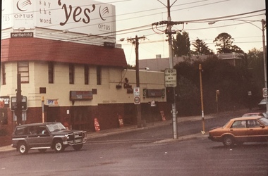
Photograph - Clifton Hotel, Kew Junction, 1994
Of the eight hotels established in Kew since European settlement, The Hotel Kew, known for most of its existence, as the Clifton Hotel was the seventh to be built in 1868. Its location on the corner of Studley Park Road and High Street at Kew Junction makes it a prominent landmark. Its current name is confusing for local historians as its main rival for the first 52 years was O'Shaughnessy's Hotel (1855), later renamed the Kew Hotel, on the corner of High Street and Denmark Street. Looking at the façade of the Hotel Kew, it is hard to imagine its mid-nineteenth appearance. There have probably been at least four renovations or rebuilding(s) of the structure. The documented renovations have occurred in the 1930s when the late Victorian façade was given an Art Deco update. In about 1970 its façade was again 'improved'. The many publicans who have held the licenses of the Clifton Hotel have been identified in in the 'Tetlow Index' and on the 'Boroondara Local History Wiki'. The most significant of these are Henry Madden (1880-87); Michael O'Donnell (1902-1920); and the Cronin-Ryan family (1935–53ff).Fading colour positive photograph of the Clifton Hotel at Kew Junction on the corner of High Street South and Studley Park Road. The hotel had been modified extensively over time, disguising the original Italianate facade. This is the colour scheme of the fourth restoration, including huge advertising billboards on the roof.Reverse: "Clifton Hotel. Studley Park Road at Kew Junction. 1994clifton hotel -- kew (vic.), hotels -- kew (vic.), kew junction -
![Bronze Plaque [Dead man Penny] 318573, Keith Winterbottom Plaque number 318573](/media/collectors/5aa8674621ea671160a40f59/items/5ab5853821ea670eb401d68c/item-media/5ab5859921ea670eb40230fb/item-fit-380x285.jpg) Camberwell RSL Sub-Branch
Camberwell RSL Sub-BranchBronze Plaque [Dead man Penny] 318573, Keith Winterbottom Plaque number 318573
Keith Winterbottom was born in the small settlement of Moulamen near Swan Hill in 1891.He enlisted in the AIF on the 7 April 1916 as a private and allocated to the 1st refit for the 38th Battalion. He was single and 25 years old and a strong 6 footer after working as a labour/timber cutter around Swan Hill. He embarked for France in July 1916 and disembarked at Plymouth on the 10 August 1916. Proceeded to France [ Ypres] on the 16 September and taken on strength with the 59th Battalion on the 8 October 1916. He suffered very serious GSW to his chest, arm, and left leg on the 10 December 1916 and was admitted to the Casualty clearing station at Heilly on the 11 December. His wounds were extensive and major and he died of these wounds on the 12 December 1916. He was buried at the Hospital Cemetery at Heilly, France. His kit that was returned to his mother contained a football, scarf, a razor strop and two ties. On the 18 June 1923 is mother was given the Memorial Plaque 318573 inscribed with her son's name Keith Winterbottom Memorial Plaque [Dead Man Penny]Inscribed with the name Keith Winterbottom. Presented to his mother on the 18 June 1923. -
 Orbost & District Historical Society
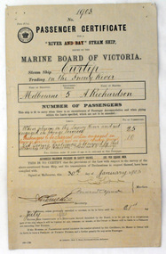
certificate, 30th January 1903
This certificate was issued on January 30, 1903 to Captain Alan Richardson by the Marine Board of Victoria entitling her to carry 25 passengers and only 10 passengers when engaged in towage service. Two children under 12 years of age to be reckoned as one passenger. The penalty of 20 pounds would be levied if these limits were exceeded. the certificate was valid until 21st July 1903. The original Paddle Steamer Curlip was built by Sam Richardson and his sons Mark, Albert and Frank, at their sawmill at Tabbara, a pioneering settlement on the Brodribb River, a tributary of the Snowy River. Curlip's keel was laid on 14th October 1889 and PS Curlip was launched in 1890. The Paddle Steamer Curlip was designed to travel up and down the Snowy and Brodribb Rivers with essential supplies from coastal ketches and schooners, that plied their trade up and down the coast between Melbourne, Sydney and Tasmania. The Curlip regularly towed one or two barges and up to five barges loaded with local farming produce and timber for the thriving cities, that was loaded offshore or in the Snowy River estuary, tide and depth permitting, on to the trading vessels.This item is associated with the P.S. Curlip and the Richardson family, early Orbost pioneers.A paper passenger certificate for a river steam ship.Details are handwritten in black and red ink.curlip-p.s. certificate-passenger richardson -
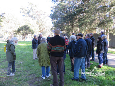
 Eltham District Historical Society Inc
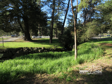
Photograph, Liz Pidgeon, Heritage Excursion; Eltham Lower Park Walk and Talk, 1 July 2017, 1 July 2017
Newsletter No., 234, June 2017 Heritage Excursion - Saturday 1st July - Eltham Lower Park - Walk and Talk Eltham Lower Park has played an important part in the history of our area since the early days of European settlement when it was used by local residents as an informal racecourse. Prior to that its location at the junction of the Diamond Creek and the Yarra River made it an important meeting place for the Wurundjeri people. The park combines formal elements and sporting facilities with remnant bushland that is of environmental significance. It is home to sporting and horse riding clubs, popular play spaces and the Diamond Valley Miniature Railway, which attracts large numbers of visitors. The park will be the venue for our July excursion which will comprise a walk of about 3.5 km around the park and adjacent areas. Along the way we will discuss the history and natural history of the area. The path along the creek and the river provides a pleasant and scenic walk. This walk on Saturday 1st July is about 3.5 km in length and will take 2 to 2.5 hours. It will start at 2pm at the Main Road car park at the front of the park. (Melway ref 21 H 10). Born Digitalheritage excursion, activities, eltham district historical society, eltham lower park, alcohol free zone, sign, grafitti -
 Eltham District Historical Society Inc
Photograph, Liz Pidgeon, Heritage Excursion; Eltham Lower Park Walk and Talk, 1 July 2017, 1 July 2017
Newsletter No., 234, June 2017 Heritage Excursion - Saturday 1st July - Eltham Lower Park - Walk and Talk Eltham Lower Park has played an important part in the history of our area since the early days of European settlement when it was used by local residents as an informal racecourse. Prior to that its location at the junction of the Diamond Creek and the Yarra River made it an important meeting place for the Wurundjeri people. The park combines formal elements and sporting facilities with remnant bushland that is of environmental significance. It is home to sporting and horse riding clubs, popular play spaces and the Diamond Valley Miniature Railway, which attracts large numbers of visitors. The park will be the venue for our July excursion which will comprise a walk of about 3.5 km around the park and adjacent areas. Along the way we will discuss the history and natural history of the area. The path along the creek and the river provides a pleasant and scenic walk. This walk on Saturday 1st July is about 3.5 km in length and will take 2 to 2.5 hours. It will start at 2pm at the Main Road car park at the front of the park. (Melway ref 21 H 10). Born Digitalheritage excursion, activities, eltham district historical society, eltham lower park -
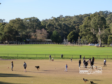
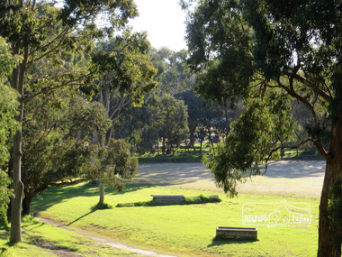
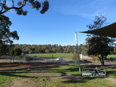 Eltham District Historical Society Inc
Photograph, Liz Pidgeon, Heritage Excursion; Eltham Lower Park Walk and Talk, 1 July 2017, 1 July 2017
Newsletter No., 234, June 2017 Heritage Excursion - Saturday 1st July - Eltham Lower Park - Walk and Talk Eltham Lower Park has played an important part in the history of our area since the early days of European settlement when it was used by local residents as an informal racecourse. Prior to that its location at the junction of the Diamond Creek and the Yarra River made it an important meeting place for the Wurundjeri people. The park combines formal elements and sporting facilities with remnant bushland that is of environmental significance. It is home to sporting and horse riding clubs, popular play spaces and the Diamond Valley Miniature Railway, which attracts large numbers of visitors. The park will be the venue for our July excursion which will comprise a walk of about 3.5 km around the park and adjacent areas. Along the way we will discuss the history and natural history of the area. The path along the creek and the river provides a pleasant and scenic walk. This walk on Saturday 1st July is about 3.5 km in length and will take 2 to 2.5 hours. It will start at 2pm at the Main Road car park at the front of the park. (Melway ref 21 H 10). Born Digitalheritage excursion, activities, eltham district historical society, eltham lower park, oval, carpark -
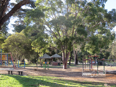 Eltham District Historical Society Inc
Photograph, Liz Pidgeon, Heritage Excursion; Eltham Lower Park Walk and Talk, 1 July 2017, 1 July 2017
Newsletter No., 234, June 2017 Heritage Excursion - Saturday 1st July - Eltham Lower Park - Walk and Talk Eltham Lower Park has played an important part in the history of our area since the early days of European settlement when it was used by local residents as an informal racecourse. Prior to that its location at the junction of the Diamond Creek and the Yarra River made it an important meeting place for the Wurundjeri people. The park combines formal elements and sporting facilities with remnant bushland that is of environmental significance. It is home to sporting and horse riding clubs, popular play spaces and the Diamond Valley Miniature Railway, which attracts large numbers of visitors. The park will be the venue for our July excursion which will comprise a walk of about 3.5 km around the park and adjacent areas. Along the way we will discuss the history and natural history of the area. The path along the creek and the river provides a pleasant and scenic walk. This walk on Saturday 1st July is about 3.5 km in length and will take 2 to 2.5 hours. It will start at 2pm at the Main Road car park at the front of the park. (Melway ref 21 H 10). Born Digitalheritage excursion, activities, eltham district historical society, eltham lower park, playground, picnic area -
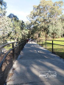
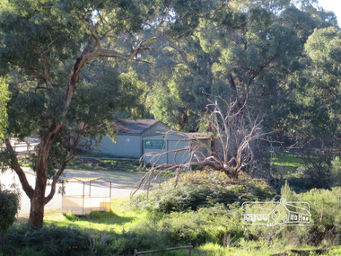
 Eltham District Historical Society Inc
Photograph, Liz Pidgeon, Heritage Excursion; Eltham Lower Park Walk and Talk, 1 July 2017, 1 July 2017
Signage Share the path Newsletter No., 234, June 2017 Heritage Excursion - Saturday 1st July - Eltham Lower Park - Walk and Talk Eltham Lower Park has played an important part in the history of our area since the early days of European settlement when it was used by local residents as an informal racecourse. Prior to that its location at the junction of the Diamond Creek and the Yarra River made it an important meeting place for the Wurundjeri people. The park combines formal elements and sporting facilities with remnant bushland that is of environmental significance. It is home to sporting and horse riding clubs, popular play spaces and the Diamond Valley Miniature Railway, which attracts large numbers of visitors. The park will be the venue for our July excursion which will comprise a walk of about 3.5 km around the park and adjacent areas. Along the way we will discuss the history and natural history of the area. The path along the creek and the river provides a pleasant and scenic walk. This walk on Saturday 1st July is about 3.5 km in length and will take 2 to 2.5 hours. It will start at 2pm at the Main Road car park at the front of the park. (Melway ref 21 H 10). Born Digitalheritage excursion, activities, eltham district historical society, eltham lower park, sign, shared pathway -
 Eltham District Historical Society Inc
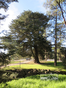
Photograph, Liz Pidgeon, Heritage Excursion; Eltham Lower Park Walk and Talk, 1 July 2017, 1 July 2017
Newsletter No., 234, June 2017 Heritage Excursion - Saturday 1st July - Eltham Lower Park - Walk and Talk Eltham Lower Park has played an important part in the history of our area since the early days of European settlement when it was used by local residents as an informal racecourse. Prior to that its location at the junction of the Diamond Creek and the Yarra River made it an important meeting place for the Wurundjeri people. The park combines formal elements and sporting facilities with remnant bushland that is of environmental significance. It is home to sporting and horse riding clubs, popular play spaces and the Diamond Valley Miniature Railway, which attracts large numbers of visitors. The park will be the venue for our July excursion which will comprise a walk of about 3.5 km around the park and adjacent areas. Along the way we will discuss the history and natural history of the area. The path along the creek and the river provides a pleasant and scenic walk. This walk on Saturday 1st July is about 3.5 km in length and will take 2 to 2.5 hours. It will start at 2pm at the Main Road car park at the front of the park. (Melway ref 21 H 10). Born Digitalheritage excursion, activities, eltham district historical society, eltham lower park, trail -
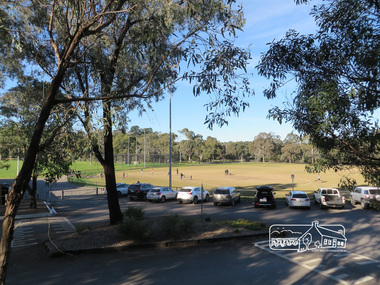 Eltham District Historical Society Inc
Photograph, Liz Pidgeon, Heritage Excursion; Eltham Lower Park Walk and Talk, 1 July 2017, 1 July 2017
Newsletter No., 234, June 2017 Heritage Excursion - Saturday 1st July - Eltham Lower Park - Walk and Talk Eltham Lower Park has played an important part in the history of our area since the early days of European settlement when it was used by local residents as an informal racecourse. Prior to that its location at the junction of the Diamond Creek and the Yarra River made it an important meeting place for the Wurundjeri people. The park combines formal elements and sporting facilities with remnant bushland that is of environmental significance. It is home to sporting and horse riding clubs, popular play spaces and the Diamond Valley Miniature Railway, which attracts large numbers of visitors. The park will be the venue for our July excursion which will comprise a walk of about 3.5 km around the park and adjacent areas. Along the way we will discuss the history and natural history of the area. The path along the creek and the river provides a pleasant and scenic walk. This walk on Saturday 1st July is about 3.5 km in length and will take 2 to 2.5 hours. It will start at 2pm at the Main Road car park at the front of the park. (Melway ref 21 H 10). Born Digitalheritage excursion, activities, eltham district historical society, eltham lower park, oval, car parking -
 Eltham District Historical Society Inc
Photograph, Liz Pidgeon, Heritage Excursion; Eltham Lower Park Walk and Talk, 1 July 2017, 1 July 2017
Newsletter No., 234, June 2017 Heritage Excursion - Saturday 1st July - Eltham Lower Park - Walk and Talk Eltham Lower Park has played an important part in the history of our area since the early days of European settlement when it was used by local residents as an informal racecourse. Prior to that its location at the junction of the Diamond Creek and the Yarra River made it an important meeting place for the Wurundjeri people. The park combines formal elements and sporting facilities with remnant bushland that is of environmental significance. It is home to sporting and horse riding clubs, popular play spaces and the Diamond Valley Miniature Railway, which attracts large numbers of visitors. The park will be the venue for our July excursion which will comprise a walk of about 3.5 km around the park and adjacent areas. Along the way we will discuss the history and natural history of the area. The path along the creek and the river provides a pleasant and scenic walk. This walk on Saturday 1st July is about 3.5 km in length and will take 2 to 2.5 hours. It will start at 2pm at the Main Road car park at the front of the park. (Melway ref 21 H 10). Born Digitalheritage excursion, activities, eltham district historical society, eltham lower park, oval -
 Eltham District Historical Society Inc
Photograph, Liz Pidgeon, Heritage Excursion; Eltham Lower Park Walk and Talk, 1 July 2017, 1 July 2017
Newsletter No., 234, June 2017 Heritage Excursion - Saturday 1st July - Eltham Lower Park - Walk and Talk Eltham Lower Park has played an important part in the history of our area since the early days of European settlement when it was used by local residents as an informal racecourse. Prior to that its location at the junction of the Diamond Creek and the Yarra River made it an important meeting place for the Wurundjeri people. The park combines formal elements and sporting facilities with remnant bushland that is of environmental significance. It is home to sporting and horse riding clubs, popular play spaces and the Diamond Valley Miniature Railway, which attracts large numbers of visitors. The park will be the venue for our July excursion which will comprise a walk of about 3.5 km around the park and adjacent areas. Along the way we will discuss the history and natural history of the area. The path along the creek and the river provides a pleasant and scenic walk. This walk on Saturday 1st July is about 3.5 km in length and will take 2 to 2.5 hours. It will start at 2pm at the Main Road car park at the front of the park. (Melway ref 21 H 10). Born Digitalelection day, heritage excursion, activities, eltham district historical society, eltham lower park -
 Eltham District Historical Society Inc
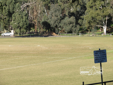
Photograph, Liz Pidgeon, Heritage Excursion; Eltham Lower Park Walk and Talk, 1 July 2017, 1 July 2017
Eltham Pony Club Newsletter No., 234, June 2017 Heritage Excursion - Saturday 1st July - Eltham Lower Park - Walk and Talk Eltham Lower Park has played an important part in the history of our area since the early days of European settlement when it was used by local residents as an informal racecourse. Prior to that its location at the junction of the Diamond Creek and the Yarra River made it an important meeting place for the Wurundjeri people. The park combines formal elements and sporting facilities with remnant bushland that is of environmental significance. It is home to sporting and horse riding clubs, popular play spaces and the Diamond Valley Miniature Railway, which attracts large numbers of visitors. The park will be the venue for our July excursion which will comprise a walk of about 3.5 km around the park and adjacent areas. Along the way we will discuss the history and natural history of the area. The path along the creek and the river provides a pleasant and scenic walk. This walk on Saturday 1st July is about 3.5 km in length and will take 2 to 2.5 hours. It will start at 2pm at the Main Road car park at the front of the park. (Melway ref 21 H 10). Born Digitalheritage excursion, activities, eltham district historical society, eltham lower park, eltham pony club -
 Eltham District Historical Society Inc
Photograph, Liz Pidgeon, Heritage Excursion; Eltham Lower Park Walk and Talk, 1 July 2017, 1 July 2017
Eltham Pony Club Newsletter No., 234, June 2017 Heritage Excursion - Saturday 1st July - Eltham Lower Park - Walk and Talk Eltham Lower Park has played an important part in the history of our area since the early days of European settlement when it was used by local residents as an informal racecourse. Prior to that its location at the junction of the Diamond Creek and the Yarra River made it an important meeting place for the Wurundjeri people. The park combines formal elements and sporting facilities with remnant bushland that is of environmental significance. It is home to sporting and horse riding clubs, popular play spaces and the Diamond Valley Miniature Railway, which attracts large numbers of visitors. The park will be the venue for our July excursion which will comprise a walk of about 3.5 km around the park and adjacent areas. Along the way we will discuss the history and natural history of the area. The path along the creek and the river provides a pleasant and scenic walk. This walk on Saturday 1st July is about 3.5 km in length and will take 2 to 2.5 hours. It will start at 2pm at the Main Road car park at the front of the park. (Melway ref 21 H 10). Born Digitalheritage excursion, activities, eltham district historical society, eltham lower park, eltham pony club