Showing 199900 items matching "12-errard-street-south"
-
 The Celtic Club
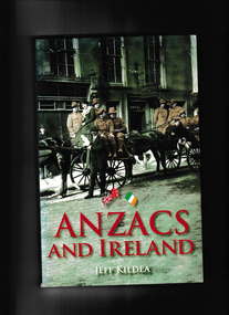
Book, Jeff Kildea, Anzacs and Ireland, 2007
This book tells the story of how Irish and Australian soldiers made deep connections as they fought side by side at Gallipoli, the Western Front and Palestine during WW1. Thousands of Irish born men and women enlisted in Australian forces. Many Australians visited Ireland on leave.Index, bib, plates, ill, map, p.231.non-fictionThis book tells the story of how Irish and Australian soldiers made deep connections as they fought side by side at Gallipoli, the Western Front and Palestine during WW1. Thousands of Irish born men and women enlisted in Australian forces. Many Australians visited Ireland on leave.ireland - social conditions., world war 1914-1918 - ireland and australia -
 The Celtic Club
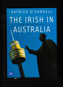
Book, Patrick O'Farrell, The Irish in Australia, 2000
Since the first fleet of 1788, the Irish have been coming to Australia. They were the beginning of a central, colourful and profoundly influential element in Australia's evolution into a nation different and separate from Britain.Index, ill, plates, bib. p.346.non-fictionSince the first fleet of 1788, the Irish have been coming to Australia. They were the beginning of a central, colourful and profoundly influential element in Australia's evolution into a nation different and separate from Britain.irish - australia - history, australia - history -
 The Celtic Club
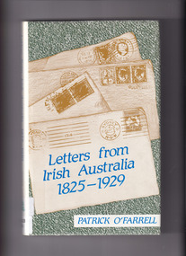
Book, Patrick O'Farrell, Letters from Irish Australia 1825-1929, 1984
Letters ranging from those of convicts writing to their wives in the 1820s, through accounts of the voyage out and pioneering life in mid-century, through love letters, to short stories and failure to master the land, to the remarkable family saga (1883-1929) which ends the book.Index, bib., p.218.non-fictionLetters ranging from those of convicts writing to their wives in the 1820s, through accounts of the voyage out and pioneering life in mid-century, through love letters, to short stories and failure to master the land, to the remarkable family saga (1883-1929) which ends the book. irish - australia - correspondence., australia- minorities- history. -
 Victorian Railway History Library
Booklet, Department of Railways, New South Wales, Railway Quiz, 1951
A book of questions relating to railway mattersp.56non-fictionA book of questions relating to railway mattersnew south wales government railways - publicity, railway questions -
 Victorian Railway History Library
Book, New South Wales Department of Railways, Souvenir of the official opening of the Sydney-Melbourne standard gauge railway line, 1962
Souvenir booklet on aspects of the opening of the Sydney to Melbourne standard gauge line in 1962Ill, p.58.non-fictionSouvenir booklet on aspects of the opening of the Sydney to Melbourne standard gauge line in 1962railways - australia - history, railway gauge - australia -
 Victorian Railway History Library
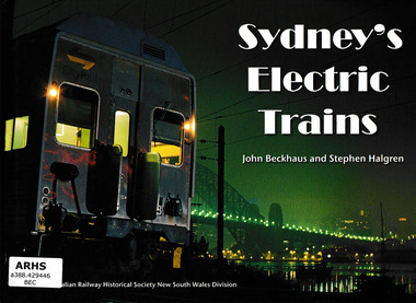
Book, Australian Railway Historical Society - New South Wales Division et al, Sydney's Electric Trains, 2007
An illustrated history of the various trains used on the Sydney Metropolitan RailwayIll, p.191.non-fictionAn illustrated history of the various trains used on the Sydney Metropolitan Railwaysuburban railways - sydney, electric trains - sydney -
 Victorian Railway History Library
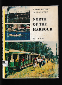
Book, Australian Railway Historical Society, New South Wales Division, North of the harbour : a brief history of transport to and on the North Shore, 1976
A history of rail tram and ferry services north of Sydney harbour.Ill, maps, p.168.A history of rail tram and ferry services north of Sydney harbour.suburban railways - sydney, tramways - sydney, ferries - sydney -
 Victorian Railway History Library
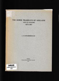
Book, Libraries Board of South Australia, The horse tramways of Adelaide and its suburbs, 1875-1907, 1965
This is a history of the Adelaide horse drawn tramways from their inception until they were taken over by the Municipal Tramways Trust. The information was gathered from various sources and that given by word of mouth has been substantiatedIll, maps, p.86.non-fictionThis is a history of the Adelaide horse drawn tramways from their inception until they were taken over by the Municipal Tramways Trust. The information was gathered from various sources and that given by word of mouth has been substantiatedtramways - australia, horse tramways - adelaide -
 Victorian Railway History Library
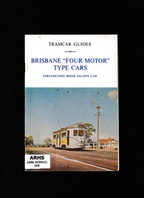
Book, South Pacific Electric Railway, Brisbane "four motor"type cars - Streamlined bogie saloon car, 1974
A pictorial review of Brisbane tramcarsIll, p.10.non-fictionA pictorial review of Brisbane tramcarstramways - brisbane, urban transportation - brisbane -
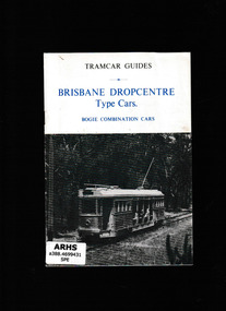 Victorian Railway History Library
Book, South Pacific Electric Railway, Brisbane dropcentre type cars - Bogie combination cars, 1974
A pictorial review of Brisbane tramcarsIll, p.10.non-fictionA pictorial review of Brisbane tramcarstramways - brisbane, urban transportation - brisbane -
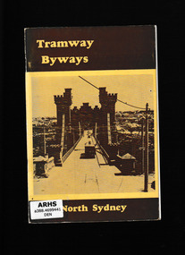 Victorian Railway History Library
Book, South Pacific Electric Railway Co-operative Society, Tramway byways, North Sydney, 1973
A study of the tramways of North SydneyIll, maps, p.58.non-fictionA study of the tramways of North Sydneytramways - sydney, tramways - north sydney -
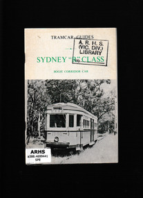 Victorian Railway History Library
Booklet, South Pacific Electric Railway Co-operative Society, Sydney "R" class : bogie corridor car, 197?
A pictorial and descriptive account of the Sydney "R" class : bogie corridor carIll, p.11.non-fictionA pictorial and descriptive account of the Sydney "R" class : bogie corridor cartramways - sydney, tramways - rolling stock - sydney. -
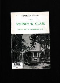 Victorian Railway History Library
Booklet, South Pacific Electric Railway Co-operative Society, Sydney "K" class : single truck crossbench car, 197?
A pictorial and descriptive account of the Sydney "K" class : single truck crossbench carIll, p.11.non-fictionA pictorial and descriptive account of the Sydney "K" class : single truck crossbench cartramways - sydney, tramways - rolling stock - sydney. -
 Victorian Railway History Library
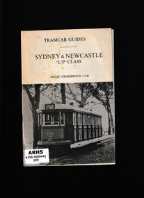
Booklet, South Pacific Electric Railway Co-operative Society, Sydney & Newcastle "L/P" class : bogie crossbench car, 197?
A pictorial and descriptive account of the Sydney & Newcastle "L/P" class : bogie crossbench carIll, p.11.non-fictionA pictorial and descriptive account of the Sydney & Newcastle "L/P" class : bogie crossbench cartramways - sydney, tramways - rolling stock - sydney., tramway rolling stock - newcastle -
 Victorian Railway History Library
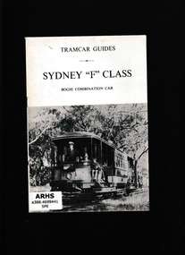
Booklet, South Pacific Electric Railway Co-operative Society, Sydney "F" class bogie combination car, 197?
A pictorial and descriptive account of the Sydney "F" class bogie combination carIll, p.11.non-fictionA pictorial and descriptive account of the Sydney "F" class bogie combination cartramways - sydney, tramways - rolling stock - sydney. -
 Victorian Railway History Library
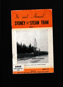
Booklet, New South Wales Steam Tram and Railway Preservation Society, In and around Sydney with the steam tram, 1969
A history of the steam trams of Sydney in four volumes.4.v. Ill, maps.non-fictionA history of the steam trams of Sydney in four volumes.tramways - sydney, steam trams - sydney -
 Victorian Railway History Library
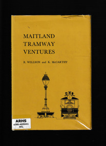
Book, South Pacific Electric Railway, Maitland tramway ventures, 1965
Apart from Broken Hill, Maitland was the only New South Wales regional city to have a tramway systemIndex, bib, ill, maps, p.79.non-fictionApart from Broken Hill, Maitland was the only New South Wales regional city to have a tramway systemtramways - maitland, steam trams - maitland -
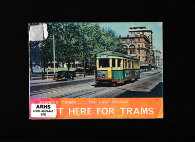 Victorian Railway History Library
Book, South Pacific Electric Railway Co-operative Society Ltd, Wait here for trams : Sydney's trams during the last decade of operation, 1974
When the last of the Sydney tramway system closed in 1961, there vanished from the streets a vehicle which had been part of the city scene for almost 100 yearsIll, p.111.non-fictionWhen the last of the Sydney tramway system closed in 1961, there vanished from the streets a vehicle which had been part of the city scene for almost 100 yearstramways - sydney, tramways - sydney - pictorial works -
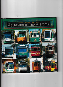 Victorian Railway History Library
Book, Randall Wilson et al, The Melbourne trambook, 2003
A pictorial description of the Melbourne tram networkIll, maps, p.79.non-fictionA pictorial description of the Melbourne tram networktramways - melbourne, trams - melbourne - history -
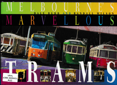 Victorian Railway History Library
Book, University of New South Wales Press et al, Melbourne's marvellous trams, 1998
History of Melbourne trams from cable trams to the present with details of routes and vehicles.Ill, map, p.96.non-fictionHistory of Melbourne trams from cable trams to the present with details of routes and vehicles.tramways - melbourne - history, tramways - melbourne -
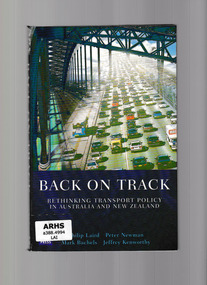 Victorian Railway History Library
Book, University of New South Wales Press, Back on track : rethinking transport policy in Australia and New Zealand, 2001
This book explains how dependence on road transport in Australia and new Zealand has developed and sets out a vision for the future of local and interstate transport in both countries.Index, ill, p.240.non-fictionThis book explains how dependence on road transport in Australia and new Zealand has developed and sets out a vision for the future of local and interstate transport in both countries.transportation - australia, transportation - new zealand -
 Victorian Railway History Library
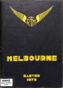
Book, The New South Wales Rail Transport Museum, Melbourne Easter 1973, 1973
A tour program detailing the route and travel information for the special train from Sydney to Melbourne with 3801 and 3820 run by the New South Wales Rail Transport Museum over the Easter holidays in 1973.maps, p.52.non-fictionA tour program detailing the route and travel information for the special train from Sydney to Melbourne with 3801 and 3820 run by the New South Wales Rail Transport Museum over the Easter holidays in 1973.railroad preservation - victoria - history, tourist trains - victoria - history -
 Victorian Railway History Library
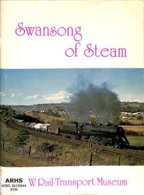
Book, Booth, Bob, Swansong of Steam, 1976
A photographic survey of steam locomotive at work on the New South Wales Railways.ill, p.64.non-fictionA photographic survey of steam locomotive at work on the New South Wales Railways.railroad steam locomotives - new south wales - history, railroad operations - new south wales - history -
 Victorian Railway History Library
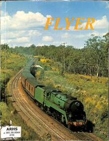
Book, The New South Wales Rail Transport Museum, Flyer, 1970
A tribute to steam locomotive operation on The Sydney - Newcastle Express on the New South Wales Railways.ill, maps, p.75.non-fictionA tribute to steam locomotive operation on The Sydney - Newcastle Express on the New South Wales Railways.railroad steam locomotives - new south wales - history, railroads - passenger trains - australia -
 Victorian Railway History Library
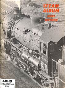
Book, The New South Wales Rail Transport Museum, Steam Album First Division, 1968
Pictures of steam locomotives in New South Wales.ill, p.56.non-fictionPictures of steam locomotives in New South Wales.steam locomotives - australia - history, railroad steam locomotives - new south wales - history -
 Victorian Railway History Library
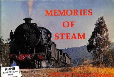
Book, Dale Budd, Memories of Steam, 1974
A pictorial history of steam locomotive operations on the New South Wales Railways especially around the Newcastle area.ill, p.54.non-fictionA pictorial history of steam locomotive operations on the New South Wales Railways especially around the Newcastle area.railroad steam locomotives - new south wales - history, railroad operations - new south wales - history -
 Victorian Railway History Library
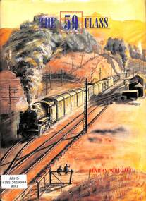
Book, Wright, Harry, The 59 Class, 1996
A history of the D59 class 2-8-2 freight locomotive on the New South Wales Railways.index, ill, p.223.non-fictionA history of the D59 class 2-8-2 freight locomotive on the New South Wales Railways.railroad steam locomotives - new south wales - history, railroad operations - new south wales - history -
 Victorian Railway History Library
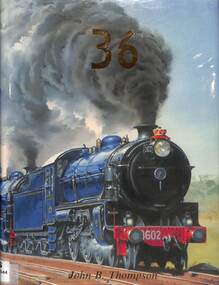
Book, Thompson, John B, 36, 1988
A service history of the C36 class 4-6-0 passenger locomotive on the New South Wales Railways.ill, p.168.non-fictionA service history of the C36 class 4-6-0 passenger locomotive on the New South Wales Railways.railroad steam locomotives - new south wales - history, railroad operations - new south wales - history -
 Victorian Railway History Library
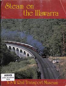
Book, The New South Wales Rail Transport Museum, Illawarra Group, Steam on the Illawarra, 1979
A pictorial history of steam operations on the Illawarra railway from Sydney to Port Kembla in New South Wales.ill, p.64.non-fictionA pictorial history of steam operations on the Illawarra railway from Sydney to Port Kembla in New South Wales.steam locomotives - nsw – pictorial, illawarra district - railways - history -
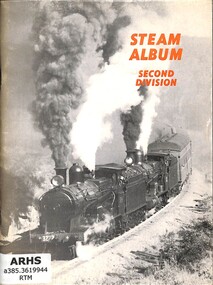 Victorian Railway History Library
Book, Ashton, David, Steam Album Second Division, 1969
Pictures of steam locomotives in New South Wales.ill, p.56.non-fictionPictures of steam locomotives in New South Wales.steam locomotives - australia - history, railroad steam locomotives - new south wales - history