Showing 2725 items
matching maps of goldfields
-
 Bendigo Historical Society Inc.
Map - MILLOO : COUNTY OF BENDIGO, 29-2-24
... Inc. History House 11 Mackenzie Street Bendigo goldfields MAP ...Map. Milloo, County of Bendigo. Wanurf, Dingee, Kamarooka, Pannoomilloo, Waranga Mallee Channel, Elmore to Kerang Road, Pannoo Estate. By authority A.J. Mullett, Govt. Printer. Photo-Lithographed at the Department of Lands and Survey, Melbourne, by W.J. Butson, 29-2-24. Price 1/-. Janiember to Rochester Road. (number 72 in map cupboard 1)A.J. Mullett, Government Printer.map, bendigo, milloo -
Bendigo Historical Society Inc.
Map - LYELL : COUNTY OF BENDIGO, 24-10-84
... Inc. History House 11 Mackenzie Street Bendigo goldfields MAP ...Map. Lyell, County of Bendigo, Eppalock, Sedgwick, Sutton Grange, Hawkestone, Kimbolton, Coliban River, Myrtle Creek. State School. Photo-Lithographed at the Department of Lands and Survey, Melbourne by J. Noune, 24-10-84. (number 71 in map cupboard 1)J. Nounemap, bendigo, lyell -
Bendigo Historical Society Inc.
Map - LYELL : COUNTY OF BENDIGO, 24-9-07
... Inc. History House 11 Mackenzie Street Bendigo goldfields MAP ...Map. Lyell, County of Bendigo, Sedgwick, Sutton Grange, Hawkestone, Kimbolton, Eppalock, Myrtle Creek, Coliban River. Photo-Lithographed at the Department of Lands and Survey, Melbourne by T.F. McGauran, 24-9-07, Price 1/-. (number 70 in map cupboard 1)T.F. McGauranmap, bendigo, lyell -
Bendigo Historical Society Inc.
Map - LOCKWOOD : COUNTY OF BENDIGO, 2=7-18
... Inc. History House 11 Mackenzie Street Bendigo goldfields MAP ...Map. Lockwood, County of Bendigo. Marong, Shelbourne, Ravenswood, Mandurang. Photo- Lithographed at the Department of Lands and Survet, Melbourne by W.J. Butson 2-7-18. By authority A.J. Mullett, Government Printer, Melbourne. Price 1/-. (number 69 in map cupboard 1)A.J. Mullett, Government Printer, Melbourne.map, bendigo, lockwood -
Bendigo Historical Society Inc.
Map - LEICHARDT : COUNTY OF BENDIGO, 15-6-19
... Inc. History House 11 Mackenzie Street Bendigo goldfields MAP ...Map. Leichardt, County of Bendigo, Bridgewater, Yarraberb, Nerring, Marong, Woodstock, Derby, Sandhurst & Inglewood Railway Line. Photo-Lithographed at the Department of Lands and Survey, Melbourne, by T.F. McGauran, 15-6-09. Price 1/-. (number 68 in map cupboard 1)T.F. McGauranmap, bendigo, leichardt -
Bendigo Historical Society Inc.
Map - MANDURANG : COUNTY OF BENDIGO, 1962
... Inc. History House 11 Mackenzie Street Bendigo goldfields MAP ...Map. Mandurang, County of Bendigo. Sandhurst, Strathfieldsaye, Sedgwick, Lockwood. By authority A.C. Brooks, Government Printer, Melbourne. Drawn and Reproduced at the Department of Lands and Survey, Melbourne, 1962, Price 2/-. (number 67 in map cupboard 1)A.C. Brooks, Government Printer, Melbourne.map, bendigo, mandurang -
Bendigo Historical Society Inc.
Map - JANIEMBER WEST : COUNTY OF BENDIGO, September 1955
... Inc. History House 11 Mackenzie Street Bendigo goldfields MAP ...Map. Janiember West, County of Bendigo. Loddon River, Janiember East, Powlett, Kinypanial, Jarklan. Welsh's Lagoon. By authority W.M. Houston, Government Printer, Melbourne. Drawn and reproduced at the Department of Lands and Survey, Melbourne, September 1955, Price 5/-. (number 66 in map cupboard 1)W.M. Houston, Government Printer, Melbourne.map, bendigo, janiember west -
Bendigo Historical Society Inc.
Map - KIMBOLTON : COUNTY OF BENDIGO, 1966
... Inc. History House 11 Mackenzie Street Bendigo goldfields MAP ...Map. Kimbolton, County of Bendigo. Eppalock, Lyell, Knowsley, Langwornor, Redesdale, County of Dalhouse, County of Rodney, Campaspe River, Coliban River,By authority A.C.Brooks, Government Printer, Melbourne. Drawn and reproduced at the Department of Lands and Survey, Melbourne, 1966, Price $1.00 (number 65 in map cupboard 1)A.C. Brooks, Government Printer, Melbourne.map, bendigo, kimbolton -
Bendigo Historical Society Inc.
Map - JANIEMBER WEST : COUNTY OF BENDIGO, September 1955
... Inc. History House 11 Mackenzie Street Bendigo goldfields MAP ...Map. Janiember West, County of Bendigo, Powlett, Janiember East, Jarklan, Kinypanial, River Loddon, Kelsh's Lagoon. By authority W.M. Houston, Government Printer. Drawn and reproduced at the Department of Lands and Survey, Melbourne. Price 2/-.September 1955. (number 64 in map cupboard 1)W.M. Houston, Government Printermap, bendigo, janiember west -
Bendigo Historical Society Inc.
Map - KAMAROOKA : COUNTY OF BENDIGO, 29-8-21
... Inc. History House 11 Mackenzie Street Bendigo goldfields MAP ...Map. Kamarooka, County of Bendigo, Milloo, Warragamba, Minto, Whirrakee, Tandarra, Piccaninny Creek, Dingee. By authority A.J. Mullett, Govt. Printer. Photo-Lithographed at the Department of Lands and Survey, Melbourne by W.J. Butson 29-8-21. Price 1/-. (number 63 in map cupboard 1)A.J. Mullett, Govt.Printermap, bendigo, kamarooka -
Bendigo Historical Society Inc.
Map - CAMPBELL COLLECTION: BENDIGO AND DISTRICT MAPS
... Inc. History House 11 Mackenzie Street Bendigo goldfields MAP ...Map. Two aerial photographs of Kangaroo Flat and Lockwood (part). Crusoe Reservoir bottom right corner on Crusoe Road, shows Merindah Road running between Lockwood and Crusoe Roads. Map Name : Bendigo Mapsheet Run 2. 14-2-71, 13,200 A.S.L.. Map shown with NORTH at bottom of page, VIC 2479 at corner. Map 2 continues to the west. A joined copy of both maps is also included.map, bendigo, agricultural lands -
 Bendigo Historical Society Inc.
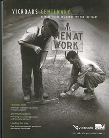
Book - VICROADS CENTENARY
Vicroads Centenary, keeping Victorians connected for 100 years, 141 pages with a loose poster, photographs and maps.victoria, history, transport -
 Bendigo Historical Society Inc.
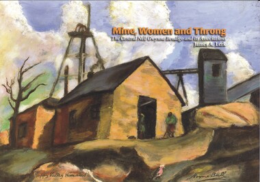
Book - MINE, WOMEN AND THRONG
Mine, Women and Throng, The Central Nell Gwynne Bendigo and its Associations, soft cover 116 pages with colour & black and white photographs, maps & graphs. Signed inside cover by author, printed by BartnPrint.James Lerkbendigo, gold mining, central nell gwynne, gold mines-gold mining victoria-bendigo-history -
 Bendigo Historical Society Inc.
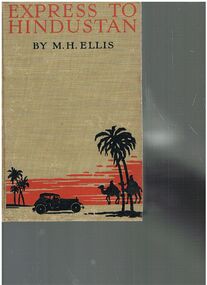
Book - ALEC H CHISHOLM COLLECTION: BOOK ''EXPRESS TO HINDUSTAN'' BY M.H.ELLIS
Book. ALEC H CHISHOLM COLLECTION. 308 page hardcover book giving an account of a motor-car journey from London to Delhi by H. M. Ellis in 1926. Illustrated with 32 B&W photographs and a sketch map of the route. Published in 1929 by the Bodley Head Ltd and printed by Butler and Tanner, London. Catalogue sticker ''2177 ELL'' on spine. Handwritten in ink inside front cover ''To A. H. Chisholm from the Perpetrator. M. H. Ellis 25/7/29''M. H. Ellisbooks, collections, travel, alec h chisholm collection, m.h.ellis, travel, motoring -
 Bendigo Historical Society Inc.
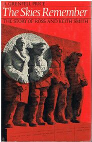
Book - ALEC H CHISHOLM COLLECTION: BOOK ''THE SKIES REMEMBER'' BY A.GRENFELL PRICE
Book. ALEC H CHISHOLM COLLECTION. 155 page hardcover book by A. Grenfell Price telling the story of Ross and Keith Smith's flight from Cairo to Calcutta and then England to Australia, 1918 - 1919. Based on the original and unpublished papers of Ross and Keith Smith. Illustrated with 39 B& W photos and 4 maps. Published in 1969 by Angus & Robertson, and printed in Great Britain by Morrison and Gibb Ltd. Catalogue sticker ''2194 PRI'' on spine. Handwritten in biro on flyleaf ''To my good friend Alec Chisholm Tom Lewis Dec '71''. SBN 207 95167 5. Copyright (c) A. Grenfell Price, 1969.A. Grenfell Pricebooks, collections, aviation, alec h chisholm collection, keith smith, ross smith, a.grenfell price, travel, aviation -
 Bendigo Historical Society Inc.
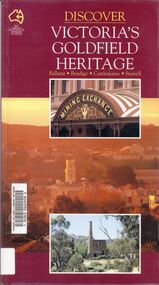
Book - VICTORIA GOLDFIELD HERITAGE
Discover Victoria's Goldfield Heritage, 128 pages in a soft cover with maps and photographs. Published by See Australia Guides.Douglas Stone & Greg Dunnettbook, rural, goldfield -
 Bendigo Historical Society Inc.
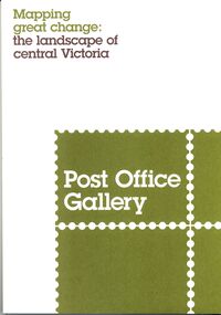
Book - POST OFFICE GALLERY MAPPING GREAT CHANGE, 2013
Post Office Gallery exhibition catalogue, Mapping great change the landscape of central Victoria, 27 pages with maps and illustrations.books, catalogues, post office gallery -
 Bendigo Historical Society Inc.
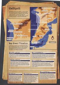
Document - AUSTRALIANS IN ACTION: ANZAC BISCUIT STORY
Information sheet from Australian War Memorial detailing brief stories of Australians in Action, the Anzac Biscuit Story, about the RSL and a timeline of Gallipoli key events with map. A3 size, buff background, sepia pictures.event, war, world war 1 - gallipoli key events, gallipoli, anzac -
Bendigo Historical Society Inc.
Map - CAMPBELL COLLECTION: BENDIGO AND DISTRICT MAPS, 8-7-29
... Inc. History House 11 Mackenzie Street Bendigo goldfields MAP ...Map. Rifle Range, Parishes of Wellsford and Sandhurst. Scale 20 chains to 1 inch. Total area in plan is 5916 acres. Wallan and Bendigo Railway to Axedale Township and station 8 miles, to Longlea Railway Station 2 1/2 - 3 miles. Rifle Range. Compiled in W.P.B. from Assessment and Parish Plans, by H.A.D. 8-7-29H.A.D.(Darby).map, bendigo, allotments -
Bendigo Historical Society Inc.
Map - CAMPBELL COLLECTION: BENDIGO AND DISTRICT MAPS, 11-4-29
... Inc. History House 11 Mackenzie Street Bendigo goldfields MAP ...Map. Huntly, Parishes of Huntly Nerring and Neilborough. Scale 20 chains to 1 inch. Total area 4738 acres. Eaglehawk. Prepared in W.J.B. from A. and C.L. Plans by W.J.Galbraith 11-4-29. (number 396 in map cupboard 1)W.J.Galbraithmap, bendigo, agricultural lands -
Bendigo Historical Society Inc.
Map - CAMPBELL COLLECTION: BENDIGO AND DISTRICT MAPS
... Inc. History House 11 Mackenzie Street Bendigo goldfields MAP ...Map. Mandurang, Parish of Mandurang. Scale 20 chains to 1 inch. Total area 5993 acres. Northern Railway. (number 395 in map cupboard 1)map, bendigo, allotments -
Bendigo Historical Society Inc.
Map - CAMPBELL COLLECTION: BENDIGO AND DISTRICT MAPS
... Inc. History House 11 Mackenzie Street Bendigo goldfields MAP ...Map. Bendigo & District. The same as 10104.1. The map is in a very damaged condition.map, bendigo, allotments -
Bendigo Historical Society Inc.
Map - CAMPBELL COLLECTION: BENDIGO AND DISTRICT MAPS, 16-4-29
... Inc. History House 11 Mackenzie Street Bendigo goldfields MAP ...Map. Kennington, Parishes of Sandhurst, Mandurang and Strathfieldsaye. Scale 20 chains to 1 inch. Total area 2918 acres. Prepared in W.P.B. from A. and C.L. Plans by W.J.Galbraith, 16-4-29. (number 394 in map cupboard 1)W.J.Galbraithmap, bendigo, allotments -
Bendigo Historical Society Inc.
Map - CAMPBELL COLLECTION: BENDIGO AND DISTRICT MAPS, 8-6 29
... Inc. History House 11 Mackenzie Street Bendigo goldfields MAP ...Map. Kimbolton, Parishes of Kimbolton and Lyell, scale 20 chains to 1 inch. Area by Plamimeter 6258 acres. Coliban River, Knowsley, Strathfieldsaye 10 1/2 miles. Prepared in W.P.B. from Parish and Assessor's Plans. G.W.Latimer 8-6-29. (number 393 in map cupboard 1)G.W.Latimermap, bendigo, allotments -
Bendigo Historical Society Inc.
Map - CAMPBELL COLLECTION: BENDIGO AND DISTRICT MAPS
... Inc. History House 11 Mackenzie Street Bendigo goldfields MAP ...Map. Management Blocks Bendigo, Forest Commission Victoria. The district has been subdivided into 8 master blocks incorporarting existing forest blocks and a register for each management block.01 Sandhurst; 02 Leichardt; 03 Whipsick; 04 Sugarloaf; 05 Brolga; 06 Mitiamo; 07 Dingee; 08 Lockington. Forest Produce Licence (number 392 in map cupboard 1)G.H.Jennings District Forestermap, bendigo, forest blocks -
Bendigo Historical Society Inc.
Map - CAMPBELL COLLECTION: BENDIGO AND DISTRICT MAPS
... Inc. History House 11 Mackenzie Street Bendigo goldfields MAP ...Map. Bendigo Whipstick Forest Park, 1:75,000, reserved forest and crown land, highway main road access forest tracks. New Moon Mine, Elliot Dam, Nuggety Dam, Rogers Tree, Old Tom Mine, Blow Holes, Skylark Dam, Monument Rock, Hartland Eucalyptus Still and Dam, Hartland Eucalyptus Farm, Millwood Dam, Sandner Eucalyptus Still Site, Various unmarked dams. (number 391 in map cupboard 1)map, bendigo, country lands -
Bendigo Historical Society Inc.
Map - CAMPBELL COLLECTION: BENDIGO AND DISTRICT MAPS
... Inc. History House 11 Mackenzie Street Bendigo goldfields MAP ...Map. Eaglehawk, Parishes of Huntly and Nerring. Scale 20 chains to 1 inch. Total area 6211 acres. Eaglehawk Kerang Railway, to Epsom 2 miles. Manure Depot. (number 390 in map cupboard 1)map, bendigo, allotments -
Bendigo Historical Society Inc.
Map - CAMPBELL COLLECTION: BENDIGO AND DISTRICT MAPS, 22-3-29
... Inc. History House 11 Mackenzie Street Bendigo goldfields MAP ...Map. Marong, Parishes of Marong, Lockwood and Mandurang, Scale 20 chains to 1 inch, Total area 5106 acres. Crusoe Reservoir & Viaduct and water race. Compiled in W.P.B. fro Field Survey and Parish Plans. B.W.L.22-3-29 (number 389 in map cupboard 1)B.W.L.map, bendigo, allotments -
Bendigo Historical Society Inc.
Map - CAMPBELL COLLECTION: BENDIGO AND DISTRICT MAPS, 14-6-29
... Inc. History House 11 Mackenzie Street Bendigo goldfields MAP ...Map. Terricks, Parish of Terrick Terrick West, scale 20 chains to 1 inch, total area 6318 acres, prepared in W.P.B. from Assessment and Parish Plans by W.J.G. 14-6-29. (number 388 in map cupboard 1)W.J.Galbraithmap, bendigo, agricultural lands -
Bendigo Historical Society Inc.
Map - CAMPBELL COLLECTION: BENDIGO AND DISTRICT MAPS
... Inc. History House 11 Mackenzie Street Bendigo goldfields MAP ...Map. Lyell, Parishes of Sedgwick, Eppalock and Lyell. Scale 20 chains to 1 inch. Total area 3307 acres. (number 387 in map cupboard 1)map, bendigo, country lands