Showing 19031 items matching "gardeners"
-
 Horsham Regional Art Gallery
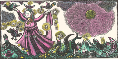
Print, Irena SIBLEY, In the garden, n.d
Donated through the Australian Government's Cultural Gifts Program by Katherine Littlewood, 2019hand coloured linocut on paper -
 St Kilda Historical Society
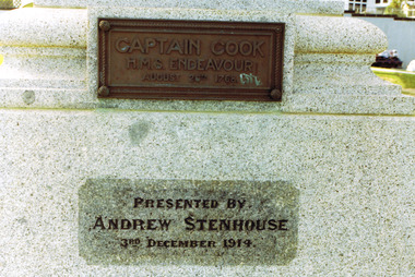
Photograph, Captain James Cook statue, St Kilda - images collection, Photographs taken c 1991 (set)
Statue presented by Andrew Stenhouse, 3 December 1914. Donated by Mr Andrew Stenhouse, a retired contractor who lived at Beaconsfield Parade, St Kilda, he was interested in the reclamation of the foreshore in front of his dwelling Captain James Cook FRS (1728-1779) was a British explorer, navigator, cartographer, and captain in the Royal Navy. During three voyages to the Pacific Ocean he achieved the first recorded European contact with the eastern coastline of Australia and the Hawaiian Islands, and the first recorded circumnavigation of New Zealand. He was killed in the Hawaiian Islands in 1779. The statue appears to have been the first monument erected to him in Victoria and is a replica of one in Whitby, England. It was unveiled on Monday December 7th, 1914 by the Governor of Victoria, Sir Arthur Stanley in front of Commonwealth and State dignitaries and hundreds of St Kilda residents. It was donated by philanthropist Mr. Andrew Stenhouse, a member of the St. Kilda Shore committee.colour photograph unmountedCaptain Cook HMS Endeavour, August 26, 1768. Presented by Andrew Stenhouse, 3rd December 1914. A plaque on the rear of the pedestal (no image provided) lists the crew of the Endeavour. st kilda, captain cook, plaques, catani gardens, captain cook statue, andrew stenhouse -
 St Kilda Historical Society
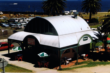
Photograph
Adjacent to the St Kilda Sea BathsColour photographst kilda, esplanade, st kilda foreshore, catani gardens -
 St Kilda Historical Society
Photograph - Photo map, 28/01/1951
One of a series of photo-maps produced for the Department of Crown Lands and Survey (1857-1983). For correlation with a current map, and access to other historical photo maps of Victoria, see the Historic Photo-Maps Index published by the Department of Environment, Land, Water and Planning at https://services.land.vic.gov.au/DELWPmaps/historical-photomaps/Black and white aerial photograph1424-45 SECRET 534 Run 18 Lens 12" Melbourne Metropolitan 12150 28.1.51 M639albert park, st kilda junction, st kilda pier, catani gardens, st kilda, prahran, albert park lake, 1951, middle park, st kilda beach, windsor -
 St Kilda Historical Society
Photograph - Photo map, 17/01/1951
One of a series of photo-maps produced for the Department of Crown Lands and Survey (1857-1983). For correlation with a current map, and access to other historical photo maps of Victoria, see the Historic Photo-Maps Index published by the Department of Environment, Land, Water and Planning at https://services.land.vic.gov.au/DELWPmaps/historical-photomaps/Black and white aerial photograph1414-21 538 Run 19 Lens 12" Melbourne Metropolitan 12150 17.1.51 M586st kilda, st kilda botanical gardens, peanut farm, elwood, 1951, point ormond, elwood canal, st kilda beach -
 St Kilda Historical Society
Photograph - Photo map, 30/01/1960
One of a series of photo-maps produced for the Department of Crown Lands and Survey (1857-1983). For correlation with a current map, and access to other historical photo maps of Victoria, see the Historic Photo-Maps Index published by the Department of Environment, Land, Water and Planning at https://services.land.vic.gov.au/DELWPmaps/historical-photomaps/Black and white aerial photographVic 1093-62 Melbourne & Metropolitan Project Run 21 30.1.60 Lens 10" 8.200middle park, albert park, catani gardens, st kilda west, 1960 -
 St Kilda Historical Society
Photograph - Photo map, 30/01/1960
One of a series of photo-maps produced for the Department of Crown Lands and Survey (1857-1983). For correlation with a current map, and access to other historical photo maps of Victoria, see the Historic Photo-Maps Index published by the Department of Environment, Land, Water and Planning at https://services.land.vic.gov.au/DELWPmaps/historical-photomaps/Black and white aerial photographVic 1092-36 Melbourne & Metropolitan Project Run 22 30.1.60 Lens 10" 8.200st kilda, st kilda pier, st kilda beach, catani gardens, 1960 -
 St Kilda Historical Society
Photograph - Photo map, 30/01/1960
One of a series of photo-maps produced for the Department of Crown Lands and Survey (1857-1983). For correlation with a current map, and access to other historical photo maps of Victoria, see the Historic Photo-Maps Index published by the Department of Environment, Land, Water and Planning at https://services.land.vic.gov.au/DELWPmaps/historical-photomaps/Black and white aerial photographVic 1092-38 Melbourne & Metropolitan Project Run 22 30.1.60 Lens 10" 8.200st kilda, st kilda beach, st kilda pier, catani gardens, 1960, st kilda botanical gardens, peanut farm -
 St Kilda Historical Society
Photograph - Photo map, 12/04/1966
One of a series of photo-maps produced for the Department of Crown Lands and Survey (1857-1983). For correlation with a current map, and access to other historical photo maps of Victoria, see the Historic Photo-Maps Index published by the Department of Environment, Land, Water and Planning at https://services.land.vic.gov.au/DELWPmaps/historical-photomaps/Black and white aerial photographVic 1933 Melbourne 1966 Project Run 12 12.4.66 Lens 122 151.75MM 9.800 154st kilda, st kilda east, balaclava, toorak, amadale, caulfield, south yarra, st kilda botanical gardens, peanut farm, 1966 -
 St Kilda Historical Society
Photograph - Photo map, 11/01/1968
One of a series of photo-maps produced for the Department of Crown Lands and Survey (1857-1983). For correlation with a current map, and access to other historical photo maps of Victoria, see the Historic Photo-Maps Index published by the Department of Environment, Land, Water and Planning at https://services.land.vic.gov.au/DELWPmaps/historical-photomaps/Black and white aerial photographVic 2132 State Aerial Survey Melbourne 1968 Proj. Run 28E 11.1.68 5100 ASL 81st kilda, balaclava, st kilda east, ripponlea, elwood, elsternwick, caulfield, st kilda botanical gardens, 1968 -
 St Kilda Historical Society
Photograph - Photo map, 11/01/1968
One of a series of photo-maps produced for the Department of Crown Lands and Survey (1857-1983). For correlation with a current map, and access to other historical photo maps of Victoria, see the Historic Photo-Maps Index published by the Department of Environment, Land, Water and Planning at https://services.land.vic.gov.au/DELWPmaps/historical-photomaps/Black and white aerial photographVic 2132 State Aerial Survey Melbourne 1968 Proj. Run 27E 11.1.68 5100 ASLst kilda, st kilda west, st kilda pier, catani gardens, st kilda beach, albert park, 1968 -
 St Kilda Historical Society
Photograph - Photo map, 14/12/1963
One of a series of photo-maps produced for the Department of Crown Lands and Survey (1857-1983). For correlation with a current map, and access to other historical photo maps of Victoria, see the Historic Photo-Maps Index published by the Department of Environment, Land, Water and Planning at https://services.land.vic.gov.au/DELWPmaps/historical-photomaps/Black and white aerial photographVic 1807 Melbourne 1963 Project Run 17 14.12.63 Lens 205 152.70 M/M 5.150 36st kilda, st kilda botanical gardens, balaclava, st kilda east, elwood canal, ripponlea, caulfield north, elwood, caulfield, 1963 -
 St Kilda Historical Society
Photograph - Photo map, Department of Crown Lands and Survey (1857-1983), 22/01/1970
One of a series of photo-maps produced for the Department of Crown Lands and Survey (1857-1983). For correlation with a current map, and access to other historical photo maps of Victoria, see the Historic Photo-Maps Index published by the Department of Environment, Land, Water and Planning at https://services.land.vic.gov.au/DELWPmaps/historical-photomaps/Black and white aerial photographVic 2358 Department of Crown Lands and Survey Victoria,.© Melbourne 1970 Project Run 42E 22.1.70 5,100 ASL 77st kilda, st kilda east, st kilda marina, elwood, elwood canal, elsternwick park, point ormond, balaclava, mc moran reserve, ripponlea, st kilda botanical gardens, peanut farm, 1970 -
 St Kilda Historical Society
Photograph - Photo map, Department of Crown Lands and Survey, 22/01/1970
One of a series of photo-maps produced for the Department of Crown Lands and Survey (1857-1983). For correlation with a current map, and access to other historical photo maps of Victoria, see the Historic Photo-Maps Index published by the Department of Environment, Land, Water and Planning at https://services.land.vic.gov.au/DELWPmaps/historical-photomaps/Black and white aerial photographCONTROLLED Vic 2358 Department of Crown Lands and Survey Victoria,.© Melbourne 1970 Project Run 41E 22.1.70 5,100 ASL 66st kilda, albert park, st kilda west, catani gardens, st kilda botanical gardens, st kilda pier, st kilda beach, 1970 -
 St Kilda Historical Society
Photograph - Photo map, 14/12/1963
One of a series of photo-maps produced for the Department of Crown Lands and Survey (1857-1983). For correlation with a current map, and access to other historical photo maps of Victoria, see the Historic Photo-Maps Index published by the Department of Environment, Land, Water and Planning at https://services.land.vic.gov.au/DELWPmaps/historical-photomaps/Black and white aerial photographVic 1807 Melbourne 1963 Project Run 16 14.12.1963 Lens 205 152.70 M/M 5.150 177st kilda, st kilda pier, catani gardens, middle park, albert park, st kilda west, st kilda beach, 1963 -
 St Kilda Historical Society
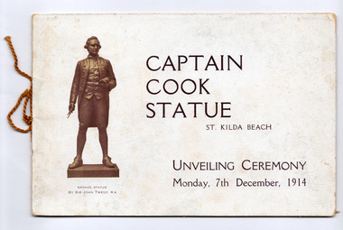
Ephemera - Special event program, Osboldstone & Co. Pty. Ltd, Captain Cook Statue St Kilda Beach Unveiling Ceremony Monday, 17th December, 1914, 1914
The booklet was produced for the unveiling of the Captain Cook Statue on 7 December 1914 at the St. Kilda Foreshore. It contains details of Cook's life, the statue and the donor, Andrew Stenhouse, as well as of its unveiling. The statue was unveiled by the Governor of Victoria, Sir Arthur Stanley, watched on by Commonwealth and State dignitaries and hundreds of St Kilda residents. Sixteen page booklet of white paper printed in brown with cardboard cover of similar colours. Secured by brown cotton cord..st kilda, catani gardens, john tweed, andrew stenhouse, captain cook statue, statue, captain cook -
 St Kilda Historical Society
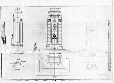
Plan - Architectural drawing, Competitive Design St Kilda War Memorial, c1923
Photocopy of extract of the winning design for the St Kilda War Memorial. The architect was G H Alsop who, at 21 years of age and with Assisting Architect JC Aisbell, won a competition to design the memorial to St Kilda's fallen servicemen and women. The memorial was unveiled in 1925.White paper, printed in black on one sidest kilda war memorial, st kilda cenotaph, catani gardens -
 St Kilda Historical Society
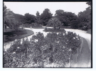
Photograph, St Kilda Botanical Gardens, c. 1950
black and white postcard -
 St Kilda Historical Society
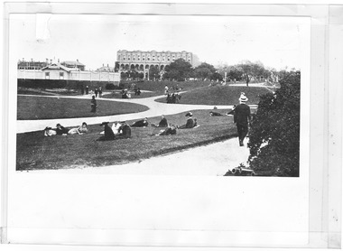
Photograph, West Beach and Catani Gardens, c. 1915-1916
c1915, site of the old bathing ship black and white photograph, unmountedMelbourne Suburbs St Kilda View of West Beach, improvement site of the Old Ship, St Kilda By the Sea Annual, p.63, season 1915-16, National Library of Australia -
 St Kilda Historical Society
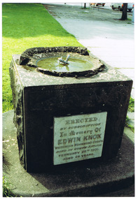
Photograph, Edwin Knox Drinking Fountain, Cleve Gardens, c. 1991
colour photograph, unmountedEdwin Knox Drinking Fountain, shows engraving: erected by subscription in 1902 -
 St Kilda Historical Society
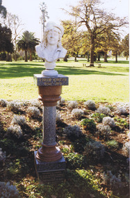
Photograph, Bust of Edith Cavell, St Kilda Botanical Gardens
colour photograph, unmounted, original, good condition -
 The Foundling Archive
Photograph- West Sydney
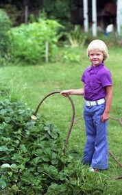
This photograph is part of the West Sydney Collection which depicts the period around Second World War in Australia from the perspective of a young unknown woman.PhotographDad, Uncle Sam, Mum, Jimwest sydney; australia; suburbia; garden; family; 1940s -
 The Foundling Archive
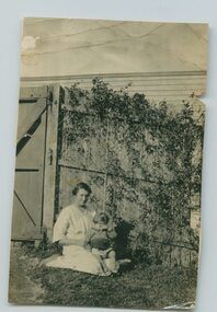
Photograph- West Sydney
This photograph is part of the West Sydney Collection which depicts the period around Second World War in Australia from the perspective of a young unknown woman.Mum with Ollie as a kid Sth Kensington Kodak Printgarden; mum; children; west sydney; australia; suburbia -
 The Foundling Archive
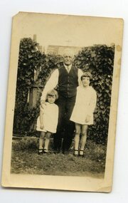
Photograph- West Sydney
This photograph is part of the West Sydney Collection which depicts the period around Second World War in Australia from the perspective of a young unknown woman.1930 Me, Uncle Sam, Cousin Francis Kodak Printcousins; uncle; family; garden; back yard; west sydney; australia; suburbia -
 The Foundling Archive
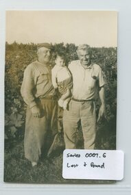
Photograph- Lost and Found
This item is part of a collection of photographs and postcards found at 'Lost and Found' market, Lygon street, Brunswick East over the period between April 2013 and September 2013.men; garden; back yard; farm; children; lost and found; 1940's -
 The Foundling Archive
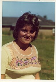
Photographs - R. Owen (Jack Collection)
This item is part of the ‘Jack’ collection. Photographs, negatives, slides, glass plates, stereographs, postcards, letters and other ephemera obtained from Tyaab Packing House Antique Centre in December 2013. All items collected by long-time collector and camera enthusiast Jack Russo. Back of photographs indicate date range from 1969 - 19741960's; 1970's; portrait; children; garden; woman; australia -
 The Foundling Archive
Photographs - R. Owen (Jack Collection)
This item is part of the ‘Jack’ collection. Photographs, negatives, slides, glass plates, stereographs, postcards, letters and other ephemera obtained from Tyaab Packing House Antique Centre in December 2013. All items collected by long-time collector and camera enthusiast Jack Russo. portrait; boat; lake; holiday; boy; garden; woman -
 The Foundling Archive
35mm photographic negatives- R Owen (Jack)
These negatives depict an Australian family in the 1970's. This series is part of the Jack Collection, photographic negativessuburbia; australia; 1970's; family; portraiture; boy on bike; grandparents; children; mum; dad; teenagers; backyard cricket; recreation; back yard; garden; -
 Clunes Museum
Document - DOCUMENT POSTER, JEANETTE SPITTLE - UNIVERSITY OF MELBOURNE BURNLEY CAMPUS, QUEENS PARK CLUNES - A MANAGEMENT REVIEW
LAMINATED MANAGEMENT REVIEW FOR QUEENS PARK CLUNES. SHOWING MASTER PLAN. COMPLETED 2006. JEANETTE SPITTLEqueens park, clunes, management review, regional botanic gardens -
 Wangaratta RSL Sub Branch
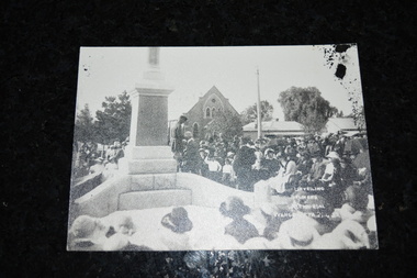
Photograph
Photograph depicting the official Unveiling of Soldiers Memorial at Wangaratta on 25th of April, 1923.From the History of Wangaratta RSL.. In 1918 there were two aims a) to organise a club for returned men and b) erect an outstanding war memorial in a beautiful garden setting. It took many years before the erection and unveiling of this memorial which took place on Anzac Day 25th April, 1923.Black and white photograph of large number of people sitting and standing around monument.Unveiling Soldiers Memorial Wangaratta 25.4.23soldier's memorial wangaratta, unveiling 1923