Showing 31923 items matching "4-masted"
-
 Greensborough Historical Society
Photograph - Digital Image, Aftermath of Plenty River flood 1972 in Poulter Reserve. (4), 1972_
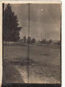
Plenty River in flood around the Poulter Reserve. There were two major floods in Greensborough at the time, 1972 and 1974. Poulter Reserve was created after the 1972 flood and had to be re-established following the 1974 flood.Digital copy of black and white photograph.plenty river, floods -
![Photograph - Digital image, Greensborough Cemetery [view 4], 26/07/2011](/media/collectors/4f729f5697f83e03086015b8/items/54c4b2e12162f10704762248/item-media/54c4b30e2162f107047625ec/item-fit-380x285.jpg) Greensborough Historical Society
Greensborough Historical SocietyPhotograph - Digital image, Greensborough Cemetery [view 4], 26/07/2011
View of Greensborough Cemetery 26/07/2011. Photograph taken by Jasmin Burge.Greensborough Cemetery was created when land was given for the cemetery by Mr William Poulter, a local settler, about 1864. The cemetery holds the graves of many of the early settlers in the district. The cemetery holds approximately 250 grave sites with 350 people buried there. Digital copy of colour photograph of cemetery.greensborough cemetery -
![Photograph - Digital Image, Marsh House [38 Hailes Street] 2014 4, 21/05/2014](/media/collectors/4f729f5697f83e03086015b8/items/550a92cb2162f10974c8c585/item-media/550a92f72162f10974c8c837/item-fit-380x285.jpg) Greensborough Historical Society
Greensborough Historical SocietyPhotograph - Digital Image, Marsh House [38 Hailes Street] 2014 4, 21/05/2014
Built by Jonah Britnell in 1860s, this house was sold to the Marsh family about 1909. The home still stands on the corner of Hailes and Church Street Greensborough Photograph taken in 2014 by Marilyn Smith.Digital copy of colour photograph.britnell, marsh, hailes street -
 Greensborough Historical Society
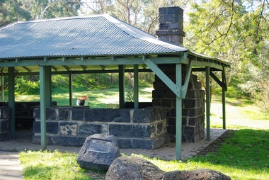
Photograph - Digital Image, Pioneer Reserve 2014 -4, 23/09/2014
Pioneer Reserve, Greensborough is a small park on the corner of St Helena and Diamond Creek Roads. It is adjacent to the site of Greensborough's first bridge across the Plenty River, c. 1864 - 1960s. The shelter, viewing platform, retaining wall and entrance are built from the bridge's massive bluestone arched abutments dismantled between 1974 and 1983. Photograph by Marilyn Smith 2014.Digital copy of colour photograph.pioneer reserve greensborough -
 Greensborough Historical Society
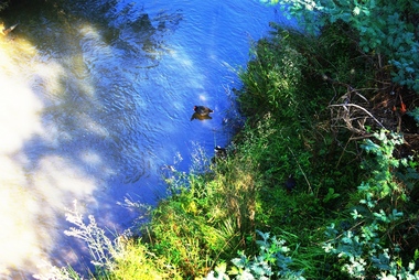
Photograph - Digital Image, Plenty River Greensborough, May 2014 -4, 21/05/2014
The Plenty River flows south from Mt Disappointment before meeting with the Yarra River at Rosanna. Early settlement in Greensborough was based around the Plenty River. These images were taken in the Greensborough area by Marilyn Smith May 2014.Digital copy of colour photograph.plenty river -
 Greensborough Historical Society
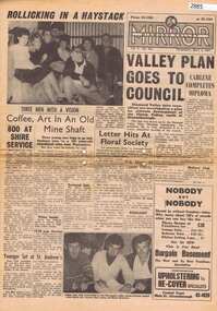
Newspaper, Elliott Provincial newspapers Pty Ltd, Diamond Valley Mirror May 4, 1965, 04/05/1965
Contains article "Valley plan goes to Council", discussing the development of the Plenty Valley, north of Greensborough.Early plan submitted to Diamond Valley Council in 19658 p.greensborough -
 Greensborough Historical Society
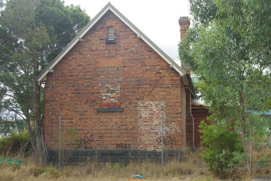
Photograph - Digital Image, Bundoora Primary School Bu1915 (old building) 4, 18/03/2014
Bundoora Primary School No.1915 was constructed in 1877 of brick on a bluestone base with an iron roof and small porch. The school consisted of a single room with the dimensions 30 feet by 18 feet. It was a small rural school and in use for over 100 years. Today it sits abandoned at the intersection of Plenty Road and the Metropolitan Ring Road. The School has a Victorian Heritage Overlay (no H062) Photograph by Marilyn Smith 2014. Update: The old building has been incorporated into a childcare facility.Digital copy of colour photograph. bundoora primary school, bundoora state school -
 Greensborough Historical Society
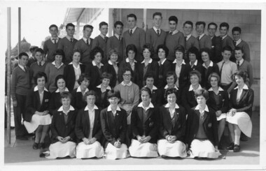
School Photograph (digital image), 1961 Macleod High School McHIGH Form 4, 1961_
Class photograph from Macleod High School. Student names are identified on back of photo. Digital copy of black and white group photograph.Names identified on back of photograph.macleod high school, rosemary davies -
 Greensborough Historical Society
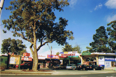
Photograph - Digital image, Marilyn Smith, Diamond Village Shopping Centre (Exterior 4), Watsonia, 2016, 22/05/2016
Diamond Village Shopping Centre (Exterior), Nepean Street Watsonia.Digital copy of colour photograph.diamond village shopping centre, watsonia -
 Greensborough Historical Society
Photograph - Digital image, Frank Solomon, Briar Hill Shops 4, 2012_
Briar Hill shops are on the corner of Sherbourne Road and Mountainview Road Briar Hill. These photographs were taken by Frank Solomon and depict a small local shopping strip.Digital copy of colour photographbriar hill shops, briar hill -
 Greensborough Historical Society
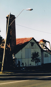
Photograph - Digital image, Frank Solomon, Briar Hill Timber 4, 2012c
Briar Hill Timber was situated on Sherbourne Road Briar Hill and operated as a timber yard for many decades from he 1950s. This photo shows the chimney, the only part of the structure still remaining. These photographs were taken by Frank Solomon and depict the business just prior to its closure in 2014.Digital copy of colour photographbriar hill timber -
 Greensborough Historical Society
Photograph - Digital image, Charles Marshall et al, Victorian scenes 3 and 4, 1920_
Victorian scenes. Location not identified. This scene is part of Charles Marshall's collection of World War 1 photographs.Digital copy of black and white photographcharles marshall, world war 1, victoria -
 Greensborough Historical Society
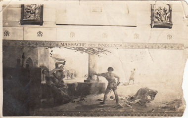
Photograph - Digital image, Charles Marshall et al, Church at Mataria. Fresco 4, 1917_
This photograph shows a fresco from a Church in Mataria, near Cairo. This fresco depicts the killing of the innocents by Herod's soldiers shortly after the birth of Jesus.Digital copy of black and white photograph. "Killing of the male children"charles marshall, world war 1 -
 Greensborough Historical Society
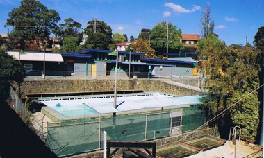
Photograph - Digital image, Frank Solomon, Greensborough Swimming Pool 4, 2012c
The old Greensborough Swimming Pool.This Pool was demolished to make way for the Watermarc complex.Digital copy of colour photographgreensborough swimming pool -
 Greensborough Historical Society
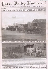
Newspaper, Mont de Lancey Historical Home and Museum, Yarra Valley Historical: Vol.1. Issue 4, 1866o
A history of settlement of the Wandin Yalloak district from 1866, includes pioneer families and events. A publication of the Mont de Lancey Historical Home and Museum in Wandin.Newspaper, 32 pages, illus."Early History of Wandin Yalloak & District" on cover.wandin, mont de lancey historical home and museum -
 Greensborough Historical Society
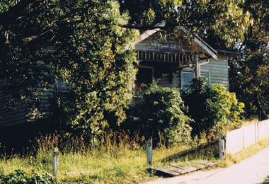
Photograph - Digital image, Frank Solomon, Mountainview Road Briar Hill: old house 4, 2010c
Old house on Mountainview Road Briar Hill.A record of the changing face of Greensborough.Digital copy of colour photographmountainview road briar hill -
 Greensborough Historical Society
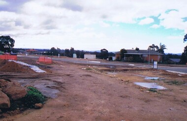
Photograph - Digital image, Frank Solomon, Development of pig farm to residential blocks, 4, 02/08/2009
A view of the redevelopment of the pig farm in Weidlich Road Greensborough, owned by Werner Hanusch. The land was used as a pig farm and quarry from 1954 and this photo shows early stages of the land being subdivided into the Evelyn Way estate. This project of fifty, one double storey, dwellings was commenced on 2/8/2009 and completed on 6/2/2011.An example of the changing land use in Greensborough, from farming to residential.Digital copy of colour photographwerner otto fritz hanusch, pig farm st helena, weidlich road greensborough, one evelyn way greensborough -
 Greensborough Historical Society
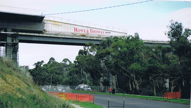
Photograph - Digital image, Frank Solomon, Plenty River Drive Bridge Roadworks 4, 2005c
These photos show the duplication of the bridge over Plenty River Drive on the Greensborough Bypass, circa 2005.Digital copy of colour photographplenty river drive, greensborough bypass -
 Greensborough Historical Society
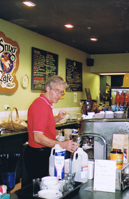
Photograph - Digital image, Frank Solomon, The Snug Cafe St Helena 4, 1990c
St Helena Marketplace was the site of "The Snug". These photographs were taken by Frank Solomon and depict a cafe called The Snug, which is no longer operating.Digital copy of colour photographthe snug, st helena marketplace, st helena -
 Greensborough Historical Society
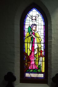
Photograph - Digital image, Marilyn Smith, St Katherine's Church St Helena: Window 4, 29/05/2015
St Katherine's Church St Helena dates from 1858. The Church was built by Major Anthony Beale in memory of his wife Katherine Rose Beale. This photograph shows one of the stained glass windows, dedicated to the memory of Frederick Tolhurst and his wife Rose Tolhurst.Digital copy of colour photographst katherines church st helena, anthony beale, frederick tolhurst, rose tolhurst -
 4th/19th Prince of Wales's Light Horse Regiment Unit History Room
Booklet, Airborne Air transported Operations No 4 (2 copies), 1945
Soft covered booklet dealing with the planning and the conduct of air transportation of troops and equipment in both aircraft and glidersdoctrine, airborne troops -
4th/19th Prince of Wales's Light Horse Regiment Unit History Room
Booklet, A H Pettifer Actg Government Printer, Royal Armoured Corps Weapon Training Military Training Pam No 34 Part 4 Tank Fire Tactics 1944, 1944
Soft covered bookletProof Copytank training, world war 2 -
4th/19th Prince of Wales's Light Horse Regiment Unit History Room
Booklet (2 copies), Manual of Land Warfare Part 2 Infantry Training Vol 4 Pam 7 The General Purpose Machine Gun 7.62 mm M60 1980, 1980
Soft covered booklet. DSN 7610-66-104-8351 m60 general purpose machine gun -
4th/19th Prince of Wales's Light Horse Regiment Unit History Room
Booklet (2 copies), Manual of Land Warfare Part 2 Infantry Training Vol 4 Pam 3 Sub Machine Gun 9 mm F1 1983, 1983
Soft covered bookletDSN 7610-66-107-6806sub machine gun f1 -
4th/19th Prince of Wales's Light Horse Regiment Unit History Room
Booklet, Infantry Training Vol 1 Infantry Platoon Weapons Part 4 Machine Carbines 1949, April 1951
Soft covered booklet incorporating amendment No 1. Deals with 9mm Owen and Austen Machine Carbinesmachine carbine, owen, austen -
4th/19th Prince of Wales's Light Horse Regiment Unit History Room
Booklet, Manual of Land Warfare Part 2 Infantry Training Vol 4 Pam 7 GPMG M60, Nov 1989
Green plastic loose leaf binder containing information required by all corps to conduct training in the use of the General Purpose Machine Gun 7.62 mm M 60. It describes the gun and associated equipment. The cover has a clear window through which the title is visibleMLW TWO 4.7machine gun, gpmg m60 -
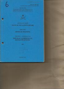 4th/19th Prince of Wales's Light Horse Regiment Unit History Room
Booklet, Manual of Land Warfare Part 2 Armour Training Vol 4 Pam 2 The RAAC Schedule of Range Practices 1983, 1983
Soft covered booklet dealing with progressive training in all levels from individual qualification courses to sub-unit continuation training and individual training for various levels of promotion.7610-66-108- 8327armour range practices -
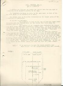 4th/19th Prince of Wales's Light Horse Regiment Unit History Room
Document - Bulletin, Royal Australian Armoured Corps Bulletin No 4 Use of Templates (2 copies), 1950
2 COPIES. Three page document on the use of range templatesrange templates, tank gunnery -
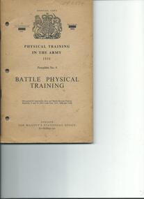 4th/19th Prince of Wales's Light Horse Regiment Unit History Room
Booklet, Battle Physical Training Pamphlet No 4, 1958, 1958
Soft covered booklet on physical training in the Army. Contains line drawings of various individual and team training exercises and lessonsWO Code No 9470physical training army -
4th/19th Prince of Wales's Light Horse Regiment Unit History Room
Booklet, Manual of Land Warfare Part One Volume 4 Pamphlet No 2 Biological and Chemical Operations (Provisional) 1978, 1978
A soft covered booklet aimed at providing commanders and staff officers with information on the effects of biological and chemical weapons on personnel and the conduct of operations, and outlining procedures to follow to reduce these effects. 2 copies7610-66-098-2586biological chemical warfare