Showing 1433 items matching "allotment"
-
 Bendigo Historical Society Inc.
Document - H. A. & S. R. WILKINSON COLLECTION: CONTRACT OF SALE
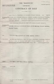
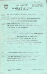
Contract of sale of land dated 19th December, 1955 between Mr J. S. Henderson as executor of estate of W. J. Henderson (vendor) and Mrs E. & Mr. F. J. Taylor (purchaser). Property: all that piece of land being part of Crown allotment 10 and 11 section 9A Parish of Sandhurst city of Bendigo being land described in certificate of title volume 5221 folio 175 and situate No. 641 High Street corner fir Street, Golden Square, together with 5 roomed weatherboard dwelling , all sundry outbuildings and all blinds. Price: 2,200 pounds.organization, business, h.a. & s.r wilkinson real estate -
 Bendigo Historical Society Inc.
Document - H. A. & S. R. WILKINSON COLLECTION: CONTRACT OF SALE
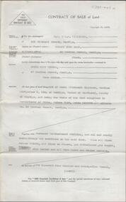
Contract of sale of land dated 7th January 1952 between Mr. H. & Mrs. E. M. Muir (vendor) and Mrs. R. F. Turvey (purchaser). Property: land being allotment 118B section D in the Township of Kangaroo Flat Parish of Sandhurst County of Bendigo, containing 1 rood 38 perches and 1/10 of a perch land described in Crown grant volume 7454 folio 004 and situate in Railway Terrace, Kangaroo Flat, together with 5 roomed weatherboard dwelling and all sundry outbuildings, also all blinds and electric light fittings and shades. Price 875 pounds.organization, business, h.a. & s.r wilkinson real estate -
 Bendigo Historical Society Inc.
Document - H. A. & S. R. WILKINSON COLLECTION: CONTRACT OF SALE
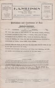
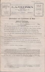
Conditions of sale by private contract dated 14th December, 1946 between Mr. J. R. Shields (vendor) and Mr. L. J. Trigg (purchaser). Property: land situate No. 110 Garsed Street, Bendigo at present occupied by Mrs. Cook as tenant, being part of Crown allotment 5 and 6 section 116C Parish of Sandhurst city of Bendigo described in certificate of title volume 1397 folio 279304, together with the right of carriage way over land coloured brown on map on certificate of title, together with 5 roomed weatherboard and rough cast dwelling and sundry outbuildings. Price: 1,020 pounds.organization, business, h.a. & s.r wilkinson real estate -
 Bendigo Historical Society Inc.
Administrative record - Right to Occupy Certificates
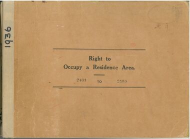
Ten books containing stubs of Right to Occupy Certificates for 1936. Includes name and address of person receiving the Right to Occupy certificate and the description of the land including allotment, Section, City, Town, Borough or Township and Parish name. Two blue covered books used for Substitute Right to occupy certificates. One book, stubs only, dated 1976 - 1981. One with four stubs dated 1981 - 1983. Four stapled bundles of stubs dated 1937 - 1971 issued for Replacement Rights. Includes names and Receipt numbers. Yellow foolscap sheet Listing reord numbers of Rights issued during 1936 and 1937.Some items have pencil and pen marks and ink stains.right to occupy, central victoria -
 Kew Historical Society Inc
Plan - Burke Road Junction Estate, East Kew, 1940
Subdivision plans and real estate flyers/brochures reveal a number of aspects of urban development and history. The Kew Historical Society's collection of these plans, as well as advertisements extracted from magazines, cover key aspects of community development and architectural history of Kew and Kew Eat as well as surrounding suburbs. While most of the plans in the collection were gifted to the Society by the former City of Kew, a number of other plans and advertisements have been donated by individuals, of which this is an example.Original 4-page bifold brochure advertising the Burke Road Junction Estate in Kew East. Advertised for sale in 1940, the estate comprised 16 'Central Allotments' fronting High Street, Kilby Road, and Glass Street. Pages 1 & 4, the front and back covers, includes a panoramic photograph of the junction which features a number of shops still extant, but also with buildings long demolished and redeveloped. These include the petrol station and the dairy on the southeast and southwest corners of Burke Road and High Street/Doncaster Road. The dairy includes a statue of a cow on its roof. Pages 2 & 3 include a detailed plan of the estate. subdivisions -- kew east (vic.), burke road junction estate -
 Kew Historical Society Inc
Plan - Subdivision Plan, Summerhill Estate, 1920-1940
Pru Sanderson, in her groundbreaking ‘City of Kew Urban Conservation Study : Volume 2 - Development History’ (1988), summarised the periods of urban development and subdivisions of land in Kew. The periods that she identified included 1845-1880, 1880-1893, 1893-1921, 1921-1933, 1933-1943, and Post-War Development. These periods were selected as they represented periods of rapid growth or decline in urban development. An obvious starting point for Sanderson’s groupings involved population growth and the associated economic cycles. These cycles also highlighted urban expansion onto land that was predominantly rural, although in other cases it represented the decline and breakup of large estates. A number of the plans in the Kew Historical Society’s collection can also be found in other collections, such as those of the State Library of Victoria and the Boroondara Library Service. A number are however unique to the collection.The Kew Historical Society collection includes almost 100 subdivision plans pertaining to suburbs of the City of Melbourne. Most of these are of Kew, Kew East or Studley Park, although a smaller number are plans of Camberwell, Deepdene, Balwyn and Hawthorn. It is believed that the majority of the plans were gifted to the Society by persons connected with the real estate firm - J. R. Mathers and McMillan, 136 Cotham Road, Kew. The Plans in the collection are rarely in pristine form, being working plans on which the agent would write notes and record lots sold and the prices of these. The subdivision plans are historically significant examples of the growth of urban Melbourne from the beginning of the 20th Century up until the 1980s. A number of the plans are double-sided and often include a photograph on the reverse. A number of the latter are by noted photographers such as J.E. Barnes.The Summerhill Estate was a subdivision in Glen Iris of 24 ‘choice allotments’. The lots were primarily on both sides of Dillon Grove. Other lots at each end of the subdivision faced Margaret Street and Summerhill Road. It was from the latter that the subdivision took its advertised title. The lots were originally advertised for £10 deposit with 20 subsequent payments over five years. Pencilled on the printed plan is a change to the deposit required; a reduction to 20/-. Annotations indicate that the new deposits ranged from 30/- to 45/-. The most expensive lots faced Summerhill Road. This subdivision plan is unusual in that the front and rear of the card are for subdivisions in different localities.subdivision plans - glen iris, summerhill estate -
 Kew Historical Society Inc
Plan - Subdivision Plan, Mayfield Estate, 1927
A number of the plans in the Kew Historical Society’s collection can also be found in other collections, such as those of the State Library of Victoria. A number are however unique to the collection.The Kew Historical Society collection includes almost 100 subdivision plans pertaining to suburbs of the City of Melbourne. Most of these are of Kew, Kew East or Studley Park, although a smaller number are plans of Camberwell, Deepdene, Balwyn and Hawthorn. It is believed that the majority of the plans were gifted to the Society by persons connected with the real estate firm - J. R. Mathers and McMillan, 136 Cotham Road, Kew. The Plans in the collection are rarely in pristine form, being working plans on which the agent would write notes and record lots sold and the prices of these. The subdivision plans are historically significant examples of the growth of urban Melbourne from the beginning of the 20th Century up until the 1980s. A number of the plans are double-sided and often include a photograph on the reverse. A number of the latter are by noted photographers such as J.E. Barnes.The Mayfield Estate subdivision included 14 allotments surrounding Evan Court (now Evans Court) in Toorak. The subdivision adjoined Toorak Road east of Kooyong Road and alerted prospective buyers to how the Toorak Road tram would take them directly to the city. This emphasis on existing transport routes was a feature of subdivisions during a period when car ownership was the preserve of the wealthy. An existing brick villa (‘Mayfield’) is noted as already constructed on lot 13. The subdivision also notes that the lots adjoin land owned by Sir Edward Miller. Today Evans Court extends beyond this subdivision through to Moonga Road.subdivision plans - toorak, mayfield estate, sir edward miller -
 Kew Historical Society Inc
Plan - Subdivision Plan, Goldthorns Hill Estate, 1925
Pru Sanderson, in her groundbreaking ‘City of Kew Urban Conservation Study : Volume 2 - Development History’ (1988), summarised the periods of urban development and subdivisions of land in Kew. The periods that she identified included 1845-1880, 1880-1893, 1893-1921, 1921-1933, 1933-1943, and Post-War Development. These periods were selected as they represented periods of rapid growth or decline in urban development. An obvious starting point for Sanderson’s groupings involved population growth and the associated economic cycles. These cycles also highlighted urban expansion onto land that was predominantly rural, although in other cases it represented the decline and breakup of large estates. A number of the plans in the Kew Historical Society’s collection can also be found in other collections, such as those of the State Library of Victoria and the Boroondara Library Service. A number are however unique to the collection.The Kew Historical Society collection includes almost 100 subdivision plans pertaining to suburbs of the City of Melbourne. Most of these are of Kew, Kew East or Studley Park, although a smaller number are plans of Camberwell, Deepdene, Balwyn and Hawthorn. It is believed that the majority of the plans were gifted to the Society by persons connected with the real estate firm - J. R. Mathers and McMillan, 136 Cotham Road, Kew. The Plans in the collection are rarely in pristine form, being working plans on which the agent would write notes and record lots sold and the prices of these. The subdivision plans are historically significant examples of the growth of urban Melbourne from the beginning of the 20th Century up until the 1980s. A number of the plans are double-sided and often include a photograph on the reverse. The Goldthorns Hill Estate subdivision was first put up for auction in 1925. The subdivision took its name from the mansion ‘Goldthorns’, shown on the plan between Normanby Road and Lady Loch’s Drive. Contemporary advertisements describe forty-three home sites being fro sale, yet only forty-one appear on this plan. Buyers were lured by the prospect of the proposed extension of the Burke Road tram to High Street. Discerning buyers were advised that only one house could be built per allotment, and that houses needed to be constructed of brick, stone or concrete and have a slate or tiled roof.goldthorns avenue -- kew east (vic.), lady loch drive -- kew east (vic.), argyle road -- kew east (vic.), lady brassey drive -- kew east (vic.), campbell street -- kew east (vic.), goldthorns -- kew (vic.), subdivisions -- kew east (viv.), goldthorns hill estate -
Bendigo Historical Society Inc.
Administrative record - Golden Carshalton N.L. Share Register, 1947 - 1951
Golden Carshalton N.L. was formerly Big Hill North N.L. states that Mr. J.H. Cahill who was formerly Maroon hard cover 'application for allotment' journal contained in a 'Kalamazoo binder'. Shareholder details entered on individual pages, in alphabetical order in journal. Date of entries range from 1947 to 1951. Inserted in journal: 'Golden Carshalton, N.L. Director's Report for the year ended 31st December 1949'; notice of ordinary general meeting of shareholders to b held on Wednesday 8th March, 1950 at Commonwealth Bank Chambers, J.J. Stanistreet, (McColl, Rankin and Stanistreet, Manager) On back of sheet is listed the 'working account and balance sheet for year ended 31st December 1949 . Register is part of the Margaret Roberts Collection of mining records. bendigo, margaret roberts, goldmining, golden carshalton n.l., share register, share allotment -
 Bendigo Historical Society Inc.
Document - H. A. & S. R. WILKINSON COLLECTION: CONTRACT OF SALE
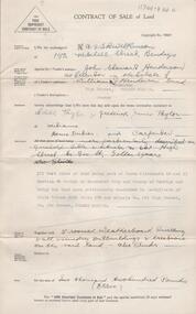
Contract of sale dated 28th November 1959 between Farmers & Citizens Trust Bendigo -Roy Buckland as executors of the estate of E. Buckland and Mrs. J. C. B. Tweed. Solicitor for vendor and purchaser: Watson, James & Rogers, 61 Bull Street, Bendigo. Property 124-126 Wills Street, Bendigo, being part of Crown allotment 22 section 90C described in certificate of title volume 6495 folio 876. Price: 659 pounds. Attached statement pursuant to section 34 of the estate agents act 1956 and engagement or appointment in writing pursuant to section 33 of the estate agents act 1956.organization, business, h.a. & s.r wilkinson real estate -
 Bendigo Historical Society Inc.
Document - MCCOLL, RANKIN AND STANISTREET COLLECTION: PLAN OF AREA LEASE 10425, 10733 AND 10734, 1934
Plan of area applied for on lease No 10425, 10733 and 10734. Applied for by Mr. R.A. Rankin. Plan shows Marong Road, state school site ; leases held by H.E. Kronk, Francis Gramann; T. Wearne; C.E. Foggitt; A. Pitcher, Crown land and Aur. licences also marked. Lease numbers marked on plan. Map signed on bottom by Garnet G. Birch on 26.11.1934. On top Rh side in black pen " applications for the Minister of Mines Authority under section 5 (1) of the Mines Act 1928 to enter upon and occupy for mining purposes such portion of allotments lodged on 19/2/35'gold, mining, lease, mining, leases, kronk, garnet g. birch -
 Bendigo Historical Society Inc.
Document - KELLY AND ALLSOP COLLECTION: APPLICATION FOR LOAN ON MORTGAGE
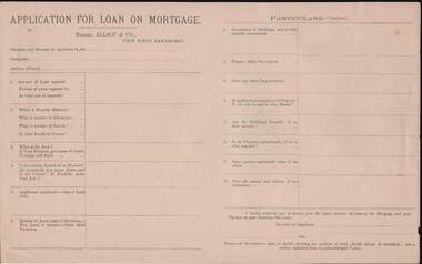
Application for Loan on Mortgage. Messrs Allsop & Co., View Point, Sandhurst. Application has space for name, occupation, amount of Loan, number of years, interest rate, Where, number of Allotment, Section, parish or County, Area, Leasehold or Freehold. Applicants opinion as to value of Land alone. Number of Acres under Cultivation. How Land is watered. State Shire Valuation, Description of Buildings and materials used, Fences, Improvements. Application for Loan on Mortgage. Messrs Allsop & Co., View Point, Sandhurst. Application has space for name, occupation, amount of Loan, number of years, interest rate. Where, number of Allotment, Section, parish or County, Area, Leasehold or Freehold. Applicants opinion as to value of Land alone. Number of Acres under Cultivation. How Land is watered, State Shire Valuation, Description of Buildings and materials used, Fences, Improvements. Is applicant in occupation of Property, if not who is, and at what Rental. Are Buildings Insured, if so, what amount. Is the Property encumbered, is so, to what amount. Present marketable value of the whole, and names and addresses of two references. Authorization to deduct from the advance the costs of the Mortgage and Charges on obtaining the Loan. Note at the end - A Government plan, or sketch showing the position of the land and written valuation from an acknowledged Valuer. On the back is space for a Valuator's Report and a note to the Valuators, also a Proposal for Loan on Mortgage with details of the loan. Date on the form is 188-.business, stockbroker, kelly & allsop, kelly and allsop collection - application for loan on mortgage, allsop & co. -
 St Kilda Historical Society
Photograph, Donald McDonald, Herford, 1872
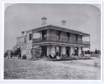
Large residence on large elevated block for Frederick Christian Lange (1832-1888) and family in 1870. The architect Lloyd Tayler (1830-1900) designed it in an Italianate style. Over time adjoining allotments were purchased until the gardens covered nearly 15 acres. Lange was in partnership with Emil Thoneman trading under the name of Lange & Thoneman, merchants and general importers. Lange was also one of the local directors of the local Australasian directors for the Swiss Lloyd Marine Insurance Company. William Officer (1835-1913), pastoralist, bought the property from Lange in 1888 for 23,500 pounds. Following Officer's death the grounds were subdivided in 1914 and the house finally demolished in 1940. Noting the spelling difference, there is now a street named 'Hertford Street' very close to this location. black and white photograph copyAlma Road south west corner Lansdowne Road built for Federick C Lange (Merchant) Photo 1872 -
 Bendigo Historical Society Inc.
Slide - No 10 Valentine Street Bendigo
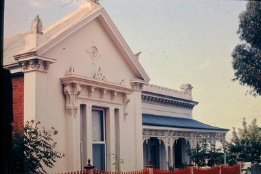
Situated walking distance from the city centre just off View Street is this superbly restored Victorian Residence displaying ornate treatment & style given to the house in 1880 by Bendigos famous architect William C. Vahland. Set amongst a private garden on a corner allotment of approx. 827m2, the residence includes entrance hall, ornate formal Lounge Room, spacious renovated kitchen and family room, 4 Bedrooms plus a music room or office, Bathroom plus provision for 2nd bathroom or ensuite off the main Bedroom. Large laundry, 2 toilets, downstairs includes large workshop, cellar and storage. Superb front & rear verandahs and private paved rear garden with double carport. The home is in excellent condition with loads of taste, style quality and charm. No 10 Valentine Street Bendigo - Slidehistory, bendigo, national trust collection bendigo, 10 valentine street -
 Kew Historical Society Inc
Plan, F R Simms & Son, Land for Private Sale: Cnr Victor Avenue and Mont Victor Road, Kew, 1950-1960
George Rimington established The Parkhill Nursery in 1877. By 1910, it was more commonly known as Rimington’s Nurseries and well known for its sale of violets. After World War II, Rimington’s Nurseries were gradually subdivided and sold. The 38 allotments were released in sections, including lots 34 to 36 on the corner of Mont Victor Road and Victor Avenue. Previous lots in the subdivision had bordered Burke Road, Rimington Avenue, Heather Grove, and Stoke Avenue. The selling point as it had been in comparable estates for a century were the proximity to transport, schools and churches, as well as the high location and excellent views. The subdivision plan shows most of the lots in the entire subdivision: 1-11, 13-26, and 34-38. Presumably, lot 12 and lots 27-33 were still to be released.Subdivision plans are historically important documents used as evidence of the growth of suburbs in Australia. They frequently provide information about when the land was sold on which a built structure was subsequently constructed as well as evidence relating to surveyors and real estate and financial agents. The numerous subdivision plans in the Kew Historical Society's collection represent working documents, ranging from the initial sketches made in planning a subdivision to printed plans on which auctioneers or agents listed the prices for which individual lots were sold. In a number of cases, the reverse of a subdivision plan in the collection includes a photograph of a house that was also for sale by the agent. These photographs provide significant heritage information relating house design and decoration, fencing and household gardens.Subdivision plan advertising five superb home sites among lots in Burke Road, Stoke Avenue, Victor Avenue, Mont Victor Road and Heather Grove.subdivision plans - kew, rimington avenue -- kew (vic.), heather grove -- kew (vic), stoke avenue -- kew (vic.), burke road -- kew (vic.), mont victor road -- kew (vic.) -
 The Beechworth Burke Museum Research Collection
Card (Series) - Index Card, George Tibbits, Corner Church, Ford & High Streets, Beechworth, 1976
George Tibbits, University of Melbourne. Faculty of Architecture, Building and Town & Regional PlanningIndex system that support the research for Beechworth : historical reconstruction / [by] George Tibbits ... [et al]Arranged by street names of BeechworthEach index card includes: street name and number of property, image of property, allotment and section number, property owners and dates of ownership, description of the property according to rate records, property floor plan with dimensions.beechworth, george tibbitsbeechworth, george tibbits -
 Wodonga & District Historical Society Inc
Functional object - Gordon Family Orchard Bell
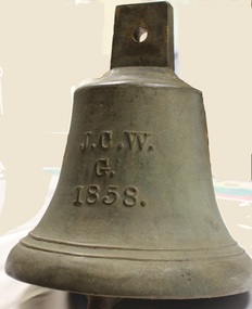
The Gordons were architects and were associated with many buildings still standing in Albury and Wodonga, St Patrick's Church and the de Kerilleau Homestead among them. They established Vermont Orchard on 74 acres to the south of the Wodonga settlement. Here they grew fruit and nuts for the domestic and export market. The enterprising family also set about transforming some of the land by clearing it, creating streets and making general improvements. It was the biggest subdivision in Wodonga at the time. The 234 allotments in the Wodonga Estate were put up for sale by auction in May 1890. A total of 200 people were said to have attended. Gordon, William, Charles and Vermont streets in Wodonga are named after the family. This bell was used at the Vermont orchard to signal the beginning and end of the working day, as well as lunch breaks.The Gordon Family orchard bell is made of cast iron. It includes the inscription "J. C. W../G./1858." This is thought to represent the initials of John Gordon and sons Walter Joseph and Charles Goodwin Sylvester Gordon. There is some conjecture about this due to the date "1858". John was born in London, England in 1823 and died in 1880. Walter is generally accepted to have been born in 1857 and died 1903. In one family tree Charles is recorded as being born on 28 January 1858 but his birth was registered in 1860. The mystery of the date is therefore not fully resolved.On one side of the bell "J. C. W../G./1858."gordon family wodonga, gordon and gordon architects, vermont wodonga -
 Glen Eira Historical Society
Album - Album page, Labassa, 4 Manor Grove, Circa 1972
This photograph is part of the Caulfield Historical Album 1972. This album was created in approximately 1972 as part of a project by the Caulfield Historical Society to assist in identifying buildings worthy of preservation. The album is related to a Survey the Caulfield Historical Society developed in collaboration with the National Trust of Australia (Victoria) and Caulfield City Council to identify historic buildings within the City of Caulfield that warranted the protection of a National Trust Classification. Principal photographer thought to be Trevor Hart, member of Caulfield Historical Society. Most photographs were taken between 1966-1972 with a small number of photographs being older and from unknown sources. All photographs are black and white except where stated, with 386 photographs over 198 pages. HISTORY:-- From Victorian Heritage Database citation for Labassa https://vhd.heritagecouncil.vic.gov.au/places/278 as at (26/10/2020) Labassa, Caulfield is one of Melbourne's most lavishly decorated nineteenth century mansions. It resulted from the extensive remodelling in 1890, of an earlier house, known as Sylliott Hill, which was begun in 1862-3 for lawyer, Richard A. Billing. The land at the corner of Balaclava and Orrong Roads was first acquired in 1854 by William Lyall, transferred to his partner, John Mickle, in 1859, who also acquired the adjoining allotment in Balaclava Road, and the three allotments were conveyed to Billing. His first eight-roomed house was extended significantly in 1873 into a twenty-roomed house by architects Crouch and Wilson, who were possibly also responsible for the first house. This reflected Billing's success as a barrister, and he resided at this property until his death in 1882. In 1883 prominent Melbourne businessman, Alexander William Robertson, leased the Sylliott Hill property from Billing's widow, and in 1885 he purchased the adjoining allotment in Balaclava Road. He purchased the Billing's property in 1887 and renamed the 6.31 hectare property, Ontario. In 1889-90, Robertson commissioned the German born architect, John A. B. Koch, to extensively remodel the house into a thirty-five roomed mansion. The existing house was extended and altered, largely resulting in the nineteenth century mansion as it now appears. After Robertson's death in 1896, the house was tenanted until it was eventually sold to the mining millionaire, John Boyd Watson, in 1904. He renamed the property Labassa and carried out repair and re-decoration work to the house. In the early twentieth century, many large estates were subdivided into smaller allotments as the demand for land grew and it became difficult to maintain such large estates. After Watson's death in 1911, portions of the Labassa estate were offered for sale, with Mrs Watson retaining a 1.73 hectare portion containing the house. In 1913 forty-six allotments were auctioned at Labassa Estate, with the formation of Labassa Grove and Ontario Street to the east of the property. Labassa was first recorded as containing flats in 1923 and in the late 1920s, the owner, Robert Hannon, built a red brick block of flats adjacent to the house. Subdivision continued, until the National Trust of Australia (Victoria) purchased the house in 1980 and subsequently purchased adjoining sites, one to the south-east in 1984 (house demolished in 1988) and to the west in 1988. Labassa as it now stands is substantially as it appeared when Koch completed the work in 1890. The original two storey house was transformed into a French Renaissance style mansion, with the addition of a two level L-shaped arcaded verandah and two prominent terminating bays to the south and the east. The building is of unpainted cement render with dressed bluestone plinths, balustraded parapet and steep, slate covered, flat topped mansard roofs behind. A truncated conical roof is a feature of the south bay and a helmeted head is incorporated in the parapet over the east bay. The main south and east facades incorporate many cast cement details, including sculptures, elaborate cornices, swagged Corinthian columns and caryatid consoles flanking the entrance porch, as well as pink marble panels and imitation marble, or scagliola, on curved surfaces. At the rear of the building is a two storey wing and a single storey cottage, the former being connected to the main house by a tower. This section of the house was constructed in 1873. The estate at its peak included stables (1873), conservatory (probably 1890) and a tennis pavilion (probably 1890). All of these outbuildings survive, with the stables and conservatory being converted for residential use after 1922. Internally a range of decorative treatments remain from the late nineteenth century and the early twentieth century, both from the Robertson and Watson periods of occupancy. These include wallpapers, ceiling decoration, chimney pieces, mouldings, joinery and decorative glass. From Victorian Heritage Database citation for H0135 Labassa 2/2A Manor Grove Caulfield North https://vhd.heritagecouncil.vic.gov.au/places/278 as at (26/10/2020) HOW IS IT SIGNIFICANT? Labassa, Caulfield is of architectural, aesthetic and historical significance to the State of Victoria. WHY IS IT SIGNIFICANT? Labassa, Caulfield is of architectural significance as the most prominent example of a small number of houses built in Australia in the French Renaissance style. It is of further note due to the German interpretation of the style and the use of Hellenistic sources, via Germany. It is exceptional for its lavish treatment externally, including marble, scagliola, caryatids, swagged columns, mansard roofs and ornamental cresting. Labassa is of architectural significance as the most important surviving example of German architect, John Koch's domestic work. He undertook a large variety of work in Melbourne, including a number of houses, however Labassa is the most lavish example of his work. Labassa is of aesthetic significance for its outstanding assemblage of late nineteenth and early twentieth century European style interior decoration, which remain remarkably intact. These include a trompe l'oeil ceiling, painted ceilings, embossed imitation leather and other papers, chimney pieces, ceramic tilework, oak parquetry and stained glass, including a tripartite window by Ferguson and Urie, probably dating from the 1873 period. Labassa is of historical significance as an illustrative example of the wealth acquired by a number of prominent Victorian families in the second half of the 19th century. The early development of the property, Sylliott Hill, was due to the wealth acquired by Richard Billing, barrister and fifth Victorian to be appointed Queen's Counsel in 1878. The significant development in 1890 of Ontario, is illustrative of the wealth of Alexander Robertson, a partner in Cobb and Co., a director of Goldsborough Mort & Co., and a pastoral speculator. John B. Watson, whose father had acquired great wealth from the goldfields of Bendigo and subsequently invested in city and country properties, was the third resident to impact on the house, particularly the interiors. The Labassa estate is of historical significance as an illustrative example of the development that occurred in such suburbs as Caulfield in the 1880s due to the land boom, its proximity to Melbourne and the establishment of the Melbourne to Gippsland railway in 1879. It is also illustrative of an estate which succumbed to the pressures of subdividing in the early twentieth century, as properties became difficult to maintain and demand for land close to the city grew. It was typically divided into flats in the 1920s and was used as such for about sixty years. It is of historical significance for its associations with the remnants of the earlier estate which remain extant. These include the stables, conservatory (H2005) and tennis pavilion which all remain on separate sites. Also significant are the remains of early electrical wiring and fittings. Labassa was one of the first houses in Caulfield to be electrified and some of the original wires remain. [Online Data Upgrade Project 2004]Page 128 of Photograph Album with four photographs (two portrait and two landscape) of Labassa.Handwritten: "Labassa" 4 Manor Grove [top right] / Neg 232 8 Oct 1966 [under bottom right photo] / 128 [bottom right]trevor hart, bracketed eaves, slate roof, bay windows, decorative brackets, caulfield north, labassa, richard a. billing, balaclava road, orrong road, sylliott hill, william lyall, crouch and wilson, alexander william robertson, ontario, 1880's, john a. b. koch, mansion, john boyd watson, labassa grove, french renaissance style, l-shaped arcaded verandah, bluestone plinths, balustraded parapet, flat topped mansard roofs, conical roof, elaborate cornices, corinthian columns, caryatid consoles, marble panels, imitation marble, scagliola, tower, conservatory, stables, tennis pavilion, mouldings, decorative glass, caryatids, swagged columns, ornamental cresting, trompe l'oeil ceiling, embossed imitation leather, oak parquetry, stained glass, tripartite window, triple window, ferguson and urie, 1870's, flats, 1920's, electric wiring, 1860's, verandahs, curved windows, arched windows, italianate, terraces, gargoyles, ornamentation, ornate entrance, la bassa, manor grove, st kilda east, victorian, cast iron work, john koch, richard billing, architects, electrification, john mickle, land subdivision, mrs watson, labassa estate, robert hannon, national trust of australia (victoria), sculpture -
 Glen Eira Historical Society
Album - Album page, Labassa, 4 Manor Grove, Circa 1972
This photograph is part of the Caulfield Historical Album 1972. This album was created in approximately 1972 as part of a project by the Caulfield Historical Society to assist in identifying buildings worthy of preservation. The album is related to a Survey the Caulfield Historical Society developed in collaboration with the National Trust of Australia (Victoria) and Caulfield City Council to identify historic buildings within the City of Caulfield that warranted the protection of a National Trust Classification. Principal photographer thought to be Trevor Hart, member of Caulfield Historical Society. Most photographs were taken between 1966-1972 with a small number of photographs being older and from unknown sources. All photographs are black and white except where stated, with 386 photographs over 198 pages. HISTORY:-- From Victorian Heritage Database citation for Labassa https://vhd.heritagecouncil.vic.gov.au/places/278 as at (26/10/2020) Labassa, Caulfield is one of Melbourne's most lavishly decorated nineteenth century mansions. It resulted from the extensive remodelling in 1890, of an earlier house, known as Sylliott Hill, which was begun in 1862-3 for lawyer, Richard A. Billing. The land at the corner of Balaclava and Orrong Roads was first acquired in 1854 by William Lyall, transferred to his partner, John Mickle, in 1859, who also acquired the adjoining allotment in Balaclava Road, and the three allotments were conveyed to Billing. His first eight-roomed house was extended significantly in 1873 into a twenty-roomed house by architects Crouch and Wilson, who were possibly also responsible for the first house. This reflected Billing's success as a barrister, and he resided at this property until his death in 1882. In 1883 prominent Melbourne businessman, Alexander William Robertson, leased the Sylliott Hill property from Billing's widow, and in 1885 he purchased the adjoining allotment in Balaclava Road. He purchased the Billing's property in 1887 and renamed the 6.31 hectare property, Ontario. In 1889-90, Robertson commissioned the German born architect, John A. B. Koch, to extensively remodel the house into a thirty-five roomed mansion. The existing house was extended and altered, largely resulting in the nineteenth century mansion as it now appears. After Robertson's death in 1896, the house was tenanted until it was eventually sold to the mining millionaire, John Boyd Watson, in 1904. He renamed the property Labassa and carried out repair and re-decoration work to the house. In the early twentieth century, many large estates were subdivided into smaller allotments as the demand for land grew and it became difficult to maintain such large estates. After Watson's death in 1911, portions of the Labassa estate were offered for sale, with Mrs Watson retaining a 1.73 hectare portion containing the house. In 1913 forty-six allotments were auctioned at Labassa Estate, with the formation of Labassa Grove and Ontario Street to the east of the property. Labassa was first recorded as containing flats in 1923 and in the late 1920s, the owner, Robert Hannon, built a red brick block of flats adjacent to the house. Subdivision continued, until the National Trust of Australia (Victoria) purchased the house in 1980 and subsequently purchased adjoining sites, one to the south-east in 1984 (house demolished in 1988) and to the west in 1988. Labassa as it now stands is substantially as it appeared when Koch completed the work in 1890. The original two storey house was transformed into a French Renaissance style mansion, with the addition of a two level L-shaped arcaded verandah and two prominent terminating bays to the south and the east. The building is of unpainted cement render with dressed bluestone plinths, balustraded parapet and steep, slate covered, flat topped mansard roofs behind. A truncated conical roof is a feature of the south bay and a helmeted head is incorporated in the parapet over the east bay. The main south and east facades incorporate many cast cement details, including sculptures, elaborate cornices, swagged Corinthian columns and caryatid consoles flanking the entrance porch, as well as pink marble panels and imitation marble, or scagliola, on curved surfaces. At the rear of the building is a two storey wing and a single storey cottage, the former being connected to the main house by a tower. This section of the house was constructed in 1873. The estate at its peak included stables (1873), conservatory (probably 1890) and a tennis pavilion (probably 1890). All of these outbuildings survive, with the stables and conservatory being converted for residential use after 1922. Internally a range of decorative treatments remain from the late nineteenth century and the early twentieth century, both from the Robertson and Watson periods of occupancy. These include wallpapers, ceiling decoration, chimney pieces, mouldings, joinery and decorative glass.From Victorian Heritage Database citation for H0135 Labassa 2/2A Manor Grove Caulfield North https://vhd.heritagecouncil.vic.gov.au/places/278 as at (26/10/2020) HOW IS IT SIGNIFICANT? Labassa, Caulfield is of architectural, aesthetic and historical significance to the State of Victoria. WHY IS IT SIGNIFICANT? Labassa, Caulfield is of architectural significance as the most prominent example of a small number of houses built in Australia in the French Renaissance style. It is of further note due to the German interpretation of the style and the use of Hellenistic sources, via Germany. It is exceptional for its lavish treatment externally, including marble, scagliola, caryatids, swagged columns, mansard roofs and ornamental cresting. Labassa is of architectural significance as the most important surviving example of German architect, John Koch's domestic work. He undertook a large variety of work in Melbourne, including a number of houses, however Labassa is the most lavish example of his work. Labassa is of aesthetic significance for its outstanding assemblage of late nineteenth and early twentieth century European style interior decoration, which remain remarkably intact. These include a trompe l'oeil ceiling, painted ceilings, embossed imitation leather and other papers, chimney pieces, ceramic tilework, oak parquetry and stained glass, including a tripartite window by Ferguson and Urie, probably dating from the 1873 period. Labassa is of historical significance as an illustrative example of the wealth acquired by a number of prominent Victorian families in the second half of the 19th century. The early development of the property, Sylliott Hill, was due to the wealth acquired by Richard Billing, barrister and fifth Victorian to be appointed Queen's Counsel in 1878. The significant development in 1890 of Ontario, is illustrative of the wealth of Alexander Robertson, a partner in Cobb and Co., a director of Goldsborough Mort & Co., and a pastoral speculator. John B. Watson, whose father had acquired great wealth from the goldfields of Bendigo and subsequently invested in city and country properties, was the third resident to impact on the house, particularly the interiors. The Labassa estate is of historical significance as an illustrative example of the development that occurred in such suburbs as Caulfield in the 1880s due to the land boom, its proximity to Melbourne and the establishment of the Melbourne to Gippsland railway in 1879. It is also illustrative of an estate which succumbed to the pressures of subdividing in the early twentieth century, as properties became difficult to maintain and demand for land close to the city grew. It was typically divided into flats in the 1920s and was used as such for about sixty years. It is of historical significance for its associations with the remnants of the earlier estate which remain extant. These include the stables, conservatory (H2005) and tennis pavilion which all remain on separate sites. Also significant are the remains of early electrical wiring and fittings. Labassa was one of the first houses in Caulfield to be electrified and some of the original wires remain. [Online Data Upgrade Project 2004]Page 129 of Photograph Album with three landscape photographs of Labassa. One of the photographs is of Labassa's drive and gates.Handwritten: 4 JUNE 1910 / SALE JUNE 28 1910 "LA BASSA' / "AUSTRALASIAN" FORMERLY "ONTARIO"/ RES OF JOHN B WATSON / 15 ACRES 3 ROADS [under bottom left photo] / 4 JUNE 1910 [under bottom right photo] / 129 [bottom left]trevor hart, bracketed eaves, intricate lacework, slate roof, bay windows, decorative brackets, caulfield north, labassa, richard a. billing, balaclava road, orrong road, sylliott hill, william lyall, crouch and wilson, alexander william robertson, ontario, 1880's, john a. b. koch, mansion, john boyd watson, labassa grove, french renaissance style, l-shaped arcaded verandah, bluestone plinths, balustraded parapet, flat topped mansard roofs, conical roof, elaborate cornices, corinthian columns, caryatid consoles, marble panels, imitation marble, scagliola, tower, conservatory, stables, tennis pavilion, mouldings, decorative glass, caryatids, swagged columns, ornamental cresting, trompe l'oeil ceiling, embossed imitation leather, oak parquetry, stained glass, tripartite window, triple window, ferguson and urie, 1870's, flats, 1920's, electric wiring, 1860's, verandahs, curved windows, arched windows, italianate, terraces, gargoyles, ornamentation, ornate entrance, la bassa, manor grove, st kilda east, gates, cast iron work, richard billing, architects, john koch, electrification, victorian style, drives, john mickle, land subdivision, mrs watson, labassa estate, robert hannon, national trust of australia (victoria), sculpture -
 Bendigo Historical Society Inc.
Document - H.A. & S.R. WILKINSON COLLECTION: CONTRACT OF SALE
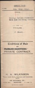
Conditions of sale by private contract dated 6th July 1932 between Bendigo Mutual Permanent Land and Building Society (seller) and J. Shade (buyer) for land situate Wood Street, California Gully, at present occupied by Mrs. Dumble as tenant, containing three roods thirty-five and two-tenths perches, having a frontage of 500 links to Wood Street by a depth of 193 links being Crown allotment 1 section P described in Crown grant volume 2129 folio 425693, together with 5-roomed weatherboard dwelling and all sundry. Also ''Lux'' wood fire stove, bath and venetian blinds. Price 340 pounds.organization, business, h.a. & s.r wilkinson real estate -
 Bendigo Historical Society Inc.
Document - H.A. & S.R. WILKINSON COLLECTION: CONTRACT OF SALE
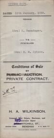
Conditions of sale by private contract dated 11th January, 1938 between Mrs. E. Banninger (seller) and Mrs. M.M. Spicer (buyer) for land situate in Wood Street, Long Gully, being Crown allotment 1 section P described in Crown grant volume 2129 folio 425693, together with 5-roomed weatherboard dwelling and all sundry, also bath, cement troughs and copper, wire doors, three venetian blinds, built in wardrobe, and vendor's interest in poultry pens built on land adjoining the above freehold, also all poultry and poultry farm equipment as per schedule on page 2. Price 550 pounds.organization, business, h.a. & s.r wilkinson real estate -
 Bendigo Historical Society Inc.
Document - H.A. & S.R. WILKINSON COLLECTION: CONTRACT OF SALE
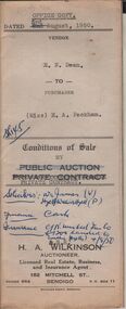
Conditions of sale by private contract dated 3rd August, 1950 between E.N. Dean (seller) and Miss E.A. Packham (buyer) for land situate No. 1 Dillon Street, Long Gully being Crown allotment 497 section K described in certificate of title volume 3999 folio 799707, together with 3-roomed weatherboard dwelling and all sundry. Price 1,650 pounds. Also attached letter dated 5th August, 1950 signed by Mr. Dean to Messrs. Williams, Watson & James solicitors advising them to pay Mr. H. Button of 28 Harrison Street, Bendigo the sum of 32 pounds from the proceeds of the sale of property.organization, business, h.a. & s.r wilkinson real estate -
 Bendigo Historical Society Inc.
Document - H.A. & S.R. WILKINSON COLLECTION: CONDITION OF SALE
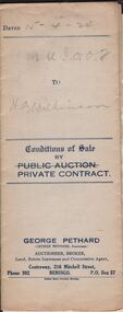
Conditions of sale by private contract issued by George Pethard dated 15th April, 1924, between George Pethard acting on behalf of The Manchester Unity Independent Order of Oddfellows Bendigo District Widows and Orphans Fund as Mortgagees and Henry Archibald Wilkinson (buyer), land situate at no. 121 Mundy Street Bendigo at present occupied by Mr. Spencer as tenant. Crown allotment 10 of section 8c Parish of Sandhurst city and county of Bendigo described in certificate of title volume 2732 folio 546267 having a frontage of 125 links by a depth of 200 links. Together with six-roomed brick house and all sundry. Price 500 pounds.organization, business, h.a. & s.r wilkinson real estate -
 Bendigo Historical Society Inc.
Document - H. A. & S. R. WILKINSON COLLECTION: CONTRACT OF SALE
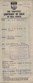
Contract of sale of real estate dated 11th February, 1966 between Mr. A. H. Bennett (vendor) and Mr. N. B. & Mrs. J. Scott. Solicitor for vendor: Messrs. Watson, James & Rogers, Bull Street, Bendigo. Solicitor for purchaser: Messrs. Watson, James & Rogers, Bull Street, Bendigo. Property 12 Bray Street, Bendigo being part of allotment 495, section K land described in Crown grant volume 7647, folio 097 together with all floor coverings, inside and outside blinds, including new holland blinds for lounge and front bedroom, curtains and electric light fittings and shades. Price 3,400 pounds.organization, business, h.a. & s.r wilkinson real estate -
 Bendigo Historical Society Inc.
Document - H. A. & S. R. WILKINSON COLLECTION: CONTRACT OF SALE
Contract of sale of real estate dated 18th December, 1963 between Mr G. A. & Mrs. N M. Wells (vendor) and Mr. H. G. & Mrs. M. E. Stephenson (purchaser). Property: 82 Hargreaves Street, corner Arnold Street, Bendigo, being lot 2 on plan of subdivision No. 28382 lodged in the office of titles, being part of Crown allotment 15 section 92C land described in certificate of title volume 4335 folio 826 together with floor coverings, blinds, curtains, electric light fittings and shades, gas stove in kitchen and gas fire heater in lounge room. Price: 3,250 pounds.organization, business, h.a. & s.r wilkinson real estate -
 Bendigo Historical Society Inc.
Document - H. A. & S. R. WILKINSON COLLECTION: CONTRACT OF SALE
Contract of sale of land dated 4th August, 1951 between Mr. R. J. Eddy (vendor) and Mrs. E. R. Tieman (purchaser). Property: land being part of Crown allotment 18 section 54C Parish of Sandhurst City of Bendigo, land comprised in certificate of title volume 7150 folio 1429983 and situate No. 30 Gratten Street, Bendigo, together with 5 roomed weatherboard dwelling, all sundry outbuildings, also all linen roller blinds, all linos on floors, gas bath-heather, gas copper, electric sink heather and all wire doors and windows screens. Price: 2,425 pounds.organization, business, h.a. & s.r wilkinson real estate -
 Bendigo Historical Society Inc.
Document - H. A. & S. R. WILKINSON COLLECTION: CONTRACT OF SALE
Conditions of sale by private contract dated 10th January, 1948 between Mrs. E. L. Gunn (vendor) and Mr. K. C. Turner (purchaser). Property: land situate No. 90 Ophir Street corner Rowan street, Bendigo, at present occupied by Mr. Sharp as tenant, being allotment 20 section 22S Parish of Sandhurst City of Bendigo land described in right to occupy residence area No. 4873, together with 6 roomed weatherboard dwelling, all sundry outbuildings on said land, except any of such outbuildings belonging to the tenant. Price: 450 pounds. Attached 3 hand written notes and 1 typed detailing repairs done to the property.organization, business, h.a. & s.r wilkinson real estate -
 Bendigo Historical Society Inc.
Document - JOHANSON COLLECTION: GRANT BY PURCHASE WILLIAM ROBERTS
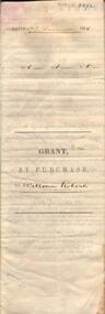
Legal document. On front: Dated 17th December 1855. Ac1 R1 P 1. ( acres, roods, perches ) Grant by purchase to William Roberts. In pencil Allot 7 of Sec 12. Inside: 'Victoria - Township Lot. Grantee W. Roberts. Document details purchase of land by above William Roberts of Heathcote, for the sum of two pounds, 12 shillings. Allotment 7, section 12, Township of Heathcote. Land sold as Lot 14. Dated 30 July 1855. Signed by C.W. Hotham ( Sir Charles Hotham ) Property is now 42 Beauchamp Street, Heathcote ( Landata research, 28.3.2017, https://www.landata.vic.gov.au/tpc_confirm_map.aspx?pfi=45257085 )heathcote, land sale, william roberts -
 Kew Historical Society Inc
Plan - Subdivision Plan, 10 Fine Villa Sites: Ermington Estate, Kew Heights, ca. 1917
Pru Sanderson, in her groundbreaking ‘City of Kew Urban Conservation Study : Volume 2 - Development History’ (1988), summarised the periods of urban development and subdivisions of land in Kew. The periods that she identified included 1845-1880, 1880-1893, 1893-1921, 1921-1933, 1933-1943, and Post-War Development. These periods were selected as they represented periods of rapid growth or decline in urban development. An obvious starting point for Sanderson’s groupings involved population growth and the associated economic cycles. These cycles also highlighted urban expansion onto land that was predominantly rural, although in other cases it represented the decline and breakup of large estates. A number of the plans in the Kew Historical Society’s collection can also be found in other collections, such as those of the State Library of Victoria and the Boroondara Library Service. A number are however unique to the collection.The Kew Historical Society collection includes almost 100 subdivision plans pertaining to suburbs of the City of Melbourne. Most of these are of Kew, Kew East or Studley Park, although a smaller number are plans of Camberwell, Deepdene, Balwyn and Hawthorn. It is believed that the majority of the plans were gifted to the Society by persons connected with the real estate firm - J. R. Mathers and McMillan, 136 Cotham Road, Kew. The Plans in the collection are rarely in pristine form, being working plans on which the agent would write notes and record lots sold and the prices of these. The subdivision plans are historically significant examples of the growth of urban Melbourne from the beginning of the 20th Century up until the 1980s. A number of the plans are double-sided and often include a photograph on the reverse. A number of the latter are by noted photographers such as J.E. Barnes.In November 1917, the Ermington Estate was advertised as an ‘Executor’s Sale’. It included the 10-roomed villa residence, ‘Ermington’, home of the late Mrs. Lorimer, and 10 ‘magnificent allotments’. The plan in the Kew Historical Society Collection is a little more specific. Ermington is described as having 9 Rooms &c. and there are 11 lots shown on the west side of Hillcrest Avenue. In the plan, the latter is named as ‘Hill Crest Avenue’. The plan indicates that the subdivision was based on the surveying work of Johnson & Tait. Opposite Ermington, the existing house ‘Parkhill’ is identified. A faded stamp on two parts of the plan indicates that it was in the possession of Jas. [R.] Mathers, Financial Agent, [136] Cotham Road, Kew.subdivision plans - kew, ermington heights estate - kew heights -
 Kew Historical Society Inc
Plan - Subdivision Plan, Jas R Mathers Son & McMillan, East Kew Tramway Estate, 1915
Pru Sanderson, in her groundbreaking ‘City of Kew Urban Conservation Study : Volume 2 - Development History’ (1988), summarised the periods of urban development and subdivisions of land in Kew. The periods that she identified included 1845-1880, 1880-1893, 1893-1921, 1921-1933, 1933-1943, and Post-War Development. These periods were selected as they represented periods of rapid growth or decline in urban development. An obvious starting point for Sanderson’s groupings involved population growth and the associated economic cycles. These cycles also highlighted urban expansion onto land that was predominantly rural, although in other cases it represented the decline and breakup of large estates. A number of the plans in the Kew Historical Society’s collection can also be found in other collections, such as those of the State Library of Victoria and the Boroondara Library Service. A number are however unique to the collection.The Kew Historical Society collection includes almost 100 subdivision plans pertaining to suburbs of the City of Melbourne. Most of these are of Kew, Kew East or Studley Park, although a smaller number are plans of Camberwell, Deepdene, Balwyn and Hawthorn. It is believed that the majority of the plans were gifted to the Society by persons connected with the real estate firm - J. R. Mathers and McMillan, 136 Cotham Road, Kew. The Plans in the collection are rarely in pristine form, being working plans on which the agent would write notes and record lots sold and the prices of these. The subdivision plans are historically significant examples of the growth of urban Melbourne from the beginning of the 20th Century up until the 1980s. A number of the plans are double-sided and often include a photograph on the reverse. A number of the latter are by noted photographers such as J.E. Barnes.The East Kew Tramway Estate was a subdivision of two separate parcels of land between Adeney Avenue and Normanby Road. The larger section included 54 lots facing Adeney Avenue, Argyle Road, and Campbell, Hunter and Wishart Streets. [Hunter and Wishart Streets were created as part of the subdivision.] A further 17 allotments faced Normanby Road, Hubert and Campbell Streets. [The name of Hubert Street was later to be changed to Cecil Street.] The promotion of the sale referred to the advantages of living between two tram routes, in High Street and Cotham Road. On the plan, quaintly drawn trams mark these routes. Also on the plan is the route of part of the Outer Circle [Railway] Line.east kew tramway estate, subdivision plans - east kew