Showing 27608 items
matching yarra-river
-
 Marysville & District Historical Society
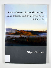
Book, Place-Names of the Alexandra, Lake Eildon and Big River Area of Victoria, 2003
Place names of the Alexandra, Lake Eildon and Big River areas in VictoriaPaperback. Front cover has a colour photograph named: 'Sunrise, Brooks Cutting near Alexandra', by Robert Douglas (2002). Back cover has a colour photograph of the author, Nigel Sinnott at McKenzie's Pinch, Alexandra (Mount Torbreck in background) by Robert Douglas (2002).To George Edwards / with best wishes, / Nigel Sinnott / 15 March 2003 To the memory of / Gordon BEATON (1911-88) / of Eildon / mycologist and engineer Stamp of Marysville & District / Historical Society Inc / P.O. Box 22 / Marysville 3779 geographical, victoria, big river region, eildon region, alexandra region, alexandra library, friends -
 Greensborough Historical Society
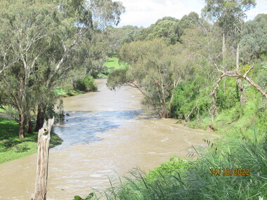
Photograph - Photograph - Digital Image, Peter Simmenauer, Plenty River floods near Plenty Lane 2022, 14/10/2022
Plenty River in flood near Plenty Lane October 2022 Greensborough. Colour digital photographDate stamped: 14/10/2022plenty lane greensborough, plenty river, floods -
 Greensborough Historical Society
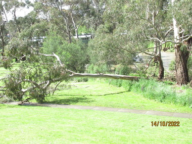
Photograph - Photograph - Digital Image, Peter Simmenauer, Plenty River floods near Plenty Lane 2022, 14/10/2022
Plenty River in flood near Plenty Lane Greensborough, October 2022. Colour digital photographDate stamped: 14/10/2022plenty lane greensborough, plenty river, floods -
 Greensborough Historical Society
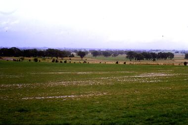
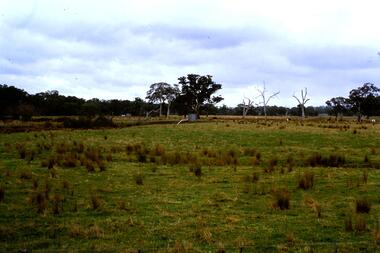
Slide - Photograph, John Ramsdale, Plenty River flood plain: Slide 95, 1990s
Photograph shows water over paddocks; Plenty River flood plain.Part of the John Ramsdale collection of slides and audio visual material.Colour photograph scanned from slide.No maker's marks. No caption on slide.plenty river, plenty river flood -
 Greensborough Historical Society
Slide - Photograph, John Ramsdale, Plenty River Trail: Slide 117, 1990s
Photograph shows a path leading into bushland, this is part of the Plenty River Trail.Part of the John Ramsdale collection of slides and audio visual material.Colour photograph scanned from slide.No maker's marks. No caption on slide.plenty river trail -
 Greensborough Historical Society
Slide - Photograph, John Ramsdale, Flood plain of the Plenty River: Slide 90, 1990s
Photograph shows farmland on the flood plain of the Plenty River, north of MerndaPart of the John Ramsdale collection of slides and audio visual material.Colour photograph scanned from slide.No maker's marks. Caption on slide "Plenty"plenty river, mernda -
 Greensborough Historical Society
Slide - Photograph, John Ramsdale, Run off into Plenty River: Slide 64, 1990s
Photograph shows water over ground. This is run off into the Plenty RiverPart of the John Ramsdale collection of slides and audio visual material.Colour photograph scanned from slide.No caption. Printed maker's mark on slide "Kodak Kodachrome Slide"plenty river -
 Greensborough Historical Society
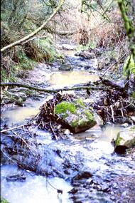
Slide - Photograph, John Ramsdale, Plenty River with low water flow: Slide 54, 1990s
Photograph shows the Plenty River with low water, rocks and fallen branchesPart of the John Ramsdale collection of slides and audio visual material.Colour photograph scanned from slide.No maker's marks. No caption on slide.plenty river -
 Greensborough Historical Society
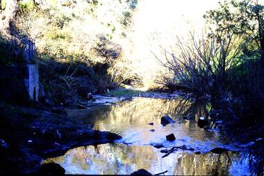
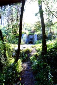
Slide - Photograph, John Ramsdale, Plenty River headwaters: Slide 65, 1990s
Photograph shows water near culvert or drain, this is the Plenty River headwaters.Part of the John Ramsdale collection of slides and audio visual material.Colour photograph scanned from slide.No maker's marks. No caption on slide.plenty river -
 Greensborough Historical Society
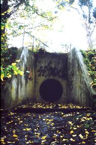
Slide - Photograph, John Ramsdale, Urban runoff into Plenty River: Slide 69, 1990s
Photograph shows a culvert or drain with graffiti. This is urban runoff into Plenty RiverPart of the John Ramsdale collection of slides and audio visual material.Colour photograph scanned from slide.No maker's marks. No caption on slide.plenty river -
 Greensborough Historical Society
Slide - Photograph, John Ramsdale, Trees and vegetation near Plenty River: Slide 75, 1990s
Photograph shows a bush scene with trees and undergrowth near Plenty River.Part of the John Ramsdale collection of slides and audio visual material.Colour photograph scanned from slide.No maker's marks. No caption on slide.vegetation, plenty river -
 Greensborough Historical Society
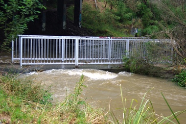
Photograph - Digital image, Plenty River in Flood 2017: The Footbridge, 14/12/2017
3 photographs of the Plenty River in flood, Greensborough. This flood was in December 2017.Digital copy of 3 colour photographs.plenty river, floods -
 Greensborough Historical Society
Photograph - Digital image, Plenty River in Flood 2017: Graffiti, 14/12/2017
Photograph of graffiti on the Plenty River bridge, Greensborough. This flood was in December 2017.Digital copy of colour photograph.plenty river, floods, graffiti -
 Greensborough Historical Society
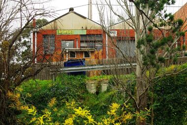
Photograph - Digital image, Marilyn Smith, Main Street mower shop from the river, 16/08/2015
The back of the mover shop on 125 Main Street, taken from the river.Digital copy of colour photographmain street greensborough -
 Stawell Historical Society Inc
Photograph, Bush Saw Mill on the Wimmera river 1887
Bush Saw Mill by Charles Nettleton. Wimmera River of Victorian 1887stawell manufacture -
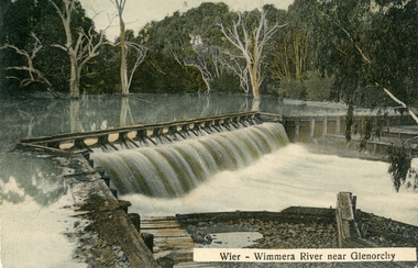
 Stawell Historical Society Inc
Postcard, Faux Weir on the Wimmera River near Lubeck 1909 -- Postcard
Faux Weir built across Wimmera River near Lubeck 1909water -
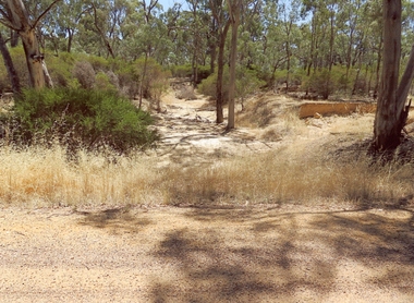 Stawell Historical Society Inc
Photograph, Dunmunkle Creek looking towards Wimmera River 2017 -- Coloured
Colour Photo of Dunmunkle Creek looking towards Wimmera River 2017water -
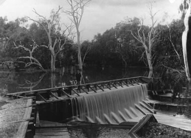
 Stawell Historical Society Inc
Postcard, Wimmera River Weir at Glenorchy -- Postcard
Wimmera River Weir Glenorchy with letter written on card and 1d stampwater -
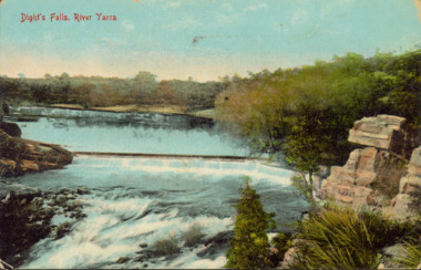 Kew Historical Society Inc
Postcard - Dight's Falls, River Yarra, c.1911
Dight’s Falls in Studley Park is an artificial weir built on a natural rock bar across the Yarra. The weir was built in the 1840s to provide water to the ‘Ceres’ flour-mill, one of the first in Victoria. The falls were later to become known as Dight’s Falls after the owners of the mill. Later, a pumping station was built on the Kew side of the river, which pumped water uphill to a reservoir in Walmer Street that provided water to the Melbourne Botanical Gardens and to Albert Park Lake. The area around Dight’s Falls was and is frequently used for recreational activities.Dated postcard allowing one to analyse the form of the Falls in 1911Colour postcard, of Dight's Falls on the River Yarra between Kew and Fairfield. The photograph is taken looking upstream towards the Falls from the Kew side, from the embankment in the vicinity of the Pumping Station. Obverse: "Dight's falls, Kew" Reverse: "Printed in Great Britain Writing in ink on Reverse: "31/3/1911 / To dear Nell with best wishes for a happy birthday from your old friend Eve / [Addressed to] "Mrs N Dunn, Prahran" Franked Victorian 1d stamp on Reverse top rightdight's falls, dight's falls - kew (vic) - fairfield (vic) -
 Orbost & District Historical Society
black and white photographs, Snowy River Mail, October 1987
In 3098.1 from L-R are John Pritchard and Graeme Rodier. Jeff Wilson is in 3098.2. Both photographs are connected to Adult Learning TAFE and CEP. These photographs were taken at the Curriculum and Technology in Schools workshop held in Bendigo, Victoria in October 1987. Eighty rural primary schools were involved including many from East Gippsland. From the Snowy River Mail; " A large number of technologies was......demonstrated at the conference. Participants were given hands on experience with audio and computer conferencing, CD Rom. an Invicon booth ( individual video console (INVICON) enables any teacher to produce short, relevant teaching videos for individual pupils without assistance), packet radio, videodisk, robotics and many more...." This is a pictorial record associated with education in Orbost.Two black / white photographs of two men seated at a desk with computers. The man on the right is holding a phone.education-east-gippsland tecnology -
 Port Melbourne Historical & Preservation Society
Map - Yarra River, Saltwater River and Coode's Canal, 1935
Plan No.7. Yarra River, Saltwater River, Coode's Canal area 1935.Signed Walker A.W.melbourne, a w walker, melbourne and metropolitan board of works, mmbw -
 Greensborough Historical Society
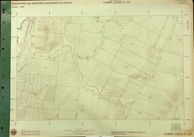
Map, Melbourne and Metropolitan Board of Works. Survey Division, MMBW, Yarra 2500 / 17.25. Hurstbridge, 1978_01
Melbourne and Metropolitan Board of Works. Yarra 2500 [base map] 17-26. Hurstbridge. Municipalities of Diamond Valley 257 and Eltham 238. Prominent streets include: Silvan Road and Hurstbridge Road. MMBW Map in 1:2500 [scale] series. Cream parchment with green tape reinforcing on edges and punched holes on left edge.mmbw, melbourne and metropolitan board of works, shire of diamond valley, hurstbridge - maps -
Port Melbourne Historical & Preservation Society
Book, Meyer Eidelson, "Yalukit Willam - The River People of Port Phillip", Feb 2015
Written as part of the City's reconciliation program and with the assistance of Carolyn Briggs over a two year program."Yalukit Willam - The River People of Port Phillip" by Meyer Eidelson: illustrated soft cover, 99 pages plus fold out map at back cover is WFE Liardet watercolour of Emerald Hill corroboree and history of Koori activity pre and during European occupationSigned IFC by author, and Carolyn Briggs, Boon Wurrung Foundation, "yours with respect"australian aborigines, parks and gardens, natural environment, meyer eidelson, carolyn briggs, derrimut, yalukit willam clan, boon wurrung, kulin nation, bunjil, george robinson, ben bow, louisa briggs, wilbraham frederick evelyn liardet, wfe liardet, josephine liardet, emerald hill, william buckley, kurburu (the bear) -
 Greensborough Historical Society
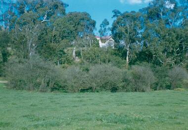
Photograph - Digital Image, Blackjack from the river flats below, 1954_
Blackjack from the river flats below. The Blackjack property, house and acres of fruit orchards ran down to the Plenty River off Hume Street Greensborough and was the home of the Robinson family to late 1956. The photographs were taken as slides by Frank Robinson and digitised by his son James in 2015.Digital copy of colour photograph.blackjack, robinson family -
 Greensborough Historical Society
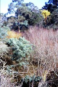
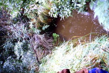
Slide - Photograph, John Ramsdale, Source of the Plenty River: Slide 32, 1990s
Photograph of the source of the Plenty River at Bruces Creek Whittlesea showing water and vegetation.Part of the John Ramsdale collection of slides and audio visual material.Colour photograph scanned from slide.No maker's marks. No caption on slide.plenty river, vegetation, whittlesea -
 Greensborough Historical Society
Slide - Photograph, John Ramsdale, Drain into Plenty River: Slide 71, 1990s
Photograph shows a culvert or drain with graffiti - long view This drains into the Plenty River.Part of the John Ramsdale collection of slides and audio visual material.Colour photograph scanned from slide.No maker's marks. No caption on slide.plenty river -
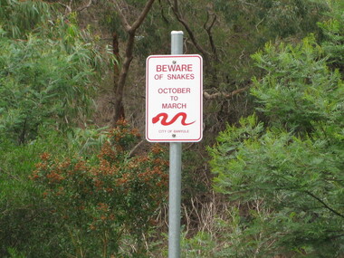 Greensborough Historical Society
Photograph - Digital image, Dennis Ward, Snake sign on the Plenty River Trail, 27/03/2010
Sign on Plenty River Trail at Greensborough warning of snakes from October to March.Digital copy of colour photograph.plenty river, plenty river trail -
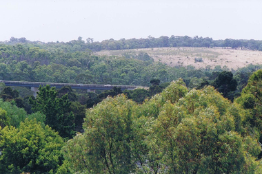 Greensborough Historical Society
Photograph - Digital image, Frank Solomon, View over Greensborough to Plenty River Drive bridge, 2010c
View over trees to the Greensborough By-pass bridge over Plenty River Drive.Digital copy of colour photographplenty river drive, greensborough bypass -
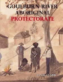 Ballarat Heritage Services
Book, Ian Clark, 'Goulburn River Aboriginal Protectorate' By Ian Clark
Gouburn River Aboriginal Protectorate was published by BHS Publishing and written by Ian Clark. gouldburn river, aboriginal protectorate, aborigines, le souef, ian clark -
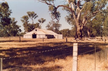 Stawell Historical Society Inc
Photograph, "Woodlands" Homestead on Wimmera River near Crowlands -- Shearing Shed -- Coloured
Coloured Photo of Shearing Shed at Woodlands Homestead on Wimmera River near Crowlandsstawell