Showing 111996 items
matching road
-
 Bacchus Marsh & District Historical Society
Map, Plan of land purchased by the Bacchus Marsh Shire Council from Mr. T. Low for a deviation of the Melbourne to Ballarat main road. 1877
The date of this plan is 1877 and the land indicted on it required for a road deviation is shaded in blue. It adjoins the Korkuperrimul Creek on one side which indicates the land is located just a few kilometers to the west of Bacchus Marsh. Single page map showing a portion of land purchased by the Bacchus Marsh Shire from Mr Thomas Low for the purpose of a road deviation. Land held by David Robertson is also shown on the map. Scale: 2 chains to 1 inch. Part of a set of maps which are pasted into a bound volume containing 76 maps or plans in total. High resolution digital image stored on BMDHS computer network. Surveyed by W. E. Standfield, Shire Engineer, Bacchus Marsh, 12/4/77bacchus marsh roads and streets, melbourne to ballarat road -
 Melbourne Tram Museum
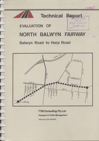
Document - Report, TTM Consulting, "Evaluation of North Balwyn Fairway, Balwyn Road to Harp Road", May. 1985
Approx a 70 page, comb bound, report by TTM Consulting in May 1985, titled "Evaluation of North Balwyn Fairway, Balwyn Road to Harp Road" for the Public Transport Corporation. Evaluates the impact of a Fairway along the North Balwyn tram route. Principal conclusions given on page - tram travel times in both AM and PM peaks were virtually unchanged. Document has many tables at rear, graphs and maps.Stamped on cover and inside page "Discarded from PTC Library 19 Oct 1989" and "1985" in red ink on front cover.trams, tramways, north balwyn, fairways, traffic control, tram priority -
 Lara RSL Sub Branch
Photograph, Burlington J Macintyre 45 Walkers Road Lara
Burlington J Macintyre 45 Walkers Road Lara (picture) -
 Lorne Historical Society
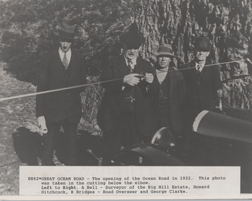
Photograph, Opening of Great Ocean Road by Howard Hitchcock 1932
A. Bell, surveyor,Photograph of Opening of Great Ocean Road 1932 by Howard Hitchcockgor opening 1932. a. bell surveyor. big hill estate. howard hitchock. george clarke -
 Lorne Historical Society
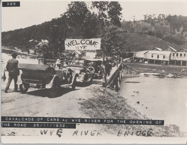
Photograph, Cavalcade of cars at Wye River Road Opening 26th November 1932
Cavalcade of cars for opening of the road at Wye River November 1932 g.o.r. opening, cavalcade of cars, wye river bridge -
 Eltham District Historical Society Inc
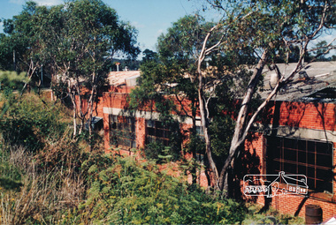
Photograph, Shoestring' Metery Road, Eltham 1990, 1990
Colour photograph of 'Shoestring' Metery Road, Elthamshowing gateway 1990.houses, shoestring, metery road, eltham -
 Eltham District Historical Society Inc
Photograph, Hat Factory, Sherbourne Road, Eltham
Six coloured photographs of Latiner's hat factory, Sherbourne Roadindustry, hat factory, sherbourne road, eltham, latiner -
 Eltham District Historical Society Inc
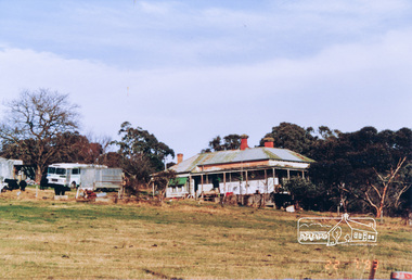
Photograph, Murray Road, Wattle Glen
Colour photograph of old house Murray Road, Wattle Glenwattle glen, murray road, houses -
 Eltham District Historical Society Inc
Photograph, Main Road, Eltham near Dudley Street
Three colour photographs of Main Road, Eltham at Dudley Streetmain road, dudley street, eltham -
 Eltham District Historical Society Inc
Photograph, Town Park, Main Road, Eltham
Colour photograph of Eltham Town Park near Main Roadmain road, eltham, twon park -
 Ringwood and District Historical Society
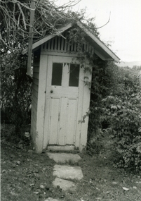
Photograph-B&W, Hill's Dairy, Canterbury Road, Ringwood 1989-Outside Toilet, 6/07/1989
Hill's Dairy, Canterbury Road, Ringwood 1989-Outside ToiletToilet -
 Ringwood and District Historical Society
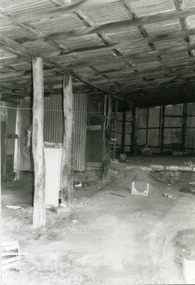
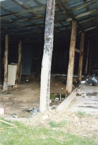
Photograph-B&W, Hill's Dairy, Canterbury Road, Ringwood 1989-Barn interior, 6/07/1989
Hill's Dairy, Canterbury Road, Ringwood 1989-Barn interiorInside the Barn -
 Ringwood and District Historical Society
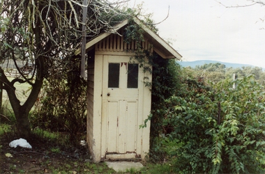
Photograph-Colour, Hill's Dairy, Canterbury Road, Ringwood 1989-Outside Toilet, 6/07/1989
Hill's Dairy, Canterbury Road, Ringwood 1989-Outside ToiletToilet -
 Ringwood and District Historical Society
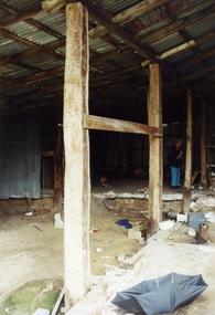
Photograph-Colour, Hill's Dairy, Canterbury Road, Ringwood 1989-Barn Interior, 6/07/1989
Hill's Dairy, Canterbury Road, Ringwood 1989-Barn InteriorHill's Dairy / Inside the Barn -
 Ringwood and District Historical Society
Photograph-Colour, Hill's Dairy, Canterbury Road, Ringwood 1989-Barn Interior, 6/07/1989
Hill's Dairy, Canterbury Road, Ringwood 1989-Barn InteriorHill's Dairy Barn -
 Ringwood and District Historical Society
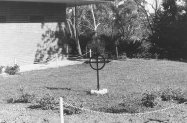
Photograph, The Garden of Remembrance at Church of England Church in Warrandyte Road, Ringwood in 1974, 1974
The Garden of Remembrance at Church of England Church in Warrandyte Road in 1974Written on back of photograph, "C. of E. ash plot, Jan. 1974. Cross is from old church in Ringwood St." -
 Ringwood and District Historical Society
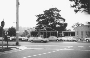
Photograph, Church of Christ Church in Bedford Road, Ringwood being built in 1978, 1978
Church of Christ Church in Bedford Road being built in 1978Written on back of photograph, "Church of Christ, Bedford Rd. 1/5/78" -
 Ringwood and District Historical Society
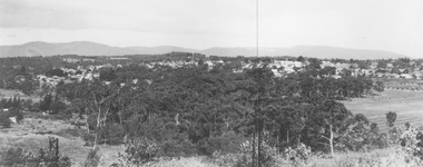
Photograph, View from Loughnan Road towards centre of Ringwood - undated
View from Loughnan Road towards centre of Ringwood - undated. -
Whitehorse Historical Society Inc.
Map, Springvale Road, c1970
Enlarged aerial photo of intersection of Springvale and Whitehorse Roads, Nunawading.Enlarged aerial photo of intersection of Springvale and Whitehorse Roads, Nunawading.Enlarged aerial photo of intersection of Springvale and Whitehorse Roads, Nunawading.springvale road, nunawading, whitehorse road, nunawading, maroondah highway, nunawading, aerial photographs -
 Whitehorse Historical Society Inc.
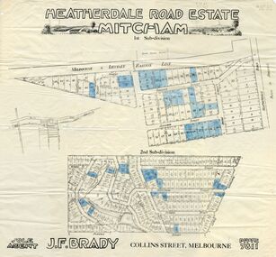
Document, Heatherdale Road Estate, ??
Plans of 1st and 2nd subdivision of Heatherdale Road estatePlans of 1st and 2nd subdivision of Heatherdale Road estate, Mitcham.Plans of 1st and 2nd subdivision of Heatherdale Road estateland subdivision, purches street, mitcham, northcote street, linlithgow street, denman street, fuller street, stanley grove, dudley street, munro street, irvine street, forster street, ferguson street, talbot street, heatherdale road -
Whitehorse Historical Society Inc.
Document, Canterbury Road estate, Unknown
Plan of subdivision of land for sale in Canterbury Road estate, Blackburn.land subdivision, canterbury road estate, blackburn, main street, norvel street, kalka street, arna street, lalwa street, ronley street, eustace street -
 Whitehorse Historical Society Inc.
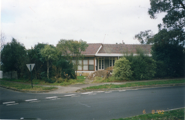
Photograph, Whitehorse Road, Mitcham No.734, 1/08/2002 12:00:00 AM
Coloured photograph of house to be demolished - 734 Whitehorse Road, Mitcham.demolition site, whitehorse road, mitcham no.734 -
 Whitehorse Historical Society Inc.
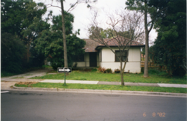
Photograph, Whitehorse Road, Mitcham No.712, 6/08/2002 12:00:00 AM
Coloured photograph of house for demolition - 712 Whitehorse Road, Mitchamdemolition site -
 Whitehorse Historical Society Inc.
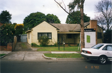
Photograph, Whitehorse Road, Mitcham No.706
Coloured photograph of house for Demolition - 706 Whitehorse Road, Mitcham.demolition site, whitehorse road, mitcham no.706 -
 Whitehorse Historical Society Inc.
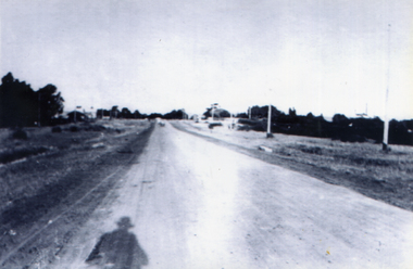
Photograph, Whitehorse Road, Tunstall, looking east
Series of photographs loaned for copying by Robert Collier through Keith Rooney. Photographs have been scanned by Ted Arrowsmith at 300dpi as a 'tiff' and burnt onto a CD Rom. copies of photographs were produced from the CD Rom for inclusion in the album.Black and white photograph of Whitehorse Road, Tunstall, looking east.whitehorse road, tunstall -
 Whitehorse Historical Society Inc.
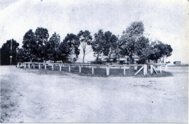
Photograph, Plantation - Whitehorse Road Mitcham
Series of photographs loaned for copying by Robert Collier through Keith Rooney. Photographs have been scanned by Ted Arrowsmith at 300dpi as a 'tiff' and burnt onto a CD Rom. copies of photographs were produced from the CD Rom for inclusion in the album.Black and white photograph of the plantation in Whitehorse Road Mitcham c1920.whitehorse road, mitcham, plantations -
 Whitehorse Historical Society Inc.
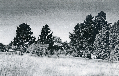
Photograph, Towards Mt Pleasant Road, c1960
Photographs relate to the Poultry Farms that existed in Nunawading and Forest Hill in the1950s and 1960s. Photos taken in 1961-62. Poultry farmers included Messrs Boyce, Gallos, Foote,Grimsley, Greenwood and Dudley|Slides scanned as a 'tiff' at 300dpi to CD Rom and cleaned and adjusted by Ted Arrowsmith.Looking towards Pleasant Road from Mr. Boyle's orchard.eckermann's, eckermann frank, poultry farm, nunawading, greenwood, forest hill, canterbury road, mount pleasant road nunawading, boyles, white, bruer's -
 Whitehorse Historical Society Inc.
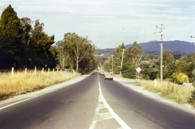
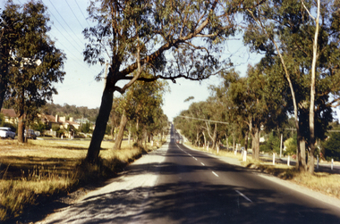
Photograph, Canterbury Road, Vermont, C.1967, C.1967
Part of Tim Shambrook's Collection for 'This is Vermont'. Not used.Coloured photo of Canterbury Road, Vermont, looking East in 1967.canterbury road, vermont, shambrook, tim -
 Whitehorse Historical Society Inc.
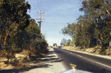
Photograph, Canterbury Road, Vermont, C.1967
Part of Tim Shambrook's Collection for 'This is Vermont'. Not used.Coloured photo of Canterbury Road, Vermont in 1967, looking West.canterbury road, vermont, shambrook, tim -
 Whitehorse Historical Society Inc.
Photograph, Canterbury Road, Vermont, C.1967, C.1967
Part of Tim Shambrook's Collection for 'This is Vermont'. Not used.Coloured photo of Canterbury Road, Vermont in 1967, looking West.canterbury road, vermont, shambrook, tim