
Showing 3120 items matching "parks victoria"
-
 Eltham District Historical Society Inc
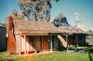
Photograph, Autumn Excursion, Hume and Hovell's 1824 expedition, 26 May 1996, 26/05/1996
... Victoria. The Society would follow a series of monuments erected for the 1924 centenary of the expedition from King Parrot Creek (Tuesday 7th December 1824), through Strath Creek, over Sunday Creek (Sunday 12th December 1824) at Broadford, Tullamarine, St Albans, Deer Park, through Werribee, skirting east of the You Yangs to Lara and Avalon Beach. ...Victoria. The Society would follow a series of monuments erected for the 1924 centenary of the expedition from King Parrot Creek (Tuesday 7th December 1824), through Strath Creek, over Sunday Creek (Sunday 12th December 1824) at Broadford, Tullamarine, St Albans, Deer Park, through Werribee, skirting east of the You Yangs to Lara and Avalon Beach. ...[article by Bettina Woodburn in EDHS Newsletter No. 109, July 1996:] ON THE TRAIL OF HUME AND HOVELL - REPORT ON THE AUTUMN EXCURSION - On a green and fresh morning (Sunday 26th May 1996) the Cobb and Co coach (driven by the most obliging Peter Tampion) set off in a north easterly direction from Eltham to connect with Hume and Hovell's route on their 1824 explorations of central Victoria. The Society would follow a series of monuments erected for the 1924 centenary of the expedition from King Parrot Creek (Tuesday 7th December 1824), through Strath Creek, over Sunday Creek (Sunday 12th December 1824) at Broadford, Tullamarine, St Albans, Deer Park, through Werribee, skirting east of the You Yangs to Lara and Avalon Beach. Because their distance-measuring wheel had broken and a one degree mistake was made in calculations, the two leaders of the original group of six convict-companions arrived at Corio Bay, instead of the expected Western Port, discovered earlier by Flinders. From below Mt. Disappointment (Hume and Hovell's difficulties in "scrambling over brush and rock", "leeches in forest, as well as no water", "cutting grass 4-5 ft. high", dreadful scrub", "devil flies") we took an easier route, saw the Strath Creek memorial in ground fog and a wonderful "field of dreams", the Hume-Hovell privately owned cricket ground with its white picket boundary fence. Now, after a steep climb, in sunshine under gums we stretched and viewed magnificent rolling hills and fog-filled valleys - not "smoke from Aborigines' bush fires". After morning tea at Broadford we followed the Sunday Creek valley beside the Hume Freeway, passed the Wallan Wallan Rest Area (more appropriately Hume and Hovell Rest Area) to tum right at Beveridge. In Gellibrand Hill Park, near the headwaters of the Moonee Ponds Creek, we experienced the landscape the first European settlers saw - huge river red gums and rolling pastures. The gardens and sheltered courtyard of the 1840s, timber, brought from .....[?] prefabricated Woodlands Homestead, provided a pleasant lunch stop. We enjoyed a private tour, panoramic views over Melbourne and surroundings and the excitement of arriving and departing aircraft. Our next river crossing was at Werribee, "in a vast treeless plain", then we drove on by-ways no coach had previously travelled, to find "an immense sheet of water" salty Corio Bay, off-course to the west. In late afternoon of a super, calm, late autumn day we headed homewards. Back at Eltham we were rather surprised to find that we had travelled a total of 347 km. Thanks again to Russell Yeoman for his research and organization. What a wonderful day! Colour photographactivities, hume and hovell -
 Eltham District Historical Society Inc
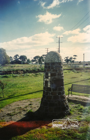
Photograph, Autumn Excursion, Hume and Hovell's 1824 expedition, 26 May 1996, 26/05/1996
... Victoria. The Society would follow a series of monuments erected for the 1924 centenary of the expedition from King Parrot Creek (Tuesday 7th December 1824), through Strath Creek, over Sunday Creek (Sunday 12th December 1824) at Broadford, Tullamarine, St Albans, Deer Park, through Werribee, skirting east of the You Yangs to Lara and Avalon Beach. ...Victoria. The Society would follow a series of monuments erected for the 1924 centenary of the expedition from King Parrot Creek (Tuesday 7th December 1824), through Strath Creek, over Sunday Creek (Sunday 12th December 1824) at Broadford, Tullamarine, St Albans, Deer Park, through Werribee, skirting east of the You Yangs to Lara and Avalon Beach. ...[article by Bettina Woodburn in EDHS Newsletter No. 109, July 1996:] ON THE TRAIL OF HUME AND HOVELL - REPORT ON THE AUTUMN EXCURSION - On a green and fresh morning (Sunday 26th May 1996) the Cobb and Co coach (driven by the most obliging Peter Tampion) set off in a north easterly direction from Eltham to connect with Hume and Hovell's route on their 1824 explorations of central Victoria. The Society would follow a series of monuments erected for the 1924 centenary of the expedition from King Parrot Creek (Tuesday 7th December 1824), through Strath Creek, over Sunday Creek (Sunday 12th December 1824) at Broadford, Tullamarine, St Albans, Deer Park, through Werribee, skirting east of the You Yangs to Lara and Avalon Beach. Because their distance-measuring wheel had broken and a one degree mistake was made in calculations, the two leaders of the original group of six convict-companions arrived at Corio Bay, instead of the expected Western Port, discovered earlier by Flinders. From below Mt. Disappointment (Hume and Hovell's difficulties in "scrambling over brush and rock", "leeches in forest, as well as no water", "cutting grass 4-5 ft. high", dreadful scrub", "devil flies") we took an easier route, saw the Strath Creek memorial in ground fog and a wonderful "field of dreams", the Hume-Hovell privately owned cricket ground with its white picket boundary fence. Now, after a steep climb, in sunshine under gums we stretched and viewed magnificent rolling hills and fog-filled valleys - not "smoke from Aborigines' bush fires". After morning tea at Broadford we followed the Sunday Creek valley beside the Hume Freeway, passed the Wallan Wallan Rest Area (more appropriately Hume and Hovell Rest Area) to tum right at Beveridge. In Gellibrand Hill Park, near the headwaters of the Moonee Ponds Creek, we experienced the landscape the first European settlers saw - huge river red gums and rolling pastures. The gardens and sheltered courtyard of the 1840s, timber, brought from .....[?] prefabricated Woodlands Homestead, provided a pleasant lunch stop. We enjoyed a private tour, panoramic views over Melbourne and surroundings and the excitement of arriving and departing aircraft. Our next river crossing was at Werribee, "in a vast treeless plain", then we drove on by-ways no coach had previously travelled, to find "an immense sheet of water" salty Corio Bay, off-course to the west. In late afternoon of a super, calm, late autumn day we headed homewards. Back at Eltham we were rather surprised to find that we had travelled a total of 347 km. Thanks again to Russell Yeoman for his research and organization. What a wonderful day! Colour photographactivities, hume and hovell -
 Eltham District Historical Society Inc
Slide, Maroondah Aqueduct, Research, Victoria, 22 Mar. 1981
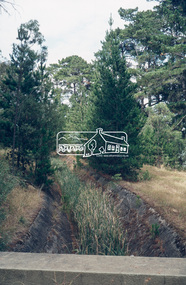
... park. The Maroondah Aqueduct is considered to be an important historic structure, not just to the local area but to the metropolitan area generally. It is considered important to preserve substantially intact long lengths of the disused aqueduct, together with its bridges and other associated structures. Activities Heritage Excursion Maroondah Aqueduct Research (Vic.) Shire of Eltham Historical Society 35 mm colour positive transparency (1 of 5) Mount - Agfachrome Agfa CS System black 8 dots Maroondah Aqueduct, Research, Victoria ...An inspection tour of the Maroondah Aqueduct was undertaken by the Shire of Eltham Historical Society on Sunday, March 22nd, 1981, commening where the aqueduct crosses Main Rd., Research, just below Eltham College. The Maroondah Aqueduct was part of Melbourne’s water supply system. It carried water over the 66 km from the Maroondah Reservoir on the Watts River at Healesville to the Preston Reservoir. Of this length, 41 km were open channel, 10 km, tunnel through hills and 15 km in 14 inverted siphons across stream valleys. The route of the aqueduct is north of Tarrawarra and Yarra Glen, along the Yarra escarpment south of Christmas Hills and crossing Watsons Creek into the present Shire of Eltham near Henley Rd. The eastern part of the route lies entirely within the former boundaries of the shire. The aqueduct passes south of Kangaroo Ground to Research and crosses the Diamond Creek by siphon at Allendale Rd., Eltham North. It then extends to Reservoir via St. Helena, Greensborough North and Bundoora. Water first flowed through the aqueduct in February 1891 when it was fed by a diversion weir on the Watts River. Records of the building of the aqueduct indicate that it was a significant construction achievement. The present Maroondah Reservoir was completed in 1927 and the aqueduct was enlarged at that time to take increased flows. About 1971 the section of the aqueduct through and north of Research was replaced by a large pipe and that section of the channel is now unused. The channel has remained largely intact (unlike sections at Greensborough and Bundoora where long lengths of the disused aqueduct have been demolished or filled in). The M.M.B.W. relinquished control of the disused aqueduct reserve which is crown land and the Shire of Eltham took control of this section of the reserve as a linear park. The Maroondah Aqueduct is considered to be an important historic structure, not just to the local area but to the metropolitan area generally. It is considered important to preserve substantially intact long lengths of the disused aqueduct, together with its bridges and other associated structures. 35 mm colour positive transparency (1 of 5) Mount - Agfachrome Agfa CS System black 8 dotsactivities, heritage excursion, maroondah aqueduct, research (vic.), shire of eltham historical society -
 Eltham District Historical Society Inc
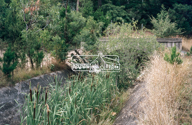
Slide, Maroondah Aqueduct, Research, Victoria, 22 Mar. 1981
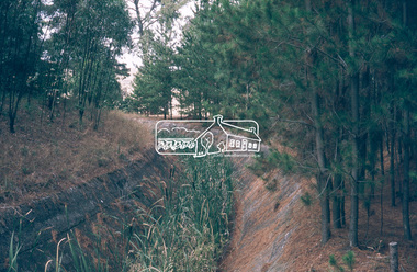
... park. The Maroondah Aqueduct is considered to be an important historic structure, not just to the local area but to the metropolitan area generally. It is considered important to preserve substantially intact long lengths of the disused aqueduct, together with its bridges and other associated structures. activities heritage excursion maroondah aqueduct research (vic.) shire of eltham historical society 35 mm colour positive transparency (1 of 5) Mount - Agfachrome Agfa CS System black 8 dots Maroondah Aqueduct, Research, Victoria Slide Slide ...An inspection tour of the Maroondah Aqueduct was undertaken by the Shire of Eltham Historical Society on Sunday, March 22nd, 1981, commening where the aqueduct crosses Main Rd., Research, just below Eltham College. The Maroondah Aqueduct was part of Melbourne’s water supply system. It carried water over the 66 km from the Maroondah Reservoir on the Watts River at Healesville to the Preston Reservoir. Of this length, 41 km were open channel, 10 km, tunnel through hills and 15 km in 14 inverted siphons across stream valleys. The route of the aqueduct is north of Tarrawarra and Yarra Glen, along the Yarra escarpment south of Christmas Hills and crossing Watsons Creek into the present Shire of Eltham near Henley Rd. The eastern part of the route lies entirely within the former boundaries of the shire. The aqueduct passes south of Kangaroo Ground to Research and crosses the Diamond Creek by siphon at Allendale Rd., Eltham North. It then extends to Reservoir via St. Helena, Greensborough North and Bundoora. Water first flowed through the aqueduct in February 1891 when it was fed by a diversion weir on the Watts River. Records of the building of the aqueduct indicate that it was a significant construction achievement. The present Maroondah Reservoir was completed in 1927 and the aqueduct was enlarged at that time to take increased flows. About 1971 the section of the aqueduct through and north of Research was replaced by a large pipe and that section of the channel is now unused. The channel has remained largely intact (unlike sections at Greensborough and Bundoora where long lengths of the disused aqueduct have been demolished or filled in). The M.M.B.W. relinquished control of the disused aqueduct reserve which is crown land and the Shire of Eltham took control of this section of the reserve as a linear park. The Maroondah Aqueduct is considered to be an important historic structure, not just to the local area but to the metropolitan area generally. It is considered important to preserve substantially intact long lengths of the disused aqueduct, together with its bridges and other associated structures. 35 mm colour positive transparency (1 of 5) Mount - Agfachrome Agfa CS System black 8 dotsactivities, heritage excursion, maroondah aqueduct, research (vic.), shire of eltham historical society -
 Eltham District Historical Society Inc
Slide, Maroondah Aqueduct, Research, Victoria, 22 Mar. 1981
... park. The Maroondah Aqueduct is considered to be an important historic structure, not just to the local area but to the metropolitan area generally. It is considered important to preserve substantially intact long lengths of the disused aqueduct, together with its bridges and other associated structures. activities heritage excursion maroondah aqueduct research (vic.) shire of eltham historical society 35 mm colour positive transparency (1 of 5) Mount - Agfachrome Agfa CS System black 8 dots Maroondah Aqueduct, Research, Victoria Slide Slide ...An inspection tour of the Maroondah Aqueduct was undertaken by the Shire of Eltham Historical Society on Sunday, March 22nd, 1981, commening where the aqueduct crosses Main Rd., Research, just below Eltham College. The Maroondah Aqueduct was part of Melbourne’s water supply system. It carried water over the 66 km from the Maroondah Reservoir on the Watts River at Healesville to the Preston Reservoir. Of this length, 41 km were open channel, 10 km, tunnel through hills and 15 km in 14 inverted siphons across stream valleys. The route of the aqueduct is north of Tarrawarra and Yarra Glen, along the Yarra escarpment south of Christmas Hills and crossing Watsons Creek into the present Shire of Eltham near Henley Rd. The eastern part of the route lies entirely within the former boundaries of the shire. The aqueduct passes south of Kangaroo Ground to Research and crosses the Diamond Creek by siphon at Allendale Rd., Eltham North. It then extends to Reservoir via St. Helena, Greensborough North and Bundoora. Water first flowed through the aqueduct in February 1891 when it was fed by a diversion weir on the Watts River. Records of the building of the aqueduct indicate that it was a significant construction achievement. The present Maroondah Reservoir was completed in 1927 and the aqueduct was enlarged at that time to take increased flows. About 1971 the section of the aqueduct through and north of Research was replaced by a large pipe and that section of the channel is now unused. The channel has remained largely intact (unlike sections at Greensborough and Bundoora where long lengths of the disused aqueduct have been demolished or filled in). The M.M.B.W. relinquished control of the disused aqueduct reserve which is crown land and the Shire of Eltham took control of this section of the reserve as a linear park. The Maroondah Aqueduct is considered to be an important historic structure, not just to the local area but to the metropolitan area generally. It is considered important to preserve substantially intact long lengths of the disused aqueduct, together with its bridges and other associated structures. 35 mm colour positive transparency (1 of 5) Mount - Agfachrome Agfa CS System black 8 dotsactivities, heritage excursion, maroondah aqueduct, research (vic.), shire of eltham historical society -
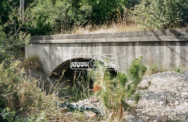 Eltham District Historical Society Inc
Slide, Maroondah Aqueduct, Research, Victoria, 22 Mar. 1981
... park. The Maroondah Aqueduct is considered to be an important historic structure, not just to the local area but to the metropolitan area generally. It is considered important to preserve substantially intact long lengths of the disused aqueduct, together with its bridges and other associated structures. activities heritage excursion maroondah aqueduct research (vic.) shire of eltham historical society 35 mm colour positive transparency (1 of 5) Mount - Agfachrome Agfa CS System black 8 dots Maroondah Aqueduct, Research, Victoria Slide Slide ...An inspection tour of the Maroondah Aqueduct was undertaken by the Shire of Eltham Historical Society on Sunday, March 22nd, 1981, commening where the aqueduct crosses Main Rd., Research, just below Eltham College. The Maroondah Aqueduct was part of Melbourne’s water supply system. It carried water over the 66 km from the Maroondah Reservoir on the Watts River at Healesville to the Preston Reservoir. Of this length, 41 km were open channel, 10 km, tunnel through hills and 15 km in 14 inverted siphons across stream valleys. The route of the aqueduct is north of Tarrawarra and Yarra Glen, along the Yarra escarpment south of Christmas Hills and crossing Watsons Creek into the present Shire of Eltham near Henley Rd. The eastern part of the route lies entirely within the former boundaries of the shire. The aqueduct passes south of Kangaroo Ground to Research and crosses the Diamond Creek by siphon at Allendale Rd., Eltham North. It then extends to Reservoir via St. Helena, Greensborough North and Bundoora. Water first flowed through the aqueduct in February 1891 when it was fed by a diversion weir on the Watts River. Records of the building of the aqueduct indicate that it was a significant construction achievement. The present Maroondah Reservoir was completed in 1927 and the aqueduct was enlarged at that time to take increased flows. About 1971 the section of the aqueduct through and north of Research was replaced by a large pipe and that section of the channel is now unused. The channel has remained largely intact (unlike sections at Greensborough and Bundoora where long lengths of the disused aqueduct have been demolished or filled in). The M.M.B.W. relinquished control of the disused aqueduct reserve which is crown land and the Shire of Eltham took control of this section of the reserve as a linear park. The Maroondah Aqueduct is considered to be an important historic structure, not just to the local area but to the metropolitan area generally. It is considered important to preserve substantially intact long lengths of the disused aqueduct, together with its bridges and other associated structures. 35 mm colour positive transparency (1 of 5) Mount - Agfachrome Agfa CS System black 8 dotsactivities, heritage excursion, maroondah aqueduct, research (vic.), shire of eltham historical society -
 Eltham District Historical Society Inc
Newsletter, Eltham District Historical Society, Newsletter, No. 240 June 2018
... Contents: • Past, Present, Future by Jim Connor • Our Next Meeting – Wednesday 13th June 2018 • July Excursion – Along the Diamond Creek • Eltham 1950s – Childhood Reminiscences – Part 4 by Ann Constable • Lavender Park Road Mysteries by Heather Eastman • Was the David Clark “Victoria’s Mayflower”? ...Contents: • Past, Present, Future by Jim Connor • Our Next Meeting – Wednesday 13th June 2018 • July Excursion – Along the Diamond Creek • Eltham 1950s – Childhood Reminiscences – Part 4 by Ann Constable • Lavender Park Road Mysteries by Heather Eastman • Was the David Clark “Victoria’s Mayflower”? ...Contents: • Past, Present, Future by Jim Connor • Our Next Meeting – Wednesday 13th June 2018 • July Excursion – Along the Diamond Creek • Eltham 1950s – Childhood Reminiscences – Part 4 by Ann Constable • Lavender Park Road Mysteries by Heather Eastman • Was the David Clark “Victoria’s Mayflower”? by Irene Kearsey • Jalna Yoghurt by Wendy Wilson • Office Bearers 2018-2019 • Subscriptions • Andrew Ross Museum • New Life Members by Russell Yeoman • Contacts for the Eltham District Historical Society The Shire of Eltham Historical Society was formed in October 1967. The first newsletter of the Society was issued May 1978 and has been published continuously ever since on a bi-monthly basis. With the cessation of the Shire of Eltham in late 1994, the Society's name was revised to Eltham District Historical Society and this name first appeared with issue No. 103, July 1995. The collection of the Society's newsletters provides a valuable resource on the history of the Society's activities, office bearers and committee members, guest speakers and subjects of historical interest pertinent to the former Shire of Eltham and the Eltham District.A4 newsletter distributed to membersnewsletter, eltham district historical society -
 Bendigo Military Museum
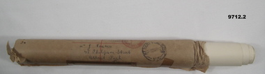
Memorabilia - MEMORIAL SCROLL, Australian Army Medal Section, c.1942
... Coates, 45 Philipson Street, Albert Park, Vi If not delivered return address "Army Medal Section, Victoria Barracks, Melbourne, Australia” ...Coates, 45 Philipson Street, Albert Park, Vi If not delivered return address "Army Medal Section, Victoria Barracks, Melbourne, Australia” White paper scroll rolled up and contained in a brown paper tubal postal container. ...Scroll re death of "Thomas Coates", VX18443. Died 5/3/42. Item is part of the Coates Family Collection. Refer 9654.4 for Tom’s service details.White paper scroll rolled up and contained in a brown paper tubal postal container. Container has postal delivery address and return address and various ink stamps. Actual scroll is in very delicate condition so not taken out for inspection of description. 1, Scroll. 2. Postal tube.1. Addressed to "Mr J. Coates, 45 Philipson Street, Albert Park, Vi If not delivered return address "Army Medal Section, Victoria Barracks, Melbourne, Australia” thomas coates, memorial scroll, coates family 1 -
 Bendigo Military Museum
photograph - Fortuna - 1st Year of Army Occupation in Bendigo, 1942
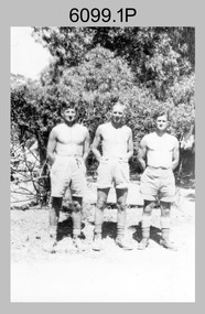
... Parks and Works tradesmen at Fortuna, Bendigo. Ted on big roof. .7) - Photo, black & white, 1942. Gold crusher battery just behind Fortuna. .8) - Photo, black & white, 1942. Scene of Bendigo from Fortuna. .9) - Photo, black & white, 1942. Nell Gwynne Mine from mullock heap at Victoria...Parks and Works tradesmen at Fortuna, Bendigo. Ted on big roof. .7) - Photo, black & white, 1942. Gold crusher battery just behind Fortuna. .8) - Photo, black & white, 1942. Scene of Bendigo from Fortuna. .9) - Photo, black & white, 1942. Nell Gwynne Mine from mullock heap at Victoria ...This is a set of 17 photographs taken during the first year of Army occupation at Fortuna, Bendigo in 1942. The photos provide an insight into the preparatory work performed on the Fortuna Villa and surrounding buildings, by the Working Party 5th Army Troop and Ordnance Training Depot, before its occupation by personnel from LHQ Cartographic Company, Royal Australian Survey Corps. The annotation on the back of Photos .9P and .10P is misspelt. The correct spelling is ‘Nell Gwynne’. The poppet head of the Central Nell Gwynne mine is still an iconic landmark in Bendigo, lying just down the road from the poppet head lookout at Victoria Hill. The Central Nell Gwynne was the premier mine of Bendigo's 1930s mining revival and is of high historical value, due to the extensive and relatively intact features which remain at the site. The annotation on the back of Photo .17P is incorrect. The location of HQ 5th Army Troop was ‘Reynard St, Coburg.’ By late 1941 as Japan extended its control throughout Indo-China, resolving the accommodation problem of AHQ Cartographic Company located in Melbourne became more urgent. The steady Japanese advance made the bombing of Melbourne no longer a remote possibility, and in accordance with a general policy of dispersion, the Deputy Chief of the General Staff, Major General Sidney Rowell instructed Major William Sarll, in the interests of security of plant and to provide against possible damage of air attack, to investigate suitable safer inland accommodation for AHQ Cartographic Company. Major Sarll inspected many properties before finding one that would meet the requirements of the Cartographic Company. In late 1941, he came to inspect Fortuna, a rambling old mansion with about fifteen acres of ground in central Bendigo. Initially there was no intention to occupy the site beyond the end of the war, although Major Sarll's report to the Director of Survey noted many advantages in moving the Company to Bendigo. Major General Rowell quickly approved the selection of Fortuna before other authorities, which were investigating the evacuation of school children, could get in ahead of the Cartographic Company. On 23 March 1942, the Commonwealth of Australia, under the provisions of the National Security Act of 1939, took possession of the house, the old battery buildings and the fifteen acres of grounds. Under Warrant Officer J. Trist’s direction, over fifty Parks and Works tradesmen completed building works necessary to accommodate the Survey Corps’ military, map making and printing requirements. The building program was still under way when the first officer, Lieutenant Ralph Westgarth, arrived in May 1942 with the advance party which received and positioned all equipment as it came up from Melbourne in semi-trailers. Once the equipment was installed the rest of the Cartographic Company completed its shift to Bendigo by 11th June 1942. The first year of the Survey Corps’ occupation of Fortuna is covered in more detail with additional historic photographs, in pages 17-22 of Valerie Lovejoy’s book 'Mapmakers of Fortuna – A history of the Army Survey Regiment’ ISBN: 0-646-42120-4.This is a set of 17 photographs taken during the first year of Army Occupation at Fortuna, Bendigo in 1942. The black and white photographs were printed on photographic paper and are part of the Army Survey Regiment’s Collection. The photographs were scanned at 300 dpi. .1) - Photo, black & white, 1942. Bendigo Parks and Works tradesmen at Fortuna. L to R: Cliff Day, Ernie Arnold, Norm? .2) - Photo, black & white, 1942. “Don” - possibly SGT Don Sutcliffe. Fortuna, Bendigo. .3) - Photo, black & white, 1942. Parks and Works tradesmen in garden at Fortuna, Bendigo. L to R: Fred & Ernie. .4) - Photo, black & white, 1942. Benny Jack Williams at Fortuna, Bendigo. Accommodation tents were erected above the lake, which later became the parade ground. .5) - Photo, black & white, 1942. Working dress - Giggle suits. Parks and Works tradesmen at Fortuna, Bendigo. L to R: Cliff and Harry on big roof. .6) - Photo, black & white, 1942. Parks and Works tradesmen at Fortuna, Bendigo. Ted on big roof. .7) - Photo, black & white, 1942. Gold crusher battery just behind Fortuna. .8) - Photo, black & white, 1942. Scene of Bendigo from Fortuna. .9) - Photo, black & white, 1942. Nell Gwynne Mine from mullock heap at Victoria Hill near Fortuna, Bendigo. .10) - Photo, black & white, 1942. Nell Gwynne Mine and crusher near Fortuna, Bendigo. .11) - Photo, black & white, 1942. Sluicing for gold at Eaglehawk. .12) - Photo, black & white, 1942. Fortuna, Bendigo taken from the far side of tennis courts. .13) - Photo, black & white, 1942. Fortuna, Bendigo & its reflection from across the lake. .14) - Photo, black & white, 1942. Fortuna, Bendigo from the fishpond. .15) - Photo, black & white, 1942. Fortuna, Bendigo. .16) - Photo, black & white, 1942. First Fortuna Football Team at unknown location. L to R: 5th Bob Wright, 11th SGT Don Sutcliffe. .17) - Photo, black & white, 1942. Working Party from 5th Army Troop and Ordnance Training Depot at Fortuna, Bendigo.Some personnel are identified. Annotated with date within photos. .1) – Annotated on back ‘Cliff, Ernie, Norm, Dec ‘42. Cliff Day - dairy farmer, plasterers’ labourer. Ernie Arnold – hard plasterer. Norm? - QM Store for tools etc. QM Store was the Stables.’ .2) - Annotated on back ‘Don. Fortuna 1942’ .3) - Annotated on back ‘Fred & Ernie. Dec 1942. Carpenters. Note the state of the gardens.’ .4) - Annotated on back ‘Benny Jack Williams Fortuna Bendigo. Tents were erected where present day parade ground is above the lake.’ .5) - Annotated on back ‘Working dress - Giggle suits. June 42. Cliff and Harry on big roof. This photo was taken as the ventilating ridge was being installed on the building housing the printing machines. The machines were installed later by civilian labour when building was complete.’ .6) - Annotated on back ‘Ted on big roof Fortuna Bendigo.’ .7) - Annotated on back ‘Gold crusher battery – Bendigo for slay heap – 1942. 12 stamp battery. Just behind Fortuna. Was working at night when the “Army” came to Bendigo. Later removed to “Coolgardie - WA. Present site of Southern Cross TV.’ .8) - Annotated on back ‘Scene of Bendigo from Fortuna. June 1942.’ .9) - Annotated on back ‘Nell Gwyne Mine from mullock heap (Victoria Hill) Sept 1942.’ .10) - Annotated on back ‘Nell Gwyne Mine and crusher September 1942.’ .11) - Annotated on back ‘Sluicing for gold at Eaglehawk. August 1942.’ .12) - Annotated on back ‘Fortuna Bendigo 1942. Taken from far side of tennis courts.’ .13) - Annotated on back ‘ “Fortuna” across the lake & reflection.’ .14) - Annotated on back ‘Fortuna from fishpond June 1942.’ .15) - Annotated on back ‘Fortuna Dec 1942.’ .16) - Annotated on front ‘X’ x2. Annotated on back First Fortuna Football Team 1942‘Bob Wright’, ‘SGT Don Sutcliffe’. .17) - Annotated ‘Working Party at Fortuna before one of the drafts’, Working Party 5th Army Troop and Ordnance Training Depot Showgrounds, now the Sportsground Bendigo’, ‘HQ of 5th Army Troop was Reynards Rd, Coburg.’royal australian survey corps, rasvy, army survey regiment, army svy regt, fortuna, asr -
 Kiewa Valley Historical Society
Photo - Tawonga Store
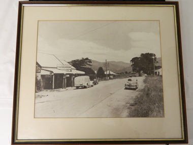
... parked outside the store. Kodak photos are advertised. The Bakery existed. The road is sealed and telephone and electric wires are shown. The Pearce Bros owned the Tawonga Store in the 1950s when the population of the area in the Upper Kiewa Valley and High Plains was high due to the construction of the Kiewa Hydro Electric Scheme by the State Electricity Commission of Victoria. tawonga store. pearce bros. tawonga bakery. i.r.northey. ...This photo was taken in the 1950's when Pearce Bros. owned the Tawonga Store. I.R.Northey's van is parked outside the store. Kodak photos are advertised. The Bakery existed. The road is sealed and telephone and electric wires are shown. The Pearce Bros owned the Tawonga Store in the 1950s when the population of the area in the Upper Kiewa Valley and High Plains was high due to the construction of the Kiewa Hydro Electric Scheme by the State Electricity Commission of Victoria.Sepia photo of Pearce Bros. Tawonga Store including a house next door, cars in the sealed street and part of the Bakery opposite. It has a slim wooden frame & white cardboard border. It has a clear glass cover. The back is lined with brown paper with a white cord across for hanging the photo.tawonga store. pearce bros. tawonga bakery. i.r.northey. -
 Kiewa Valley Historical Society
Photos: 2003 Fires at Bogong and Scientific Research at Bogong
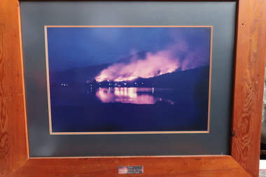
... The 2003 bushfires caused by a lightning strikes on 8th January 2003. 87 fires were ignited 8 of which would join to form the largest fire in Victoria since the 1939 Black Friday bushfires, burning through 60% of the Alpine National Park. ...The 2003 bushfires caused by a lightning strikes on 8th January 2003. 87 fires were ignited 8 of which would join to form the largest fire in Victoria since the 1939 Black Friday bushfires, burning through 60% of the Alpine National Park. ...The 2003 bushfires caused by a lightning strikes on 8th January 2003. 87 fires were ignited 8 of which would join to form the largest fire in Victoria since the 1939 Black Friday bushfires, burning through 60% of the Alpine National Park. Ref. The Mountain Journal. Scientific research was used to test new methods during construction.These fires were close to Bogong village and Mt Beauty. The photos were displayed in the Mountain Monk Hotel, Mt Beauty which was the original SEC Working Mens Club during the construction of the Kiewa Hydro Electric Scheme. Scientific research was used to create new improved methods during construction. Framed photos (1-3) of the 2003 bushfires at Bogong village and Photos (4-11) with titles involving scientific work by the SECV. 1-3 2003 Bogong Complex Fires at Moncrieffs Gap 4. Phasmid Eggs 5. Insect cages 6. Spraying Bitumen 7. Grass grown after spray 8. "Finn" method 9. Erosion raceline bank 10. "Finn" treatment 11. Machine spraying grass seed2003 bushfires, moncrieffs gap -
 Kiewa Valley Historical Society
Collection - Ian Roper
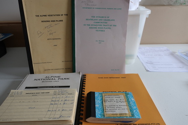
... Victoria. 1. Kiewa River Improvement Trust- Master Plan 1984. 2. Guidelines Conservation Mountain Pygmy Possum -Management Strategy 1989. 3. Proposed Interim Management Plan -Bogong National Park...Victoria. 1. Kiewa River Improvement Trust- Master Plan 1984. 2. Guidelines Conservation Mountain Pygmy Possum -Management Strategy 1989. 3. Proposed Interim Management Plan -Bogong National Park ...Various reports and studies ordered by the Victorian Government and the Alpine shire.History of the Kiewa Valley and North East Victoria including the airport at Mount BeautyA collection of publications and Items significant to the Kiewa Valley Including Kiewa Valley and Surrounds, the Kiewa River, and Pygmy Possums. Also items and reports relating to the North East of Victoria. 1. Kiewa River Improvement Trust- Master Plan 1984. 2. Guidelines Conservation Mountain Pygmy Possum -Management Strategy 1989. 3. Proposed Interim Management Plan -Bogong National Park 1983. 4. The Dynamics of Heathland and Grassland Communities in the Subalpine Tract - Bogong High Plains 1987. 5. Alpine National Park Bogong Unit -Management Plan 1992.6. Alpine Vegetation of the Bogong High Plains - Bogong High Plains 1982. 7. Early 1970s onwards, records of banking, receipts, landing fees, letters, photos, key, minutes, visitor book, record of landings (book), postcards, SEC Victoria's Kiewa Valley Brochure - Mt Beauty Airport History 1`977+ian roper, mount beauty airport, pygmy possums, vegetation -
 Kiewa Valley Historical Society
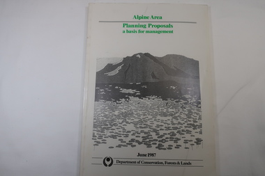
Book - Book - Alpine Area - Department of Conservation, Forests & Lands, Alpine Area / Planning Proposals / a basis for management. 1987
... Park in N.S.W.. This is yet to be achieved (1987), however there is a need for sound, efficient and coordinated management based on the area's natural features, values and uses. Planning is proceeding on this basis. Victoria's ...It is the policy of the Government that most of the State's alpine area will be proclaimed as an Alpine National Park, which would complement the Kosciusko National Park in N.S.W.. This is yet to be achieved (1987), however there is a need for sound, efficient and coordinated management based on the area's natural features, values and uses. Planning is proceeding on this basis.Victoria's alpine area is one of the State's most outstanding and spectacular natural areas. It is noted for its diverse plant and animal life, scenery, recreation opportunities and as a water catchment. This country is at the upper end of the Kiewa Valley and the planning for it is of interest to the Kiewa Valley inhabitants.White bound book with green print for title at the top, black & white picture and black print at the bottom for the name of the government authority publishing the book.143 pages with fold out map after page 7. The map is coloured green to indicate the planning area.alpine area, bogong national park, victorian department of conservation forests & lands -
 Eltham District Historical Society Inc
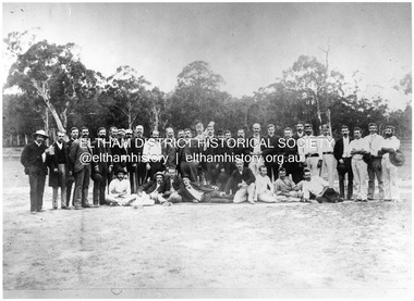
Photograph, Eltham Cricket Club at Eltham Sports Oval. E.H. Cameron ninth from left (standing)
... Park at the conclusion of a match between Eltham Club and a team made of players from various District clubs. The photograph was taken by Mr. Beaumont the then well known photographer of Hawthorn. Local identities in the photo include Ewen Hugh Cameron, Charles Symons Wingrove who were umpires on the day. Tom Horan a cricketer who had played for Victoria...Park at the conclusion of a match between Eltham Club and a team made of players from various District clubs. The photograph was taken by Mr. Beaumont the then well known photographer of Hawthorn. Local identities in the photo include Ewen Hugh Cameron, Charles Symons Wingrove who were umpires on the day. Tom Horan a cricketer who had played for Victoria ...Photo of two teams: Eltham Cricket Club versus a District combined side taken at Eltham Park at the conclusion of a match between Eltham Club and a team made of players from various District clubs. The photograph was taken by Mr. Beaumont the then well known photographer of Hawthorn. Local identities in the photo include Ewen Hugh Cameron, Charles Symons Wingrove who were umpires on the day. Tom Horan a cricketer who had played for Victoria and Australia is also identified. Earlier options were that this photograph was of Kangaroo Ground Cricket Club at Eltham. ..The photograph was taken on 19th February 1887, at the conclusion of a match between Eltham Cricket Club and a team made of players from various District clubs. The photograph was taken by Mr. Beaumont the then well known photographer of Hawthorn. See attached PDF - Research conducted by Society member Alan Sheehan, 5 August 2014. Originally noted as Kangaroo Ground Cricket Club. Source: Mrs. E.M. Jackson, Pigeon Bank, Kangaroo Ground.This photo forms part of a collection of photographs gathered by the Shire of Eltham for their centenary project book,"Pioneers and Painters: 100 years of the Shire of Eltham" by Alan Marshall (1971). The collection of over 500 images is held in partnership between Eltham District Historical Society and Yarra Plenty Regional Library (Eltham Library) and is now formally known as the 'The Shire of Eltham Pioneers Photograph Collection.' It is significant in being the first community sourced collection representing the places and people of the Shire's first one hundred years.Digital image PDF file - Eltham Cricket Club Photograph 1887 sepp, shire of eltham pioneers photograph collection, kangaroo ground, charles symons wingrove, e.h. cameron, eltham cricket club, eltham sports oval, ewen hugh cameron, ewen cameron -
 Eltham District Historical Society Inc
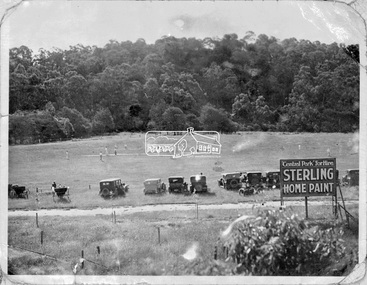
Negative - Photograph, Cricket match, Central Park, Eltham, c.1931
... The other park is a splendid one, but it is far away, and one is required close to the station, so that young people can have a day's enjoyment, without having to go far from the station. The trouble in Victoria...The other park is a splendid one, but it is far away, and one is required close to the station, so that young people can have a day's enjoyment, without having to go far from the station. The trouble in Victoria ...The new Central Park was opened on Monday, 21 April 1930 by Mr. W.H. Everard, M.L.A. followed by a sports carnival. The Advertiser reported on Friday, April 25, 1930 that – “Perfect weather prevailed on Monday for the sports gathering in aid of the recently-acquired park near the railway station, and from every point of view the day was a success. The Central Park contains 9½ acres, and has the Diamond Creek on one side and the railway line on the other. It cost £760, of which the council contributed £500, and the citizens, are finding the balance. Already about £80 has been spent in levelling, and a pavilion has been erected by the footballers, who will use the ground for training until it is sufficiently, improved for matches. There is ample shade along the banks of the creek, where there were numerous picnic parties. The committee has already done some planting on the railway side of the park, and where the trees grow on the higher side, overlooking the arena, the natural stand will have shade, command a view of the events, and have the trees on the banks of the creek in the distance. There were between 600 and 700 people present, many in motor cars having a little difficulty in, finding their way under the aqueduct to the ground, but the council is at present effecting improvements to the road. A merry-go round was a source of pleasure to the children, and the Northcote Soldiers and Citizens Band under Bandmaster Gore, de-lighted everyone with their varied selections of good music.” “Cr. E. J. Andrew, president of the Park Committee, said it was the first function held in the park, and although the citizens have guaranteed £420 towards it, there is still some-thing owing. Mr. W. H. Everard, M.L.A., who can always be relied upon to attend any gathering which draws the people together, said that he and Mrs. Everard had great pleasure in being present to declare the park open. He congratulated the Eltham people upon their public spirit, and the new park would be more appreciated in years to come. The other park is a splendid one, but it is far away, and one is required close to the station, so that young people can have a day's enjoyment, without having to go far from the station. The trouble in Victoria is not having enough parks. The early settlers did a lot in getting park lands, but the present generation is not doing enough. Eltham people are entitled to the highest commendation for their action, and Cr. Andrew and the council are to be thanked for what they have done. What is wanted is ingress and egress so that people can get in comfortably. When he was motoring in his wife said, "Surely you are not going down that precipice," and he replied that he would go anywhere where the people were. In the future it will be the big centre of Eltham.” Reproduced on page 96 of 'Pioneers & Painters'This photo forms part of a collection of photographs gathered by the Shire of Eltham for their centenary project book,"Pioneers and Painters: 100 years of the Shire of Eltham" by Alan Marshall (1971). The collection of over 500 images is held in partnership between Eltham District Historical Society and Yarra Plenty Regional Library (Eltham Library) and is now formally known as the 'The Shire of Eltham Pioneers Photograph Collection.' It is significant in being the first community sourced collection representing the places and people of the Shire's first one hundred years.Digital image 4 x 5 inch B&W Neg 9 x12.5 cm printsepp, shire of eltham pioneers photograph collection, eltham, eltham central park, automobile, central park, cricket match, pioneers and painters -
 Eltham District Historical Society Inc
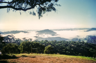
Photograph, Murchison Gap, Autumn Excursion, Hume and Hovell's 1824 expedition, 26 May 1996, 26/05/1996
... Victoria. The Society would follow a series of monuments erected for the 1924 centenary of the expedition from King Parrot Creek (Tuesday 7th December 1824), through Strath Creek, over Sunday Creek (Sunday 12th December 1824) at Broadford, Tullamarine, St Albans, Deer Park, through Werribee, skirting east of the You Yangs to Lara and Avalon Beach. ...Victoria. The Society would follow a series of monuments erected for the 1924 centenary of the expedition from King Parrot Creek (Tuesday 7th December 1824), through Strath Creek, over Sunday Creek (Sunday 12th December 1824) at Broadford, Tullamarine, St Albans, Deer Park, through Werribee, skirting east of the You Yangs to Lara and Avalon Beach. ...[article by Bettina Woodburn in EDHS Newsletter No. 109, July 1996:] ON THE TRAIL OF HUME AND HOVELL - REPORT ON THE AUTUMN EXCURSION - On a green and fresh morning (Sunday 26th May 1996) the Cobb and Co coach (driven by the most obliging Peter Tampion) set off in a north easterly direction from Eltham to connect with Hume and Hovell's route on their 1824 explorations of central Victoria. The Society would follow a series of monuments erected for the 1924 centenary of the expedition from King Parrot Creek (Tuesday 7th December 1824), through Strath Creek, over Sunday Creek (Sunday 12th December 1824) at Broadford, Tullamarine, St Albans, Deer Park, through Werribee, skirting east of the You Yangs to Lara and Avalon Beach. Because their distance-measuring wheel had broken and a one degree mistake was made in calculations, the two leaders of the original group of six convict-companions arrived at Corio Bay, instead of the expected Western Port, discovered earlier by Flinders. From below Mt. Disappointment (Hume and Hovell's difficulties in "scrambling over brush and rock", "leeches in forest, as well as no water", "cutting grass 4-5 ft. high", dreadful scrub", "devil flies") we took an easier route, saw the Strath Creek memorial in ground fog and a wonderful "field of dreams", the Hume-Hovell privately owned cricket ground with its white picket boundary fence. Now, after a steep climb, in sunshine under gums we stretched and viewed magnificent rolling hills and fog-filled valleys - not "smoke from Aborigines' bush fires". After morning tea at Broadford we followed the Sunday Creek valley beside the Hume Freeway, passed the Wallan Wallan Rest Area (more appropriately Hume and Hovell Rest Area) to tum right at Beveridge. In Gellibrand Hill Park, near the headwaters of the Moonee Ponds Creek, we experienced the landscape the first European settlers saw - huge river red gums and rolling pastures. The gardens and sheltered courtyard of the 1840s, timber, brought from .....[?] prefabricated Woodlands Homestead, provided a pleasant lunch stop. We enjoyed a private tour, panoramic views over Melbourne and surroundings and the excitement of arriving and departing aircraft. Our next river crossing was at Werribee, "in a vast treeless plain", then we drove on by-ways no coach had previously travelled, to find "an immense sheet of water" salty Corio Bay, off-course to the west. In late afternoon of a super, calm, late autumn day we headed homewards. Back at Eltham we were rather surprised to find that we had travelled a total of 347 km. Thanks again to Russell Yeoman for his research and organization. What a wonderful day! Three colour photographsactivities, murchison gap, murchison valley -
 Eltham District Historical Society Inc
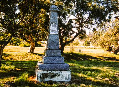
Photograph, Hume and Hovell Monument, Broadford, Autumn Excursion, Hume and Hovell's 1824 expedition, 26 May 1996, 26/05/1996
... Victoria. The Society would follow a series of monuments erected for the 1924 centenary of the expedition from King Parrot Creek (Tuesday 7th December 1824), through Strath Creek, over Sunday Creek (Sunday 12th December 1824) at Broadford, Tullamarine, St Albans, Deer Park, through Werribee, skirting east of the You Yangs to Lara and Avalon Beach. ...Victoria. The Society would follow a series of monuments erected for the 1924 centenary of the expedition from King Parrot Creek (Tuesday 7th December 1824), through Strath Creek, over Sunday Creek (Sunday 12th December 1824) at Broadford, Tullamarine, St Albans, Deer Park, through Werribee, skirting east of the You Yangs to Lara and Avalon Beach. ...[article by Bettina Woodburn in EDHS Newsletter No. 109, July 1996:] ON THE TRAIL OF HUME AND HOVELL - REPORT ON THE AUTUMN EXCURSION - On a green and fresh morning (Sunday 26th May 1996) the Cobb and Co coach (driven by the most obliging Peter Tampion) set off in a north easterly direction from Eltham to connect with Hume and Hovell's route on their 1824 explorations of central Victoria. The Society would follow a series of monuments erected for the 1924 centenary of the expedition from King Parrot Creek (Tuesday 7th December 1824), through Strath Creek, over Sunday Creek (Sunday 12th December 1824) at Broadford, Tullamarine, St Albans, Deer Park, through Werribee, skirting east of the You Yangs to Lara and Avalon Beach. Because their distance-measuring wheel had broken and a one degree mistake was made in calculations, the two leaders of the original group of six convict-companions arrived at Corio Bay, instead of the expected Western Port, discovered earlier by Flinders. From below Mt. Disappointment (Hume and Hovell's difficulties in "scrambling over brush and rock", "leeches in forest, as well as no water", "cutting grass 4-5 ft. high", dreadful scrub", "devil flies") we took an easier route, saw the Strath Creek memorial in ground fog and a wonderful "field of dreams", the Hume-Hovell privately owned cricket ground with its white picket boundary fence. Now, after a steep climb, in sunshine under gums we stretched and viewed magnificent rolling hills and fog-filled valleys - not "smoke from Aborigines' bush fires". After morning tea at Broadford we followed the Sunday Creek valley beside the Hume Freeway, passed the Wallan Wallan Rest Area (more appropriately Hume and Hovell Rest Area) to tum right at Beveridge. In Gellibrand Hill Park, near the headwaters of the Moonee Ponds Creek, we experienced the landscape the first European settlers saw - huge river red gums and rolling pastures. The gardens and sheltered courtyard of the 1840s, timber, brought from .....[?] prefabricated Woodlands Homestead, provided a pleasant lunch stop. We enjoyed a private tour, panoramic views over Melbourne and surroundings and the excitement of arriving and departing aircraft. Our next river crossing was at Werribee, "in a vast treeless plain", then we drove on by-ways no coach had previously travelled, to find "an immense sheet of water" salty Corio Bay, off-course to the west. In late afternoon of a super, calm, late autumn day we headed homewards. Back at Eltham we were rather surprised to find that we had travelled a total of 347 km. Thanks again to Russell Yeoman for his research and organization. What a wonderful day! Colour photographactivities, broadford, hume and hovell, monument -
 Eltham District Historical Society Inc
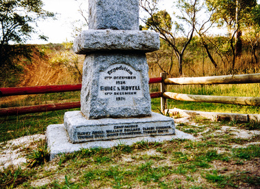
Photograph, Hume and Hovell Monument, Autumn Excursion, Hume and Hovell's 1824 expedition, 26 May 1996, 26/05/1996
... Victoria. The Society would follow a series of monuments erected for the 1924 centenary of the expedition from King Parrot Creek (Tuesday 7th December 1824), through Strath Creek, over Sunday Creek (Sunday 12th December 1824) at Broadford, Tullamarine, St Albans, Deer Park, through Werribee, skirting east of the You Yangs to Lara and Avalon Beach. ...Victoria. The Society would follow a series of monuments erected for the 1924 centenary of the expedition from King Parrot Creek (Tuesday 7th December 1824), through Strath Creek, over Sunday Creek (Sunday 12th December 1824) at Broadford, Tullamarine, St Albans, Deer Park, through Werribee, skirting east of the You Yangs to Lara and Avalon Beach. ...[article by Bettina Woodburn in EDHS Newsletter No. 109, July 1996:] ON THE TRAIL OF HUME AND HOVELL - REPORT ON THE AUTUMN EXCURSION - On a green and fresh morning (Sunday 26th May 1996) the Cobb and Co coach (driven by the most obliging Peter Tampion) set off in a north easterly direction from Eltham to connect with Hume and Hovell's route on their 1824 explorations of central Victoria. The Society would follow a series of monuments erected for the 1924 centenary of the expedition from King Parrot Creek (Tuesday 7th December 1824), through Strath Creek, over Sunday Creek (Sunday 12th December 1824) at Broadford, Tullamarine, St Albans, Deer Park, through Werribee, skirting east of the You Yangs to Lara and Avalon Beach. Because their distance-measuring wheel had broken and a one degree mistake was made in calculations, the two leaders of the original group of six convict-companions arrived at Corio Bay, instead of the expected Western Port, discovered earlier by Flinders. From below Mt. Disappointment (Hume and Hovell's difficulties in "scrambling over brush and rock", "leeches in forest, as well as no water", "cutting grass 4-5 ft. high", dreadful scrub", "devil flies") we took an easier route, saw the Strath Creek memorial in ground fog and a wonderful "field of dreams", the Hume-Hovell privately owned cricket ground with its white picket boundary fence. Now, after a steep climb, in sunshine under gums we stretched and viewed magnificent rolling hills and fog-filled valleys - not "smoke from Aborigines' bush fires". After morning tea at Broadford we followed the Sunday Creek valley beside the Hume Freeway, passed the Wallan Wallan Rest Area (more appropriately Hume and Hovell Rest Area) to tum right at Beveridge. In Gellibrand Hill Park, near the headwaters of the Moonee Ponds Creek, we experienced the landscape the first European settlers saw - huge river red gums and rolling pastures. The gardens and sheltered courtyard of the 1840s, timber, brought from .....[?] prefabricated Woodlands Homestead, provided a pleasant lunch stop. We enjoyed a private tour, panoramic views over Melbourne and surroundings and the excitement of arriving and departing aircraft. Our next river crossing was at Werribee, "in a vast treeless plain", then we drove on by-ways no coach had previously travelled, to find "an immense sheet of water" salty Corio Bay, off-course to the west. In late afternoon of a super, calm, late autumn day we headed homewards. Back at Eltham we were rather surprised to find that we had travelled a total of 347 km. Thanks again to Russell Yeoman for his research and organization. What a wonderful day! Two colour photographsactivities, hume and hovell, monument -
 Eltham District Historical Society Inc
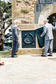
Photograph, Governor Landy with assistance from Harry Gilham unveils the Korea-Borneo plaque, Rededication Ceremony, War Memorial Tower, Kangaroo Ground, 08 November 2011
... park. The Committee decided to produce plaques to commemorate the armed conflicts in Korea, Malaysia, Borneo and Vietnam. The plaques were funded by public donations and cost $10,000. The community donated via donation boxes placed at Eltham Library. NL 140 Sept 2001 Governor John landy and other digniaries attended the event for the unveiling of the plaque. Gov Landy unveiled the plaque which was attached to the historical tower in November 2001. kangaroo ground war memorial tower rededication ceremony governor of victoria ...Victorian State Governor John Landy AC, MBE, re-dedicates the 75-year-old Memorial Tower of Remembrance at Kangaroo Ground with the unveiling of the cast bronze plaques which recognize the Australian participation in the Armed Conflicts of Korea 1950-1953, Borneo 1962-1966, Malaya 1948-1960, and Vietnam 1962-1973 - on the memorial's 75th anniversary to those who served in Armed Conflicts between 1948 and 1972. Harry Gillham, President of EDHS and Convenor of the Nillumbik Shire Council's Advisory Committee for the War memorial at Kangaroo Ground was for some years working on the refurbishment of the Tower of Rememberance and the surrounding park. The Committee decided to produce plaques to commemorate the armed conflicts in Korea, Malaysia, Borneo and Vietnam. The plaques were funded by public donations and cost $10,000. The community donated via donation boxes placed at Eltham Library. NL 140 Sept 2001 Governor John landy and other digniaries attended the event for the unveiling of the plaque. Gov Landy unveiled the plaque which was attached to the historical tower in November 2001. Colour photographkangaroo ground, war memorial tower, rededication ceremony, governor of victoria, john landy, harry gilham -
 Eltham District Historical Society Inc
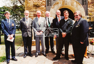
Photograph, The Advisory Committee of the Park and Tower, Rededication Ceremony, War Memorial Tower, Kangaroo Ground. 8 November 2001, 08/11/2001
... Park and Tower), Governor John Landy, Mick Woiwod, Dennis Ward, Dean Stewart, Mayor Cr. Sigmund Jorgensen. (Contained in an album originally put together by Harry Gilham. Photos subsequently relocated to photosafe archival storage.) [2001] kangaroo ground war memorial tower rededication ceremony dean stewart dennis ward governor of victoria harry gilham john landy mick woiwod nicholas pelling sigmund jorgensen Colour photograph The Advisory Committee of the Park and Tower, Rededication Ceremony, War Memorial Tower, Kangaroo Ground. 8 November 2001 Photograph ...L-R: Nicholas Pelling, Harry Gillham (Convenor of the Advisory Committee of the Park and Tower), Governor John Landy, Mick Woiwod, Dennis Ward, Dean Stewart, Mayor Cr. Sigmund Jorgensen. (Contained in an album originally put together by Harry Gilham. Photos subsequently relocated to photosafe archival storage.) [2001]Colour photographkangaroo ground, war memorial tower, rededication ceremony, dean stewart, dennis ward, governor of victoria, harry gilham, john landy, mick woiwod, nicholas pelling, sigmund jorgensen -
 Eltham District Historical Society Inc
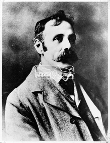
Negative - Photograph, Walter Withers, c.1903-1914
... There are important collections at the National Gallery of Victoria and the Geelong Art Gallery. His Eltham house remains and his name is honoured by a small park at the corner of Bible and Arthur Streets. ...There are important collections at the National Gallery of Victoria and the Geelong Art Gallery. His Eltham house remains and his name is honoured by a small park at the corner of Bible and Arthur Streets. ...Walter Withers (1854-1914) was born in Handsworth, Warwickshire, England. He migrated to Australia in 1882 and in time was to become one of the country's most famous painters. In 1887/8 he spent a year in London and Paris during which time he married Fanny Flinn. When he returned to Melbourne he was engaged by publishers doing black and white illustrations. In the late 1880's he became associated with artists who formed the renowned "Heidelberg School" and in 1890 moved to "Charterisville" at Eaglemont. He lived in the Heidelberg area until 1903 when he purchased a house on two and a half acres (one hectare) at the corner of Brougham and Bolton Streets, Eltham. He had long been attracted to the Eltham area, but needed access to Melbourne for his painting classes. The extension of the railway in 1901 made the move possible. He remained in Eltham until his death and is buried at nearby St Helena. Many of his important paintings were painted during these later years. There are important collections at the National Gallery of Victoria and the Geelong Art Gallery. His Eltham house remains and his name is honoured by a small park at the corner of Bible and Arthur Streets. Source: Information panel produced for EDHS exhibition in 1990.This photo forms part of a collection of photographs gathered by the Shire of Eltham for their centenary project book,"Pioneers and Painters: 100 years of the Shire of Eltham" by Alan Marshall (1971). The collection of over 500 images is held in partnership between Eltham District Historical Society and Yarra Plenty Regional Library (Eltham Library) and is now formally known as the 'The Shire of Eltham Pioneers Photograph Collection.' It is significant in being the first community sourced collection representing the places and people of the Shire's first one hundred years.Digital image 4 x 5 inch B&W Neg 120 format B&W negative B&W printsepp, shire of eltham pioneers photograph collection, eltham, walter withers, artist -
 Eltham District Historical Society Inc
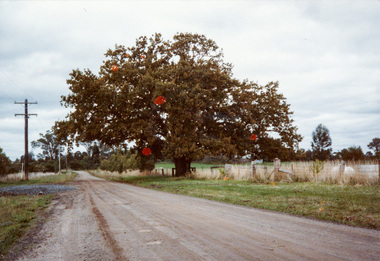
Photograph, Donaldson Oak, Donaldson Road, Kangaroo Ground, 1986, 1986
... Park, where he collected some acorns which he brought back to Australia, to his property, "Kangaroo Hall" at Kangaroo Ground. He and his son John Anstruther Davidson Donaldson, who was then 10 years old, planted one near the present Donaldson's Lane, in 1878. This is now a very fine tree, 108 years old. This information comes from Miss Victoria...Park, where he collected some acorns which he brought back to Australia, to his property, "Kangaroo Hall" at Kangaroo Ground. He and his son John Anstruther Davidson Donaldson, who was then 10 years old, planted one near the present Donaldson's Lane, in 1878. This is now a very fine tree, 108 years old. This information comes from Miss Victoria ...Used for the Society's Banner project. [note written by Joy Ness, "View Hill", Kangaroo Ground, 11 June 1986:] In 1878 while on a trip to Scotland and England, John Donaldson visited Windsor Castle Park, where he collected some acorns which he brought back to Australia, to his property, "Kangaroo Hall" at Kangaroo Ground. He and his son John Anstruther Davidson Donaldson, who was then 10 years old, planted one near the present Donaldson's Lane, in 1878. This is now a very fine tree, 108 years old. This information comes from Miss Victoria Donaldson, daughter of John Anstruther Davidson Donaldson. Miss Donaldson suggests that Wippell's Oak at Kangaroo Ground may also have been grown from one of the same Windsor Park acorns.Colour photographactivities, banner project, donaldsons oak, john anstruther davidson donaldson, kangaroo ground, significant trees, william donaldson -
 Eltham District Historical Society Inc
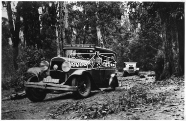
Photograph, Goodwood Powelltown Melbourne Daily
... Park. Front vehicle has sign: "Goodwood Powelltown Melbourne daily". Photo sourced from the Forests Commission of Victoria. ...Park. Front vehicle has sign: "Goodwood Powelltown Melbourne daily". Photo sourced from the Forests Commission of Victoria. ...Two cars, probably 1929 Chryslers navigate the forest track probably Kinglake National Park. Front vehicle has sign: "Goodwood Powelltown Melbourne daily". Photo sourced from the Forests Commission of Victoria. Ref. JJ 399This photo forms part of a collection of photographs gathered by the Shire of Eltham for their centenary project book,"Pioneers and Painters: 100 years of the Shire of Eltham" by Alan Marshall (1971). The collection of over 500 images is held in partnership between Eltham District Historical Society and Yarra Plenty Regional Library (Eltham Library) and is now formally known as the 'The Shire of Eltham Pioneers Photograph Collection.' It is significant in being the first community sourced collection representing the places and people of the Shire's first one hundred years.Digital imagesepp, shire of eltham pioneers photograph collection, kinglake, goodwood powelltown melbourne daily, automobile, chrysler, kinglake national park, forest track -
 Eltham District Historical Society Inc
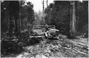
Photograph, Goodwood Powelltown Melbourne Daily rear view
... Park. Front vehicle has sign: Goodwood Powelltown Melbourne daily". Source: Forests Commission of Victoria. ...Park. Front vehicle has sign: Goodwood Powelltown Melbourne daily". Source: Forests Commission of Victoria. ...Two vehicles, possibly 1929 Chryslers negotiate a forest track, probably in the Kinglake National Park. Front vehicle has sign: Goodwood Powelltown Melbourne daily". Source: Forests Commission of Victoria. Ref. JJ 397This photo forms part of a collection of photographs gathered by the Shire of Eltham for their centenary project book,"Pioneers and Painters: 100 years of the Shire of Eltham" by Alan Marshall (1971). The collection of over 500 images is held in partnership between Eltham District Historical Society and Yarra Plenty Regional Library (Eltham Library) and is now formally known as the 'The Shire of Eltham Pioneers Photograph Collection.' It is significant in being the first community sourced collection representing the places and people of the Shire's first one hundred years.Digital imagesepp, shire of eltham pioneers photograph collection, kinglake, goodwood powelltown melbourne daily, automobile, forest track, chrysler, kinglake national park -
 Warrnambool and District Historical Society Inc.
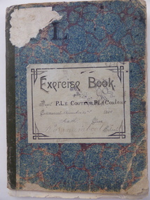
Book, Exercise book P Le Couteur, 1898
... Park State School and continued it in Warrnambool at the Warrnambool Academy run by Richard Lawson and William Oakley. He matriculated at the age of 14 and completed an Arts degree at Melbourne University before studying first year medicine. At the university he excelled in sport – cricket, football and tennis. In 1908 he won the Rhodes Scholarship for Victoria...Park State School and continued it in Warrnambool at the Warrnambool Academy run by Richard Lawson and William Oakley. He matriculated at the age of 14 and completed an Arts degree at Melbourne University before studying first year medicine. At the university he excelled in sport – cricket, football and tennis. In 1908 he won the Rhodes Scholarship for Victoria ...This school exercise book belonged to Philip Ridgway Le Couteur, Warrnambool’s first Rhodes Scholar. Philip Le Couteur (1885-1958), the son of George Le Couteur, a Warrnambool chemist and Fanny Byron (nee Maling), began his schooling at Middle Park State School and continued it in Warrnambool at the Warrnambool Academy run by Richard Lawson and William Oakley. He matriculated at the age of 14 and completed an Arts degree at Melbourne University before studying first year medicine. At the university he excelled in sport – cricket, football and tennis. In 1908 he won the Rhodes Scholarship for Victoria and studied classics, classical history and philosophy at Oxford University. In 1913 he was appointed the foundation lecturer in Mental and Moral Philosophy at the University of Western Australia. Following this he was the Head Master at various secondary schools, including Methodist Ladies’ College for 11 years. This book is of great interest because it contains examples of the schoolwork of Warrnambool’s first Rhodes Scholar, Philip Le Couteur.This is a school exercise book of 40 pages. The cardboard cover is a mottled blue and red colour with brown binding. All the pages have handwritten school work including dictation, arithmetic, spelling, map work, grammar and composition. The pages are detached from the cover and the cover is partly torn away and bent. The cover has some sketches drawn presumably by the owner of the book Philip Le Couteur. ‘P. Le Couteur, commenced 22nd November 1898, Sixth Class, Warrnambool School.’rhodes scholars, philip le couteur -
 Eltham District Historical Society Inc
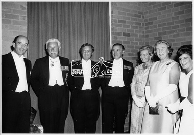
Photograph, Shire of Eltham Centenary Dinner, 6 Apr 1971
... Victoria; Cr. G.C. Dreverman, Shire President; Mrs. Hamer; Lady Delacombe and Mrs. Dreverman. The event was held in the West Riding Hall, Petrie Park Community Centre, Montmorency. ...Victoria; Cr. G.C. Dreverman, Shire President; Mrs. Hamer; Lady Delacombe and Mrs. Dreverman. The event was held in the West Riding Hall, Petrie Park Community Centre, Montmorency. ...Shire of Eltham Centenary Dinner; Official Guests - Left to Right: His Excellency Major General Sir Rohan Delacombe, K.C.M.G., K.C.V.O., K.B.E., C.B., D.S.O., D.St.J., Governor of Victoria; Cr. G.C. Dreverman, Shire President; Mrs. Hamer; Lady Delacombe and Mrs. Dreverman. The event was held in the West Riding Hall, Petrie Park Community Centre, Montmorency. This photo forms part of a collection of photographs gathered by the Shire of Eltham for their centenary project book, "Pioneers and Painters: 100 years of the Shire of Eltham" by Alan Marshall (1971). The collection of over 500 images is held in partnership between Eltham District Historical Society and Yarra Plenty Regional Library (Eltham Library) and is now formally known as 'The Shire of Eltham Pioneers Photograph Collection.' It is significant in being the first community sourced collection representing the places and people of the Shire's first one hundred years.Digital imagesepp, shire of eltham pioneers photograph collection, shire of eltham, shire of eltham centenary, the hon. r.j. hamer, official dinner, mrs. hamer, mrs. dreverman, m.b. watson, lady delacombe, sir rohan delacombe, cr. g.c. dreverman, centenary celebrations, formal wear, petrie park community centre montmorency -
 Eltham District Historical Society Inc
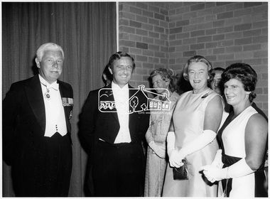
Photograph, Shire of Eltham Centenary Dinner, 6 Apr 1971
... Victoria; Cr. G.C. Dreverman, Shire President; Mrs. Hamer; Lady Delacombe and Mrs. Dreverman. The event was held in the West Riding Hall, Petrie Park Community Centre, Montmorency. ...Victoria; Cr. G.C. Dreverman, Shire President; Mrs. Hamer; Lady Delacombe and Mrs. Dreverman. The event was held in the West Riding Hall, Petrie Park Community Centre, Montmorency. ...Shire of Eltham Centenary Dinner; Official Guests - Left to Right: His Excellency Major General Sir Rohan Delacombe, K.C.M.G., K.C.V.O., K.B.E., C.B., D.S.O., D.St.J., Governor of Victoria; Cr. G.C. Dreverman, Shire President; Mrs. Hamer; Lady Delacombe and Mrs. Dreverman. The event was held in the West Riding Hall, Petrie Park Community Centre, Montmorency. This photo forms part of a collection of photographs gathered by the Shire of Eltham for their centenary project book, "Pioneers and Painters: 100 years of the Shire of Eltham" by Alan Marshall (1971). The collection of over 500 images is held in partnership between Eltham District Historical Society and Yarra Plenty Regional Library (Eltham Library) and is now formally known as 'The Shire of Eltham Pioneers Photograph Collection.' It is significant in being the first community sourced collection representing the places and people of the Shire's first one hundred years.Digital imagesepp, shire of eltham pioneers photograph collection, shire of eltham, shire of eltham centenary, the hon. r.j. hamer, official dinner, mrs. hamer, mrs. dreverman, lady delacombe, sir rohan delacombe, cr. g.c. dreverman, centenary celebrations, formal wear, petrie park community centre montmorency -
 Eltham District Historical Society Inc
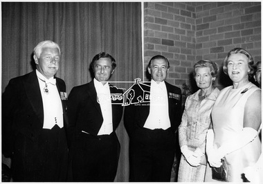
Photograph, Shire of Eltham Centenary Dinner, 6 Apr 1971
... Victoria; Mrs. Hamer; Lady Delacombe. The event was held in the West Riding Hall, Petrie Park Community Centre, Montmorency. ...Victoria; Mrs. Hamer; Lady Delacombe. The event was held in the West Riding Hall, Petrie Park Community Centre, Montmorency. ...Shire of Eltham Centenary Dinner; Official Guests - Left to Right: His Excellency Major General Sir Rohan Delacombe, K.C.M.G., K.C.V.O., K.B.E., C.B., D.S.O., D.St.J., Governor of Victoria; Cr. G.C. Dreverman, Shire President; The Hon. R.J. Hamer, E.D., M.P., Chief Secretary of Victoria; Mrs. Hamer; Lady Delacombe. The event was held in the West Riding Hall, Petrie Park Community Centre, Montmorency. This photo forms part of a collection of photographs gathered by the Shire of Eltham for their centenary project book, "Pioneers and Painters: 100 years of the Shire of Eltham" by Alan Marshall (1971). The collection of over 500 images is held in partnership between Eltham District Historical Society and Yarra Plenty Regional Library (Eltham Library) and is now formally known as 'The Shire of Eltham Pioneers Photograph Collection.' It is significant in being the first community sourced collection representing the places and people of the Shire's first one hundred years.Digital imagesepp, shire of eltham pioneers photograph collection, shire of eltham, shire of eltham centenary, official dinner, mrs. hamer, mrs. dreverman, lady delacombe, sir rohan delacombe, cr. g.c. dreverman, centenary celebrations, the hon. r.j. hamer -
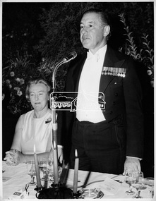 Eltham District Historical Society Inc
Photograph, Shire of Eltham Centenary Dinner, 6 Apr 1971
... Hamer, E.D., M.P., Chief Secretary of Victoria speaking at the formal dinner to celebrate the Shire of Eltham's centenary. The event was held in the West Riding Hall, Petrie Park Community Centre, Montmorency. ...Hamer, E.D., M.P., Chief Secretary of Victoria speaking at the formal dinner to celebrate the Shire of Eltham's centenary. The event was held in the West Riding Hall, Petrie Park Community Centre, Montmorency. ...Lady Joyce Delacombe with The Hon. R.J. Hamer, E.D., M.P., Chief Secretary of Victoria speaking at the formal dinner to celebrate the Shire of Eltham's centenary. The event was held in the West Riding Hall, Petrie Park Community Centre, Montmorency. This photo forms part of a collection of photographs gathered by the Shire of Eltham for their centenary project book, "Pioneers and Painters: 100 years of the Shire of Eltham" by Alan Marshall (1971). The collection of over 500 images is held in partnership between Eltham District Historical Society and Yarra Plenty Regional Library (Eltham Library) and is now formally known as 'The Shire of Eltham Pioneers Photograph Collection.' It is significant in being the first community sourced collection representing the places and people of the Shire's first one hundred years.Digital imagesepp, shire of eltham pioneers photograph collection, shire of eltham, shire of eltham centenary, official dinner, centenary celebrations, the hon. r.j. hamer, lady delacombe, speech, talk -
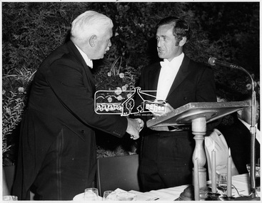 Eltham District Historical Society Inc
Photograph, Shire of Eltham Centenary Dinner, 6 Apr 1971
... Dreverman presenting a silver centenary medal to His Excellency Major General Sir Rohan Delacombe, Governor of Victoria at the Shire of Eltham Centenary Dinner in 1971. The event was held in the West Riding Hall, Petrie Park Community Centre, Montmorency. ...Dreverman presenting a silver centenary medal to His Excellency Major General Sir Rohan Delacombe, Governor of Victoria at the Shire of Eltham Centenary Dinner in 1971. The event was held in the West Riding Hall, Petrie Park Community Centre, Montmorency. ...Cr. G. C. Dreverman presenting a silver centenary medal to His Excellency Major General Sir Rohan Delacombe, Governor of Victoria at the Shire of Eltham Centenary Dinner in 1971. The event was held in the West Riding Hall, Petrie Park Community Centre, Montmorency. This photo forms part of a collection of photographs gathered by the Shire of Eltham for their centenary project book, "Pioneers and Painters: 100 years of the Shire of Eltham" by Alan Marshall (1971). The collection of over 500 images is held in partnership between Eltham District Historical Society and Yarra Plenty Regional Library (Eltham Library) and is now formally known as 'The Shire of Eltham Pioneers Photograph Collection.' It is significant in being the first community sourced collection representing the places and people of the Shire's first one hundred years.Digital imagesepp, shire of eltham pioneers photograph collection, shire of eltham, shire of eltham centenary, official dinner, centenary celebrations, cr. g.c. dreverman, sir rohan delacombe
