Showing 8697 items matching "park road"
-
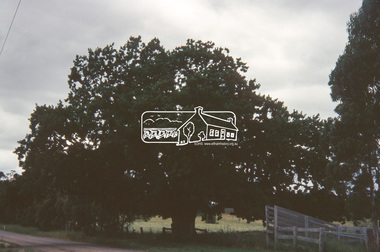
 Eltham District Historical Society Inc
Slide, Construction of Eltham Town Park, 25 Jul 1973
... Alistair Knox Park. eltham main road alistair knox park eltham town ...Construction of Eltham Town Park; landscape has been scupltured and lakes formed. View looking from near Shillinglaw Cottage south to Bridge Street. The park was later renamed Alistair Knox Park.35 mm colour positive transparency Mount - Agfacolor Service (Blue)Memorial Park 25 July 1973eltham, main road, alistair knox park, eltham town park, shillinglaw cottage, bridge street -
 Eltham District Historical Society Inc
Slide, Shillinglaw Cottage, c.1973
Shillinglaw Cottage was relocated in 1963 from its former site a few hundred metres up Main Road to make may for new shire offices built in 1964. It was situated near the Eltham Railway Trestle Bridge on a site that was developed into the Eltham Common. The new Eltham Town Park was constucted opposite on the other side of what was to become Panther Place. In 1993/94 the new Eltham Library was constructed on the Eltham Common. This picture, though out of focus still gives a reasonable impression of the cottage at the time.35 mm colour positive transparency Mount - Kodak Kodachrome Cardeltham common, shillinglaw cottage -
 Eltham District Historical Society Inc
Slide, Main Road, Lower Plenty, 25 Jul 1973
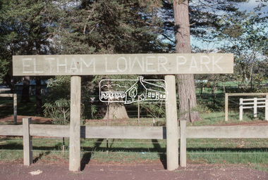
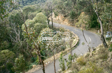
This section of Main Road was known by locals as the "Windy Mile" due to its many little wists and turns. It was also the setting for Billy Cart derbies held on special occassions such as the Eltham Easter Gymkhana at Eltham Lower Park. Contestants would line up and race each other down the hill to the finish line at Bolton Street. Main Road, Lower Plenty underwent substantial changes when it was duplicated with the road becoming two lanes each way and split level due to the cross gradient. This particular section running down the hill from Panorama Avenue to Bolton Street with its twists and turns had many of them straightened out during the road widening constuction work.35 mm colour positive transparency Mount - Agfacolor Service (Blue)main road, infrastructure, lower plenty, roads, windy mile -
 Eltham District Historical Society Inc
Slide, Construction of Eltham Town Park, 22 Feb 1974
... Knox Park. View looking towards the intersection of Main Road ...Construction of Eltham Town Park, later renamed Alistair Knox Park. View looking towards the intersection of Main Road and Bridge Street. The lake body has been formed and young trees planted.35 mm colour positive transparency Mount - Agfacolor Service (Blue)alistair knox park, eltham town park, bridge street, main road -
 Eltham District Historical Society Inc
Slide, Main Road, Eltham South, Nov. 1981
... in the 1950s and 1960s; now Wingrove Park infrastructure main road ...Roll of film taken by Eltham Shire Council officers (Nov. 1981) reflecting road infrastructure. Golden Fleece Service Station on left now the Shell/Coles Express. On right is Bremner's Flats where the original Eltham tennis courts were siutaed at the turn of the 20th century and where the circus would be located in the 1950s and 1960s; now Wingrove Park35 mm colour positive transparency (1 of 27) Mount - Kodak Ektachrome CardProcessed 18 Jan 1982infrastructure, main road, roads, bremner's flat, construction, eltham south, golden fleece service station, mount pleasant road, wingrove park -
 Eltham District Historical Society Inc
Photograph, Madine Way, Eltham, 3 Sep 1981
... roads madine way Tadema Park 35mm colour positive transparency ...Roll of film taken by Eltham Shire Council officers of roads and houses in the Eltham East area, 3 September 1981 prior to construction of new water main; including views of existing damage to footpaths and gutters and general views of Beard Street. These images provide a perspective of housing estate developments and changes in housing styles and road development which began sweeping in from the mid 1970s with increasing urbanisation of what was once more outlying suburbs and regions.35mm colour positive transparency (1 of 28) Mount - Kodak Kodachrome Cardeltham, infrastructure, roads, madine way, tadema park -
 Eltham District Historical Society Inc
Photograph, Water Main Pipe Track (Madine Way-Eucalyptus Road), Eltham, 3 Sep 1981
... of roads and houses in the Eltham East area, 3 September 1981 prior ...Roll of film taken by Eltham Shire Council officers of roads and houses in the Eltham East area, 3 September 1981 prior to construction of new water main; including views of existing damage to footpaths and gutters and general views of Beard Street. These images provide a perspective of housing estate developments and changes in housing styles and road development which began sweeping in from the mid 1970s with increasing urbanisation of what was once more outlying suburbs and regions.35mm colour positive transparency (1 of 28) Mount - Kodak Kodachrome Cardeltham, infrastructure, roads, water main pipe track, madine way, eucalyptus road, tadema park -
 Eltham District Historical Society Inc
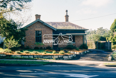
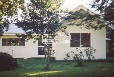
Slide - Photograph, Shire of Eltham, Parks & Environment, 728 Main Road, Eltham, c.May 1988
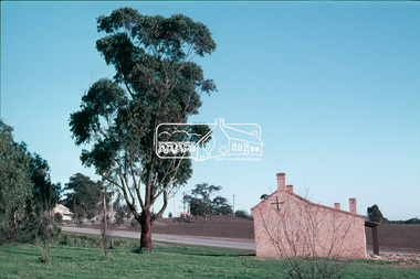
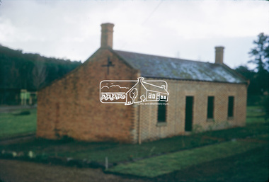
... Historical Society. eltham local history centre main road parks ...Originally built 1859 as the Eltham Police Residence, the Police moved intio new premises in Pryor Street in 1961. It was then occupied by the Eltham Shire Council Department of Parks and Environment from c.1985. In 1998 it became home of the Eltham District Historical Society.35mm colour positive transparency (1 of 23) Mount - Kodak EktachromeProcess Date MAY 88Meltham, local history centre, main road, parks and environment, police residence, shire of eltham -
 Eltham District Historical Society Inc
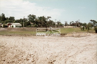
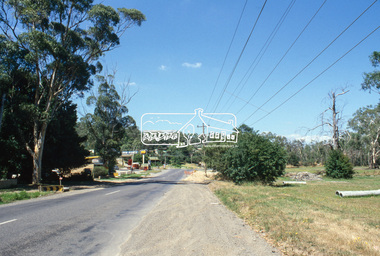
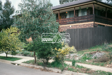
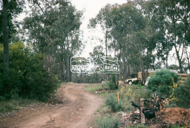
Slide - Photograph, Eltham Town Park, c.May 1988
... of the park. The site is now within the intersection of Main Road ...In 1981 the Shire of Eltham Historical Society was asked by the Victorian Place Names Committee to comment on a proposal by the Shire of Eltham to assign names to parklands in Eltham as follows:- "Eltham Common" - the area between the municipal offices, Main Road, the Eltham railway -line, and Panther Place and containing Shillinglaw Cottage. The Shire has advised that this name has been used locally for the site since about 1975. "Alistair Knox Park" - the area bounded by the Eltham railway -line, Panther Place, Main Road, Bridge Street, and Susan Street, and through which flows the Diamond Creek. The area has been known locally as "Eltham Town Park" The proposed name "Alistair Knox Park" had created some local controversy with a number of reversals of the Council's decision and letters to the local paper both for and against the proposal. The society was reluctant to be drawn into this controversy particularly as there were known to be members with strong views both for and against the proposed name. The society appreciated the work done by Alistair Knox both in the formulation of the park concept and in its development but because of the controversy generated by the proposed naming and also because of the wide general use of the park by the public·, the name Eltham Town Park was felt more appropriate. The society noted that there was no outstanding historical associations with the land comprising the park which would warrant naming the park after any particular person, place or event. No objection was raised to the Eltham Common proposal as set-out above. The decision was made in the knowledge that Alistair Knox had been associated with the society over many years and was a prominent figure in the recent history of Eltham. He was regarded as a key figure in the environmental building movement and in particular was renowned for his use of mud bricks as a building material. He served as a councillor of the Shire of Eltham from 1971-1975, his final year as Shire President. It was during these years that the proposals to create the park in its present form were shaped and Alistair played a leading part in the decision to make it a landscaped passive recreational park rather than a sporting area. The parklands comprise a section of the Diamond Creek valley. The creek itself flows through the centre of the area which is overlooked by steep hills on each side. The parks form part of the land purchased from the Crown in 1851 by J.M. Holloway and then subdivided into allotments and called "Little Eltham". While most of the area was subdivided into residential lots the creek valley was subdivided into lots suitable for small farms. Some further subdivision took place over the years and the whole of the parks now comprises eight separate titles. A list of some of the former owners has been compiled but exhaustive research on all owners has not been carried out. The ownership of one parcel has been traced back to when it was purchased from Holloway by John Hicks Petty in 1874, long after it was subdivided. Other families owning land within the area over the years included Lyon, Rees, Clark, Waterfall, Carrucan, Graham, Hill and Morant. The character of the valley area has remained rural while development occurred on each side. Early photos show the area as orchard and grazing land. In 1901 the railway was constructed through the area resulting in the timber trestle bridge across the Diamond Creek. which is an important feature of the park landscape. A memorial obelisk to the Eltham servicemen killed in World War 1 was erected at the south eastern corner of the park. The site is now within the intersection of Main Road and Bridge Street and the memorial was shifted in the 1950s to the Eltham R.S.L. clubrooms. Following the financial failure of the local sub-branch, the memorial obelisk was again relocated to the Eltham War Memorial building precinct in 2011. During the early 1960's the Council started purchasing the land which now comprises the parks. In the late 1960's the area to the east of the Diamond Creek was used as a garbage tip and filled above the flood plain of the creek. When this area was filled the tip was transferred to the west side of the creek. From the early 1970's the area has been progressively developed as a park for passive recreation with ornamental lakes, extensive tree planting and landscaping. The character of the valley before the days of the tip has been recreated and this has earned a Landscape classification from the National Trust, an unusual honour for a man-made landscape. The parks are not only attractive in appearance. The large number of people using them, particularly at weekends and holidays is evidence of their popularity and the foresight and careful planning of local residents, Councillors and Council Staff. 35mm colour positive transparency (1 of 23) Mount - Kodak EktachromeProcess Date MAY 88Meltham, main road, alistair knox park, eltham town park -
 Eltham District Historical Society Inc
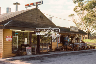
Slide - Photograph, Milk Bar and Craft Gallery, 573 Main Road, Eltham South, c.May 1988
Former Eltham Park Tea Rooms35mm colour positive transparency (1 of 9) Mount - Kodak KodachromeProcess Date MAY 88Meltham, main road, ansell and muir, chicken shop, eltham park team rooms, eltham south, milk bar, riverclay craft gallery, craft gallery -
 Eltham District Historical Society Inc
Slide - Photograph, Eltham Lower Park, c.May 1988
... of Central Park in April 1930 eltham main road Eltham Lower Park ...Originally known as Eltham Park until the establisment of Central Park in April 193035mm colour positive transparency (1 of 9) Mount - Kodak KodachromeProcess Date MAY 88Meltham, main road, eltham lower park -
 Eltham District Historical Society Inc
Slide - Photograph, Diamond Vlley Railway, Eltham Lower Park, c.May 1988
35mm colour positive transparency (1 of 9) Mount - Kodak KodachromeProcess Date MAY 88Meltham, main road, diamond vlley railway, eltham lower park -
 Eltham District Historical Society Inc
Slide - Photograph, Former Elltham Courthouse and Police Residence, c. Feb. 1989
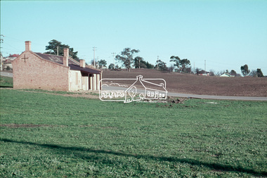
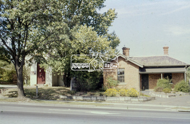
The bluestone blocks were originally part of the bluestone lockup located behind the Police Residence and Courthouse. The stones at one stage formed an edging to a grass island at the intersection of Wattletree Road and Main Road and were painted white. When that intersection was reconstructed the stones were brought back to the former residence, occupied by the Shire Department of Parks and Environement where again they were used as edging for a newly constructed driveway put through from Main Road through where the original Police Station was sited. The stones now form part of the garden bed edging at the rear of the building. At some stage in 1989 a reproduction Police Station was built beside the residence as originally located, for the purpose of providing a lunch room for shire staff. The residence has been the home of the Eltham District Historical Society and Local History Centre since 2008. 35mm colour positive transparency (1 of 8) Mount - Agfa CS System grey 8 dots728 main road, eltham, eltham courthouse, local history centre, police residence, parks and environment, shire of eltham -
 Eltham District Historical Society Inc
Slide - Photograph, Main Road, Eltham South near Wingrove Park, c.Mar. 1989
35mm colour positive transparency (1 of 28) Mount - Kodak KodachromeProcess Date MAR 89Meltham, main road, vintage cars -
 Eltham District Historical Society Inc
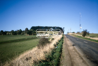
Slide - Photograph, Heidelberg-Kinglake Road, Kinglake National Park, c.June 1990
... Heidelberg-Kinglake Road, Kinglake National Park... melbourne roads heidelberg-kinglake road Kinglake National Park 35mm ...35mm colour positive transparency (1 of 36) Mount - Agfa CS System grey 8 dotsroads, heidelberg-kinglake road, kinglake national park -
 Eltham District Historical Society Inc
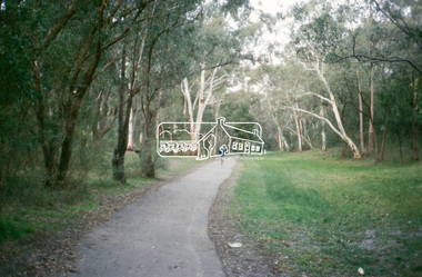
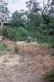
Slide - Photograph, Woodridge Linear Park Walkway, Eltham, c.June 1990
... melbourne roads eltham Woodridge Linear Park Walkway 35mm colour ...35mm colour positive transparency (1 of 36) Mount - Agfa CS System grey 8 dotsroads, eltham, woodridge linear park walkway -
 Eltham District Historical Society Inc
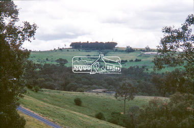
Slide - Photograph, Eltham-Yarra Glen Road, Kangaroo Ground, c.May1990
... memorial park roads Processing Date Code Jun 90M 35mm colour ...35mm colour positive transparency (1 of 25) Mount - Kodak EktachromeProcessing Date Code Jun 90Mkangaroo ground, eltham-yarra glen road, garden hill, memorial park, roads -
 Eltham District Historical Society Inc
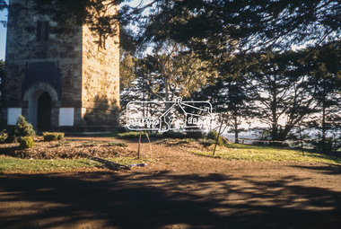
Slide - Photograph, Shire of Eltham War Memorial, Memorial Park, Garden Hill, Eltham-Yarra Glen Road, Kangaroo Ground, c.May1990
... melbourne kangaroo ground eltham-yarra glen road garden hill ...35mm colour positive transparency (1 of 25) Mount - Kodak EktachromeProcessing Date Code Jun 90Mkangaroo ground, eltham-yarra glen road, garden hill, memorial park, shire of eltham war memorial -
 Eltham District Historical Society Inc
Slide - Photograph, Caretaker's Cottage, Shire of Eltham Memorial Park, Garden Hill, Kangaroo Ground, c.May1990
... melbourne kangaroo ground eltham-yarra glen road garden hill ...35mm colour positive transparency (1 of 25) Mount - Kodak EktachromeProcessing Date Code Jun 90Mkangaroo ground, eltham-yarra glen road, garden hill, memorial park, caretaker's cottage, shire of eltham memorial park -
 Eltham District Historical Society Inc
Slide - Photograph, Wingrove Park, Eltham, c.1992
... melbourne Eltham South main road bridge wingrove park 35mm colour ...35mm colour positive transparency Mount - Black and Whiteeltham south, main road bridge, wingrove park -
 Eltham District Historical Society Inc
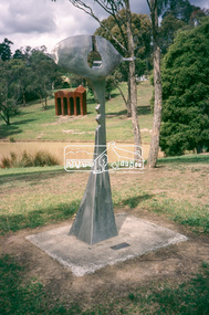
Slide - Photograph, Sculpture, Surveyor of Suburban Environs, Ernst Fries (1991), Alistair Knox Park, cnr Bridge Street and Main Road, Eltham, c.1993
35mm colour positive transparency Mount - Black and Whitealistair knox park, art in public places, classical-landscape (1996), cliff burtt, public art, sculptures, surveyor of suburban environs (1991) -
 Eltham District Historical Society Inc
Slide - Photograph, Memorial Park, Garden Hill, Kangaroo Ground, c.1993
... -Warrandyte Road Memorial Park Shire of Eltham War Memorial 35mm ...35mm colour positive transparency Mount - Black and Whitegarden hill, kangaroo ground tower, kangaroo ground-warrandyte road, memorial park, shire of eltham war memorial -
 Eltham District Historical Society Inc
Slide - Photograph, Donaldson's Oak, Donaldson Road, Kangaroo Ground, c.1993
... Donaldson from seed collected from Windsor Great Park in 1878 ...Quercus Robur (English Oak) - Was planted by John Donaldson from seed collected from Windsor Great Park in 1878.35mm colour positive transparency Mount - Black and Whitedonaldson road, donaldson's oak, heritage tree, kangaroo ground, significant tree -
 Eltham District Historical Society Inc
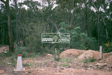
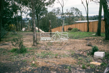
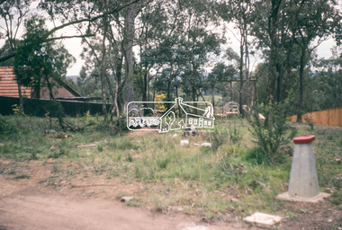
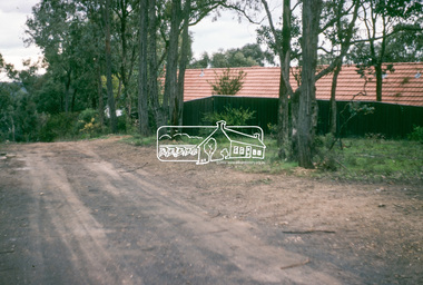
Slide - Photograph, On the Eltham Road, Walter Withers (1906), Heidelberg School Artists Trail, Alistair Knox Park, Eltham, c.Nov. 2001
The Heidelberg School Artists Trail was established in about 1999 with about 52 signs across four local governemnt areas including Nillumbik and Banyule. It extends from Heidelberg through Eltham and Warrandyte and to the Dandenongs. It features signs depicting paintings of artists in the location in which they were painted. This one acknowledges "On the Eltham Road", 1906. Transcription of the text states: "In this cheerful rural landscape, Walter Withers has captured the spirit of early Eltham. Eltham was a quiet, sleepy village, where geese wandered up the main Road and the locals either walked or rode their horses or bicycles around the township. Walter Withers was known to load up his bicycle with his collapsible easel, folding stool, paint box, water bottle and canvases, and would head off for a day’s painting. He was also known for his walking, as was his family, and they became known as the ‘Walking Withers’ Part of a slide show presentation "A Trip Down the Diamond Creek" by Russell Yeoman to the Eltham District Historical Society meeting of 14 Nov. 200135mm colour positive transparency Mount - Black and Whiteeltham, alistair knox park, heidelberg school artists trail, on the eltham road, public art, sign, walter withers