Showing 289 items
matching geological survey.
-
 The Beechworth Burke Museum
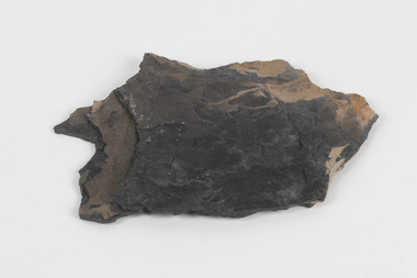
Geological specimen - Oil shale
... 1868 Geological Survey of Victoria... as part of the Geological Survey of Victoria that begun in 1852 ...This particular specimen is found in Wolgan Valley, New South Wales. It could be linked to the abandoned oil shale mining sites in Wolgan Valley such as Newnes. Newnes was an industrial complex operational in the early 20th century is now partly surrounded by Wollemi National Park. It produced motor spirit, kerosene, and gas oil. Newnes's Torbanite oil shale rock contained around 350 litres of oil shale per tonne. The Torbanite was mined by the Commonwealth Oil Corporation Ltd. Oil shale is a sedimentary rock and also a form of fossil fuel. It is often formed millions of years ago and usually contain fossilised remains of plants and/or animals. Oil shale is rich in kerogen that releases hydrocarbon when heated. These hydrocarbon can be used as an alternative petroleum or natural gas. The oil-shale rock was converted into oil by "destructive distillation"; the rock being heated until it broke down to form an oily vapour and an ash residue. Oil bearing shale is one of Australia's national assets. There are many oil companies established in Australia. It reflects Australia's rich natural resources as well as connection to the Australia's engineering and oil industry. The booming oil shale extraction businesses can be traced as far back as 1920s. This specimen is part of a larger collection of geological and mineral specimens collected from around Australia (and some parts of the world) and donated to the Burke Museum between 1868-1880. A large percentage of these specimens were collected in Victoria as part of the Geological Survey of Victoria that begun in 1852 (in response to the Gold Rush) to study and map the geology of Victoria. Collecting geological specimens was an important part of mapping and understanding the scientific makeup of the earth. Many of these specimens were sent to research and collecting organisations across Australia, including the Burke Museum, to educate and encourage further study.Piece of dark gray oil bearing shale with shades of light brown and fossilised leavesExisting label: OIL BEARING SHALE with / FOSSILISED LEAVES / Locality: Wongan Valley, NSW / Donor: Miss M. Cambell geological specimen, geology, geology collection, burke museum, beechworth, oil shale, shale, fossil fuels, alfred selwyn, wolgen valley, 1868 geological survey of victoria, rocks, sedimentary rocks, newnes, torbanite, commonwealth oil corporation ltd -
 Marysville & District Historical Society
Document (Item) - Research Document, Rene de Koning, Murchison Street Named After Roderick Impey Murchison (1792-1871), 13-08-2022
... geological survey of great britain... cambrian system silurian system geological survey of great britain ...An account of the life of Roderick Impey Murchison whom Murchison Street in Marysville in Victoria is named for.An account of the life of Roderick Impey Murchison whom Murchison Street in Marysville in Victoria is named for. Roderick Murchison was one of the most distinguished geologists of the 19th century. His liberality and social position plus the pride he took in his science were of immense value in furthering the cause of learning in Britain.roderick impey murchison, murchison street, marysville, victoria, durham school, royal military college great marlow, peninsular war, charlotte hugonin, scotland, muir of ord, tarradale house, ross and cromarty, lower palaeozoic, old red sandstone, south wales, welsh borderland, the silurian system, graywacke rocks, adam sedgwick, permian, the geology of russia in europe and the ural mountains, siluria, cambrian system, silurian system, geological survey of great britain, geological society, the geographical society, british association for the advancement of science, wollaston medal, geology, geologist -
 Federation University Historical Collection
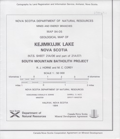
Map - Geological, Nova Scotia Department of Natural Resources, Kejimkujik Lake, Nova Scotia: Geological Map 94-05, 1994
... geological survey... nova scotia kejimkujik lake geological survey cartography mine ...Produced b Nova Scotia Department of Natural Resources, Mines and Energy Branches. The Minister of the Department was the Honourable Donald R Downe and the Deputy Minister was Darrell D HiltzLarge coloured map depicting different areas and deposits. Includes a legend, symbols used, mineral abbreviations and alteration abbreviations.Symbolsnova scotia, kejimkujik lake, geological survey, cartography, mine and energy branches, donald r downe, minister, darrell d hiltz, deputy mnister, south mountain batholith project, legend, symbols -
Federation University Historical Collection
Book, Geologiocal Survey of Victoria No 4. The Ballarat East Goldfield, 1907, 1907
... geological survey no. 4... geological survey no. 4 llanberris .1) 52 page fooslcap book with 41 ....1) 52 page fooslcap book with 41 plates and plans. Mines include News Zealand Trust, Lannberris No 1, etc. .2) Photographic image taken from the book ballarat east, ballarat east goldfield, mining, gregory, j.w. gregory, geological survey no. 4, llanberris -
 Federation University Historical Collection
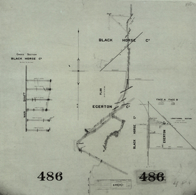
Plan, Black Horse Co
... geological survey... horse co cgt mining geological survey cross section egerton co ...Plan showing a plan and cross section of the Black Horse Co. It also shows the Egerton Co, black horse co, cgt, mining, geological survey, cross section, egerton co -
 Federation University Historical Collection
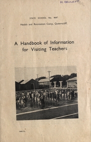
Booklet, J.J. Gourley (Government Printer), A Handbook of Information for Visiting Teachers, 1951
... geological survey of queenscliff... margaret bennett history of camp site geological survey ...A 55 page booklet about Health and Recreation Camp Queenscliff M.Bennett written on the front cover and M.J. Bennett 19 Waller Ave Ballarat written inside front cover.handbook, health and recreation camp, queenscliff, visiting teachers, margaret bennett, history of camp site, geological survey of queenscliff -
Bendigo Historical Society Inc.
Book - MINING REPORTS - MINES DEPARTMENT CAN WE HELP YOU?
... Geological Survey of Victoria... J C M Balfour Geological Survey of Victoria Mines Department ...Small, 40 page paper booklet issued by E. Condon, Secretary of Mines, under the authority of The Hon. J. C. M. Balfour, MLA, Minister of Mines. The booklet was printed Melbourne, Victoria 1969. Topics include: Assistance to Mining, Commencing Mining Operations, Concessions to Mining Industry, Miners Rights and Claims, Mining Leases and Licences, Examination Boards, Gold Buying and Selling, Air Conditions in Mines, Cyanide Plant, State Crushing Batteries, Extractive Industries, Petroleum (On Land), Petroleum (Offshore), Pipelines, Explosives, Inflammable Liquids, Gas Meter Examination and Liquified Pertoleum Gas.book, mining reports, mines department can we help you?, e condon, the hon j c m balfour, geological survey of victoria, mines department laboratories, explosives and gas examining branch, minister for mines, depot & core laboratory -
 Bendigo Historical Society Inc.
Map - GREAT EXTENDED HUSTLER'S MINE - PLAN OF THE GREAT EXTENDED HUSTLER'S MINE
... Geological Survey of Victoria... & Watson's Shaft Geological Survey of Victoria Underground Survey ...Plan of the Great Extended Hustler's Mine. Bulletin No 33, Plate No XI. Shows No 2 Shaft, Latham & Watson's Shaft, levels and their depths and some geographical features. Geographical Survey of Victoria emblem and signed by H A Whitelaw, Underground Survey Office, Bendigo, September 1913. Has reference to photos.mining, parish map, great extended hustler's mine, no 2 shaft, latham & watson's shaft, geological survey of victoria, underground survey office bendigo, h a whitelaw -
Bendigo Historical Society Inc.
Map - FORTUNA HUSTLER'S MINE - TRANSVERSE SECTION OF THE FORTUNA HUSTLER'S MINE
... Geological Survey of Victoria... Geological Survey of Victoria Underground Survey office Bendigo H ...Transverse Section of the Fortuna Hustler's Mine on the Hustler's Line of Reef, Bendigo. Bulletin No 33, Plate No III. Drawing shows poppet legs on the surface and Sill of Shaft 745.38 feet above Sea Level. Shows levels and their depths, geographical features and stone encountered. Reference table to stone and geographical features. Geographical Survey of Victoria emblem. Signed by H A Whitelaw, Underground Survey Office, Bendigo. This item has not been scanned or photographed.mining, parish map, fortuna hustler's mine, hustler's line of reef, geological survey of victoria, underground survey office bendigo, h a whitelaw -
Bendigo Historical Society Inc.
Map - HUSTLER'S CONSOLS MINE - TRANSVERSE SECTION OF THE HUSTLER'S CONSOLS MINE
... Geological Survey of Victoria... of the Hustler's Consols Mine Geological Survey of Victoria Underground ...Transverse Section of the Hustler's Consols Mine Bulletin No 33, Plate No XXXIII. Map shows poppet legs at the surface and Sill of Shaft 779.42 feet above Sea Level. Shows the different levels and their depths and the different stone and geographical features encountered. Has larger drawing of Section A - B. Geographical Survey of Victoria. Signed by H A Whitelaw, Underground Survey Office Bendigo, September 1913. This Item has not been scanned or Photographed.mining, parish map, hustler's consols mine, transverse section of the hustler's consols mine, geological survey of victoria, underground survey office bendigo, h a whitelaw -
Bendigo Historical Society Inc.
Map - HUSTLER'S REEF MINE - TRANSVERSE SECTION OF THE HUSTLER'S REEF MINE
... Geological Survey of Victoria... of the Hustler's Reef Mine Geological Survey of Victoria H A Whitelaw ...Transverse Section of the Hustler's Reef Mine on the Hustler's Line of Reefs. Bulletin No 33, Plate No XVIII. Shows cross-cuts and their depth, different types of stone and geological features encountered. Drawing of poppet legs at the surface and Sill of Shaft 756.39 ft above Sea Level. Reference Table shows key to the different stone and geographical features encountered. Geographical Survey of Victoria. Signed by H A Whitelaw, Underground Survey Office, Bendigo, September 1913. Thompson's Reef is also mentioned on the map. This item has not been scanned or photographed.mining, parish map, hustler's reef mine, transverse section of the hustler's reef mine, geological survey of victoria, h a whitelaw, underground survey office bendigo, thompson's reef. -
Bendigo Historical Society Inc.
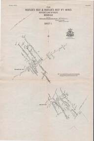
Map - HUSTLER'S REEF & HUSTLER'S REEF NO 1 MINES - PLAN OF THE HUSTLER'S REEF & HUSTLER'S REEF NO 1 MINES
... Geological Survey of Victoria... Geological Survey of Victoria Underground Survey Office Bendigo H ...Plan of the Hustler's Reef & Hustler's Reef No 1 Mines on the Hustler's Line of Reefs Bulletin No 33, Plate No XVII. Two drawings with different levels on each for clarity. Shows depth and some geographical features.Geological Survey of Victoria emblem. Signed by H A Whitelaw Underground Survey Office Bendigo, September 1913. This item has not been scanned or photographed.mining, parish map, hustler's reef & hustler's reef no 1 mines, plan of the hustler's reef & hustler's reef no 1 mines, hustler's line of reefs, geological survey of victoria, underground survey office bendigo, h a whitelaw -
Bendigo Historical Society Inc.
Map - RAYWOOD GOLD FIELD MAP, 1902
... Geological Survey of Victoria Bulletin No 12 Plate 11... Geological Survey of Victoria Bulletin No 12 Plate 11 Map. Raywood ...Map. Raywood Gold Field Map. Linen backed map of Raywood and Neilborough Township and surrounds showing the location of varying underground workings. Surveyed by H S Whitelaw 1/6/02. It shows underground workings from The Perseverance Party and moreshed and Party and underground workings on the Old Pioneer Reef. Mentions the Parish of Yallook, Parish of Neilborough, Yarraberb, Mushroom Flat, Murray Valley Plain, Eaglehawk and Kerang Railway, Green Hill, Doughboy, Redmond's Gully, Pickpocket Lead, Raywood Lead, Inglewood Lead, Shaw's Road, Nuggety Shaft, Barkly Shaft, Maori Bendmap, gold field map, raywood gold field map, neilborough, h s whitelaw, geological survey of victoria bulletin no 12 plate 11 -
 Bendigo Historical Society Inc.
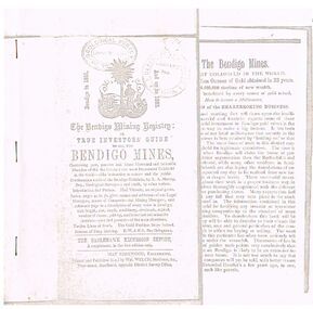
Document - THE BENDIGO MINING REGISTRY
... Geological Survey of Victoria... Geological Survey of Victoria Photocopy of The Bendigo Mining ...Photocopy of The Bendigo Mining Registry or True Investors guide to all the Bendigo Mines in 1851 and up to 1883. Contains an original poem, Index, names and addresses of Legal Managers, names of Companies and Mining Managers, and reference page to a description of every mine in Bendigo, with length, size, depth, machinery, dividends, capital, number of shares, paid-up, and historical and scientific sketches - past and present - of the main situations. Twelve Lines of Reefs. The Gold Problem Scare Solved. Success of Deep Sinking. E - W & N. S. Parallelograms.document, gold, bendigo mines 1851 - 1883, the bendigo mining registry, r a murray, hay kirkwood, wm welch, district survey office, geological survey of victoria -
 Rutherglen Historical Society
Map, 1908
... Geological Survey... Chiltern Underground Mine Map Geological Survey Reef Drives ...This is a map produced as part of a book entitled.. It is also stamped on the back in blue ink with an oval ring and the words North of England Institute. Newcastle. Mining & Meterolgical Faculty. Purchased on 23rd July 2017 by the Society after research by member Simon Killeen. Mining map of one of the first mines in Rutherglen area ( Chiltern West)Cream paper, black printing, rectangle with a drawingGeographical Survey of Victoria, Memoir, No6. Plate XX Plan of Underground Workings CHILTERN VALLEY CONSOLS MINE, RUTHERGLEN, PARISH OF CHILTERN WESTgold, rutherglen, mining, chiltern, underground mine map, geological survey, reef drives -
 The Beechworth Burke Museum
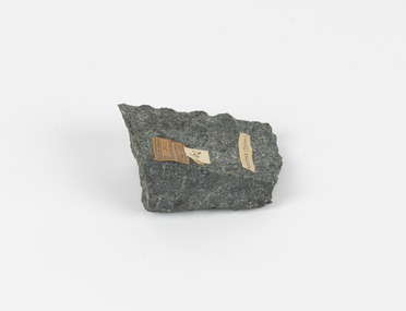
Geological specimen - Fossil Leaves
... 1868 Geological Survey of Victoria... were collected in Victoria as part of the Geological Survey ...A fossil refers to any remains or traces of past life that are preserved in the rock. It could be remains of plants or animals. Fossil leaves are commonly found on different types of rocks. These fossils can go as far back as the Triassic Age just like the series of fossil plants collected at Denmark Hill, Ipswich in Queensland. Fossils leaves are formed when dead plants get buried by sediments like mud, sand, or volcanic ash. Often, it gets detached cleanly from stems along a special layer of weak cells, then twigs, and, less commonly, cones of conifers and fruits and seeds of flowering plants. Over time, the leaves or pieces of leaves get buried by more sediments and eventually gets 'lithified' or hardened into a rock. Erosions and mining can cause the rocks to break and reveal the fossils buried in it. Fossilisation frequently takes place at sites in the lowlands where deposits of clay, silt, sand are found. This is usually due to weathering and erosion of rocks. Fossil leaves can provide information about ancient Australia's way of living. It contributes to Victorian biodiversity records and its botanical collections. It also contributes information on the geographical profile of Victoria as fossilisation usually occur at estuaries and deltas of rivers, river flood plains, ponds and lakes. This specimen is part of a larger collection of geological and mineral specimens collected from around Australia (and some parts of the world) and donated to the Burke Museum between 1868-1880. A large percentage of these specimens were collected in Victoria as part of the Geological Survey of Victoria that begun in 1852 (in response to the Gold Rush) to study and map the geology of Victoria. Collecting geological specimens was an important part of mapping and understanding the scientific makeup of the earth. Many of these specimens were sent to research and collecting organisations across Australia, including the Burke Museum, to educate and encourage further study.Piece of light brown rock with fossilised leaves in shades of golden yellow and brown.Existing label: Fossil Leaves / Locality unknown / might be worth checking if this is Glossopteris, a Permian age plant. / C. William 16/4/21 geological specimen, geology, geology collection, burke museum, beechworth, fossil leaves, fossilization, 1868 geological survey of victoria, lithified, rocks, fossilised leaf, rock, fossils, leaves -
 Flagstaff Hill Maritime Museum and Village
Book, Manual of the New Zealand Coleoptera
... Broun Publisher: Colonial Museum and Geological Survey dept Date... Museum and Geological Survey dept Date: 1880 Manual of the New ...Manual of the New Zealand Coleoptera Author: CaptainThomas Broun Publisher: Colonial Museum and Geological Survey dept Date: 1880Label on spine with typed text RH 595.76 BRO Inside front cover has a sticker that reads Warrnambool Mechanics Institute and Free Library warrnambool, shipwrecked-coast, flagstaff-hill, flagstaff-hill-maritime-museum, maritime-museum, shipwreck-coast, flagstaff-hill-maritime-village, shipwrecked-artefact, book, manual of the new zealand coleoptera -
 The Beechworth Burke Museum
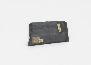
Geological specimen - Slate (Metamorphic), Unknown
... Geological survey / R S / Loc Moorabool /Slate quarries / 1... collected in Victoria as part of the Geological Survey of Victoria ...This particular specimen was found in the Moorabool Slate quarries in Victoria. The Moorabool Slate quarries was established in the 1860’s by a company of Welshmen with a crew of six who purchased land by the riverside to mine for slate. Under the promise of adding to existing recourses the crew mined the slate which was used for paving and roofing. Slate is a fine-grained, low-grade metamorphic rock that is formed by the transformation of mudstone, shale or sometimes volcanic ash under low pressure and temperatures. It dark colour is due to carbonaceous material or to finely divided iron sulphide. It is believed that Evan Rowlands and Theophilus Williams of Ballarat were the first to discover the slate veins. Slate is a one of the most common natural stones in general use. Being used as paving, flooring, roofing and more. However, its history of being mined in Australia is not common as it is considered that the best places to mine slate is Spain and parts of the United Kingdom. This specimen is part of a larger collection of geological and mineral specimens collected from around Australia (and some parts of the world) and donated to the Burke Museum between 1868-1880. A large percentage of these specimens were collected in Victoria as part of the Geological Survey of Victoria that begun in 1852 (in response to the Gold Rush) to study and map the geology of Victoria. Collecting geological specimens was an important part of mapping and understanding the scientific makeup of the earth. Many of these specimens were sent to research and collecting organisations across Australia, including the Burke Museum, to educate and encourage further study.A somewhat rectangular foliated metamorphic rock composed of quartz, sericite and minerals from the chlorite group that make up the compounds of slate. The rock is dark grey almost black.Geological survey / R S / Loc Moorabool /Slate quarries / 1/4 sheet | 78 | Roofing Slate /burke museum, beechworth, geological, slate, metamorphic, slate (metamorphic), geological specimen, slate specimen, indigo shire -
 Bendigo Historical Society Inc.
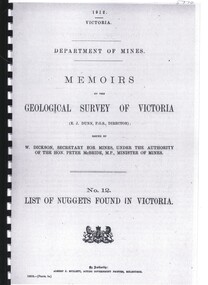
Book - LIST OF NUGGETS FOUND IN VICTORIA
... Department of Mines, Memoirs of the Geological Survey... of the Geological Survey Of Victoria No 12 List of Nuggets found in Victoria ...Department of Mines, Memoirs of the Geological Survey Of Victoria No 12 List of Nuggets found in Victoria. 67 pages in spiral binder with clear plastic cover.victoria, history, gold mining, geology, and gold pros, victoria- gold mining-gold nuggetts -
 Kiewa Valley Historical Society
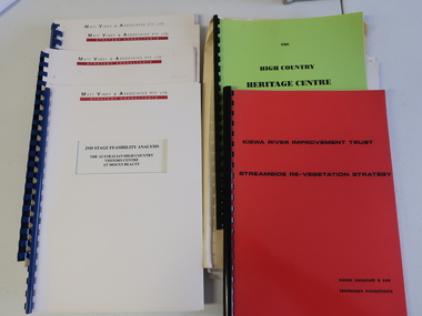
Collection of Papers and Books re - Mt Beauty Heritage Centre
... - Upper Kiewa Valley Water Supply Catchment 8. Geological Survey... Beauty Discovery Centre Geological Surveys 1. Bogong - The Alpine ...In the early 1990s the KVHS applied for a grant to create the Mt Beauty Heritage Centre / Discovery Centre. This involved employing consultants and further research.This collection includes a lot of detail of the Kiewa Valley area.1. Bogong - The Alpine Discovery Centre 2. Heritage Centre - black folder 3. Heritage Centre - manila folder 4. High Country Heritage Centre - 1991 - green spiral folder 5. Six Heritage Centre - Matt Viney & Associates - white spiral folders 6. Landscape Consultants - Susan Campbell & son - red spiral folder 7. Plant List - Upper Kiewa Valley Water Supply Catchment 8. Geological Survey of Vic., Plates, Bulletin No. 44 - in battered paper 'bag' with front cover list of contents - 15 plates 9. Geological Survey - A3 photo copies of pages 106-117 10. Geological Survey of Vic. - Report of Progress No VII 1884 - bound book 11. Geological Survey of Vic. Bulletin 56 - includes nth east Vic. 1958 - bound book with green cloth spine 12. Department of Mines Report Vic. 1906 - booklet held with two staples 13. Royal Society of Vic book - The Geology of the Kiewa Area 1961 14. Miscellaneous papers - Geological Survey, Reports of Fossil Specimens and maps of local area 15. Gold - Appendix K and Appendix 111, Part C - photocopied pages from Vic Mining Registrars Report 1888 - manila foldermt beauty heritage centre, mt beauty discovery centre, geological surveys -
Federation University Historical Collection
Booklet, The Science and Art of Mining: Handbook for Mining Students and Colliery Managers
... Fifty page book with the following sections: * Geology... with the following sections: * Geology * Surveying * Lighting of Mines ...Fifty page book with the following sections: * Geology * Surveying * Lighting of Mines (safety lamp, Dr Clowes' gas detecting lamp, Mueseler and Marsact Safety Lamp * Coal Miners Regulation Actcoal mining, colliery, mining, safety lamp -
 The Beechworth Burke Museum
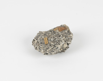
Geological specimen - Granodiorite, Unknown
... label: Geological survey / R S / Loc Harcourt quarries... were collected in Victoria as part of the Geological Survey ...This specimen was found in Harcourt, Victoria. Harcourt is a small historic gold rush town located in a valley at the foot of Mount Alexander (741 m) in the Central Highlands of Victoria. In recent times the goldrush origins of the town have been replaced by a district known for apples, cider and wine. The Traditional owners of Harcourt are The Dja Dja Wurrung people. Granodiorite is a coarse-grained intrusive igneous rock similar to granite, but containing more plagioclase feldspar than orthoclase feldspar. Granodiorite has greater than 20% quartz by volume, and between 65% and 90% of the feldspar is plagioclase. This piece is of significance due to its provenance in Harcourt, Vic. Granodiorite is commonly produced in volcanic arcs, and in mountain buildings where it emplaces as large batholiths in mountain roots. Granodiorite is the plutonic equivalent of dacite. This specimen is part of a larger collection of geological and mineral specimens collected from around Australia (and some parts of the world) and donated to the Burke Museum between 1868-1880. A large percentage of these specimens were collected in Victoria as part of the Geological Survey of Victoria that begun in 1852 (in response to the Gold Rush) to study and map the geology of Victoria. Collecting geological specimens was an important part of mapping and understanding the scientific makeup of the earth. Many of these specimens were sent to research and collecting organisations across Australia, including the Burke Museum, to educate and encourage further study.Granodiorite is a coarse-grained intrusive igneous rock similar to granite, but containing more plagioclase feldspar than orthoclase feldspar. According to the QAPF diagram, granodiorite has a greater than 20% quartz by volume, and between 65% and 90% of the feldspar is plagioclase.GRANDIORITE. / Locality: / Harcourt, Victoria / Other label: Geological survey / R S / Loc Harcourt quarries [?] Alexander / 1/4 Sheet. | 4 | Granite /granodiorite, granite, burke museum, harcourt, coarse-grained, igneous, plagioclase feldspar, orthoclase feldspar, quartz, mount alexander, the dja dja wurrung people, the traditional owners, central highlands of victoria, gold rush -
 Federation University Historical Collection
Plan, Scarsdale County of Grenville, 1889, 26/01/1889
... Rectangular plan of a geological survey edged in masking... crown lands Ferdinand Krause Rectangular plan of a geological ...Rectangular plan of a geological survey edged in masking tape. It is predominantly grey, pink and green, but has some yellow. scale is 40 chains to one inch. (see Cat. No. 1098 for report on the Parish of Scarsdale)scarsdale, grenville, krause, browns and scarsdale, mopianimum, watershed, yarrowee, woady yalloak, timber reserve, department of mines, plans, cgt, crown lands, ferdinand krause -
Clunes Museum
Document - REPORTS
... .2 & .3 PHOTOCOPY OF TWO PAGES OF A GEOLOGICAL SURVEY... OF A GEOLOGICAL SURVEY COMPLETED FOR THE GOVERNMENT (SENT IN 17/5/1909 ...E J Dunn described the geology of the mining in an around Clunes and a recommendation for re-commencing mining operations in Clunes 1909.1 PHOTOCOPY OF A PAGE SHOWING RETURNS MADE BY MINING SURVEYORS AND REGISTERS TAKEN FOR THE QUARTER ENDED 31ST MARCH 1875 .2 & .3 PHOTOCOPY OF TWO PAGES OF A GEOLOGICAL SURVEY COMPLETED FOR THE GOVERNMENT (SENT IN 17/5/1909)NILlocal history, document, mining -
 Bendigo Historical Society Inc.
Document - MCCOLL, RANKIN AND STANISTREET COLLECTION: THE REDESDALE GOLDFIELD, 1909
... 1909 report from the Department of Mines Geological Survey... the Department of Mines Geological Survey on the Redesdale Goldfield by E ...1909 report from the Department of Mines Geological Survey on the Redesdale Goldfield by E. J. Dunn. F.G.S. Reefs mentioned are the Horseshoe Bend Reef, Linda Reef, Bill Smith's workings, the Ben Guy Reef and the Amelia ReefDepartment of Minesgold mining, miners' safety cage, redesdale goldfield, gold mining, redesdale. -
 The Beechworth Burke Museum
Geological specimen - Greenstone / Gabbro, Unknown
... Geological Survey label/and probably collected by/Richard Daintree... collected in Victoria as part of the Geological Survey of Victoria ...This specimen was recovered from Ceres West of Geelong, Victoria. Greenstone is the name for any metamorphosed basic igneous rock (in the case of this specimen, Gabbro) that gains its greenish colour to the presence of the minerals chlorite, actinolite, or epidote, hence the term 'green' and 'stone'. Greenstone is often formed through metamorphsis along a convergent plate boundary. In the rock cycle (the series of processes that creates the various types of rocks) there are identified three different types of rocks, which are the sedimentary, the igneous and the metamorphic. Metamorphic rocks started out as sedimentary, igneous or earlier metamorphic rocks but changed from their original condition under the effect of high heat, high pressure or hot, mineral-rich fluid. However, if pressure or heat is too high, then the rock will melt, resulting in the formation of an igneous rock. The name used to describe these types of rocks reflects this specific inherent trait of change, since the word “metamorphic” derives from the Greek word “metamorphosis”, meaning “change of form or structure”. Metamorphic rocks form in the Earth`s crust but can be also found on the surface, due to elevation of the Earth`s surface. They are divided into two categories: the foliated metamorphic and the non-foliated metamorphic rocks. Gabbro is a highly useful mineral that is often polished to create cemetery markers and kitchen benches. It is notable for its qualities of durability, being able to withstand extreme elements and wear. Whilst not rare, Gabbro is of great utility and has been highly desirable for its qualities. This specimen is part of a larger collection of geological and mineral specimens collected from around Australia (and some parts of the world) and donated to the Burke Museum between 1868-1880. A large percentage of these specimens were collected in Victoria as part of the Geological Survey of Victoria that begun in 1852 (in response to the Gold Rush) to study and map the geology of Victoria. Collecting geological specimens was an important part of mapping and understanding the scientific makeup of the earth. Many of these specimens were sent to research and collecting organisations across Australia, including the Burke Museum, to educate and encourage further study.Greenstone is a solid hand-sized metamorphic mineral of a green colour. Greenstone is the name for any metamorphosed basic igneous rock (in the case of this specimen, Gabbro) that gains its greenish colour to the presence of the minerals chlorite, actinolite, or epidote, hence the term 'green' and 'stone'. Gabbro is a medium to coarse grained rocks that consist primarily of plagioclase feldspar and pyroxene. Greenstone is often formed through metamorphsis along a convergent plate boundary. Gabbro forms due to cooling and crystallization of magma underneath Earth's surface. Greenstone/Gabbro/from Ceres west/of Geelong. Has old Geological Survey label/and probably collected by/Richard Daintree in 1861/C.Willam 15/4/21/ Other label: 62 /greenstone, metamorphosed, igneous rock, gabbro, chlorite, actinolite, epidote, metamorphsis, rock cycle, various types of rocks, sedimentary, high heat, high pressure, mineral-rich fluid, metamorphosis, foliated metamorphic, non-foliated metamorphic, convergent plate boundary, greenish colour, minerals -
 Bendigo Historical Society Inc.
Map - STRUGNELL COLLECTION: HUSTLER'S LINE OF REEFS, September 1913
... No. 33. Included is the emblem of the Geological Survey... Bulletin No. 33. Included is the emblem of the Geological Survey ...Map, Hustler's Line of Reefs, Hustler's Reef & Hustler's Reef No.1 Mines, Plan view . Plate No. XV (15).Sheet 1 Bulletin No. 33. Included is the emblem of the Geological Survey of Victoria. Signed by H.A.Whitelaw Underground Survey Office, Bendigo, Septembe ,1913.Underground Survey Office, Bendigo.map, bendigo, hustler's reef & hustler's reef 1 -
 Federation University Historical Collection
Book, William Harvey Emmons, The Principles of Economic Geology, 1940, 1940
... of Minnesota geological Survey; and previously Geologist, Section... of Minnesota geological Survey; and previously Geologist, Section ...The book was used by Charles Bacon who studied at the University of Nevada in the late 1930s/early 1940s. Bacon worked at Bunker Hill Mines and Kellogg Idaho, before arriving in Australian in 1951. He worked for CN Myers, a company involved with paper converting. CN Myers was a family business (on Charles Bacon's maternal line). William Emmons was Professor and head of Geology and Mineralogy at the University of Minnesota; Director of Minnesota geological Survey; and previously Geologist, Section of Metalliferous Deposits, United States Geological Survey.Maroon soft covered book of 529 pages. Chapters include Magmatic Segregations, Pegmatities, Hypothermal Deposits, Sedimentary Depostis, Openings in Rocks, Metasomatic Processes, Mineral Associations and more.Inside front cover "Charles Bacon 1940 Lincoln Hall Ass. University of Nevada Reno, Nevada"charles bacon, mining engineering, metallurgy, university of nevada, mackay school of mines, geology, california -
Bendigo Historical Society Inc.
Document - MINING REPORTS - REPORT OF, ON AURIFEROUS DRIFTS AND QUARTZ REEFS
... describes the gravels and rocks of a Geological Survey. Survey... the gravels and rocks of a Geological Survey. Survey is compared ...Printed document: Geological Department: Report of, on auriferous Drifts and Quartz Reefs, dated 8th May,1866. Paper describes the gravels and rocks of a Geological Survey. Survey is compared with the lower drifts of Bendigo, Epsom, Ballaarat, Castlemaine and other gold-fields. Four colour sketch-sections included.document, gold, mining reports, mining reports, report of, on auriferous drifts and quartz reefs, mr bindon, alfred r c selwyn, john ferres -
Bendigo Historical Society Inc.
Map - UNITED HUSTLER'S & REDAN MINE - TRANSVERSE SECTIONS N & S OF SHAFT UNITED HUSTLER'S & REDAN MINE
... and depth. Geological Survey of Victoria emblem and signed by H... on the levels and depth. Geological Survey of Victoria emblem and signed ...Transverse Sections N & S of Shaft United Hustler's & Redan Mine on the Hustler's Line of Reef Bulletin No 33, Plate No XXX. Map shows some of the stone encountered on the levels and depth. Geological Survey of Victoria emblem and signed by H A Whitdan, Underground Survey Office Bendigo, September 1913.mining, parish map, united hustler's & redan mine, transverse sections n & s of shaft united hustler's & redan mine, hustler's line of reef