Showing 134 items
matching index of plans
-
 University of Melbourne, Burnley Campus Archives
Plan, AMRAD Burnley Development Civil Drawings, 1997-1998
Job No 74046 New Laboratories & Offices Building 5 & 9 AMRAD Burnley Development, for AMRAD Operations Pty. Ltd. By Scott Wilson Irwin Johnston. (1) C1 Drawing Index, Legend & General Notes, Nov 97. (2) C2 Pavement & Drainage Plan 03.98. (3) C3 Pit Schedule & Pavement Details 03.98.scott wilson irwin johnston, amrad, johnston merat kurdiovsky architects, amrad burnley development -
 Bendigo Historical Society Inc.
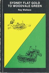
Book - SYDNEY FLAT GOLD TO WOODVALE GREEN, 1984
... and Illustrations and plan. 80 pages. With Index.... Photographs and Illustrations and plan. 80 pages. With Index Book ...Sydney Flat Gold to Woodvale Green. Espress Printers, Bendigo. ISBN L0-9591143-0-0. Cover Design & illustrations by Kevin Vallence. Woodvale Progress Association 1984. Photographs and Illustrations and plan. 80 pages. With IndexRay Wallacehistory, woodvale, ray wallace, woodvale progress association, sydney flat, weddikar run, myers creek, eaglehawk, poet, book collector, naturalist, history 1845, gold 1852, squatters, government, early settlers, farmed, school, church, industry, pubs, railway, sport, artists -
Canterbury History Group
Book, Claire Levi, For the honour of our school : 120 years of Fintona Girls' School, 2016
History of the school, the people - principals, teachers, students, support staff, and volunteers - and events. The stories and memories are designed to "tell a story of Fintona's developments and changes over 120 years".200 pages; : illustrations (some colour), portraits (some colour), plan, facsimiles. Includes bibliographical references (pages [180]-195) and indexnon-fictionHistory of the school, the people - principals, teachers, students, support staff, and volunteers - and events. The stories and memories are designed to "tell a story of Fintona's developments and changes over 120 years".fintona girls school, schools, balwyn -
 Bendigo Historical Society Inc.
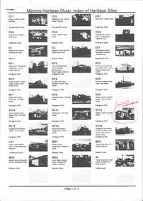
Book - MARONG HERITAGE STUDY
Eighty one loose pages stapled together. Marong Heritage Study: Index of Heritage Sites. First three pages identifies the various sites followed by an in depth description of each sites and the recommendations for inclusion in the Heritage Overlay Table in the City of Greater Bendigo Planning Scheme.bendigo, council, heritage study -
 Melbourne Tram Museum
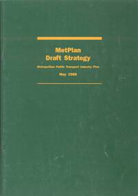
Document - Report, Metropolitan Transit Authority (MTA), "Metplan Draft Strategy - Metropolitan Public Transport Industry Plan - May 1988", May. 1988
Report - 40 pages, green card cover, centre stapled titled "Metplan Draft Strategy - Metropolitan Public Transport Industry Plan - May 1988", looking at Melbourne's transport needs over the next 15 years. Comments were to close on 15/8/1988. Produced by the MTA, signed off by K. P. Shea as Managing Director. Has an index, looks at the Task, heavy, light rail, tram, bus, taxis, ticketing systems, management, and the various regions including funding and budget.trams, tramways, discussion paper, transport, light rail, tramways, railways, road transport, minister for transport, mta, metplan -
 Melbourne Tram Museum
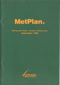
Document - Report, Metropolitan Transit Authority (MTA), "Metplan Metropolitan Public Transport Industry Plan - September 1988", May. 1988
Report - 64 pages, green card cover, centre stapled titled "Metplan Metropolitan Public Transport Industry Plan - September 1988", looking at Melbourne's transport needs over the next 15 years. Produced by the MTA, signed off by Jim Kennan Minister for Transport . Has an index, looks at the Task, heavy, light rail, tram, bus, taxis, ticketing systems, management, and the various regions including funding and budget.trams, tramways, transport, light rail, tramways, railways, road transport, minister for transport, mta, metplan -
 Melbourne Tram Museum
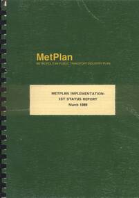
Document - Report, Metropolitan Transit Authority (MTA), "Metplan Metropolitan Public Transport Industry Plan - Metplan Implementation - 1st Status Report, Mar. 1989
Report - approx. 100 pages - un-numbered, A4, black comb binder with green covers titled "Metplan Metropolitan Public Transport Industry Plan - Metplan Implementation - 1st Status Report - March 1989." Report looks at the implementation of Metplan (See Regg Item 348). Produced by the Metropolitan Transit Authority. Does not have an index, does provide a large list of projects.trams, tramways, transport, light rail, tramways, railways, road transport, minister for transport, mta -
 Warrnambool and District Historical Society Inc.
Book, Pam Marriott (publisher), Top Dog of the West, 2017
This book, written by Pam Marriott, is subtitled ‘A Study of the Belfast and Western District Civil Service 1841-1886’. It contains information on the police, police magistrates, court officials, customs and immigration officials etc who lived and worked in the Port Fairy and Warrnambool districts in the 19th century and many of the incidents and events with which they were connected. The book includes much information that is relevant to Warrnambool’s past. This book is an important acquisition to the Warrnambool & District Historical Society library as it contains information on many 19th century Warrnambool personalities, including policemen and court officials. It also has detailed information on some events that occurred in the Warrnambool district in the 19th century. This is a soft cover book of 480 pages. The cover and spine are white, with a black and white photograph and black printing. The pages include an introduction, eleven chapters of printed material, an index, a bibliography and appendices. There are several black and white photographs, plans, maps and other illustrative material. western district 19th century history, western district civil service 19th century, history of warrnambool -
 Ballarat Tramway Museum
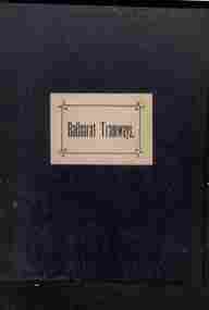
Administrative record - Book, Andersons' printing, "Ballaarat Tramways", Jan. 1888
Book with an index or table of contents, listing all the documents relating to the establishment of the Ballaarat Tramways (the horse tram operator) including, references to Legislation and orders in council, original tender conditions, the contract between the Council and Edward Thomson, Specifications for the construction, delegation to the operator, and plan of routes. Last document dated 17/1/1888.Yields information about the establishment of the Ballarat horse trams, Councils and the operator.Bound book, with end papers, 20 pages, patterned covers, titled with a label on the front cover - "Ballaarat Tramways"Has an old ownership note on the inside front cover.secv, tramways, horse trams, city of ballaarat, ballaarat tramway company, tenders, specifications, operations, maps -
 Narre Warren and District Family History Group
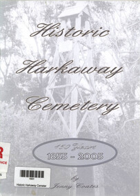
Book, Jennifer Coates et al, Historic Harkaway Cemetery - 150 years 1855 - 2005, 2005
Published in 2005, it provides a detailed history of the Harkaway Cemetery, including maps, plans, and genealogical records. The book is 27 pages long and includes an index. Some names included are Aurisch, Ramsden, Barr, Bruhn, Hessel, Troup, Wanke, Kent, Koenig, Meyer and Nichol.vi, 27 p.; 21 cmnon-fiction Published in 2005, it provides a detailed history of the Harkaway Cemetery, including maps, plans, and genealogical records. The book is 27 pages long and includes an index. Some names included are Aurisch, Ramsden, Barr, Bruhn, Hessel, Troup, Wanke, Kent, Koenig, Meyer and Nichol.harkaway (vic.), harkaway cemetery -
 Wodonga & District Historical Society Inc
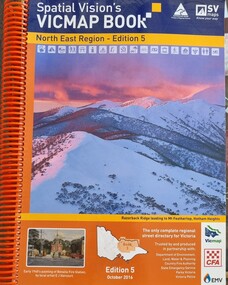
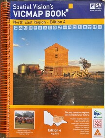
Book - Spatial Vision's VICMAP BOOK 2016 - Northeast Region, Spatial Vision Innovations Pty Ltd, 2016
This edition of Spatial Vision's VicMap Book North East Region was published in October 2016 and provides detailed topographic maps for the region. It was used by emergency services and various agencies, including the Country Fire Authority (CFA). It covers areas including Wodonga, Albury, Wangaratta, and beyond, including national parks and recreation areas. Text on the cover states that the volume is "Trusted by and produced in partnership with: Department of Environment, Land, Water & Planning, Country Fire Authority, State Emergency Service, Parks Victoria, Victoria Police".A spiral bound volume of 409 pages including colour topographic maps and illustrations of North East Victoria. The cover features a colour photo of Razorback Ridge leading to Mount Feathertop, Hotham Heights, Victoria. It also features an index map inside the front cover, a legend, road index, and locality index.This edition of Spatial Vision's VicMap Book North East Region was published in October 2016 and provides detailed topographic maps for the region. It was used by emergency services and various agencies, including the Country Fire Authority (CFA). It covers areas including Wodonga, Albury, Wangaratta, and beyond, including national parks and recreation areas. Text on the cover states that the volume is "Trusted by and produced in partnership with: Department of Environment, Land, Water & Planning, Country Fire Authority, State Emergency Service, Parks Victoria, Victoria Police".emergency management north east victoria, state emergency service, cfa wodonga -
 Wodonga & District Historical Society Inc
Book - Spatial Vision's VICMAP BOOK 2014 - North East Region
This edition of Spatial Vision's VicMap Book North East Region was published in May 2014 and provides detailed topographic maps for the region. It was used by emergency services and various agencies, including the Country Fire Authority (CFA). It covers areas including Wodonga, Albury, Wangaratta, and beyond, including national parks and recreation areas. Text on the cover states that the volume is "Trusted by and produced in partnership with: Department of Environment, Land, Water & Planning, Country Fire Authority, State Emergency Service, Parks Victoria, Victoria Police".A spiral bound volume of 409 pages including colour topographic maps and illustrations of North East Victoria. The cover features a colour photo of the old flour mill at Milawa, Victoria. It also features an index map inside the front cover, a legend, road index, and locality index.non-fictionThis edition of Spatial Vision's VicMap Book North East Region was published in May 2014 and provides detailed topographic maps for the region. It was used by emergency services and various agencies, including the Country Fire Authority (CFA). It covers areas including Wodonga, Albury, Wangaratta, and beyond, including national parks and recreation areas. Text on the cover states that the volume is "Trusted by and produced in partnership with: Department of Environment, Land, Water & Planning, Country Fire Authority, State Emergency Service, Parks Victoria, Victoria Police".emergency management north east victoria, cfa wodonga -
 Port Melbourne Historical & Preservation Society
Archive, 1970s and 1980s
Various typescripts, publications, card indexes, etc. compiled by Nancy U'Ren relating to her 1976 MA thesis "Early Growth and Development of Sandridge" and her contribution to the 1983 book "A History of Port Melbourne"city of port melbourne, metropolitan town planning commission, port melbourne gateway proposal 1999, garden city, electoral rolls, marriage and baptism records, victorian legislative council, censuses -
 Monbulk RSL Sub Branch
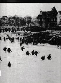
Book, Time-Life Books, The second front, 1977
Text and photographs survey the planning and execution of Operation Overlord, the Allied invasion of Germanoccupied Europe on June 6, 1944.Index, bib, ill, , maps, p.208.non-fictionText and photographs survey the planning and execution of Operation Overlord, the Allied invasion of Germanoccupied Europe on June 6, 1944.world war 1939-1945 - campaigns - western europe, operation overlord