Showing 199897 items matching "12-errard-street-south"
-
 Whitehorse Historical Society Inc.
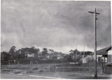
Photograph, Corner South Parade & Main Street, Blackburn
Black and white photo of Corner South Parade and Main Street, Blackburnsouth parade, blackburn, main street -
 Rutherglen Historical Society
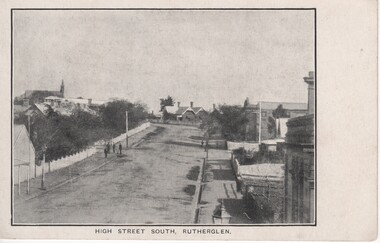
Image, High Street South, Rutherglen, c1890
At left of photo is the roof and spire of St Stephen's Church. The building that can be seen at the centre of the photo is the house now located between the police station and the former court house.Black and white postcard photograph of High Street, Rutherglen, facing south.high street -
 Ballarat Heritage Services
Photograph, Clare Gervasoni, Glencoe, 3 Dawson Street South, Ballarat, 21/04/2020
Colour photograph of a weatherboard cottage at 3 Dawson Street South, Ballaratballarat, architecture, dawson st south, glencoe -
 Ballarat Heritage Services
Photograph, Clare Gervasoni, Elders, Armstrong Street South, Ballarat, 2020, 23/04/2020
Colour photograph of a double storey building in Armstrong Street South, Ballarat.elders, armstrong st south, ballarat -
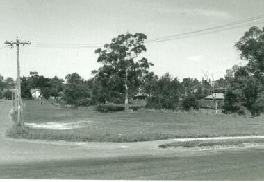
 Ballarat Heritage Services
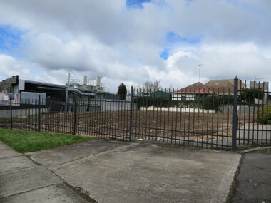
Photograph - Colour, Vacant Lot on the Corner of Armstrong Street South and Grant Street, Ballarat, 2017, 15/09/2017
Colour photograph of a vacant block. It had formerly been Leading Edge Computer which burnt down in 2016. The building was leveled in September 2017.armstrong street south, vacant black, grant street -
 Ballarat Heritage Services
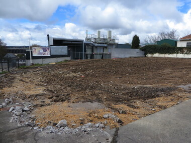
Photograph - Colour, Vacant Lot on the Corner of Armstrong Street South and Grant Street, Ballarat, 2017, 15/09/2017
Colour photograph of a vacant block. It had formerly been Leading Edge Computer which burnt down in 2016. The building was leveled in September 2017.armstrong street south, ballarat -
 Ballarat Heritage Services
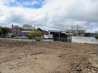
Photograph - Colour, Vacant Lot on the Corner of Armstrong Street South and Grant Street, Ballarat, 2017, 15/09/2017
Colour photograph of a vacant block. It had formerly been Leading Edge Computer which burnt down in 2016. The building was leveled in September 2017.lamp, anderson and ritchie -
 Surrey Hills Historical Society Collection
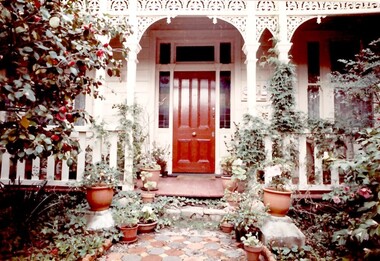
Photograph, 'Glen Affric', 12 Durham Road, Surrey Hills, 1980s
Negative No 2121. Miss Jessie McCleverty operated a girls' high school at 12 Durham Road from 1903-1905/6. After this time she moved the school to 44 Windsor Crescent where it operated until 1933. Oral testimony from Mrs R McCoy: (NB/ It is unclear whether this refers to 12 Durham Road or 44 Windsor Crescent, but it is more likely to be the later as Mrs McCoy donated a photo taken in 1982 of 44 Windsor Crescent.) "She added school rooms and a veranda to the back. She was keen on Esperanto, the international language and wanted her pupils to know it. There was an archway over the gate, part of the design being a star, part of the Esperanto sign - and some suitable wording. Each morning the pupils greeting had to be "Good Morning Fraternity", in Esperanto."Colour photo taken front-on from the street of a Victorian-style house painted white and with ornate lacework along the veranda. It has a mature garden either side of a tessalated tile path.miss mccleverty's girls' school, victorian style, glen affric, miss jessie mccleverty, schools, durham road -
 Port Melbourne Historical & Preservation Society
Document, Bay Street Committee of management, "Bay Street Information Guide - Be Tempted", 2005
"Bay Street Information Guide - Be Tempted". Coloured 51 page booklet produced by Bay Street Committee of Management in 2005. Advertising for Bay St shops.advertising, business and traders, built environment - industrial, built environment - commercial, bay street, information guide -
 Federation University Historical Collection
Map - Geological, Tallangatta, New South Wales: 1:250,000 Geological Series, SJ 55-3, 1966, 1966
Compiled by the Geological Survey of N.S.W., Division of Regional Geology. Topographical base compiled from Snowy Mountains Hydro Electrical Authority, Department of Lands, County maps and Snowy Lease Map. Other sheet adjoin this map. There are 13 formation sections grouped into 9 - Quaternary, Tertiary, Middle Devonian, Lower to Middle Devonian, Lower Devonian, Upper Silurian, Silurian, Upper Ordovician and Ordovician.Large coloured map showing geological features, faults, bores, rivers and mineral deposits.Scale of map, longitude and latitude, river names. "Tallangatta 1:250,00" written in black pen.tallangatta, new south wales, geological survey, topographical base, snowy mountains hydro electrical authority, department of lands, snowy lease map, department of mines, quaternary, tertiary, middle devonian, lower to middle devonian, lower devonian, uper siluran, silurian, upper ordovician, ordovician -
RMIT GSBL Justice Smith Collection
Report, The Law Foundation of New South Wales, Lawyers and their work in New South Wales : preliminary report, 1978
ISBN: 0909136157practice of law -- new south wales, lawyers: new south wales. reports: surveys, lawyers -- new south wales -
 Victorian Railway History Library
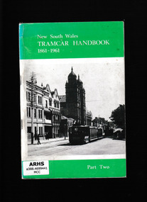
Book, South Pacific Electric Railway Co-operative Society et al, New South Wales tramcar handbook, 1861-1961. part 2, 1976
A study of the various types of rolling stock used on the tramways of New South wakes including trolley busesIll, maps, p.92.non-fictionA study of the various types of rolling stock used on the tramways of New South wakes including trolley busestramways - new south wales, tramway rolling stock -
 Victorian Railway History Library
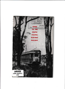
Booklet, Guide to the South Pacific Electric Railway, 196?
An illustrated guide to the South Pacific Electric RailwayIll, p.23.An illustrated guide to the South Pacific Electric Railwaytramways - sydney, sydney tramway museum - loftus nsw -
 Victorian Railway History Library
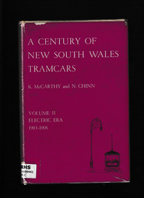
Book, South Pacific Electric Railway, A century of New South Wales tramcars. v. 2, Electric era ; 1903-1908, 1968
Descriptions of the electric trams in Sydney between 1903 and 1908Index, ill, maps, p.199.non-fictionDescriptions of the electric trams in Sydney between 1903 and 1908tramways - sydney, electric trams - sydney -
 Victorian Railway History Library
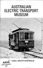
Book, Australian Electric Transport Museum (South Australia) Inc, Australian Electric Transport Museum - St Kilda South Australia, 1974
Details of the rollingstock collection at the Australian Electric Transport Museum - St Kilda South Australiaill, maps, p.32.non-fictionDetails of the rollingstock collection at the Australian Electric Transport Museum - St Kilda South Australiatramway museum - south australia, railway and tramway preservation - australia -
 Victorian Railway History Library
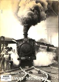
Book, New South Wales Rail Transport Museum, New South Wales Railway Museum, 1974
A submission to the Government of New South Railways about the future of the New South Wales Rail Transport Museum at Enfield Sydney NSWmaps, p.55.non-fictionA submission to the Government of New South Railways about the future of the New South Wales Rail Transport Museum at Enfield Sydney NSWenfield railway museum - sydney nsw, tourist railways and museums - australia -
 Victorian Railway History Library
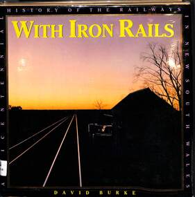
Book, Burke, David, With Iron Rails - A Bicentennial History of the Railways in New South Wales, 1988
a history of the railways in New South Wales up to 1988 the bicentenary of the colonizing of Australia.index, ill, maps, p.248.non-fictiona history of the railways in New South Wales up to 1988 the bicentenary of the colonizing of Australia.railroads -- australia -- new south wales -- history., state rail authority of new south wales -- history. -
 Ringwood and District Historical Society
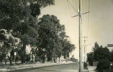
Photograph, Ringwood Street at Bourke Street Ringwood, looking south, early 1960s prior to Eastland development
Black and white photograph of road. Trees line left of street. Power pole to right of photograph with signage reading, 'Court House' and 'Bourke St.' Police station sign to right of picture.Typed below photograph, "Ringwood St. looking south. Ringwood Reserve on left". -
 Warrnambool and District Historical Society Inc.
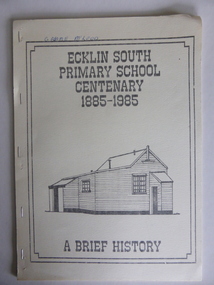
Booklet, Ecklin South Primary School 1885-1985, 1985
This is a short history of the Ecklin South Primary School from 1885 to 1985. Ecklin South is 37 kilometres from Warrnambool and 25 kilometres from Port Campbell. The school was established on a five acre site in 1885 with the first teacher, Andrew Harkness. A new building was erected in 1937.This booklet is of interest because it gives the history of a school in Ecklin South, a district not far from Warrnambool. It will be useful for research. This is a soft cover booklet of 28 pages produced in-house by Ecklin South Primary School Centenary Committee members.. The cover is a buff colour with a black, grey and white sketch of the school on the front. The history of the school is type-written and there are several black and white photographs reproduced by photocopying. The booklet includes a poem, ‘Ecklin School’ by Iris Wormald and a list of the teachers from 1885 to 1985. The booklet has been stapled. Some of the pages are difficult to read. Front cover: ‘Ecklin South Primary School Centenary 1885-1985 A Brief History’ecklin south, ecklin south primary school, warrnambool -
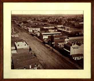 Federation University Historical Collection
Photograph - Photograph - Sepia, Ballarat Looking South Along Armstrong Street, 1872
This photograph was taken not long after the Ballarat Town Hall tower was builtFramed sepia photograph showing a bird's eye view of Ballarat looking south from the tower of the Ballarat Town Hall. Businesses shown in the photograph include Town Hall Hotel, West's Hotel, National Loan Office, Edinburgh Castle Hotel, Magill and Coglan, Dana Street Primary School, Band of Hope and Albion Mine, I. Dean auctioneer, Pritchard, Murray, Victoria Foundry. Just south of West's is the Phoenix Foundry.ballarat, ballarat town hall, ballarat streetscape, ballarat townscape, william bardwell, fotobiennale -
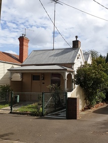 Ballarat Heritage Services
Photograph, Clare Gervasoni, 216 Dawson Street South, Ballarat, 21/04/2020
Colour photograph of a weatherboard miners cottage at 216 Dawson Street South, Ballaratballarat, architecture, dawson st south, miners cottage -
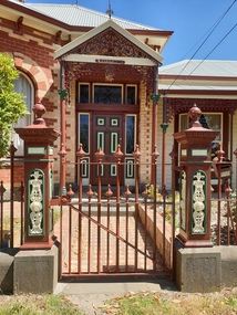 Ballarat Heritage Services
Photograph, 404 Armstrong Street South, Ballarat, 19/01/2019
A brick house at 404 Armstrong Street South, Ballarat with an iron fence in bluestone.armstrong street south, ballarat, brick, bluestone, architecture -
 Ballarat Heritage Services
Photograph, Clare Gervasoni, 216 Dawson Street South, Ballarat, 2024, 30/06/2024
Colour photograph of a weatherboard miners cottage at 216 Dawson Street South, Ballaratballarat, architecture, dawson st south, miners cottage -
 Ringwood and District Historical Society
Photograph, South-east corner Ringwood Street and Reynolds Ave. Ringwood. Undated but probably 1971-73
No date, but other photos in this SS358 series are 1971-73Written on back of photograph, "South-east corner Ringwood Street and Reynolds Ave." -
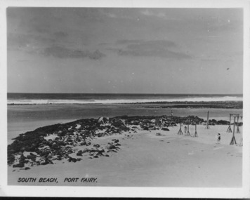 Port Fairy Historical Society Museum and Archives
Postcard - Photograph, South Beach Port Fairy
Early photo South BeachReflects change in the coastline over the yearsBlack and white seascape of South beach showing the bluestone shore and the wooden swings to the rightSouth Beach Port Fairybeach, sea, seascape -
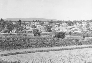 Ringwood and District Historical Society
Photograph, New housing developments, New Street, 1960 viewed from railway line near Madden Street looking south-east
Written on back of photograph, "New housing settlement New Street, 1960. From railway line near Madden Street looking south-east. Dam centre foreground". -
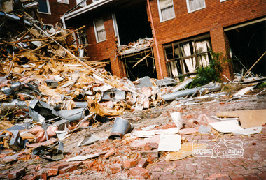
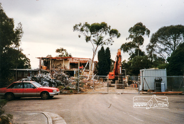 Eltham District Historical Society Inc
Photograph, Cr. Peter Graham, Looking from the old library end of former Shire offices (south wing), 12 Aug 1996, 12/08/1996
Demolition of the former Shire of Eltham Offices, 895 Main Road, Eltham, 12 August 1996. Originally mounted as a group of 9 photos on 42 x 55 cm display card.Colour photographeltham shire office, shillinglaw trees, demolition, eltham library -
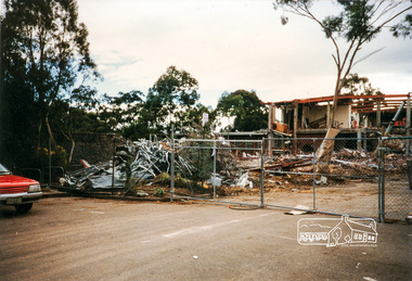
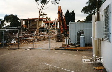
 Eltham District Historical Society Inc
Photograph, Cr. Peter Graham, Administrative office end of former Eltham Shire offices, looking south, 12 Aug 1996, 12/08/1996
Demolition of the former Shire of Eltham Offices, 895 Main Road, Eltham, 12 August 1996. Originally mounted as a group of 9 photos on 42 x 55 cm display card.Colour photographeltham shire office, demolition -
 Eltham District Historical Society Inc
Photograph, Cr. Peter Graham, Looking from the old library end of former Shire offices (south wing), 12 Aug 1996, 12/08/1996
Demolition of the former Shire of Eltham Offices, 895 Main Road, Eltham, 12 August 1996. Originally mounted as a group of 9 photos on 42 x 55 cm display card.Colour photographeltham shire office, shillinglaw trees, demolition, eltham library