Showing 177 items
matching 1934 flood
-
 Orbost & District Historical Society
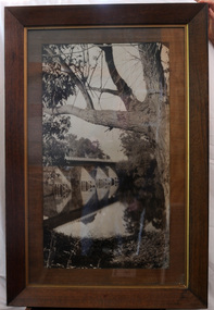
black and white photograph, Howard D. Bulmer, first half 20th century
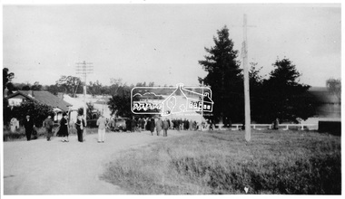
... bridge, and was again partly washed away by flood waters in 1934... bridge, and was again partly washed away by flood waters in 1934 ...A new bridge over the Snowy River at Orbost was opened for traffic on June 20th 1922. It was intended as a road and rail bridge, and was again partly washed away by flood waters in 1934. After the end of the first World War the Victorian Railways considered an extension of the railhead across the river at Orbost, and in 1922 a new timber and steel girder structure, a joint Country Roads Board — Victorian Railways venture, was built and completed at a cost of £41,000 (the steel girders came from the Flinders Street viaduct reconstruction). Subsequently it was decided decided not to take the railway across the river, and the bridge was only used by road traffic. This is a pictorial record of an early bridge over the Snowy River at Orbost.A black / white postcard photograph of a bridge across a shallow river with men on horseback underneath.snowy-river-bridge -
 Orbost & District Historical Society
black and white photograph, first half 20th century
... , and was partly washed away by flood waters in 1934. After the end..., and was partly washed away by flood waters in 1934. After the end ...This is a bridge across the Snowy River at Orbost. This bridge was built in the 1920s as a road and rail bridge, and was partly washed away by flood waters in 1934. After the end of the first World War the Victorian Railways considered an extension of the railhead across the river at Orbost, and in 1922 a new timber and steel girder structure, a joint Country Roads Board — Victorian Railways venture, was built and completed at a cost of £41,000 (the steel girders came from the Flinders Street viaduct reconstruction). Subsequently it was decided not to take the railway across the river, and the bridge has only been used by road traffic.This is a pictorial record of an early bridge across the Snowy River at Orbost.A very large black / white photograph under glass in a timber frame. It is of a bridge across a river and is framed by trees.bridge snowy-river-bridge road-transport-orbost -
 Eltham District Historical Society Inc
Photograph, Heidelberg - River Yarra in flood at Heidelberg, 1934
... Heidelberg - River Yarra in flood at Heidelberg, 1934... Heidelberg - River Yarra in flood at Heidelberg, 1934 Photograph ...Black and white photographCopied by Hugh Fisher, Photographer, 6 York Street Eltham A1679Bfloods, heidelberg, other areas, shire of eltham pioneers photograph collection, yarra river -
 Eltham District Historical Society Inc
Photograph, M. North, Main Road, Eltham near Fitzsimons Lane Roundabout, Dec 1985, 1/12/85
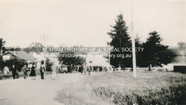
Two colour photographs of Main Road, ElthamSouth between Falkiner Street and Bolton Street at the roundabout of Fitzsimons Lane, Eltham, Dec 1985Noted on 463B 'See 1934 small black and white snap of flooded bridge and the same two shops. This snap taken from same location, Dec 1985. Old Eltham Park on right of photo The two shops at left (Ansel and Muir) Road ahead crosses new bridge over the Diamond Creek, Eltham Main Road now dual highway, through Lower Plenty to this bridge'main road, eltham, eltham south, fitzsimons lane, round about, falkiner street -
 Orbost & District Historical Society
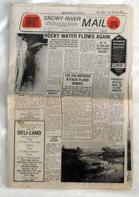
newspaper, Snowy River Mail, June 14 1978
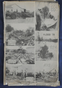
Orbost has been subject to major floods throughout its history, such as those which left the town isolated in 1934, 1952, 1971 and 1978. It is recorded that the Snowy River broke its banks and flooded the flats 104 times between 1884 and 1978. Extensive flooding in Eastern Victoria during June 1978, caused widespread damage to roads, road closures and hazards to traffic, particularly over the Queen's Birthday holiday weekend.Since 1890 the Snowy River Mail has been the local newspaper of the Orbost district.This local paper has been the means by which readers in Orbost were able to learn about newsworthy events and issues in their local community for over a century. This paper is a contemporary record of a significant event in Orbost's history of flooding.A newspaper, Snowy River Mail, which contains black / white photographs of the 1978 floods in Orbost.orbost-floods-1978 -
 Ringwood and District Historical Society
Photograph, Mullum Creek in flood, Ringwood. Adelaide St. Bridge to Reynolds Ave washed away, 1931
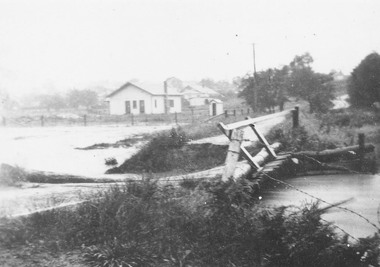
... Creek in flood. Adelaide St. Bridge to Reynolds Ave washed away ...Catalogue card reads, "Mullum Creek in flood. Adelaide St. Bridge to Reynolds Ave washed away, 1931". Typed below photograph, "Adelaide St. bridge, to Reynolds Ave washed out in 1931 (Bridge not replaced). 1934?" -
 Orbost & District Historical Society
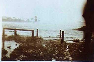
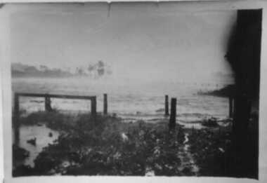
black and white photographs, 1934
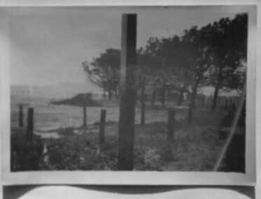
... McKillop's-Bridge Snowy-River flood-damage-1934... Bridge was completed after the flood damage. The current.... McKillop's-Bridge Snowy-River flood-damage-1934 Three black / white ...These photographs were taken just after the McKillop's Bridge was completed after the flood damage. The current McKillop’s Bridge was built by the Country Roads Board in two stages between 1931-36, during which its height was raised after the original bridge superstructure was washed away in record floods of January 1934, prior to its original official opening. In its reconstructed form the original concrete abutments were turned into additional piers and the welded-steel trusses were cantilevered back over them to meet the new higher road approaches. It is sited at McKillops Crossing, named after pioneer overlanding squatter George McKillop who crossed here in 1835. This was a stock crossing place for almost a century before the bridge was constructed. (info. from Victoria Heritage Register)This is a pictorial record of the history of McKillop's Bridge, in itself of historical significance for its association with Victoria's long and important pastoral history, its technicl significance and aesthetic significance.Three black / white photographs. 3133.1 shows the approach to a washed away bridge. 3133.2 is of a bridge over a river with men clearing debris. 3133.3 is a close-up showing the wreckage of the bridge.mckillop's-bridge snowy-river flood-damage-1934 -
 Orbost & District Historical Society
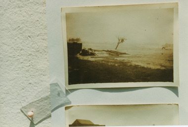
black and white photograph, mid 1930s
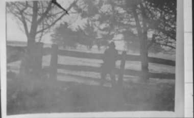
... superstructure was washed away in record floods of January 1934, prior... superstructure was washed away in record floods of January 1934, prior ...This is a photograph of McKillop's Bridge probably taken just after its rebuilding. The current McKillop’s Bridge was built by the Country Roads Board in two stages between 1931-36, during which its height was raised after the original bridge superstructure was washed away in record floods of January 1934, prior to its original official opening. In its reconstructed form the original concrete abutments were turned into additional piers and the welded-steel trusses were cantilevered back over them to meet the new higher road approaches. "McKillops Bridge was Heritage listed due to its social and technological significance – the steel trusses' arc-welded construction technique was a pretty big deal in the 1930s. It was once an important route for cattlemen, who used the ford across the Snowy in the years preceding the bridge's existence"This is a pictorial record of McKillop's Bridge just after its construction.A black / white photograph of a wooden bridge across a river. At the bottom right is a man with his back to the camera. He is looking at flood debris on the bank. At the bottom left are two men near a pylon.on back - McKillops Bridgebridge-mckillop's snowy-river-bridge -
 Ringwood and District Historical Society
Document, Council flood relief for Mullum Creek flood in Ringwood in 1934
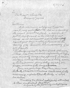
... Council flood relief for Mullum Creek flood in Ringwood in... relief for Mullum Creek flood in Ringwood in 1934 Document ...Hand written letters to Ringwood Council re flood relief.Correspondence to Council from Ratepayers asking for flood relief resulting from the flood damage in the vicinity of Harrison Street bridge over Mullum Creek in 1934. -
 Orbost & District Historical Society
newspaper clippings, June 1978
Orbost has been subject to major floods throughout its history, such as those which left the town isolated in 1934, 1952, 1971 and 1978. It is recorded that the Snowy River broke its banks and flooded the flats 104 times between 1884 and 1978. Extensive flooding in Eastern Victoria during June 1978, caused widespread damage to roads, road closures and hazards to traffic, particularly over the Queen's Birthday holiday weekend. These newspaper articles are contemporary records of a significant event in Orbost history.A collection of black/white newspaper clippings relating to the 1978 flood in Orbost. Some are original articles. others are photo-copies. They appear to be from the Snowy River Mail newspaper.floods-orbost-1978 newspaper-articles -
 Eltham District Historical Society Inc
Photograph, Heidelberg - River Yarra in flood at Heidelberg, 1934, 1934
... Heidelberg - River Yarra in flood at Heidelberg, 1934.... in flood at Heidelberg, 1934. Photograph ...This photo forms part of a collection of photographs gathered by the Shire of Eltham for their centenary project book,"Pioneers and Painters: 100 years of the Shire of Eltham" by Alan Marshall (1971). The collection of over 500 images is held in partnership between Eltham District Historical Society and Yarra Plenty Regional Library (Eltham Library) and is now formally known as the 'The Shire of Eltham Pioneers Photograph Collection.' It is significant in being the first community sourced collection representing the places and people of the Shire's first one hundred years.Digital imagesepp, shire of eltham pioneers photograph collection, other areas, yarra river, floods -
 Inverloch Historical Society
Photograph, 1934 Dec - Pound Creek - tidal floods - pig paddock - side of house - Henderson property
-
 Inverloch Historical Society
000250 - Photograph - 1934 Dec - Pound Creek - tidal floods - pig paddock - Henderson property - E Henderson
-
 Inverloch Historical Society
000251 - Photograph - 1934 - Pound Creek - Henderson property - floods in front of house - E Henderson
-
 Inverloch Historical Society
000253 - Photograph - 1934 - Pound Creek - Henderson property - floods - water coming around pig paddock side of house - E Henderson
-
 Inverloch Historical Society
000241 - Photograph - 1934 - Pound Creek - Henderson property - front fence floods - E Henderson
-
 Inverloch Historical Society
000236 - Photograph - 1934 Dec - Pound Creek - Henderson property - floods at front gate and horses - E Henderson
-
 Inverloch Historical Society
000171 - Photograph - 1934 Dec - Pound Creek - Tidal floods - Nick near stables and Henderson property fence - E Henderson
-
 Kew Historical Society Inc
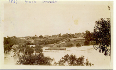
Photograph, Yarra at Fairfield, 1934 Floods, 1934
... floods - kew - 1934 1934 YARRA FAIRFIELD FROM OPPOSITE RUDDER ...One of three digital copies of flooded areas of Kew (1923-34), donated by Jan Coutts of Bulleen in 2019. The handwriting on the originals predates the copy.1934 YARRA FAIRFIELD FROM OPPOSITE RUDDER GRANGE floods - kew - 1934 -
 Kew Historical Society Inc
Photograph - Flooding of the Yarra River in North Kew, 1934
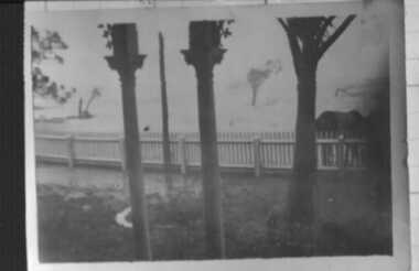
... -- north kew floods -- 1929 floods -- 1934 natural disasters -- kew ...North Kew, now divided between Kew and Kew East, bordered the Yarra River. As such, it was a region subject to flooding in the Yarra Valley. Development beyond this point (ie Kellett Grove) was limited by the City of Kew's planning regulations. Prior to urban development, the area since European settlement and the first land sales in the district in the 1840s, had been used for dairy farming. Small sepia snapshot taken from the river ramp of a house at 8 Kellett Grove, in what was then known as North Kew. The point of view is from a backyard looking towards Fairfield. Beyond the fence line are two almost submerged houses. A number of people are in a motor driven boat midstream. Fairfield at this period, (ie 1934) was noted for its limited river side development. Verso: 2/12/34 / TAKEN FROM OUR RAMPyarra river -- north kew, floods -- yarra valley, floods -- north kew, floods -- 1929, floods -- 1934, natural disasters -- kew -
 Kew Historical Society Inc
Photograph - Flooding of the Yarra River in North Kew, 1934
... -- north kew floods -- 1934 natural disasters -- kew Verso ...North Kew, now divided between Kew and Kew East, bordered the Yarra River. As such, it was a region subject to flooding in the Yarra Valley. Development beyond this point (ie Kellett Grove) was limited by the City of Kew's planning regulations. Prior to urban development, the area since European settlement and the first land sales in the district in the 1840s, had been used for dairy farming. Small sepia snapshot taken from the back yard of a house at 8 Kellett Grove, in what was then known as North Kew. The point of view is from a backyard looking towards Fairfield. Floodwaters have submerged the fence and a clothes line. Verso: BACKYARD NTH. KEWyarra river -- north kew, floods -- yarra valley, floods -- north kew, floods -- 1934, natural disasters -- kew -
 Kew Historical Society Inc
Photograph - Flooding of the Yarra River in North Kew, 1934
... -- north kew floods -- 1934 natural disasters -- kew Verso: 8 ...North Kew, now divided between Kew and Kew East, bordered the Yarra River. As such, it was a region subject to flooding in the Yarra Valley. Development beyond this point (ie Kellett Grove) was limited by the City of Kew's planning regulations. Prior to urban development, the area since European settlement and the first land sales in the district in the 1840s, had been used for dairy farming. Small sepia snapshot taken from the back yard of a house at 8 Kellett Grove, in what was then known as North Kew. The point of view is from a backyard looking towards Fairfield. Verso: 8 KELLETT GROVEyarra river -- north kew, floods -- yarra valley, floods -- north kew, floods -- 1934, natural disasters -- kew -
 Kew Historical Society Inc
Photograph - Flooding of the Yarra River in North Kew, 1934
... -- north kew floods -- 1934 natural disasters -- kew Verso: OUR ...North Kew, now divided between Kew and Kew East, bordered the Yarra River. As such, it was a region subject to flooding in the Yarra Valley. Development beyond this point (ie Kellett Grove) was limited by the City of Kew's planning regulations. Prior to urban development, the area since European settlement and the first land sales in the district in the 1840s, had been used for dairy farming. Small sepia snapshot taken from the back yard of a house at 8 Kellett Grove, in what was then known as North Kew. The point of view is from a backyard looking towards Fairfield. Verso: OUR BACKYARD 8 KELLETT GROVEyarra river -- north kew, floods -- yarra valley, floods -- north kew, floods -- 1934, natural disasters -- kew -
 Kew Historical Society Inc
Photograph - Flooding of the Yarra River in North Kew, 1934
... -- north kew floods -- 1934 natural disasters -- kew Verso: OUR ...North Kew, now divided between Kew and Kew East, bordered the Yarra River. As such, it was a region subject to flooding in the Yarra Valley. Development beyond this point (ie Kellett Grove) was limited by the City of Kew's planning regulations. Prior to urban development, the area since European settlement and the first land sales in the district in the 1840s, had been used for dairy farming. Small sepia snapshot of floodwaters taken from near Kellett Grove, in what was then known as North Kew. The point of view is from a backyard looking towards Fairfield. In the foreground ar two men in a rowboat.Verso: OUR BACKYARD / Stamped 3 163yarra river -- north kew, floods -- yarra valley, floods -- north kew, floods -- 1934, natural disasters -- kew -
 Kew Historical Society Inc
Photograph - Flooding of the Yarra River in North Kew, 1934
... -- north kew floods -- 1934 natural disasters -- kew willsmere road ...North Kew, now divided between Kew and Kew East, bordered the Yarra River. As such, it was a region subject to flooding in the Yarra Valley. Development beyond this point (ie Kellett Grove) was limited by the City of Kew's planning regulations. Prior to urban development, the area since European settlement and the first land sales in the district in the 1840s, had been used for dairy farming. Small sepia snapshot of floodwaters taken from near Willsmere Road, in what was then known as North Kew. The point of view is looking towards Fairfield. In the foreground are two figures viewing a group in a rowboat in the middle of the flooded river. Semi-submerged street lighting indicates that entire streets had been. overwhelmed by the flood waters. Verso: WILLSMERE ROAD NORTH KEW / Stamped 3 163yarra river -- north kew, floods -- yarra valley, floods -- north kew, floods -- 1934, natural disasters -- kew, willsmere road -
 Kew Historical Society Inc
Photograph - Flooding of the Yarra River in North Kew, 1934
... -- north kew floods -- 1934 natural disasters -- kew willsmere road ...North Kew, now divided between Kew and Kew East, bordered the Yarra River. As such, it was a region subject to flooding in the Yarra Valley. Development beyond this point (ie Kellett Grove) was limited by the City of Kew's planning regulations. Prior to urban development, the area since European settlement and the first land sales in the district in the 1840s, had been used for dairy farming. Small sepia snapshot of floodwaters in North Kew. The point of view is of two houses belonging to local families that were surrounded by floodwater. Verso: HYATTS HOUSE / WILLSMERE ROAD / Stamped 3 163yarra river -- north kew, floods -- yarra valley, floods -- north kew, floods -- 1934, natural disasters -- kew, willsmere road -
 Kew Historical Society Inc
Photograph - Flooding of the Yarra River in North Kew, 1934
... -- north kew floods -- 1934 natural disasters -- kew willsmere road ...North Kew, now divided between Kew and Kew East, bordered the Yarra River. As such, it was a region subject to flooding in the Yarra Valley. Development beyond this point (ie Kellett Grove) was limited by the City of Kew's planning regulations. Prior to urban development, the area since European settlement and the first land sales in the district in the 1840s, had been used for dairy farming. Small sepia snapshot of floodwaters in North Kew, from the rear of 8 Kellett Grove. Verso: OUR BACKYARD / Stamped 52yarra river -- north kew, floods -- yarra valley, floods -- north kew, floods -- 1934, natural disasters -- kew, willsmere road -
 Kew Historical Society Inc
Photograph - Grandfather and granddaughter in the yard of 8 Kellett Grove, Kew, 1934
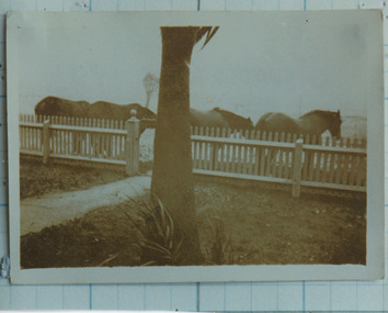
... and relationships with natural disasters such as the flood of 1934. yarra ...North Kew, now divided between Kew and Kew East, bordered the Yarra River. As such, it was a region subject to flooding in the Yarra Valley. Development beyond this point (ie Kellett Grove) was limited by the City of Kew's planning regulations. Prior to urban development, the area since European settlement and the first land sales in the district in the 1840s, had been used for dairy farming. Vivid photograph contrasting domestic life and relationships with natural disasters such as the flood of 1934.Small sepia snapshot of a grandfather and granddaughter sitting in the backyard of 8 Kellett Grove, North Kew, with the floodwaters stretching behind them.Verso: GRANDDAD AND I IN BACKYARDyarra river -- north kew, floods -- yarra valley, floods -- north kew, floods -- 1934, natural disasters -- kew, willsmere road -
 Kew Historical Society Inc
Photograph - Flooding of the Yarra River in North Kew, 1934
... and relationships with natural disasters such as the flood of 1934. yarra ...North Kew, now divided between Kew and Kew East, bordered the Yarra River. As such, it was a region subject to flooding in the Yarra Valley. Development beyond this point (ie Kellett Grove) was limited by the City of Kew's planning regulations. Prior to urban development, the area since European settlement and the first land sales in the district in the 1840s, had been used for dairy farming. Vivid photograph contrasting domestic life and relationships with natural disasters such as the flood of 1934.Small sepia snapshot of the donors grandfather rescuing the family dog's kennel from rising floodwaters at the rear of 8 Kellett Grove, North Kew, .Verso: DAD SECURING NIPPY'S DOG KENNEL / Stamped 6414yarra river -- north kew, floods -- yarra valley, floods -- north kew, floods -- 1934, natural disasters -- kew -
 Kew Historical Society Inc
Photograph - Flooding of the Yarra River in North Kew, 1934
... -- north kew floods -- 1934 natural disasters -- kew Verso ...North Kew, now divided between Kew and Kew East, bordered the Yarra River. As such, it was a region subject to flooding in the Yarra Valley. Development beyond this point (ie Kellett Grove) was limited by the City of Kew's planning regulations. Prior to urban development, the area since European settlement and the first land sales in the district in the 1840s, had been used for dairy farming. .Small sepia snapshot of a local family's house in what was then River Avenue, North Kew being surrounded by floodwaters.Verso: THE SIDE OF RYANSyarra river -- north kew, floods -- yarra valley, floods -- north kew, floods -- 1934, natural disasters -- kew