Showing 81755 items
matching goldfields.
-
 Clunes Museum
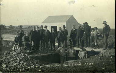
Photograph, HORNBY - CLUNES, 1913
PHOTOGRAPH - GROUP OF SEVENTEEN MEN AND THREE YOUNG BOYS STANDING IN FRONT OF SHED AT CLUNES GOLD FIELDS LTD. 1913 ORIGINAL AND 2 COPIESTHE CLUNES GOLDFIELDS LTD 1913local history, photography, photographs, mining -
 Whitehorse Historical Society Inc.
Document, Logan Family, n.d
Nunawading Historical Society questionnaire and some notes on the Logan McClare family, also related to Sir John O'Shanassy.Nunawading Historical Society questionnaire and some notes on the Logan McClare family, also related to Sir John O'Shanassy. the Logan brothers had a sand pit in Canterbury and also took supplies to the goldfields. Thomas Logan arrived in Australia 1857.Nunawading Historical Society questionnaire and some notes on the Logan McClare family, also related to Sir John O'Shanassy. logan family, mcclare family, o'shanassy, john (sir), pioneers -
 Federation University Historical Collection
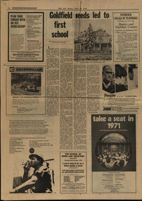
Newspaper - Newspaper Supplement, Technical Education Centenary Supplement , 1970, 26/10/1970
The beginning of the School of Mines and Industries school in BallaratSix pages; supplement to the age; pages 16 - 17 Goldfields needs lead to the first schoolschool of mines and industries school, ballarat, anniversary, history, centenary -
 Federation University Art Collection
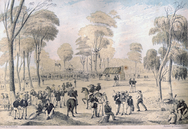
Print - Printmaking - Lithograph, Tulloch, David, 'Great Meeting of Gold Diggers Dec 15th 1851' by Thomas Ham, 1852
One of the first large goldfield meetings was at Castlemaine in 1851. After the extraordinary success of the Mt Alexander Diggings the Government issued a proclamation, raising the licence fee from thirty shillings to three pounds. As soon as these intentions became known a public meeting of miners was held. For miles around work ceased, with diggers travelling as far as Bendigo to attend the meeting. It is estimated that around 18,000 people attended the meeting. The notes with the engraving state The trees in this locality are chiefly Stringybark; some of them are peeled of their covering, as many persons prefer erecting bark huts to living in a comfortless tent. The various groups, and costumes of the men, are characteristic of our gold digging community. This item is part of the Federation University Art Collection. The Art Collection features over 2000 works and was listed as a 'Ballarat Treasure' in 2007.Colour lithograph of a meeting of diggers at a meeting in Mt Alexander. The meeting was the result of goldfields agitations against the license fee. lower centre "Great Meeting of Gold Diggers Dec 15th 1851" lower left side "Drawn By D. Tulloch" lower right side "Engraved by Thomas Ham"art, artwork, ham, thomas ham, tulloch, castlemaine, goldfields agitation, printmaking, edition, coloured lithograph, david tulloch, gold pan, shovel, wheelbarrow, waggon, bark hut, ring barked tree, gold mining -
 Bendigo Historical Society Inc.
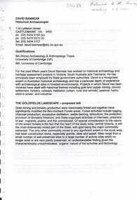
Document - DAVID BANNEAR, THE GOLDFIELDS LANDSCAPE - PROPOSED TALK, 2/11/2023
The goldfields resulted in the almost complete denuding of trees for access to the gold bearing land, for firewood and for the tanning industry. The need for wood further increased with the advent of deep quartz mining that required timbers for shoring up the shafts and tunnels. At some point in time it became necessary for timber to be carted long distances to fulfil the need. Between 1878 and 1884, the government set up 5 nurseries to try and rectify the shortage of native softwoods and encouraged the growth of State plantations and the thinning of trees to encourage growth of those remaining. 1907 - Creswick School of Forestry and Forest Management was started 1919 Establishment of the Forests Commission and the planting of many pine plantations 1924 Establishment of the first fire spotting towers Forest management tasks became a main project for "Susso" recipients during the Great Depression and again for internees during WWII.An 8 page document by David Bannear about the various industries of the Bendigo Goldfields and their effects on terraforming the local environment david bannear, central goldfields -
 Marysville & District Historical Society
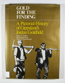
Book - Hardcover book, Gold for the Finding-A Pictorial History of Gippsland's Jordan Goldfield, 1979
A pictorial history of Gippsland's Jordan goldfieldHardcover. Gold dust cover. Front cover has a photograph of two miners carrying mining equipment.This work is dedicated to the people of the Jordan Goldfields,/ the Pioneers who worked, lived, loved and died in the moun-/ tains of Gippsland, giving us a rich and varied heritage. It is especially dedicated to Mr William Rae, Gentleman, Late of/ Jericho, without whose assistance this work would have/ remained a dream. Stamp of the Marysville & District Historical Society Inc / P.O. Box 22 / Marysville 3779gold, gold mining, gold mines, victoria, gippsland, history, bosa, marysusan, tomlin, owen f., chamberlain, peter g. -
Stawell Historical Society Inc
Map, Portion of Stawell Goldfield
Portion of Stawell Goldfieldstawell, mining -
 Ballarat Heritage Services
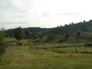
Photograph - Photograph - Colour, Agitation Hill, Chewton, 2011, 2011
The site of goldfields agitation at Chewton.chewton, goldfields reform league, agitation -
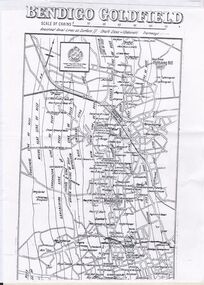
Bendigo Historical Society Inc.
Map - BENDIGO GOLDFIELD MAP 1913
CD, Bendigo Goldfield Map 1913. -
 Stawell Historical Society Inc
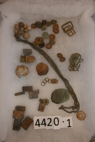
Memorabilia - Realia, Late 1800's
Relics from Goldfields in Stawell Areastawell -
 Stawell Historical Society Inc
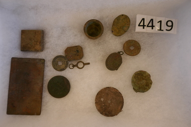
Memorabilia - Realia, Late 1800's
Relics from Goldfields in Stawell Areastawell -
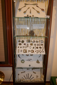 Stawell Historical Society Inc
Memorabilia - Realia, Late 1800's
Relics from Goldfields in Stawell Areastawell -
Lakes Entrance Historical Society
Book, Christie, R.W. and Gray, G.D, Victorias Forgotten Goldfield, 1981
A History of the Dargo, Crooked River Goldfieldmetals, mines and mining -
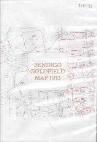 Bendigo Historical Society Inc.
Map - BENDIGO GOLDFIELD MAP 1913, 1913
DVD. Bendigo Goldfield Map 1913. -
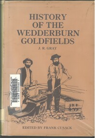 Bendigo Historical Society Inc.
Book - HISTORY OF THE WEDDERBURN GOLDFIELDS, 1888
... Goldfields ...Gold was first discovered in 1852 on what was then named Korong or Mt Korong goldfields. It was soon found that the area was not suitable for alluvial mining because of a lack of water but quartz mining was more successful. The township of Wedderburn was surveyed 1856/57. The first public crushing works was established in 1859.Hardcover book with printed dust jacket and plastic cover. 92 pages with black and white illustrations, fold out map and index. Covers the history of the Wedderburn Goldfields and the discovery of gold generally in Australia from the 1850s until c1880s. Written by Joshua R Gray and edited by Frank Cusack.Joshua R Gray and Frank Cusack.gold, goldfields, goldfield -
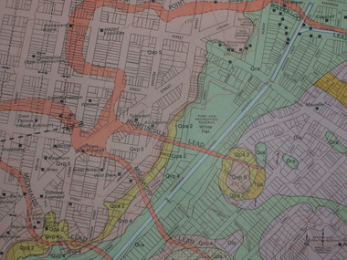 Federation University Historical Collection
Plan, Ballarat Goldfield - Geological Survey of Victoria, 1981, 1981
Coloured geological plan showing the Ballarat goldfields. It includes coloured scales and nuggets from the Ballarat Goldfield. It also shows leads and mines.ballarat, geology, geological, gold nuggets, mining, mining companies, gold leads -
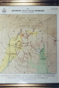 Halls Gap & Grampians Historical Society
Photograph - Coloured, C 1900
Colour photo of framed map of Mafeking Goldfield.mining, mafeking, maps -
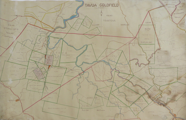 Federation University Historical Collection
Plan, Tavua Goldfield, 1935
Printed plan with coloured shading of Tavua Goldfield tavua goldfield, tavua, lands department fiji -
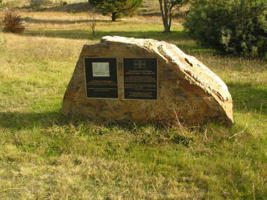 Ballarat Heritage Services
Photograph - Colour, Clare Gervasoni, Plaque, Ballarat Reform League, Agitation Hill, Chewton, 2011
Colour photograph of a monument to goldfields agitation at Chewton. agitation hill, chewton, goldfields reform league, ballarat reform league, eureka stockade -
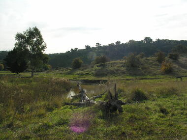 Ballarat Heritage Services
Photograph - Colour, Agitation Hill, Chewton, 2011, 2011
Colour photograph of the site of goldfields agitation at Chewton. chewton, agitation hill, goldfields agitation league -
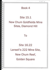 Bendigo Historical Society Inc.
Book - NEW CHUM GOLDFIELDS MINE SITE DIAMOND HILL TO LANSELL'S 222 MINE SITE NEW CHUM REEF GOLDEN SQUARE, 1992
... goldfields ...Book 4, Site 15.1 New Chum Goldfields Mine site Diamond Hill to site 16.22, Lansell's 222 Mine site, New Chum Reef, Golden Square. Significance reports prepared for North Central Goldfields Project: Bendigo Goldfield.David Bannearbendigo, mining, goldfields report, bendigo, gold, goldfields, history -
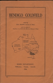 Bendigo Historical Society Inc.
Book - BENDIGO GOLDFIELD
booklet, 51 pages. 'Bendigo Goldfield' issued by Geo Brown, Secretary for Mines. Mines Department 1936. Contains information on the geology of the Bendigo goldfield and major lines of reef and mines. Map of goldfield showing reef lines and mines attached to back cover.bendigo, mining, bendigo goldfield -
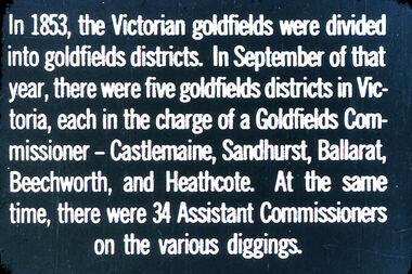 Bendigo Historical Society Inc.
Slide - DIGGERS & MINING. THE GOLD LICENCE, c1853
... goldfields ...Diggers & Mining. The gold licence. The Government Camp. In 1853, the Victorian goldfields were divided into goldfields districts. In September of that year, there were five goldfields districts in Victoria, each in the charge of a Goldfields Commissioner - Castlemaine, Sandhurst, Ballarat, Beechworth, and Heathcote. At the same time, there were 34 Assistant Commissioners on the various diggings. Markings: 30 994.LIF. 4. Used as a teaching aid.hanimounteducation, tertiary, goldfields -
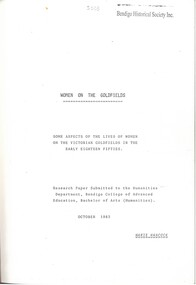 Bendigo Historical Society Inc.
Book - WOMEN ON THE GOLDFIELDS, 1983
... GOLDFIELDS ...WOMEN ON THE GOLDFIELDS. 34 pages with illustrations and maps. Some aspects of the lives of women on the Victorian Goldfields in the early eighteen fifties. Research paper for BA by Marie Hancock.Marie Hancockgoldfields, women on the goldfields, goldfields, women, work, health, caroline chisholm -
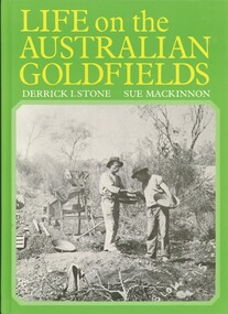 Bendigo Historical Society Inc.
Book - LIFE ON THE AUSTRALIAN GOLDFIELDS, 1984
... Goldfields ...Life on the Australian Goldfields 221 pages with photos and illustrations.Derrick I Stone, Sue MacKinnongold, goldfields, living conditions, bendigo, goldfields, mining techniques, gold discovery -
 Bendigo Historical Society Inc.
Document - CONSTABLE RYAN COLLECTION: LINES OF REEFS OF BENDIGO FIELD
... goldfields ...Photocopy of a map showing the lines of reefs of Bendigo goldfields.map, bendigo, goldfields -
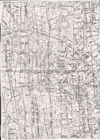
 Bendigo Historical Society Inc.
Document - CONSTABLE RYAN COLLECTION: MAP OF BENDIGO GOLDFIELD
... goldfields ...A copy of a map of the Bendigo Goldfields showing reef lines.map, bendigo, goldfields -
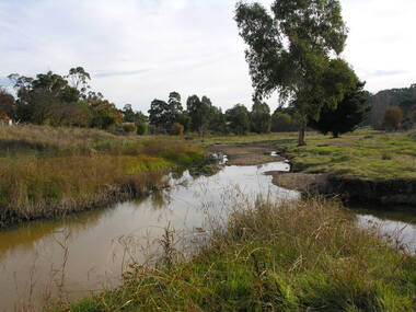 Ballarat Heritage Services
Photograph - Colour, Agitation Hill, Chewton, 2011, 2011
Colour photograph of the site of goldfields agitation meetings at Chewton. chewton, agitation hill, goldfields agitation league -
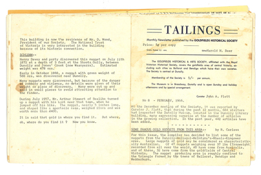 Tarnagulla History Archive
Issues of 'Tailings' newsletter, 1966 to 1969 & 1997
David Gordon Collection. 16 issues of 'Tailings', the newsletter of the Goldfields Historical Society. -
Bendigo Historical Society Inc.
Map - GOLDEN SQUARE GEOLOGICAL SURVEY, 1992
BHS CollectionGolden Square Geological Survey of Goldfields Coloured map.Dept of manufacturing and Industry Development.bendigo, gold mining, geological survey